
Earlier this summer, King County Department of Transportation installed a protected bike and pedestrian lane in the rural east of King County. The new facility is along High Point from the eastern end of the Issaquah-Preston Trail to the start of the Preston-Snoqualmie Trail.
The two paths that the cycle track connects are rail-trails. One is paved while the other is soft surface. The trails use disused right-of-way that once formed the Chicago, Milwaukee, St. Paul and Pacific Railway (also known as the Milwaukee Road). After going bankrupt in 1980, the railroad right-of-way gave way to many other fantastic rail-trails in the state. Some of these include the Cedar River, Snoqualmie Valley, Lake Sammamish, and Burke-Gilman trails, but also the John Wayne Pioneer Trail/Iron Horse State Park.
The Preston-Snoqualmie Trail links the small community of Preston, 6 miles past Issaquah on I-90, to the city of Snoqualmie, 7 miles further along the route. The trail runs primarily through the rural forestlands and crosses some impressive wood trestles, a great way to escape the city. The Issaquah-Preston Trail essentially acts as a a continuation of the Lake Sammamish Trail, which runs along the east bank of its namesake lake, and climbs up through the Issaquah Alps to arrive in Preston–or at least close to it.
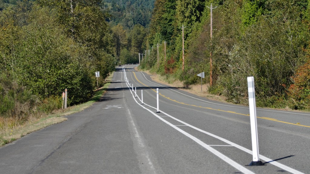
Prior to this summer, trail users had to ride on the shoulders of SE High Point Way for the seven-tenths mile trip to the Preston-Snoqualmie Trail. But now, this part of the trail is gone, and the shoulders of the road have been converted. On the southside of the road, the shoulder has been widened, which now forms a bike and pedestrian trail protected by reflective plastic bollards. These bollards and added shoulder space creates a much safer space for trail user. In order to accommodate trail users, the shoulder on the north side has been slightly reduced in width.
When I biked through the area in early September, I asked a family riding in the cycle track how they felt about the facilities. They indicated that the new facilities created a safe space for them. Thanks to new smoothing paving, a shoulder completely clear of debris, comfortably wide bicycle lanes, and protection offered by the bollards separating traffic, it’s unsurprising that they had a positive impression. The cycle track crosses High Point Way at its east end with a well-marked crosswalk before linking up to the Issaquah-Preston Trail. A few further improvements could be made though. The Issaquah-Preston Trail remains gravel, mostly smooth, but with some rough spots here and there. The trail shouuld eventually be upgraded to a harder surface. KCDOT could also implement inexpensive, permanent buffers for the cycle track. Permeable curb stops, more solid bollards, or planted boxes could be placed along the cycle track to separate it further and increase safety.
The new cycle track fills in not only a key part of the Issaquah-to-Snoqualmie trails corridor, but also connects to the countywide network of trails, and makes it possible to ride all the way from Fremont to Snoqualmie only using trails and being protected from car traffic along the whole corridor.
Guy is a high school student in Bellevue with a strong desire to become an urban planner. Before moving to Bellevue, he grew up in the Paris metropolitan area where he fell in love with and learned from some of the best rail systems in Europe. Translating his experiences from abroad to Seattle, Guy is now passionate about improving this region's public transit (especially marine-based transportation) and cycling infrastructure. Aside from the technical side of things, Guy also enjoys photography and music.