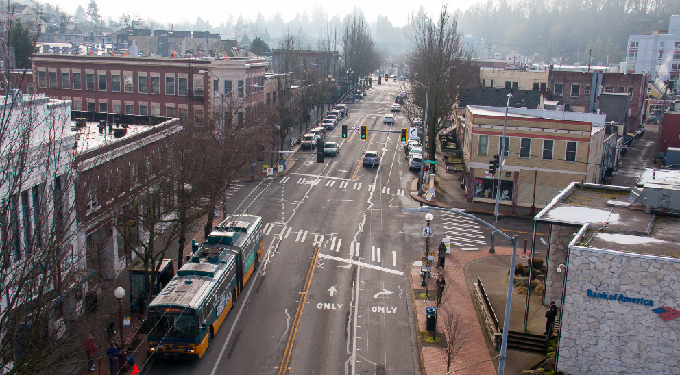
Join The Urbanist for a tour of an ongoing Vision Zero safety project, the Rainier Avenue South corridor. In 2015 a one mile segment of Seattle’s most dangerous street was redesigned from four to three lanes, and the results for safety and mobility are promising. We’ll talk to Rainier Valley Greenways volunteers and business owners about how the street changes have affected the Hillman City and Columbia City neighborhoods. Seattle Department of Transportation staff will join us to share data, offer insight, and collect your feedback for the second phase to the south.
The tour will conclude at Mount Baker Station, where the bow-tie intersection of Rainier Avenue and Martin Luther King Jr. Way will be split as part of the Mount Baker Urban Design Framework and the North Rainier Neighborhood Plan. The project will facilitate greater transit priority and protected bike routes.
When registering, please consider a donation of $10 or more per person to support The Urbanist’s educational mission. We are an all-volunteer nonprofit organization and our programming is free and open to the public.
CLICK HERE TO REGISTER
Facebook RSVP (optional)
When: Saturday, September 9, 10:00 AM – 12:00 PM
Where: Fire Station 28, 5968 Rainier Avenue South
Walking distance: 1 mile
Transit: This tour includes a ride on Metro route #7. Regular fare is $2.50 with exact change or an ORCA card.
Rainier Avenue Rechannelization Heads Into Phase 2