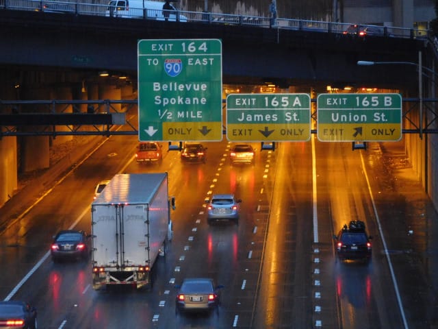
Amid Seattle’s rapidly growing inner neighborhoods remains the urban scar of I-5, a massive concrete and steel ribbon that is the lasting legacy of 20th century transportation engineers. It helps move thousands of people and tons of freight every day through the biggest city in the Pacific Northwest, but it gives little to those who don’t drive and to people who live and work around it. The problems are obvious: noise, traffic, and poor urban design that makes people on the street feel isolated and wastes valuable urban land. The solution is equally clear but admittedly ambitious: lidding the freeway to mitigate its sights and sounds while simultaneously transforming the public realm of Downtown Seattle.
In an attempt to summarize nearly two years of research, this series of articles on lidding I-5 will share my recommendations for interim solutions and key findings on lid design, funding, and management. (I first wrote about the concept in February 2014 and again in July of that year.) I’m not the first to bring up the idea; even before the freeway was built in the 1960s, the First Hill Improvement Association and local architects Paul Thiry and Victor Steinbrueck fought for concurrent improvements like lid parks and rapid transit. Eventually I-5 was partially lidded using construction techniques similar to highway bridges (steel trusses and concrete beams), starting with Freeway Park and later the Washington State Convention Center. More recently, I’ve met with a number of community members, including architects and real estate professionals, who have been thinking about lidding more of I-5 over the past few years.
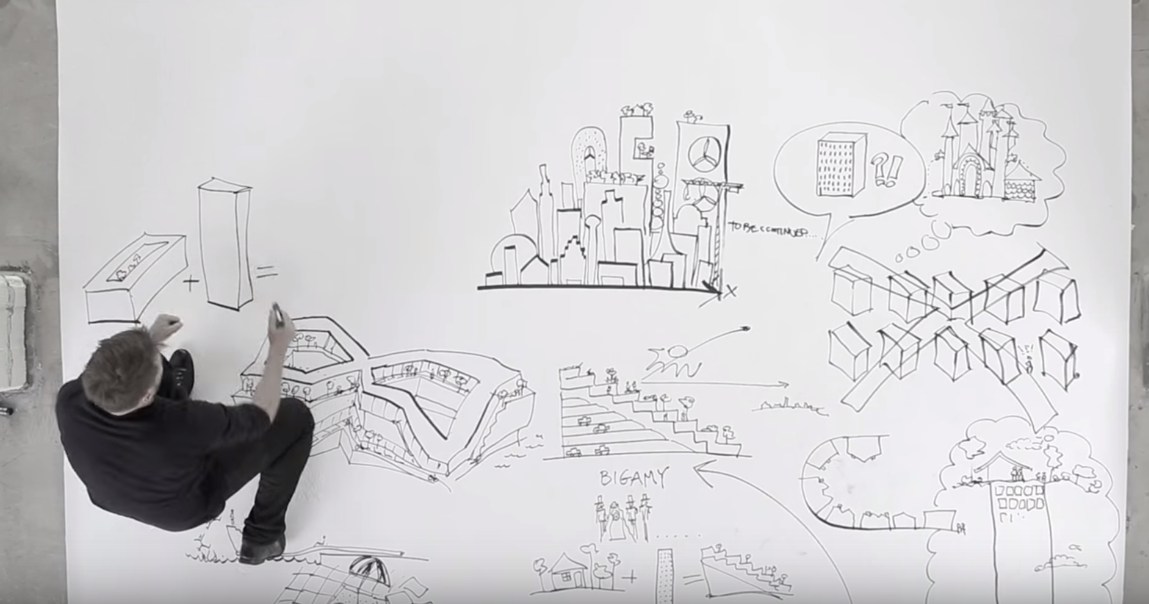
Since my last public foray into the discussion, I’ve greatly refined my own proposal which culminated into a completed graduate thesis on the topic that was released in June 2015. My research sought to answer how freeway lids should be built over I-5 in Downtown Seattle between Madison Street and Olive Way. I’ve assembled a trove of data on completed and planned lids across the United States, done a rough cost estimate, performed a site analysis, and written case studies that offer important lessons for design. Here I present my findings and call upon local leaders to move towards implementation.
The Time to Act Is Now
Seattle is greeting new residents at a rate not seen since the gold rush of the early 1900s. The city is growing with thousands of new residents and jobs every year. Construction cranes and gleaming new towers are dotting the skyline. These rapid changes are bringing as many opportunities as they are challenges, not the least of which are crowded schools, slow buses, and skyrocketing rents. With an influx of new people comes a greater need for urban infrastructure, and this article argues that one of the key pieces of that needed infrastructure is municipal parks that can provide a multitude of benefits.
The Center City (the Downtown, First Hill/Capitol Hill, South Lake Union, and Uptown urban centers) is now so intensely developed that there are few vacant sites left for new buildings. But growth will continue for the foreseeable future, and the unused airspace over Interstate 5 will inevitably beckon developers and city planners. My assumption is that the freeway will eventually be lidded, so I started by researching what the new artificial land should be used for. I found that using lids to create public parks is the most beneficial option for the city.
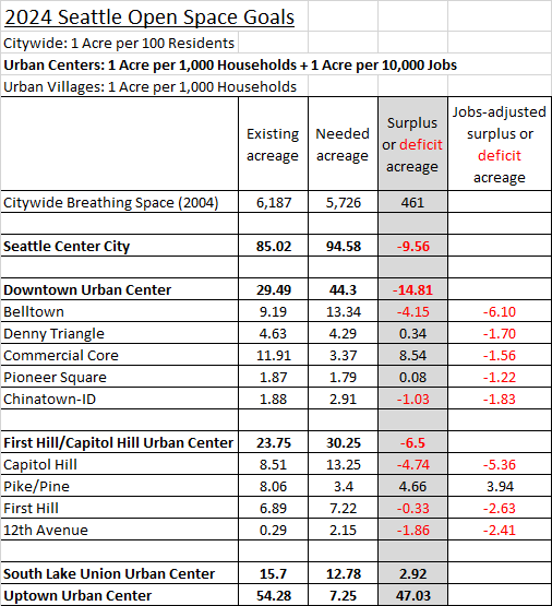
According to a gap analysis by the Seattle Parks and Recreation Department, the Center City has a 9.56 acre shortage of “useable public open space” (defined as at least 10,000 square feet). Breaking this down further by the nine smaller urban villages in the Center City, and accounting for the department’s jobs-related goal, I determined five urban villages have a larger deficit totaling 13.08 acres.
Based on the Seattle 2035 Development Capacity Report (PDF), the First Hill/Capitol Hill urban center also has an employment capacity deficit of about 800 jobs; however, most of that is likely to be covered by the independent master plans of local colleges and hospitals. Still, it has become clear that lids could support some job growth in the retail sector while simultaneously ensuring the new parks are well used and generate their own maintenance funding. Seattle already has a number of commercial services in its parks, like the snack shack at Golden Gardens and boat rentals at Green Lake.
I’ve generally recommended against other uses for lids, especially residential development. In my original proposal, I shared a conceptual rendering with office towers and apartment buildings on top of the freeway, but the cost and technical complexity likely dampen the reality of that idea. I did find one example of apartments built above a freeway in Manhattan; The New York Times chronicled the significant problems with noise, vibration, and fume that residents experience. Office uses beyond space for management staff are not ideal because they wouldn’t generate nearly as much foot traffic as retail activities can.
Lids could possibly host some civic uses, like a community center, museum, or a small extension of the Seattle Public Library. Existing civic examples include other convention centers in Kansas City and Detroit and municipal buildings like the city hall for Fall River, Massachusetts. Lids should absolutely not be used to provide any public parking, of which there are several examples. The much higher cost is not justified when there is so much parking in Downtown already, and building more infrastructure for cars opposes the purpose of building lids in the first place.
With the failing search for a downtown elementary school site I considered if one could be built above the freeway. But it’s not a good solution for several reasons. Pollution from major roadways is considered harmful within 500 feet, and children are particularly susceptible. Whether Seattle’s other schools located near I-5 have lower air quality has been a matter of debate in recent years. The site would also be inflexible and the building would likely cost more than normal due to increased engineering needs.
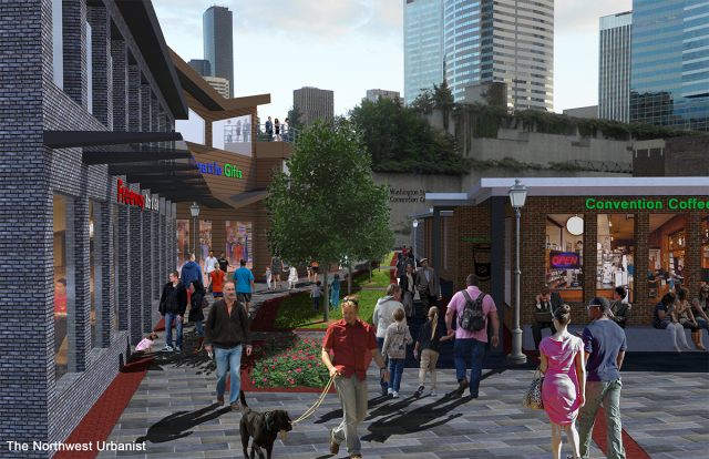
Through all of this, it has become clear that the ideal design of future lids in Downtown should primarily include park space with a variety of modern amenities, and secondarily provide space for indoor and outdoor retail uses. Ideal tenants would be restaurants, bars, coffee shops, art galleries, small grocery stores, and similar businesses that can use small spaces. This has the highest potential to improve the quality of living in the Center City, create better environmental conditions, and generate an economic return on the public’s investment.
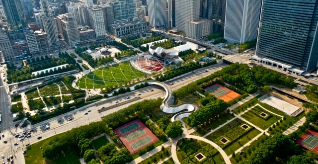
Unlike many major U.S. cities (New York, Chicago, Boston, Denver, and Portland to name a few), Seattle has no identifiable central park. Smaller open spaces like Westlake Park and the waterfront piers are great contributors to Downtown life and should be cherished. But big public spaces like Chicago’s Millenium Park and Portland’s South Park Blocks are also essential to city living because they provide a refuge from the urban environment while offering a wide variety of amenities and programming for all walks of life. Establishing a large urban park in Downtown would be one of the most transformative capital projects in Seattle’s history, and there’s only one place it could go.
The economic, environmental, and public health benefits of urban parks are also well documented. Parks improve quality of life by providing spaces for relaxing, exercising, and socializing. Proximity to parks boosts property values and attracts business, and people are more likely to use parks when they are located near their homes and jobs. Parks that are naturally landscaped capture air pollutants, filter rain water, reduce the urban heat island, create wildlife habitat, and improve the urban aesthetic.
Additionally, the Washington State Convention Center (WSCC) is planning its third major expansion adjacent to I-5. This is a shot to knit together neighborhoods which have been divided by a vehicular canyon for over 50 years. The $1 billion, 440,000 square foot facility is due to begin construction in 2017.
In the long term, another leverage point is the inevitable reconstruction of the freeway itself. Designed in the mid-20th century, its aging concrete and steel was not built to modern seismic standards and the lane configurations create bottlenecks for traffic and transit. By 1999 the state began thinking about a complete rebuild, but the idea dropped off the public radar as quickly as it arrived. A 2003 Seattle Times article chronicled the deteriorated state of the freeway in King County:
The state Department of Transportation [WSDOT] says the 40-year-old pavement on Interstate 5 through Seattle and Shoreline — the busiest stretch of freeway in the state — has deteriorated so badly that it needs to be torn out and rebuilt.
Not just resurfaced, but replaced. Not just the freeway’s skin, but its muscles and its bones…It could take decades to complete work on all 18 miles. Construction could affect traffic for years. Project director Maureen Sullivan says the project could cost $2 billion or more.
The state legislature has never provided any funding to plan this megaproject, let alone carry it out. Within the next decade or two (or three) it will become an unavoidable issue. If local pressure fails to build lids anytime soon, I-5’s eventual reconstruction will provide the opening. Other infrastructure that can piggyback on the project are completion of the the HOV gap, pedestrian and bike trails, and perhaps even regional high-speed rail.
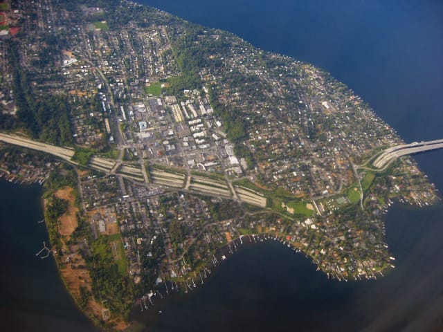
Lids are also a matter of environmental justice in the Puget Sound region. On State Route 520, three new lids were recently built in the small and mostly single-family municipalities of Medina, Hunts Point, and Clyde Hill. According to U.S. Census data, the median household incomes in these cities are, respectively, about $180,000, $136,000, and $207,000. On Mercer Island, where two large lids were built in the 1990s, the median household income is $126,000.
In Seattle, the median household income is much lower, only $65,000. Yet even the existing lid in the Mount Baker neighborhood and two planned lids in the Montlake neighborhood mostly benefit outlying, low-density, and affluent neighborhoods. Additional Downtown lids will correct these regional imbalances by providing new park space for the many low-income and middle class people who live and work in Seattle. With a larger population and robust transit access, Downtown Seattle parks are accessible to many more people and can support more economic activity than the isolated parks over SR-520 and I-90 ever will. WSDOT has indulged the high-income suburbs and should now provide a similar level of public investment for the people of Seattle.
This article is the first installment in a four-part series on lidding I-5 in Downtown Seattle. A version of this series originally appeared on The Northwest Urbanist.