On Friday, the Seattle City Council’s transportation committee voted to send the locally preferred alternative of the Madison bus rapid transit (BRT) project to a vote on the full council.
This locally preferred alternative (LPA) incorporates the decisions made by the Seattle Department of Transportation (SDOT) after studying the engineering and geographical obstacles and listening to public comment from neighborhood residents, business, and interest groups. The evolution of this process played out over many months as public meetings were held and City staff responded to what they were hearing.
I would like to lay out some of the changes from earlier alternatives of the Madison BRT project that have now been moved forward in the LPA:
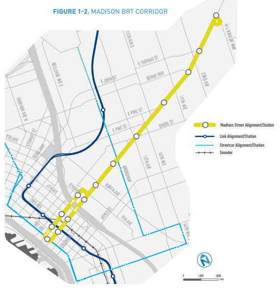
- Originally, the project was not planned to travel east of 23rd Avenue & Madison Street on the edge of Capitol Hill. Rider feedback was very supportive of it travelling further, into the Madison Valley, and now the current easternmost stop is planned at Martin Luther King, Jr Way, where the Route 8 also exits Madison Street.
- The placement of a stop near I-5 was solidified: original plans suggested no stations between Third Avenue and Terry Avenue. The LPA concludes that a station at both Fifth Avenue (west of I-5) and 8th Avenue (east) will not impact travel times and serve the maximum number of riders.
- In Downtown, both Spring Street and Marion Street were considered as options for the buses running eastbound, as Madison Street is one-way westbound. The LPA concludes that Spring Street is better for transit times and was preferred by the public.
- A western terminus closer to the waterfront than First Avenue was also considered, but due to traffic impacts, it was concluded that the quickest way for riders to reach the waterfront is via pedestrian bridge. A First Avenue stop also allows a seamless transfer to the future First Avenue streetcar.
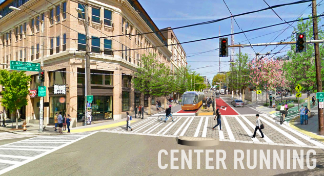
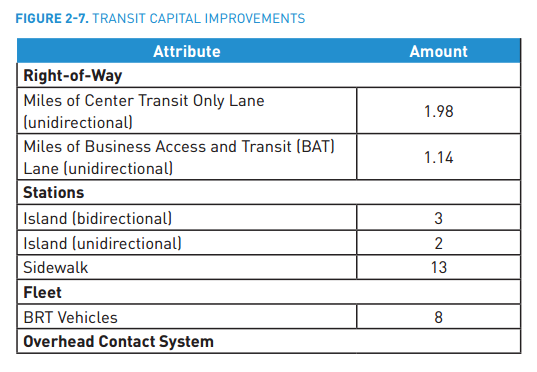
- Perhaps most notable is the moving ahead of plans for center running lanes between 9th and 15th Avenues. This means that a fleet of trolleybuses with doors on both sides will need to be procured. As you can see from the chart above, eight are planned to be purchased as part of the project, but will other BRT projects be inclined to move toward the same type of buses now that they are being added to the Metro fleet?
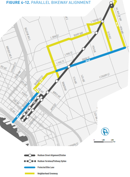
Another large aspect of public comment included the desire for improvements to pedestrian facilities on Madison and the introduction of bike facilities with the project. Because there is not room for bike facilities on Madison Street, and because there is not a parallel street to Madison Street all along the corridor, it will be a challenge to create bike facilities that truly meet the needs of the entire corridor in the way that transit might.
The main bike upgrade in the LPA is a protected bike lane on Union Street between Broadway and 27th Avenue E, and greenways on University Street, E Denny Way, and E Thomas St.
It is important to note that transit advocates did not get everything they were hoping to get into the LPA. The lack of dedicated lanes east of 18th Ave E for the BRT, as well as the fact that on Spring Street, there is no dedicated lane for the BRT vehicles travelling eastbound between 6th and 9th Avenues, despite the fact that parking is remaining on both sides of the street and a bike facility is being added. The fact that there is no dedicated right-of-way near the critical chokepoint of I-5 could prove troublesome in allowing the buses to be as reliable as they could be.
The LPA is a very important step in securing the federal funding upon which most of the $120 million cost of the project depends. The project will also be utilizing $15 million from the Move Seattle levy, and $4 million from the state. Much of the rest of the project’s funding will come from Sound Transit 3, which voters will see on their ballots in November. This project could help provide a shovel-ready project to sell to voters as a more tangible benefit in a slate of mostly long-term transit projects.
The current timeline for the project envisions construction starting to take place in 2018 and opening in 2019.
You can browse the LPA document on the SDOT project webpage. The project moves to full Council on Monday February 1.