
An interesting new tool is now available on the Seattle Department of Transportation (SDOT)’s website. It’s a city map that displays construction-related street impacts happening around major development projects. The map indicates not only that there’s an impact to street use, but also grades the severity of impact to users. Find the map here.
Each clickable colored region on the map brings up a particular construction project with some details about how it effects road conditions. The key below demonstrates the level of detail captured by this map.
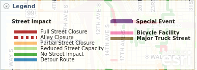
The level of street impact is rated from no impact to full street closure, but this only is a general indication and does not indicate what part of the street is closed or specify specific pedestrian or bicycle infrastructure impacts beyond the sidewalk being closed. This map does track marked detours, some special event related closures, and additionally contains map layers to display major truck routes and marked bike facilities. The bike facilities, however, appear to include sharrow routes and do not distinguish cycle routes by quality or safety.
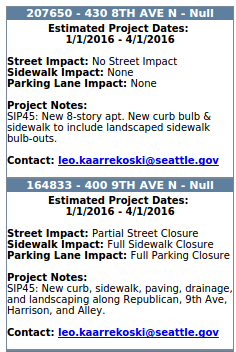
Individual projects list the street location, the project dates, expected impacts and notes that usually contain information on what work will be done during this project. Additionally a contact email is provided for each project.
This information could be useful for transit planning and freight deliveries. Unfortunately the site does not yet provide enough information for people to know if they need to modify their bicycle or walking routes.
We sent a field reporter to visit some sites listed on the map to see how they compare to how they’re described on the interactive map.

This project at 2301 6th Avenue lists a full sidewalk closure on all sides of the project site through the end of March.
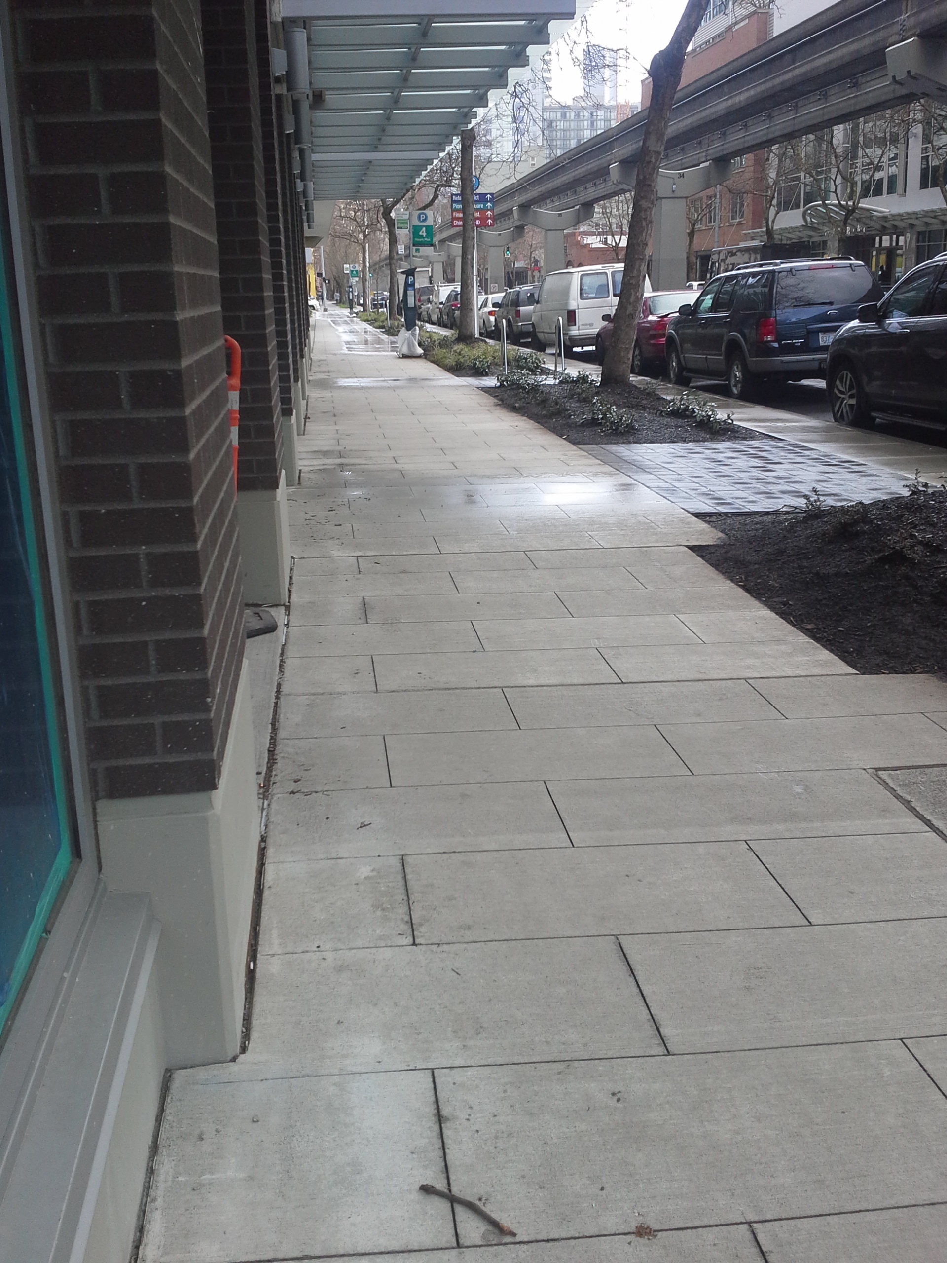
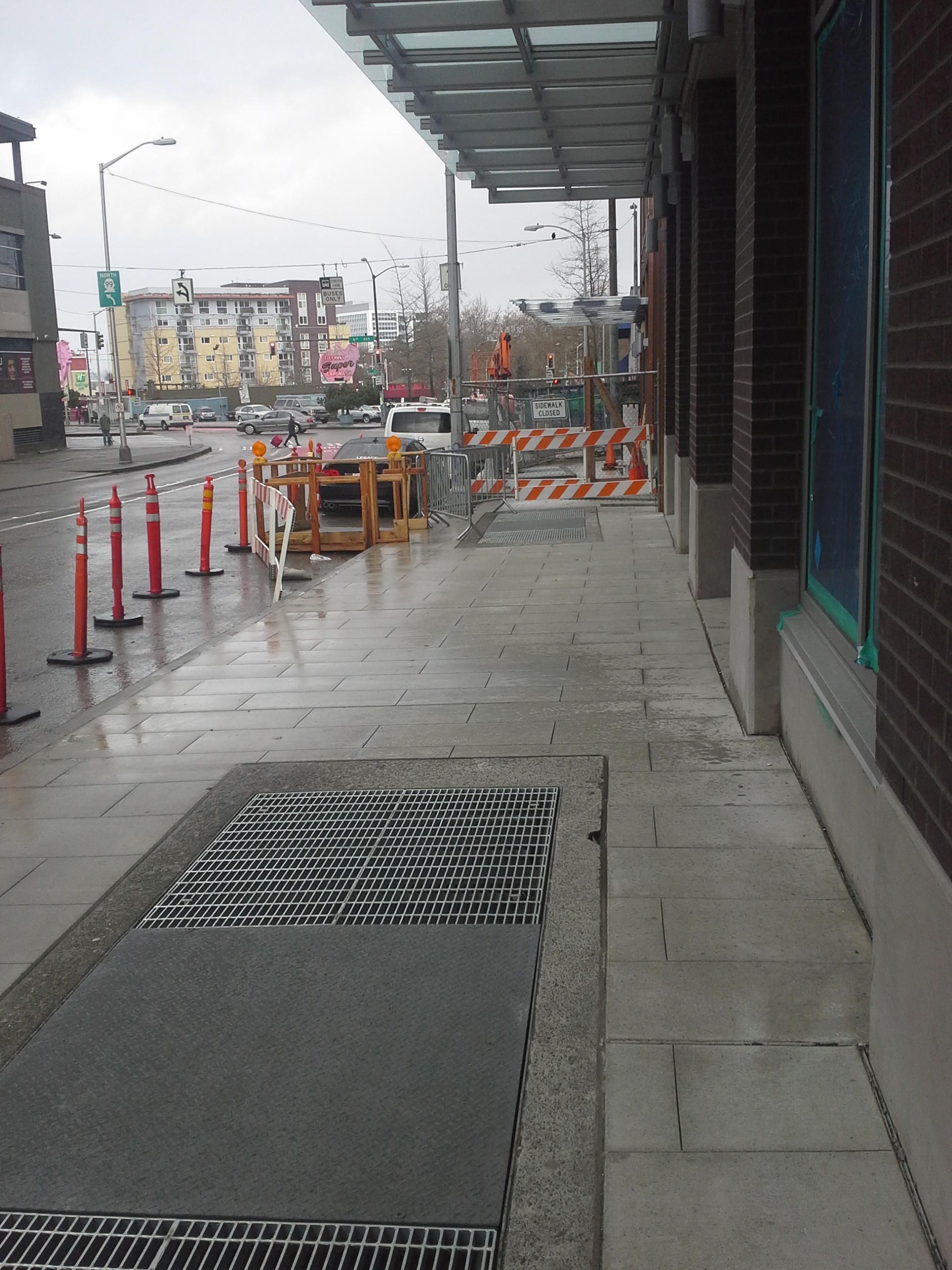
The 5th Avenue side of the project has a fully open sidewalk as of March 3, with the Battery Street side still closed to pedestrians.
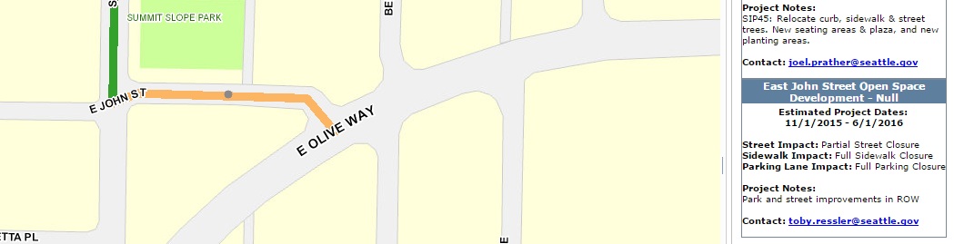
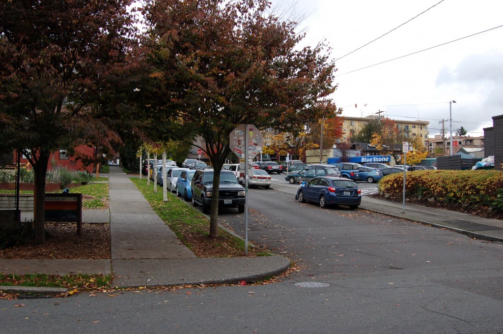
On Capitol Hill, the map indicates a full street closure between E Olive Way and Summit Ave E due to the John Street Enhancement Project from last November through May of this year. However, this street remains open as of this time.
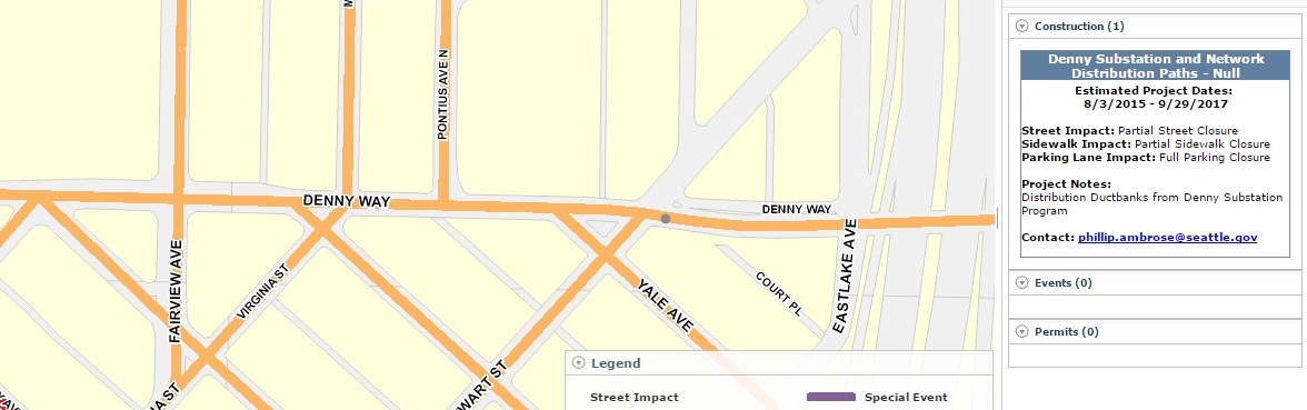
Finally, according to the map, there are partial sidewalk closures on Denny Way for a 6 block span from I-5 to 9th Ave through September of 2017.
These examples show that the tool might be a great resource to understand where projects are impacting the streetscape and what they are, but it is not likely to become a good tool for trip planning day-to-day. SDOT should be applauded for their efforts to make things easier for people trying to navigate all of the construction impacts happening right no, especially paired with Scott Kubly’s recent director’s rule intended to limit full sidewalk closures around construction sites.

Charles Bond
Charles is an avid cyclist that uses his bike as his primary mode of transportation. He grew up in the Puget Sound, but is currently overseas living in Japan. He covers a range of topics like cycling, transit, and land use. His time in Tokyo really opened his eyes to what urbanism offers people and has a strong desire to see growth happen in Seattle.