The University of Washington (UW) is deep into its Seattle campus master planning update for 2018. Earlier this month, the university released the draft plan and Draft Environmental Impact Statement (DEIS). The master plan is intended to cover a 10-year planning horizon, but also takes a look at future needs further beyond on the time period.
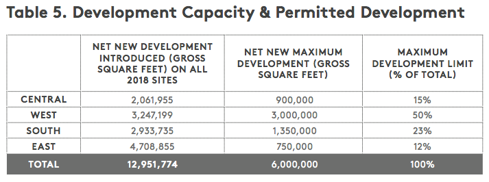
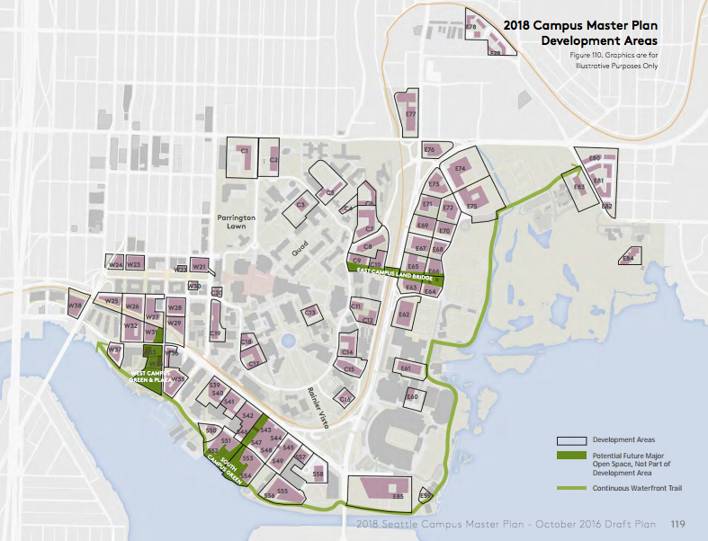
The draft plan anticipates that up to 6,000,000 net new gross square feet of space may be developed in the next ten years across dozens of development sites. In fact, 85 potential development sites are identified in the draft plan, which account for a maximum development capacity that exceeds 12.9 million net new gross square feet available for university use. No off-campus development expansions would be required to achieve to accommodate the anticipated growth.
What the Campus Master Plan doesn’t account for are other satellite spaces that the UW leases or owns throughout the city, including: UW Medical Center-Roosevelt, Sand Point, office space in Smith Tower, the University Tracts in Downtown Seattle, Harborview Medical Center (a UW affiliate), research space in South Lake Union, and dozens of other locations in Seattle proper.
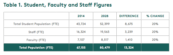
Here is what precipitated the plan: UW planners expect to see a 20% growth rate over the next year 14 years. The growth rates cuts across the board for student, faculty, and other staff.
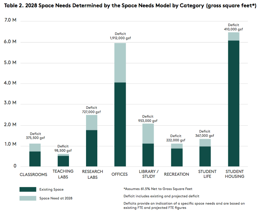
With 8,500 more students and 4,700 additional employees by 2028, the casual observer might assume most of the space needs would be required for teaching space. But that’s not exactly the case. A collective 427,00 gross square feet would be required for classrooms and teaching labs compared to 1,912,000 gross square feet for offices, the largest area of new space investments. The biggest space jump in terms of percentage would be library and study space, which would need to nearly double. A total of 5,063,000 gross square feet is expected to be required for all uses during the time period.
The UW says that new space would be directed into four areas:
- Central Campus (900,000 net new gross square feet);
- West Campus (3,000,000 net new gross square feet);
- South Campus (1,350,000 net new gross square feet); and
- East Campus (750,000 net new gross gross square feet).
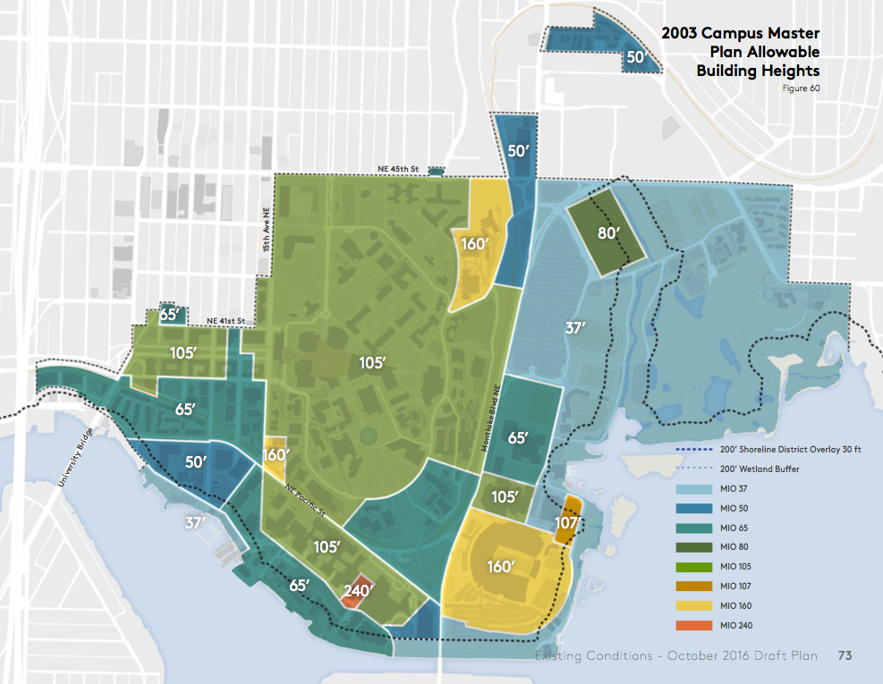
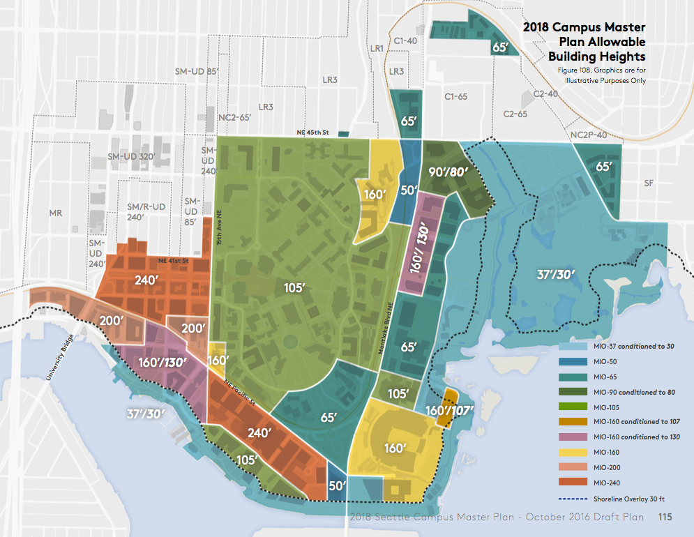
The campus master plan is an important document for the university if for no other reason that it alone guides the amount of development capacity that the main UW-Seattle campus has during the life of the plan. That’s because under a City-University agreement the university is only beholden to development standards of the campus master plan and Major Institutional Overlay (MIO) that UW property is designated, not other development regulations established under the Seattle Land Use Code. For those who may have wondered why the University District rezone and urban design proposal skipped areas south of NE 41st St and east of 15th Ave NE, the university’s separate MIO is why.
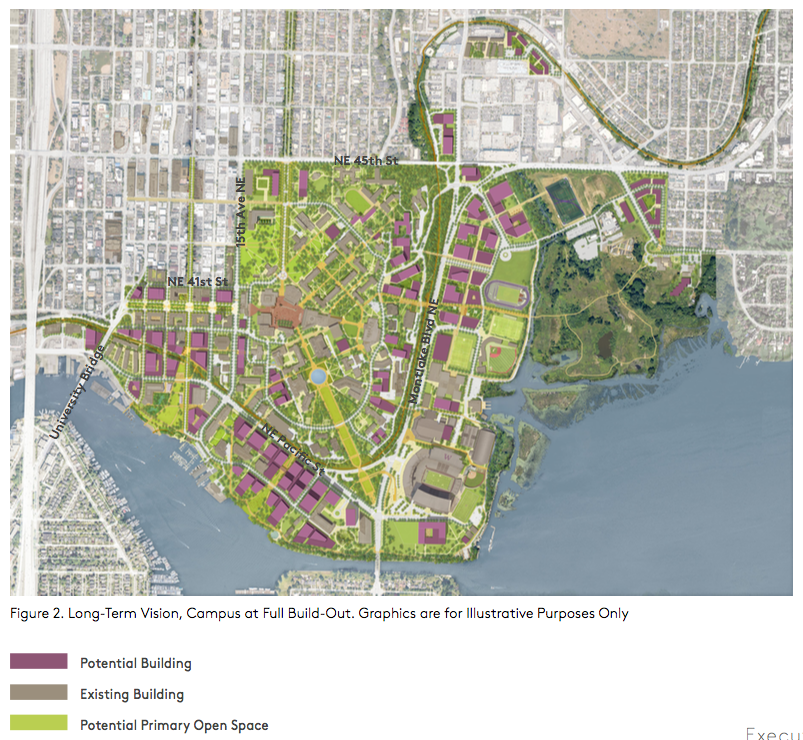
Long-Term and 10-Year Vision
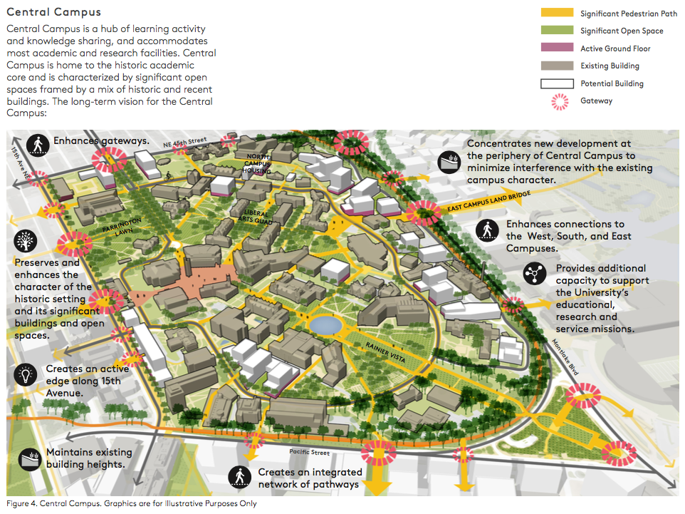
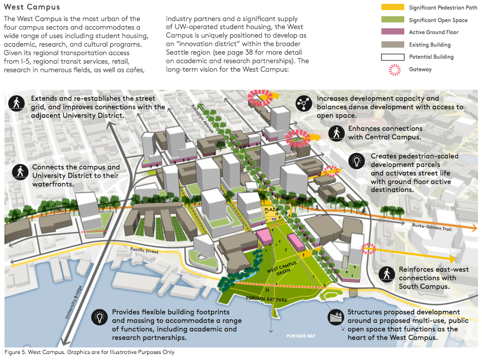
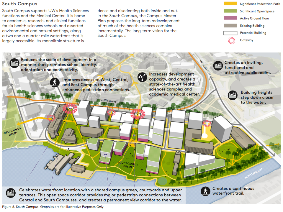
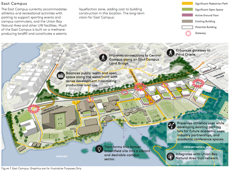
The University of Washington’s long-term vision would see significant new investments in space in the burgeoning West Campus and introduce new space in areas like East Campus, which both have ample amounts of surface parking. Most new development on the Central Campus would be focused along the eastern hillside that runs parallel to Montlake Blvd NE; some targeted infill locations near the Burke Museum, 15th Ave NE, and Benson Hall could also see development. The South Campus, which is home to UW Medical Hospital, would see substantial amounts of redevelopment, both on NE Pacific St and along Portage Bay.
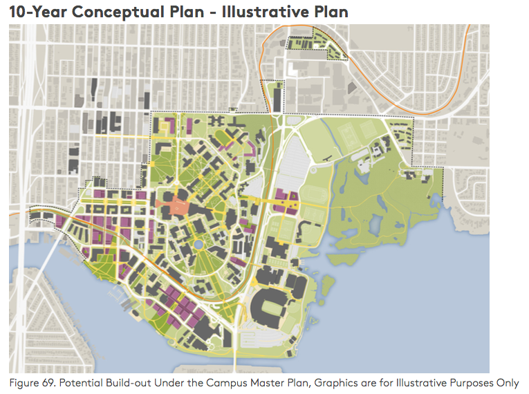
The 10-year conceptual plan, however, would focus most new campus development in the West Campus and South Campus. The beginnings of a new academic precinct could find its way to the north parking lots in the East Campus area; four sites that would provide up to 740,000 new gross area of space. And some infill development could be scattered throughout the Central Campus.
Conceptual Subarea Campus Plans
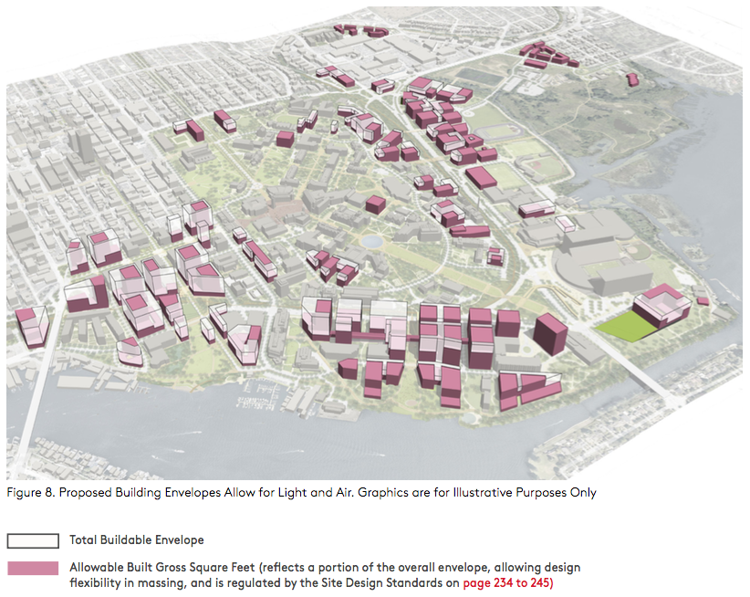
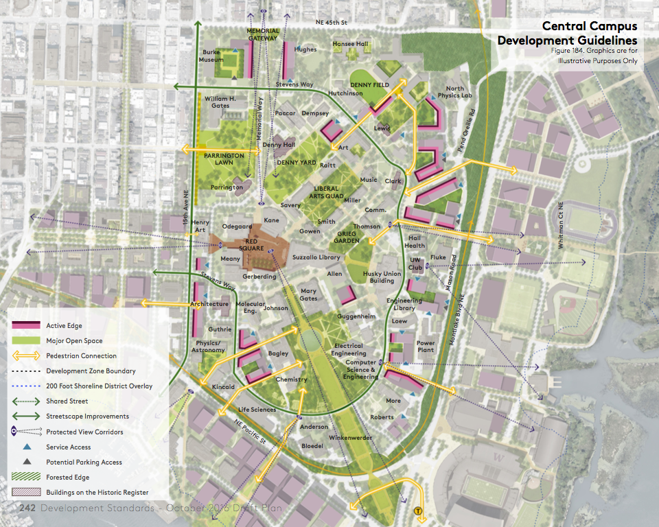
The draft plan highlights each of the four campus subareas by depicting the existing built form and future building forms. Plan objectives and benefits are noted throughout the diagrams, in addition to major campus gateways, active ground floor spaces, primary pedestrian paths, and open spaces. What’s encouraging about the conceptual plans is an emphasis on reducing barriers between campus sectors and adjacent areas (e.g., softening 15th Ave NE and creating physical and visual linkages across Montlake Blvd NE and NE Pacific St), and making use of the extensive central university landholdings. The diagrams speak for themselves:
Existing and Proposed Conditions
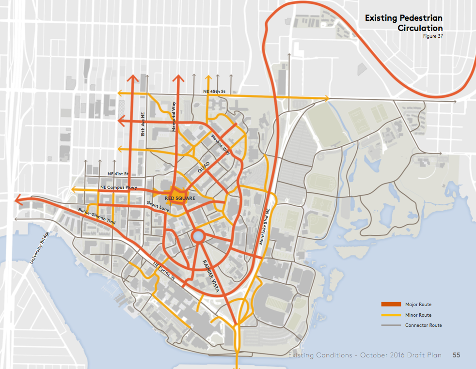
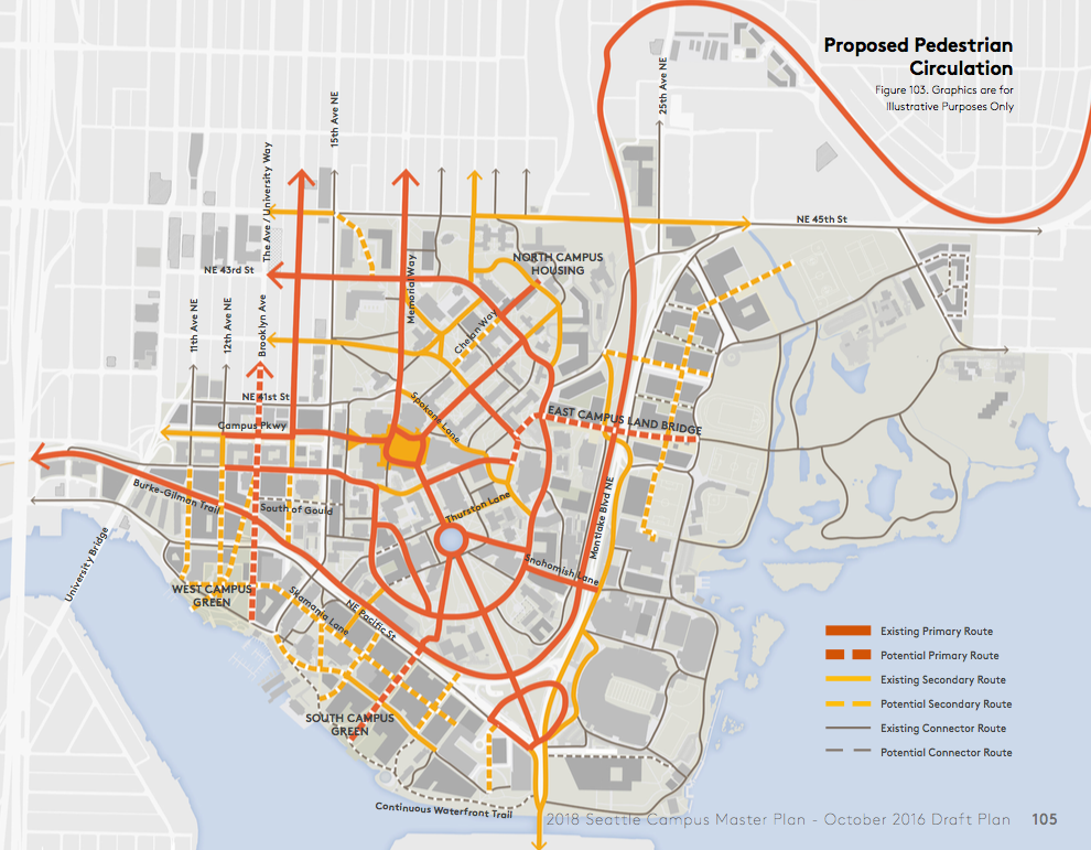
The draft plan has a lot more in it that just building assumptions. Planners have paired existing and proposed conditions together to show what might change in terms of the pedestrian network, open space, bicycle network, shoreline amenities, accessibility, transit, building heights, and parking to name a few.
Pedestrian Network
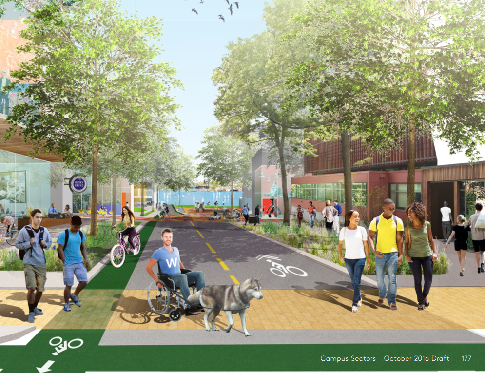
Planners expect to greatly infill the primary and secondary pedestrian routes throughout the campus. Most of the new routes would appear at the edges of the campus:
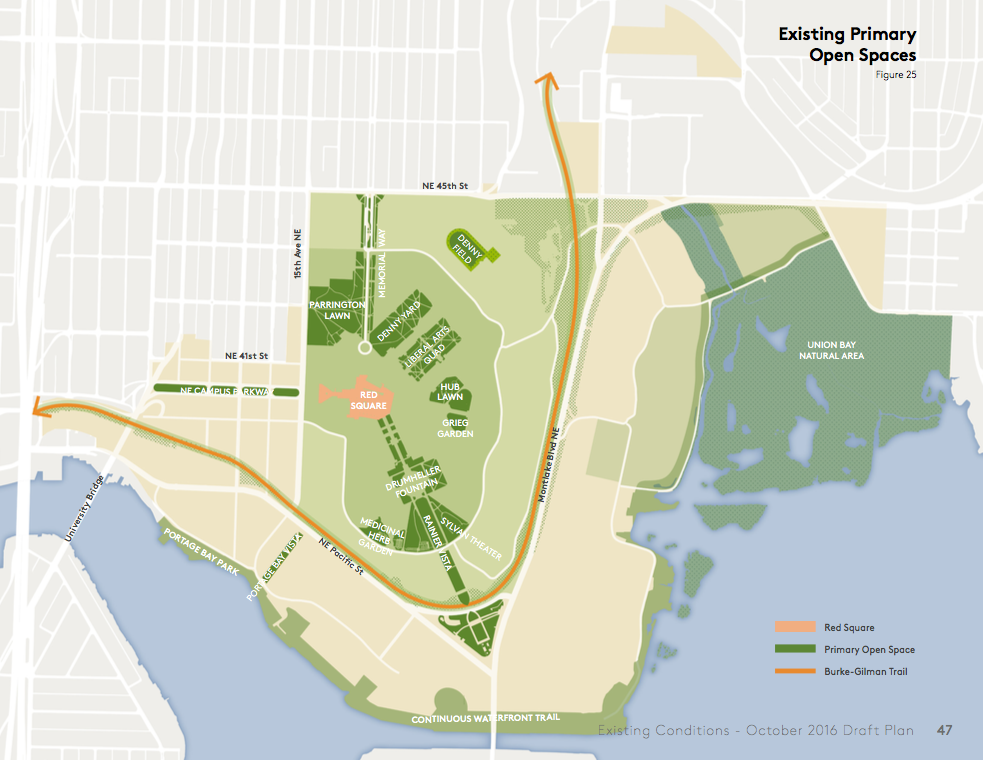
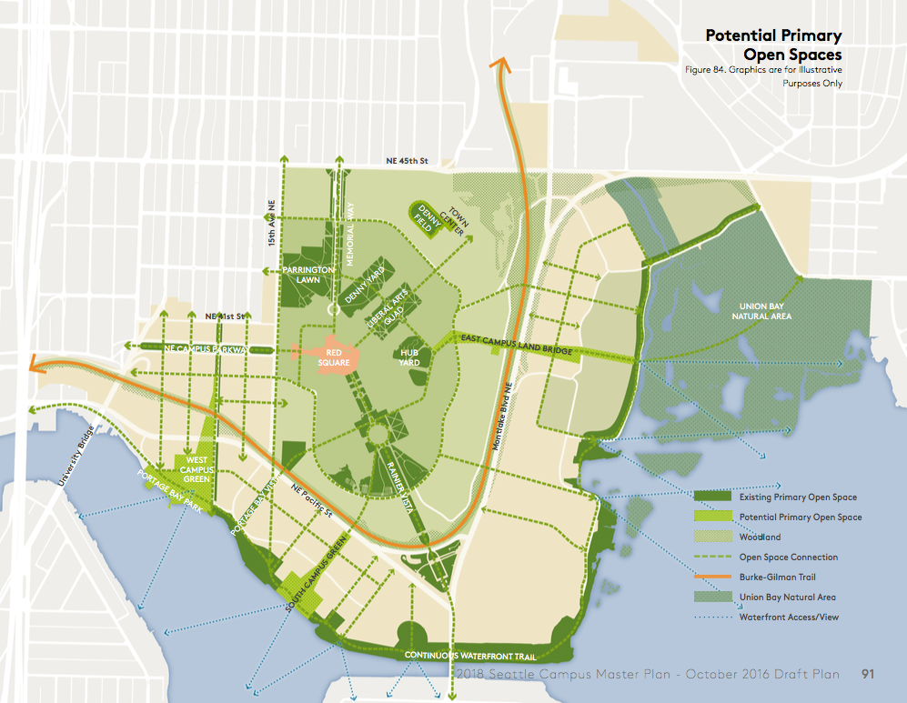
Open Space
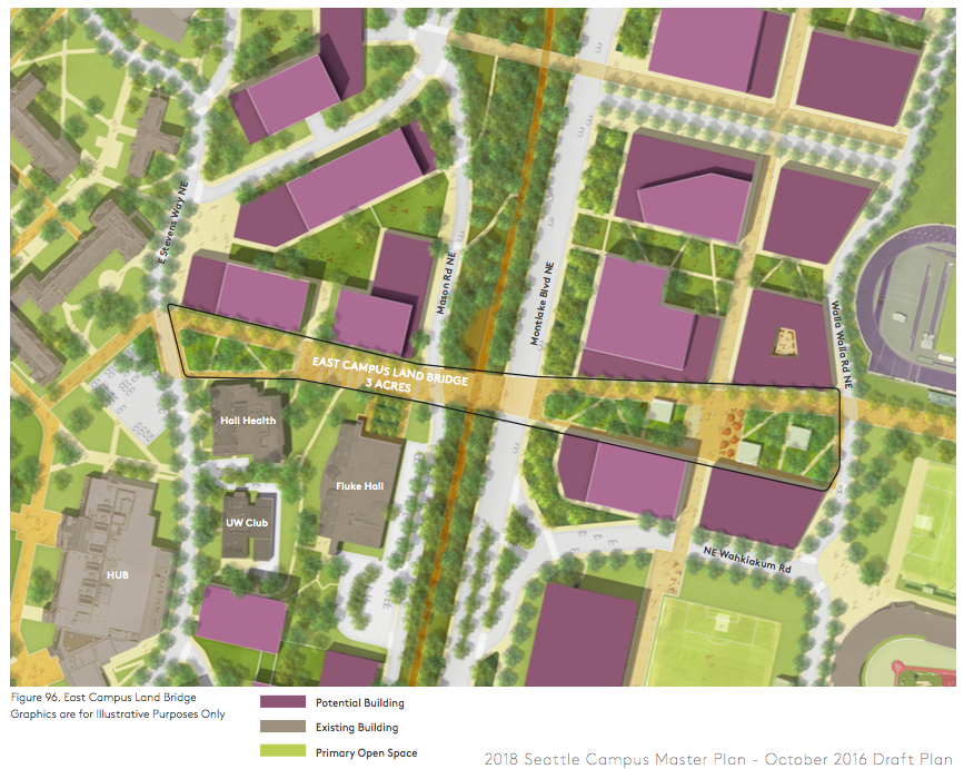
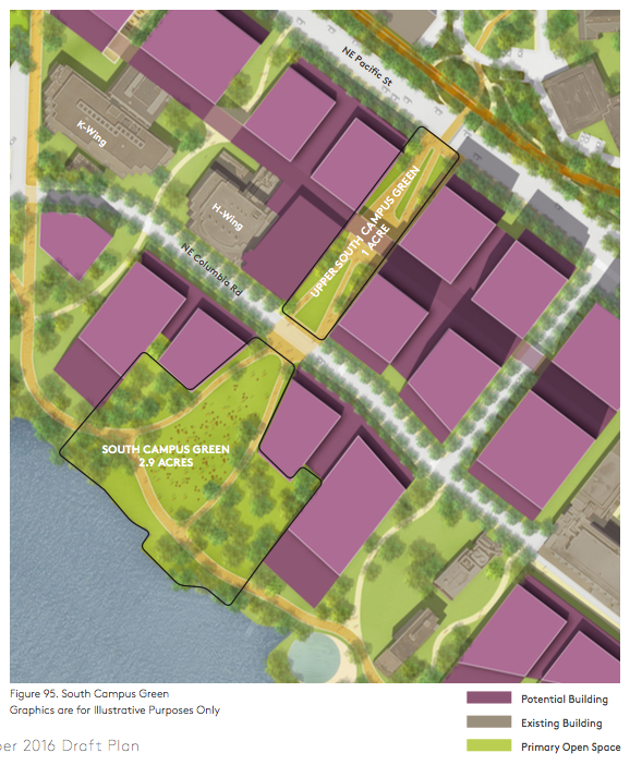
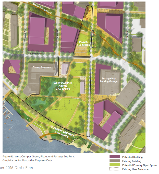
The university is considering big lifts in open space by greening up existing pedestrian corridors with more landscaping and recreation opportunities in addition to new investments in purely open spaces via the West Campus and South Campus Greens, East Campus Land Bridge, and Brooklyn Ave NE streetscape enhancements:
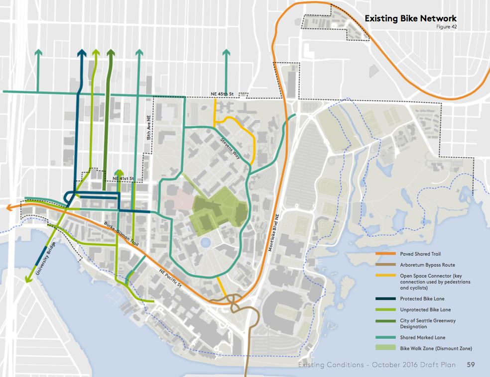
Bicycle Network
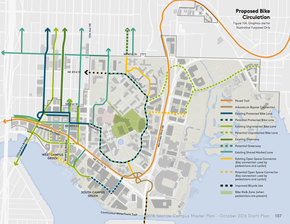
Bicycle facilities could get on-campus improvements beyond changes to the Burke-Gilman Trail. Things like protected bike lanes on Stevens Way, a new through connection at the UW Medical Center, bike lanes to East Campus and University Village, and other infill routes are all on the table:
Open Space
New campus development will come with considerable investments in open space and grand connections.
The East Campus could get a 3-acre land bridge that connects to the Central Campus, creating a new open space with landscape gardens and passive recreation uses. The land bridge would cross the wide Montlake Blvd separating the two sides of campus and ford the divide caused by the hillside. The land bridge would establish a new heart for the East Campus and draw pedestrians toward Union Bay Natural Area and outdoor track facility. Presumably, the land bridge would also connect to the Burke-Gilman Trail.
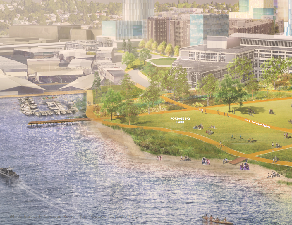
The university wants to continue creating access to the shoreline. To do this, a new Upper South Campus Green (1 acre) and South Campus Green (2.9 acres) would be created by divvying up the Magnuson Health Sciences Center and UW South Campus Center. The Upper South Campus Green a new north-south corridor and view from campus. An enhanced crossing of NE Pacific St would accompany the open space. The image below doesn’t highlight it, but the pathway just west would elimination of the Rotunda, which may just happen to also create a similar north-south view corridor.
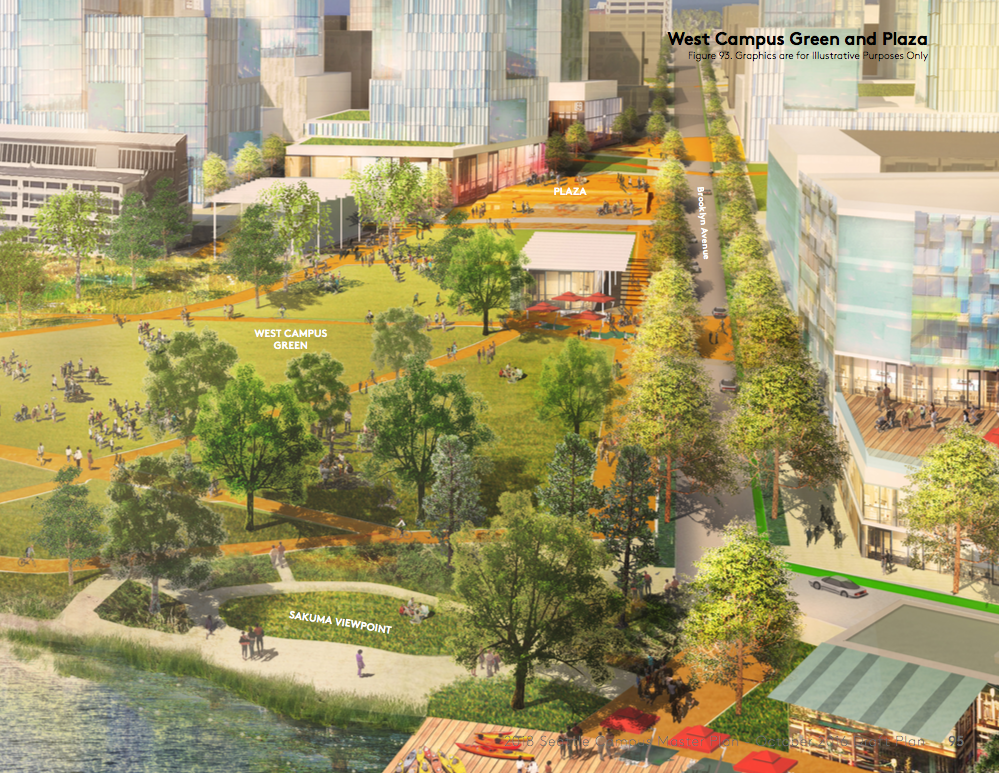
West Campus could get perhaps the grandest public space on campus with a new 4.16-acre green and 0.4-acre plaza. This is on top of the 2.44-acre site that the City of Seattle is developing as the new Portage Bay Park (presently in planning) and enhancements to the university-owned Sakuma Viewpoint on the edge of Portage Bay. The university’s proposal would require vacation of NE Boat St and major street calming changes to NE Pacific St and Brooklyn Ave NE.
The university’s renderings show an elaborate, connected green space surrounded by a burgeoning mid-rise and high-rise University District community. Outdoor event space, wide open fields, and wet, forested edges should draw in the district’s residents and university staff for recreation.
Parking
The University of Washington has a total parking cap of 12,300 spaces across the main campus, though some areas and facilities are not subject to the cap (which are identified below). So far, the university has 10,667 parking spaces across dozens of locations that are subject to the cap.
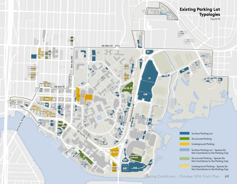
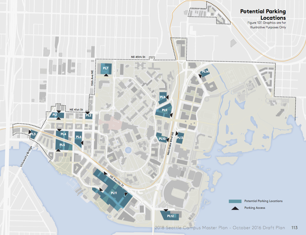
The university assumes that 10,940 parking spaces subject to the cap could be consolidated to 14 parking lots (indicated below). Most new parking would be housed in two-story structures, usually below other uses in a building:
Development Sites and Buildout
As noted before, planners have taken stock of remaining development sites and newly identified sites:
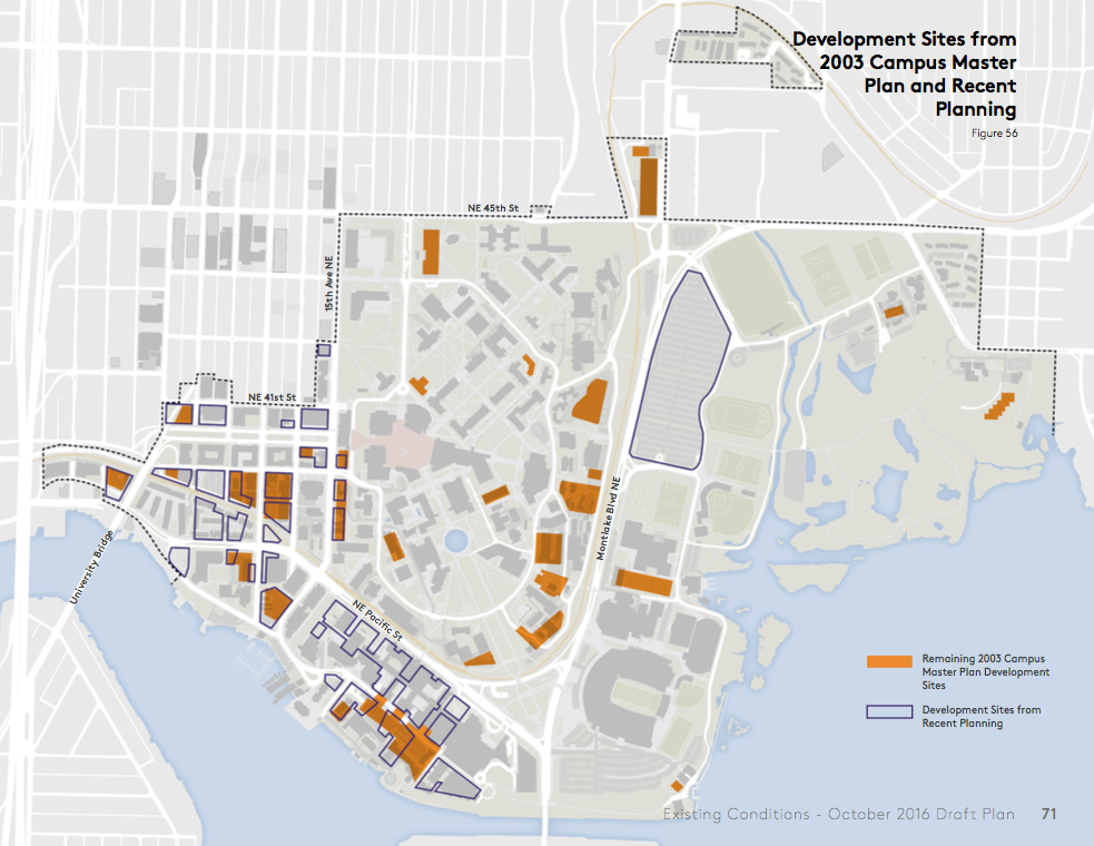
85 separate development sites have been identified by planners with the bulk of them outside of the Central Campus subarea:
To facilitate efficient and economical development of the sites, the university would propose changes in allowable building heights and capacity:
Development Standards
The University of Washington recognizes the importance of the university as a historied public institution and dynamic space. Written into the plans are specific vision goals to create active and inviting spaces, preserve historical and architecturally significant resources, emphasize key vistas and open space assets, and respect the human-scale character of the university. Each of these goals are important aspects of placemaking and thoughtful infill development and redevelopment.
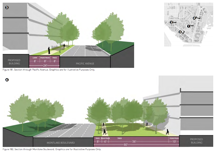
The kinds of development standards that guide the design approach include things like control of signs and banners, development near shoreline areas, historic and cultural conservation, setbacks and height allowances, active street level uses and transparency, building orientation and floorplates, and much more. The university assigns project review to the UW Design Review Board, UW Architectural Commission, and the University Landscape Advisory Committee where appropriate for the type and scale of a proposal. To give a sense of the standards, the following quotes from the draft campus master plan offer a window into the university’s approach to controlling campus development.
Development review:
The zoning of the Campus is Major Institution Overlay (MIO), as shown in on page 28. Pursuant to the 1998 City-University Agreement and Seattle Municipal Code Chapter 23.69, University development within the University’s MIO boundary is governed by this Campus Master Plan, not the underlying zoning or land use code. This Campus Master Plan replaces the underlying zoning, development standards, and land use control ordinances for development within the MIO boundary. The development standards in this section are tailored to the University and its local setting, and are intended to allow development flexibility and improve compatibility with surrounding uses. These development standards supersede those of the underlying zoning for University development. If a development standard or land use control ordinance associated with the City’s code or underlying zoning is not acknowledged to apply in this Campus Master Plan, then it does not apply.
Demolition:
Demolition is permitted prior to future development. Demolition permits are submitted in advance of a building site being selected for development and are allowed as long as sites are left in a safe condition and free of debris. Demolition of any structure, including any structure that is more than 25 years old or historic is allowed if authorized by the UW Board of Regents.
There is an extensive discussion on the process for identifying and protecting historic and cultural resources.
Calculating allowed gross square footages:
If a project includes demolition, the gross square feet demolished will be a deduction from the total project gross square feet to calculate net new gross square feet. Only the net new gross square feet will be deducted from the Campus Master Plan development allocation.
Consistent with other methods of calculating building square footage, the Campus Master Plan gross square feet will not include open areas such as parking lots, playing fields, courts, and light wells, or portions of upper floors eliminated by rooms or lobbies that rise above single-floor ceiling height. It will include top, unroofed floors of parking structures where parking is available
Building modulation:
Façade modulation is not required for University development, however the design of buildings will strive to incorporate measures that provide for appropriate variety, express varying functions of the building and respect the pedestrian scale at the ground level.
Active street level uses and transparency:
All development sites with active ground floor designations should have well-placed pedestrian entry points, and largely transparent ground level facades that make visible interior amenities and activities. The design should contribute to and enhance the quality of streetscape and neighborhood character with multi-functional landscapes and pedestrian-environment amenities.
All buildings situated along active edges shall have an active use along 75 percent of their frontage at the street level, as identified on pages 242 through 245. Sixty percent of this frontage should be transparent to allow visibility into the space. In areas that a blank façade is required, its maximum width shall not exceed 15 feet. Active street level uses support pedestrian activity throughout the day along public right of ways and public realm spaces, where pedestrians can view the activities inside.
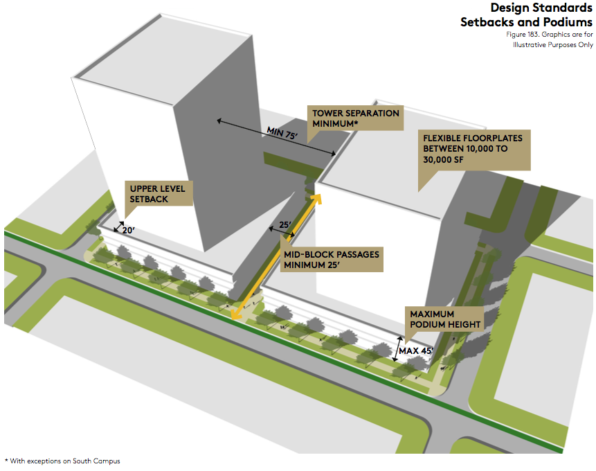
Podium height:
Podium height refers to the base of a building and is clearly differentiated from the spaces above by its physical form and extent. Podiums shall be a maximum of 45’ in height, with development above stepping back according to upper level setback guidelines under the public realm allowance. The intent is to maintain a pedestrian friendly scale and minimize the impact of shadows on the public realm.
These, of course, are only a few of the development standards that the university intends to set for itself. There’s a lot more packed into the draft plan to govern the form of development. The document as a whole is worth perusing.
If you have comments on the proposal, you should send them to cmpinfo@uw.edu. The public comment period on the draft plan and DEIS are open through November 21st. Early next year, the university will issue the final plan and FEIS before sending the proposal to the City of Seattle for recommendation by the Hearing Examiner and approval by the Seattle City Council. The precise timeline is unknown given the public hearing and appeals process, and the discretion of the City Council to put the proposal on their agenda. Regardless, a final version of the campus master plan update could be adopted by mid- to late-2017.