When the Seattle Department of Transportation (SDOT) announced the end of an eight-year study on traffic collision data, it had a very comprehensive set of data on where collisions took place, what modes were involved, and how the collisions occurred. The big question was: how would the department begin to apply the data across the city to reduce those collisions?
One big aspect of how the department will use the data was announced earlier this month, on the SDOT blog: traffic signal replacement. It sounds boring, but it could really galvanize Seattle’s progress toward Vision Zero. From the blog:
In the past, we’ve installed new signals primarily after public feedback, generally one or two new signals per year. But, this process was costly to administer, difficult to prioritize, did not adequately consider crash history, and ignored intersections that weren’t publicly requested.
In other words, prior to this policy change, new traffic signals were not prioritized based on where crashes occurred, but rather where residents brought it up. But now…
We’re now using data on expected growth, crash history, costs for partnering with developers, and equity to prioritize the roughly 9,000 intersections throughout Seattle without signals.
…
Each year the top 10 intersections by these metrics are analyzed and prioritized, with an emphasis on crash history. We also check if the intersection meets federal standards for new signals. In many cases, a new traffic signal is not the best treatment for an intersection and a less costly treatment, such as a four-way stop or turn restriction, are more appropriate–especially in situations where traffic volume isn’t high.
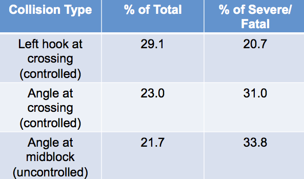
Not only will they be using that more robust set of data to determine where to add signals, they will also be prioritizing the improvement of existing traffic signals to improve the left turn movements. That eight-year collision data study showed that among collisions that involved a pedestrian, 29% involved a left hook at a controlled crossing. Nearly one in three pedestrian collisions were at controlled intersections that clearly were not doing their job.
SDOT has released a list of the top ten intersections that it is prioritizing for left turn improvements:
- Martin Luther King Jr Way S and S McClellan St
- 25th Ave NE and NE 75th St
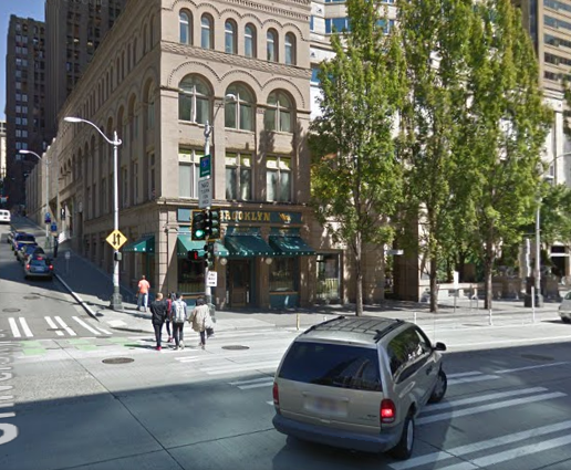
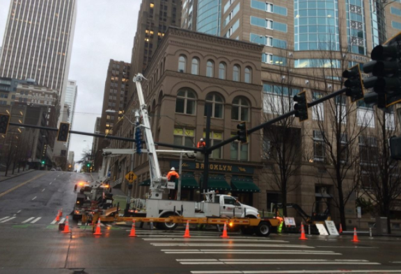
- 6th Ave and James St
- Denny Way and Dexter Ave N
- 12th Ave S and S Weller St
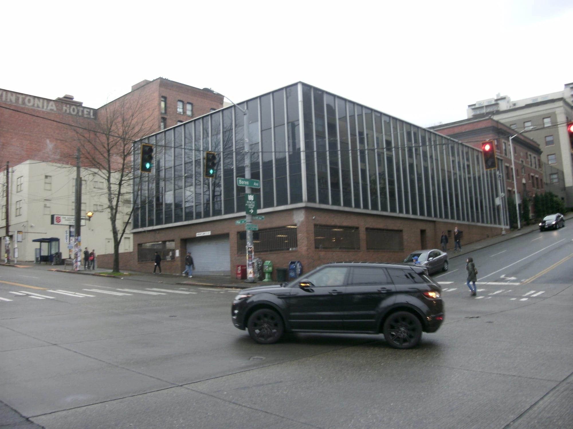
- Boren Ave and Pike St
- 15th Ave NE and NE 50th St
- 23rd Ave E and E John St
- Martin Luther King Jr Way S and S Cloverdale St
- 2nd Ave and Denny Way
Many of these are high traffic intersections with a long rap sheet of collisions. We do not yet have access to the SDOT collision data study, but The Seattle Times compiled data from collisions between 2007 and mid-2014 and many of the most frequent intersections for collisions are listed here. Six of the intersections listed above saw three or more collisions involving pedestrians during that time frame, and two of them, Denny/Dexter and Boren/Pike saw eight collisions, the highest number.
The intersections prioritized for new traffic signals are not as frequent offenders as the ones slated for left turn improvements, but they are definitely located along corridors that are sorely in need of improved crossings.
- E Marginal Way S and S Alaska St
- 12th Ave S and S Main St
- 10th Ave S and S King St
- Aurora Ave N and N 128th St
- SW Holden St & Highland Park Way SW
- E Marginal Way S and S Dawson St
- 1st Ave NE and NE 105th St
- Aurora Ave N and N 97th St
- E Jefferson St and Terry Ave
- 12th Ave E and E Marion St
- 12th Ave E and E Spring St
- 20th Ave NW and Leary Way NW
Three of the new signals are located along the 12th Avenue corridor between Capitol Hill and the Central District, an area currently experiencing a great deal of development. Many of the other intersections fill in gaps in the pedestrian network, particularly along Aurora and E Marginal Way.
To look at the new signal at 12th Ave and Main St as an example, this year’s Neighborhood Street Fund process ended up giving a top five rating to a new signal there but in the review SDOT concluded that pedestrian counts did not warrant a new signal there. The reason we are now seeing it on a list for new signals is that focus on expected growth and opportunities for partnership with developers.
This change is a big step toward a data-driven approach to the day-to-day business that SDOT engages in all the time: routine maintenance, system upgrades, and safety improvements. This does suggest that Vision Zero is taking hold at SDOT on an institutional level. Time will tell how effective it is as we head toward our goal of eliminating serious injuries and fatalities on our roads by 2030.
One of the best demonstrations in Seattle of how traffic light design can influence safety is the Second Avenue bike lane. When it first opened in 2014, the traffic lights were positioned so that drivers did not immediately notice the red left turn arrows when the general signal was green. SDOT has slowly been replacing the traffic lights that were located at the side of the street or, at a few intersections, on wires over the intersections, with steel mast arm poles that span the entire intersection and make signals for specific lanes more clear. The steel mast arms have the nice byproduct of increasing the lifespan of the traffic equipment significantly.
With some of the traffic signals still being installed along Second Avenue, it may be too soon to draw conclusions from the data. Though, anecdotally, the number of illegal turns along Second Avenue across the bike lane has gone down quite a bit at the intersections that are now complete. Presumably the same design will be used when the bike lane is extended north to Denny Way next Spring.
Kudos to SDOT for continued focus on using data to improve safety and mobility city wide. Keep it up!