SDOT said it would prioritize busses rather than bikes on Rainer, but instead cars continue to win out over both.
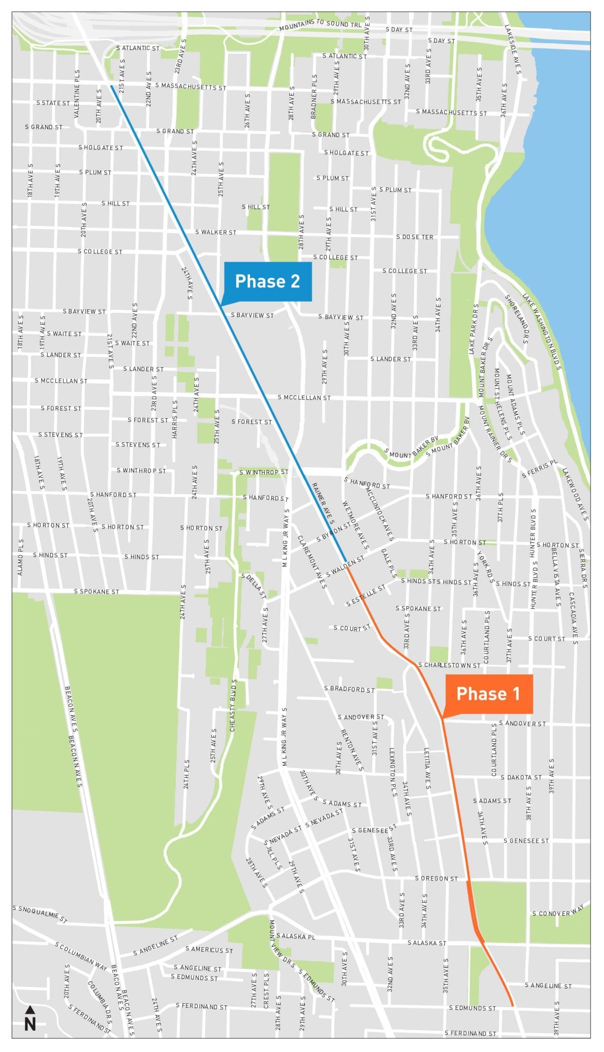
Last month, The Urbanist reported on the Seattle Department of Transportation’s (SDOT’s) plan to add a short stretch of northbound bus-only lane to Rainier Avenue north of Columbia City, with the intention of extending that lane north to I-90 and the soon-to-open Judkins Park light rail station in the next few years. This week SDOT reiterated that plan in a blog post, announcing that the first phase of bus lane will be installed over the weekend of July 8-10.
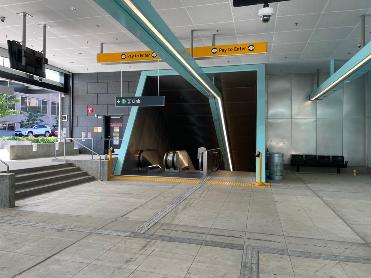
But SDOT’s proposal leaves unmentioned any prospect of a third phase, which would run north of soon-to-open Judkins Park Station, even though a report that the department co-authored with King County Metro identified that northernmost segment of Rainier Avenue as one of the top candidates for spot improvements around Seattle’s center city. The agencies measured a higher rider delay per mile for that stretch than most other segments of Rainier. The Move All Seattle Sustainably coalition (of which The Urbanist is a member) has been calling for bus lanes in this section since 2019.
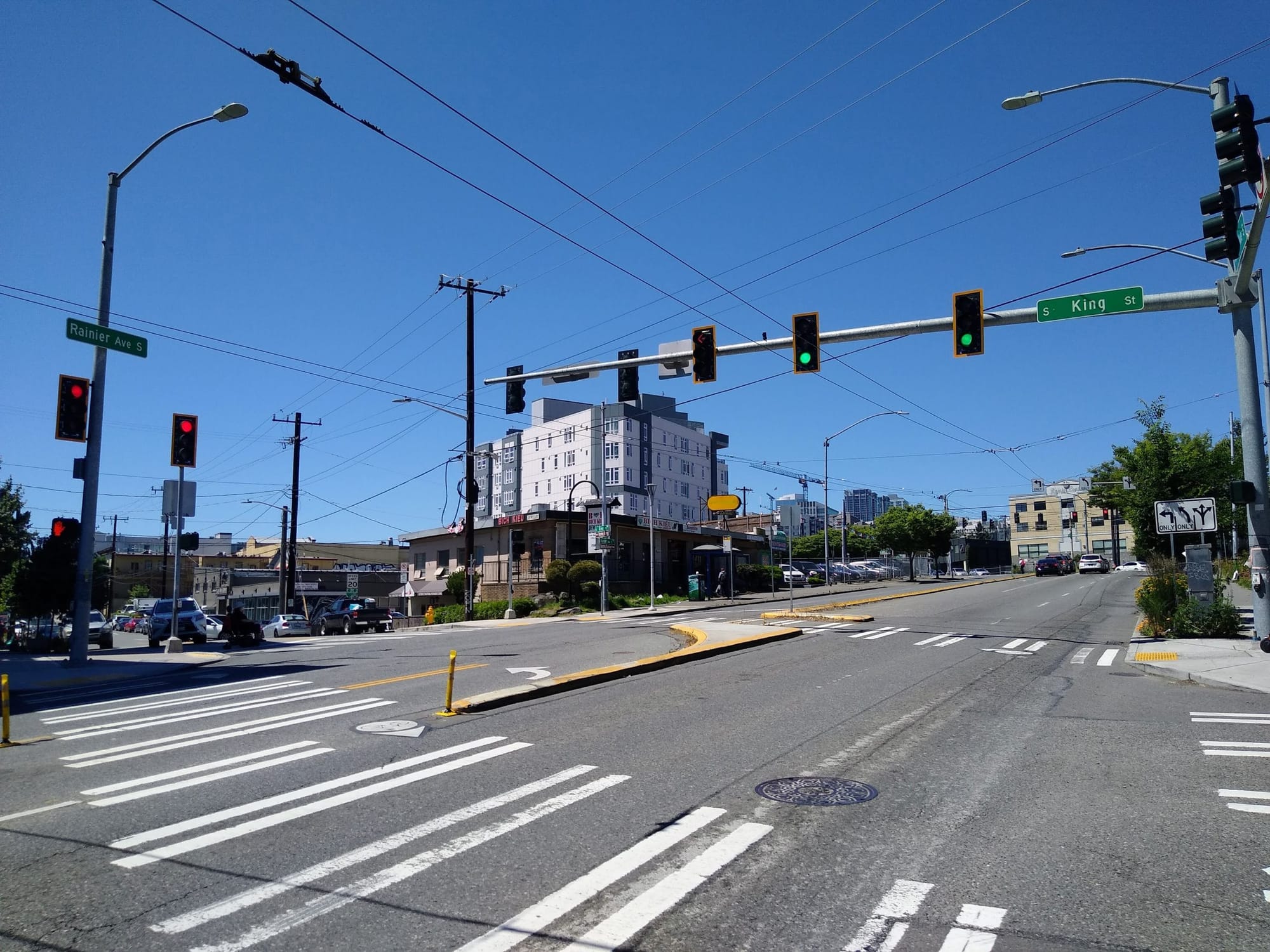
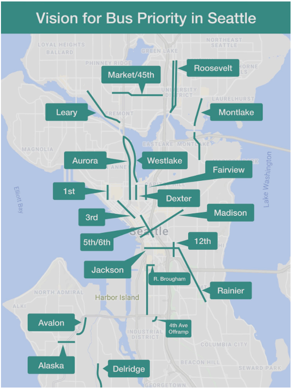
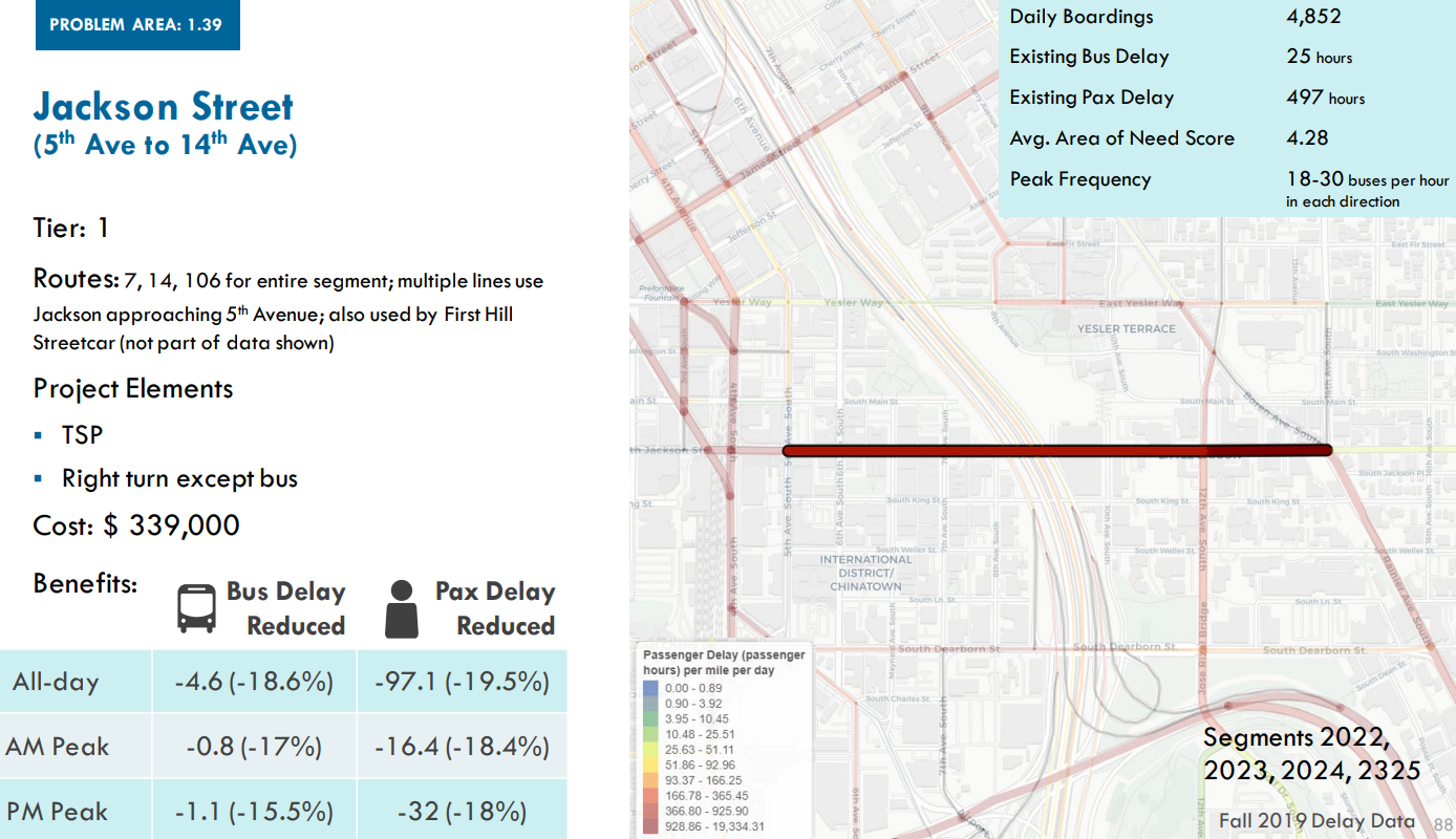
King County Metro’s 2022 Speed and Reliability Planning Project report (which expanded upon its earlier spot improvements report) identified an entire slew of spot improvements in Seattle that would speed up its buses through the most traffic-laden roadways. These projects see some of the highest volumes of buses in the entire system, and barriers to adding improvements here are often more political than financial or technical. Very visible on the map of spot improvements is the Jackson Street and Rainier Avenue corridor, both of which Metro identifies as Tier 1 projects, the highest priority.
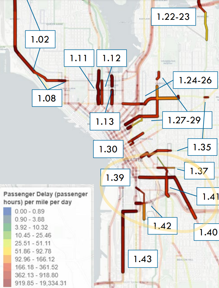
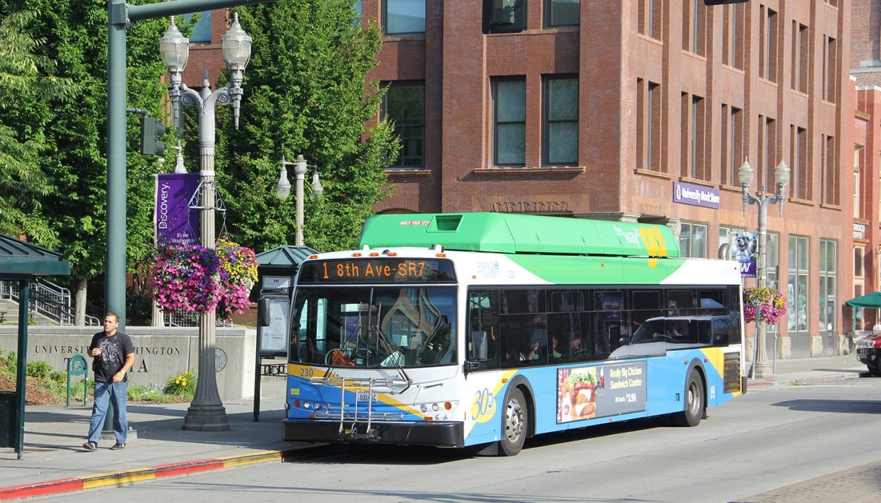
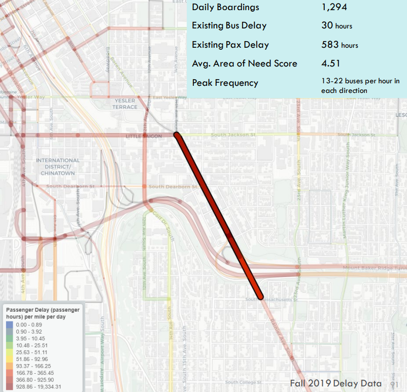
According to Metro, in 2019 buses on this segment of Rainier, north of S Massachusetts Street, experienced 30 hours of cumulative delay per weekday across the routes that use it, which include Routes 7, 9, and 106. Multiplied by the number of passengers on each bus, that works out to 583 hours of delay, a figure that doesn’t even include any delay on Jackson Street, which Route 7 and 106 use to connect to Downtown.
However, Metro didn’t provide a full analysis of this segment of Rainier in its report because improvements along the street are moving forward as part of the Route 7 “Transit Plus Multimodal” improvement project, and the street was also looked at by SDOT as part of a package of bus lanes developed during the pandemic which the department has been dubbing “COVID recovery lanes.” In other words, since that analysis is taking place elsewhere within SDOT, we don’t have an estimate of how much time bus lanes on this segment of Rainier would save.
But it is known that Metro thinks adding transit signal priority and converting the curbside lane on Jackson Street to right turn only, except for buses, could speed up coaches by double digits, reducing passenger delay in the corridor by 19.5% across the entire day, according to Metro’s report. That project would be a bit trickier to implement since the First Hill Streetcar occupies the inside lane on Jackson. Rainier Avenue, however, does not present as many complications for installing bus lanes.
In a written statement for the The Urbanist, SDOT assured that bus lanes on the northern segment of Rainier are still possible in the future. “The bus lanes are not ruled out completely,” SDOT’s Mariam Ali confirmed via email. “There is additional analysis that still needs to be completed north of I-90 and [there] the lanes have not been explicitly ruled out.” But so far there are no indications that this will be put on the table anytime soon.
The second phase of the planned northbound bus lane, between S Webster Street and S Massachusetts Street, is not planned to go in until either 2023 or 2024 — potentially a year after Judkins Park Station opens. Thus space for buses is being added in an order that opposes what the data shows it should be, with the segments of Rainier to the south with lower bus delays per mile being prioritized first. While this might be the easiest way to implement them, it’s not the way to achieve the biggest impact per rider. There’s also the issue of dedicated space for southbound buses, which is only proposed for a few blocks near Columbia City, despite data showing high rates of delay.
Last week, during a Seattle City Council transportation committee discussion on Vision Zero, Councilmember Tammy Morales asked the SDOT team a pointed question about allocating space for bikes on Rainier Avenue, one of the only flat direct routes in and out of the Rainier Valley. “Can you talk about why there’s no protected bike lane infrastructure being considered on Rainier?” Morales asked.
SDOT Project Development Director Jim Curtin told Morales that space for buses won out over space for bikes when the department did its community outreach in the neighborhood over the past few years. “What we heard from our in-person outreach out there [in the Rainier Valley] was that transit efficiency was a much higher priority for the folks that we were talking to,” Curtin said.
He did say, however, that the northern segment of Rainier could yield opportunities for space for safe bike connections. But the question remains: if SDOT heard from community members in the Rainier Valley that speeding up transit is a priority, then why isn’t making space for transit on the most impactful segment of Rainier moving forward?
Making space for buses on a high-demand street like this won’t get any easier in the future, and Metro’s own data shows that the addition of bus lanes could be highly impactful for riders. Waiting until 2024 or beyond to give riders of Routes 7, 9, and 106 a truly fast and reliable trip isn’t acceptable given what SDOT and the City have stated their values around moving transit riders are.
Rainier Avenue To Get Northbound Bus Lane Extension, but Corridor Vision Is Still Missing