Yesterday’s article went over cost estimates and offered three freeway lid case studies across. In this third piece on lidding I-5, I will summarize a site analysis for Downtown Seattle and suggest interim solutions that could be used to build support for expansions of lids on I-5.
Site Analysis
One completing review of freeway lid case studies, my work focused on developing a comprehensive study area site analysis in Downtown Seattle. The site analysis focused on some of the key elements of the case studies, such as traffic and topography.
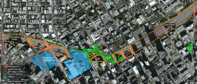
I affirmed the prime location for lidding is between Olive Way and Madison Street, where I-5 runs in a deep trench between the surrounding streets and buildings. I used the existing divisions of freeway airspace to parcel this area into sections numbered, 1 through 6. I also looked at possible redevelopment opportunities around the freeway. At the suggestion of my faculty adviser I expanded the scope into secondary study areas, which are north to Denny Way and south to Yesler Way. Because of their topographic situations, I considered these areas in much less detail.
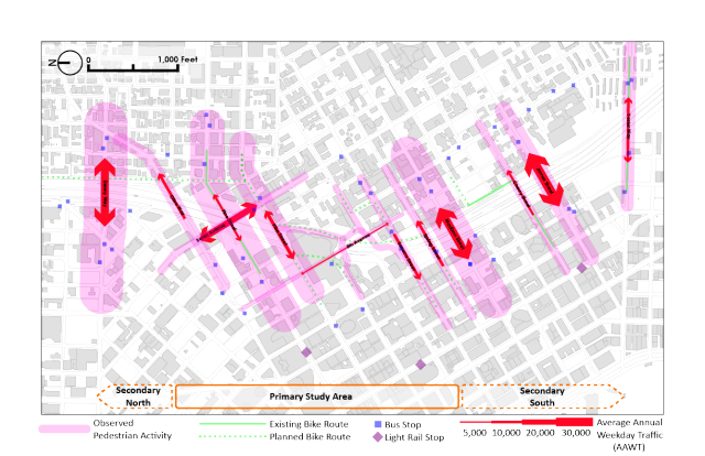
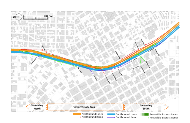
Using public data and my own feet on the ground, I documented characteristics like predominant land uses and landmarks, trees and vegetation, traffic volumes, noise, views, and the freeway’s configuration. King County’s topographical data and WSDOT engineering drawings were used to find the rough dimensions and slope of each study area. I determined that the lid surfaces will need to be sloped or terraced due to grade changes between the sides of the freeway trench. I found no examples of similar challenges in the lid inventory, but there’s no reason it couldn’t be done as long as columns are able to be located within the medians.
Lids will also facilitate a few beneficial changes to freeway ramps and city streets. The Spring Street and Seneca Street ramps duplicate the functions of nearby ramps, for instance, and could be demolished to streamline east-west traffic flow and enable lids to completely cover the freeway airspace. Seneca Street and Olive Way can be converted to two-way traffic to create better vehicle and transit flows. Sidewalks and crosswalks need to be added in a few key locations where they are currently missing.
In my original research process, I had evaluated a concept that would close the Spring Street overpass to create a larger park space between Madison Street and Seneca Street. However, the Madison BRT project now appears to be set on using Spring Street for eastbound buses. Given this limitation, the overpass should be modified or rebuilt to be curbless and possibly even restricted only to transit vehicles.
Interim Soultions
Using site analysis as a basis, I have developed a number of key solutions for improving the environment around I-5 in the short-term. These simple steps will convert marginalized areas into pleasant and useful spaces while building public support for permanent freeway lids.
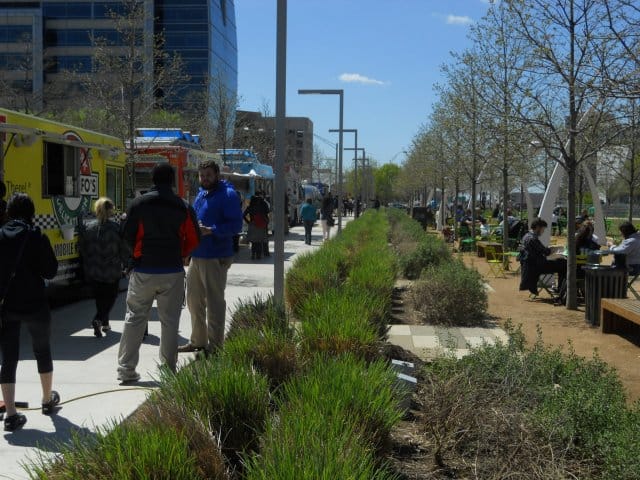
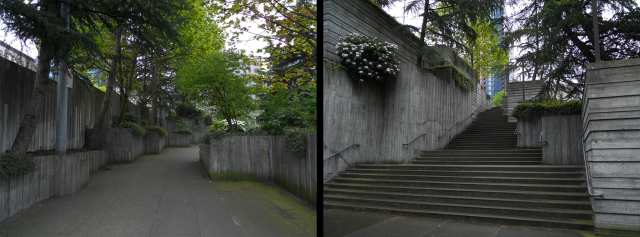
First and foremost, one case study concluded that Freeway Park needs major upgrades and more civic attention. Despite its unique place in Seattle’s public realm, it remains neglected by the city government and its citizens. This is partially due to a legacy of crime and inadequate maintenance since the 1980s, but also because the park is so hidden from the surrounding streets.
The park’s design is inflexible and offers little for visitors to do besides sit or stroll. Improvements in visibility and landscaping have been made, but today the park is still primarily used by a only a few select groups:
- First Hill residents who walk through it to work;
- Nearby office workers who visit to smoke or have lunch;
- Convention Center visitors;
- Those interested in summer programming like evening dances; and
- Hmeless people who find refuge in the park’s dangerous nooks and ledges.
A revitalized Freeway Park would be more attractive to families, youth, tourists, and others who wouldn’t otherwise know about it. As the original freeway lid in Seattle, improving Freeway Park’s accessibility and programming will implant a more positive image of lids in Seattleite’s minds.
A 2004 report by the Project for Public Spaces made a number of recommendations to improve the park, and I’ve stressed a few of them and added my own.
- Changes need to be made to the park’s surface structures and entrances.
- In the spirit of creating a unified pedestrian corridor above the freeway, new handicap-accessible ramps are needed at the Pike Street, Union Street, and University Street entries.
- Walls around all of the park’s entries need to be lowered and vegetation needs to be trimmed even further.
- Barriers need to be placed at the hidden ledges where people precariously camp over the freeway.
- More flexible seating, covered structures, food vending, and frequent daily programming are needed to draw more people into the park.
- A nonprofit or specialized public office needs to directly manage the park on a daily basis.
Freeway Park also offers positive lessons for future lid design. Its blend of hard concrete and lush landscaping is an inspiring juxtaposition between the functionality of transportation infrastructure and the traditional design of municipal parks. And while its street entries need improvement, the park connects well with several surrounding buildings, providing direct pathways to the Union Square office towers, the Ceilo apartment tower, and the south side of the Convention Center. Similar connections need to be made with neighboring properties on future lids in the area, such as the Paramount Theater and the low-income Olive Tower.
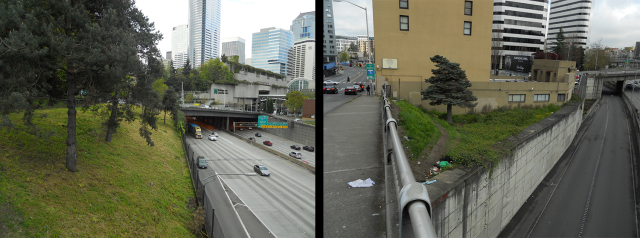
The city must reclaim the “dead spaces” along the freeway edge. There are a number of these linear and triangular spaces characterized by trash and overgrowth. They’re mostly fenced off, but these forgotten spaces are often inhabited by homeless people despite steep slopes, exposure to fumes and noise, and proximity to fast-moving freeway traffic. Interventions in these spaces can take the form of pocket parks, new pedestrian routes, noise walls, or even official tent encampments. They could also be leased or sold by the state for private development, with the revenue going to a dedicated fund for future lid construction. Similar to the needed improvements at Freeway Park, this interim step to future lids can also build political support for human uses of freeway spaces.
This idea is planned for implementation in the south next to the Yesler Terrace public housing redevelopment. The Seattle Housing Authority wants to install temporary improvements like community gardens and dog runs in the strips of unused space on the east side of the freeway. Those dead spaces, along with the strip below Harborview Medical Center and a large King County-owned parcel on the west side of the freeway, could be positive changes in an area where lidding is less feasible.
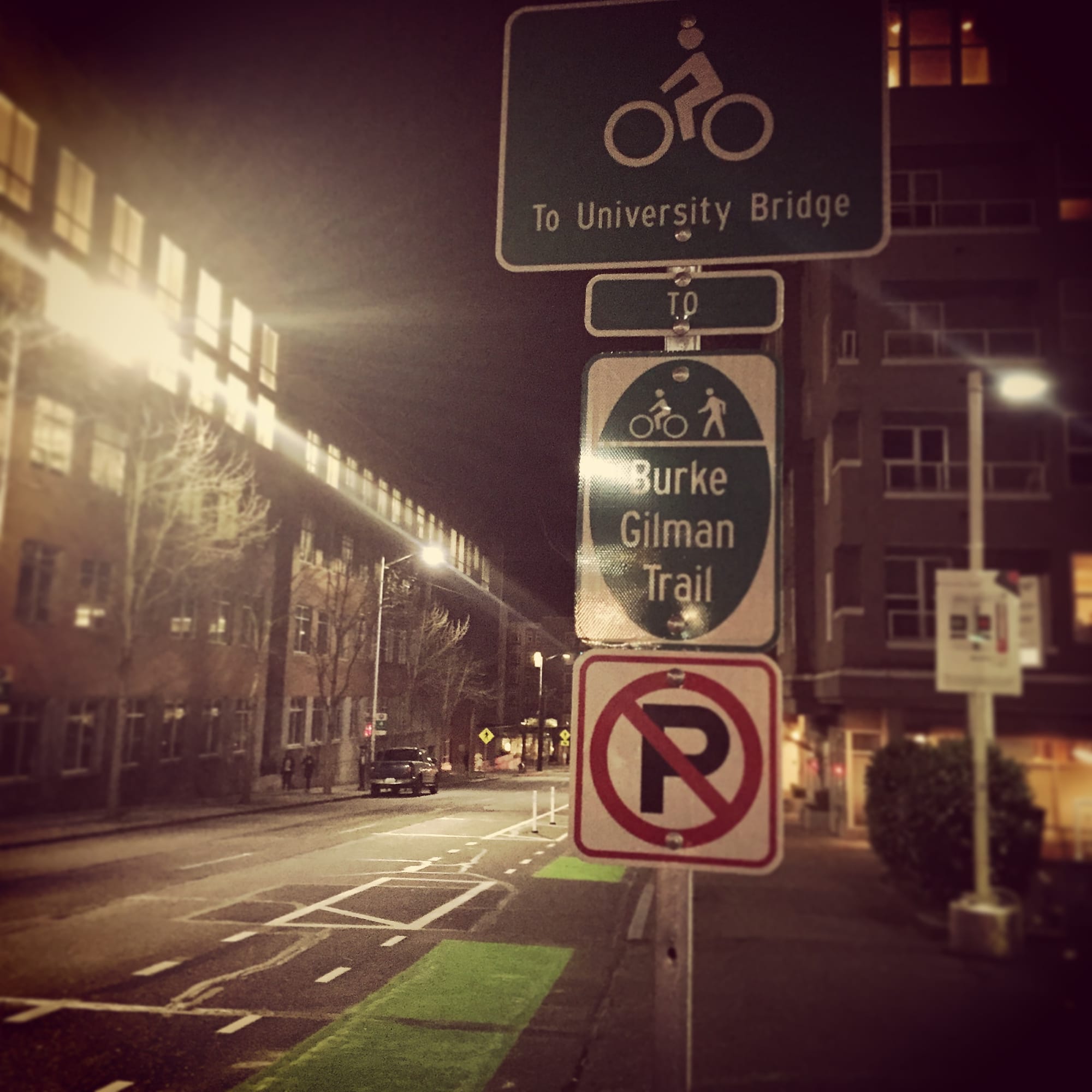
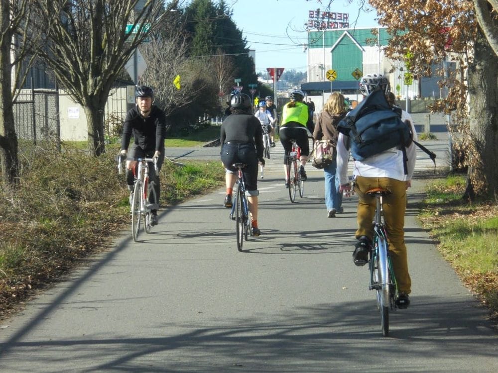
Another short-term solution is to remove parking from the freeway overpasses. Parking on Pike Street, Seneca Street, Madison Street, and Yesler Way does not directly serve any residence or business. It’s also unnecessary in light of the glut of Downtown parking spaces. The parking lanes can be replaced by anything from protected bike lanes or widened sidewalks to parklets, landscaping, or public art. Bringing more people above the freeway will no doubt spur conversations about further improvements.
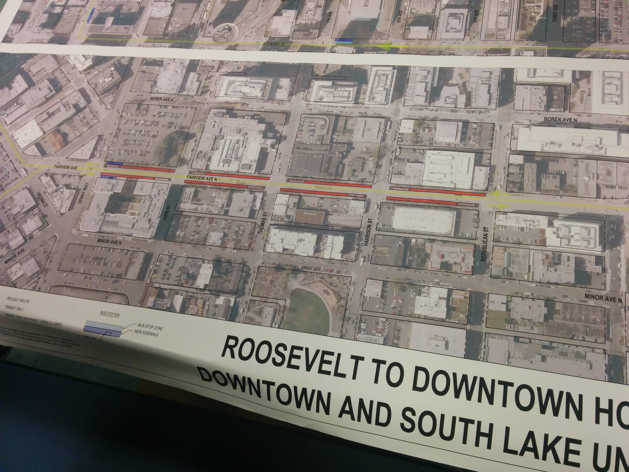
Both interim and permanent solutions must integrate with other ongoing projects in the area. Broadly, the 2002 Blue Ring open space strategy includes a freeway lid among ideas for linking urban neighborhoods to Elliot Bay and Lake Union. As part of that, Waterfront Seattle promises to reshape the city’s connection to Puget Sound. With the I-5 lids proposed only a few blocks away, the two projects can act as bookends to the Downtown public realm. Improvements on key streets should link these two projects, such as Pike Street and Pine Street. Indeed, the Pike-Pine Renaissance is a proposed plan to create a consistent streetscape between Pike Place Market and Melrose Market. Coming off that could be the Melrose Promenade, a vision to improve the walking, bicycling, and public space experience along the eastern side of I-5 on Melrose Avenue.
In a final article tomorrow, I will discuss design guidelines and how to move forward on an I-5 lid in Downtown Seattle.
This article is third installment in a four-part series on lidding I-5 in Downtown Seattle. A version of this series originally appeared on The Northwest Urbanist.