The long-range plan for King County Metro Transit has been approved. On Monday, the Metropolitan King County Council adopted the 25-year plan, Metro Connects, as a guiding policy framework for the evolution of Metro. The plan is a necessary piece to accommodate future growth in King County over the coming decades. In the next 23 years, the Puget Sound will grow by one million residents and some 800,000 jobs. Transit will pick up that slack by carrying more than one million daily riders in King County by that time. Through 2040, Metro will grow to provide:
- Six million annual service hours (up from 3.5 million annual service hours in 2015);
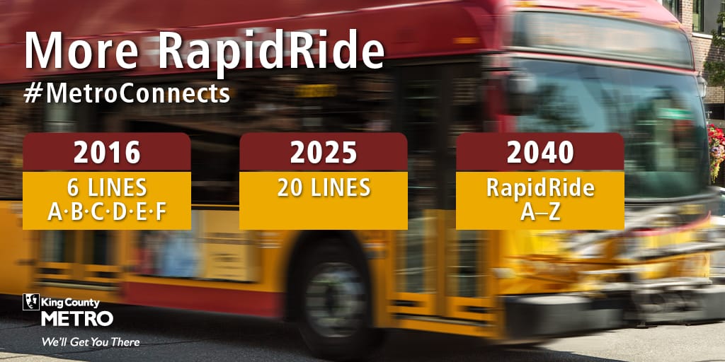
- 26 RapidRide lines–making a full alphabet to boot (up from six RapidRide lines);
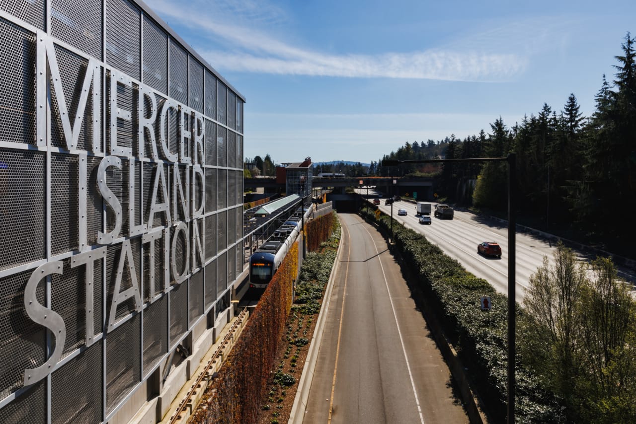
- Four times as many riders with easy connections to light rail;
- 24% of peak-weekday trips on transit (up from 12% in 2015); and
- Approximately 73% of King County residents having frequent service within walking distance of their home.
While the Metro Connects plan places an emphasis on increasing frequencies on routes and adding new RapidRide corridors, it also plans to deploy significant investments to benefit all of its service lines whether they be frequent, express, local, or RapidRide services. To illustrate this, Metro has a useful graphic to explain what types of improvements will be made to each corridor type and the resulting time savings that could come from them:
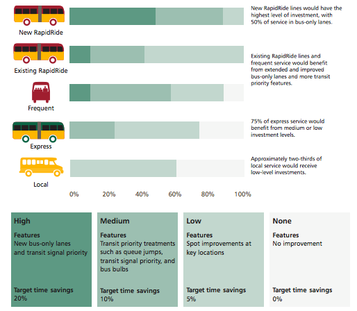
Metro’s ambitious corridor investment goals come with real costs. New bus-only lanes, queue jumps, and transit signal priority don’t come cheap. The investment goals would take at least $2 billion to fully realize.
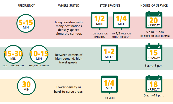
Another dimension of the plan is how service will be designed. In the densest corridors with many destinations, service on corridors could run at least 20 hours per day with frequencies as high as once every five minutes during peak periods. The corresponding type of stop spacing would depend upon whether it were a RapidRide or standard local frequent route, meaning that stop spacing could be less than or greater than a half-mile. Juxtapose that with lower density and hard-to-serve hours: the highest frequencies achieved might be one bus every 30 minutes with service running only 18 hours per day. Considering today’s baseline services, the proposed span of service and frequencies would still be far and away better on most routes. The likely result of these service improvements would be greater reliance on transit by riders as a means to carryout their daily lives rather than just a commute-to-work or commute-to-a-game exercise.
2040 RapidRide Network
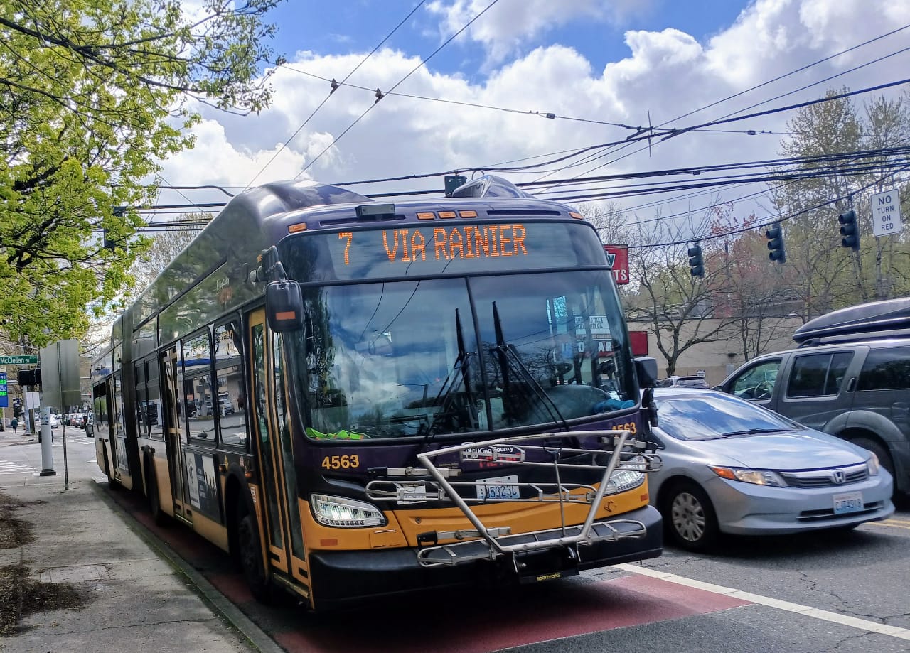
Metro is going all in on RapidRide with 20 additional lines coming online by 2040, bringing the total to 26. Early deployment of 13 new RapidRide routes are planned for roll out by 2025, and a further seven will following on during the last 15 years of the plan. All of those routes plus the existing six are slated to meet the international bus rapid transit (BRT) bronze standard or better. That means Metro will need to make substantial upgrades to most of the routes to achieve the goal.
They will have assistance with this from the Seattle Department of Transportation, and from Sound Transit. Funding sources like the Move Seattle levy and ST3 will contribute to funding improvements along future RapidRide corridors, with Madison being the first corridor likely implemented.
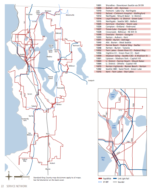
The RapidRide network will serve most key urban centers and cities across the heart of urban King County with the bulk of the lines running to and through Seattle. A strong emphasis on RapidRide in Seattle will be placed on routes in the central and northern quadrants of the city. But the light rail lines in Southeast Seattle and West Seattle will help fill in what would otherwise be considered gaps.
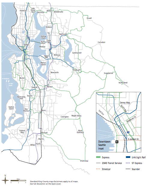
2040 Express Network
While express bus service will see increases in service hours, the number of express corridors will gradually be reduced. That’s largely because all-day frequent service and light rail will offer superior replacements to routes like the 76, 316, and 355. However, some routes like the 143 and 309 might continue to live on in one form or another.
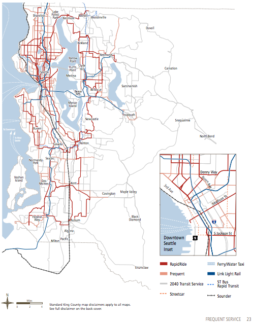
2040 Full Network
Seattle will reign supreme with the most complete bus network in King County. Almost all all-day routes will meet the frequent standard with a significant bulk made up from RapidRide. The further reaches of Seattle, however, will have a more basic bus service standard with less frequent routes. In other parts of urban King County, RapidRide will function as the main network backbone with lesser frequent routes and basic routes filling in the gaps. The degree to which the transit network holds together in those areas really depends upon the closeness of urban nodes. Parts of the network east of Renton and Kent quickly become very barebones with infrequent routes, but a visible network nonetheless.
Transit Access Zones
Metro Connect identifies four types of transit access zones based upon density, anticipated walking and biking shares, and the types of investments necessary to provide accessibility improvements.
- Zone 1 is the highest density areas where Metro will focus investments on bicycle and pedestrian facilities with zero additional parking; 96% of all riders will utilize walking or biking.
- Zone 2 is the medium density areas that are considered to be within walking distance of at least one frequent service corridor; generally investments will focus on walking and biking, and 82% of all riders will use those modes.
- Zone 3 is the lower density areas that are considered to be within walking distance of less frequent service or express service corridors; a moderate level of investments will be focused on walking and biking, though some parking investments may be made as well, and 50% of all riders will walk or bike.
- Zone 4 is the lowest density areas with little or no walking access to transit; most investments will be focused on parking access, and only 16% of riders will be expected to walk or bike.
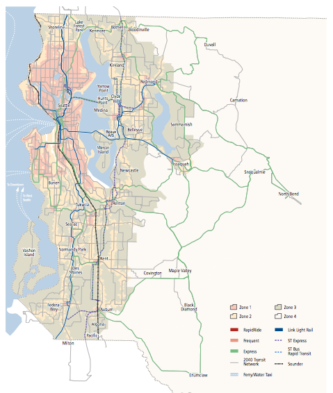
The map above suggests that most of Seattle will meet Zone 1 status with the remainder falling primarily into the Zone 2 category. Urban centers throughout the region will also fall into those categories. By and large, suburban areas will fall into the Zone 3 category while only exurban and rural areas will fall into the Zone 4 category. The implications of these designations could be far reaching as Metro rolls out changes to bus service and improves facilities along corridors.
There’s Much More
The Metro Connects plan covers a lot of territory. In addition to the meaty pieces we highlighted, the plan also speaks at length on topics like transit-oriented development, fleet goals, sustainability objectives, customer communications, and boarding and fares reform. The breadth of the plan and its trajectory should largely improve the quality of public transit across King County by making it more convenient, reliable, and accessible for all.
King County – Metro Connects Plan by The Urbanist on Scribd
Related Article
Fix NE 65th Street And Make It RapidRide Ready