This is a two-part series. The first part is a very brief overview of the Growth Management Act, King County’s Urban Growth Boundary, and how we ended up with neighborhood plans. The second part will go into what the neighborhood planning documents actually say, what neighborhood planning did, and how Seattle’s homeowner-dominated neighborhood planning codified anti-renter bias, and where Seattle is headed.
A number of candidates in this year’s election have been waxing poetic about neighborhood planning Seattle undertook in the 1990s, some even claiming the process was “robust”–and this is never followed up on in forums. I come from a planning background, have seen what democratic planning (and democratic architecture–baugruppen) can look like. So when I first started looking at the neighborhood planning documents years ago, I imagined I would find plans that were inclusive, welcoming, and open. And in some ways, they are. The plans are very pro-transit, very pro-biking and safe streets, and very much geared toward fixing deficiencies that existed in Seattle neighborhoods after decades of neglect and economic downturns. These are all good.
But Seattle’s neighborhood plans also have a dark side. When it comes to housing and land use, they are extremely biased and exclusionary. And this is not an accident, this was largely by design.
But first, a little history.
Like today, in the beginning of the century, Seattle was a boomtown. As with most American cities, there really was no formal planning. New construction was haphazardly placed, there was largely no way to direct where new housing or buildings could or should go. There was only the building code. And at something like 150 pages, Seattle’s early building codes were a pithy thing of beauty. Today, Seattle’s building code is more than 700 pages long–then there are other codes to comply with like fire, mechanical, and plumbing.
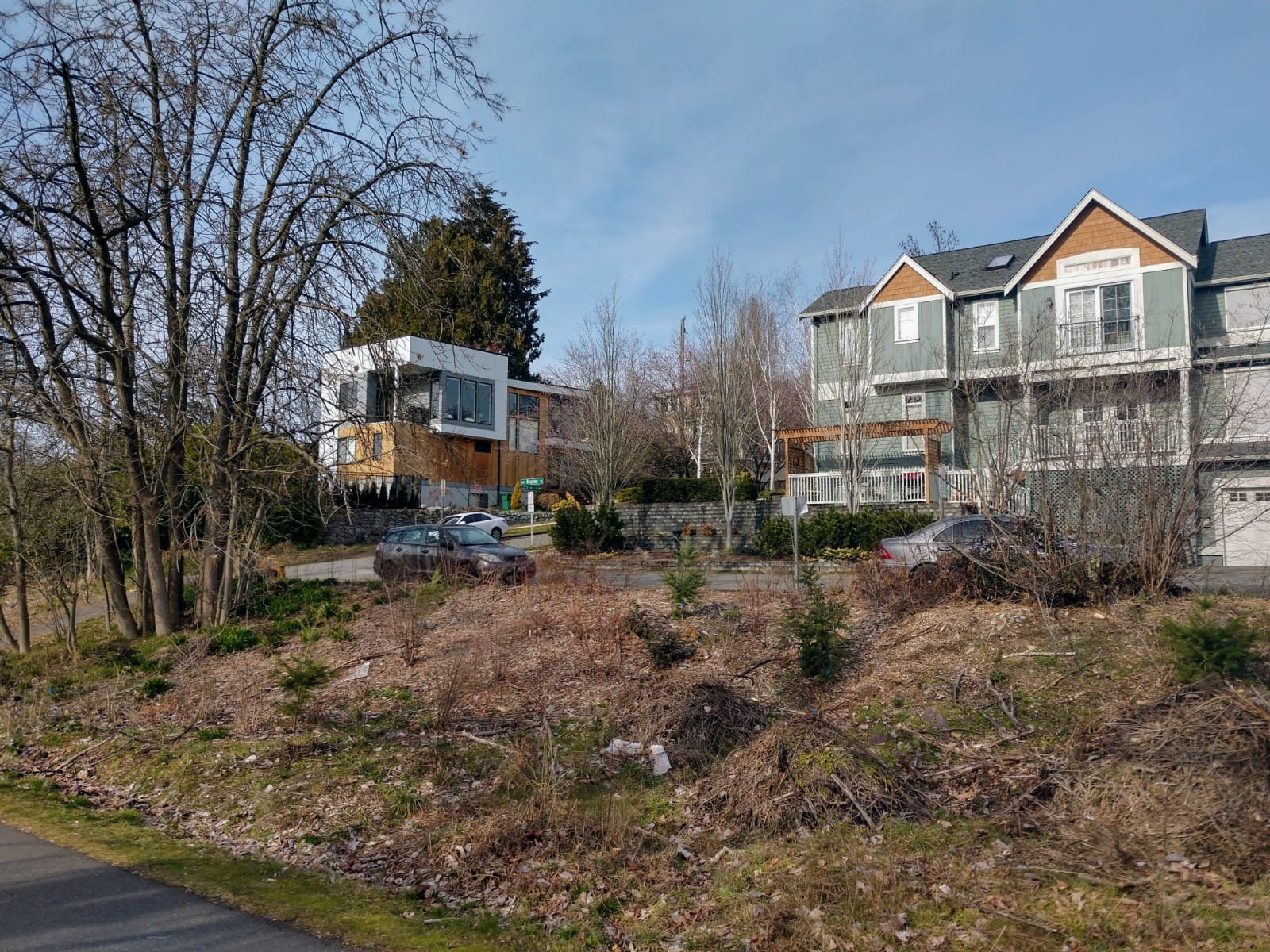
Very much unlike today, the original building code had no limits on where housing could go. You could build three-story apartment buildings on every square inch of Seattle. The amount of the city zoned for detached houses was a whopping 0% (as it should be). So you could have apartments next to fine houses, and those proximities still exist in many of Seattle’s older and more walkable neighborhoods.
This changed with the passing of the 1923 zoning ordinance, which immediately downzoned much of Seattle. It was largely a zoning plan as snapshot, meaning multifamily housing and small neighborhood commercial were largely limited to where it already existed. Over time, the planning documents got longer and longer, the restrictions became stricter and stricter (larger setbacks, smaller height limits, less lot coverage, and density limits) leading to a fairly dire housing situation in the 1970s.
In 1980, the city attempted to pass rent control, but homeowners helped kill it. Further downzones in the 1980s, even as the region was growing, caused massive amounts of sprawl and environmental destruction. In 1990, the state passed the Growth Management Act (GMA), which among other things, required counties to plan for growth. But it is also kept to local control, and doesn’t say how or where growth should go. This can be problematic, and is one of the reasons I really like Vienna’s approach, which is both top down, and bottom up, planning.
One of the aspects to come out of the GMA was designation of rural and agricultural lands for protection. This is how we came to get the Urban Growth Boundary (UGB) for King County.
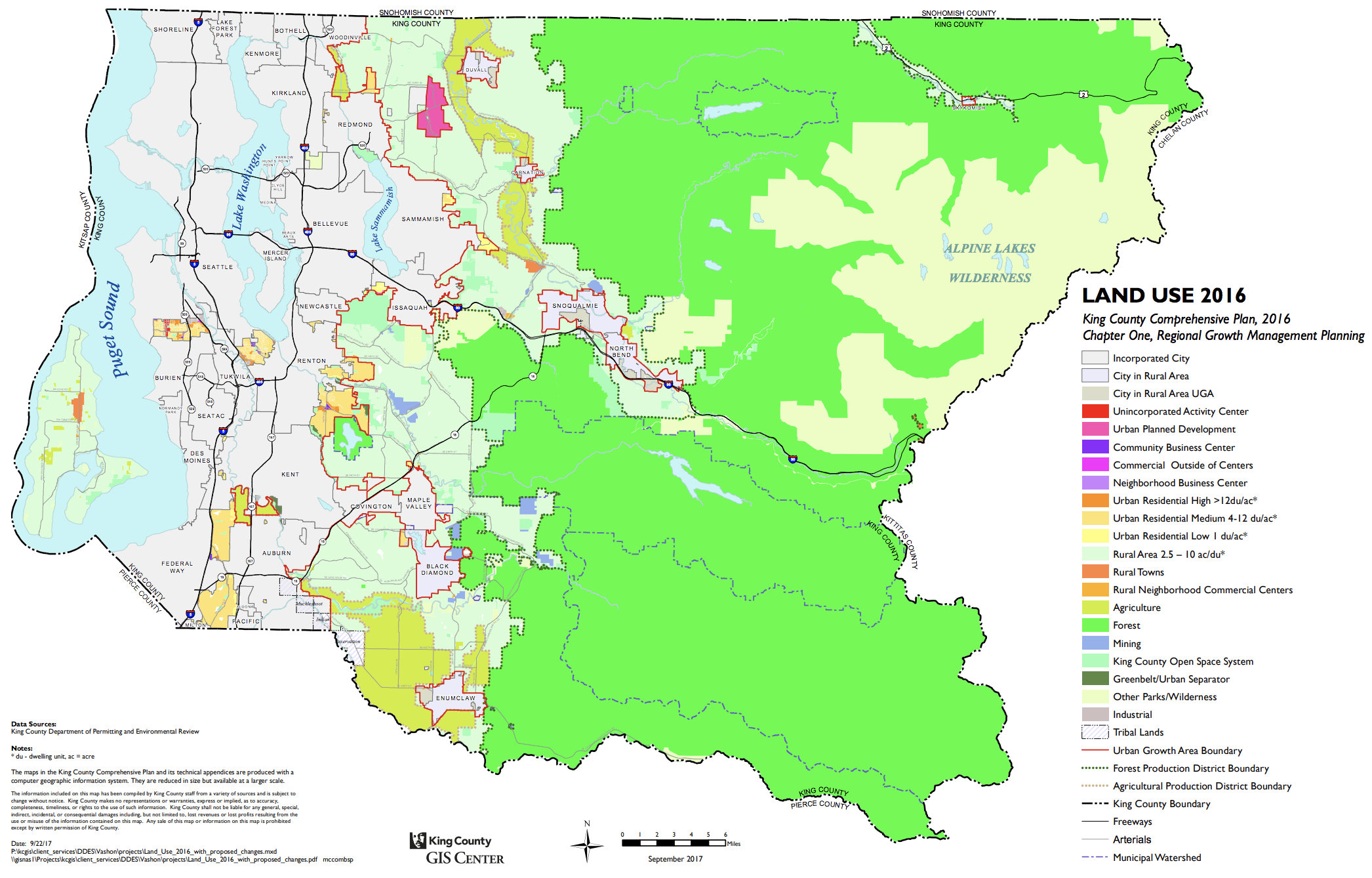
But there is also a fatal flaw in the Urban Growth Boundary (UGB). In King County, areas of “snob zoning” were, shall we say, mislabeled. The UGB doesn’t require re-compaction or really even constrain new housing in most of the region. The UGB just contained how dense the sprawl could be, and even that hasn’t been effective. Instead of sprawl in King County decimating national and state parks, it is offloaded to neighboring counties, inducing super-commutes. UGBs are loathed by libertarians, and even though a homevoter recently called me an, “extreme market urbanist,” I’m a huge fan of UGBs. But, in order for urban growth boundaries to work, they have to be strict, they have to actually allow density, and they have to have planning and funding to enable said density.
Germany’s Urban Growth Boundaries are stark; they largely constrain dense urbanity to cities, and leave compact villages and open space relatively protected. It also means that citizens have relatively quick access to green spaces, which for the most part are open for wandering. Germany’s spatial planning is rather comprehensive, with several levels of government working on spatial planning documents. Cities have the freedom to develop within their boundaries, but there is overview from higher levels of government, and there are funding implications as well. Zoning levels are incredibly permissive by comparison to the United States, and there is no single-family zoning anywhere. Cities generally don’t even have much low-density sprawl either, which makes transit, walkability, and biking significantly easier.
This is an aerial view of the growth boundary at the edge of Freiburg’s 172-acre Rieselfeld development, a compact, transit-oriented, car-light district of 4,500 homes including a ton of social and middle-income housing. The boundary is hard, and the housing set to the limit is not low. Let’s zoom in and see what those buildings actually look like.
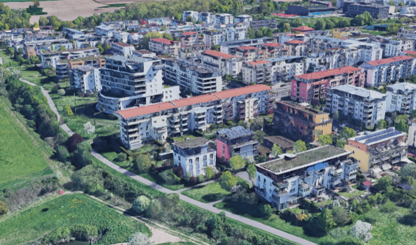
Holy moly! Four- to six-story multifamily buildings and some of them even touch! Egads! There was a high degree of citizen planning in this district (as well as Vauban). But you’ll notice there are no detached homes. There are, however, shops. There are schools, playgrounds, parks, open space and libraries, and cafes. There is transit. This is what sustainable, democratic, and inclusive planning can look like.
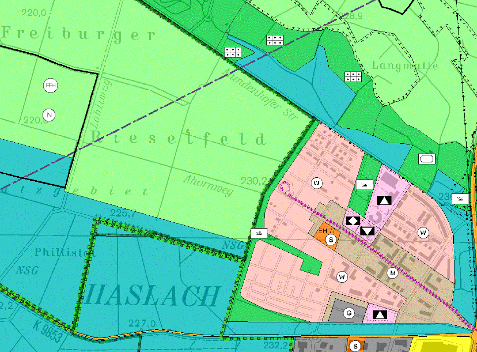
Here is a snapshot of the Flaechennutzungsplan (FNP — Area Use Plan) showing Rieselfeld (pink) and the protected (birds, flora and fauna) landscapes next to it. That pink area is the residential zone. The green and green-blue areas are nature-protected areas and forests on city land. The FNP is a general use plan. Developments are required to obtain planning permission through the Bebauungsplan (BBP) or Development Plan, which involves even more planning, and goes into issues of heights, roof angles, and building extents.
Now, let’s compare this to the Urban Growth Boundary for Seattle. Oh wait, there isn’t a growth boundary for Seattle, there is only one for King County. The King County Urban Growth Area is 460 square miles, with a population just under 2.2 million. To give a sense of how much land this consumes, the city of Paris has a population of 2.2 million, but sits on just 41 glorious square miles. The King County “Urban Growth Area” alone, consumes over 11 times as much land as just the city of Paris. Paris is presently building dense, beautiful affordable housing in every neighborhood–100,000 homes in 18 years. Due to zoning constraints, we can’t build affordable housing in 90% of Seattle, let alone most of the Urban Growth Area.
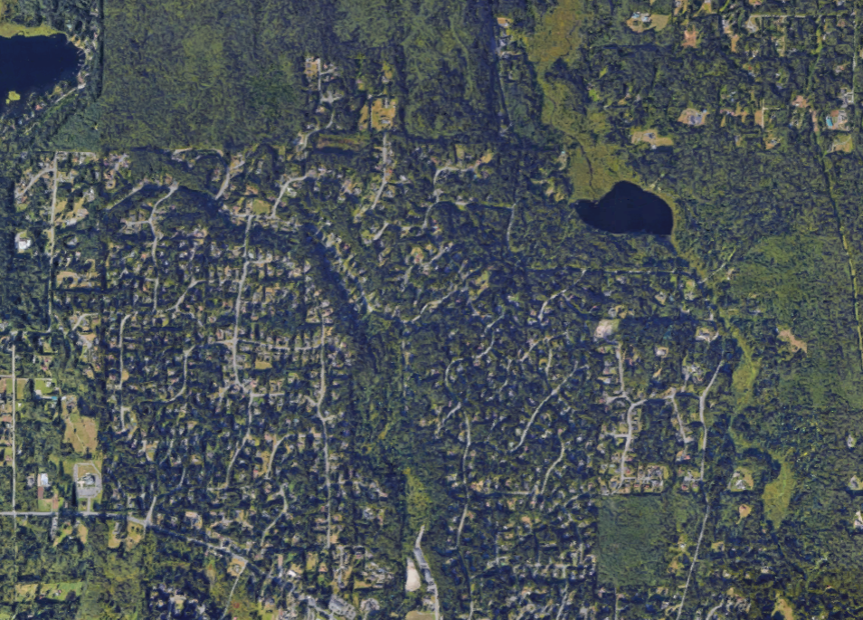
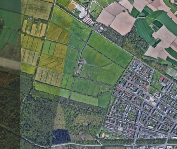
Back to King County’s UGB. Here’s a quick test: looking at the photo above, can you tell where the UGB is?
It’s a trick. That aerial is outside of the Urban Growth Boundary, in “rural” King County. Within that red rectangle, to be exact. The green areas are rural designation. The light pink is incorporated areas. The heavy red line is the Urban Growth Boundary.
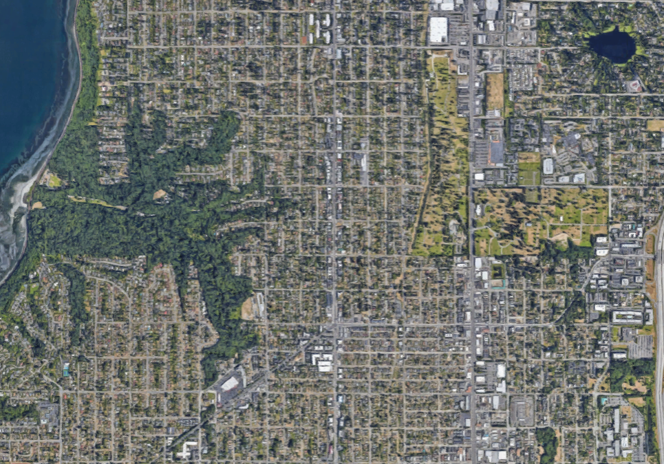
Looking at the King County aerial, you might notice it isn’t actually much denser than many parts of Seattle. Growth boundaries can work, but not when the boundary is arbitrarily positioned miles and miles from jobs and dense neighborhoods. And definitely not when most of the land use specifically excludes urbanity. The GMA is pretty weak on land use. It doesn’t really limit sprawl. Nor does it really facilitate urban densification or re-compaction. And the region should be honest with itself: King County’s comprehensive plan basically just repackaged sprawl as “urban”. This is especially ridiculous, because until 1949, King County didn’t have any single-family zoning and allowed duplexes everywhere.
The GMA required cities to plan for growth, and this was largely with no oversight from above, no minimum densities, just a requirement to plan. Then-Mayor Norm Rice put forth a plan for how to grow the city, the Urban Village Strategy, which was partially adopted into the 1994 Comprehensive Plan. The following year, the Neighborhood Planning Program (history here) was formalized, laying out a path for neighborhoods to plan where growth in the city would go, and what it would look like. The program gave a significant amount of leeway to neighborhoods to do the planning, funding facilitation and management. Ultimately, the program formalized how neighborhood plans would be adopted into the Comprehensive Plan, and would accommodate (or constrain) where new people would be allowed to live.
This is a cross-post from Mike Eliason’s medium blog.