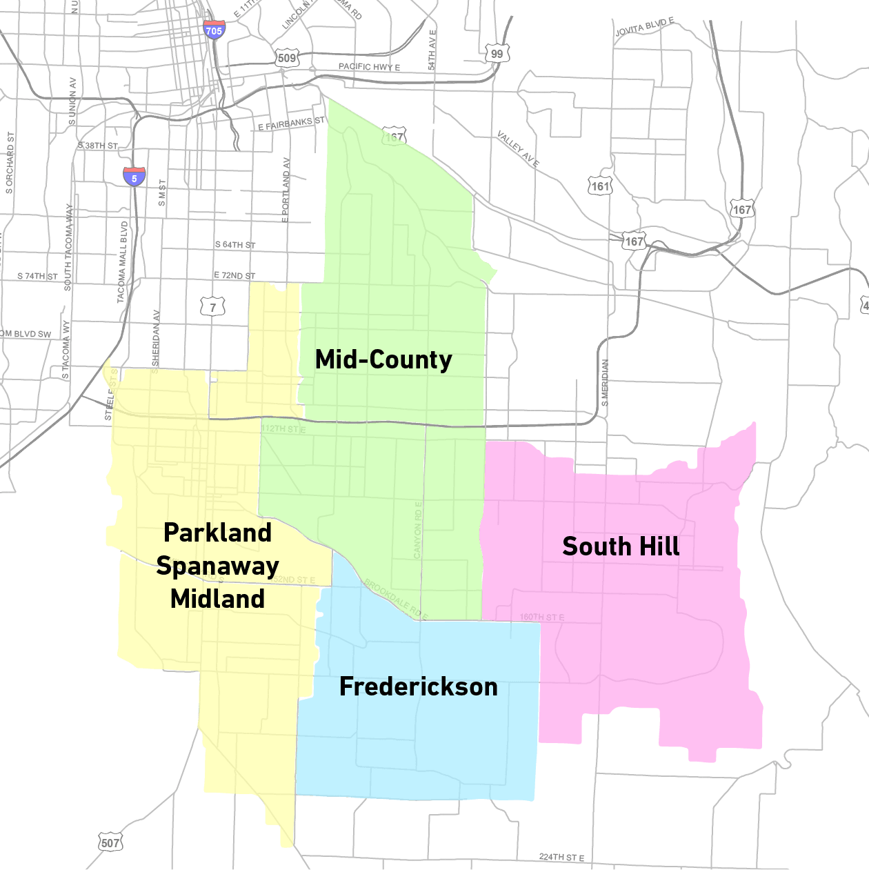
In October, the Pierce County Council adopted updates to the community plans of Frederickson, Mid-County, Parkland-Spanaway-Midland, and South Hill that should encourage denser development near the planned Pacific Avenue bus rapid transit (BRT) line. These communities were outlined in a 2016 “Urban Communities of Pierce” report that called for growth being directed to them to increase walkability and transit access. The four updated plans themselves formalize transportation corridors in the communities, rezoning the corridors with new development standards to mostly allow for more multifamily and commercial development.
These updates follow a 2015 action to conduct a periodic review and update of the Comprehensive Plan, including update of individual community plans. Then in 2016, movement began to develop the changes to the community plans that we see in the 2020 update. The changes were expected to be effective on March 1, 2021, but three submitted appeals that have been consolidated (case number 21-3-0003c) by the Growth Management Hearings Board may delay that date for weeks or months.
Pierce County is expecting the population of unincorporated urban growth areas to increase by 57,000 people between 2010 and 2030. So far, the plan to continue absorbing the growth is solely focused on increasing density and language on increasing transit-focus in and around half-mile wide Corridors and Centers, rather than reforming the vast swathes of rural and low-density residential zones. Examination of incoming zoning changes demonstrates the unbalanced actions the Pierce County Council is making.
Inspecting the changes
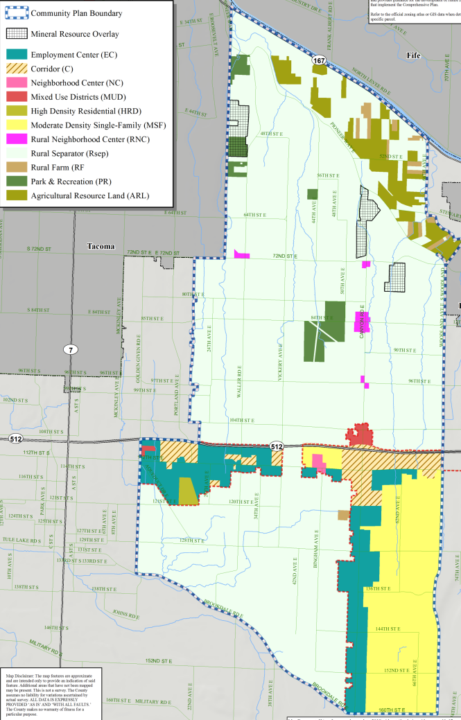
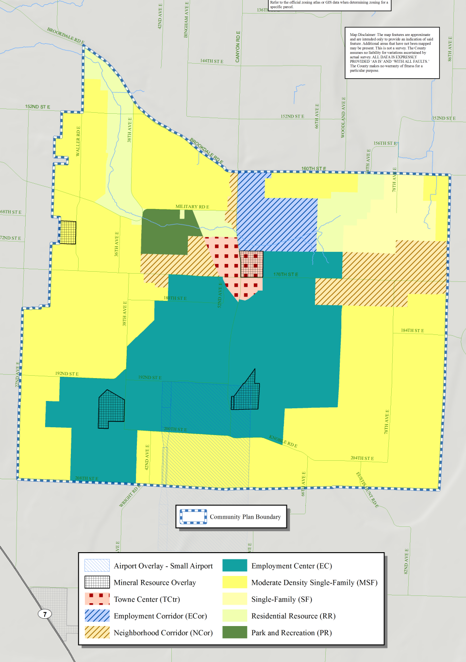
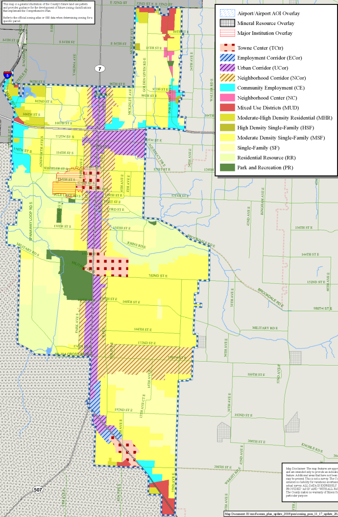
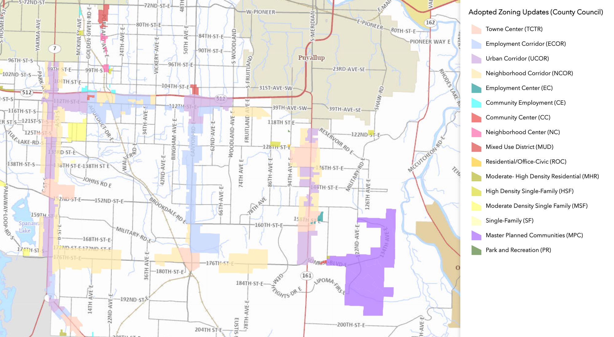
Of all the community plans, the Parkland-Spanaway-Midland plan includes the most upzoning of land. These changes predominantly occur on the SR-7 and 112th St E corridors, with lesser changes on Portland Ave E and 176th St E. Along the corridors, the previous mix of zoning designations are consolidated into strips of corridor zones. For the most part, this consolidation produces increases of allowed housing units per acre that double or more than double the previous maximum housing density (the highest previous maximum density was 30 housing units per acre). The median maximum height increases by 10 feet.
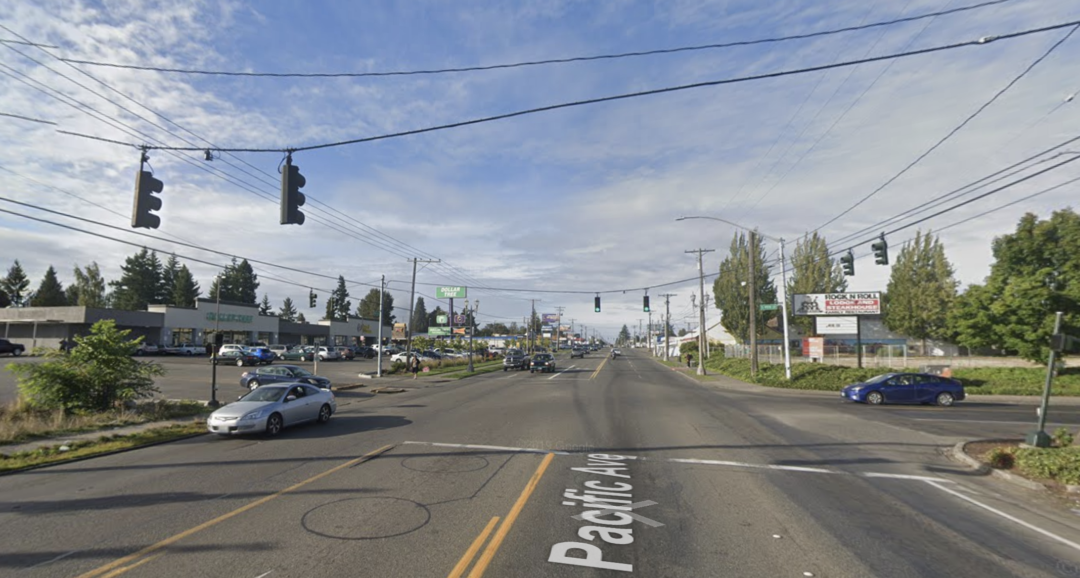
The most dramatic increases occur where “Towne Center” zoning goes and where the rare and small patches of previously single-family or residential resource zones are captured by the new half-mile wide corridor zones. The Towne Center designation is where the densest development is allowed in the unincorporated urban growth areas, with a somewhat underwhelming maximum of 80 housing units per acre and 65 feet in maximum height–or 85 feet if 20% of units are affordable. The designation also comes with a minimum density requirement of 15 housing units per acre In the plans, these Towne Centers are placed in preparation for bus rapid transit stations–already funded is the SR-7 BRT route that is planned to be operational in 2024.
The “Urban Corridor” and “Neighborhood Corridor” zones are more widespread versions of the Towne Center zone. For Urban Corridor zoning, the maximum density is 60 housing units per acre and maximum height is generally 55 feet. Neighborhood Corridor allows for a maximum density of 25 housing units per acre and generally 45 feet of height. All three zoning types benefit from no setbacks.
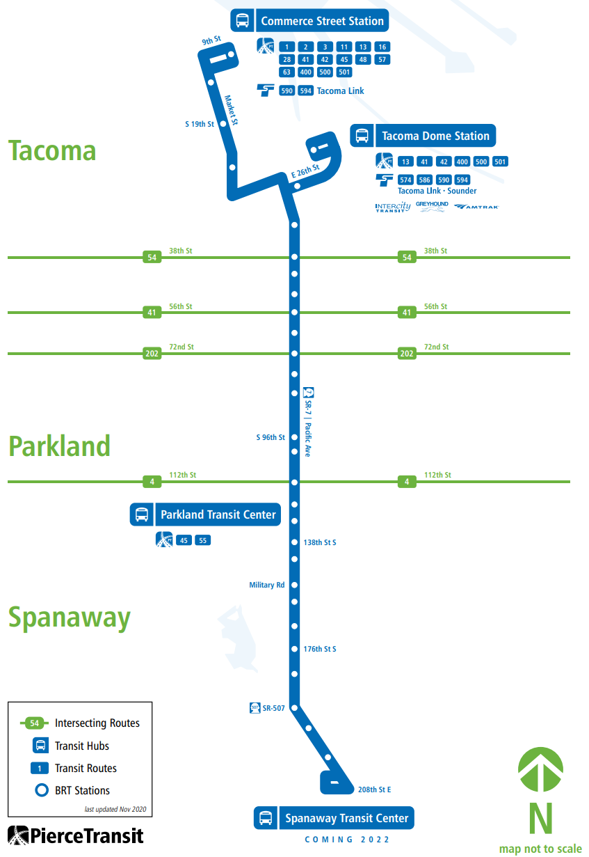
[Planning and Public Works] worked with Pierce Transit to coordinate land use planning with Pierce Transit’s long-range plan which identifies a Bus Rapid Transit (BRT) line funded for SR-7 (Pacific Avenue) and future lines planned for 112th Street East and SR-161 (Meridian Avenue East).
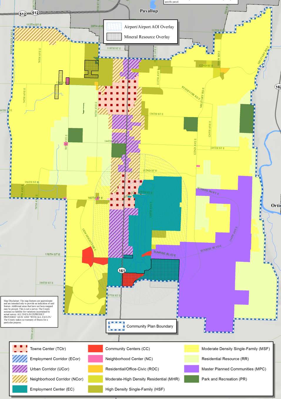
Pierce County’s intention to have transportation policy influence land use policy is mostly evident in the South Hill Community plan, which will lock the maximum housing units per acre at 25 until a BRT line serves its section of SR-161. This restriction creates an odd quirk in South Hill’s plan since it will actually downzone the two Urban Village zones-turned Towne Center zoning by reducing allowed housing density. The plan also chooses to convert small parts of the Urban Village zoning into Employment Center zoning that does not allow housing. South Hill’s plan also gives the Sunrise Development special zoning that allows for commercial uses in its planned community. Otherwise, this plan looks like a smaller Parkland-Spanaway-Midland plan.
Along Canyon Road, the remaining Frederickson and Mid-County community plans include the least change. As a BRT line is being planned for 112th St E, some major housing density is added to the Mid-County portion of the 112th St E corridor. Increased housing density is otherwise incredibly limited in the community plans. The county merely rebrands an older Employment Center designation into the Employment Corridor that dominates Canyon Road. The designation does not allow for housing. For Frederickson, the new Towne Center designation similarly does not allow for housing because the area is not included within a Transit Service Boundary currently. Outside of 112th St E, Neighborhood Corridor zoning for a little increased housing density can be found as a blip on Canyon Road and on 176th St E.
Next Steps
The county had hoped that these plans would go into effect at the start of next month. However, the pending appeals filed by a trio of organizations, including Futurewise, have put that in doubt. A prehearing conference was scheduled on Monday to review the restated claims of Growth Management Act violations by the plans. The appeal process could drag out into summer and possibly later depending upon how it evolves in the hands of the Growth Management Hearings Board.
The crux of our appeal regards the Centers and Corridors plan, which proposes to increase densities in parts of unincorporated Pierce County without transit service, sidewalks, schools, adequate fire protection, and other necessary public services. This plan will also compete with parts of Tacoma served by transit and other public facilities. The lack of transit in the Centers and Corridors area will increase greenhouse gas pollution. Based in part on Futurewise’s advocacy, Pierce County dropped plans to upzone 4,586 acres within stream corridors.
Futurewise
Futurewise
Assuming that the community plans eventually go into effect, the county intends to monitor performance of the plans. This process may produce recommendations for further actions to correct deficiencies within the plans. Regular two-year cycles are conducted for community plan updates, though a 2018 ordinance now allows amendments to the comprehensive plan outside of that regular window.
You can explore the changes with an interactive map provided by the County. You can also contact your county councilmembers to your share views on land use changes you want to see in unincorporated Pierce County.