The replacement overpass will not open for at least a year and a half.
The Washington State Department of Transportation (WSDOT) has announced that the pedestrian and bicycle path underneath State Route 520 in Seattle just west of the floating bridge will permanently close on the morning of Monday, June 6. The closure announcement has taken many regular users of the trail by surprise, given that the only nearby alternative to using this trail to cross the highway is the chaotic sidewalk along Montlake Boulevard. It poses a huge setback to people who travel through the Montlake area by bike, as WSDOT has worked for years to keep vehicle traffic moving even as it’s demolished entire highway bridges as part of the megaproject.
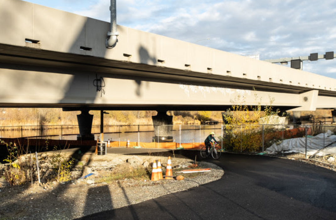
Ultimately, a brand new path for people who are walking and biking across 520 will be available in the form of a new “land bridge” overpass, but Steve Peer, Media and Construction Communications Manager for the 520 program told me that the new bridge is not expected to be completed until late 2023, and even that schedule could slip if there are any unforeseen delays, which have been common in the past few years. Peer said the contractor working on the 520 bridge replacement tried to keep the pedestrian path open as long as they could, and had even intended to close the trail this past winter.
“While we were glad to keep this innovation from our contractor open for two years, for safety reasons, we now need to close it,” he said. “One of the supports for the future land bridge lands directly in the footprint of the path. Additionally, grades will begin to change on the south side for the land bridge approach and additional fill needs to be placed where the path is now. In addition, the approach to the new eastbound lanes needs to be built in this area. In other words, the area the temporary trail is currently on will become a work zone.”
The pathway has been in place since 2020, and was announced as temporary at the time, but the short notice has caught many who use the trail off guard. Major detours for people who travel by car are routinely announced many weeks if not months in advance.
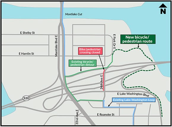
When asked if any mitigation measures would be put in place along busy Montlake Boulevard given the new influx of walkers and rollers coming through there instead of on the underpass trail, Peer responded no. As WSDOT’s contractor works to expand Montlake Boulevard into a nine-lane street next to a new highway lid, people on foot or wheels will continue to contend with the heavy traffic and myriad turning movements that users on Montlake Boulevard have been dealing with for years now, with few alternatives.
The Bill Dawson Trail still allows walkers and rollers to get around 520 west of Montlake Boulevard, but that’s the only way to avoid the busiest part of the street. Currently many of the “sidewalks” along Montlake Boulevard are just separated by traffic by traffic cones or a shallow temporary asphalt curb, and space is very tight for people trying to navigate through the area.

Once the 520 project is fully complete in Montlake, people will be able to get over 520 via the land bridge and underneath Montlake Boulevard via a new underpass being constructed right now between the 520 bike trail and the Bill Dawson Trail that connects to Montlake Playfield.
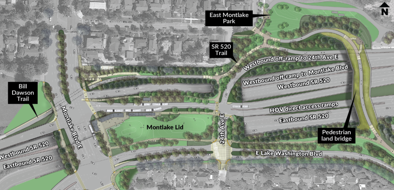
After the Montlake phase is complete, the $5.1 billion 520 bridge replacement will move onto replacing the Portage Bay Bridge between Montlake and north Capitol Hill, where another highway lid will create pedestrian and bike connections that have never existed. Most notably, the 520 Trail will connect all the way from the Eastside to I-5, substantially expanding the benefits of this pathway across Lake Washington. But that work isn’t expected to wrap up until well into the next decade. And it will likely come with more construction detours like this one.
Traffic Shift Coming to Allow for Montlake Boulevard’s Expansion to Nine Lanes