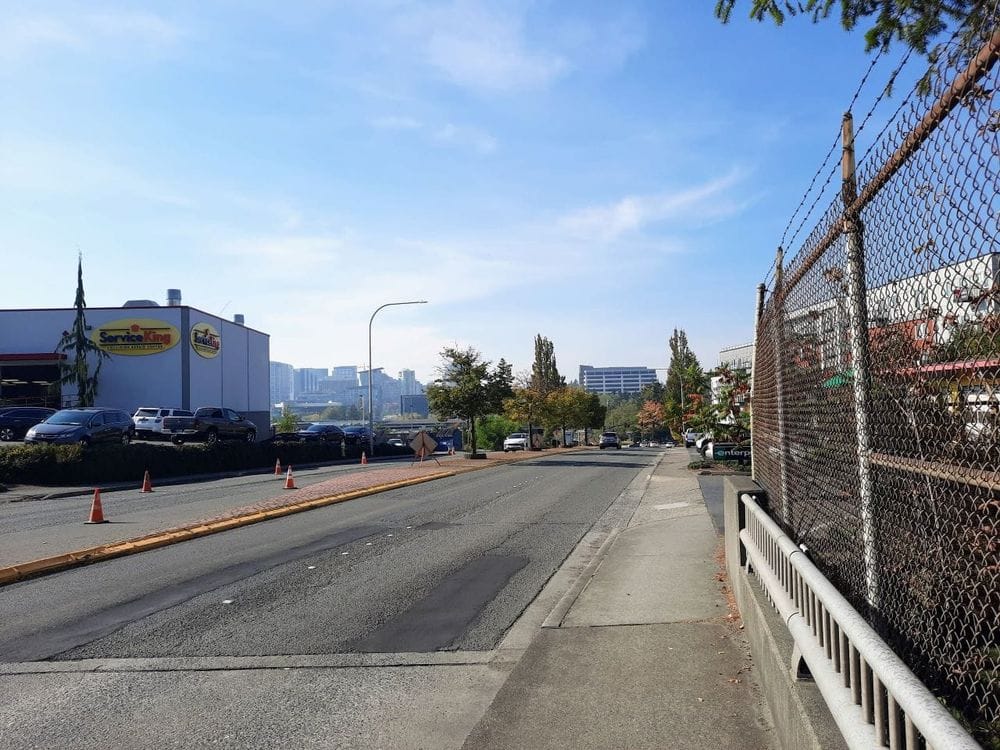
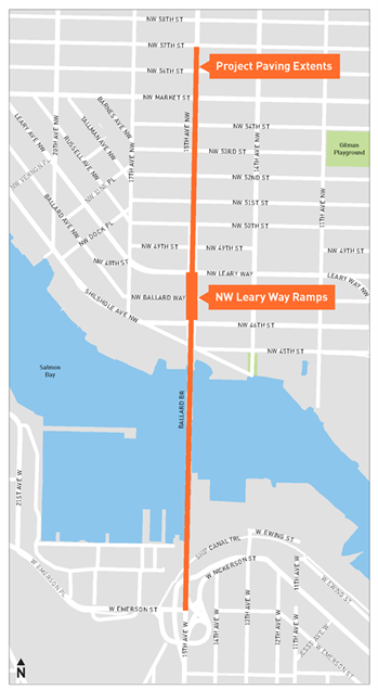
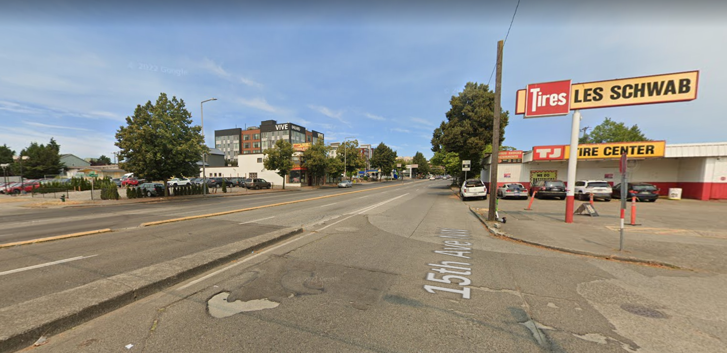
The gaps in Seattle’s current complete streets legislation are becoming more apparent as the city moves ahead with a repaving project on one of the city’s busiest and highest speed corridors, with minimal adjustments planned to slow traffic or make space for other modes of travel like walking or biking. The repaving project, which will impact the bridge deck of the Ballard Bridge down to the Emerson Street interchange and up 15th Avenue NW to 57th Street, is expected to start construction in 2023.
A copy of the project’s Complete Streets Checklist, a requirement for nearly all Seattle Department of Transportation (SDOT) projects that will cost more than $500,000, was obtained by The Urbanist via a records request. The document, which was signed earlier this summer, runs though the changes the project will, and will not, be making to the corridor.
“This paving project will preserve and extend the life of one of Seattle’s busiest arterial streets,” it notes. “Improvements made will contribute to a safer space for all road users. The approximately 1.1-mile, multi-lane corridor will contribute approximately 6.7 lane-miles to our Levy goal to pave up to 180-lane miles of arterial streets by 2024. Through the Complete Streets process, there may be opportunities to partner with SDOT’s transit and pedestrian groups to better connect neighborhood residents to transit.”
The street, signed 30 miles per hour, remains one of the few non-state highways in the city with a speed limit higher than 25 miles per hour. Speed data collected by SDOT also shows a high level of speeding on the corridor, relative to that limit, with 38.7% of northbound traffic at 56th Street, and 23.1% of southbound traffic going faster than the speed limit.
Those speeds seem to be at odds with the street’s designation, at least north of the Ballard Bridge as the street separates two parts of Ballard from each other.
“Traveling north, as the bridge touches down at NW 50th St, 15th Ave NW becomes an Urban Village Main Street until the end of the project area,” the checklist states. “Urban Village Main Streets are the spines of Seattle’s urban villages and centers (outside of Downtown) providing residents and workers with daily essentials and visitors a range of services. While Urban Village Main Streets must accommodate the movement of people and goods through the Urban Center or Village, the design of these streets encourages slower speeds and clearly communicates that walking, bicycling and transit access are prioritized.”
That seems to be almost wishful thinking, as there is no space dedicated to bike facilities, and all but the most daring pedestrians would try and cross the corridor away from the few signalized crossings. But SDOT’s not proposing any changes to the street’s layout as a part of this major maintenance work.
“Rechannelization is not being considered with this project. [The Average Weekday Daily Traffic volume] is over 25k and this is a Major Transit street, an Over Legal route, and on the Major Freight network.” SDOT’s Matthew Howard provided more details via email. “Given that this corridor is on the Frequent Transit Network – including transit (King County Metro’s high-volume D Line) – and hosts emergency, and freight vehicles, we must provide sufficient capacity and enough room for these vehicles’ turning radii so that the overall transportation network can keep moving,” he wrote.
Howard noted that the threshold SDOT uses to move forward with reducing the number of lanes on the street is 25,000 per weekday. North of the bridge, 15th Avenue NW ranged from around 36,000 to 32,000 vehicles per day, prior to the pandemic.
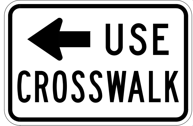
On top of the fact that no measures are being planned to slow traffic, particularly around 15th Avenue NW and NW Market Street where pedestrian volumes are highest, the Complete Streets Checklist actually lists a recommendation from SDOT’s Vision Zero team that pedestrian crossings across 15th Avenue NW should be restricted.
“Recommendations from Vision Zero (Chris Svolopolous, per email received 10.14.21) -15th & 54th closing the pedestrian crossing here and officially restricting ped crossings with R9-3BL or R9-3BR signs on the east/west approaches. -[1]5th & 56th might also warrant closing the ped crossing and sending them to Market,” the checklist states in an area designated for comments from different areas within SDOT. The signs referenced prohibit pedestrians from using a marked crosswalk.
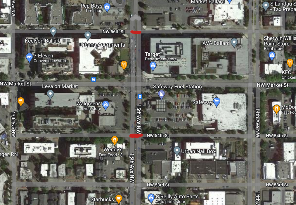
Ultimately, the project team made a decision not to close those unmarked crosswalks close to Market Street. But the fact that it was the Vision Zero team that recommended doing that in the first place is incredibly noteworthy: there were no notes on slowing the vehicles on the corridor from that team in the checklist. The checklist does note, however, that they will be adding closure signs to 15th Avenue NW and NW 50th Street, an intersection much further away from Market where the ramps to and from Leary Way connect with the corridor.
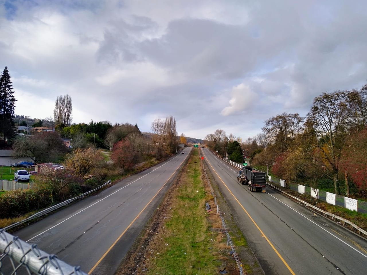
As for the issue of the Ballard Bridge itself, one of the most hostile places to bike in Seattle and a designated bike route on the city’s master plan, SDOT says any improvements here would be out of scope of the repaving. “While the Ballard Bridge is on the 2014 Bicycle Master Plan Recommended Bike Network, it is not on the 2019-2024 Planned Bicycle Master Plan Implementation Plan,” the checklist states.
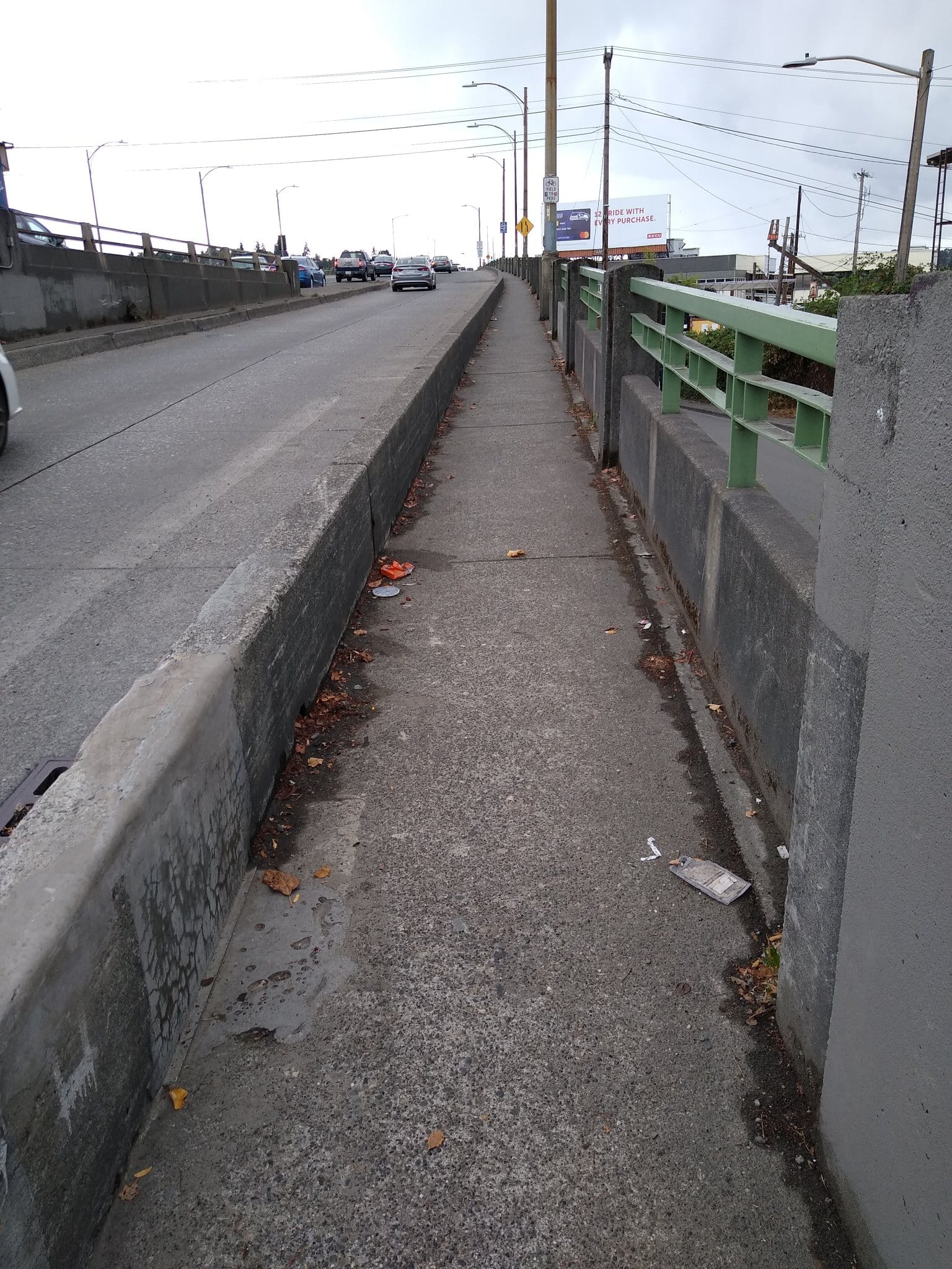
The 2015 Move Seattle Levy designated $10 million to go to near-term improvements on bridges like the Ballard Bridge. But that amount was ultimately spread to several bridges around the city, with the funding for the Ballard Bridge spent on spot improvements that didn’t significantly change the pedestrian and biking environment. The bridge itself is classified as an industrial access street, designed to accommodate some of the highest traffic volumes and largest trucks in the city.
“Given that maintaining a sufficient capacity for transit, freight, and emergency vehicles is critically important for the area, there are significant challenges associated with modifying the Ballard Bridge to provide more space for people biking,” Howard wrote. “Widening the bridge and/or adding a cantilevered structure is not practical given the structural limitations and financial costs. All of this being said, the Ballard Bridge Planning Study provides some insight into options that could be further explored when we embark on a larger rehabilitation/replacement in the future (although we have no date currently identified).” But a future Ballard Bridge is also being designed to accommodate significant traffic volumes with safety and consideration for people walking and biking also taking a backseat there as well.
The $16.2 million repaving project will spend some of its budget repairing sidewalks along 15th Avenue. But it largely serves to represent a huge lost opportunity to move a high volume, high speed corridor closer toward what the city’s goals and priorities all suggest it should be: a street that prioritizes people both inside and outside cars. Right now, it’s incredibly far from being a street like that.
“We will continue to monitor the corridor and pursue solutions that encourage slower speeds while providing mobility,” Howard wrote. It sounds like immediately after recreating this dangerous corridor almost exactly how it is, we’ll come back and add spot improvements to make it a little bit safer. The paradigm shift that’s needed to make it safer for people walking or rolling will be found elsewhere.
The Urbanist Podcast: Walking the Ballard Bridge
Moving the Ballard Bridge Will Remake Northwest Seattle for the Better