Prepare for light rail, slow down Interbay, and save 15th Avenue
Imagine for a moment taking a pleasant walk from Ballard to Queen Anne. Coming from one of the neighborhood’s fine breweries, you step out onto a tree lined Northwest 14th Avenue, busy with folks walking and rolling. You head south, stopping occasionally at crosswalks as lights change and intersections easily clear. There’s a decision on whether to grab a bite at the waterfront restaurants, but someone’s waiting to meet you at a spot on the other side. You keep walking.
Still on 14th, you start up the gentle ascent of the New Ballard Bridge, with its wide sidewalk. The counter on the dedicated bike lane clicks up two, three, four more numbers as a cycling family passes safely. Cars move past at a speed and distance that does not send shivers of panic through you or rumbling stress through the bridge. You cross the mid point of the drawbridge and stop for a second to see a sailboat pass under with clearance to spare. You look up. On the pylons of the Old Ballard Bridge, concrete ascends to support the new light rail bridge. The arch frames the Olympics in the distance. A train passes in each direction.
On the downslope, you get a message. Your friend has a table waiting at the distillery. It has a good view of the TV that’s playing the Kraken playoff game. You type “5 minutes,” delete it, and send “15 minutes.” From the bridge sidewalk, you decide not to cross at the intersection, instead taking the spur of a path to the Ship Canal trail. A few extra minutes of walking through the flowering spring trees never hurt anyone.
Such a story sounds like fantasy now because the Kraken are DFL and the best distillery on the south side (Fast Penny) doesn’t have TVs. But the rest of the image – replacing Ballard Bridge a block east, making the new bridge a neighborhood connection rather than a highway, and converting 15th Avenue from a car sewer to a transit park – is not so far fetched. It’s just difficult because the current plans for transportation in Ballard and Interbay rely on questionable projections to propose dangerous and expensive new highways.
Let’s do better by doing something different. That starts with swapping some roads around. Bridge reshuffling will require thoughtfulness and courage, but it will make every bit of Northwest Seattle better. Construct a new Ballard Bridge at 14th Avenue. Prepare the entire 15th Avenue corridor for light rail. Reconnect neighborhoods and prepare for the future. Easy enough. Let’s take them in order.
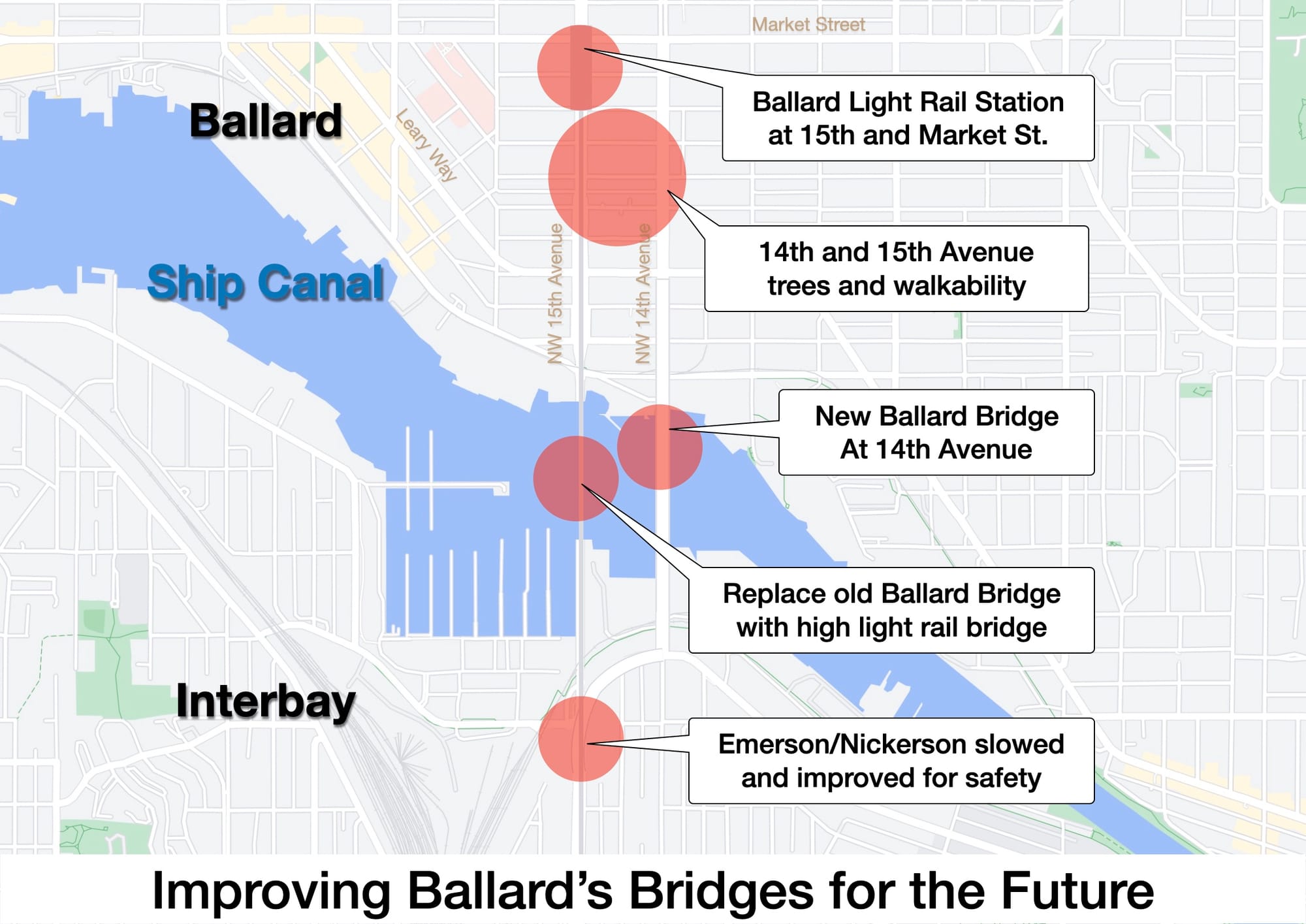
The New Ballard Bridge
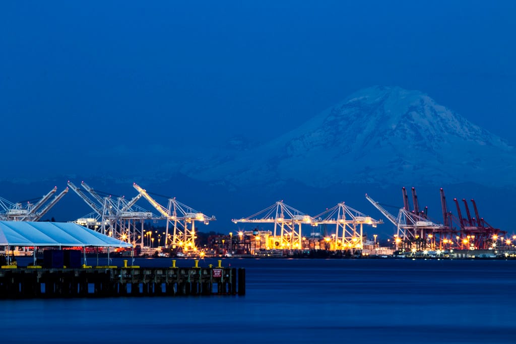
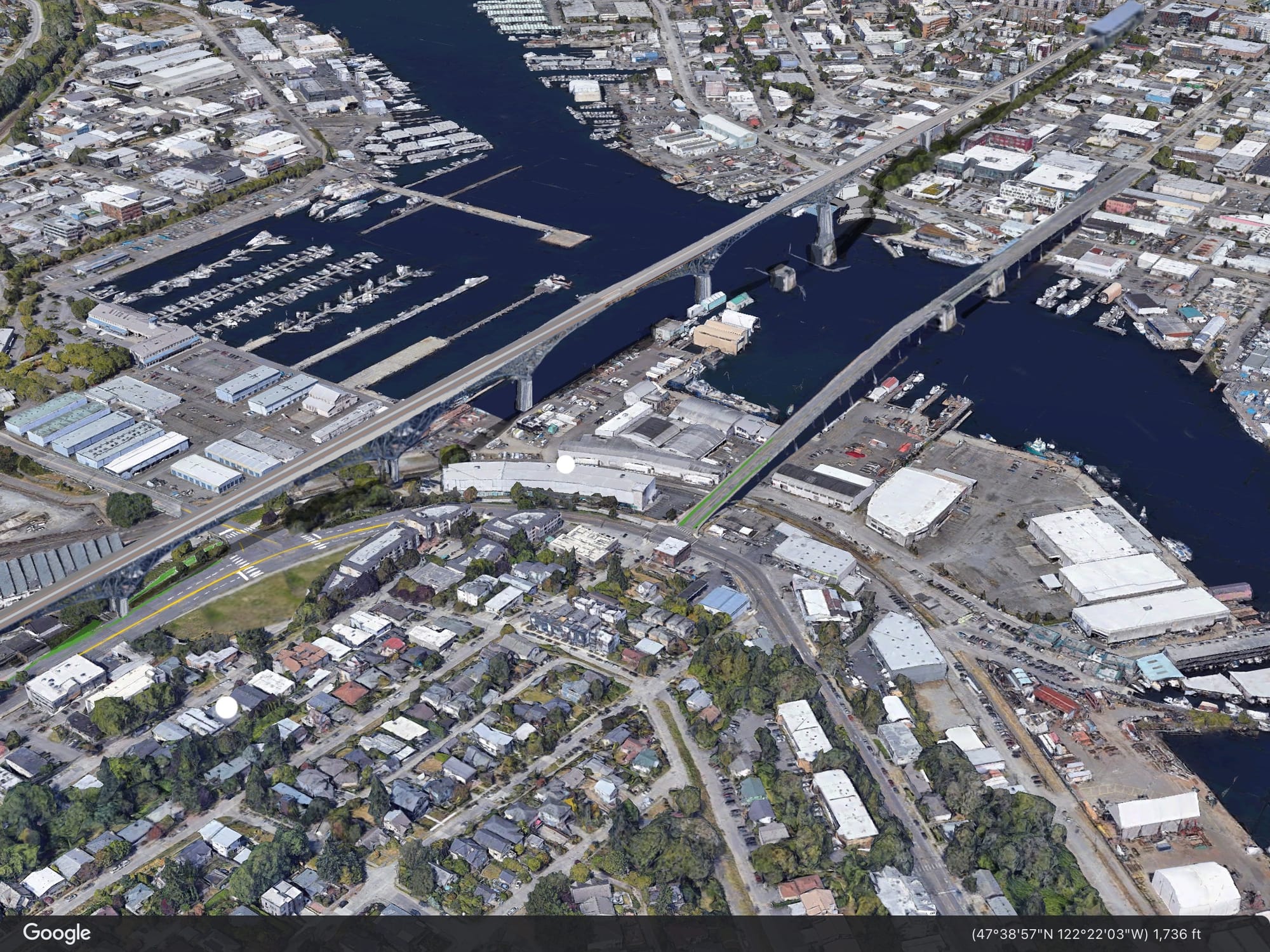
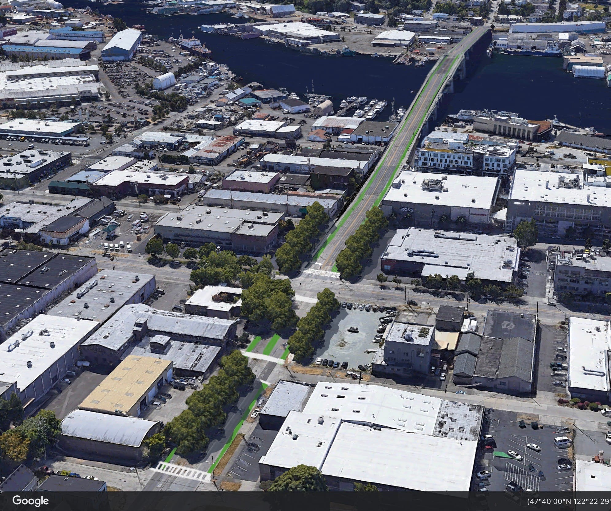
The 105 year-old Ballard Bridge needs replacement. There is nothing that says it has to cross the ship canal at 15th Avenue. Before the Ballard Locks opened, there were several crossings — 14th Avenue among them -0 up and down what was then a wetland slough. When it opened in 1917, the bridge at 15th Avenue only crossed from Fisherman’s Terminal to Ballard Avenue. Where the short ramps take off and land near Mike’s Chili Parlor was the north end of the bridge. That worked for 40 years, until the bridge started growing.
What we call the Ballard Bridge now is actually three bridges. The main span crosses the Ship Canal with a draw bridge. The north end over Leary Way has been dumping traffic deeper into Ballard since 1957. The south end tangle with Emerson Street and Nickerson Street was added in phases in 1959 and 1969.
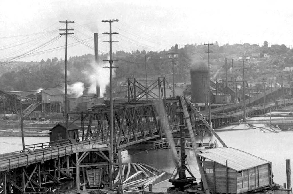
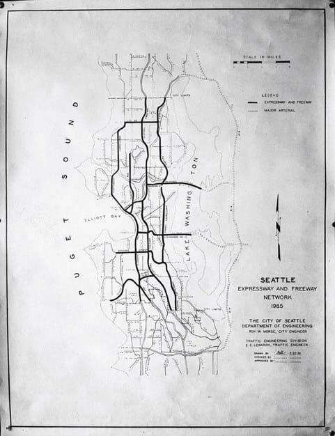
Road construction in 1950s and 60s came from a very different mindset. It was an era of highway building and neighborhoods bulldozing that was only stopped by freeway revolts a decade later. Ballard at the time was also very different. Steel mills, gas works, and heavy industry lined each side of the Ship Canal. A massive Ballard Bridge complex fit into all those schemes as a west side highway.
That is not the world we live in today. The steel mill become a Fred Meyer and the Gas Works are a park. The Ballard Urban Village has grown by 9,000 people over the last decade alone. Freight traffic crossing the bridge is mostly small delivery trucks, and they only make up 2% of traffic on the bridge. The Ballard Bridge complex is pavement in search of a traffic jam.
So instead of letting Ballard Bridge remain a link in a discredited highway plan, we can build a bridge that connects neighborhoods. Make the Ballard Bridge part of the neighborhood fabric rather than a launch ramp to downtown. It can be most effective in three ways. First, like all neighborhood streets, people get priority. Removing the bridge from 15th Avenue allows it to connect with the area’s bike and pedestrian network and provide a safe crossing over the water. That benefits both the north and south side as people have more places to visit on foot rather than to fight over for parking.
Second, vehicle entrances and exits for the bridge can be signalized and part of the neighborhood’s street grid. Think more Fremont Bridge rather than the I-90 style spaghetti cluster we have. The current proposals to replace Ballard Bridge feature spirals of flyovers at both ends ensuring increasing traffic and ridiculous high speeds. Those deadly mistakes must be avoided.
Third, the underside of the bridge does not have to be horrible. The kludgy addition of the Leary Way extension and the bridge’s aging pilings have left the underside of the bridge derelict and led the city to install hostile fencing. Around the world, areas under bridges feature amenities, providing ways to connect to the surrounding landscape. A new location with a complete rethinking of how the bridge comes to the ground offers the opportunity to make actual decisions about how to best use the space rather than poor reactions spurred by ill-thought planning.
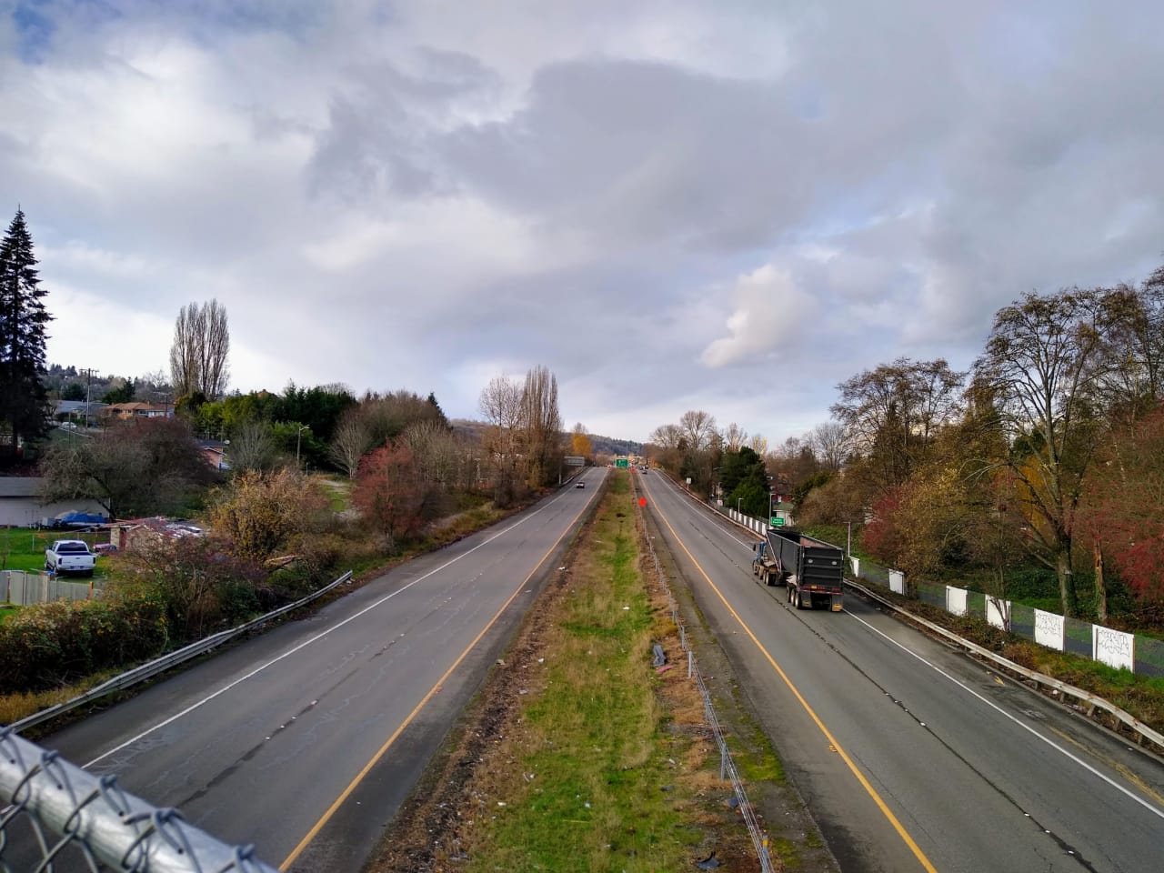
What makes 14th Avenue the best opportunity to accomplish these things? First of all, it breaks the cycle of overbuilding 15th Avenue as a west side highway. There are physical barriers to speed on 14th Avenue. Traffic in Interbay will need to slow and merge together in a curve to approach the bridge. The bridge will have fewer traffic lanes and broad pedestrian sidewalks and bike lanes, which we can even protect with walls and bollards. It will remain a drawbridge, rather than the proposed high bridge that does not open. At the north, the first encounter will be a stop light at Leary Way. Continuing north on 14th will present multiple intersections for cars to join the street grid and pedestrians to grab a bite, groceries, or get to work. Then 14th Avenue ends at Ballard High School instead of a northbound straight shot to more highway.
15th Avenue Transitway
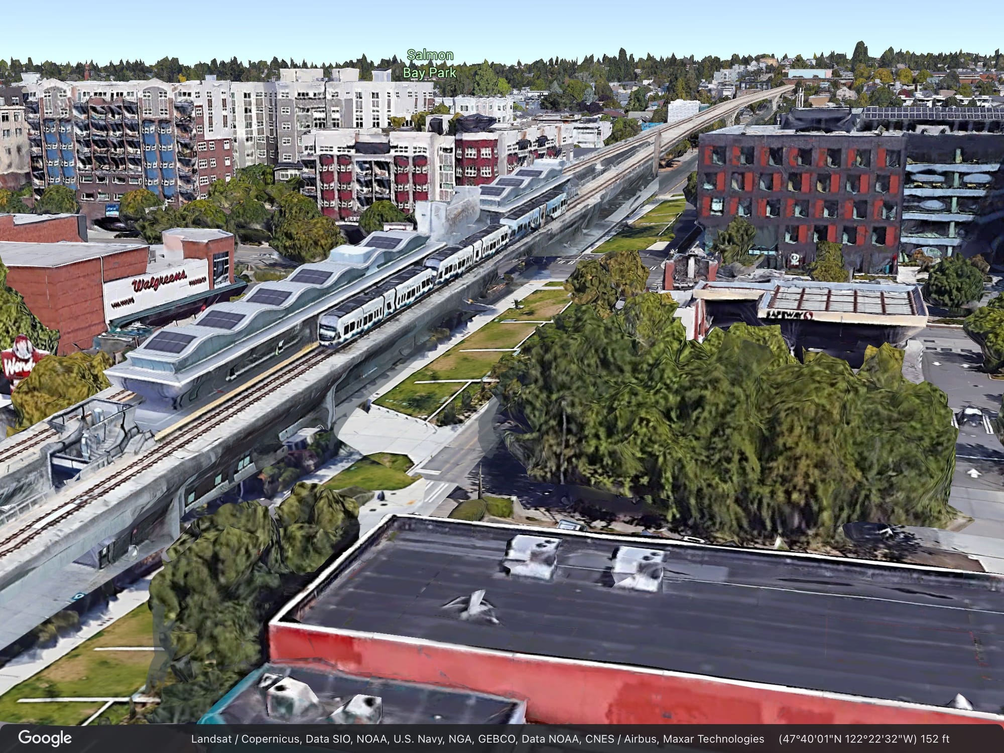
All the things that make 15th Avenue terrible for traffic will make it a godsend for light rail. A clear, straight connection through Interbay and into Ballard will save money, simplify design, and open opportunities for pretty nice looking bridge and stations to boot.
Moving the Ballard Bridge to 14th Avenue will turn off the massive spigot of cars from the north, so 15th Avenue through Interbay will not need to be the six lane drag strip as it’s currently configured. Light rail will be able to run up one side of the road on elevated piers with the remaining lanes split between general purpose and freight and bus lanes. Space under the light rail piers can include walking and bike facilities. The train can cross over the Ship Canal in a dedicated high bridge that does not need to open for ships. When that bridge lands in Ballard, it will come into a 15th Avenue that is part of the street network rather than a dangerous car sewer and barrier.
Why a second bridge for light rail? Ballard’s light rail extension has to cross the Ship Canal, but not on any bridges owned by Seattle Department of Transportation (SDOT). This is a mechanism of the way things are funded in Washington. Sound Transit is a dedicated funding source on a completely different schedule separate from SDOT. Never the twain shall meet. It’s infuriating for many reasons, but in the case of the Ballard Bridge it does offer a transformational opportunity.
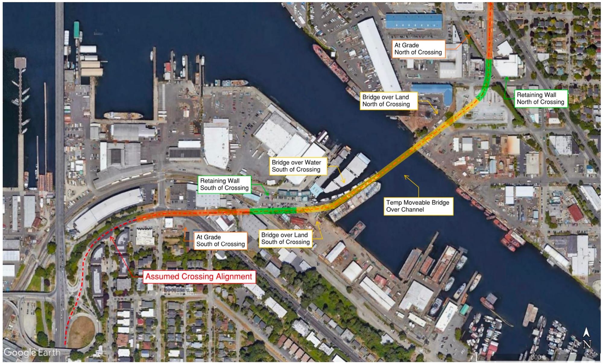
Most of the current light rail designs focus on light rail leaving downtown for an Expedia/Smith Cove station and crossing to the west side of 15th Avenue. The run up Interbay will likely squeeze the train between the BNSF rail yard and the clusters of shops and industry before a Dravus Street station. Then the train crosses back to the east, and in a draw bridge, crosses the Ship Canal to a station at 14th or 15th Avenue and Market Street.
The fight over locating the Ballard station comes down to the best way to connect the station with Ballard neighborhood. Putting the station west of 15th Avenue demolishes parts of the neighborhood or runs up the bill with a tunnel. A station east of 15th Avenue offers more opportunity for dense transit oriented development, but cuts off pedestrian access from the busiest part of Market Street. All the variants have unique difficulties expanding north to future stations in Crown Hill.
Repurposing 15th Avenue as a transit way solves all those problems while making the entire project spectacularly less expensive. There’s little additional land acquisition beyond what’s already in city or state hands. The distance for the train line is cut because it’s not crossing back and forth across 15th Avenue at varying heights and directions. A high bridge has a larger initial budget, but sees massive cost savings down the road without upkeep on a drawbridge mechanism. (Insert escalator joke.) And all of it is vastly cheaper than a tunnel.
Probably the neatest side effect to the north end of a 15th Avenue Transitway will be expanding Ballard. Sure, it’s at the expense of West Woodland, but they’ll get over it. They don’t like the apartment buildings that are coming on their side of Market Street anyway.
But “at the expense” is the wrong phrase. Taming 15th Avenue will not be like moving a wall in house where one room gains at another’s loss. It will be like taking down a closet wall and realizing there was a hidden pool and pinball arcade on the other side. Instead of having sides of a highway, a new neighborhood will form, flowing together with West Woodland and Ballard. Its main street will run north and south along the reconsidered 14th Avenue. It will have a mix of industrial and commercial uses along with some impressive housing density
Finding what is lost
It’s interesting to think about that for a minute. Something so spectacular as a new neighborhood forming. So much of the argument against out-of-the-box proposals focus on perceived costs of change. How much additional time for commuting? How many customers won’t come? What’s the budget for this plan? There are indeed significant questions for this plan, including property access and acquiring land on the south side of the Ship Canal, routing buses like the Rapid Ride D, and properly designing intersections to keep them safe. But the deepest resistance is always concerned with perceived costs.
Those questions don’t account for the miserable failures of our current situation. We rarely consider what’s lost by 15th Avenue existing as a deadly speedway, transportation nightmare, and polluting barrier between neighborhoods. Because we’re used to it and change is scary.
The upshot of the current plans is that Northwest Seattle has to fester in car exhaust while waiting 20 years for light rail. During that delay, an enormous amount of cash will be sunk into preserving roads and bridges for cars. But it doesn’t have to be this way. Instead, we can address the problem of traffic in Ballard and Interbay, prepare the area for the most cost effective light rail connection, and remedy some of the deep divisions that highways have caused.
Think about what we can have by stepping away from what’s here now. Think about 14th Avenue as a leafy boulevard that’s an easy connection in all directions on foot or on wheels. Think about being able to cross 15th Avenue without crippling fear. Think of the twenty blocks of cool stuff between those two streets, anchored by waterfront at the south and the front door to the high school at the north. Gyms, groceries, churches, parks, restaurants, breweries. All accessible instead of hidden behind a highway.
So let’s design for the neighborhood we want, not the traffic we have.
SDOT is Planning the Future of the Ballard Bridge
Two Horrendous Studies Perpetuate Efforts To Destroy Interbay