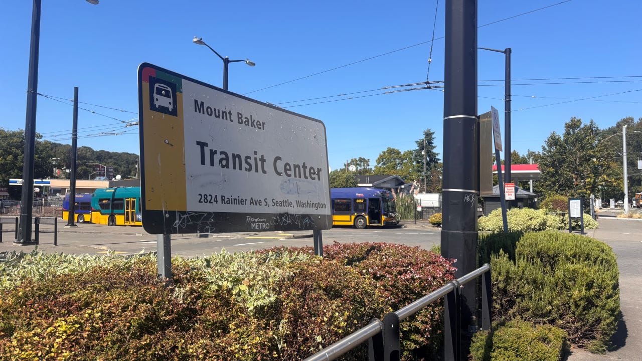
A thriving Mount Baker Transit Center requires pedestrian upgrades, a revitalized commercial district, and plenty of housing nearby.
As we prepare to step off the bus, my kid grips my hand tighter. The back door of the 7 opens and we step over roots and skirt a large puddle as we make our way towards the Mount Baker Transit Center to make our transfer.
I can see my kid anxiously scanning the area, his firm grip steering us away from a person yelling angrily at ghosts. In 2023, he was on a bus in downtown Seattle where a fight broke out and someone emptied a can of bear spray. Ever since then, at any sign of yelling or conflict, I can sense him looking for an exit.
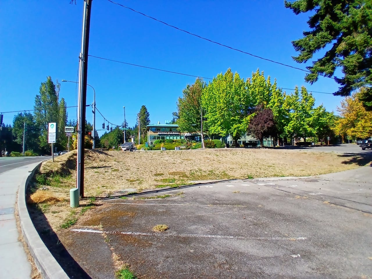
The 8 is running late (shocking!) I wish there was somewhere I could grab a cup of coffee, but it’s all parking lots and boarded-up buildings. There are a couple of banks, but they’re so sealed off from the outside world that it’s hard to tell if they’re open at all. The coffee shop across Rainier by the light rail station isn’t open, and I’m not sure we’d have time to cross there and back anyway.
Today, there’s another mom and daughter waiting with us. I recognize them from school drop-offs and I nudge my kid to go say hi, but both kids stay close at our sides, silently waiting.
In my head, I’m reimagining this transit center. I’m imagining what it would look like injected with some of those shiny new public space dollars we just piled into the Seattle waterfront: new smooth sidewalks, welcoming lighting, native plants and artistic seating, coffee cart and ice cream vendors, and a place to fill up a water bottle or go to the bathroom.
Travelling lately, I’ve been snapping photos of transit centers with built-in playgrounds. If there was one here today, I’d shoo my kid over there to meet and play with the other kids. Maybe there would be more kids, too — this station area now gives vibes of a choice of last resort. Only families like us, those families who can’t drive or can’t afford to drive, end up waiting here.
But it doesn’t have to be this way. For years, community members and organizations like Mt. Baker Hub Alliance have worked to revitalize this area, address safety issues and increase foot traffic. A community outreach process by the Seattle Office of Planning and Community Development (OPCD) led to redevelopment recommendations for land owned by Sound Transit and the Seattle Department of Transportation (SDOT). Those transit-oriented development (TOD) projects are now progressing. According to Sound Transit:
“The Sound Transit East Portal site that is to the west of the former UW Laundry site and is bisected by the guideway as it enters Beacon Hill. The southern portion in particular is a challenging and expensive site to build on because of the slope. We have been provided conflicting information about the cost of building on this site and therefore contracted for additional feasibility investigations to determine the true development potential of that site. That work is currently wrapping up and we hope to go to the Board with a development strategy recommendation in the next 6-12 months.
In the interim we have received a request from the nonprofits who are developing the former UW Laundry site to use the southern portion for construction staging. Although we haven’t fully vetted that request, we are inclined to assist that development in any way that we can and feel that their timeline would not interfere with planning for any potential future development on the East Portal site.”
Sound Transit
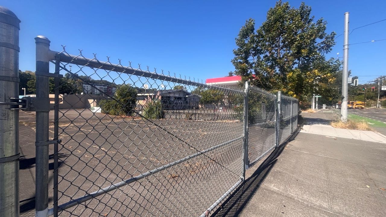
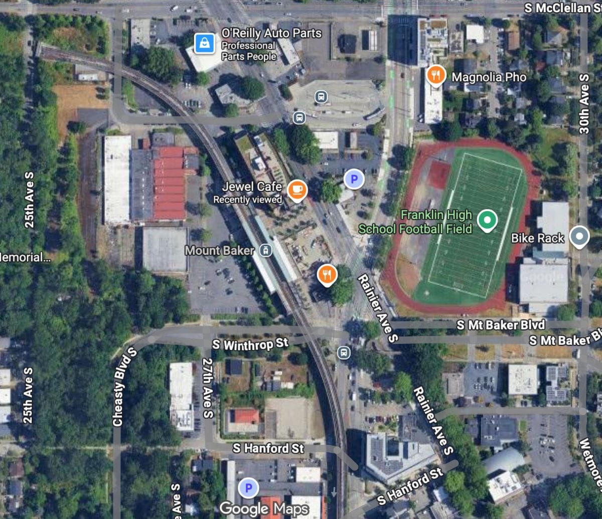
So, while it’s great that these TOD projects are moving forward(ish), a full revitalization will require thinking beyond those publicly owned pieces of land. If you look at a satellite view of the area, it’s mostly parking lots, despite being one of the most transit-rich areas of Seattle and adjacent to a large high school. In spring of 2026, Judkins Park Station will open about a mile north, adding access to 2 Line light rail to the area. (Along this stretch of Rainier Avenue, Seattle Transit Measure funded two new signals to cross at Grand and College streets).
What we need is more housing and more retail, and less of these half-empty parking lots and abandoned commercial buildings. For instance, what would it take to house a pedestrian-centered business in what used to be the corner Starbucks? Could we adopt a parking-spot maximum for properties directly around light rail stations?
While I firmly believe that redevelopment of unused land around the station area is the most critical component to creating a vibrant station area, there are also street-design improvements that can help. As part of the Accessible Mount Baker planning led by SDOT, there were discussions around re-locating the bus terminal to the same side of Rainier Avenue as the light rail station, and a full redesign of the MLK and Rainier traffic patterns to create a “bow-tie” intersection — an idea that has been around for at least a decade. But these plans are unfunded and have been shelved indefinitely, as far as I can find out.
On a smaller scale, SDOT did complete some much needed small-scale pedestrian and bike access improvements to the intersection of MLK and Rainier in 2024. And while those 2024 improvements are a start, there is a lot more that could be done to ease transit users and pedestrian access. Flora Tempel, Director of the Mt. Baker Hub Alliance, is interested in seeing the pedestrianization of Mount Baker Boulevard at Franklin Field with Greenway connections.
“We’re excited to have a new space for community activities that will be closer to Franklin and will be asking how folks would like to see it activated in 2026,” Tempel said. “Adding a flat Greenway connection between MLK Jr Way and John Muir Elementary via Wetmore is a big extra benefit that we’re looking forward to.”
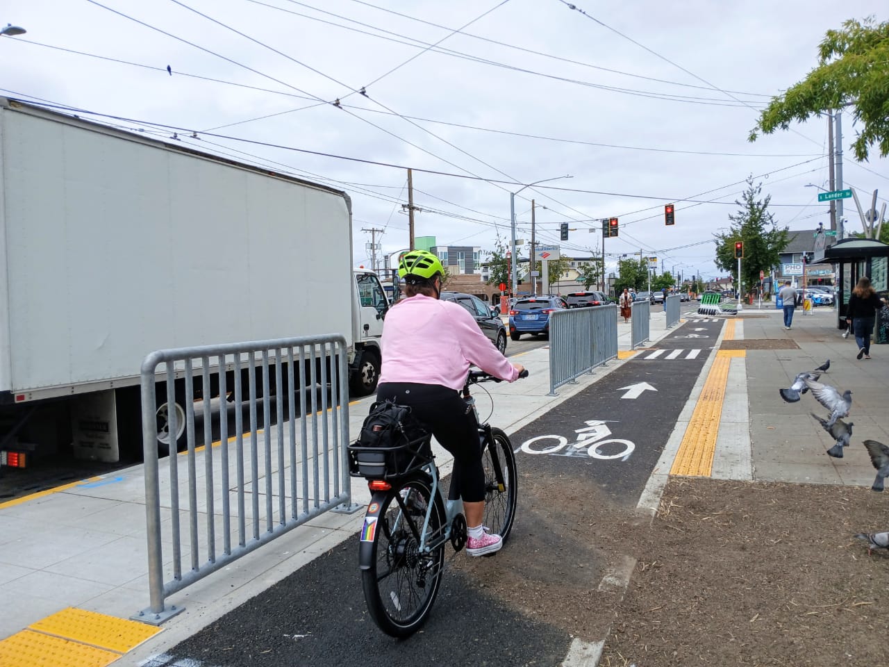
(I’ve become a regular user of the new bike lane on the northern part of MLK, though it continues to be a point of frustration that there’s no safe biking connection to continue south. So when the bike path ends and you want to continue further into Rainier Valley, you’re either riding the sidewalks on Rainier or MLK, or turning around and biking back up the hill you just descended to loop around Franklin High School.)
Through its new Community + Mobility Hubs program, SDOT is considering the Mount Baker station area as one of the hub projects. According to SDOT’s Allison Schwartz, the program is designed to “make connections across public space activation and placemaking near transit that can hopefully make it more comfortable, safe, welcoming, and even joyful for people to get to, from, and wait for transit as part of a set of investments made possible by the voter-approved Seattle Transit Measure.”
In partnership with Sound Transit and Art Station Mt. Baker, SDOT will be hosting a pop-up activation and community input session Wednesday, September 24 from 2pm to 5pm at the Mount Baker Station.
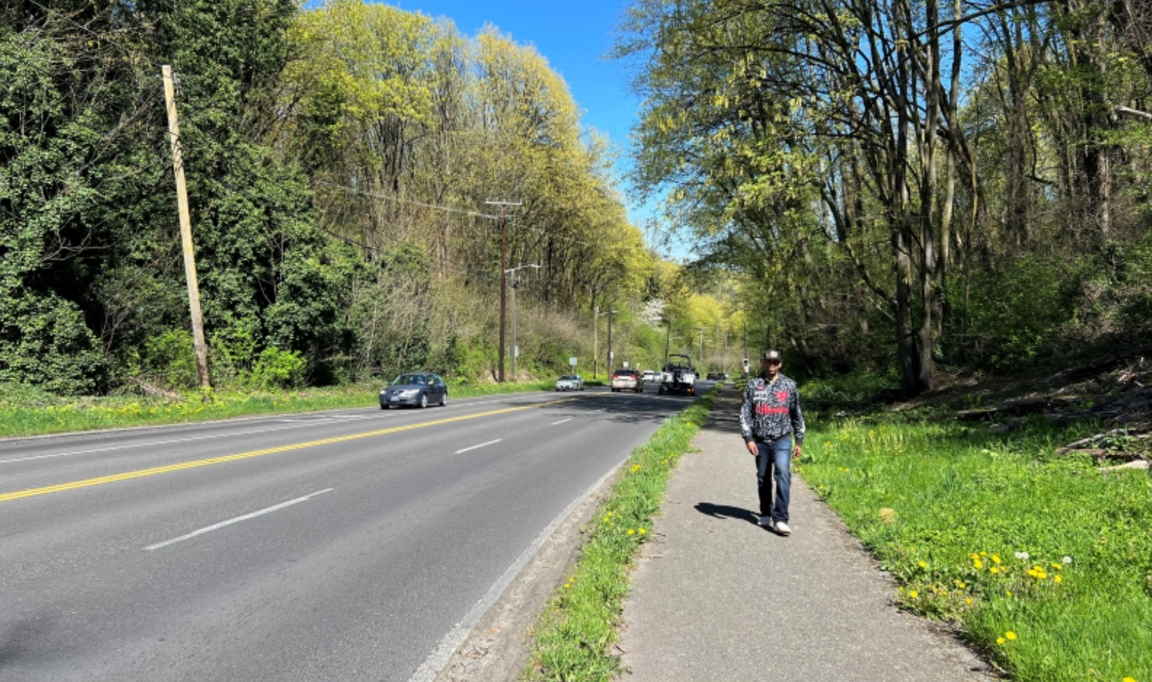
The levy will also fund the reconstruction and repaving of Rainier Avenue between S Walden and S Jackson Street. Our complete streets policy should mean that this project also covers pedestrian and bicycle access improvements — at the very least, I hope that I don’t have to dodge roots and mud puddles when getting off the 7 at a major transit hub.
I’m eager to see improvements to this transit center because I want my kid to be able to ride King County Metro to school on his own in a year or two, which means he’ll need to transfer at this station. In Seattle, car traffic around our schools is a nightmare, and our yellow school bus fleet is underfunded and overstretched. We should be creating environments and encouraging more students to ride the public bus. But even among the transit-loving parents I speak with, there’s hesitation because of the desolate environments at too many of the bus transfer points.
The waterfront redevelopment project shows that we have the resources in Seattle to invest in beautiful, thriving public spaces. But those spaces shouldn’t just exist for tourists or in wealthy areas. Transit riders in Rainier Valley deserve beautiful and vibrant spaces too.
I reached out to the Mayoral and D2 city council candidates to ask about their vision and hopes for the Mount Baker Transit Center and have included their written responses below.
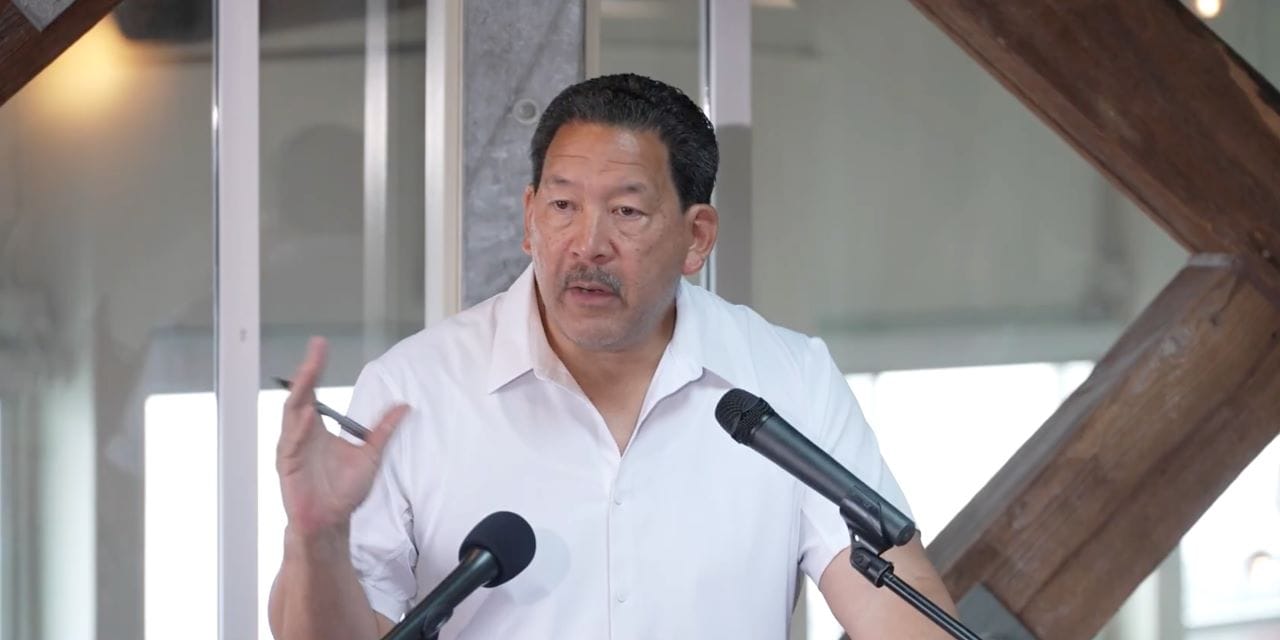
D2 Candidate Adonis Ducksworth:
“I was a supporter of Accessible Mt Baker when it had traction pre-Covid days — it was even slated to be my project at SDOT had it gone to construction. Today, I’m still a supporter of making the area where MLK and Rainier meet more welcoming, safer and accessible for everyone. This means completing the connections to the MLK bike lane, consolidating the bus stop/transfer station with the Light Rail station, and removing the pedestrian bridge across Rainier and prioritizing pedestrian crossings on MLK and Rainier. I’m more than happy to use the platform I have now as a candidate for City Council to help move the early efforts to rethink this part of Rainier Valley forward.”
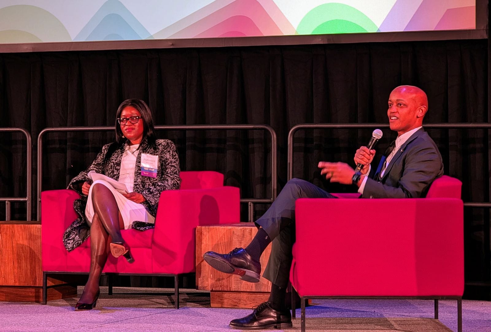
D2 Candidate Eddie Lin:
“I’m proud to have worked with the Office of Housing since 2020 on plans to redevelop the former University of Washington Mt. Baker laundry site (next to the light rail station) into affordable housing. The City recently chose El Centro and Mercy Housing as the developers, and their plans include over 400 new affordable apartments, with 60% of them anticipated to be family sized and 30% of the homes reserved for families at 30% or below of Area Median Income. There are also plans for new public spaces, a community hub, commercial spaces and a new UW Early Learning Center for childcare, teaching, and education. More information is available here: Reenvisioning the Mt. Baker Station – El Centro de la Raza and here: City of Seattle Selects Affordable Housing Partners for Mount Baker Redevelopment – Office of the Mayor.
“My son currently takes light rail or the 106 bus to get to and from Franklin High School, and it’s absolutely critical that we make this intersection and transfer location and the associated buses and light rail safe, reliable and pleasant for students and families, including the many future families that will live at the new affordable housing here. I would like to work with the owner of the former Starbucks property, which currently sits empty, and the City’s Office of Economic Development to see if we can re-activate that space in a way that benefits transit riders, perhaps with a local small business like The Station coffee house.
“Finally, we need to rapidly expand the City’s shelter and treatment options, as too often our public transit systems are used as shelters of last resort, which is not ideal for those who need shelter nor for transit riders.”
Mayor Bruce Harrell:
“I love the vision outlined by Anna– a dynamic, diverse and inclusive urban neighborhood that provides a safe, welcoming space for residents, students, and commuters. This is exactly the vision I have for not only Mt. Baker, but for high-capacity transit hubs across our city. I’ve included much of this vision in our existing work to bring affordable housing and childcare to Mt. Baker, improving roadway and pedestrian safety through last year’s successful Transportation Levy, and promoting density and affordability through our housing investments and One Seattle Comprehensive Plan updates.
“By investing in transit, safety, and community hubs, we’re transforming Mt. Baker into a vibrant, accessible gateway where people can walk, bike, ride, and thrive.
“We have proven as a City that when we align around a shared vision and common values, we can achieve great things– like the Waterfront and other transformative projects. Let’s bring that ambition and thinking to Mt. Baker and other priorities across all neighborhoods to deliver the progress we need and affordability we deserve.”
Mayoral candidate Katie Wilson:
“I frequently transfer at the Mt. Baker Transit Center between buses or between bus and light rail, often with my toddler. It’s one of those areas of the city where, as a pedestrian, you feel you’re in a hostile environment that simply was not built with you in mind. You don’t want to dwell there, you just want to get where you’re going as fast as possible. It doesn’t have to be this way. We have an obligation to do better, not just for transit riders but for everyone who lives nearby. I envision a safe, walkable (and bikeable!) area with abundant affordable housing, thriving small businesses, and places for kids to play. As mayor, I’ll work with the Mt. Baker Hub Alliance and other community partners to advance a shared vision for this vital transit hub and neighborhood.”