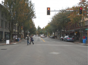
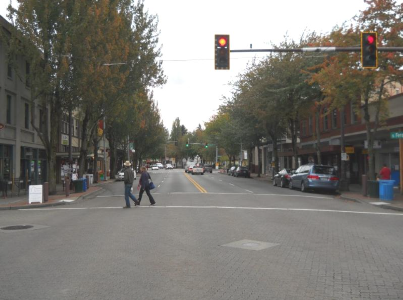
Rainier Ave has long been recognized as a dangerous street, but little has ever been done to fix the issue. Residents have suggested various fixes multiple times since the 1970s, but were constantly rebuffed with concerns over budget or how such a move would affect the flow of cars down a principal arterial. That “cars first” attitude over the years has resulted in Rainier Ave being more of a highway than a neighborhood street, with disastrous results: Rainier sees an average of one crash every day, with 1,243 occurring in the past three years. In the past 10 years, 11 people have been killed, and at least another 1,700 injured.
With such a history, cynicism was high and hopes rather low when SDOT began presenting its preferred design alternatives Thursday Night at the Columbia City School. Many residents expected much of the past to be repeated, with a few inexpensive and inconsequential patches applied to Rainier and no substantive change.
Thankfully, that isn’t what happened. With Vision Zero’s goal of no road fatalities or serious injuries by 2030 as a starting point, SDOT showcased three design alternatives that amount to a massive redesign of Rainier Ave S as a neighborhood street.
May of the elements neighborhood activists expected are part of the plan: About 225 hours of extra enforcement by the Seattle Police Department, funded by grants and focusing on pedestrian safety; improved lane striping and road signage; and retimed traffic signals that prioritize pedestrian movement. Restrictions on left turns and other forms of ‘access control’ along the northern portion of the project area are also planned from S Alaska St to S Letitia St.
SDOT’s decision to drop the speed limit between Columbia and Hillman cities to 25 MPH was less expected, with staff noting the lower speed is far safer for people walking, and better aligned with the area’s overall character. But with an average of 40% of drivers on Rainier speeding by 3+ MPH (4,500 of them by 10+) merely lowing the speed limit isn’t enough: SDOT emphasized that the best way to control speed is through engineering and design. In line with that fact, Rainier Avenue is getting a road diet from S Alaska Street to S Henderson St. The question presented to the community wasn’t if such a change would happen, but what to do with the extra space – and how much it would cost.
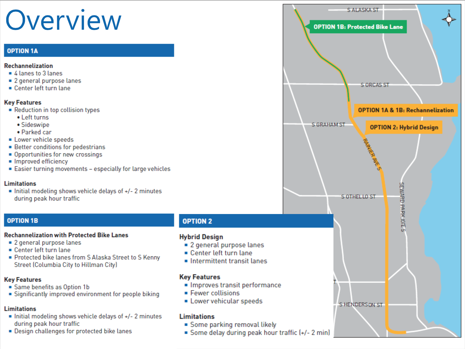
The most basic option presented (1a) would feature two general purpose lanes (one in each direction), a center turn lane, and wider parking lanes: Rainier’s existing street parking only allocates seven feet of space, which is enough to park most cars but doesn’t give people much room to exit their vehicle. Project Manager Jim Curtin also noted that “parklets and curb extensions have both been brought up as possibilities,” with SDOT still working to determine exactly what is possible. At about $500K, this option would mostly fit into the project’s existing budget, and would allow for phased improvements as more funds become available next year.
While early modeling has shown that traffic delays from a road diet and lowered speed limit would only be about two minutes during peak commuting hours, those delays can have a significant impact on transit. Given that Rainer Ave is host to Metro’s Route 7, which carries about 11,000 people a day, this is a problem worth avoiding. SDOT plans to do more advanced traffic simulations to confirm their numbers, but in the meantime they’ve proposed Option 2, which is similar to Option 1a but would take “some parking” away to create multiple transit queue jumps and “partial transit lanes” along the corridor. According to City Traffic Engineer Dongho Chang, this could include a first for Seattle: reverse queue jumps, which would allow for a faster, cheaper implementation since bus stops wouldn’t need to be relocated. Additional improvements such as Transit Signal Priority would also be deployed to help speed buses along Rainier as quickly as possible, and Curtin noted that even outside of Option 2 SDOT “may decide that some transit and right turn lanes would be helpful further south on the corridor,” depending on what detailed modeling reveals. Surprisingly, even with the significant transit improvements, SDOT expects Option 2 to cost roughly the same as Option 1a: 500k to 750k.
Some community members expressed concerns about buses and bikes potentially mingling with each other along Rainier, but SDOT staff noted that this isn’t an unusual occurrence in Seattle, and hasn’t posed any significant issues in the past. It’s worth noting here that Metro specifically trains its drivers how to maneuver around bicycles, and that collisions between buses and bikes are far less common than those between bikes and cars. Still, Curtin told me via email that “this would not be the kind of all ages and abilities [biking] facility that we’re hoping to install on the corridor.”
To see what kind of biking facilities SDOT does want to see on Rainier, we can look at Option 1B, which is largely similar to Option 1A, but adds a full protected bike lane from S Alaska St to S Kenny St. While substantially more expensive than the other two options, Option 1B would revolutionize bicycle access in Southeast Seattle, providing a direct, all-ages connection between the area’s two neighborhood centers, Link Light Rail, and the North/South Rainier Valley Greenway. While SDOT noted that this option presented some “design challenges,” Curtin assured me that they’re “aiming for a substantial barrier for the PBL regardless of the available space,” which is highly encouraging given how often existing PBLs on Broadway and Second Ave are abused by cars seeking parking. Likewise, he noted that a PBL on Rainier would likely preserve most of the existing parking along the route.
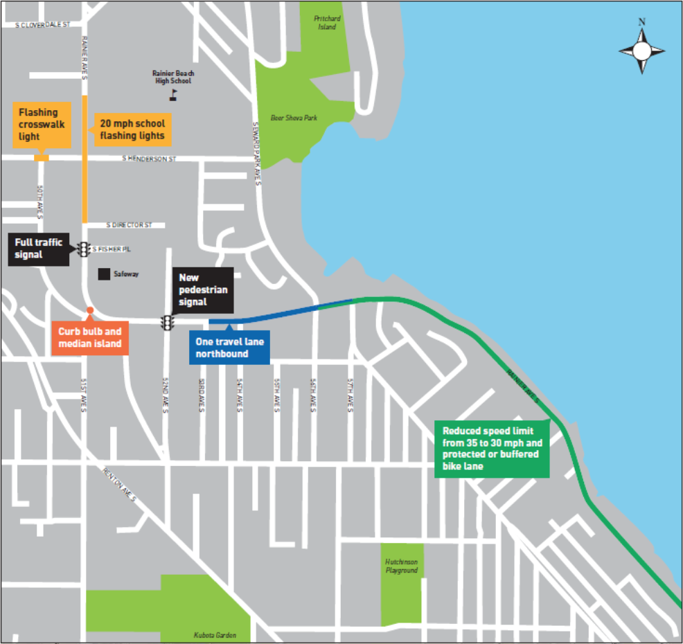
While the planned Protected Bike Line is still rather short – only about 9/10ths of a mile long – it could easily serve as a starter route for the valley, and that would appear to be SDOT’s goal: When asked by a resident why they didn’t extend the PBL all the way down Rainier, Dongho Chang noted “That’s a desire of ours as well.” Such hope is boosted by plans released by SDOT yesterday showing a second PBL on Rainier further south in Rainier Beach.
Ultimately, SDOT’s proposals still lack some details and misses a few potential improvements, such as additional marked crosswalks north of Genesee or revised street furniture to reduce blind spots at some intersections. However, the data and proposed changes laid out by SDOT are incredibly encouraging, and all of them represent a significant improvement over Rainier Ave as it stands. Regardless of what you think of the proposals, it’s clear SDOT is taking Vision Zero seriously–and that can only be good news.