For many parents, getting their children to and from school safely is an issue of deep concern. Now parents have a new tool at their disposal. With over 80 new maps, the Seattle Department of Transportation (SDOT) has developed a comprehensive map series showing safe walking and biking routes to every public school1 across the city.
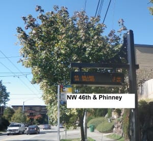
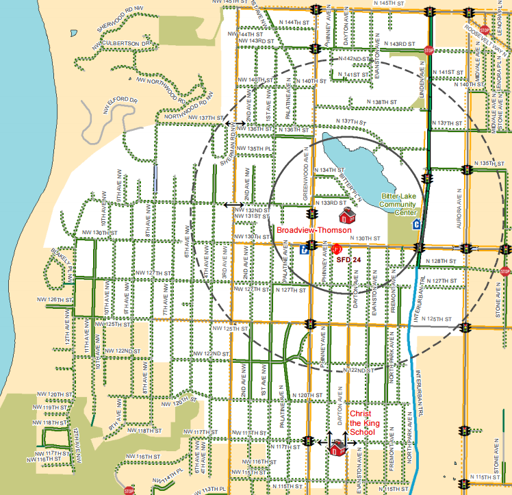
Take this map for Greenwood Elementary as an example.
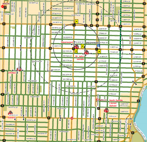
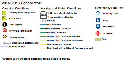
Highly detailed, the map shows the location of the school, street type, walksheds and bikesheds, key crossing points, and more than a dozen other important elements. Areas shown in white indicate the school assignment boundaries while areas depicted in peach lie outside.
Interestingly, SDOT has cleverly placed two sets of walksheds and bikesheds on the map. The innermost circle around the school translates to a 5-minute bike ride or 10-minute walk while the outermost circle means a 10-minute bike ride or 20-minute walk. Conditions, of course, matter and SDOT clearly marks streets as either busy or calm, with sidewalks or without sidewalks, and if there is a Green Street or protected bike lane.
Another striking feature is the inclusion of community facilities. On first glance, that may not seem all that important for walking and biking. But when you consider the daily activities of children, knowing the best ways to them is incredibly practical. Trips to parks, libraries, and community centers after school are fairly routine activities for many students. “Safe” places — that is, fire and police stations — also get noted as community facilities, which probably shouldn’t come as a surprise. It may be helpful for that off chance where a child needs to seek refuge, but more importantly, alerts children where to expect emergency vehicles to appear in an instant. One community facility that seems to be missing is bus stops. Perhaps that’s a matter of clutter, but it could be useful for older students.
The maps are somewhat revealing though. Using mapping themes, SDOT clearly discourages children from using streets that are busy and lack sidewalks. That seems like a no-brainer, but some areas are incredibly challenging for children on foot, and Broadview-Thomson Elementary shows it. Most streets in the area lack any waking facilities to speak of. Worse, even on main streets, sidewalk gaps still remain on both sides of the street for pedestrians like in the area just north of N 130th St.

Fortunately, the City is pushing for more Safe Routes to School funding and trying to stretch pedestrian facility dollars much further in places with limited walking and biking infrastructure. And in the Broadview-Greenwood area, progress has been made with many of the closest gaps near schools getting filled in and speed enforcement getting stepped up.
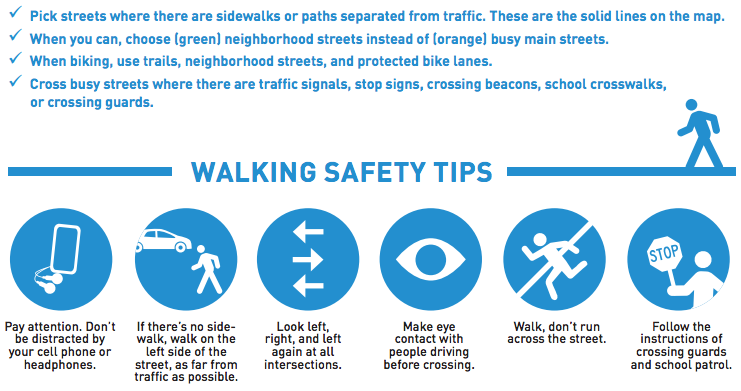
Aside from the maps themselves, each map flyer comes with handy safety tips for walking and biking.
SDOT should be commended for putting out this sort of informational material as it greatly helps parents and children make better decisions about how to and from school on foot regardless of their local destination. Perhaps as a next step, SDOT should consider adding bus stops and put this data into an online interactive app and promote this widely at schools as part of public education. But are there other ways that you think that this map series could be improved?
Footnotes
- Alternative schools are shown on the maps as well, but individual maps are not produced for private schools.