Last week, we reported on Commute Seattle’s survey of downtown commute modes, which is getting widely shared because it reports single occupant vehicle (SOV) mode share dipped to 30%. Decreasing SOV mode share is a huge victory for our city and reflects the fact that new commuters recognize that downtown cannot handle any more cars.
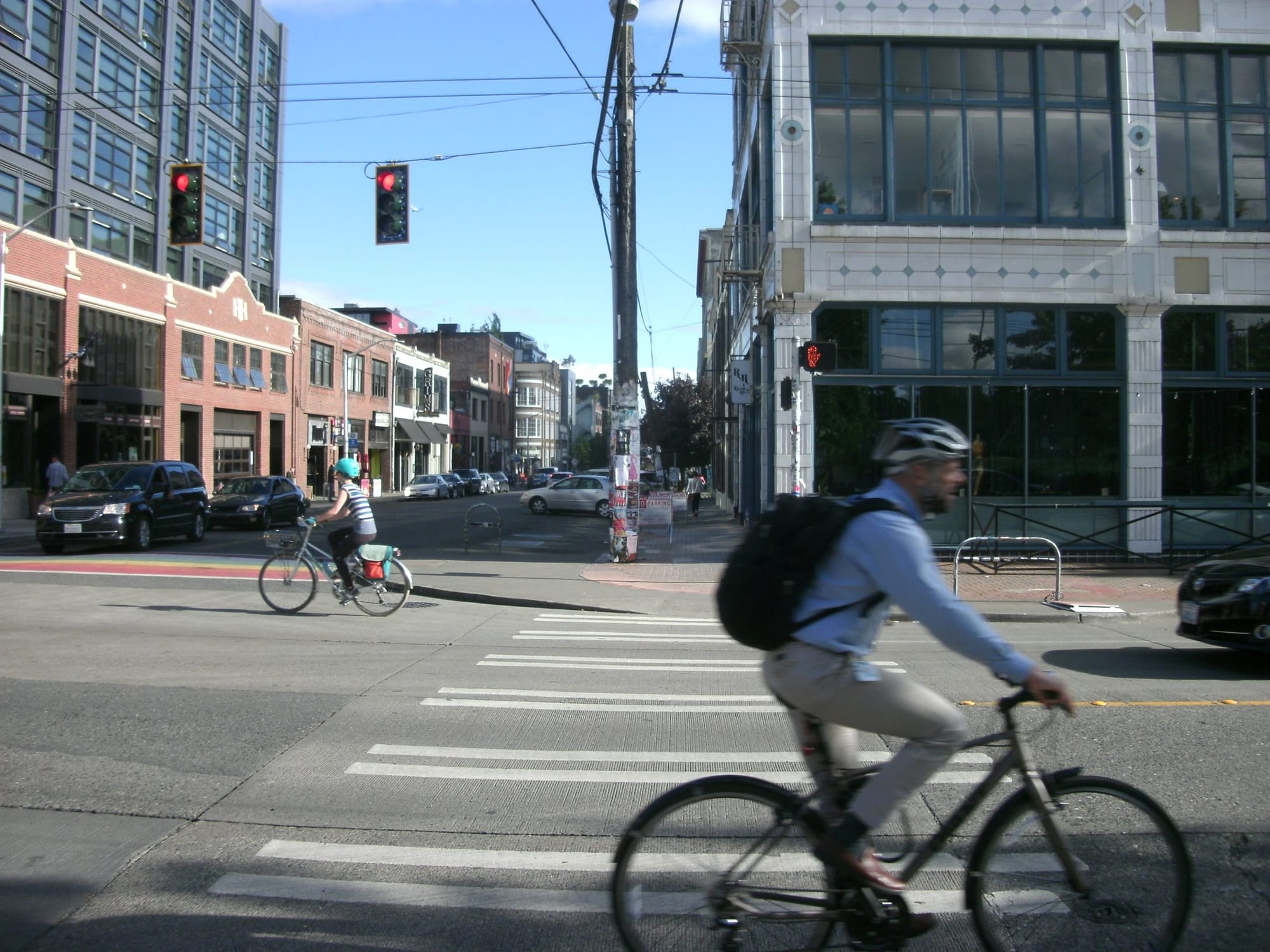
Also getting some attention: bike commuting is essentially flat from two years prior. This is not surprising, considering the fact that downtown bike lane expansion was put into a deep freeze ever since the 2nd Avenue bike lane proved itself to be safe, invaluable, and mildly confusing to motorists downtown. Meanwhile, Seattle has invested more and more in transit, with the 2014 bus levy probably causing the biggest impact on downtown commuters as much-needed relief was brought to riders on overcrowded routes.
If you are wondering what the roadmap to increasing mode share for bike commuters is, we have an idea of what the plan for implementing the bike master plan will look like for the next 5 years. Every year, the Seattle Department of Transportation (SDOT) reprioritizes projects based on feedback, particularly from the Seattle Bicycle Advisory Board. This plan gets approved by the City Council around March. At this time the plan is still in draft form, but taking a look at the document does allow insight into the department’s plan to get back on track after the disappointing scaling-back of prior years. And the draft plan is actually fairly downtown-heavy.
At the City Council’s Transportation Committee meeting last week, chair Mike O’Brien directed leaders at SDOT to come back to the table in March with a plan that fully connects downtown–running with the Basic Bike Network idea that our board wholeheartedly has endorsed. But I want to give an overview of what’s planned so we know what we’ll be gaining when that plan becomes more clear.
In this article I am only going to outline the projects slotted for completion within the next three years. Most of the projects within that timeline have begun planning stages, and so they are less likely to fall of the implementation plan next year. Beyond that timeline it’s easier to see projects getting swapped out as more pressing needs come up.
Neighborhood Greenways
- In 2017, only one greenway is planned for construction, but it’s a big one. The Rainier Greenway will stretch from Mount Baker to Rainier Beach on streets mostly parallel to Rainier Avenue. However, the grades of those streets vary pretty widely. Many south-end bike advocates are unhappy that SDOT was not able to find room for bike infrastructure in their high-profile Rainier Avenue road diet because Rainier remains the most direct, flat route into and out of the Rainier Valley. By contrast, the greenway will make quite a few turns and wind around the back streets of the valley–more optimal for short local trips than long commutes.
- 2018 is a busier year for greenway construction. The biggest project, clocking in at more than three miles (which is really big for a greenway not being done in phases) is one that would connect existing Ballard greenways with the Northgate area around College Way N via N 90th and 92nd Street. This will be HUGE for residents of Northwest Seattle to be able to have easier access to Northgate by 2021 when the light rail station opens there. There is also a small greenway proposed in Wedgwood that would run parallel to NE 65th Street. 2018 will also bring construction of another big segment in Seattle’s greenway network: a greenway on S King Street connecting downtown with the Judkins Park neighborhood. (I wrote about this earlier this year) We don’t yet know what SDOT has planned for the very urban segment west of I-5 on King in the International District and will report more on that when we do. Another greenway in central Seattle planned for next year is an east-west greenway connecting Broadway to 21st Ave E on E Republican Street. This is a Safe Routes to Schools (STRS) project benefiting Meany Middle School.
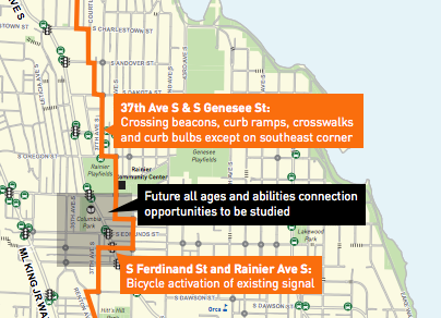
- 2019 greenways planned include another big one connecting parts of south West Seattle, from the existing greenway on 26th Ave SW off Delridge all the way down to Roxbury. In Central Seattle, the Ridge Route will connect Volunteer Park with the new King Street greenway referenced above via 16th/17th Avenues. There is also a project to create a greenway around the “Lake Washington Loop”. The routes being analyzed would all connect Madison Street to Boyer Ave near the Arboretum. In fact, there is a meeting this weekend on early planning for that project: details here.
Protected Bike Lanes
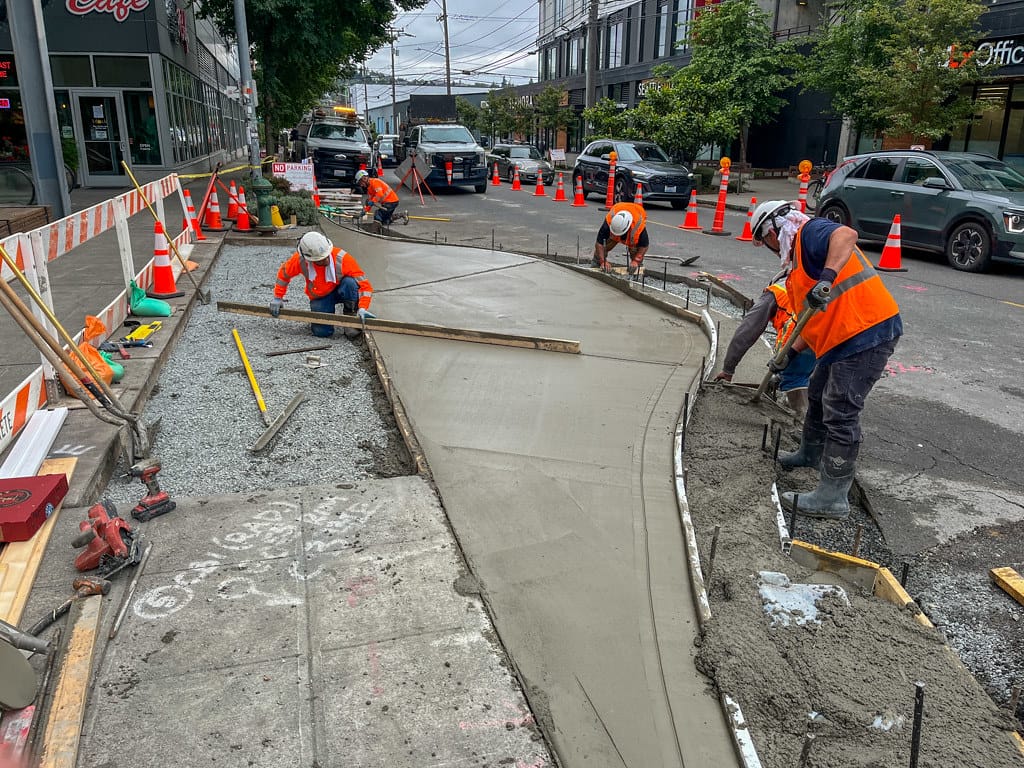
- There are a mess of protected bike lanes (PBL) proposed for this year. Partly this is because a few projects were delayed from last year’s work plan. Those projects include a N 92nd Street PBL between Wallingford and 1st Ave NE, and a fantastic connection between the Elliott Bay Trail and the Ballard Locks in Magnolia. Downtown, the centerpiece project this year is going to be the extension of the two-way cycletrack on 2nd Avenue north to Denny Way. This will be a big deal for downtown commuters, as there is currently no dedicated lane northbound through Belltown, only southbound. In addition, SDOT will extend the protected lane on 7th Avenue (that was procured through Amazon’s alley vacation process in front of the new Doppler and Day One buildings) south of Westlake Avenue to Pike Street. Both of these projects set downtown up to be highly connective from the moment the east-west bike lanes promised as part of One Center City opens (on, ahem, day one).
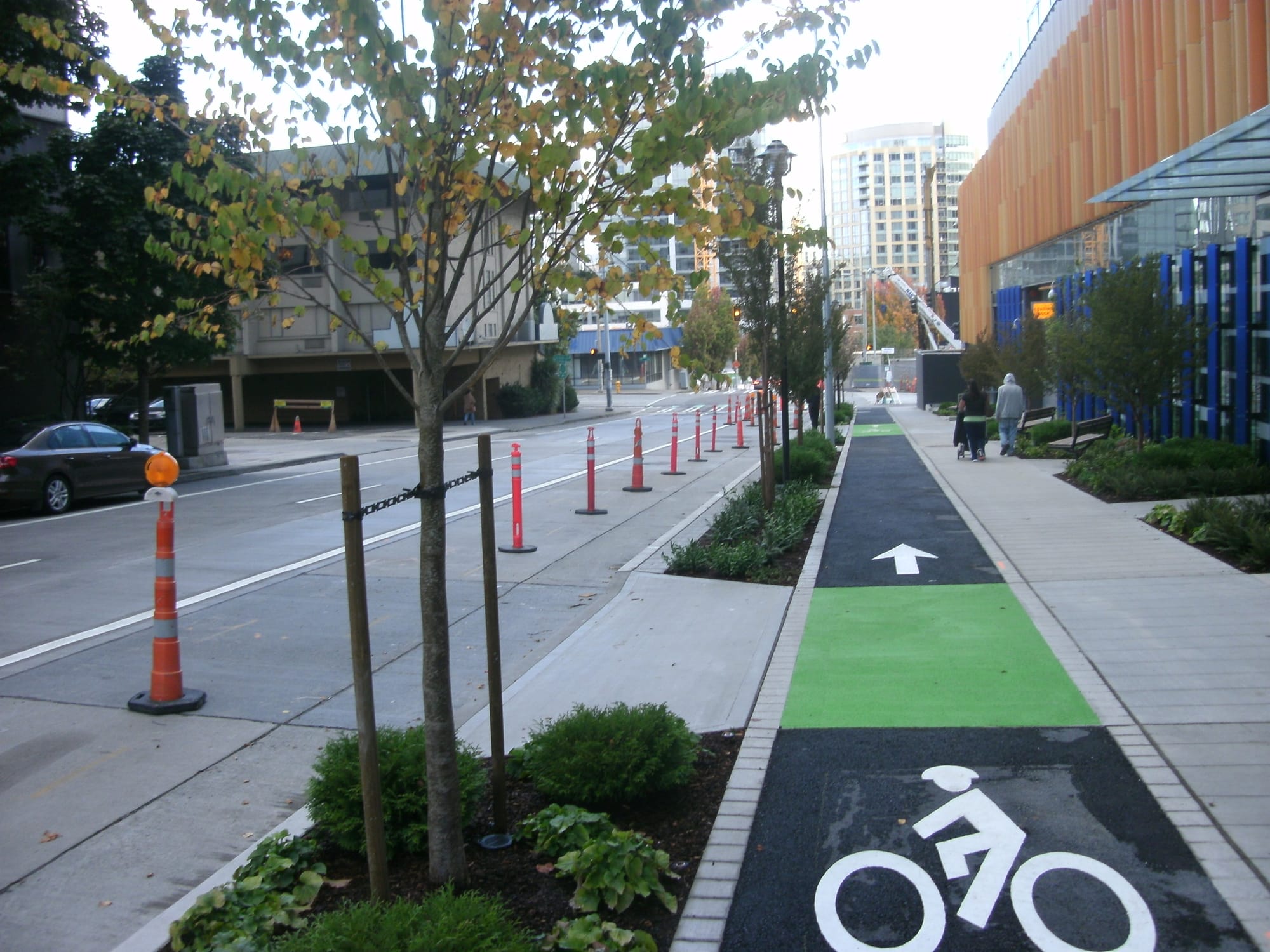
A bike lane on Blanchard Street built as part of Amazon’s campus. Unlike the lanes on 7th, there are no plans to extend the lanes on Blanchard right now (photo by the author) There are a few other gaps getting filled downtown this year: Roy Street between Dexter and 9th Ave N, as well as a block of Dexter between Mercer and Roy that lacks protection now. SDOT will also start construction on 9th Avenue N but not be able to complete the entire project until 2018 due to construction on the south end of the block.
S Dearborn Street was also planned to start construction this year, but that project’s route going underneath I-5 has caused delays, through coordinating with WSDOT. We should have more on that project soon.
- Next year, there are quite a few bike projects that are coming along with planned repavings. These include Swift Ave S and S Columbian in the south end, and sections of 15th Ave NE and 35th Ave NE in the north end.
2018 will also see, finally, the bike lane on N 34th Street in Fremont between Fremont Ave and Stone Way get protection– probably one of the most highly used bike facilities in Seattle.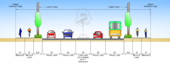
Fauntleroy Boulevard Project (City of Seattle) Fauntleroy Way between Alaska Junction and 36th Ave SW will get protected bike facilities next year as part of the Fauntleroy Boulevard project, which will add a tree-filled median to that unfriendly stroad in West Seattle.
But next year’s flagship project is going to be NE 65th Street. After months of rallying, the community surrounding this dangerous street in northeast Seattle have succeeded in getting a rechannelization in the budget. While we haven’t seen any plans for this yet, a protected bike lane is planned from 39th Avenue NE all the way to Ravenna Boulevard, where there is already a PBL.
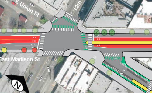
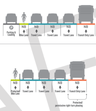
- 2019 will see some more repaving projects that add bike features, most notably one of Seattle’s most iconic streets, Green Lake Way. Avalon Way and N 50th Street will also be repaved with bike features added. What is not clear right now is what bike projects will be coming along with Madison BRT. Complementary bike facilities were initially planned but the last update from the transit planners is that most bike facilities near the transit line were “out of scope” for the project. The biggest deal was going to be protected bike lanes on E Union Street, which are not in the plans anymore. That doesn’t mean they won’t be added, but bike advocates need to press the issue when planners release the next phase in design for the route later this year.
Plain Old Bike Lanes
- Also in the plan is the addition of plain old unprotected bike lanes. These are cheaper, but limit the number of users that will be able to effectively navigate them. The most notable of these in the plan is an extension of the 4th Avenue bike lane–this was added as a part of the deal to reallocate funds toward Pronto bike share. The 4th Avenue bike lane is a widely complained about narrow lane that cars frequently turn across when heading down 4th Avenue. The bike plan proposes it be extended in two phases to Vine Street. (In addition, as someone who bikes 4th Avenue every day, Vine is a random place to end the lane- two blocks more and 4th Avenue terminates at Clay Street.) The One Center City plan includes a 4th Avenue protected bike lane in most of its iterations–allocating the street space now might spare a fight in the future, but it is disappointing to see the City not able to add protection to provide a temporary All Ages and Abilities route east of 2nd Avenue downtown.
One proposal for 4th Avenue in the One Center City proposal (City of Seattle) The same is true on Banner Way NE, which is a really scary intersection for users of all modes. A bike lane is proposed there this year, but is a painted lane adequate there?
Counting the Miles
In the five-year implementation plan, North Seattle is currently slated to receive 28.6 miles of bike facilities to South Seattle’s 23.2 and Central Seattle’s 17.4. While counting miles can be slightly misleading, for example when the projects downtown might be very short, high-use segments, it is important to take a step back and look where we are investing. On the South End, 50% of those miles are coming in the form of greenways, with half of the greenways coming this year with the Rainier Valley greenway. It will be very important that the entire city ensures that the greenways constructed there are high-quality. City Council district two faces an outsized portion of deaths and injuries due to traffic violence. It is the duty of all Seattleites to reduce that however we can.
It’s also worth looking at where we are not building bike facilities. Georgetown and South Park do not have any projects in the five-year implementation plan at this point in time. South Park is an urban village and it’s time that we started treating it like one. It is my hope that we can correct this oversight in the implementation plan in the next few years. Vision Zero demands that we do so.