With plans for most Downtown bike facilities on hold pending the results of the One Center City study, work creating safe connections is still moving forward in a few places. I’ll lay out two projects in different stages of planning both on Downtown’s southern end in the International District.
South Dearborn Street Protected Bike Lane
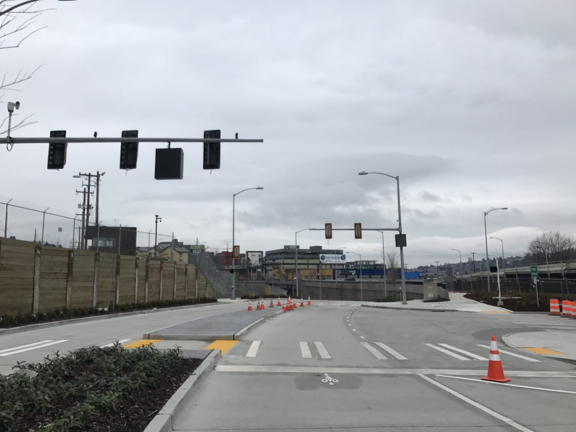
The first is South Dearborn Street, where a protected bike lane has been in the works for a few years. Because the project area goes under I-5, coordination was required with the Washington State Department of Transportation, which has delayed the project a bit.
Dearborn is a fast-moving corridor favored by freight vehicles, an easy way to get between SoDo and the Rainier Valley. It is a collision-promoting street: according to the project website, there were 175 crashes between 2009 and 2013, 11 percent of those involving people on bike. A narrow bike lane next to the curb in both directions provides meager refuge and at parts the markings disappear where traffic turns to enter and exit the on- and off-ramps from the freeway entrance. Notably no sidewalk exists underneath I-5 on the south side of the street, so pedestrian traffic is pretty likely to use the only available space that is not a car traffic lane: the bike lane.
Sidewalks are not planned as part of these improvements for areas lacking them–any sidewalk additions would happen through a separate evaluation process (and demand dramatically outstrips available funds city-wide).
Construction is slated to begin this spring on the area west of I-5, all the way to 6th Ave S. In the summer, crews will put down a pilot protected bike lane between the west side of I-5 and Rainier Avenue. This will allow SDOT to see how the protected bike lane works before summer 2018, when Dearborn is repaved between Rainier and the east side of I-5 and the bike lane has to be redone with the rest of the street.
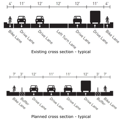
The protected bike lane will take the space currently occupied by a center turn lane. Lanes will not be narrowed, with one 12-foot lane and one 11-foot lane in both directions remaining. NACTO standards do not recommend lanes wider than 11 feet for streets with freight traffic and 10 feet otherwise.
At intersections where the turn lane will still be required, including at 6th Ave S, S Maynard St, I-5, and Corwin Pl S, the bike lane will narrow to accommodate the extra lane.
Rainier Avenue is the key intersection to improve in this stretch of Dearborn. The planned street configuration there appears to do a good job of separating bikes and motor vehicles, but the effectiveness of the facilities will lie in whether the different modes of traffic are truly separated from one another. The southbound turn lane from Dearborn westbound onto Rainier is likely to prove the most problematic for bikes and vehicle traffic intermixing.
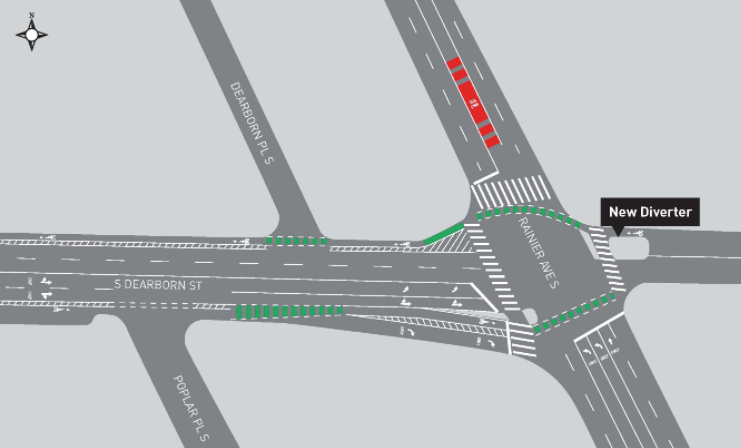
Something pretty notable was added to the project this year after its delay: a diverter on the east side of Rainier Avenue will prevent motor vehicle traffic from accessing either Dearborn or Rainier. The Seattle Department of Transportation’s (SDOT) traffic models show that the intersection will clear much more quickly and traffic will flow more smoothly if traffic from that direction has to access Rainier or Dearborn from another direction. Bike traffic will still be permitted through the diverter. It’s encouraging to see SDOT utilizing a diverter outside of a greenway project and, by doing so, improving travel times for all modes by reducing vehicle traffic from one direction.
King Street Greenway
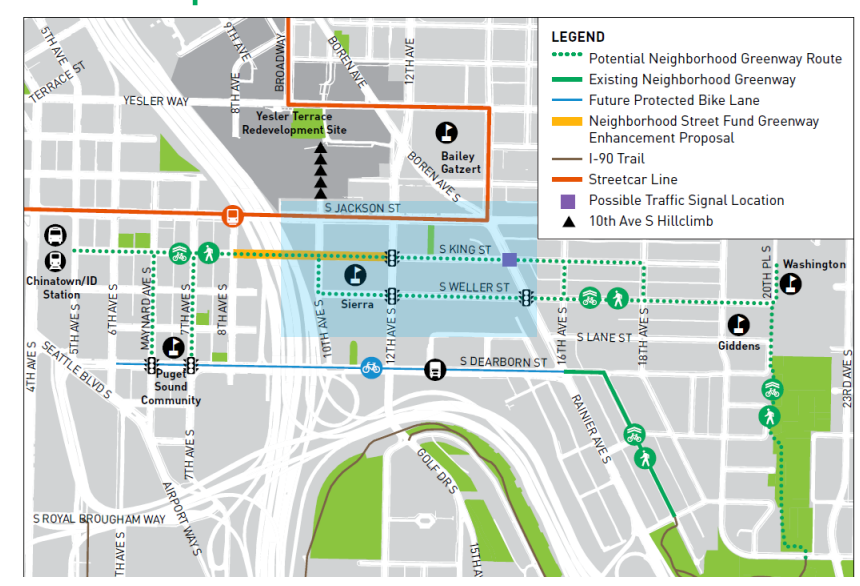
Another transportation corridor is being planned for the south end of Downtown, to be constructed in 2018: a neighborhood greenway through the International District. While a couple routes are under consideration, South King Street is going to at least end up with part of the project on it, and likely the entire thing. SDOT is also studying South Weller Street, but much higher vehicle speeds undermine its potential as a greenway–granted a good greenway design would presumably help slow traffic somewhat. Traffic calming on Weller or not, King Street is a much better route between the International District and Judkins Park due the fact that King connects on both sides of I-5.
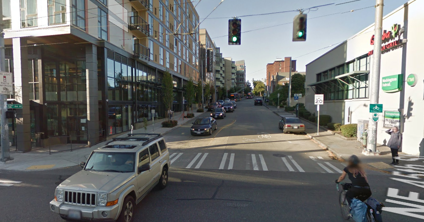
A King Street greenway will bring the Seattle greenways program into a different sort of territory: a wholly urban one. King Street is a very lively street with restaurants, businesses, some light industrial uses, and even one of Seattle’s best museums: the Wing Luke Museum of the Asian American Experience. Many of Seattle’s existing greenways are in quiet residential areas. In areas where they have ventured into more commercial zones, the results have been pretty disappointing. The most obvious example is the 12th Avenue NE Greenway in the University District, which is hard to call much of a greenway in the area around NE 45th Street. As one most unpleasant and dangerous intersections to cross, people walking or biking feel the lack of strong greenway design here all the more.
For King Street, the only way a greenway is going to become welcoming for users on foot or on bike is if the roadway gets narrowed considerably. Most of the intersections along King Street are already four-way stops, but vehicle traffic is so high that frequent conflicts arise between people on foot and in vehicles over who has the right of way. Narrowing the roadway would provide quite a few ways to enliven the street in the process. Imagine a pavement park that occupies the width of car lane running up and down King Street. Pedestrians could use it as an extended sidewalk, and occasional tables and chairs would encourage people to stick around in the space.
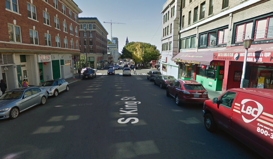
The million dollar question here is will SDOT utilize diverters to calm the traffic and, if so, where? The obvious choice for diverting traffic is at I-5. King is an easy shortcut to avoid getting on Jackson Street, but for the design to work most east-west traffic should be shunted onto Jackson. A diverter sending people up to Jackson or down to Dearborn could be able to do the job of calming traffic on much of King Street.
The King Street greenway is still in planning stages, with preliminary designs happening this spring. Greenway work can happen very fast, because there isn’t as much street treatment required compared to a project like a protected bike lane.
While these two projects might seem a little bit redundant being so close to each other, both are incredibly important. Dearborn’s improvements will connect neighborhoods that are currently unsafe to travel between on a bike, and calm a ridiculously stroad-y corridor. Though sidewalks are absolutely needed on Dearborn, and it is really quite dumb that we cannot take care of this while we tear up the road next year. King Street is less about connecting neighborhoods that creating a stronger one by utilizing underused space and transforming what that public space can do in the meantime. Both are projects to keep an eye on in the next year.
Visit the project website to see more details of this project, and contact the project manager at SDOT for greenways, Summer Jawson, at Summer.Jawson@Seattle.gov to provide feedback on what the new King Street greenway should look like.
What’s Going On At King Street Station?
Street Signs: Identity Of The International District
The Urbanist Christmas Wish List For Seattle


