One of the final things that safe cycling advocate Mike O’Brien did before exiting the Seattle City Council at the end of last year was to prioritize funding for a bike connection to the southeast quadrant of the city. The Move Seattle levy’s bicycle route program was set to run out of funds before adding that crucial connection, but the funds from the Mayor’s negotiated deal for the Mercer Megablock were allocated to fill the gap. On the council’s end, Councilmember O’Brien ensured that completing gaps in Southeast Seattle was codified by resolution.

This year, that work moves forward. The Seattle Department of Transportation (SDOT) is moving forward with designs for a protected bike lane that will run the entirety of Beacon Avenue S in Beacon Hill, and with designs for a protected bike lane on Martin Luther King Jr Way S between the Judkins Park light rail station (set to open in 2023) and the Mount Baker light rail station. It is this MLK Way S bike lane that is the subject of a survey that SDOT is asking community members to complete by May 5th. SDOT plans to complete the connection by the time the new light rail station opens for service.

The 2014 bicycle master plan envisions a protected bike lane on MLK Jr Way S running all the way from E Union Street in the Central District south to the city’s limit. This segment, however, would start at S Judkins Street just north of I-90 and run to the intersection with Rainier Avenue S.

Seattle’s bike master plan as envisioned for the area around Judkins Park and Mount Baker Stations. (City of Seattle)

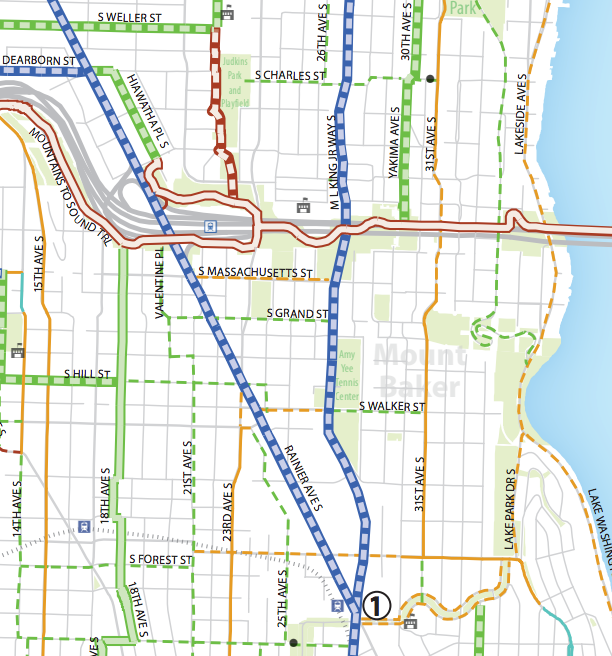
The primary connection to an existing bike facility will be to the Mountains-to-Sound (I-90) trail. This year SDOT will construct a protected bike lane between that trail and the S King Street “calmway” that connects to downtown’s north-south protected bike lane. The trail also almost completes the connection to the S Dearborn Street protected bike lanes.

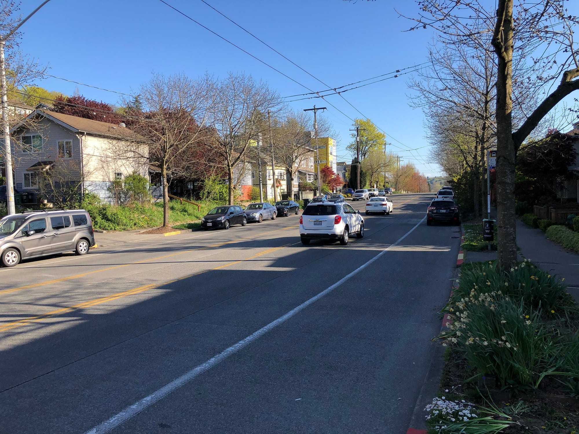
North of S Judkins Street, SDOT’s official bike map indicates that there’s an existing paint-only bike lane running on MLK Way all the way to E Union Street, but it’s not evident to anyone who has tried to use this lane that it actually exist. It’s really just a slightly wider-than-normal parking lane. It’s not likely to get turned into a real bike facility for a long time.

SDOT has stated they are studying the feasibility of extending this planned bike lane south of Rainier Avenue S in Mount Baker all the way to S Henderson Street in Rainier Beach. That would become one of the longest continuous bike facilities in the city, so it matters how the first segment will be designed.

The survey has three different options SDOT is considering. The three options are shown in two different contexts, the residential segment of the project and the business district segment, but they are nearly identical.

“Business district” alternatives depicted in the survey. (City of Seattle)

Alternative 1 is a two-way protected bike lane on the east side of the street. Alternative 2 is a two-way protected bike lane on the west side. The trade-offs between these two options are not laid out in the survey. Both of these options include riding against the direction of traffic on a busy thoroughfare, no matter what side of the street. The designs appear to depict a concrete barrier in the business district and paint and-post protection in the residential area.

Having the two way facility on the west side of the street would probably be more frequently used by riders coming to and from downtown Seattle, allowing a transfer to the I-90 trail without crossing a road.

Alternative 3 is probably the option that many people who ride bikes will prefer: it would mean a one-way protected bike lane on either side of the street in the direction of traffic.

Residential alternatives depicted in the survey. (City of Seattle)

There are different tradeoffs depicted for the vehicle lanes as a result of the bike lane configuration, of course: the one-way option shows one fewer travel lane through the business district, which signals that it would be a harder political battle. But it also shows more room for a turn lane in the residential segment with the one-way lanes than with a two-way on the west side of the street.

Ultimately, it may be too early to tell what unexpected hurdles will pop up for any of these designs. Having bike lanes on MLK Way S outside Judkins Park Station on the day it opened would be amazing, and hopefully they can be installed in the most intuitive and user-friendly way imaginable. As always, we won’t be holding our breath waiting for that to happen. Regardless, take the survey now and help guide the vision. You can also check the project website and sign up for updates.

Featured image by Rachael Ludwick.

Article Author

Ryan Packer lives in the Summit Slope neighborhood of Capitol Hill and has been writing for the The Urbanist since 2015. They report on multimodal transportation issues, #VisionZero, preservation, and local politics. They believe in using Seattle's history to help attain the vibrant, diverse city that we all wish to inhabit. Ryan's writing has appeared in Capitol Hill Seattle Blog, Bike Portland, and Seattle Bike Blog, where they also did a four-month stint as temporary editor.