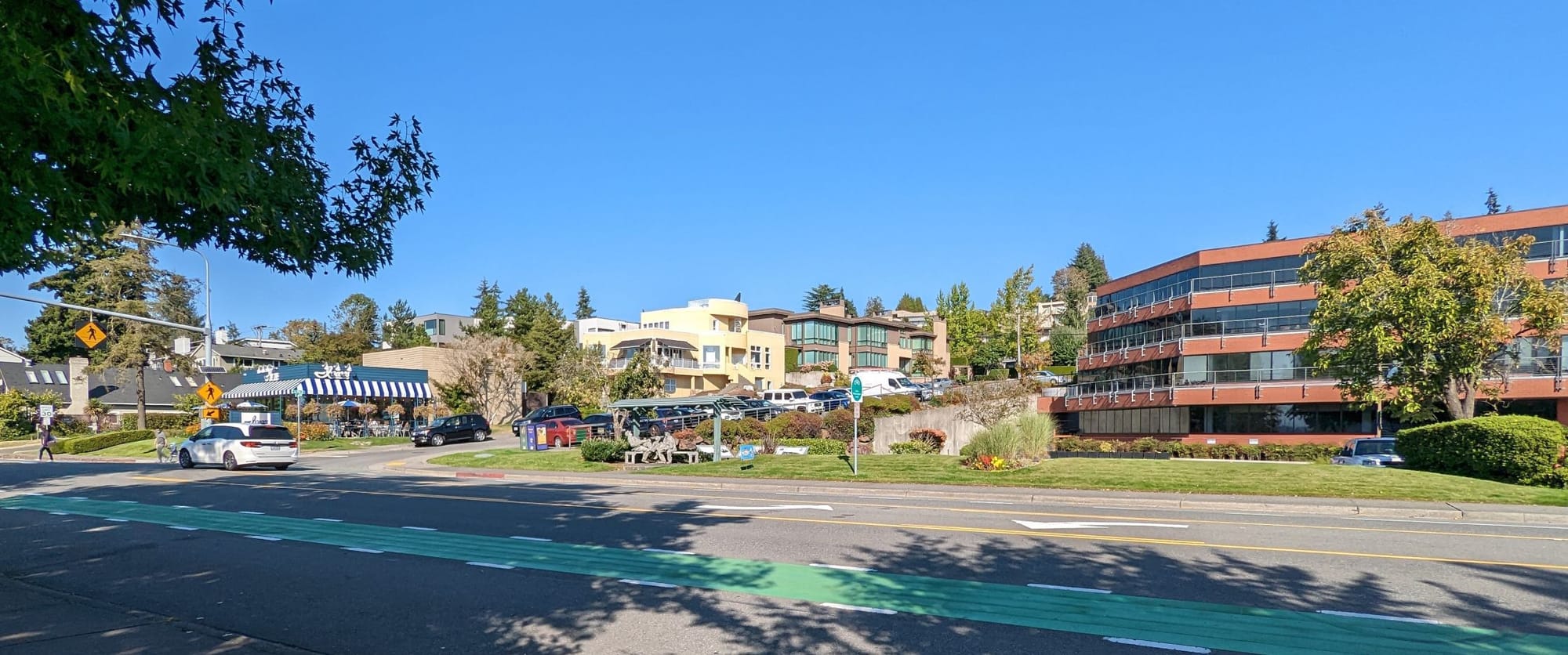
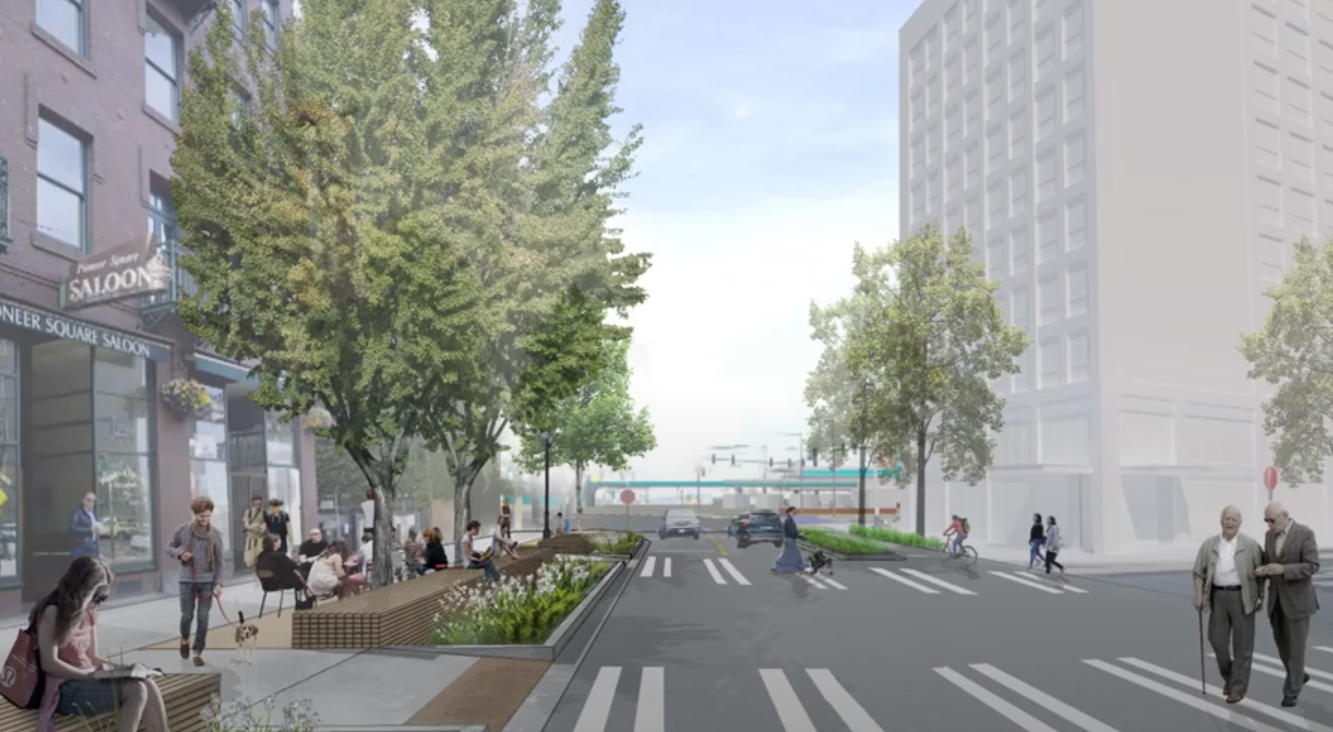
Early next year, a construction grant will be awarded and work will start on a $20 million overhaul of four east-west streets in Pioneer Square, kicking off one of the final independent projects as part of the larger Seattle waterfront redevelopment. The remaking of Yesler, Washington, Main, and King Streets is intended to knit Pioneer Square together with the new waterfront, improving accessibility, adding greenery, and better connecting the neighborhood with its central open space, Occidental Park.
However, that project leaves unfinished a final piece of badly needed downtown mobility infrastructure: a connection between the coming waterfront bike trail on the west side of Alaskan Way and the rest of Seattle’s Center City Bike Network. The project will not fill a conspicuous gap between the existing protected bike lane on Yesler, which currently ends at Occidental Avenue S, and the waterfront. And despite efforts at the Seattle Department of Transportation (SDOT) to find funding for that final connection, it remains absent from the city’s plans as the entire waterfront project heads toward ultimate completion.
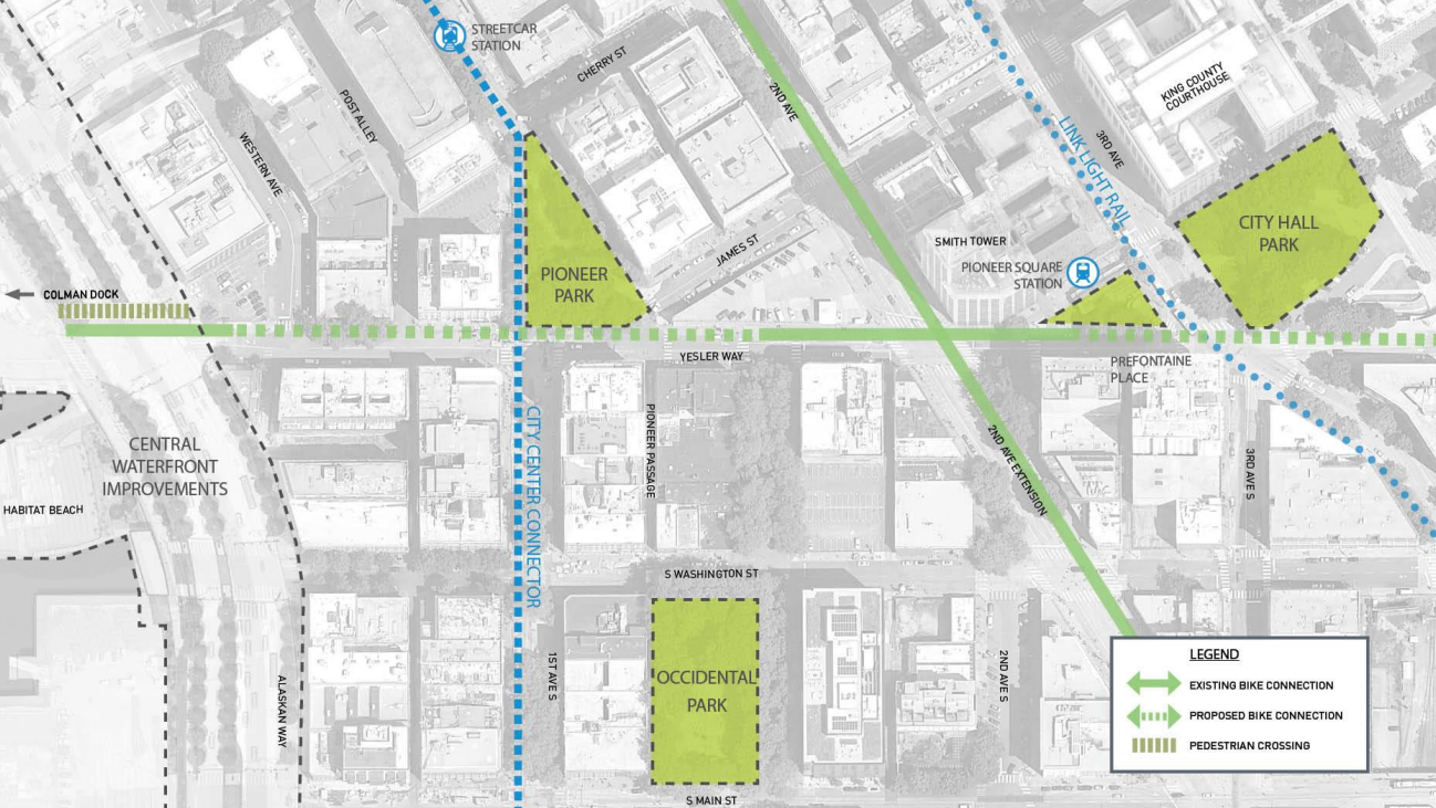
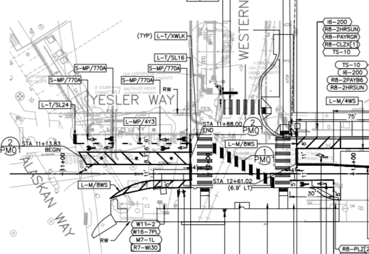
Current plans for the “Pioneer Square East-West Pedestrian Improvements” project show a short two-way protected bike lane on the north side of the street between Alaskan Way and Western Avenue, a block that is less than 100 feet long. People biking on the waterfront from either side of Yesler Way will cross on the north side of the street because there is no crosswalk on the south side, as drivers exiting ferries at Colman Dock are provided an unobstructed right turn onto Alaskan Way.
From there, people biking eastbound toward downtown are directed into a diagonal bike crossing to cross to the other side of the street at Western Avenue, an intersection which is unsignalized. Riders will have to judge whether it is safe to merge with drivers heading east on Yesler while they watch for drivers who are heading west on Yesler, or even drivers turning in multiple directions on Western Avenue. That mess will likely prompt a lot of people on bikes to completely ignore the area.
The plans do leave SDOT the ability to come in and install the missing segment of bike lane, which would not require riders to cross diagonally at all.
“While a connection farther east to Occidental Ave S was not identified in the Bike Master Plan, this is something that we have considered adding to our center city bike network and would build if we can identify funding,” Ethan Bergerson, SDOT media relations lead told The Urbanist. “While this is only three blocks, the project would likely require us to fully rebuild the traffic signal at Yesler Way and 1st Ave to allow for a bike-only phase, and create a safer crossing at the diagonal intersection with James St. Both of these crossing improvements would add to the complexity and cost of the potential project.”
Bergerson said that SDOT had sought a grant to fund the project in 2020 but was not successful. The department has been seeking a number of grants to move projects forward since then, including the Beacon Hill and MLK Jr Way S protected bike lane projects.
The potential for this gap to remain between downtown’s most used bike lane and the central waterfront bike trail echoes the way that the northern connection between the central waterfront and the Elliott Bay Trail was absent from the conversation around the waterfront, with SDOT only identifying funding to be able to complete that connection fairly recently. That project still includes an awkward double street crossing to avoid a fight with the Port of Seattle over conflicts at the Pier 66 cruise terminal, but it is moving forward.
If the gap remains unfilled, people connecting to and from the waterfront on the south end of downtown may prefer to skip Yesler and wind through Pioneer Square instead. Once complete, the east-west pedestrian improvements project will have created a couplet of one-way streets that narrow to one lane of vehicle traffic on both Washington and Main Streets. Near Occidental Mall and Park, the street will be raised, making it easier to transition onto Occidental, but with bollards keeping out vehicle traffic. But east of the park, both Washington and Main Streets are set to get added back-angle parking stalls, not great for the safety of people on bikes.
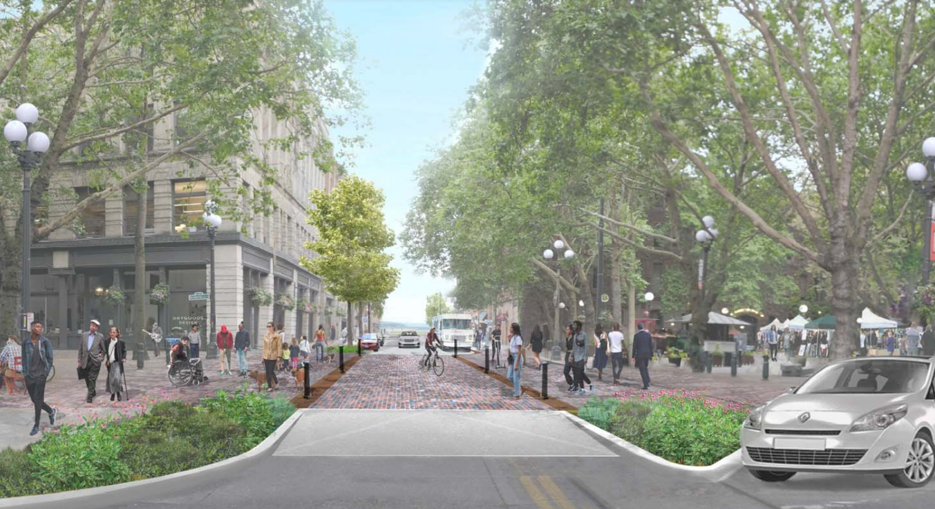
A 2019 outreach summary on the project noted support for going even further with pedestrianizing Pioneer Square’s streets. “While many were happy with the curbless treatments and increased pedestrian space on Main and Washington streets, even more people encouraged the project to look further at fully pedestrianizing streets that have low traffic volumes,” the city report stated. A 2021 follow-up report noted that the design could be “easily adaptable” to even more restrictions on vehicle traffic, but defended the current design as necessary to preserve business and resident access.
Ideally, funding for the new signal and protected bike lane on Yesler would be found and the projects completed in tandem. If the three-block gap remains indefinitely, it will serve as another aspect of the waterfront project missing the mark when it comes to the long term benefits for people trying to get around downtown Seattle without a car.
Surface Highway Undermines Seattle’s Waterfront Park
Final Segment of Alaskan Way Bike Trail Being Planned with Double Street Crossing