Fewer corners of Seattle are set to look more starkly different between the beginning of 2023 and the end than the area around SR 520 in Montlake. More than a decade in the works, crews with the Washington Department of Transportation’s contractor, Graham Construction, have been making steady progress in recent years setting up the pieces for the coming highway lid and rebuild of Montlake Boulevard. By year’s end, nearly all of those pieces are planned to come together in advance of a full wrap-up of the project in 2024.
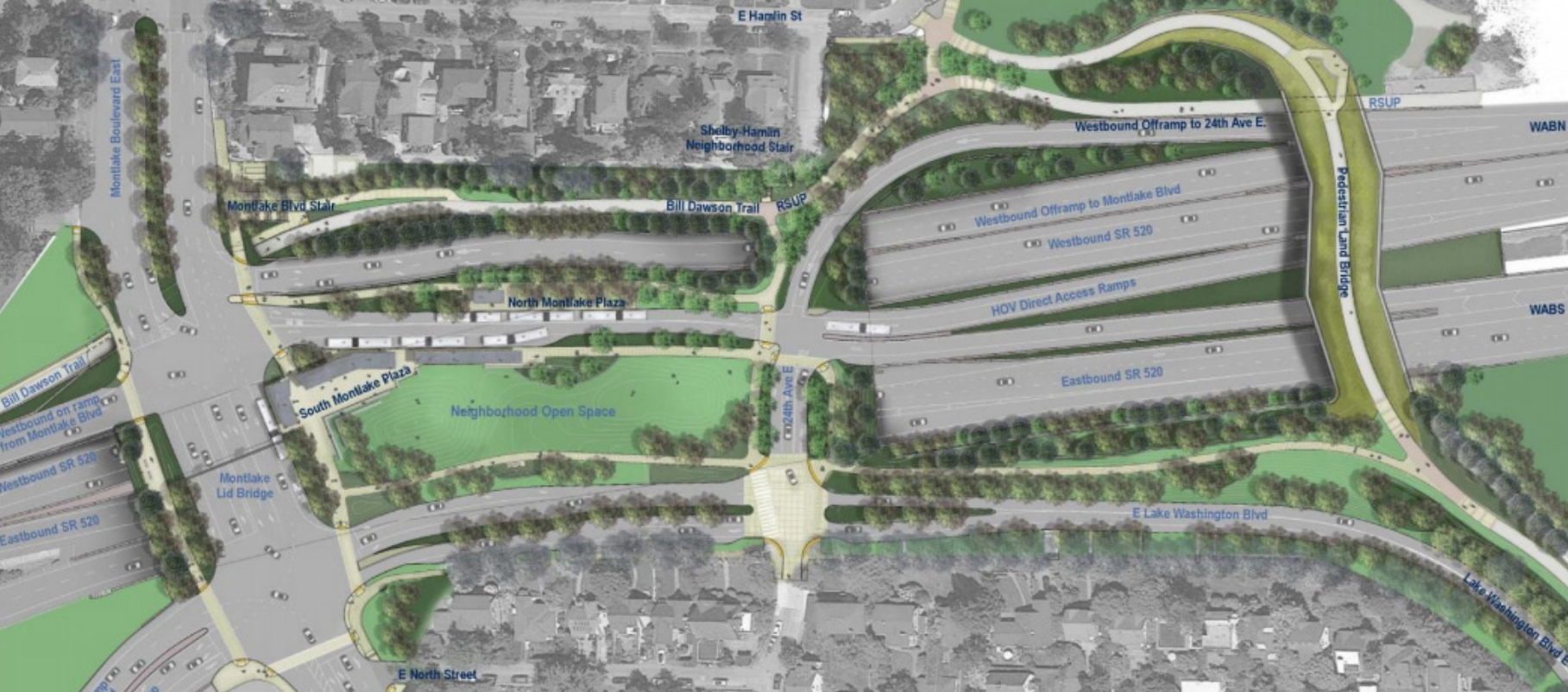
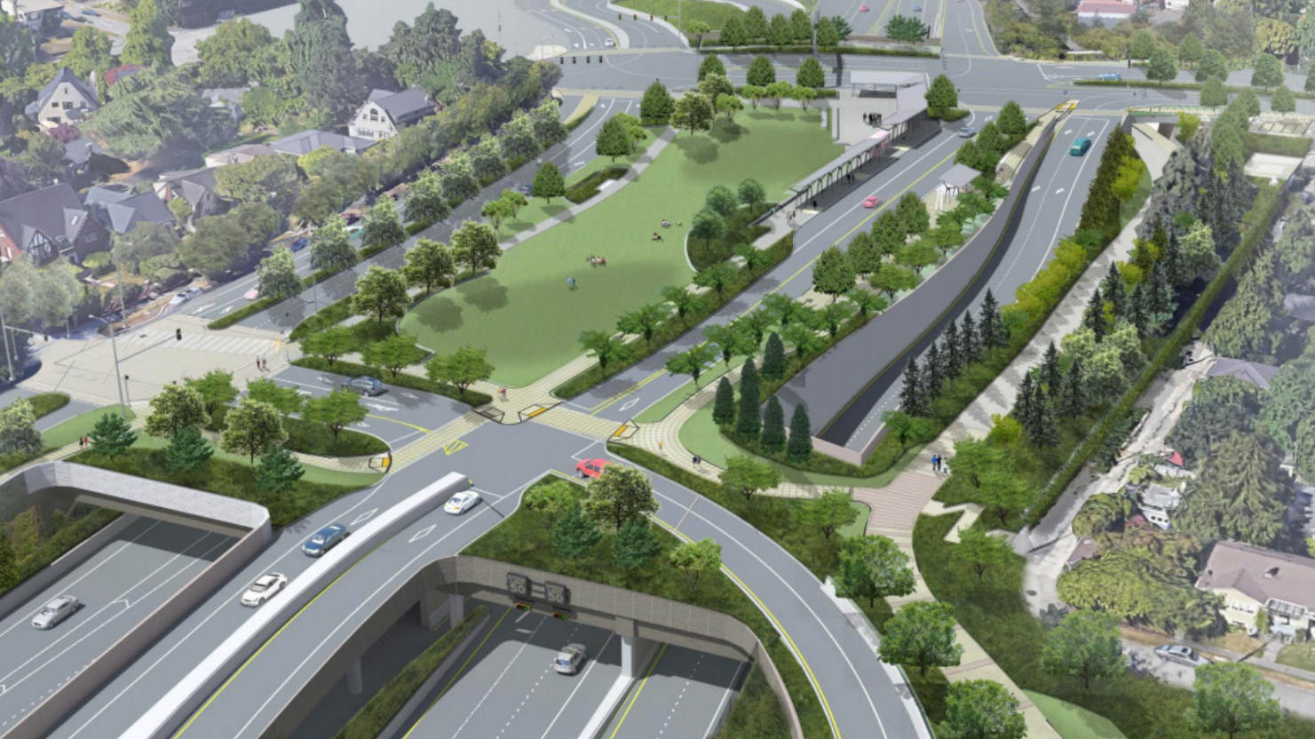
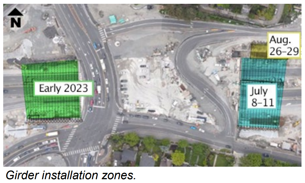
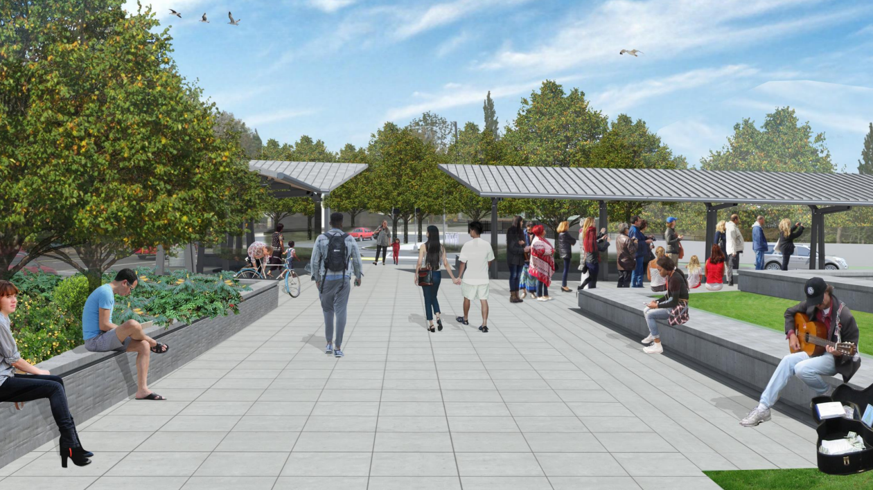
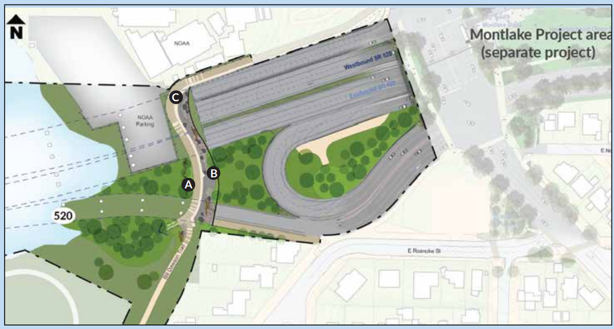
The centerpiece of the project is a 3-acre lid being constructed right now on top of girders spanning above the highway. The new parcel of open space will sit to the east of a new, nine-lane Montlake Boulevard also in the rebuild process. Right now, a temporary Montlake Boulevard sits on what will become open space. In the coming months, girders will extend to the west, allowing Montlake Boulevard to be reconstructed in its permanent position. To the east end of the lid, girders were installed in 2022 that will hold up a reconstructed 24th Avenue E and the westbound off-ramp from SR 520. Once all of the road girders are in place, construction of the lid itself will commence.
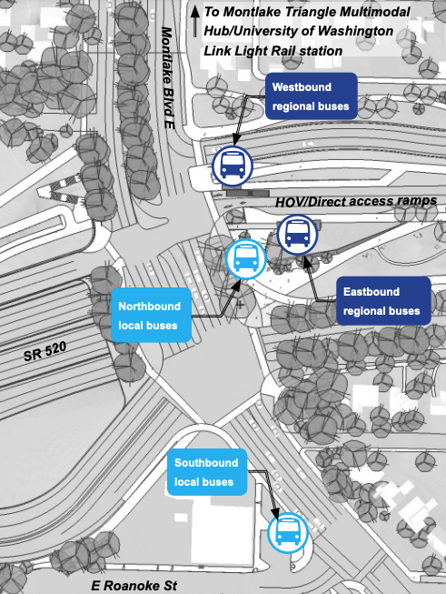
At Montlake Boulevard, a new transit center will take shape on the northeast corner of the lid, replacing the old Montlake freeway station in the center median of the highway, which closed in 2019. In contrast with the old, punishing environment, riders will soon board both east and westbound buses along a narrower, calmer roadway with its own dedicated access to SR 520 in either direction. Will it be as pleasant a place to hang out as its renderings suggest? Likely not. But it will provide a fairly seamless connection between northbound buses and buses heading on and off SR 520. Riders transferring from the 48 to the 255 to Kirkland, for example, will no longer have to cross the Montlake bridge twice to make a transfer.
Riders connecting to and from southbound buses, though, have a less seamless connection as they will have to head all the way down to E Roanoke Street to make their connections. That is due to the design of the new Montlake Boulevard failing to include any new pedestrian crossings between E Roanoke Street and E Shelby Street, just south of the Montlake Bridge. The omission emphasizes that vehicle throughput was the primary motivation for almost all elements of the project’s design.
Bike and Pedestrian “Land Bridge” To Take Shape
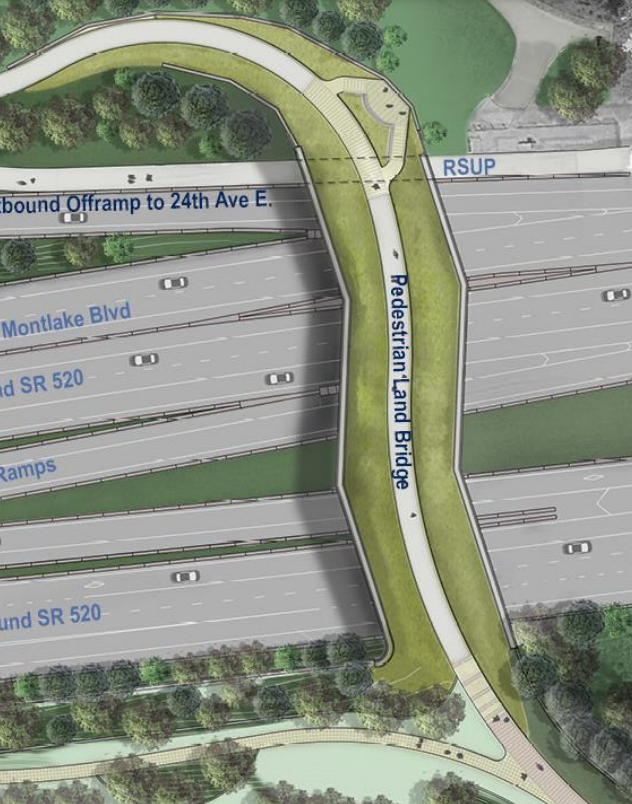
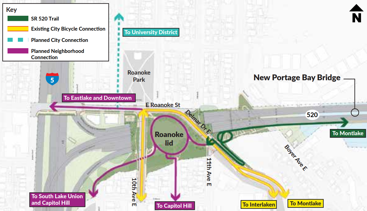
The lid is certainly the most significant new addition to Montlake, but the public’s attention might instead be drawn toward the bicycle and pedestrian “land bridge” to the east of the lid, connecting the SR 520 regional trail crossing the lake with the northern edge of Seattle’s arboretum. Unlike any pedestrian bridge in the city, the land bridge is planned at 73 feet wide at its widest point and includes a 14-foot path for people walking or biking.
Designed into the land bridge is an overlook pointing toward Union Bay and Laurelhurst, and greenery buffering users from the highway on either side. This land bridge permanently replaces an underpass that was available to people walking or biking on the east side of Montlake Boulevard, which closed in 2022. Its existence is due to an earlier design for the Montlake lid that extended fully from Montlake Boulevard to this location, but which had to be scaled back partially due to cost.
But that is not the only dedicated biking and walking connection set to be completed this year. Crews are also expected to complete a new bike and pedestrian tunnel underneath Montlake Boulevard just to the north of SR 520. That tunnel will allow users to travel directly from the SR 520 regional trail on the bridge directly to the Bill Dawson Trail on the other side of Montlake Boulevard without interacting with the boulevard or highway exits. In the interim, the Bill Dawson Trail provides a connection to west Montlake and the street grid on that side of the highway-like street.
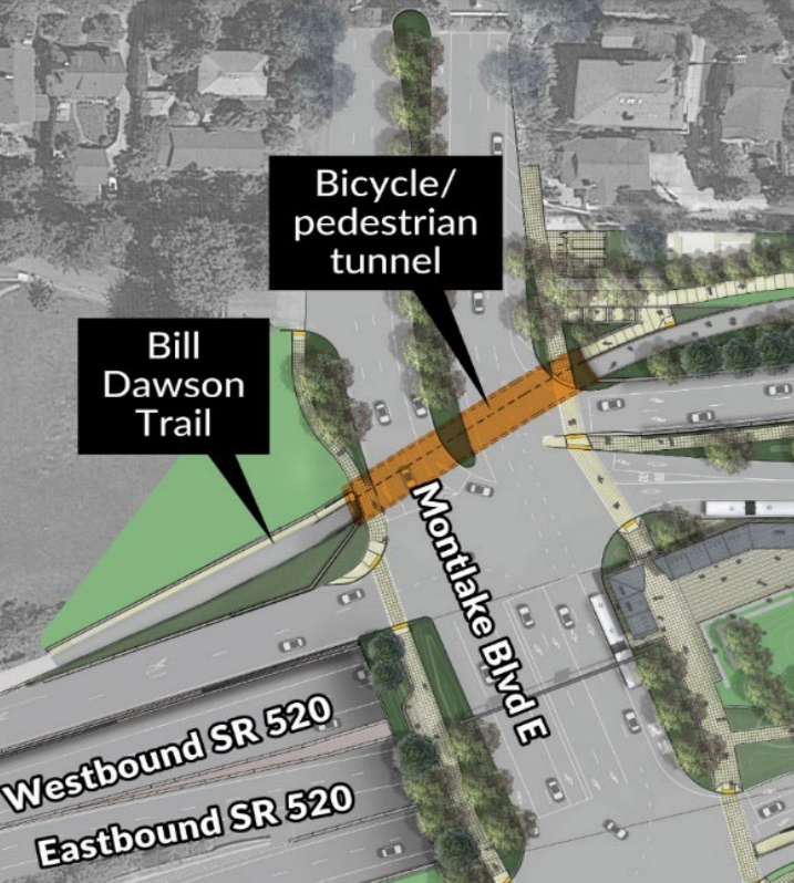
In the long term, this connection will also be improved as part of the Portage Bay bridge replacement project, which is heading toward construction in the coming years and is expected to open around the turn of the decade. Once open, the Bill Dawson Trail will serve as a transition point as people walking or biking switch from the north side of the bridge across the lake to the south side of the bridge between Montlake and north Capitol Hill. Originally, the Portage Bay bridge was not slated to even include a walking and biking trail, but one was added through the design process after listening to community feedback. That connection will ultimately change the entire landscape of Seattle’s bike network in central Seattle.
Creating a direct connection to the second planned lid over SR 520, around Roanoke Street in north Capitol Hill (also planned to open around the beginning of the next decade), people biking will have a connection to the planned bike corridor on Eastlake, to the University District, to the rest of Capitol Hill, and by extension much of the rest of the city.
For now, the new lid, land bridge and bike/pedestrian tunnel under Montlake Boulevard will go far in reshaping access to SR 520 and by extension strengthen the connection between the entire Eastside and much of Seattle. Transit riders will more easily access buses on the Montlake lid, and people biking will seamlessly access the walking and biking trail.
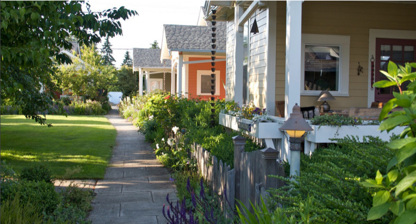
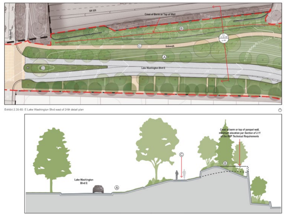
Crews will also be completing finishing touches on some other elements that repair the connections between the highway and the neighborhood, disrupted by years of construction. Lake Washington Boulevard, which no longer will have a direct ramp connection either to or from SR 520, is being fully rebuilt along the southern edge of the highway. The sidewalk reconstructed there is being built away from the roadway, with vegetation providing a buffer from traffic on both sides.
While most of these projects will see substantial completion this year, not everything on the list is set to have its ribbon cut in 2023. “In early 2024 we anticipate putting the finishing touches (such as landscaping throughout the project area) on the project before it is complete,” Steve Peer, communications manager for the 520 project, told The Urbanist.
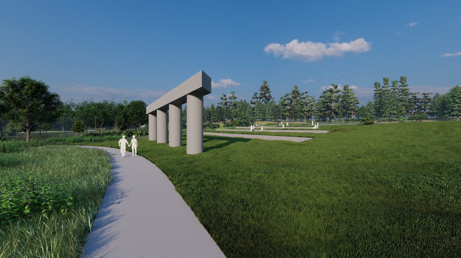
Looking even further ahead, once the entirety of the 520 bridge replacement project has wrapped up in the early 2030’s, Seattle will start work on the Arboretum North Entry project. Thanks to a transfer agreement approved by the city council in late 2022, Seattle will take possession of the piece of land literally named for the state highway department as work completes. “WSDOT Peninsula” is currently being used for construction staging, the property will turn into the north gateway that the 230-acre park has never had.
Proposed for the north entry project is a symbol of why the peninsula was named for WSDOT in the first place: a sole support beam from the completed ramps for the R.H. Thomson Expressway. Once a planned highway that would have cut directly through the Arboretum, the land acquisitions for the expressway compelled the eviction of thousands of Seattle residents in the Central District and the demolition of their homes. While the rest of the ramps have been torn down as part of the current SR 520 construction, this one structure is set to be installed in the expanded park as a symbol of Seattle’s civic activism.
With the debate over how to replace the SR 520 bridge going back over three decades, it is something to celebrate that Seattleites — particularly transit riders and people who walk and bike — will start to see the fruits of the project that makes their daily lives easier and put an end to years of construction. We’ll be watching how it all starts to take final shape over the year ahead.
Support for Freeway Lids Advances in Seattle Comprehensive Plan