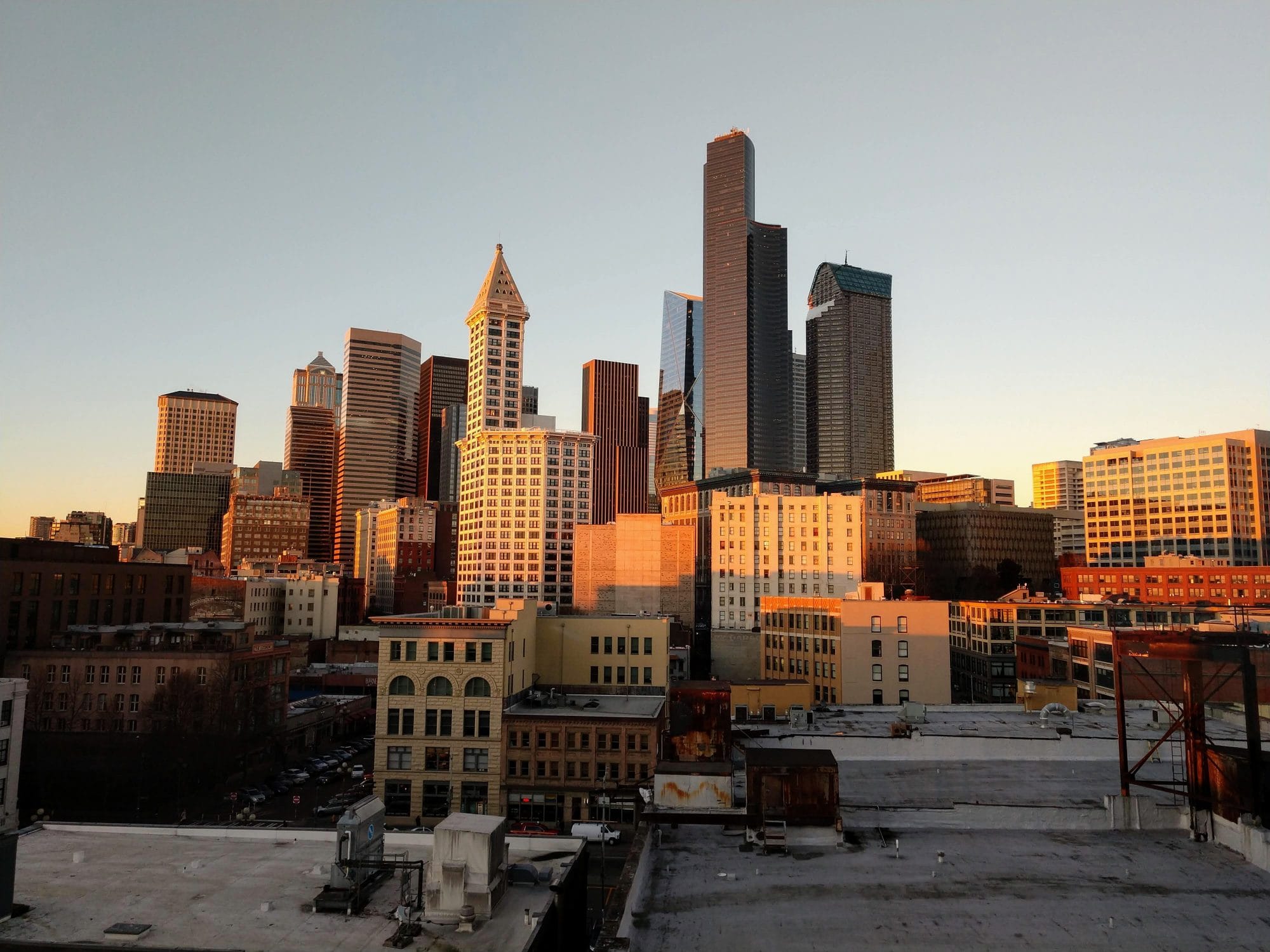
Seattle’s massive number of zones hide a couple very weird outliers. Or they would be outliers, if there weren’t so many.
Today, we’re going to revisit the idea that Seattle’s Zoning Ordinance is a massive, confusing, antiquated document and nothing goes further in showing its failures than the astronomical number of zones the city has created.
While the code only lists 38 flavors of commercial, residential, and industrial zones, it also adds a ton of height requirements, specific neighborhood rules, and special provisions for campuses. Each of these complications ends up creating its own zone, and the real total gives Seattle 285 separate zones. This number is absurd, dedicating individualized and convoluted zoning rules to less than an acre of the city.
Let’s take a look at five of the most ridiculous zoning unicorns: single-use land use controls that only apply on a tiny shard of Seattle.
MIO 200 LR3 (M) – Major Institution Overlay, Low Rise 3
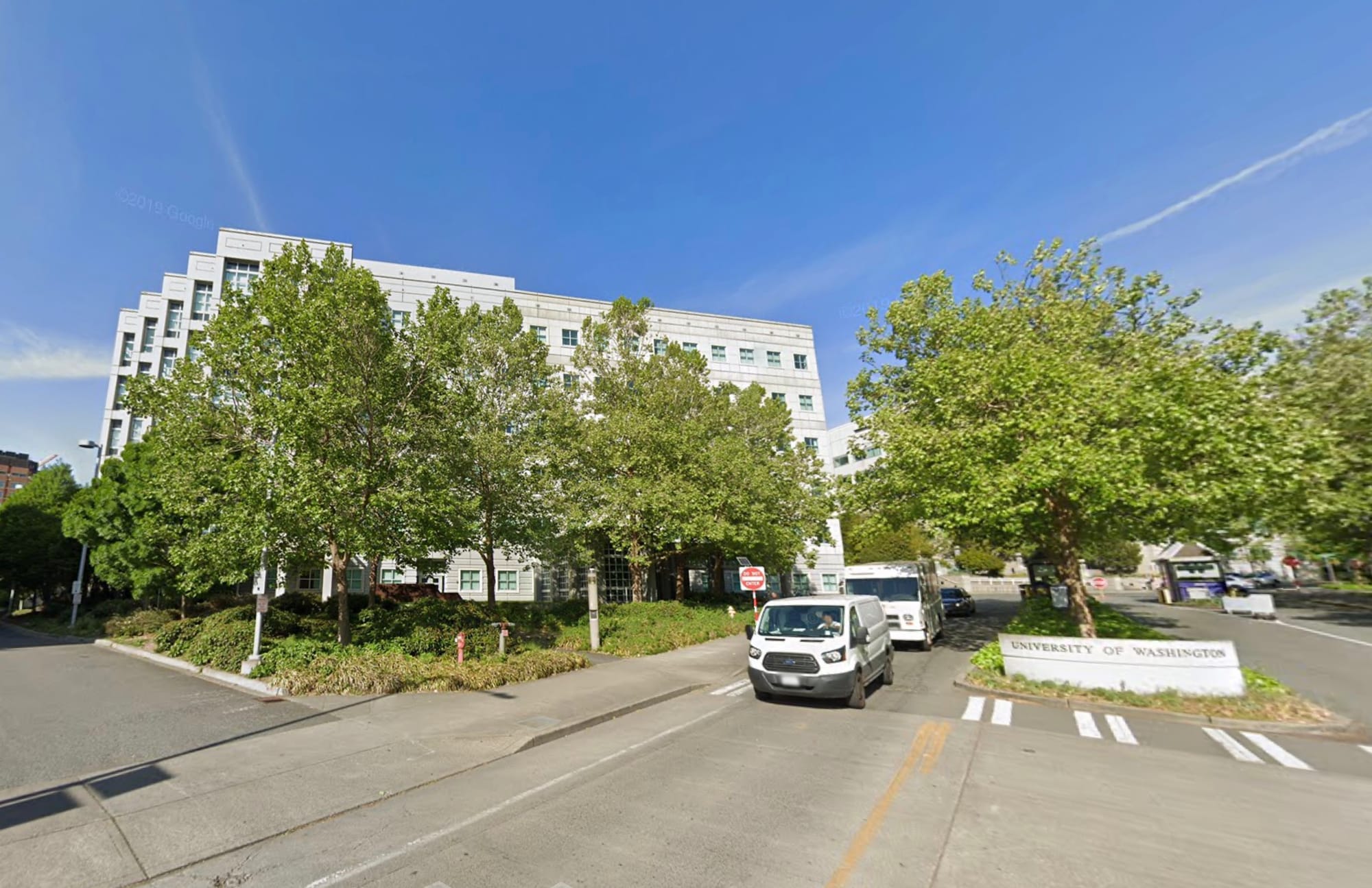
The big schools and hospitals around Seattle are permitted to develop special overlay zones for their campuses and nearby neighborhoods. The Major Institution Overlay (MIO) designation relies on an underlying zoning from elsewhere in the code, then puts a new height limit on it. There are 84 separate institutional overlay zones, 38 of which are used just once, and another 17 are used twice.
So MIO zones could gum up this article just on their own. Instead, we’ll symbolize the entire silly bunch and look at the smallest singly used one: MIO 200 LR3 (M). Breaking this jumble of letters down down, this is a Low Rise 3 (LR3) zone that allows a variety of multifamily housing in existing residential neighborhoods up to 40 or 50 feet in height. The (M) says development requires affordable housing contributions to the city’s Mandatory Housing Affordability (MHA) fund at the lowest values. However, that MIO tag means the parcel falls under the institutional overlay of a nearby campus, which raises its height limit to 200 feet.
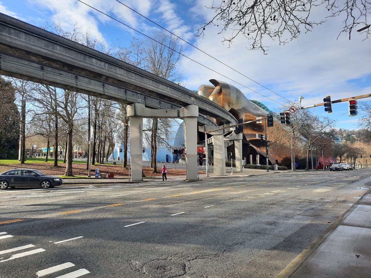
The zone only exists in one corner of the area around the University of Washington. It is an open grassy triangle in front of the Department of Biochemistry building on Boat Street. And it’s truly a pain to find on zoning maps because it’s right on the edge of two pages in the map book. Which kind of describes the odd zoning designation to begin with. There are other LR3 zones to the south but not as tall, and other 200-foot height limits to the north but higher density residential. This is a converging no-man’s land, a Bermuda Triangle appropriately close to the school’s Ocean Sciences research offices.
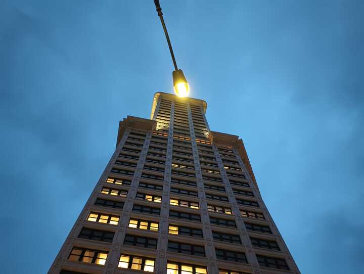
PSM – 245: Pioneer Square Mixed
Pioneer Square Mixed Use is a zone with specifications to protect the aesthetics of Seattle’s founding neighborhood, and the land uses reinforce ground level commercial and artist live-work housing. A good amount of Pioneer Square is zoned for 85 or 100 foot height limits. Except for one special use zone that’s applied to less than an acre which allows the height limits go up to a very peculiar 245 feet.
Yes, Smith Tower gets its own zone.
The PSM-245 zone’s only application in the entire city is to the single parcel at the corner of Yesler and 2nd Avenue. It’s possible to recognize the cultural and architectural significance of Smith Tower without thinking it needs this kind of special treatment. No other structure downtown gets its own zoning. From Bon Marche to Columbia Tower to the central library, plenty of unique buildings share a zone and height limit with their neighbors. It is difficult to say whether designating a special building with a single use unicorn zone reinforces the uniqueness of the building, or the uselessness of the zoning ordinance.
SM – UP 85 – Seattle Mixed-up Town, er.. Seattle Mixed, Uptown
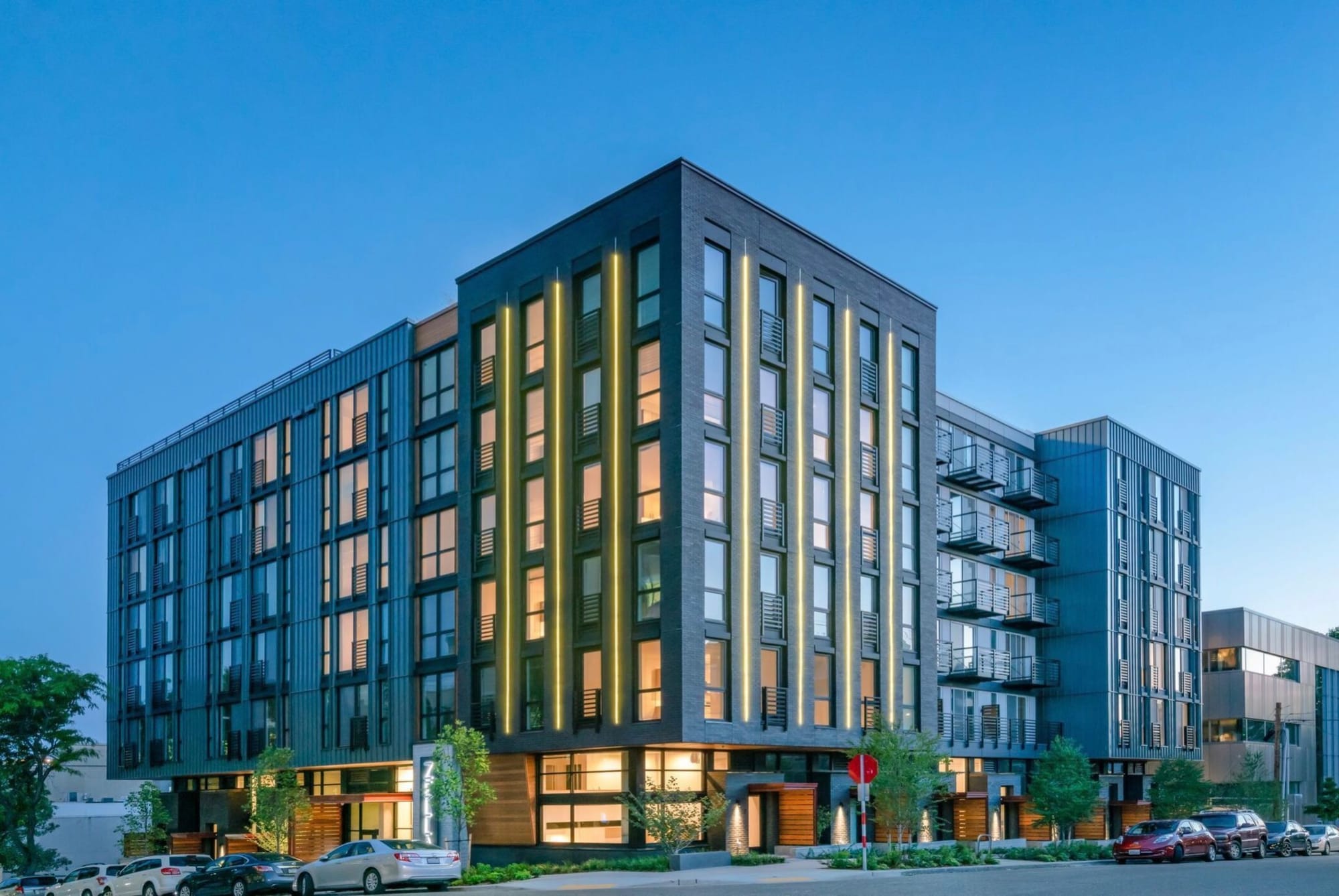
Like the MIO zone, Seattle Mixed Use (SM) zones have unique provisions for different parts of town. Also like MIO zones, SM designations can gum up the discussion because there are 33 separate ones, of which 17 are only used once or twice. The Seattle Mixed designations are based on seven particular neighborhoods like North Rainier, West Dravus, and South Lake Union. We’ll pick the one single-use zone in Uptown, SM-UP 85 which applies to a single parcel, the new Zella Apartment building at the southwest corner of W Republican Street and W 2nd Avenue. The UP designator is for Uptown, and the 85 limits the height to 85 feet.
The interesting thing here is that everything in the Zella Apartments zoning matches the entire surrounding area, including the height limit and the SM designation. Everything except this one building does not have the MHA designation applied to it while almost all the surrounding buildings do. There are three other buildings nearby that get similar exemptions under a slightly different zone (SM-UP65), including Queen Anne Square at 200 W Mercer Street and the two apartment buildings just north of KEXP on Republican Street.
The zoning map shows all of these parcels have been contract zoned, that is had their zoning designation altered by action of the city council. While the Zella Apartments building is new, it’s zoning was set in 2016. The 100 block Republican properties were rezoned in 2006. Queen Anne Square was constructed in 1982. All of these predate the MHA rules. Weird zoning unicorns in Queen Anne owe themselves to exclusions carved out by several city councils back.
LR2 (.75) – Low Rise 2 and NC1P-55 – Neighborhood Commercial 1
Now, we’re going to cheat a little bit and combine the last of these five weird zones into one description. First, because searching for one, I found the other. Second, because these last two zones are particularly irritating.
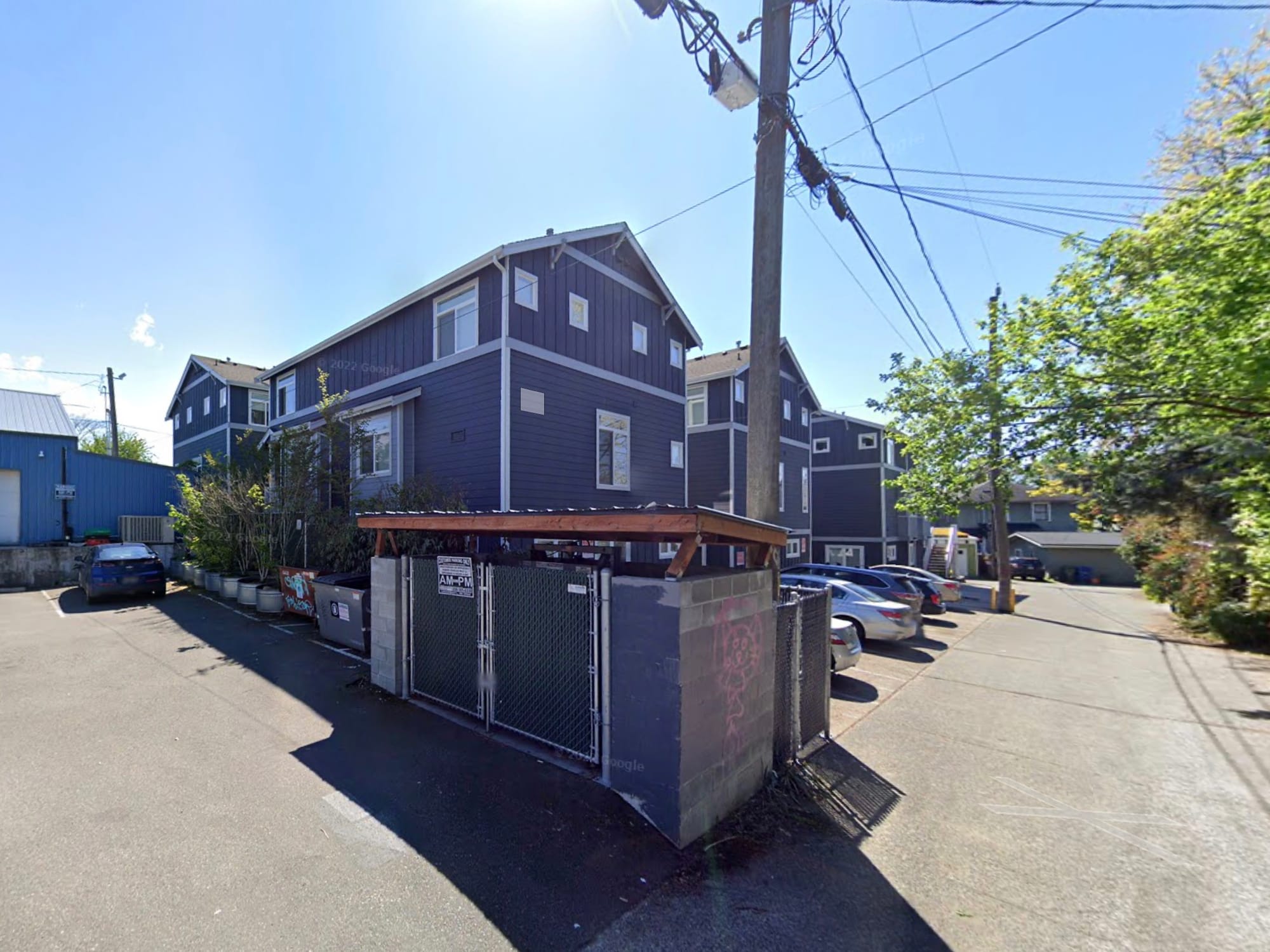
The lone location of LR2 (.75) zoning is a block east of the Roosevelt Light Rail Station. Low Rise 2 designations allow 40 to 50 foot high multifamily residential near urban villages.
To be honest, I’m not entirely sure what the (.75) means.
From everything I’ve found, this is the one and only zone in the city that has the .75 moniker. The designation appeared in 2018 discussions of MHA showing a calculation of floor area ratio or FAR, that beloved planner number of how high a building can go based on its footprint. There were several other zones that had similar numbers, but all of them got rezoned to something in the current code. This seems to be a holdout. Whatever it is, there aren’t provisions for using the zone in the current ordinance.
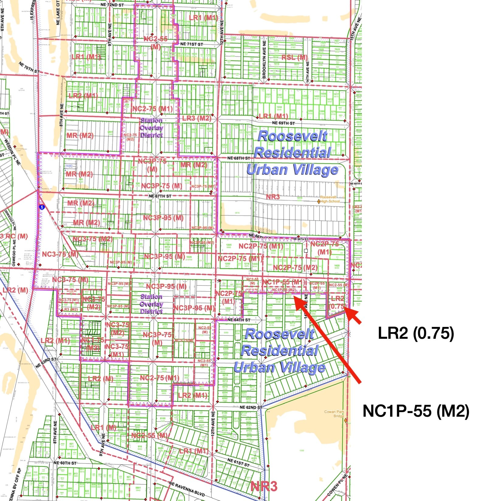
Which leads us to the NC1P-55 zone. This is a Neighborhood Commercial 1 designation, which allows a small scale shopping areas. It is in a P – Pedestrian street area, which allows waivers of parking and calls for ground floor uses. And the height limit is 55 and the (M2) sets the MHA contribution at its highest level. The only application of this zone in the entire city is a quarter-acre strip that stretches behind a row of buildings on NE 65th Street. It’s zoned for ground floor retail, but only touches the street at opposite ends.
Combined, these zones are just two of the massively confusing, overlapping nonsense that comprises zoning around a brand new light rail station. Within three blocks of Roosevelt Station, there are eight base zones, three separate height limits, three different MHA levels, and a pedestrian street toggle. That adds up to at least 16 separate zones, plus the station overlay district and the Roosevelt Residential Urban Village.
Whew. It’s almost as if the city wants to make it as difficult as possible to construct anything near the very expensive new transit station.
And that’s the rub. Seattle’s three lowest density residential zones – NR1, NR2, and NR3 – cover 61% of the zoned land in the city. The smallest of these, NR1, covers double the amount of land than 138 single-use zones – combined. But it is these single use, micro-zones that get applied to the most developable and productive space around Seattle’s transit hubs.
Worse, Seattle’s most egregious zoning fouls do not appear purposeful, just collisions of complex ideas. Whether it’s a UW netherworld triangle or a convergence of different village and affordability plans, so many of these ridiculous zones crop up as accidents. Or with Smith Tower, it’s the blunt tool of zoning being used to preserve one thing that’s nice.
Such preservation comes at a cost. The cacophony of zones undermines the zoning ordinance itself. Combined, these five zones cover less than a football field. Instead of investing time and energy into a zoning code that looks forward to the smart development of 60% of the city’s land, there are hundreds of pages spent defining a sliver that just happens to be near a train stop.