In March, Seattle published plans for redesigning Aurora Avenue, though a transformative vision for the corridor was still lacking in those early plans. Despite the City assumption that Aurora Avenue cannot accommodate pedestrians, bicyclists, transit, cars, and freight simultaneously, I have a design proposal that will do just that.
The Seattle Department of Transportation (SDOT) has three redesign options for each of the five segments they have broken the road into. Broadly, those three options propose:
- A wide sidewalk;
- A wide sidewalk with bike lanes;
- Narrow sidewalks with center-running bus lanes.
None of their designs combine these options, so I will go north from downtown and present my designs that do just that.
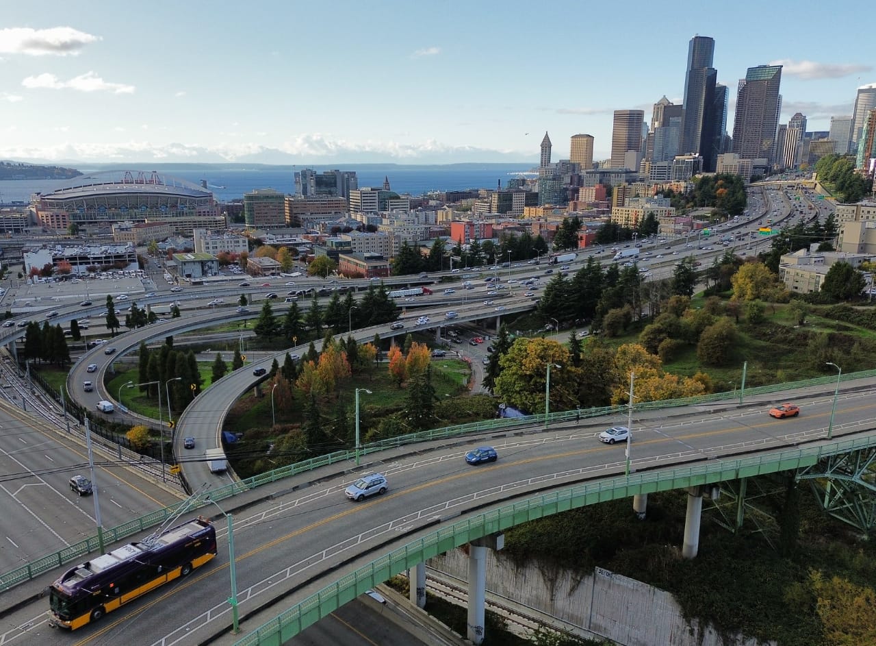
First, we need some context. Running along Aurora is the RapidRide E Line which, according to Metro’s most recent performance report, is the busiest bus route in the system and moves about 11,500 people each weekday in 2023 (ahead of Route 7 with 10,000 and the D Line with 9,000). It is also one of Metro’s most productive routes per mile. For such a route, we should be treating it as one of the workhorses of the system and giving it upgrades to make it better for everyone who uses it.
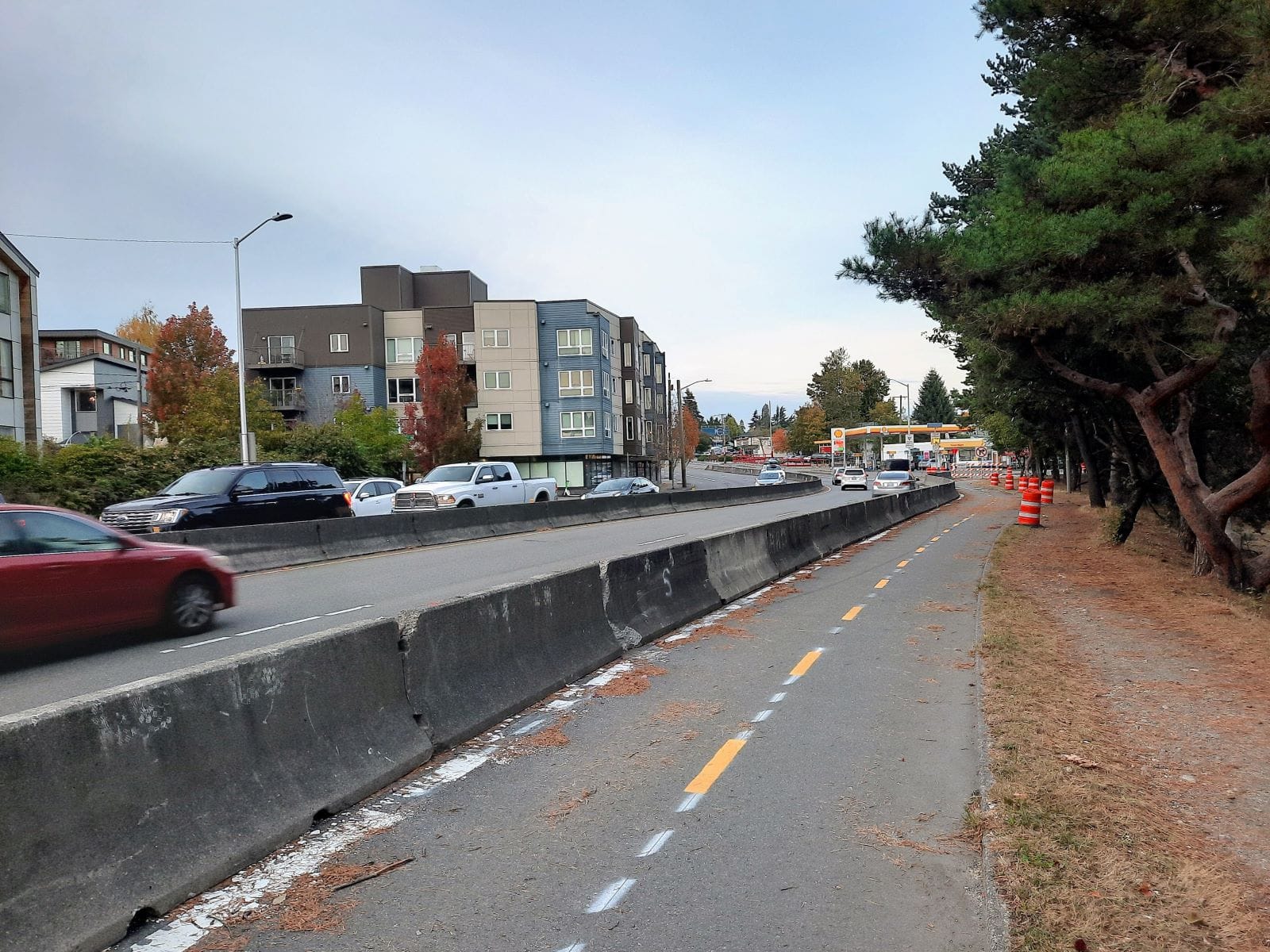
Meanwhile, if you look at a bike map, you’ll notice a lack of protected bike infrastructure near Aurora, mostly just paint-only lanes. While better than nothing at all, people deserve properly separated bicycle infrastructure protecting them from traffic. Located at the base of Phinney Ridge, Aurora Avenue occupies one of the flattest routes through North Seattle, leaving people biking with few viable alternatives to travel through the area.
Lastly, as the RapidRide routes are intended to meet (or at least flirt with) bus rapid transit (BRT) standards, I will be following some directions and advice from the BRT standard put forward by the Institute for Transportation and Development Policy (ITDP), which is one of the leading international authorities on bus improvements.
SDOT’s initial survey on its proposals closed in April, but be sure to share your feedback with the agency as this slow-moving project gradually works its way through the Seattle Process. They will certainly have more community outreach later on. One key message that the City needs to hear is that Seattleites are happy losing some general purpose lanes on Aurora if it means more reliable transit and a safer street for all. Or even better, we should go farther and have one car and one bus lane in each direction for the whole length, rather than just the northernmost segments as SDOT suggests. If we make that choice, everything else can still fit in the existing right-of-way.
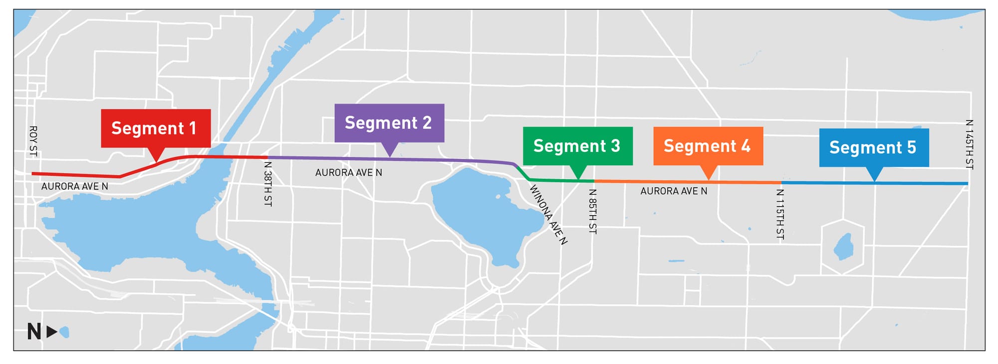
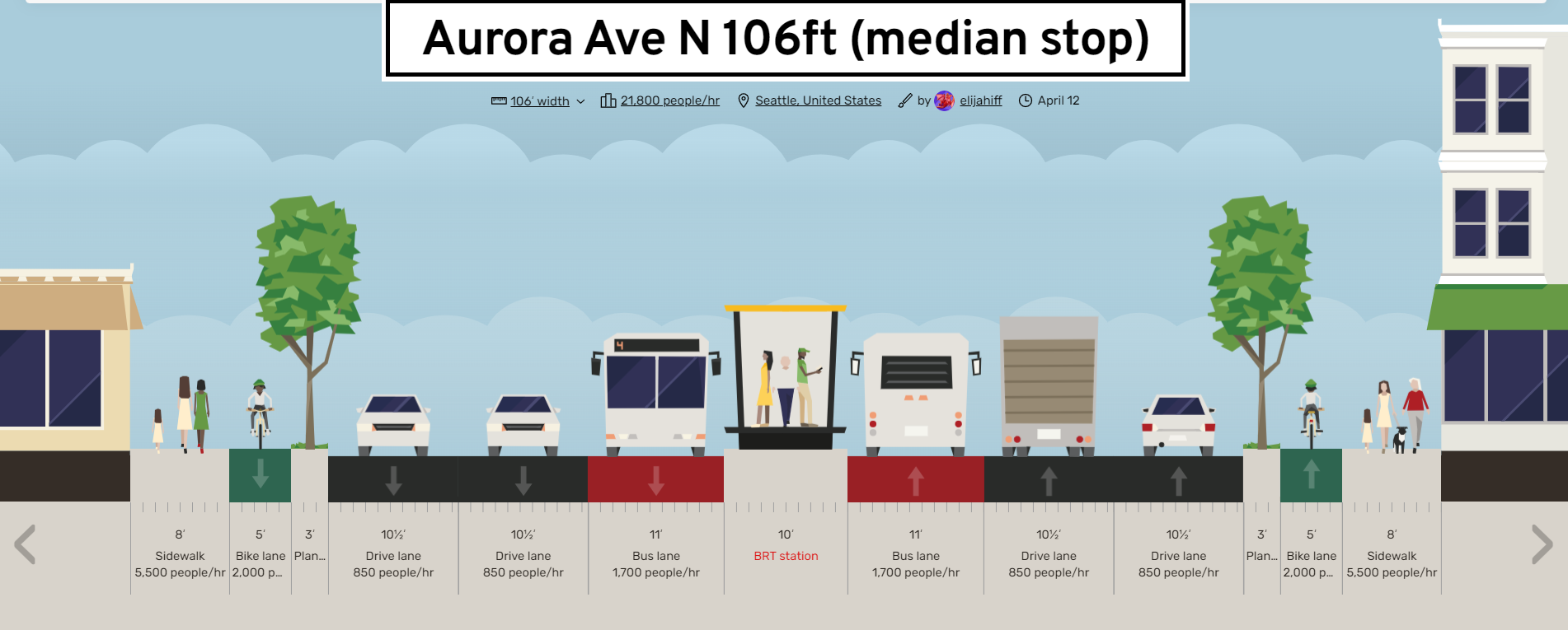
Segment 1: 106 feet wide – Downtown to Fremont
From where 7th Avenue joins SR 99 to become Aurora Avenue all the way until just past Green Lake at Winona Avenue, we have 106 feet of space to play with, excluding the narrower bridge over the ship canal. With 106 feet, we can fit in each direction the two general-purpose lanes the city wants, one bus lane, one bike lane, greenery, and a wide sidewalk.
As the exit to and entrance from 7th Avenue is a ramp in the center, center-running bus lanes make a lot of sense, in addition to being best practices from the ITDP. Give traffic a little time to merge right and bus lanes can start by Aloha Street.
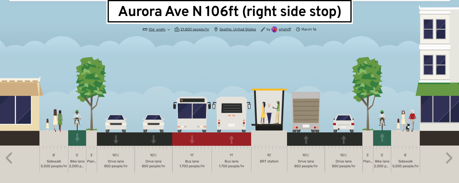
Segment 1 is also the only section that has any other bus route that substantially uses Aurora Avenue, with the 5 and 28 using it; the 28, however, is express in this section and only stops at the same places the E does. As we would have some buses on non-RapidRide routes sharing Segment 1, we will need right-side platforms as well. I propose this design for how it might look, fitting platforms and everything else we want in.
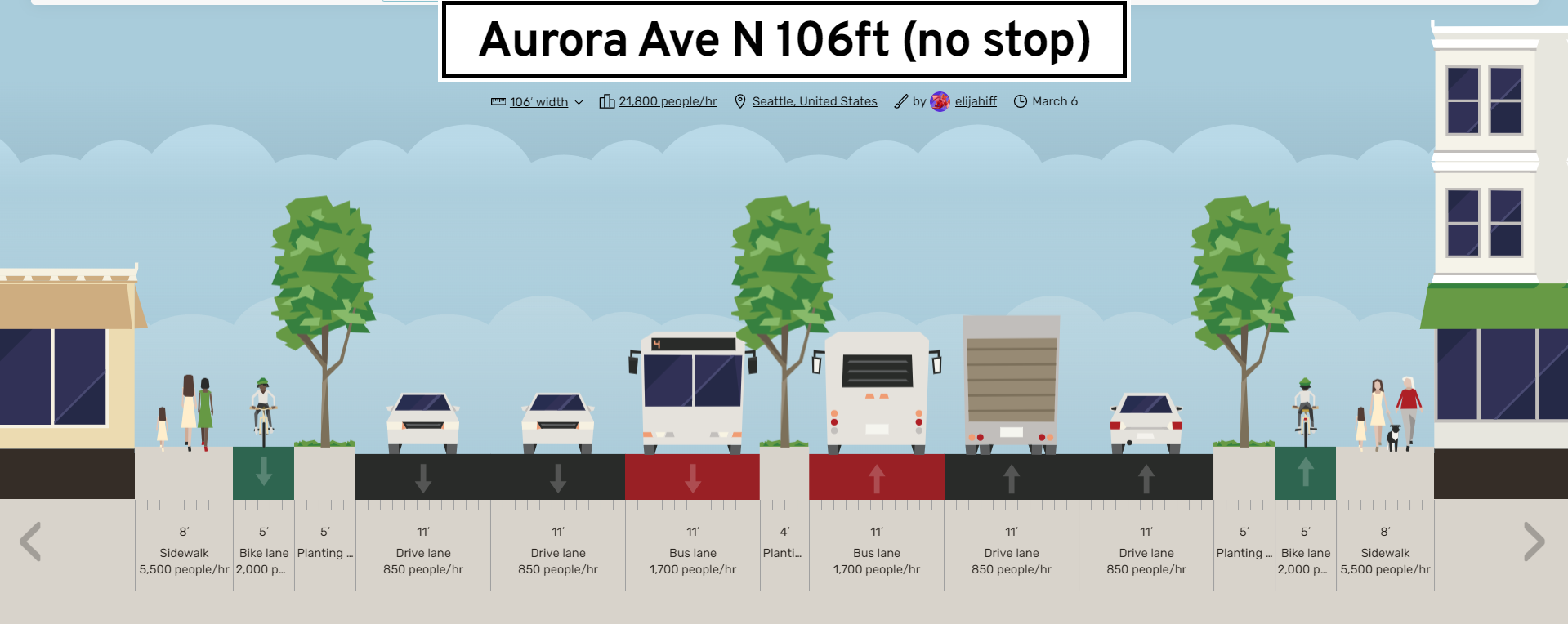
To minimize the number of times the bus lanes must move left and right at stops that every route does not serve, I would propose consolidating all the existing stops in this segment, including those only served by the 5, into just four at Aloha Street, Galer Street, Crockett Street, and Halladay Street. This would also place the stops more evenly and provide access at each down to Westlake and up to Queen Anne with only Crockett Street requiring new stairs up.
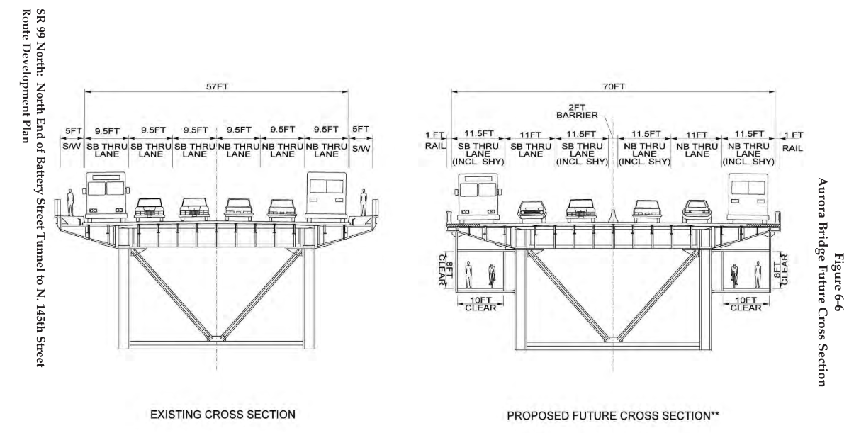
The City deemed the Aurora Bridge not in scope (likely due to its narrowness), but I will discuss it here. If removing lanes is impossible, we should go with what the Washington State Department of Transportation (WSDOT) proposed over two decades ago in 2003: lower the sidewalk and bike lanes under the bridge (page 73). Hopefully lanes are removed, in which case we should use something like the design from Aurora Reimagined, just with center-running bus lanes.
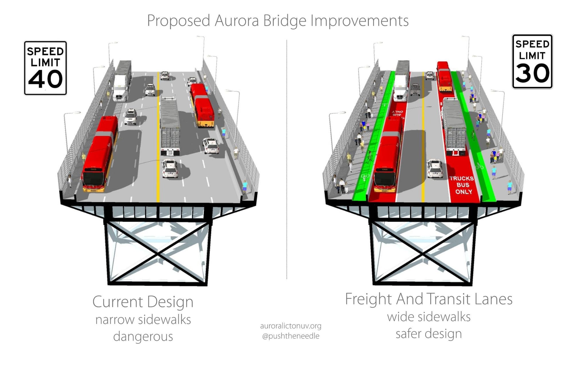
While the speed limit is currently 40 MPH, few actually travel at that speed due to the wide lanes and other freeway-like design elements. As part of a redesign of Aurora, we should lower the speed for which the road is designed to at most the 35 MPH maximum recommended by the National Association of City Transportation Officials (NACTO), a body to which both Seattle and King County Metro belong.
NACTO also states intersections are “a significant stressor [for cyclists] at all but the very lowest speed conditions. Bicycle design treatments that require people biking to cross or mix with motor vehicle traffic are stressful at all but low volumes.” That low-speed category does not contain the ramps currently entering and exiting Aurora at various points, with vehicles crossing cyclists and pedestrians at roadway speeds.
Segment 2: 106 feet wide – Fremont to Winona Avenue
Segment 2 starts at N 38th Street, just after northbound Route 5 and 28 buses turn off. This segment currently features some of the widest lanes, as wide as 14 feet in some places, and ramps to and from downtown at 38th and 48th Streets. As previously mentioned, such ramps are not a good way to keep cyclists and pedestrians safe, with speeding traffic crossing bike lanes and crosswalks. I would recommend removing the ramps and replacing them with signalized intersections instead. Signalized intersections also slow drivers down, important for minimizing collisions and lowering the speed the road is designed for. Removing the ramps also would make space to expand the adjacent parks.
The E Line currently bypasses most of Fremont, so we should add some bus stops, at 38th, 41st, and 46th Streets. Signalized intersections should be added here as well, to remove the high-speed ramps at 38th and 46th and to allow a crossing at 41st without requiring the bridge.

At 50th Street, the city notes the area in Woodland Park is not in scope right now, but it is an important part of the corridor. I would separate the sidewalks and bike lanes from the roadway and direct them through the park instead, creating a much more pleasant way to bike or walk there. A new connection would have to be created on the zoo side at 50th Street, but a connection to the existing trail should be doable. A station could be placed at the middle of the three bridges, though isn’t necessary.
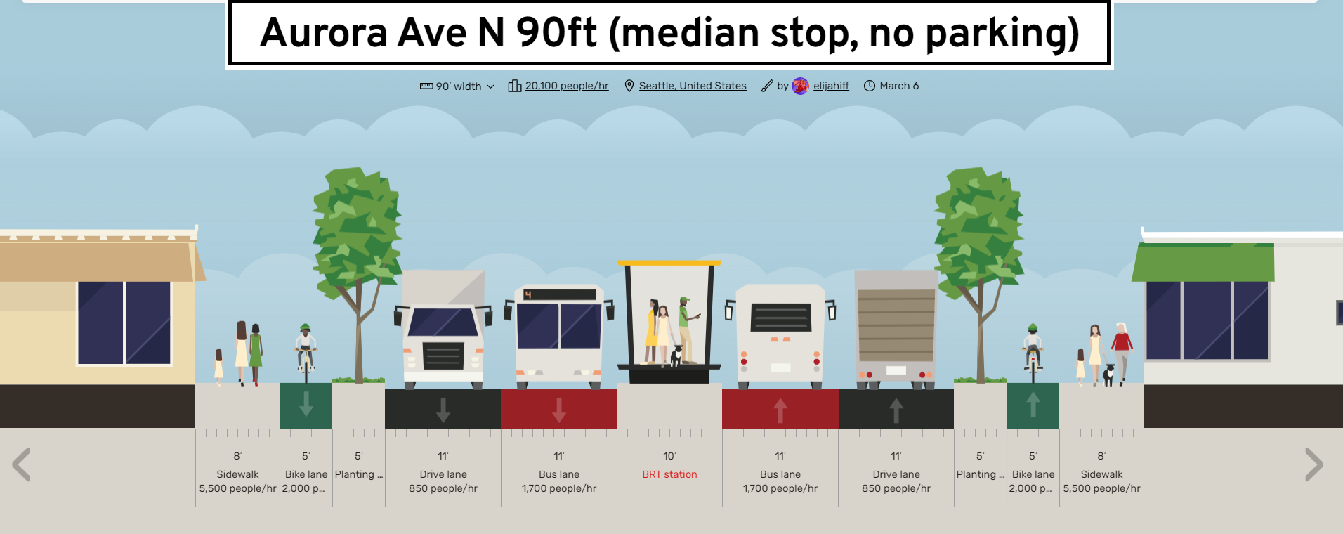
After Woodland Park, some fast ramps are encountered on the Green Lake side. According to WSDOT, “the preferred configuration for bicycle safety […] will not provide the motor vehicle free right turn and will realign ramps to intersect perpendicular with the crossroad”. This could easily be fixed by replacing the ramps with a signal at either W Green Lake Way / Linden Avenue or 63rd Street / Woodland Place. An intersection would also allow a median stop to be accessed, replacing the current diversion stop at 65th Street.
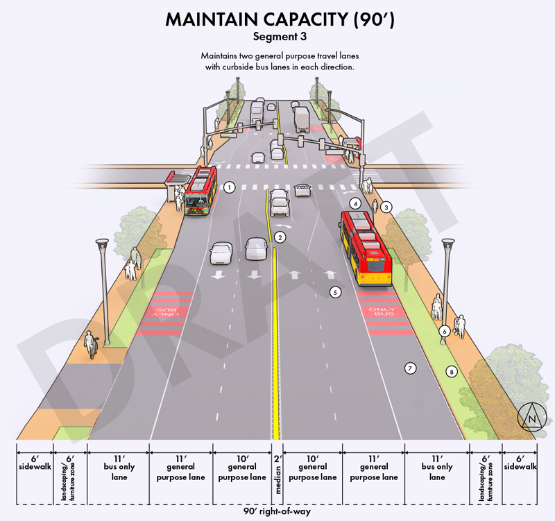
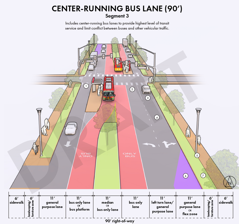
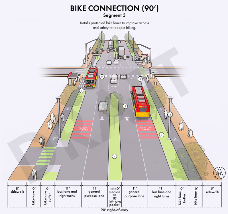
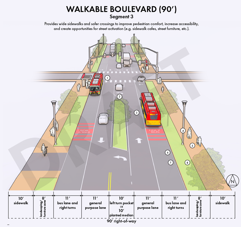
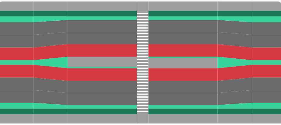
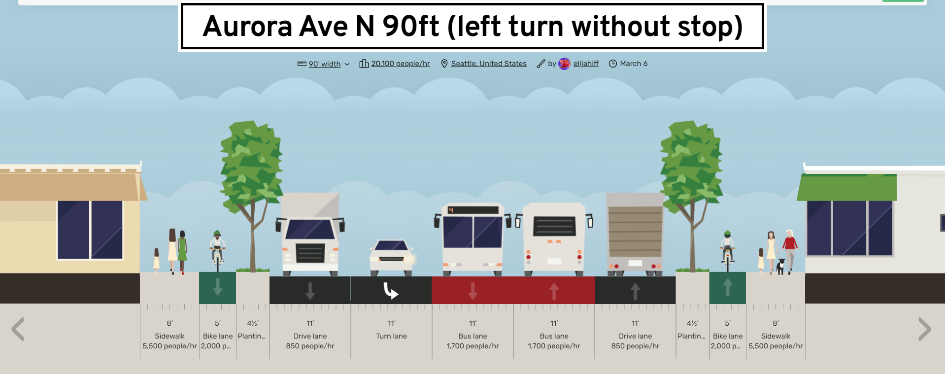
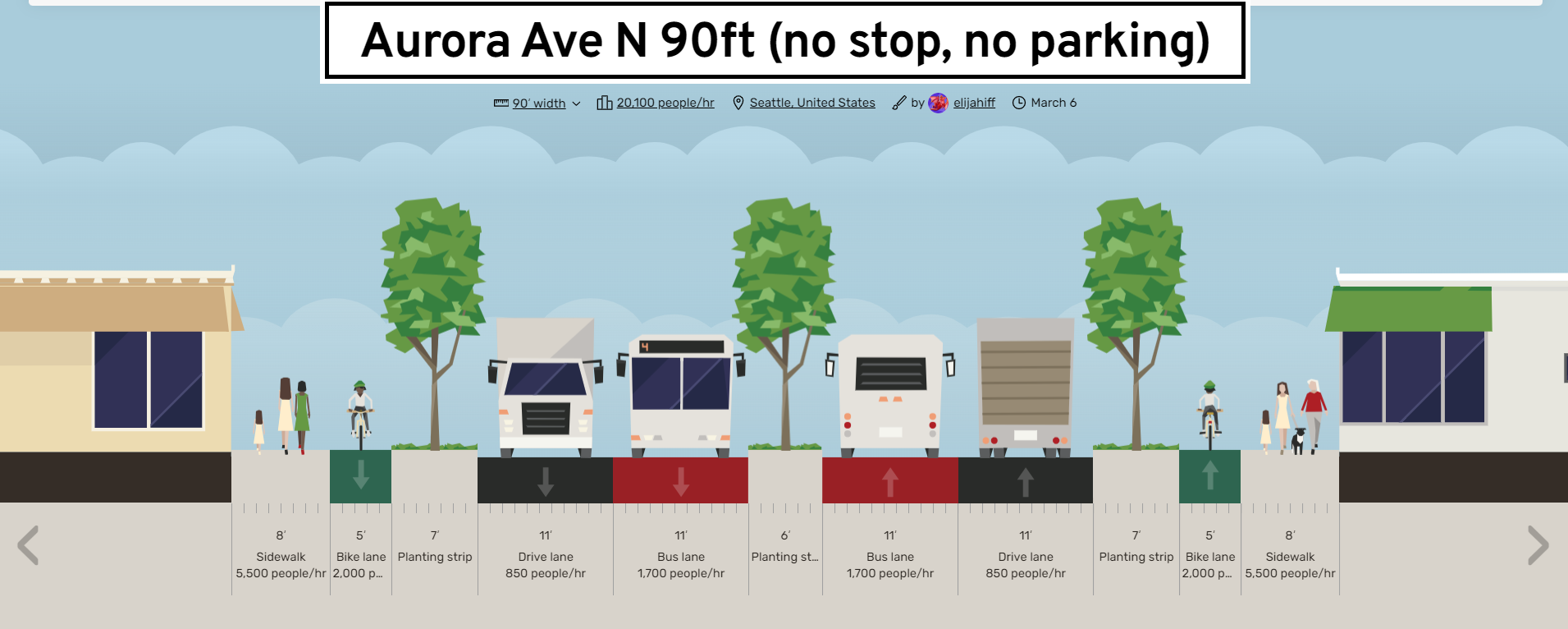
Segment 3: 90 feet wide – Winona Avenue to 85th Street
Segment 3 sees Aurora Avenue narrow by 16 feet at Winona Avenue, with the city proposing it loses a lane in each direction here as well. We no longer have any highway-like ramps at this point, either. The lack of protection for cyclists through intersections has been a major complaint as Seattle Transit Blog pointed out, but one that does have a potential fix.
Thomas Street and Dexter Avenue received buffers, preventing drivers from cutting the corners and providing a modal filter protecting people walking, rolling, and biking. Bump outs and medians would make the experience of crossing Aurora much less harrowing. While the concrete median can’t happen at all the intersections, it can at intersections such as 77th Street.


BRT standards also recommend minimizing turns across bus lanes, so at intersections like 83rd, no left turns could be made from Aurora (left turns onto Aurora as part of the cross-street’s green phase would be still allowed). Only the arterial streets should have breaks in the median, allowing left turns onto Aurora. Motorists traveling on Aurora should also face left-turn restriction at most intersections to reduce points of conflict with other street users.
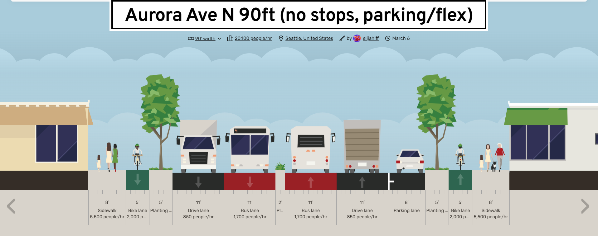
One interesting consideration is the city’s use of a “flex zone” in their proposals. Interestingly, the city only shows that on the center-running bus lanes. If we must provide parking in order to win the other street improvements, I’d be absolutely for that. On-street parking is seven to nine feet wide, according to WSDOT, so the diagrams and cross-sections show eight.
Segments 4 and 5 – 90 feet wide – 85th to 145th Street
Segment 4 from 85th Street to 115th Street and segment 5 from 115th Street to 145th Street is much the same. Install concrete medians in signalized intersections such as 95th Street where motorists should be prevented from making left turns or continuing straight, minimizing the bus lanes being crossed by vehicles. Replace bridges that don’t have accessibility (such as 102nd Street) with signalized crosswalks. This might also be the area that would benefit the most, as it currently has no sidewalks at all for large portions of this area.
Scoring on the BRT standard
I will score the E Line as if everything I just suggested were implemented, including new or relocated stop locations. Without participation from Shoreline, the corridor would stretch from the terminus in Downtown to 145 Street for a 9.3-mile (15-kilometer) corridor. If Shoreline does participate, then we would have essentially the entire route (except for the last 300 meters on 200th Street) for a 12-mile (19.4 kilometer) corridor. Either way, it should score a BRT Silver based on my calculations.
One of the most common criticisms of the bus is “it takes too long,” a problem these proposals would help solve by removing any traffic that might be in the way of the bus and providing alternatives to car trips. Even if you’re a driver, you should want the least stressful option, without worrying about hitting people at the on-ramps and with fewer cars on the road because people can bike or walk instead of driving. If we are completely redoing Aurora, we should have not just incremental improvement but something that would dramatically improve the corridor.
Follow the Aurora Reimagined Coalition for more opportunities to advocate for a safer and greener Aurora.
Op-Ed: Here’s How We Can Fix Aurora Avenue – From People Who Might Know