Neighborhood Street Fund applications are due today (Monday, November 19th), so there’s still time to get yours in and potentially win a grant for your street improvement project.
The City’s website lists the following guidelines for proposals:
- “Any transportation-related improvement in the city’s public right-of-way with an anticipated cost between $100,000 and $1 million is eligible for consideration.
- Projects can fall into various categories such as: art, community placemaking, and safety improvements.
- Past projects have included sidewalk repair, pedestrian lighting, bike safety improvements, or festival streets and can all be reviewed on our Past Projects page.”
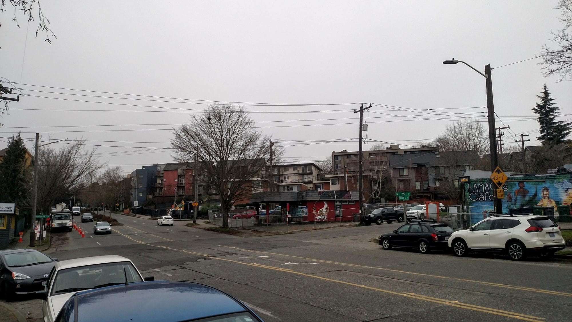
Here’s my idea to improve safety in my neck of the woods: turn the intersection of Bridge Way and Woodland Park Ave N into a four-way stop with bump outs to shorten crossing distances for people walking.
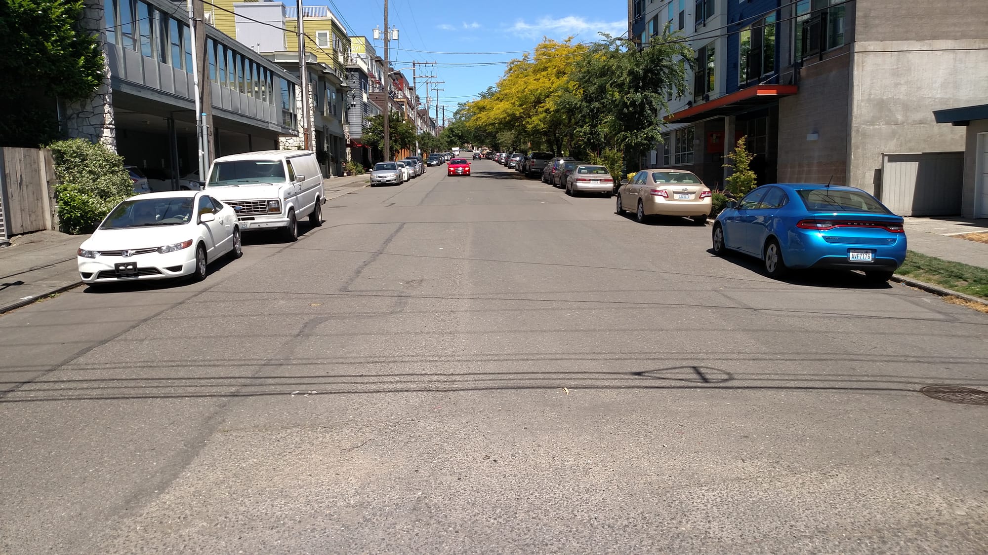
It’s an increasingly busy intersection with hundreds of apartments added within a few blocks and hundreds more on the way. Nonetheless, the intersection does nothing for people and walking besides wish them good luck with five lanes of traffic. At the very least, crosswalks would be nice, but the skewed geometry of the intersection and unnecessary second Bridge Way lanes in each direction invite further intervention in the form of bumps outs. The two downhill Bridge Way lanes especially aren’t really wide enough to fit. It’s a tight squeeze with the parked cars. The intersection should clarify that there’s only one lane in each direction there (plus a turn lane) rather than the four implied (and five with the turn lane). That means striping farther up the hill to merge the two downhill lanes into one.
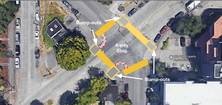
Woodland Park Avenue used to host a streetcar line back in the day, which is why it’s wider than neighboring streets. The right-of-way is 66 feet (according to City zoning maps) instead of a standard 60 feet and more of that right-of-way is road space rather than sidewalks.
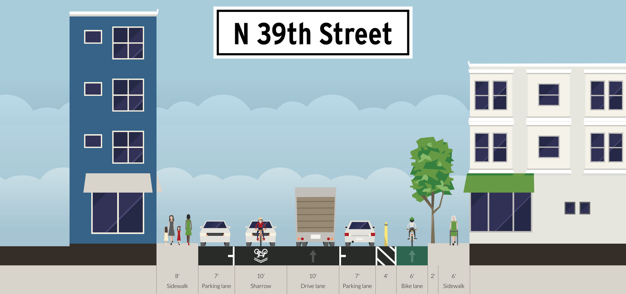
In addition, Woodland Park Avenue has a jog in it meaning somebody headed south has to counter-intuitively turn onto N 39th St at a “Y” intersection just north of Bridge Way to continue on Woodland Park Avenue south of Bridge Way.

Since Woodland Park Avenue doesn’t continue straight through to Albion Place because there’s a median in the way, making Woodland Park Avenue after the Y a one way (southbound only) into a right turn only is also a good option. That would also also a much shorter crossing distance for people walking along Bridge Way.
While beyond the scope of one neighborhood street fund grant, the entirety of Woodland Park Avenue could use a road diet, especially considering it’s indicated as a future neighborhood greenway on the Bike Master Plan. There is room for parking protected bike lanes or parklets on every block. When Woodland Park Avenue is repaved–and some of it is in pretty rough shape–it’d also be wise to narrow the street and return more of the edges to green space.
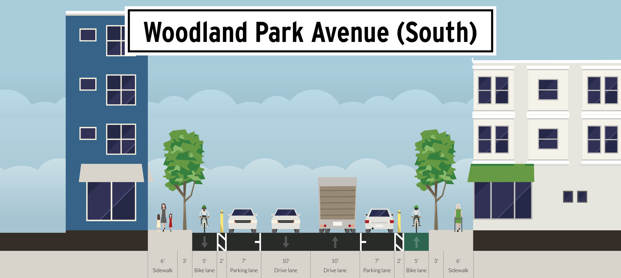
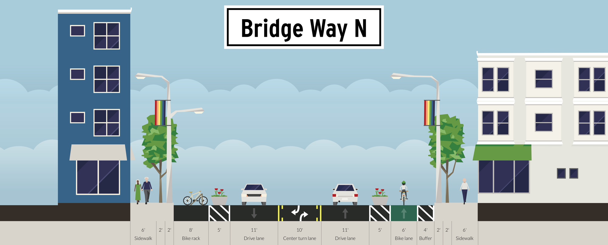
Returning to the immediate solution, Bridge Way N has 80 feet of public right-of-way and the intersection sorely need shorter crossing distances and more order to discouraging speeding and daredevil passing maneuvers. I represented those bump outs in the Streetmix rendering with the bicycle parking and the planters. I also included an uphill protected bike lane to help calm the street further and to offer people biking from Lower Fremont and Lower Wallingford a reasonable route to Upper Fremont. Bridge Way is the most direct path, but, as is, it’s hostile to people biking.
The Seattle Department of Transportation has some options to shorten the crossing distances. Bollards would be the simplest and probably the cheapest, but some planters could help spruce up the place too and provide a little more heft to deter motorists. The stop signs themselves could also be placed in the bump out area so motorists don’t miss them when they are bombing down the hill or accelerating up it.

The pushback likely to the idea of adding a four-way stop and trimming the streets excessive width is that Bridge Way is a busy thoroughfare that feeds SR-99. However, the interchange at Aurora Avenue (SR-99) is also frequently congested, so, spreading some of the queuing out could also make the system work better. Too often Route 5 and Route 28 buses are stuck by long lines of cars waiting to make it through the five-way Fremont Avenue intersection on the other side of Aurora Avenue. This might dissipate some of the congestion, or at worst hardly change things for motorists, but finally offers a safe way to cross Bridge Way.
Get your street fund application in today if you have an idea of your own.