Note: This article was edited on 10/31/21 to add recommendations for improving accessibility on Main Street.
Downtown Bellevue is undergoing one of the fastest transformations our region has seen. By 2023, commercial office space is expected to double. This poses a once-in-a-lifetime opportunity to shape the urban character of the city.
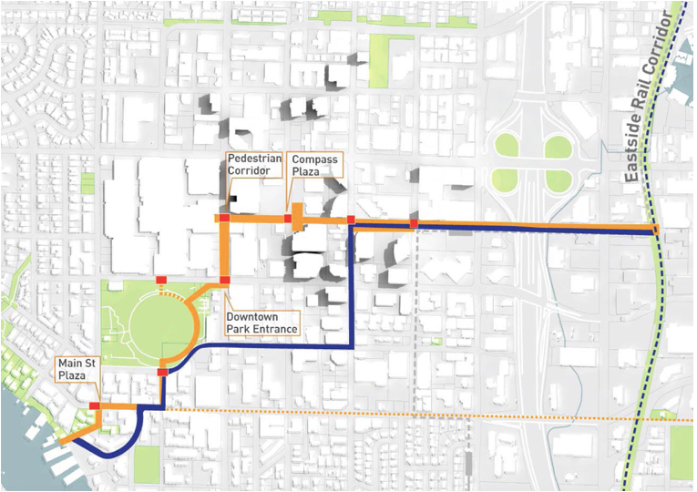
Bellevue has its roots as a city built around the car, but with forward-looking progressive city leadership it has adopted many urbanist features in recent years. Wide sidewalks, protected bike lanes, transit priority and designated pedestrian corridors are just some of these features. Bellevue’s Grand Connection, described by the City as a 1.5-mile “series of cohesive, connected and memorable spaces and pedestrian-focused experiences through the heart of downtown Bellevue” will advance these urbanist improvements further. The Grand Connection also is posed to reshape land use patterns throughout the corridor.
I have previously written about the Grand Connection and I am glad that recent developments like Vulcan’s 555 Tower are indeed implementing a pedestrian design that lives up to the highest standards I envisioned. This article is the first in a series presenting an in-depth look at every segment of the Grand Connection with the latest plans spanning public and private development, and crucially, ways to improve them further.
Let’s take a stroll! (Part 2 and Part 3 of the series can be accessed here or at the end of this article.)
Meydenbauer Bay Park to Main Street
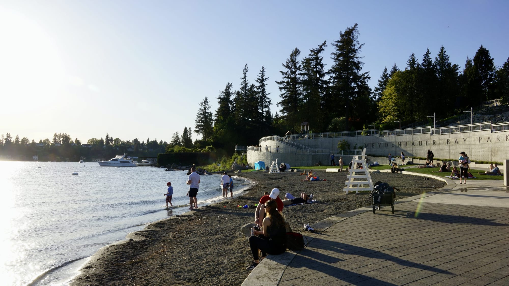
On one end of the Grand Connection we start our journey in beautiful Meydenbauer Bay Park on Lake Washington. This park was completed in 2019 and was a dream for the city for decades. They actually acquired very expensive waterfront residential land to make it happen which is an amazing feat.
Current state
For this first leg of our journey, Lake Washington Blvd connects the park with Main Street. It is currently flanked by 70s/80s dingbat-style multifamily residential buildings (meaning open carport on the ground floor) to the east and a steep ridge to the west with no sidewalk there. Both introduce significant discontinuity between the highly activated pedestrian environments of the park and Main Street.
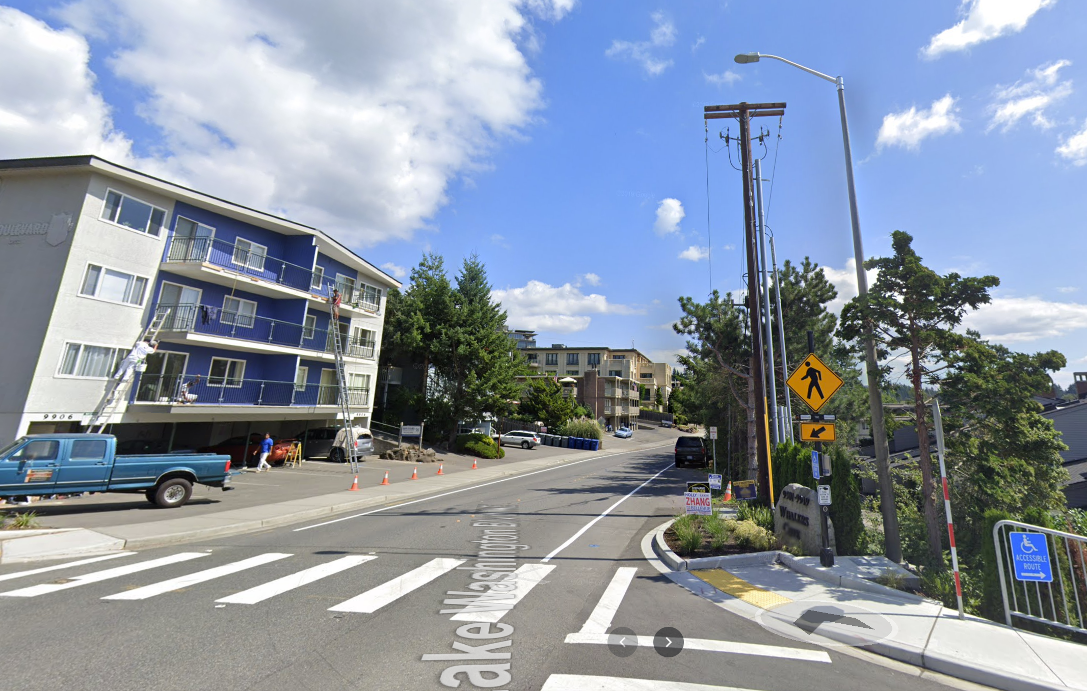
Suggested improvements
A number of strategies can improve the pedestrian realm here:
- Widening the sidewalk on the east side and adding a green buffer where possible.
- Creating a sidewalk and bike lane (since it is uphill) on the west side where neither exists.
- Furthermore the entire row of buildings on the east side is ripe for redevelopment. Pedestrian realm improvements should be part of the zoning code for new builds. Ideally we would see mixed-use development with ground-floor retail and a larger setback. This can help extend the active pedestrian environment of Main Street towards the park.
Main Street and 100th Ave NE
Moving further east along Lake Washington Blvd we get to the intersection with 100th Avenue NE. This is where Main Street begins. One could consider this the gateway into town. This is also another access point to Meydenbauer Bay Park (via the marina) that feels very much secondary today, but could easily become the most desirable path.
Current state
The current pedestrian environment of the southern approach (south on 100th Avenue NE) presents narrow sidewalks next to suburban style development. It provides no indication or affordance that going down any direction of the intersection would lead to the park, nor does is it a particularly pleasant walk.
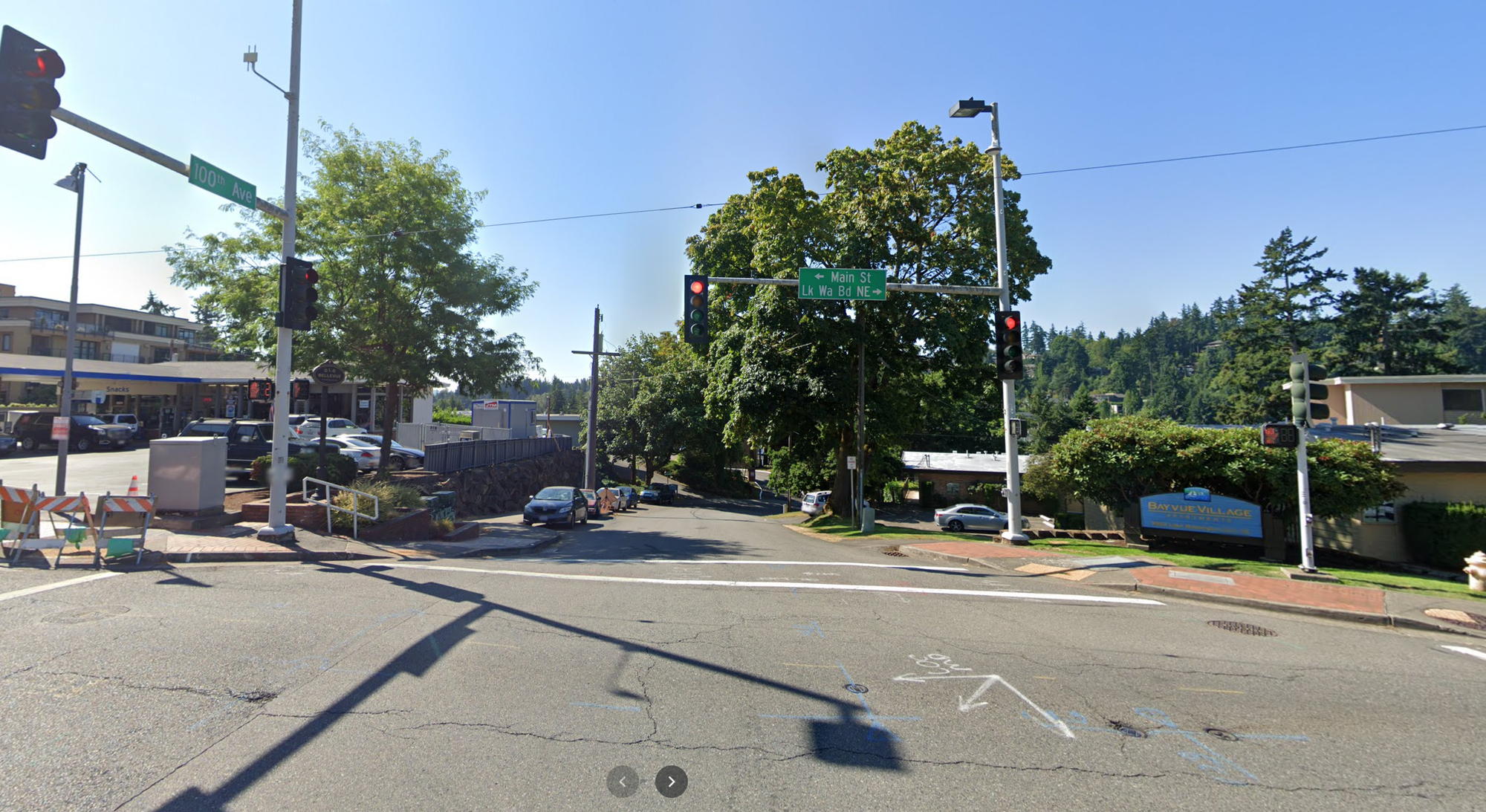
Suggested improvements
The Grand Connection Framework Plan already has a proposal for building a new entrance to Meydenbauer Bay Park here including extending the park itself through the marina.
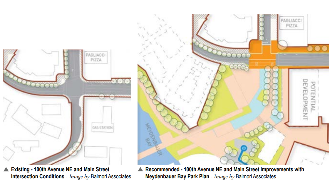
This treatment would not just benefit the park but also make the marina more attractive, since right now it faces a bleak grey parking lot. A raised intersection is also proposed here. These are ambitious plans, especially since they require some property acquisition, but are fully justified given the significance of the public space.
Main Street from 100th Ave NE to Bellevue Way
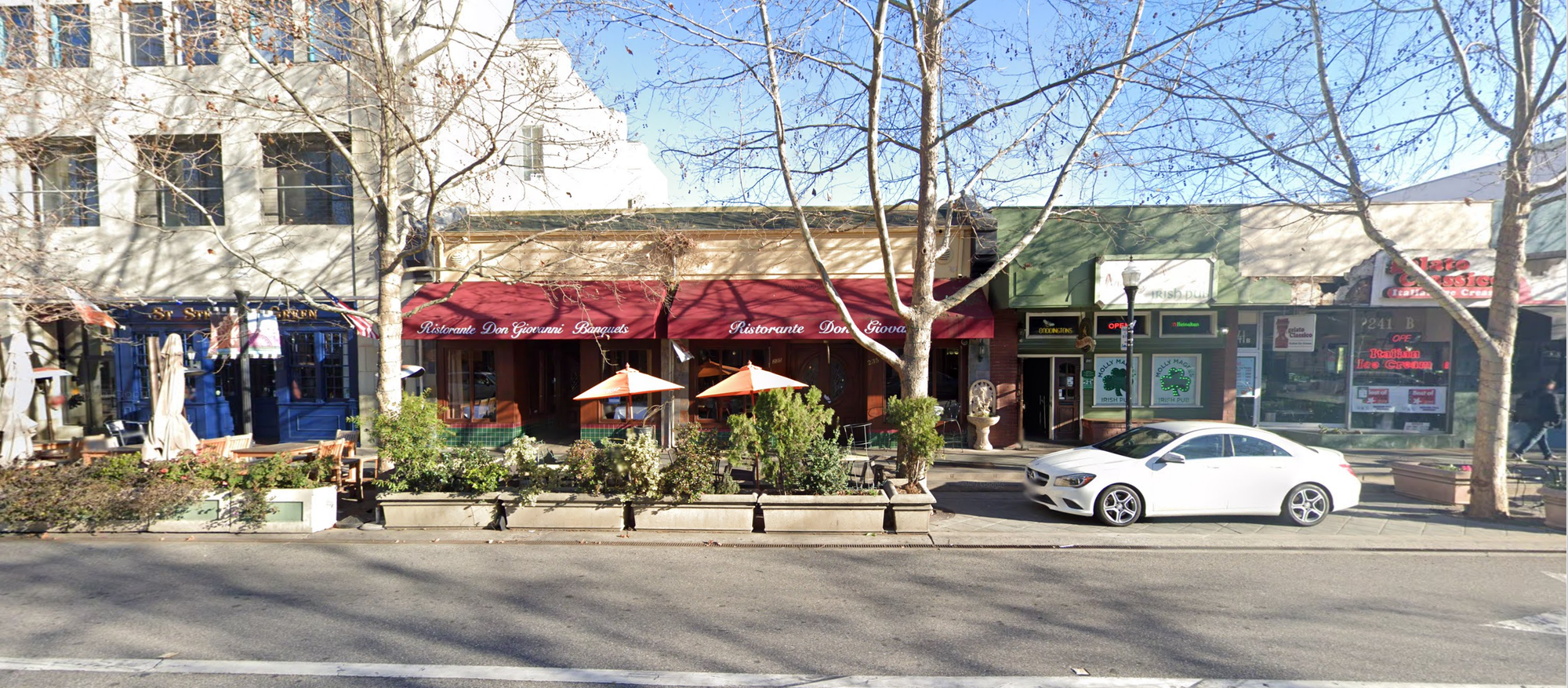
Main street is one of downtown Bellevue’s busiest pedestrian retail corridors – a truly wonderful nexus of activity. Car traffic here is confined to two lanes and average speed appears to be about 10 mph when things get busy.
Current state
One of the positive effects of the pandemic included the repurposing of most street parking spots to outdoor dining.

This treatment is temporary, however, and also not consistently applied. This is baffling given that there is no shortage of off-street parking nearby. Many of the large buildings have structured parking directly off Main Street (meaning on the exact same block) — including The Meyden and Venn (even includes a Tesla supercharger). Other buildings also offer complimentary customer parking.
Given this extremely high availability of parking it is surprising that outdoor dining isn’t given some form of more permanent or higher quality treatment. After all, even when parking is available, the two spots in front of a restaurant with 20+ seats obviously don’t make a large dent in their bottom line. I should note that this is an issue where typically a very small but vocal minority of patrons would complain to the restaurant about lacking parking and the restaurant owner would think the issue is much bigger than it actually is. The reality is that in highly walkable areas like this, often times a bigger proportion of patrons arrive by means other than driving. But they also don’t complain about parking and are taken for granted. Either way, it would be better for any restaurant to have outdoor dining than two outdoor parking spots.
Suggested improvements
One of the closest examples of a similar sized city improving a similar street is in Mountain View, California. Their Castro Street is of similar length with a similar retail mix (although also including a section with banks, city hall and a performing arts center) and similar parking situation.
Here is what they have implemented:
- Created a “flex zone” from the street-side parking area by raising it slightly and paving it in a special material. The curb is more gradual and allows vehicles to climb it if needed. This zone is very clearly designed to either be pedestrian (outdoor dining) or parking depending on the need.
- Trees are planted to dot this flex zone. The space between two trees is long enough to fit a vehicle so that each space can be used as parking if needed. From the pedestrian perspective it also creates great shaded areas plus protection from vehicles going straight through.
You can see three spots, each separated by a tree in the picture. Two of the spots are used for outdoor dining and are nicely separated from the street with concrete planter boxes. This provides both a safety and aesthetic barrier. The one remaining spot is used as parking.
A significant change to the street layout like above must also be pair with fixing some of the long-standing accessibility issues on Main Street. A good set of goals would include:
- Ensure the walking path is wide enough for one or ideally two wheelchairs side by side when all outdoor dining is set-up.
- Ensure that all outdoor dining areas are accessible.
- Ensure that all restaurants get an accessible entrance even if they didn’t have one before.
- Ensure there are accessible parking spots available within a set distance of each business (could designate some of the flex zones as accessible parking).
Main Street and 102nd Avenue SE
The Grand Connection corridors turns north on 102nd Avenue SE towards Downtown Park.
Current state
This street sees almost no traffic, yet has three lanes dedicated to traffic plus two additional partial lanes for parking. This space is not well utilized today. At the same time nearby restaurants struggle to take over every little bit of sidewalk space for seating.
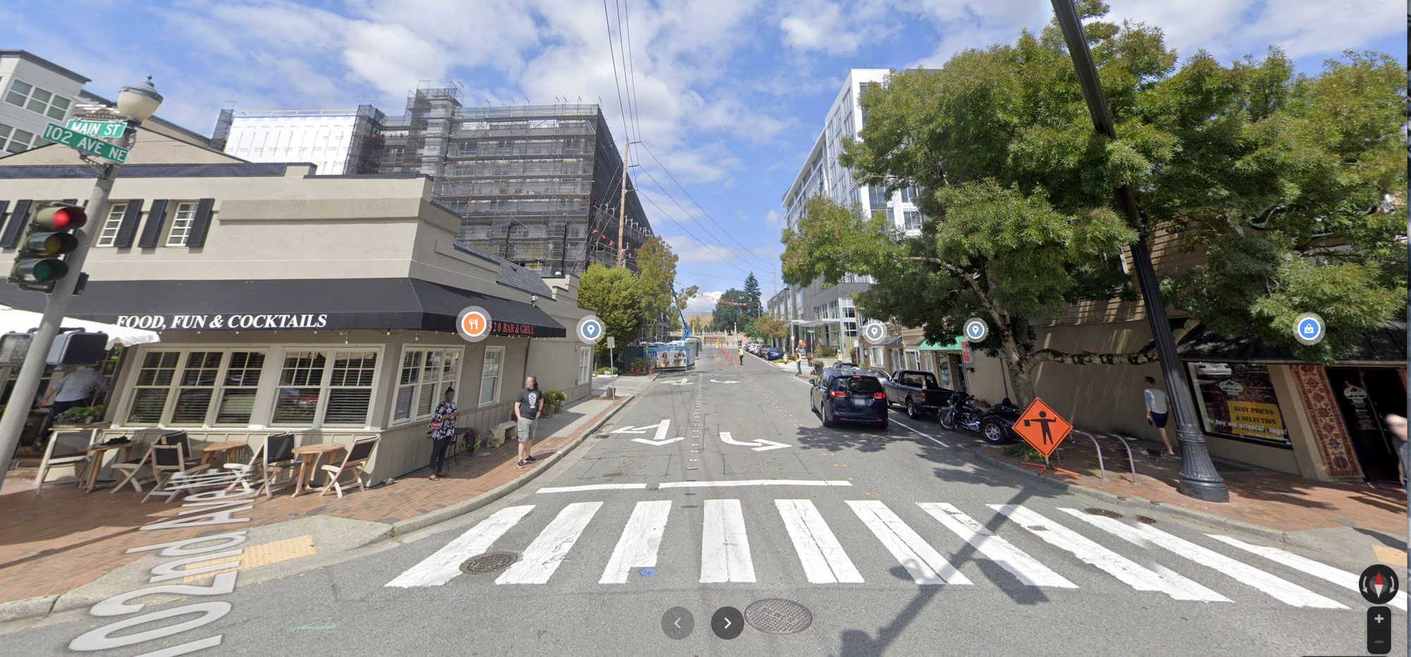
Suggested improvements
It would be great if we get widened sidewalks with flex outdoor seating areas long the path here as well. Instead of a configuration of two parking plus three travel lanes, far more people would benefit if the configuration is two wide flex plus two travel lanes.
I’ll pause my analysis here. Part 2 of the series continues exploring the Grand Connection at Bellevue’s Downtown Park.
Improving Bellevue’s Grand Connection: Part 2 – Downtown Park to Bellevue Transit Center
Improving Bellevue’s Grand Connection: Part 3 – Downtown Link Light Rail to I-405 Lid Park