This article is the second in a series that takes a deep dive into Bellevue’s Grand Connection, an ambitious project to improve the pedestrian experience and engage in distinctive placemaking over a 1.5 mile corridor in heart of central Bellevue. In the first article, I took a close look at the stretch of the Grand Connection spanning from Lake Washington through the Main Street area of Downtown Bellevue and identified some improvements for current plans. This article picks up at one of the city’s most iconic locations, the Downtown Park, while the final piece in the series addresses the Downtown Link light rail station to future I-405 lid park.
Downtown Park
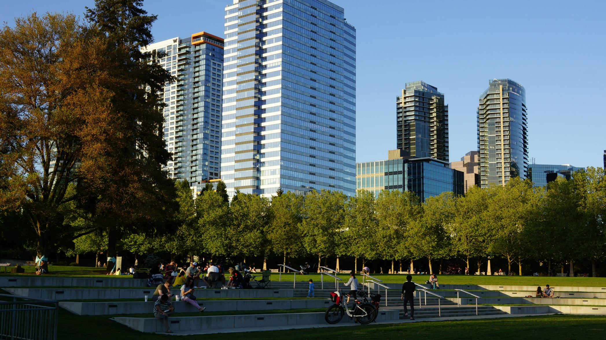
Next we enter the wide open 20-acre Downtown Park, a tremendously valuable amenity to have right in Downtown.
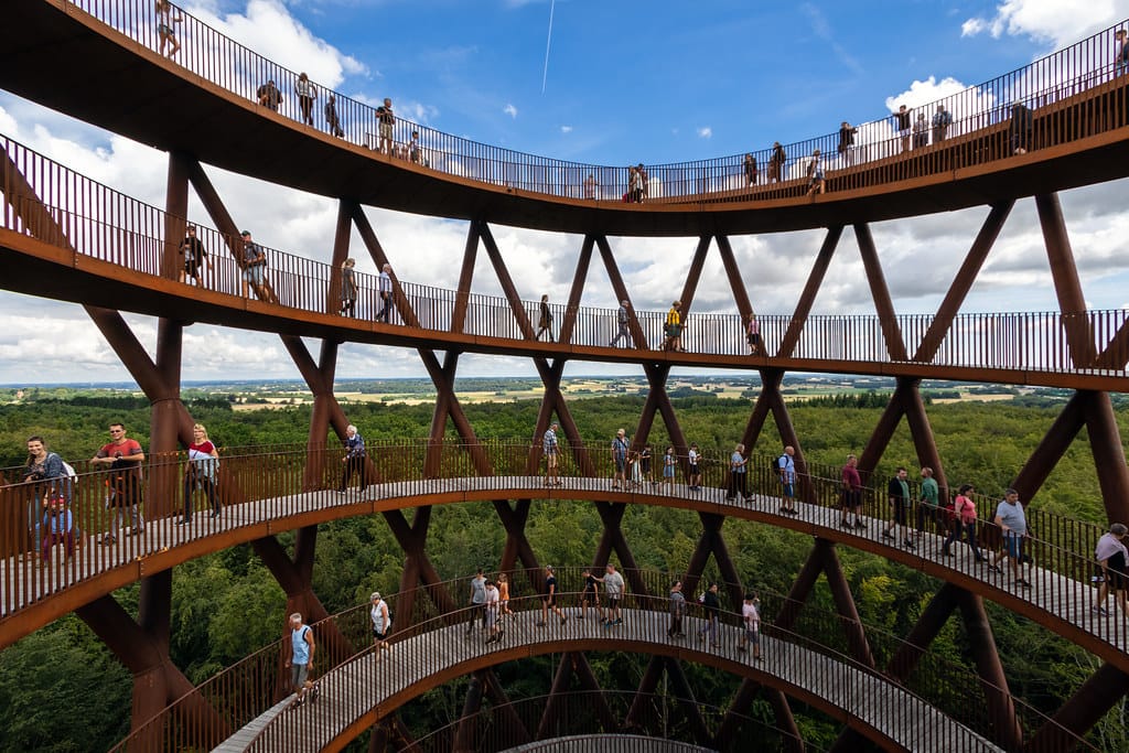
I do not really have any suggestions for improvement here, the park is already an amazing asset. However, if I were to dream big, I would build an elevated viewing platform near the trees in the very center of the park, so that everyone can enjoy the views of Mount Rainier, the Cascades and Olympics that open up from just 30 to 60 feet above the park. Bellevue means “beautiful view” in French, yet there are few public locations where one can enjoy the mountain views that clearly inspired the name and I think that’s a real shame. A stronger connection to nature will lead to a healthier population and greater care for the environment.
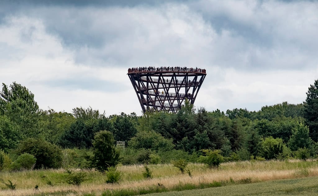
A great example of this idea is the Camp Adventure tower in Denmark — it’s a beautiful oak and steel spiral design that is fully accessible! This is key since many similar attractions are not accessible without an elevator (cough… Vessel… cough) and this really spoils their ability to be a community meeting spot.
4th and Bellevue Way
Current state
A new park entrance was recently unveiled at this corner, allowing for a direct link to the street-running portion of the Grand Connection. However, crossing from the park entrance on the south-west corner towards the row of restaurants and other businesses on the north-east corner requires waiting out Bellevue’s notoriously pedestrian-unfriendly light cycles twice. How can this be a grand pedestrian connection if it can easily take more than three minutes (!!!) to cross a single intersection?
Suggested improvements
Create an all-way walk intersection and provide a pedestrian cycle every 71 seconds. This is how long it takes for the direction of the intersection to change. This is not an easy change given the level of vehicular traffic on this intersection, but if there is a place to prioritize pedestrians, this is it!
Bellevue Way NE between NE 4th Street and NE 6th Street
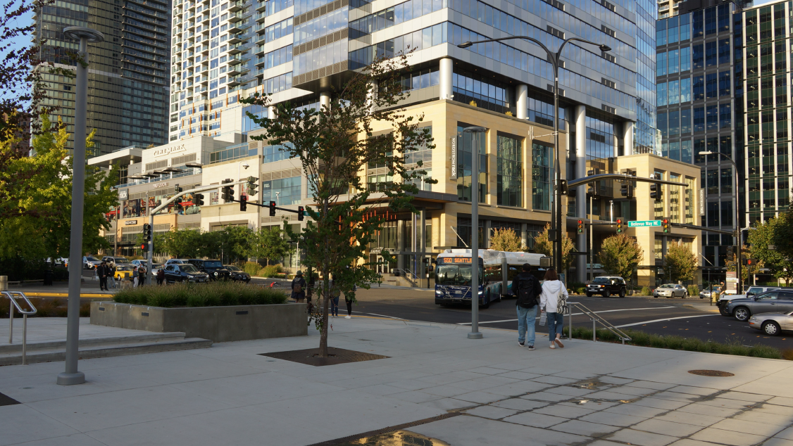
The Grand Connection goes north for a Bellevue superblock, following the busy retail corridor along Bellevue Way. The sidewalk environment along Lincoln Square II here is actually really pleasant and has a great buffer towards the busy street.
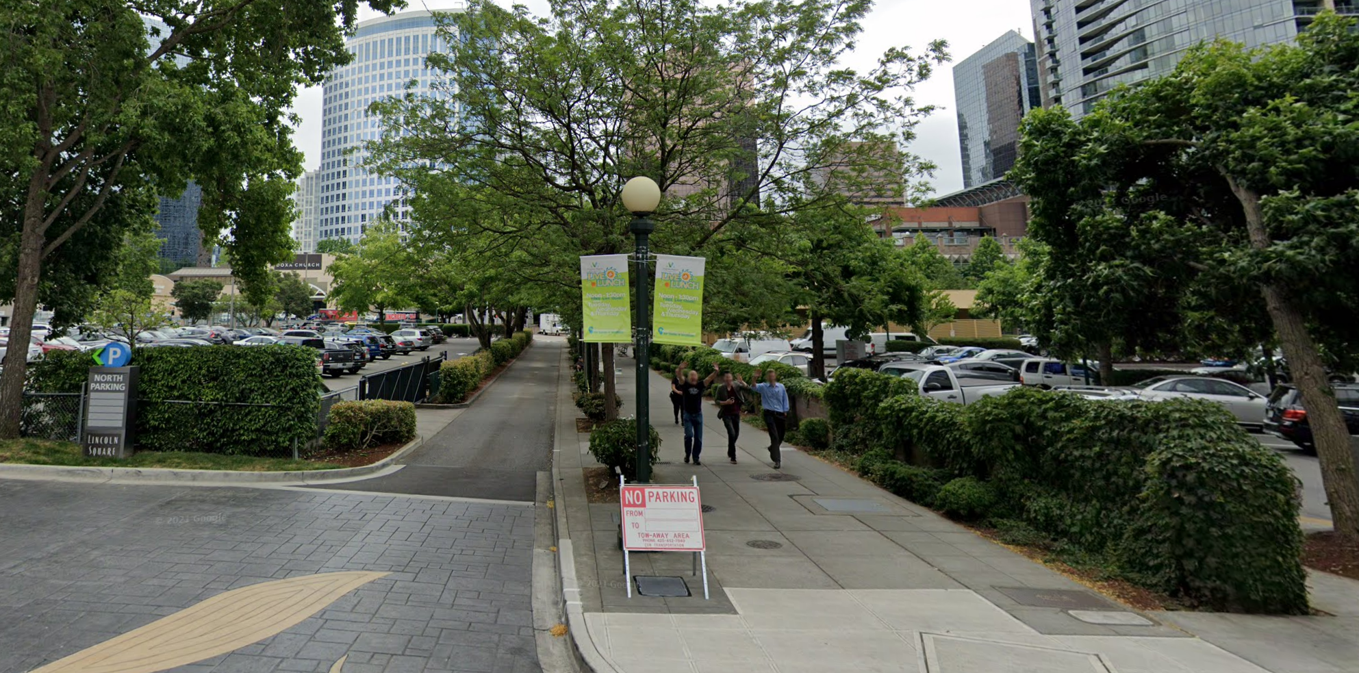
NE 6th Street between Bellevue Way NE and 105th Avenue NE
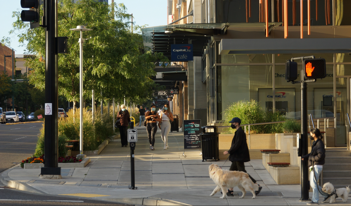
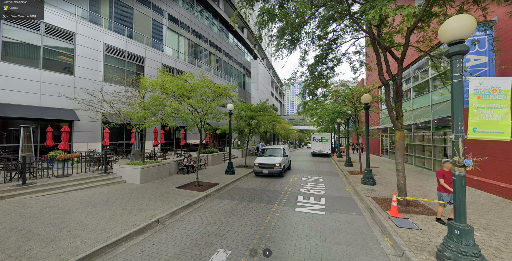
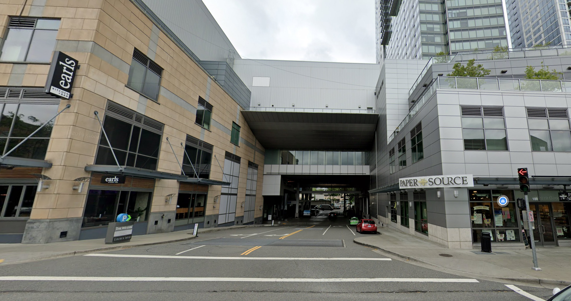
Now we are turning onto NE 6th Street — this is Bellevue’s pedestrian corridor, and when I say pedestrian, I really mean it since most of it does not have space for or allow cars. This section, right by the mall, however, does. While you can see two lanes, they only lead to 105th Avenue NE which is effectively an alley only useful for accessing the parking garages of the Lincoln Square complex. While this alley does span from NE 4th Street to NE 8th Street, the actual through traffic between them is effectively zero.
Current state
In recognition of the pedestrian character of the corridor the travel lanes are paved in brick, but that’s about it. These are still vehicle lanes and as you can see, are mostly used as impromptu parking. This function could be handled by already existing parallel dedicated pass-throughs through the actual Lincoln Square complex.
These pass throughs are located about block north and south:
Pass-through a block north also known as NE 7th Street — very wide and includes dedicated parking:
Pass-through a block south also known as NE 5th Street:
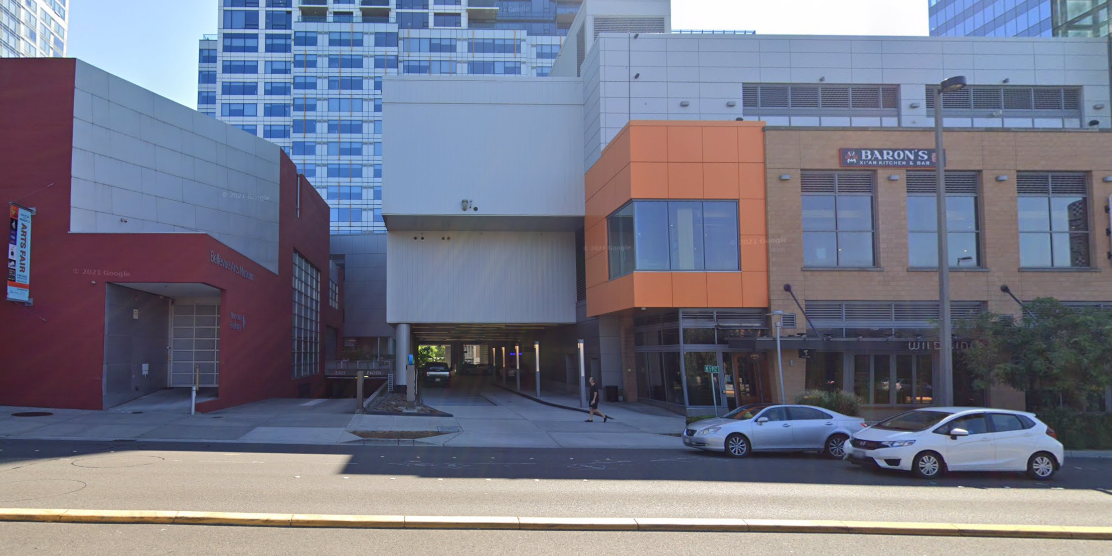
These pass-throughs are pretty important not just for this section but also the one after it.
Suggestions for improvement
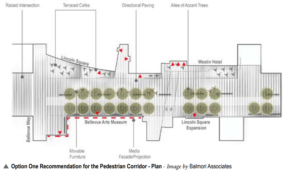
First let’s review what The Grand Connection Framework Plan suggests. There are two options there: Option 1 proposes a series of terraced outdoor dining areas, raising and de-curbing the street, and leaving a single lane for vehicles (which could be sufficient given the low amount of traffic and the fact that the alley parking access is also available off NE 4th Street and NE 8th Street).
Option 2 includes many of the prior elements but uses a rolling berm to separate the dining spaces from a shared street space.
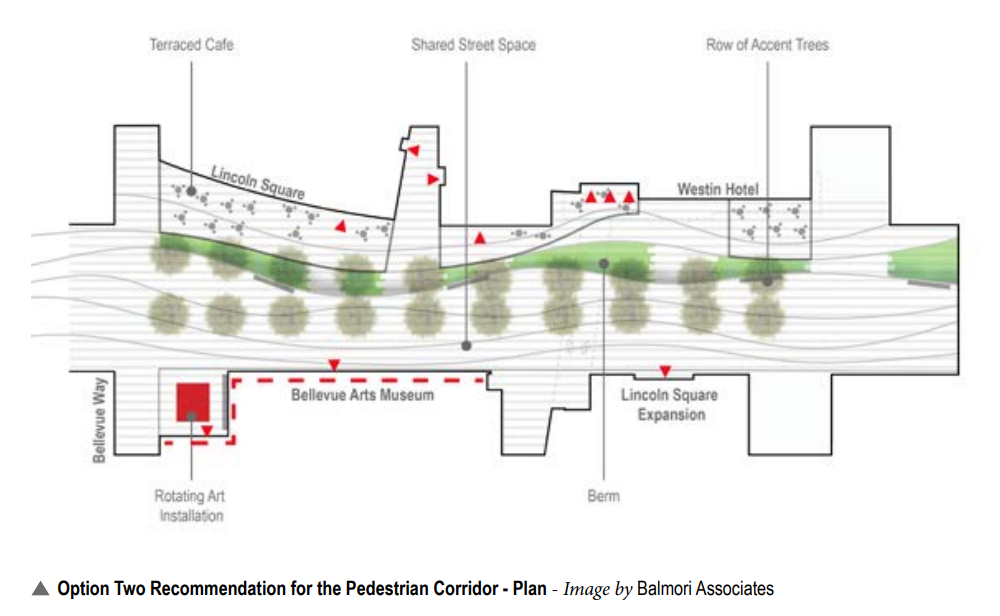
Just like on Main Street, creating space that can either be fully pedestrian or for vehicles is the appropriate configuration for this corridor. Given that this is not the only connection to 105th Avenue NE around and that this is part of a designated pedestrian corridor that does not allow motor vehicles outside of this block, we really ought to be thinking bold here. This means Option 2 is the better option given the full spectrum of needs coming together here.
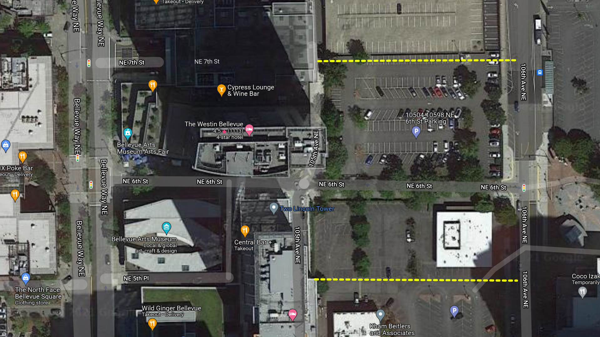
NE 6th Street between 105th Avenue NE and 106th Avenue NE
Current state
Continuing further east on NE 6th Street past 105th Avenue NE we get to a section that is surrounded by parking lots on both sides. Those are parcels zoned for 600-foot buildings and likely to be redeveloped soon.
While there is a pedestrian path and it is quiet, it is much narrower than NE 6th Street prior or after this point — effectively it is a continuation of the south sidewalk of 6th only.
The single one-way vehicle travel lane also sees incredibly sparse traffic, mostly from vehicles coming out of parking garages. Since they meet a traffic light at 106th Avenue NE and there is no through connection, this lane isn’t particularly useful. They would still have to access NE 4th Street or NE 8th Street from 106th and end up waiting at another light there. It may actually be faster to just use the 105th Avenue NE “alley” to get to 4th or 8th.
Suggested improvements
To enable this section of NE 6th Street to function like the fully pedestrianized street that the rest of the corridor is, this single access lane should be relocated either north or south of 6th. Basically it should connect to either the NE 7th Street or NE 5th Street pass-throughs and be built out as part of new developments.
Since the properties both to the north and south are open for redevelopment this is very much possible. The time to make this happen is now, before new development is even proposed.
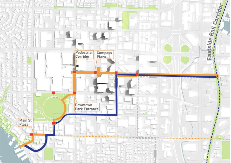
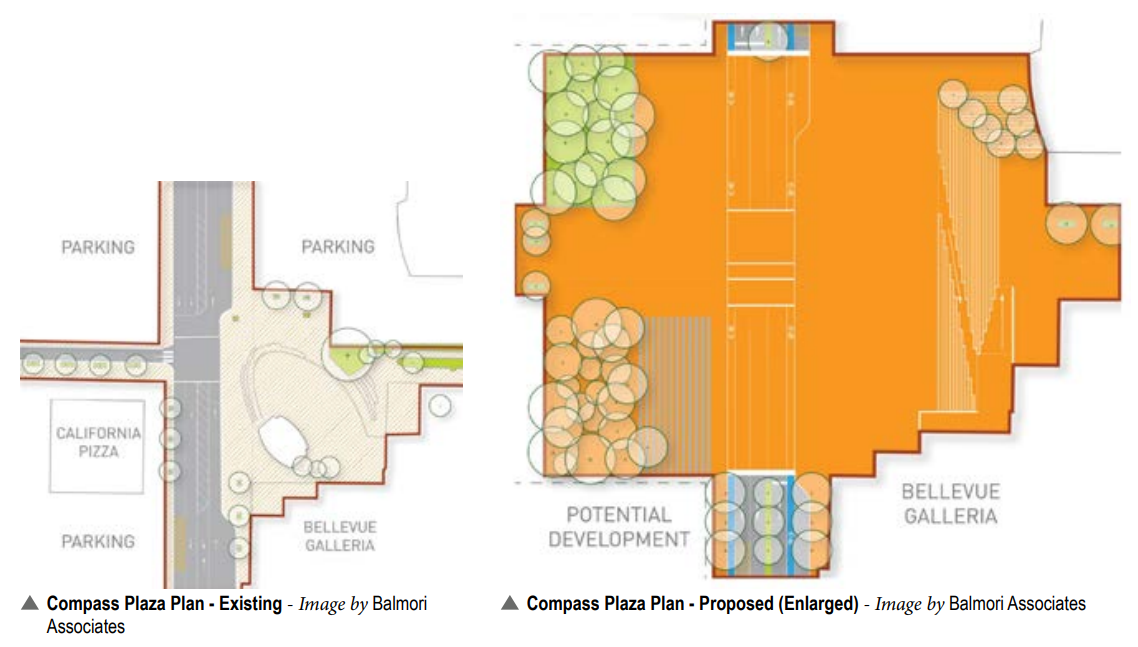
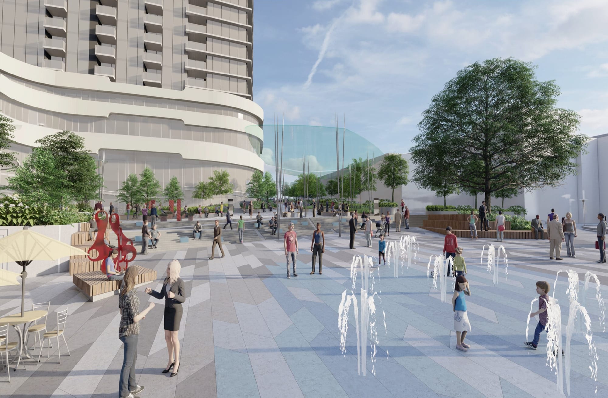
Compass Plaza (106th Avenue NE and NE 6th Street intersection)
This intersection is right in the geographic center of downtown Bellevue. The existing Compass Plaza occupies part of the southeast corner of the intersection. The current space is a little too small to be programmed effectively, but too large to be activated on its own.
The Framework Plan has an ambitious proposal for expansion of the plaza across all four corners of the intersection. This would turn it into a true public square.
Ambitious public realm plans like this one warm my heart. How can one not be full of joy seeing renderings like this?
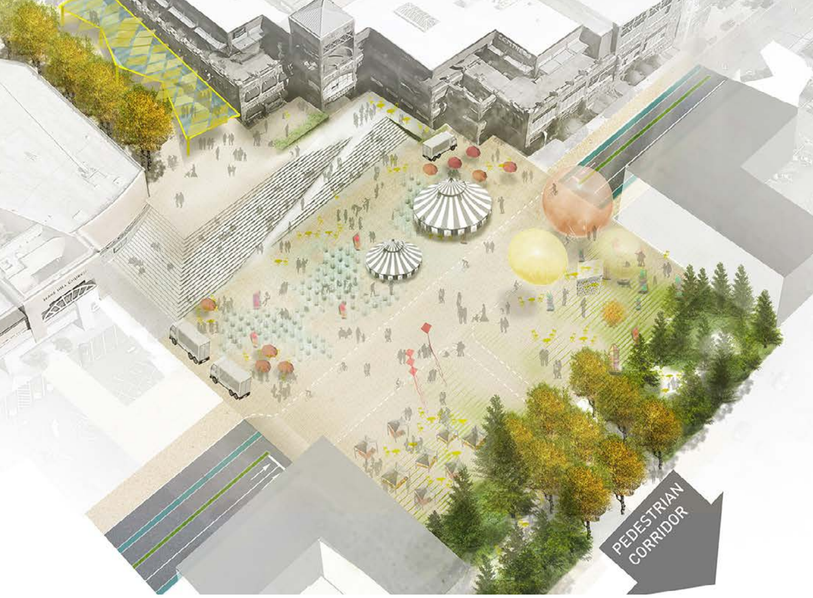
Perhaps the only suggestion I would provide is that the ramp across the stairs should be wider – ideally able to fit at least two wheelchairs side by side. It’s unclear from the provided materials if that is the case.
NE 6th Street between 106th Avenue NE and 108th Avenue NE
This part of NE 6th Street is already free of any kind of motor vehicles which makes it Bellevue’s only true pedestrian street today. Right now it’s mostly a construction zone with two out of four parcels and their adjoining pedestrians space being closed off.
While not under construction yet, first on our path is the three-tower Onni project, which is to replace the Doxa Church. It will accommodate the larger Compass Plaza and an expansion of the pedestrian corridor.
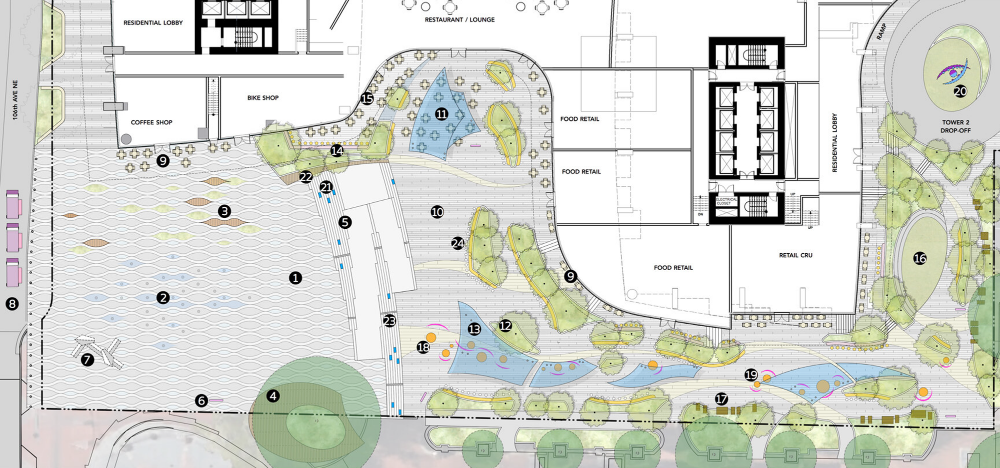
It’s really great that they have all this retail facing the pedestrian corridor and the plaza.
Suggested improvements
It would be much better for Compass Plaza if (at least some of) the adjacent retail spaces are small rather than large. This is to enable local small businesses to occupy them rather than large chains. It is small businesses that typically become “cultural centers” or common meeting spots for people. It is those businesses combined with public space that typically form the “soul of the city”. And I believe it is a key ingredient for enabling Compass Plaza to become as attractive as Downtown Park.
Across from it, on the south side of Compass Plaza is the Bellevue Galleria which is currently being remodeled. Before closing, it was a great place to enjoy lunch — either from the on-site Homegrown sandwich shop (a local small business) or the food trucks lining the perimeter of the plaza. In other words local small business food is already what this area is known for!
Next, already under construction is what Vulcan’s 555 Tower project is building along the pedestrian corridor – quite in line with what I suggested in an earlier article.
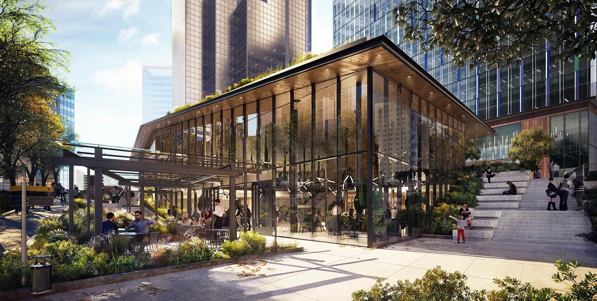
I am incredibly happy that they are paying such close attention to the pedestrian experience.
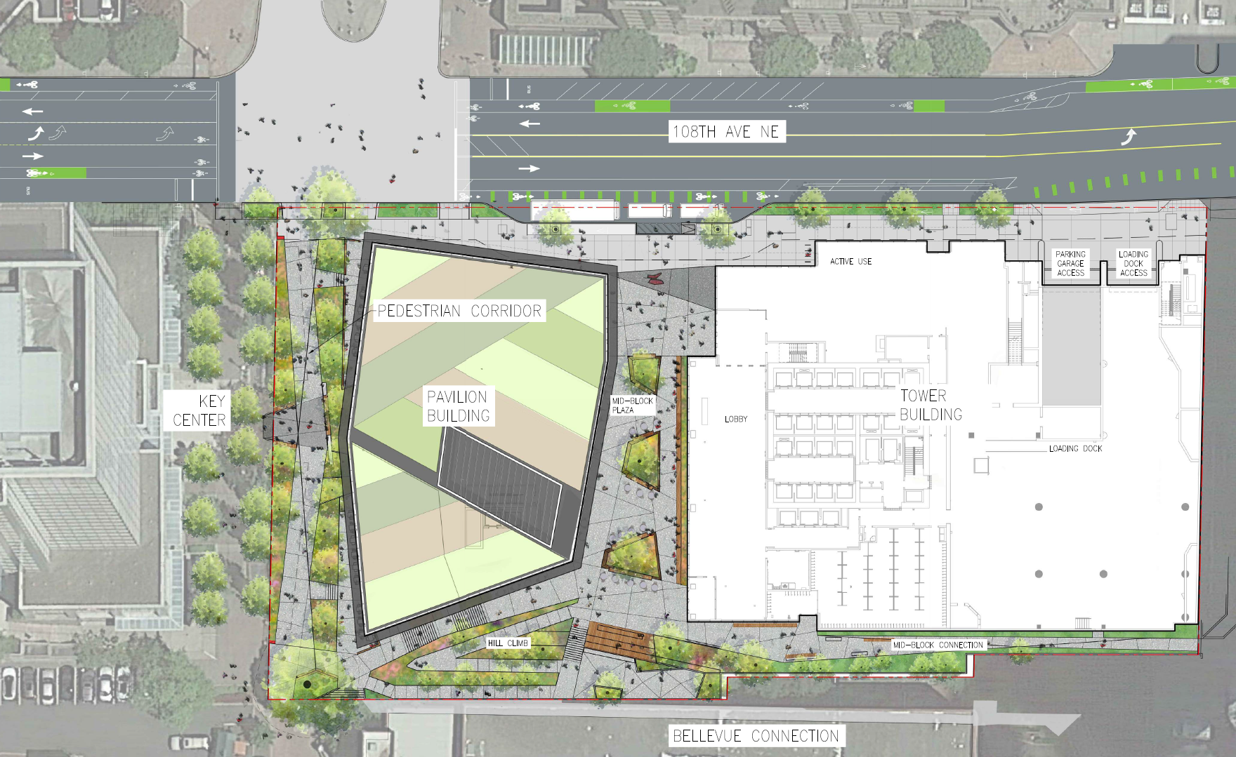
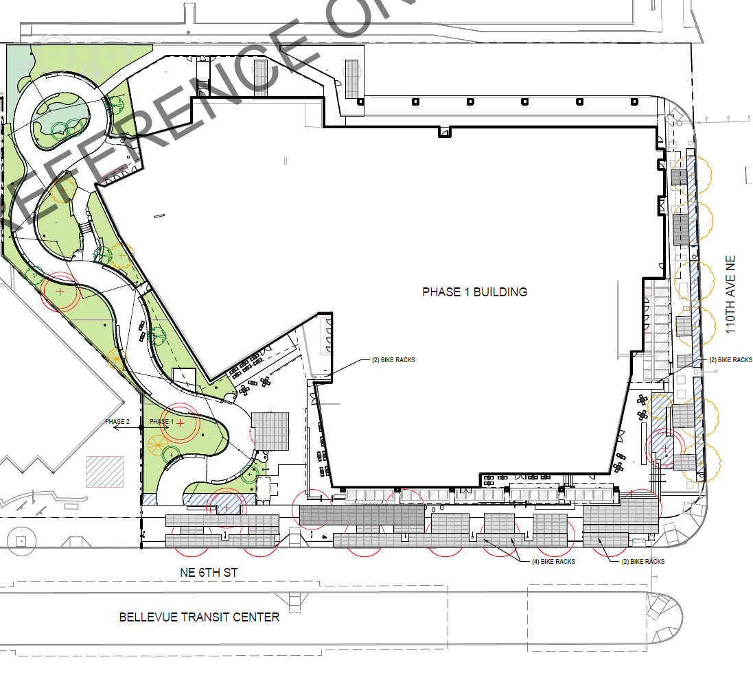
NE 6th Street between 108th Avenue NE and 110th Avenue NE
Now we enter the Bellevue Transit Center area. On the south side we have two office buildings with ground floor retail and a plaza/park in between.

Two new developments are planned on the north side including permeability deep into the block:
With all the public space this is overall quite a nice spot and will become even nicer as buses become electric over the next decade and the noise and pollution from diesel engines disappears.
We’ll pause our tour here and pick back up again in the next article at the Downtown Bellevue Link light rail station, which scheduled to open in 2023.
Improving Bellevue’s Grand Connection: Part 3 – Downtown Link Light Rail to I-405 Lid Park
Improving Bellevue’s Grand Connection: Part 1 – Lake Washington and Main Street