Sign our petition to elected leaders urging that they fully study Everett Link alternatives.
Sound Transit has expanded the scope for Everett Link to study alignments along SR 99 and I-5 in the South Everett area. For years, elected officials have tried to foist the Paine Field deviation, a 6.75-mile loop that would deliver only a single station near Boeing’s plant, on the community. But these new alignments present a unique opportunity to serve natural ridership and speed up connections between community destinations north and south while also delivering service sooner and better achieving climate goals.
Background on new alternatives and their benefits
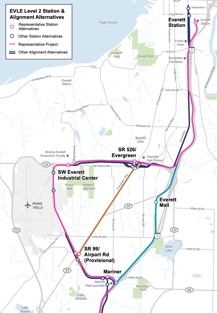
In June, Sound Transit revealed some high-level details on the SR 99 and I-5 alignments to be studied as part of the Level 2 Alternatives Analysis process, a pre-planning phase of the Everett Link Extension. In broad strokes, here’s how the alternatives stack up against the baseline Paine Field Deviation plan:
| Metric | SR 99 Alignment | I-5 Alignment | Paine Field Deviation |
| Number of Stations | 3 | 2 | 4* |
| Miles of Track | 5 | 3 | 6.75 |
| Travel Time | 8.5 minutes | 5 minutes | 12 minutes |
| Operations and Maintenance Facility Options | 2: SR 99/Gibson Road and 164th Street SE/I-5 | 1: 164th Street SE/I-5 | 5: 75th Street SW/16th Avenue W, SR 526/16th Avenue W, 100th Street SW/Airport Road, SR 99/Gibson Road, and 164th Street SE/I-5 |
*Includes the provisional SR 99/Airport Road Station, which is unfunded in the Paine Field alternative.
Under both the SR 99 or I-5 alternatives, many more residents in Everett would have access to high quality transit if some version of those alignments is selected and additional stations are developed. This would be especially beneficial to transit-dependent communities in South Everett near Casino Road, offering more direct service to critical community services and amenities (e.g., grocery and retail stores, medical services, and schools and libraries). These alternatives would open up many more opportunities to support the growth of dense transit-oriented districts and tame dangerous streets like SR 99.
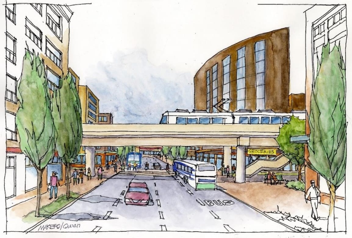
With an alignment along SR 99, Sound Transit also has the benefit of using existing state right-of-way at very low cost. Where to place guideway and stations in the street does present some interesting choices. Guideway could be situated off to the side near the pedestrian zone or it could be situated toward the median. Both come with some tradeoffs, but the big benefit of either is the opportunity to repurpose car lanes to transit and other sustainable transit modes while making the pedestrian experience of SR 99 safer and more appealing.
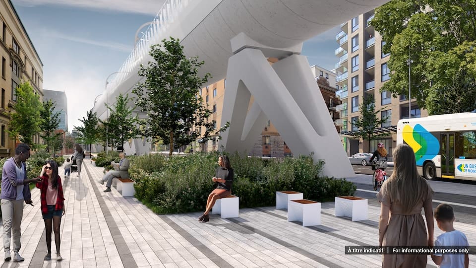
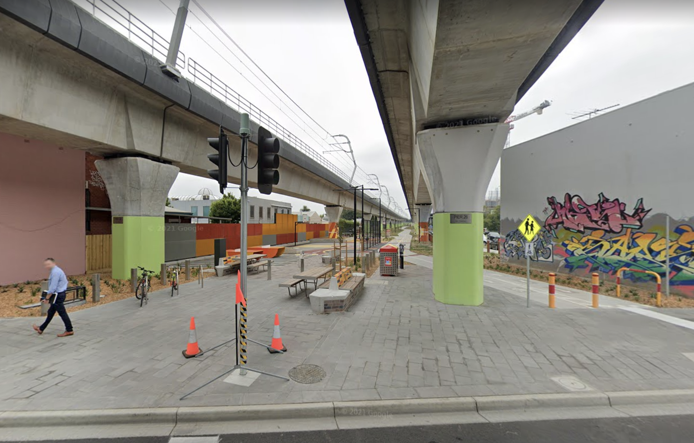
Elevated transit lines the world over have been used to provide secondary benefits, such as new cycletracks, park spaces, landscaping/greenswards, and even restaurants and retail built in the areas below and to the side of guideway. Snohomish County, for instance, has been evaluating how to make the most of areas below potential elevated guideways near the Mariner Station, which could include a variety of active and passive public amenities.
While both the SR 99 and I-5 alignments are worth studying, the ridership and equitable transit-oriented development potential of SR 99 may be the greater of the two, which a complete study will likely bear out.The Problem with the Paine Field deviationWhile the Paine Field deviation has always been presented as inevitable, it has been a questionable policy choice from the very beginning. Studies prior to the Sound Transit 3 ballot measure showed that an I-5 alignment performed better in terms of ridership and travel time and suggested that a spur off the mainline to Paine Field could better serve the area, but elected officials decided they knew better than the data.It’s worth ticking through how the Paine Field deviation is a flawed political campaign:Travel times would be 3.5 to 7 minutes longer than other alternatives;Trains would serve a low-density suburban industrial areas that are hostile to walking and biking, making transit trips undesirable;The Paine Field area hasn’t seen a significant boom in jobs beyond the commercial airport in recent years;Data from the Puget Sound Regional Council shows that only about 2,050 people used transit (about 4% of workers and mostly Boeing workers), but that was prior to the pandemic when ridership was more robust; andThe deviation would cost a lot more in terms of money (billions of dollars) and time to deliver.It can’t be overstated how hostile the Paine Field area is to transit and transit riders. Most industrial and office sites set buildings significantly back from main streets and some like Boeing throw up roadblocks with checkpoints and fences limiting access. The streets generally do not connect within the area and certainly provide no connections to residential areas to the east. Pedestrian and bike facilities are also incomplete and mostly not direct.A few years ago, bus service in the area was adjusted and improved with the launch of bus rapid transit (i.e., the Swift Green Line) and opening of the state-of-the-art Seaway Transit Center at the doorstep of Boeing. Despite all of this and special Boeing shuttles, transit ridership has not notably changed from a decade prior.While there is a rider bias toward rail, particularly among non-transit dependent riders, it’s hard to fathom how ridership doubles let alone triples or quadruples over today’s faithful bus riders in the Paine Field area. And there are a lot of reasons to be skeptical of assertions to the contrary.The PSRC was able to produce origin-destination data for the Paine Field area. On average, workers live within 6.5 miles of the area, but that number can be misleading since substantial numbers of workers live further afield in places like Granite Falls, Stanwood, and Monroe. Nevertheless, there are pockets of large numbers of potential riders near future Link stations, including Mariner (~500 people), Ash Way (~450 people), and Evergreen Way (~950), which bring the average distance down. A considerable chunk of workers (over 700) live within walking distance of the potential Boeing station essentially negating any potential nearby work-related use of Link by this group.According to the PSRC’s data, most workers live far enough away from potential stations that walking and biking wouldn’t make sense, which would necessitate driving or taking a connecting bus (which are both time penalties), waiting at a station for up to 10 minutes, traveling to the Boeing station which would take anywhere from 2 and 8 minutes from nearby stations, and then either taking another bus or enduring a very long walk or uncomfortable bike ride. That’s asking a lot of potential riders with so many connection points when local and commuter buses today provide a superior option. Most of the industrial area employers provide free parking, so assuming there is much latent demand for transit — even rail transit — seems to be overestimating the power of rail bias given all of the massive shortcomings and transit-related time penalties Paine Field presents.
While elected officials haven’t tried to hang their hat on any potential expansion of the passenger terminal in the area, others have pointed to it as a potential source of considerable ridership. None of the options Sound Transit is evaluating would bring a station within walking distance of the passenger terminal, so that alone is a critical fault with this theory. But the bigger problem with it is its direct comparative: SeaTac/Airport Station right at Seattle-Tacoma International Airport is a fairly poor performing station despite it being served by a light rail line passing through very urban areas. Ridership at the station prior to the pandemic only measured about 5,800 boardings per day (or about 11,600 on and offs per day). No matter how you cut it, that only represents at best 8% of passengers at an airport that reached 51.8 million passengers in 2019 (in reality, the ridership mode share percentage is even lower when accounting for airport staff trips).
What Sound Transit should study
As part of the study process, Sound Transit ought to craft its study broadly to capture important decision-making information. In addition to delivering travel time, cost, and basic ridership information, the study should include information on the following:
- Strategies to address displacement risks;
- Ridership per dollar spent on alignment segment;
- Potential features of a community benefits package from cost savings;
- Analysis of transit-oriented development potential (not just based on existing codes but realistic potential with rezones) outside the Paine Field area;
- Climate impact per dollar spent on alignment segment;
- Potential for infill stations from cost savings;
- A separate analysis of SR 99/Airport Road Station since it is only provisional and unfunded;
- Usefulness per dollar spent on alignment;
- Positive global examples of urban elevated rail corridors, particularly where used to calm and create multimodal streets; and
- Strategies to help heal the pedestrian environment.
Additionally, Sound Transit would be wise to consider other blended variations on the SR 99 and I-5 alignments, potential infill station locations, and supplementary transit options for South Everett. In terms of alignment variations, light rail could run along 4th Avenue W or Evergreen Way and connect into other portions of the alignments north and south of the South Everett area. For supplementary transit options, Sound Transit could evaluate contributions to Community Transit’s Swift Silver Line, which will serve the northern Paine Field area and South Everett, to deliver it sooner, additional areawide bus service options, and a short Link spur to the Paine Field area as a future phase. As for potential infill station locations for the alternative alignments, obvious ones include 112th Street SW/SR 99, SW Everett Mall Way/SR 99, 4th Avenue W/SR 99, 112th Street SE/I-5, and Beverly Boulevard/I-5.
Elected officials must give Sound Transit the breathing room to fully vet alternatives for Everett Link and they must legitimately give consideration to them going forward. Urge them to do so by weighing in. Let Sound Transit and policymakers know that they can deliver a better Everett Link project to South Everett and Snohomish County residents.
Elected Leaders Must Press Forward With Study of SR 99 and I-5 Everett Link Alternatives
Direct I-5 and SR 99 Alternatives Reemerge for Everett Link Light Rail