Alignment and station alternatives to be studied for the Everett Link light rail extension have been set. In June, the Sound Transit board adopted a slate of preferred and non-preferred alternatives to be further refined and evaluated in the Draft Environmental Impact Statement (DEIS). Conspicuously absent from the June vote were Everett Mayor Cassie Franklin and Snohomish County Executive Dave Somers whose jurisdictions are most impacted by the alternatives they largely engineered.
Board member Claudia Balducci sparked some discussion at the June meeting about the heavy property-takings-first approach to proposed project alternatives, but those alternatives were ultimately left in the motion directing their incorporation into the DEIS, for now. That means staff and their consultant Kimley-Horn will proceed with evaluating hundreds of potential property takings that disproportionately impact low-income and minority families and minority-owned businesses, barring additional direction from the board.
Following guidance from the agency’s Technical Advisory Group that Sound Transit staff make recommendations to the board, agency staff did offer their own recommendations for each segment and facility. But all of those recommendations curiously mimic the recommendations made by the Elected Leadership Group (ELG), raising red flags over whether staff were truly given independence in this endeavor. Some Snohomish County members of the ELG have harshly criticized corridor planning staff when they stray from their vision, excoriating them at a public meeting. Going against the grain of the ELG publicly at this point in the process may be something that staff are loath to do.
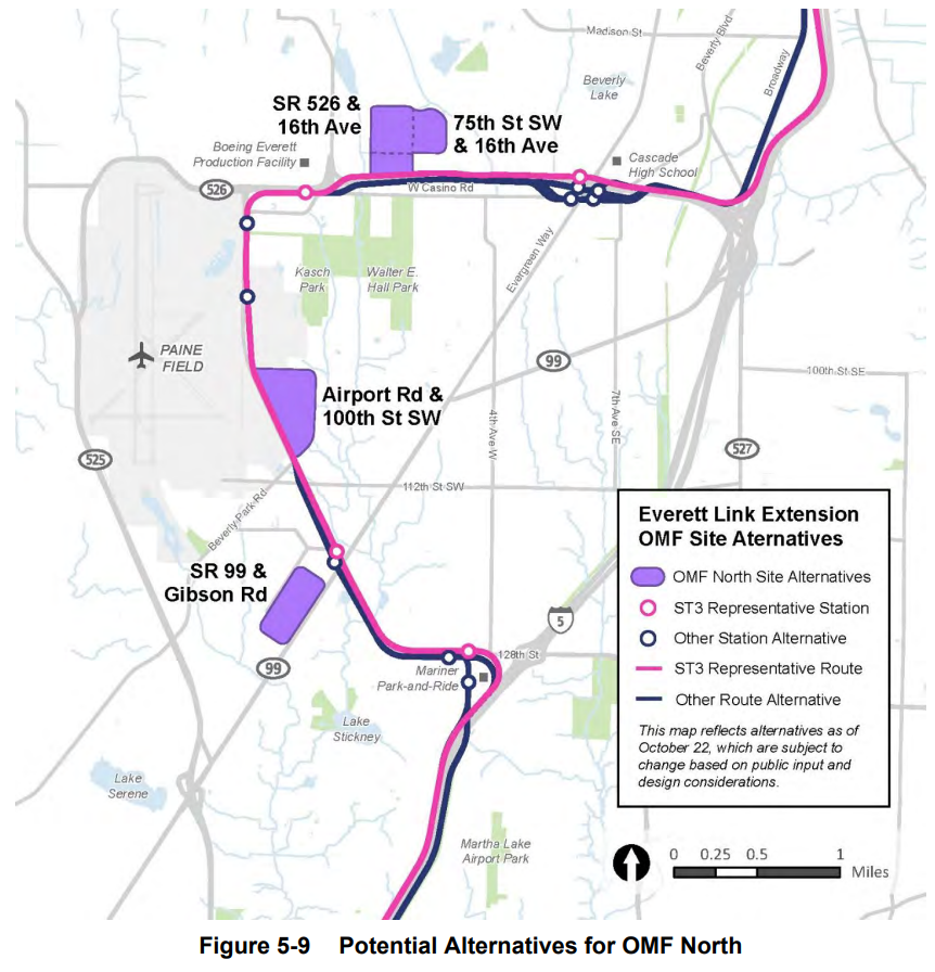
The DEIS will evaluate alternatives for dozens of alignments, six stations, one provisional station, and four sites for an operations and maintenance facility (OMF). Those alternatives have shaken out as follows:
By and large, it’s hard to get excited about many of these alternatives that have been identified as preferred or are otherwise set to be studied further. There are a lot of tradeoffs for them given the nature of the alignments being threaded through so much private property and overengineered station designs.
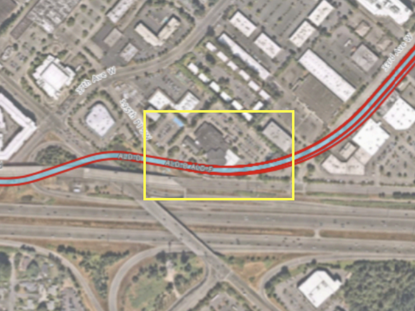
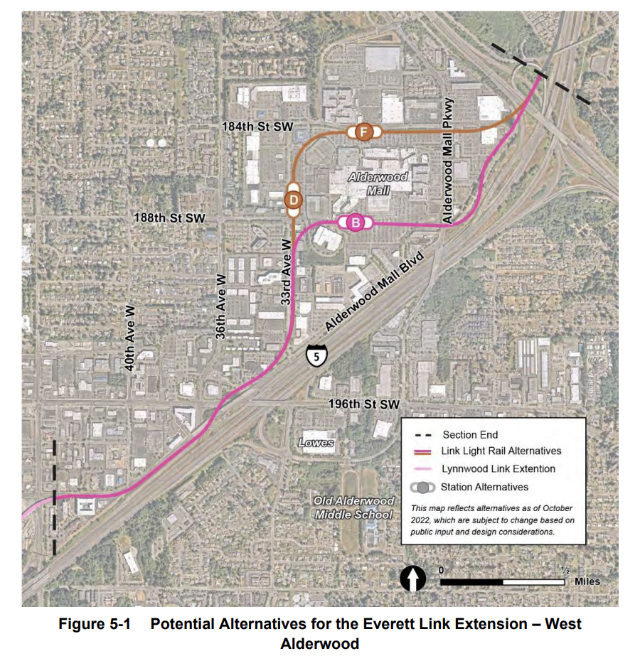
For instance, all three West Alderwood alternatives would plow through a church property as the alignment makes its way from Lynnwood City Center station to a station near the mall. Landing the elevated guideway itself on Alderwood Mall Boulevard — a massive stroad — is apparently a transgression against cars, but taking a house of worship is blessed. Whether or not the many pleas of churchgoers — some of who turned up to the June meeting — will be heard and change the hearts and minds of policymakers and planners alike remains to be seen.
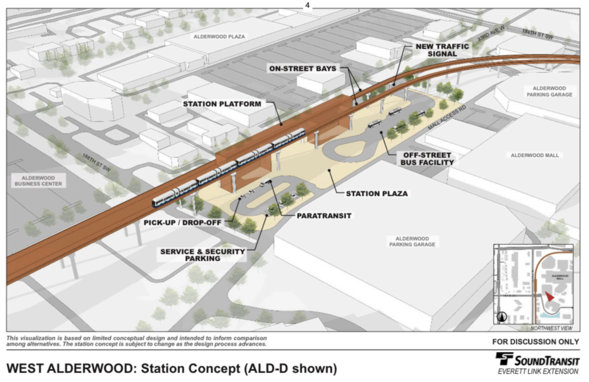
As for the West Alderwood station location alternatives go, ALD-D being preferred is a genuinely good choice. This would put a station in an optimal location for walk-to-station ridership and building up transit-oriented development compared to alternatives that place stations far too close to I-5. But like its alternatives, ALD-D is proposed to be an overbuilt station on private property rather than in the middle of 33rd Avenue W. Sound Transit is proposing to build West Alderwood almost as a transit center with tons of off-street add-ons that are wholly unnecessary. This station isn’t even getting a parking facility. Using a little curb space on 33rd Avenue W would more than suffice for bus stops and security/operations needs.
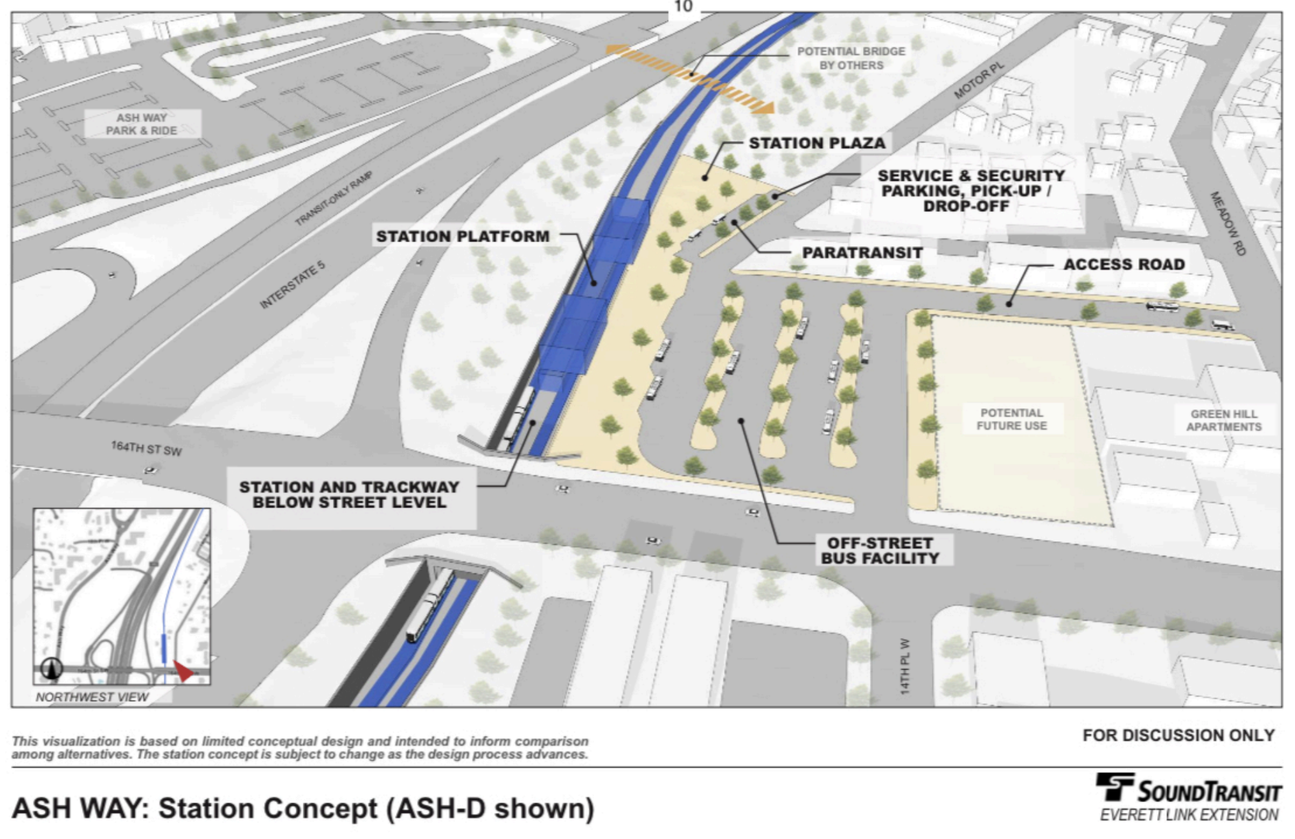
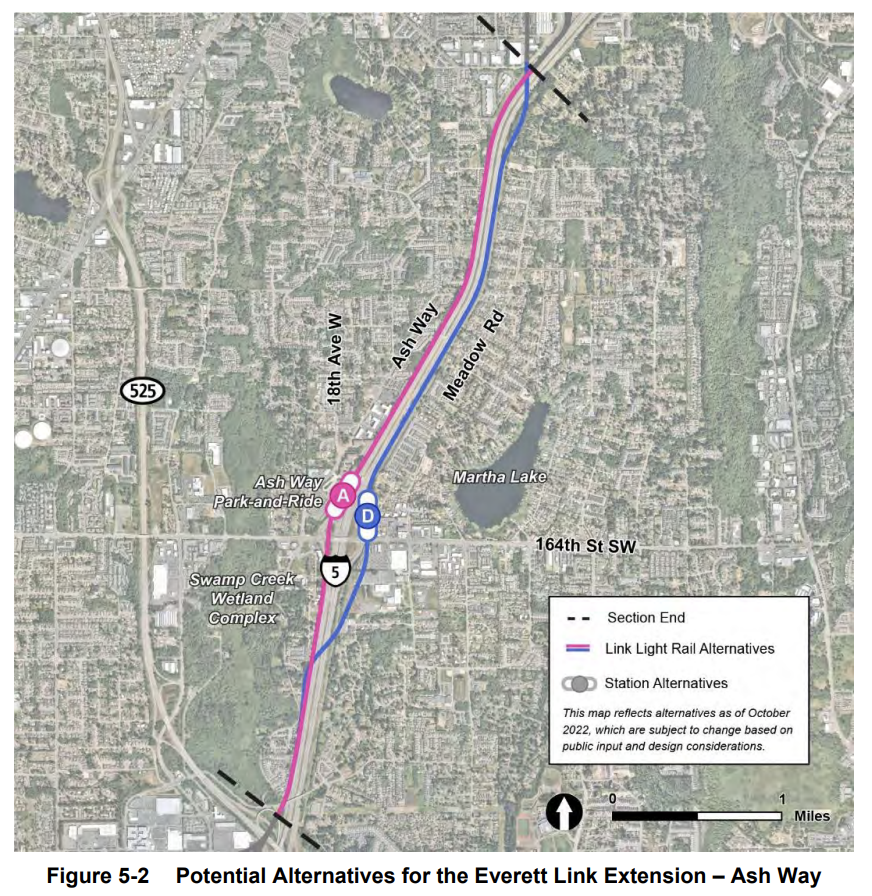
Similarly for Ash Way, Sound Transit is studying a genuinely good alternative east of I-5 (ASH-D) that has better transit-oriented development and walkshed potential, but the station design is on steroids. The agency is seriously considering acquisition of multiple properties, including another church, to build a massive off-street bus facility, replacing the existing one west of I-5. Once the Everett Link Extension opens, express and commuter buses are poised to disappear so there is little apparent benefit of an off-street bus facility over using curb space on 164th Street SW for bus stop zones.
164th Street SW is a terrible stroad, but an underpass is proposed for Link so expanding that ever so slightly more for the Interurban Trail and riders alike is an obvious solution. This would allow riders to alight and board eastbound buses on the south side of 164th Street SW without having to deal with the threat of the stroad. Better that than forever punishing bus riders with long waits at stoplights and loops to an unnecessary off-street bus facility.
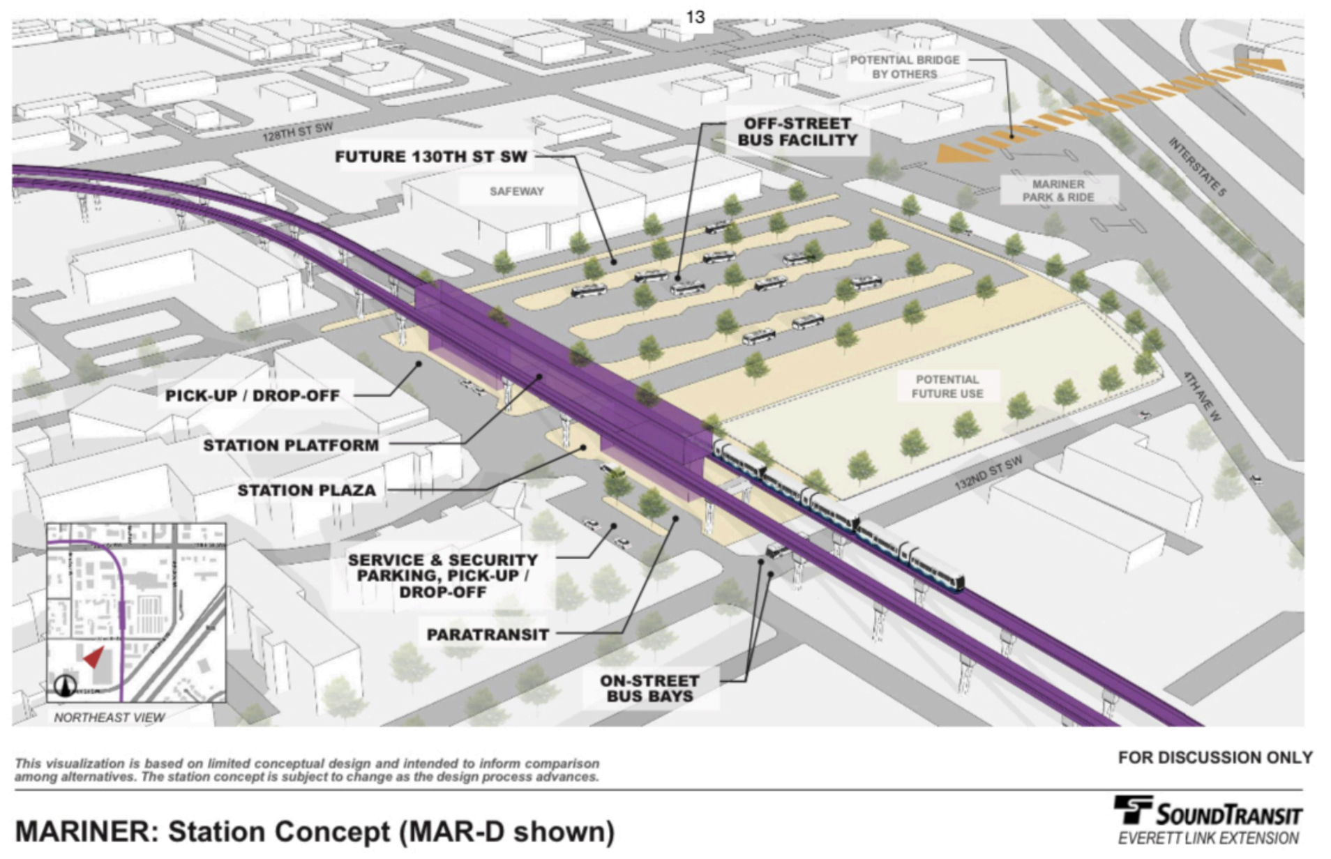
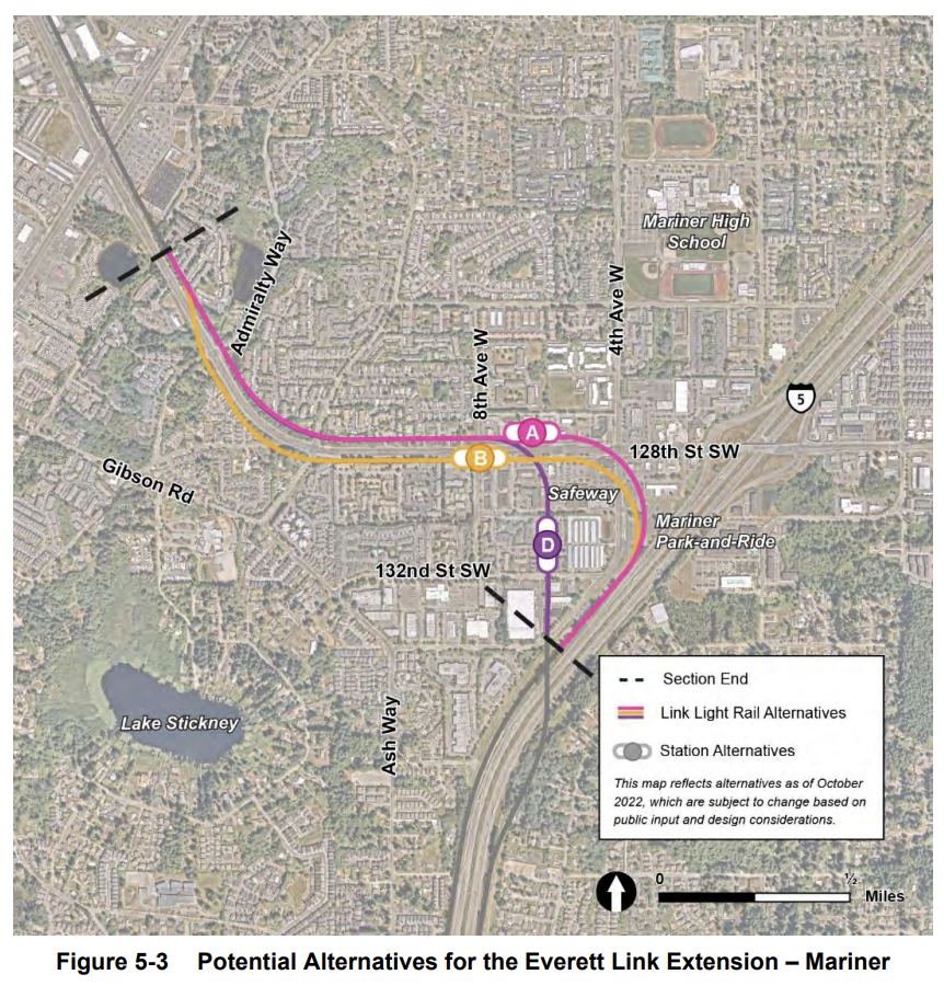
Just a bit further up the line, Sound Transit is tasked with looking at two alternatives for Mariner. MAR-D would pulverize many apartments and several businesses as it emerges from the south side of I-5 and reaches toward the Safeway commercial plaza just so it can be more centrally located and offer another massive off-street bus facility that isn’t needed. MAR-B is comparatively delicate, at least until it heads up 128th Street SW, by skirting most buildings and being better centrally located near 8th Avenue W on 128th Street SW. But west of here, both alignments continue via private property and require many more residential displacements.
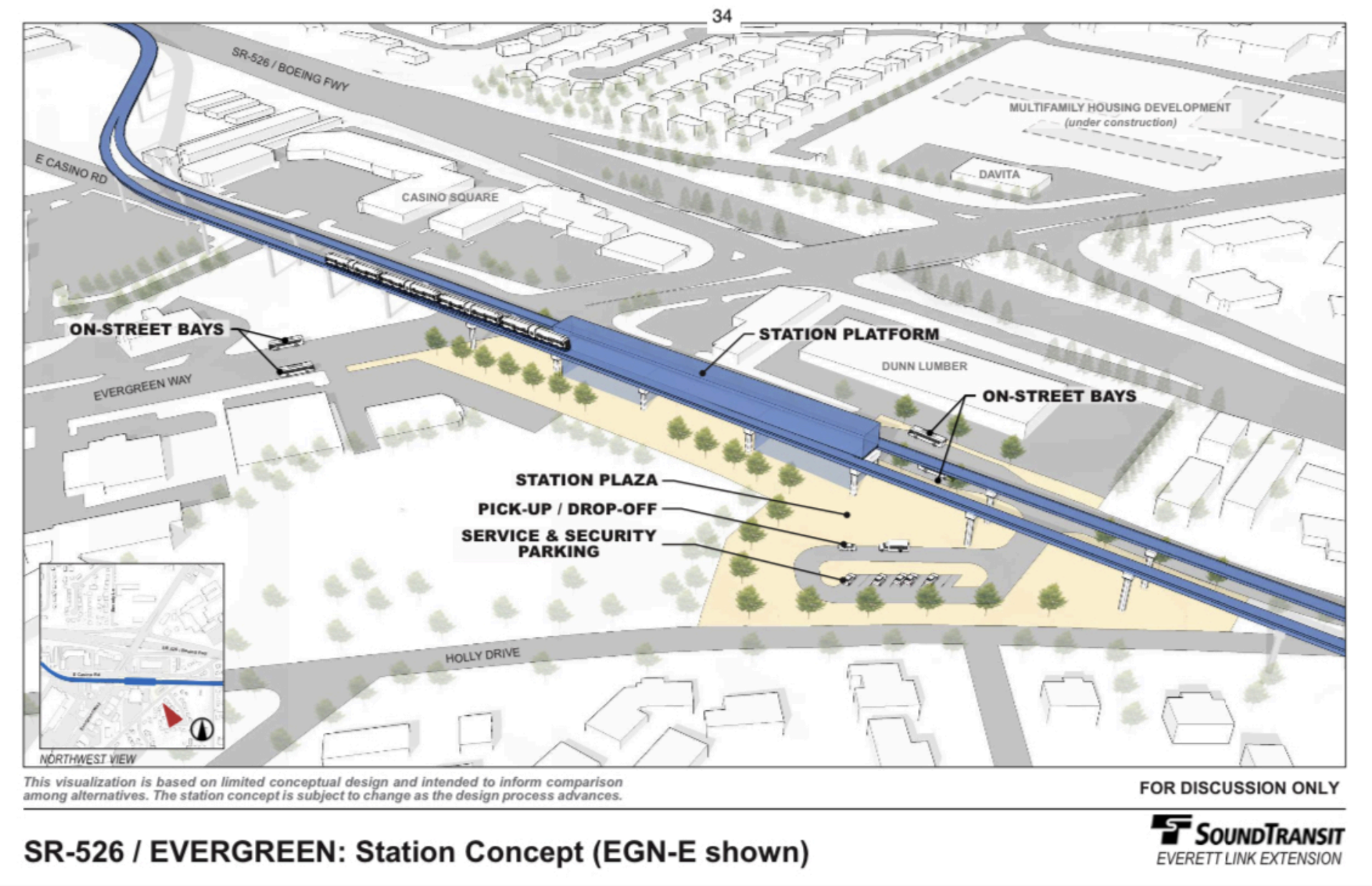
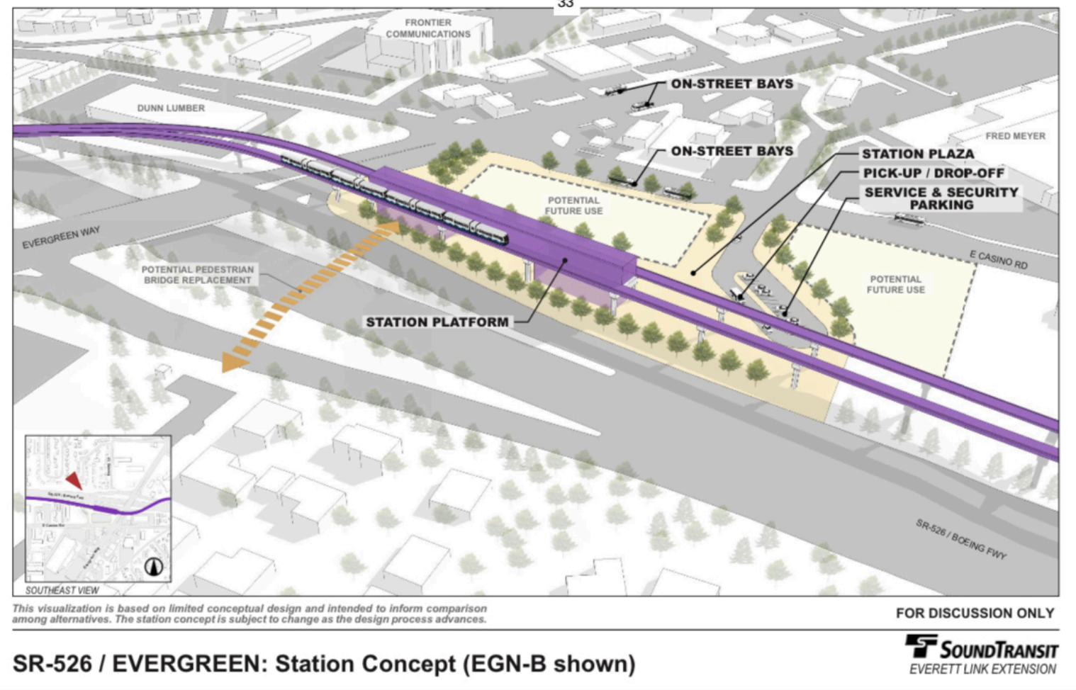
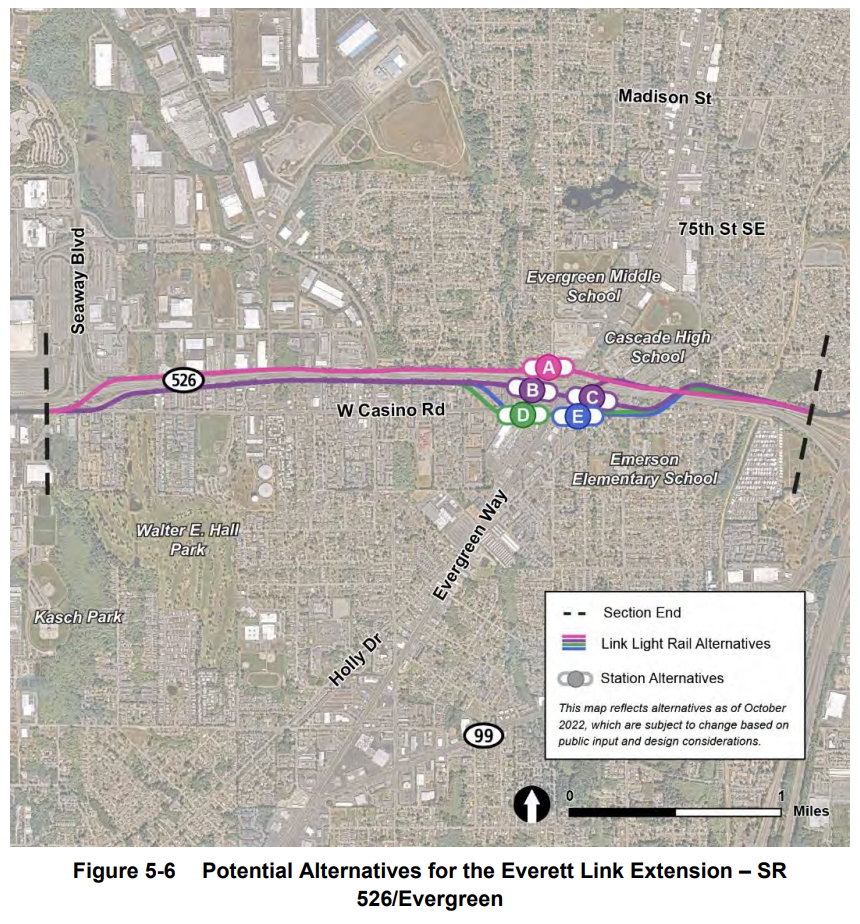
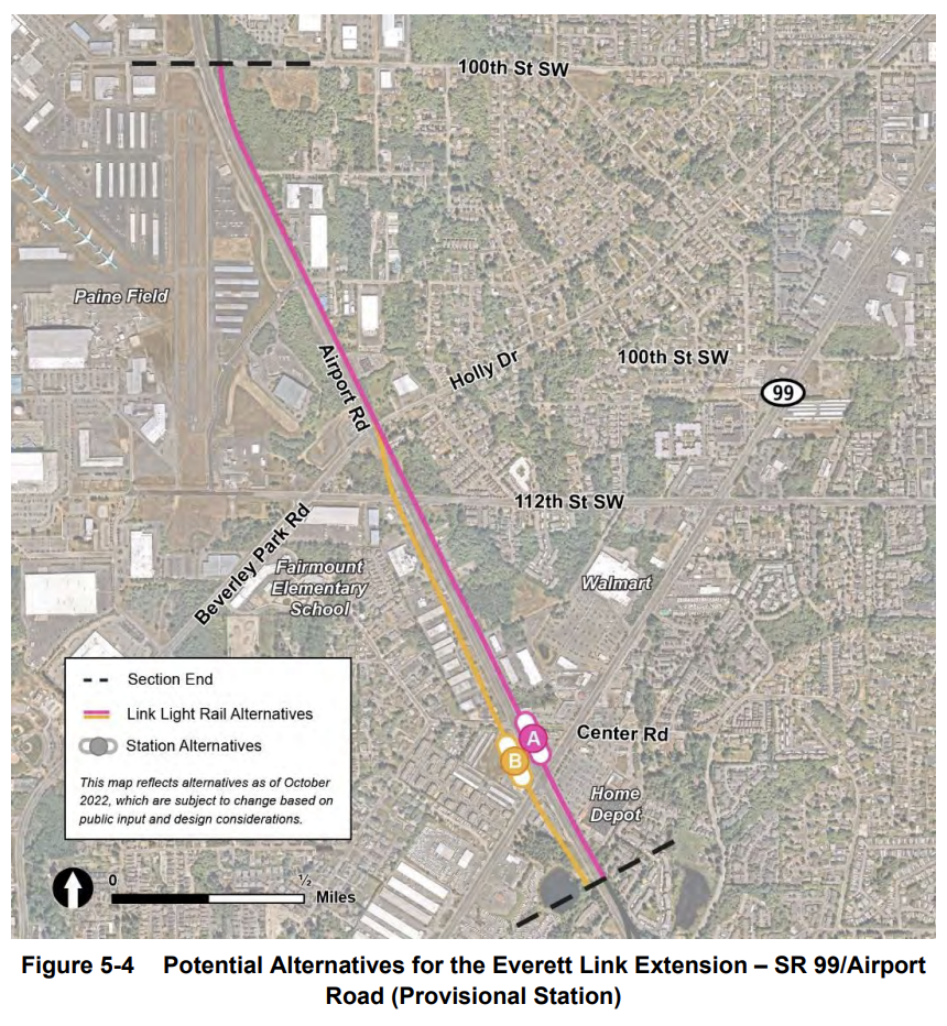
Once the alignment reaches toward Evergreen Way near SR 526, the remaining alternatives all leave a bad taste in the mouth. All of the alternatives south of SR 526 (EGN-B and EGN-E) would route the alignment through apartment complexes and commercial businesses in an area of primarily low-income and minority families and minority-owned businesses. On top of this, large station footprints would maximize commercial displacements because of Sound Transit’s peculiar obsession with unnecessary off-street bus facilities.
As for EGN-A, it would result in many fewer displacements, but the station location would offer substantially worse access for walk-to-station riders. Understandably, residents and advocates along Casino Road have been very vocal about getting this segment right to avoid harsh impacts. EGN-E could be a workable alternative if the station is right-sized and located in the street — as well as its alignments to the west and east — to eliminate the displacements.
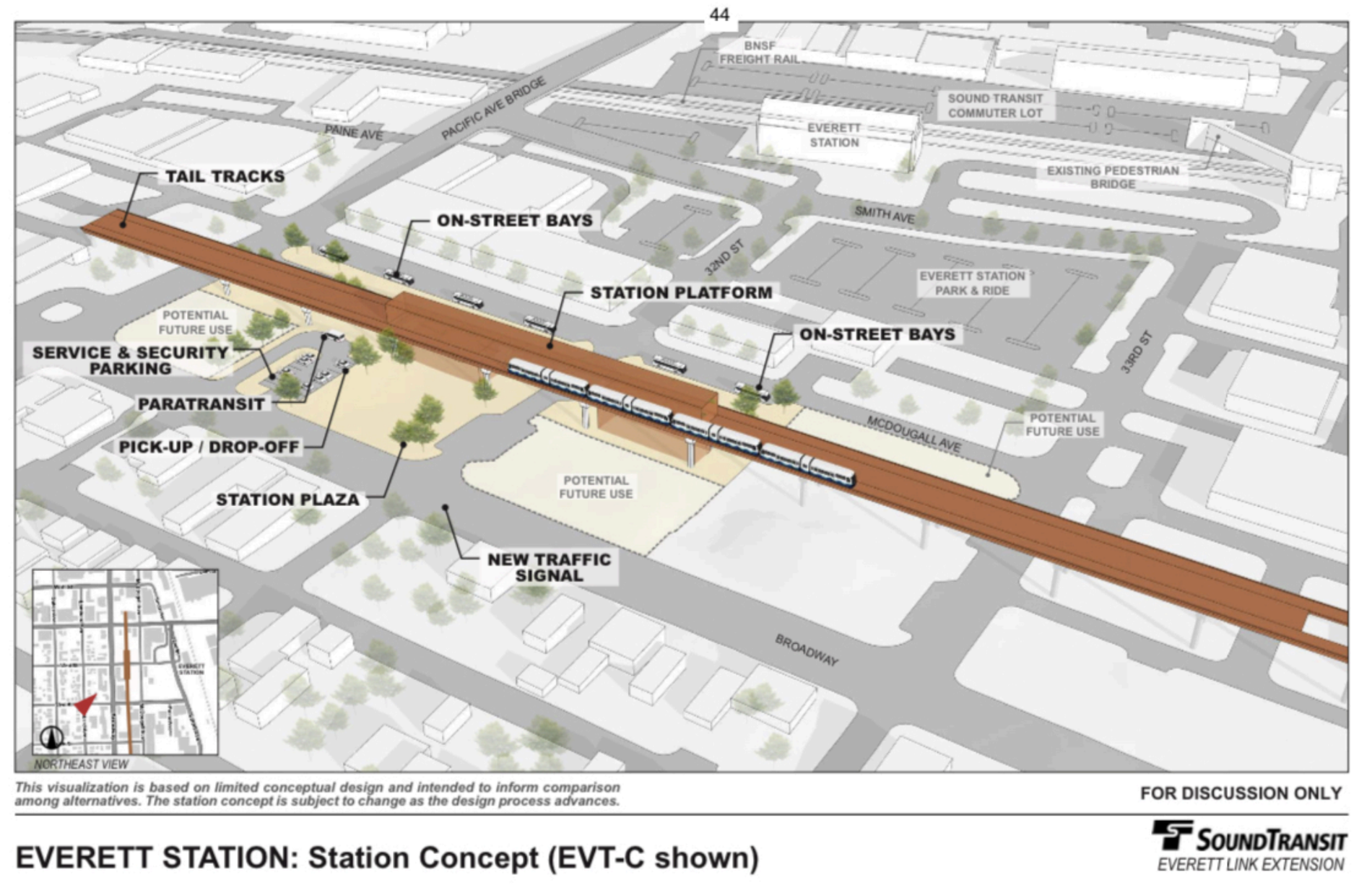
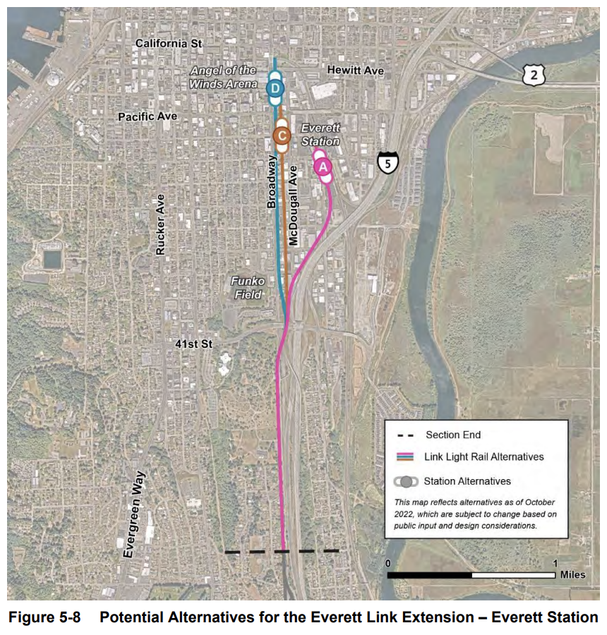
And then there are the decisions around an Everett Station station. Preferred alternatives (EVT-C and EVT-D) would actually abandon Everett Station and all the benefits it offers in order to locate yet another station near a massive jail complex or the Angel of the Winds Arena (and a possible new minor league baseball field). Both station alternatives would involve wiping out the blocks between Broadway and McDougall Avenue to build guideway and station facilities, at the cost of hundreds of jobs and low-income residents. Those station facilities would try to duplicate many of the features already present at Everett Station, such as bus bays, security and operations parking, and kiss-and-ride zones.
What these station alternatives would, however, lack is the superior station amenities offered at the real Everett Station and intercity transit options. And though parking is a decidedly poor investment to win Link ridership, the agency is slated to construct another 1,000 parking stalls at Everett Station. Co-locating a station (EVT-A) at Everett Station itself is the better choice. And ultimately, cumulative project savings could be put into planning and building a thoughtful and strategic Link extension deeper into Downtown and North Everett.
So far, the Everett Link Extension plans aren’t offering a lot of utility to Snohomish County residents. That’s, in part, the result of misdirected design priorities and a misunderstanding of the future transit network. Less impactful alignments and, perhaps counterintuitively, simpler stations would better serve the county. Adjusting alignments and stations to be elevated in streets offers greater opportunity to integrate them neatly with existing neighborhoods and surface transit while delivering better amenities beneath them, such as bike lanes, trails, and play spaces. It’s not too late to get Everett Link back on track, but right now the project is barreling toward a disastrous outcome.
Build Light Rail In-Road Instead of Demolishing Housing, Balducci Urges Sound Transit
Leaked Everett Link Plans Heavy on Displacement, Light on Connectivity