Sound Transit plans continue to avoid taking car lanes to site light rail. Greater displacement, less space for transit-oriented housing, and more dangerous crossings for pedestrians would be the result.
The Sound Transit board is poised to vote on alternatives to be studied in the Everett Link Extension’s first round of environmental review. But the alternatives set to be incorporated into that review process evoke more the horrors of the 1950s and 1960s highway building era than a modern rapid rail transit system that belongs in urban communities.
Alternatives hand-picked by Snohomish County officials threaten to needlessly displace hundreds of families and jobs and provide far from ideal conditions for transit. Some of the harshest alignments and station locations are in areas under the purview of Everett Mayor Cassie Franklin and Snohomish County Executive Dave Somers. Both leaders have brushed off criticism and refused to consider alternative alignments and designs supported by the public throughout the process.
Sound Transit’s approach is heavy on costly property takings
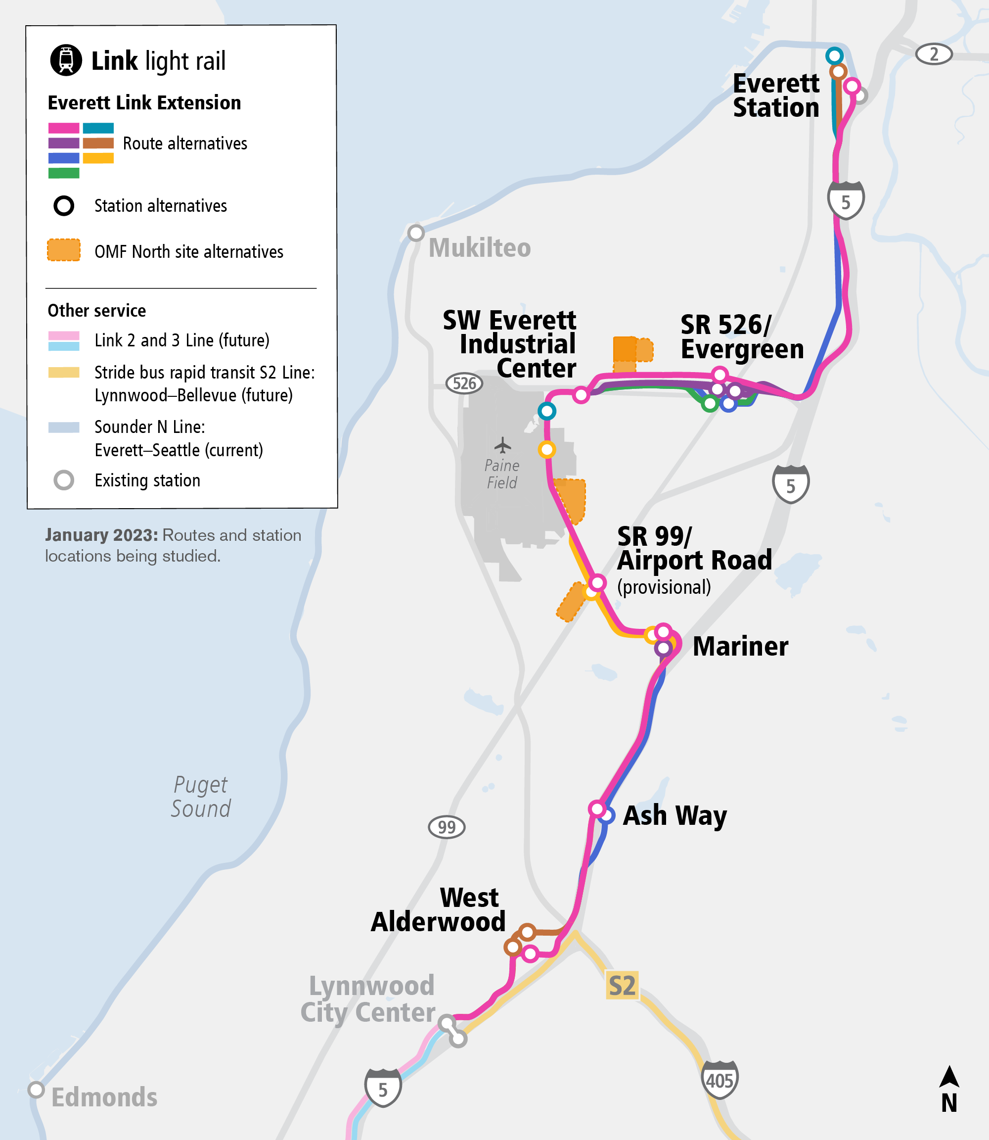
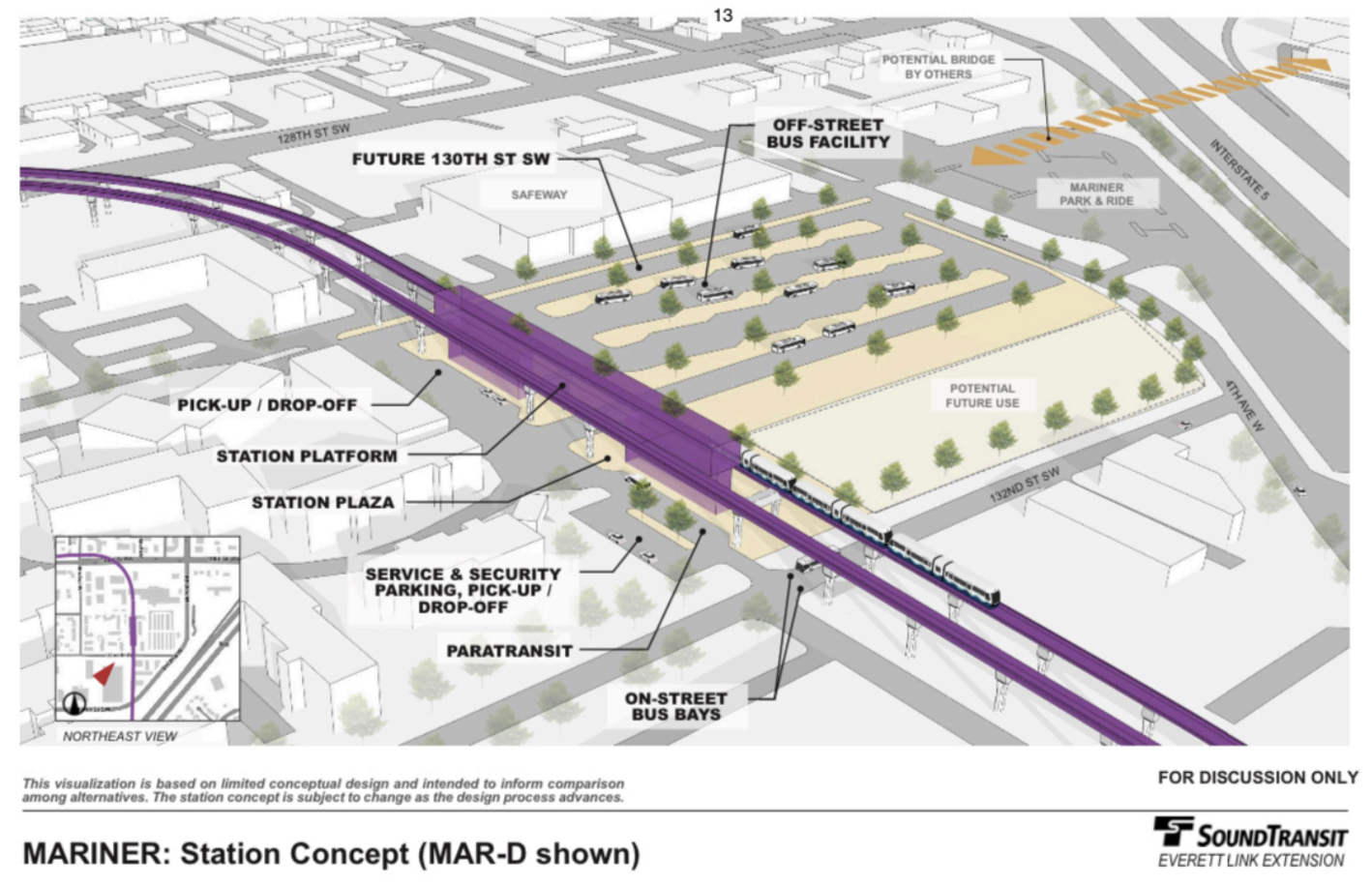
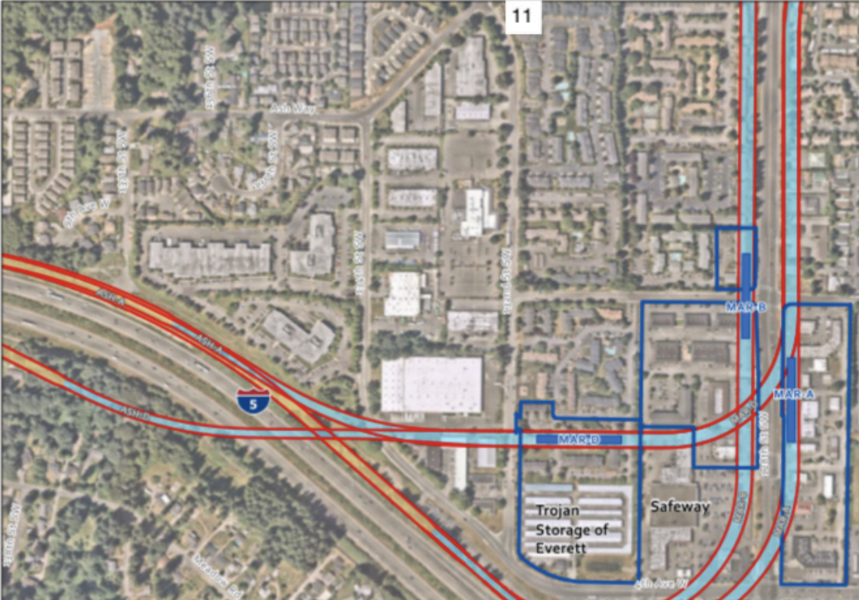
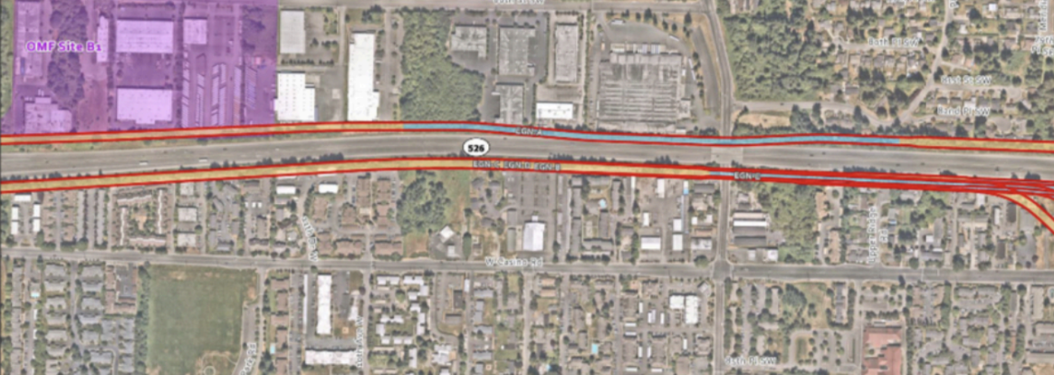
The areas that could see the most significant displacement impacts from Link expansion are Mariner-Lake Stickney, Westmont (Casino Road), and Port Gardner. By and large, these displacement impacts are avoidable, not inevitable. That’s because Sound Transit could locate its elevated guideway and stations into existing streets. The alignment alternatives that county officials have settled upon are almost universally parallel to streets and stroads that exceed 60 feet in width. That’s more than enough to accommodate guideway, pylons, and stations while maintaining sufficient lanes for car traffic.
Pursuing a property-takings-first approach to build a project like Link has serious cost and construction timeline drawbacks. This is because Sound Transit would need to make hundreds of costly and time-consuming property acquisitions with property owners, and then would have to push out tenants, clear properties of buildings and vegetation, and remove other improvements and features. The agency may also have to resort to even more costly and time-consumptive processes like eminent domain to take properties.
In acquiring properties, the agency faces a variety of potential scenarios. In many cases, buildings fall directly within conceptual alignments and station areas and would need to be taken as well as the land underneath them or their entire lot. In other cases, conceptual right-of-way doesn’t fall on buildings. The agency may only need to take a strip of the land in those cases but there are also many circumstances where the agency would still need to take whole properties since they may be left effectively valueless or undesirable. Each of those property acquisitions would be complicated and expensive to complete.
When properties are taken, Sound Transit can be on the hook for relocation assistance to displaced tenants and compensatory measures for on-site construction impacts to property owners. The agency also faces more complicated planning and design processes as well as delayed construction timelines. These costs all add up to a project already estimated to be well over budget under most scenarios and behind schedule.
Ultimately, focusing on in-street alignments would be a boon to more timely project delivery and save the Snohomish County subarea an immense amount of money that could be reinvested in building a better project.
Sound Transit moved to bury information on its concepts
Over the weekend, Sound Transit posted materials online for the upcoming agency board meeting on Thursday. That included a presentation showing detailed alignments, station locations, site plans, and guideway/station models. The Urbanist broke the news and shared a link to the presentation with important context on the alternatives’ impacts. That revelation led to a rash of swift and harsh criticism of the agency, officials, and designers’ thinking on the expansion plan strategy. Saying the link had been made public in error, the agency quickly took down the presentation link rendering it inaccessible to the public.
Following the link removal, Sound Transit told The Urbanist that the presentation was only meant as background material for agency boardmembers and was not intended for public consumption. However, given the critical nature of the information, this publication decided that it was in the public interest to post the presentation online and share it on social media.
Previously, Sound Transit had only published documents with generalized paths of alignments using same sized lines and approximate locations. That allowed only vague interpretations of potential impacts. But the newly surfaced presentation offers a much higher level of precision of guideway and station widths overlaid on aerial maps.
The scale of displacement tacitly contemplated in the presentation could be immense on some of the Everett Link extension segments if boardmembers don’t push back on the alignments and a perplexing property-takings-first approach.
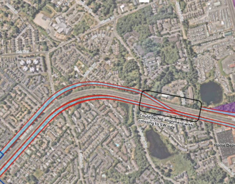
As seen with just these examples, the alignment alternatives include plenty of head-scratchers. Many apartments, townhouses, and businesses in some of the densest parts of Everett and unincorporated Snohomish County are right in the path of destruction. That could disproportionately impact low-income and minority families and minority-owned businesses.
But again, displacement is a policy choice that could be averted if Everett’s Mayor and Snohomish County’s Executive direct Sound Transit to put the alignment in streets that they own. Roger Millar, a fellow boardmember and Secretary of the Washington State Department of Transportation (WSDOT), has already shown a willingness to allow Sound Transit to convert lanes on WSDOT-owned right-of-way to transit.
Everett Link planning driven by vibes, not data
The fact that Snohomish County leaders prematurely quashed study of any other substantive alignment and station alternatives between Mariner and Everett Station is highly problematic and a loss for communities. Snohomish County leaders have relied upon unsubstantiated vibes on the future to drive their decision-making over hard data, real circumstances, and public feedback. During the early alternatives analysis process, the public strongly supported more out-of-the-box thinking that would deliver a better transit project for the Everett area, offering more local stops, serving many more riders, and doing it faster.
To date, Sound Transit has not provided useful qualitative and quantitative information to support county leaders’ preferred alternatives. Information has consistently been squishy and vague. At no point has the agency published comparable ridership numbers for options or definitive cost estimates.
Ahead of a vote Thursday, Sound Transit has published information that is equally unhelpful in evaluating the remaining alternatives that could end up in the Draft Environmental Impact Statement. The agency has offered two pieces of information to theoretically aid in decision-making: tables with recommendations for remaining options in each segment and tables analyzing performance of options. On first blush, these may sound useful but when actually referring to them it becomes obvious that they don’t provide the kind of quantitative and qualitative information that a decision-maker should want.
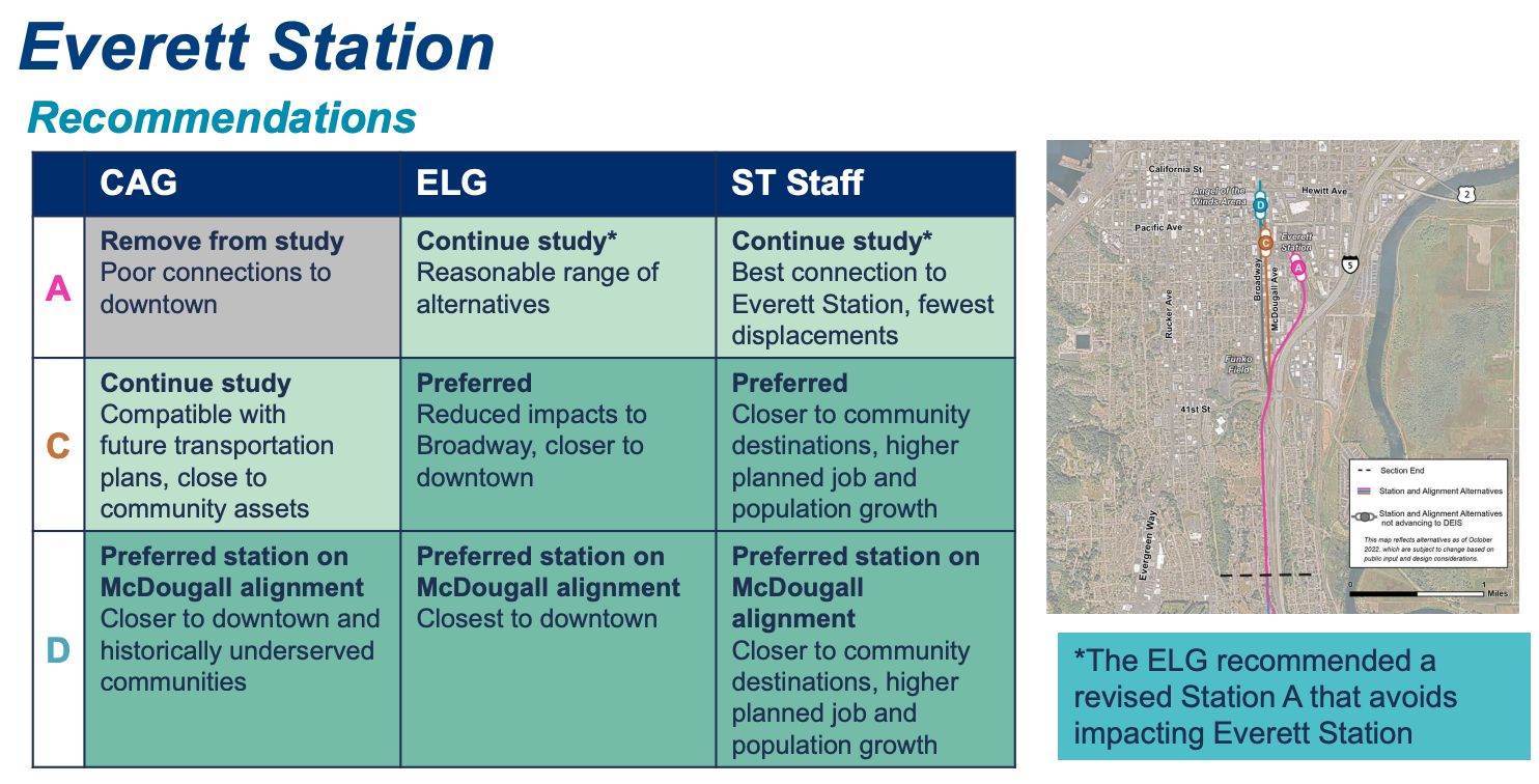
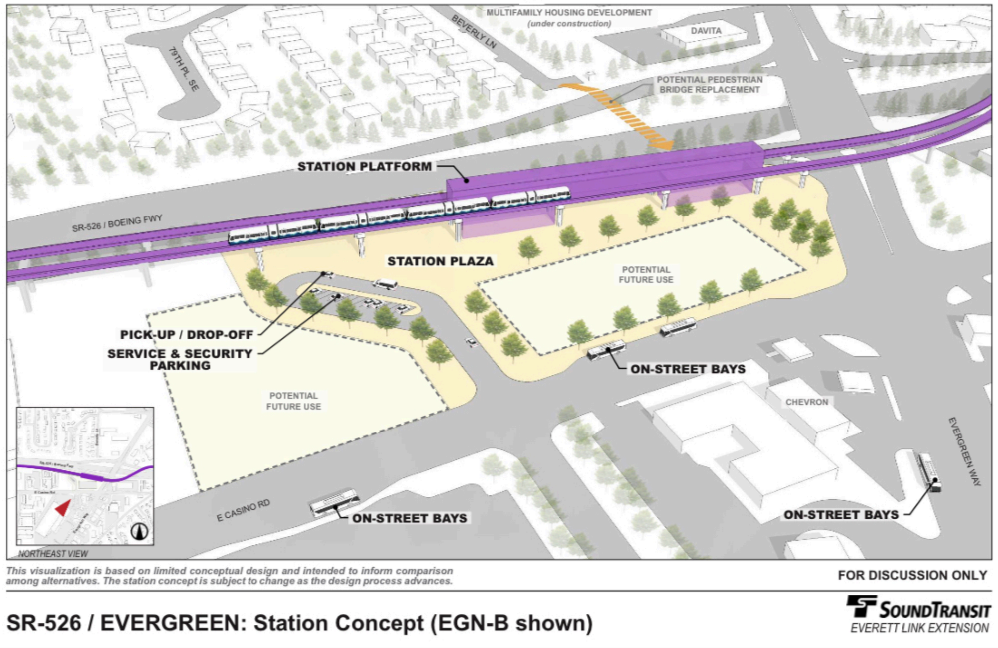
The recommendation tables lay out each option and then notes recommendations made separately by the Community Advisory Board, Elected Leadership Group, and Sound Transit staff. These recommendations each briefly note things like “fewest displacements,” “closer to community destinations,” and “higher planned population growth.” Recommendation boxes also indicate if the group recommended continued study, removal from study, or a preference for a given option. In the case of the Everett Station segment, the recommendations incredibly don’t provide quantitative information with the statements provided and in the case of the Broadway and alley alignment options never states clearly the impact they would have on displacements.
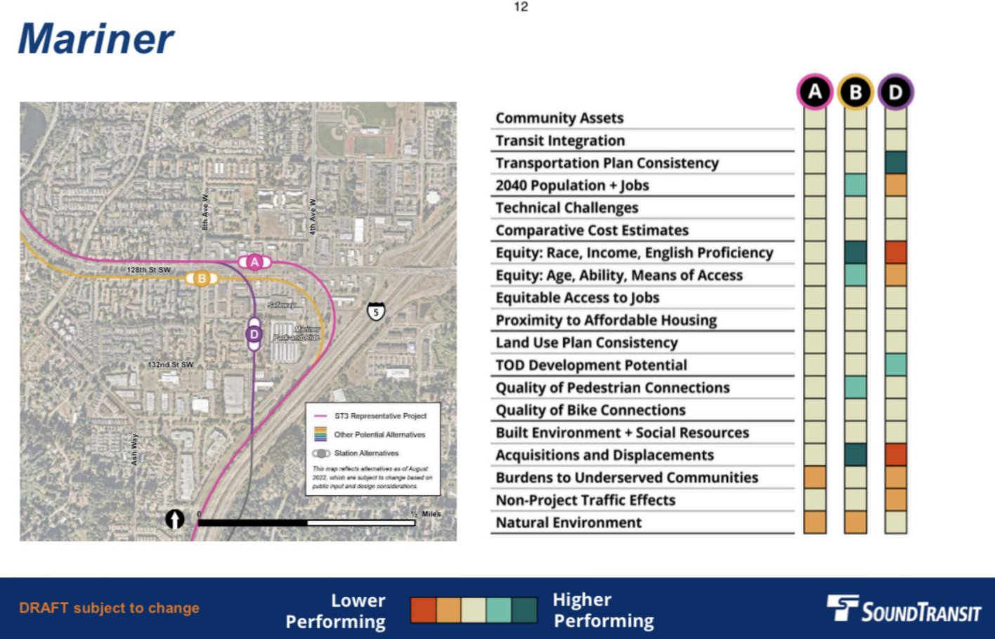
The tables analyzing options for a given segment also lack any genuine use in decision-making. None of these are accompanied by hard quantitive information and all of them merely make a performance assessment in relation to the other remaining options. It doesn’t make an assessment if other options that have been removed may have been higher performing and essentially makes all of the metrics seem like they are equal because there is no quantitative and qualitative information to support and explain them. Whether or not these are even the right metrics to make an evaluation is just an assumed given. In short, the tables read more like the justifying of a decision after the fact than a serious analysis.
It’s still possible to change course
With the Sound Transit board set to express a dozen or so preferred options for the Draft Environmental Impact Statement review process, it is important that the board chooses the best preferred options to study among a decidedly bad bunch. That starts with making a corridor-wide policy choice to put stations and alignments in existing street right-of-way as much as possible.

Pylons need not take up much right-of-way and can be situated in multiple areas of a street. The agency can also study guideway alignments that are set to one side of the street instead of the middle to allow for expanded sidewalks and protected bike lanes under them. Stations can similarly be located to one side of a street for direct access to sidewalks and pedestrian crossings as well as community and station amenities. With the width of some stroads, bus bays and drop-off zones could be located immediately next to the stations in the street for efficiency.
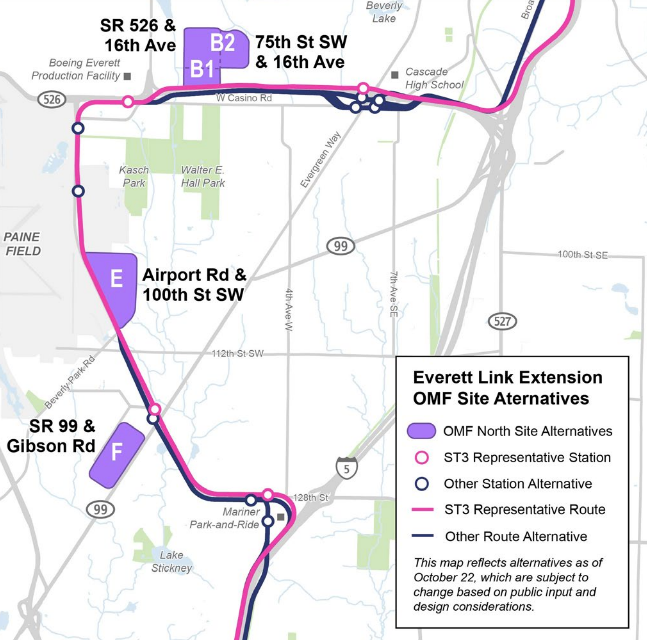
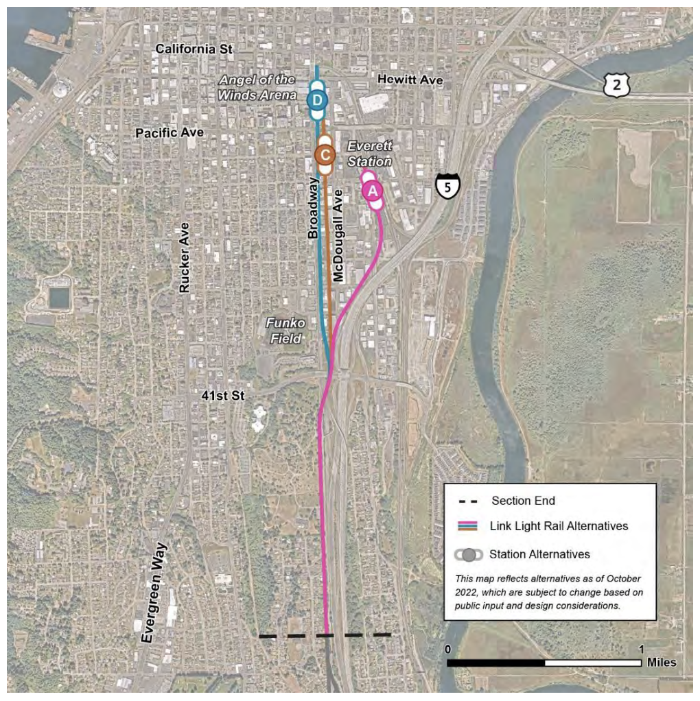
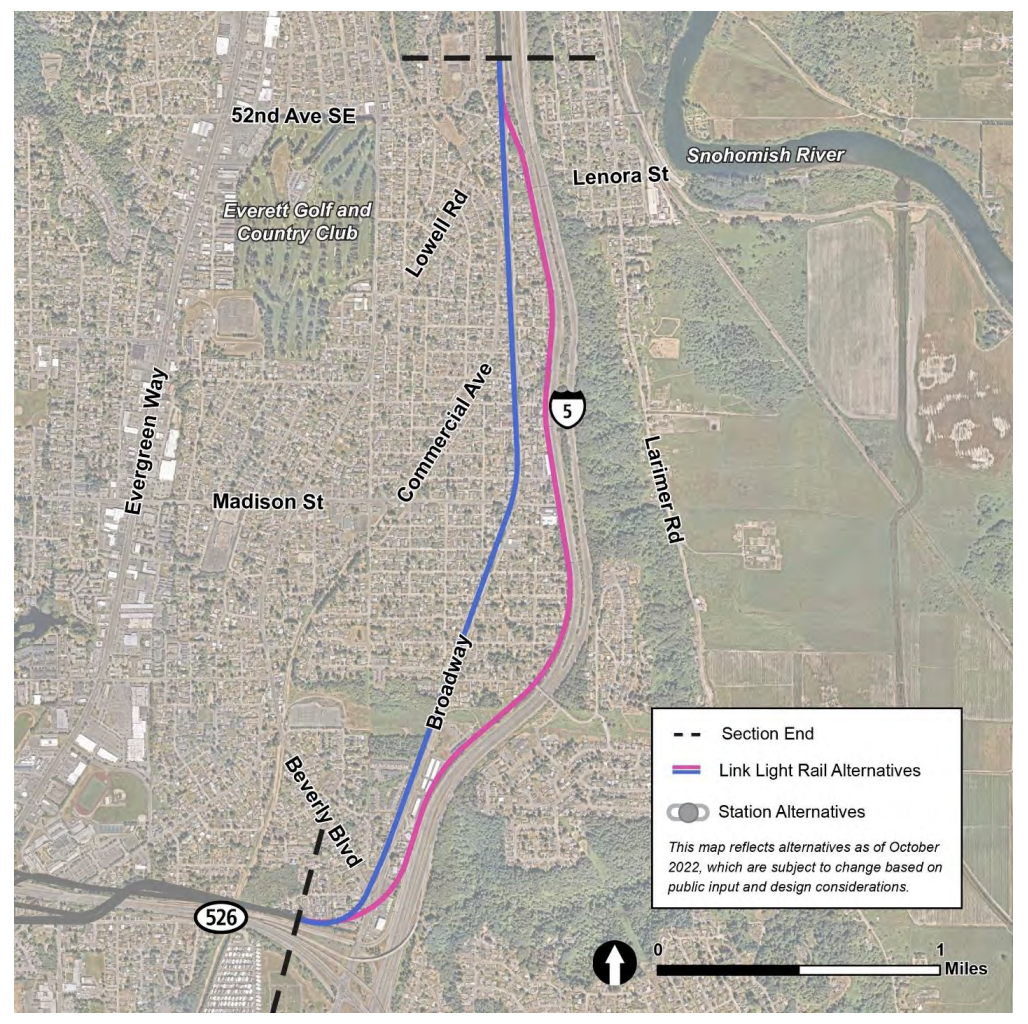
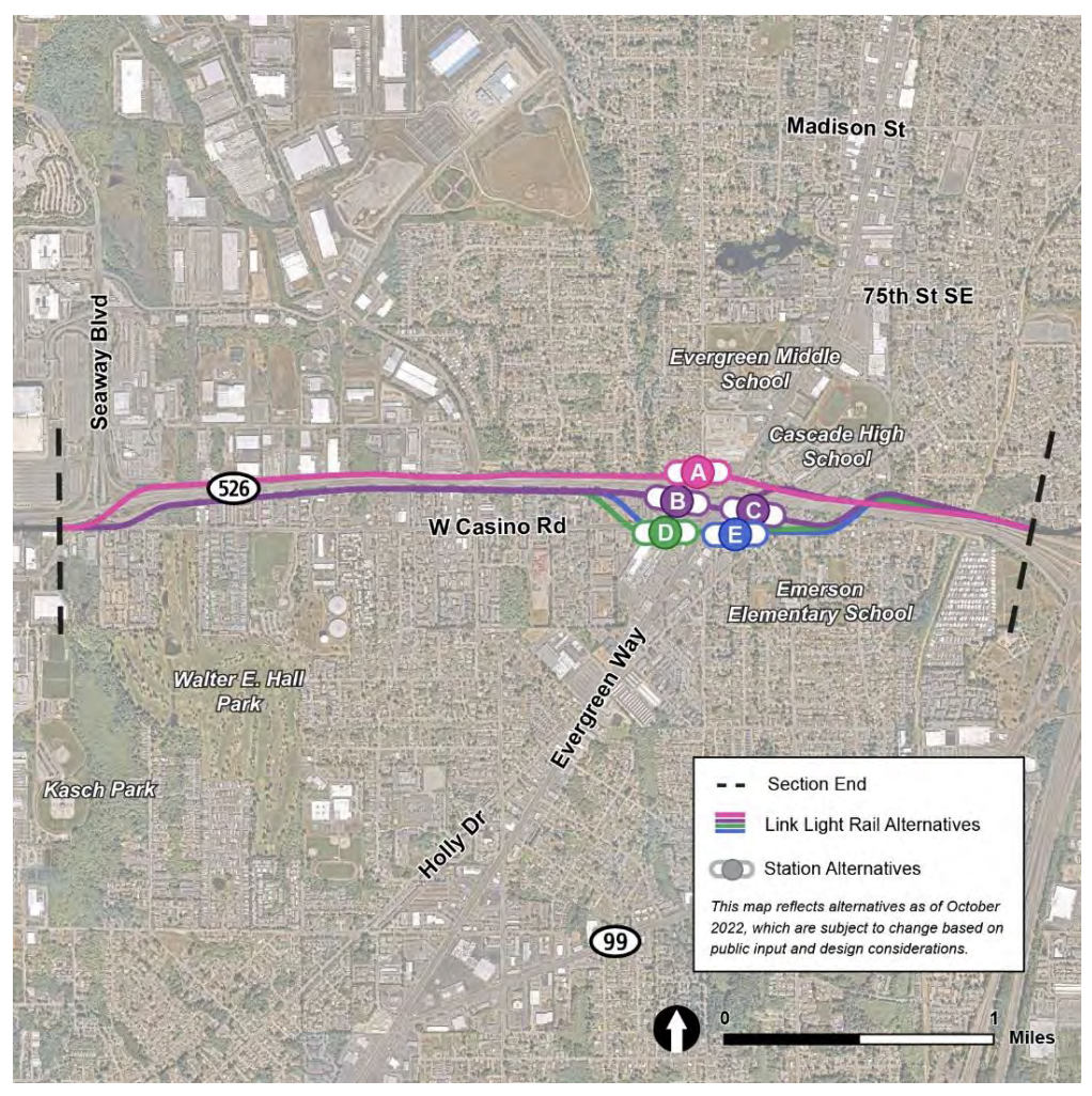
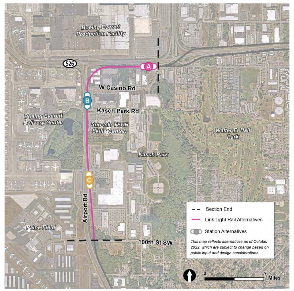
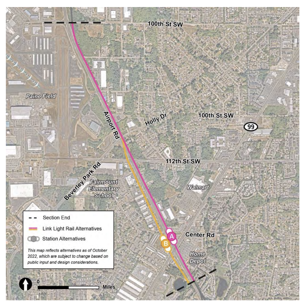
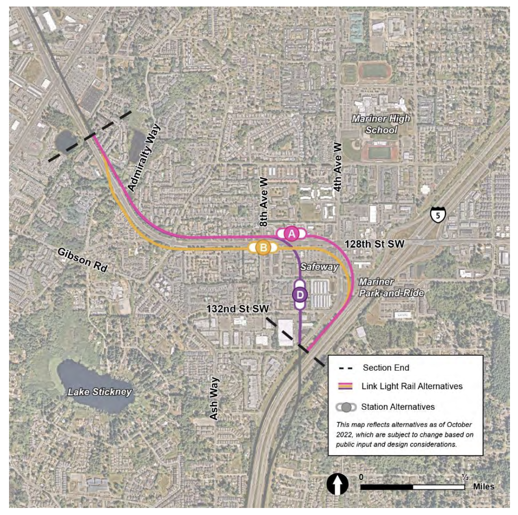
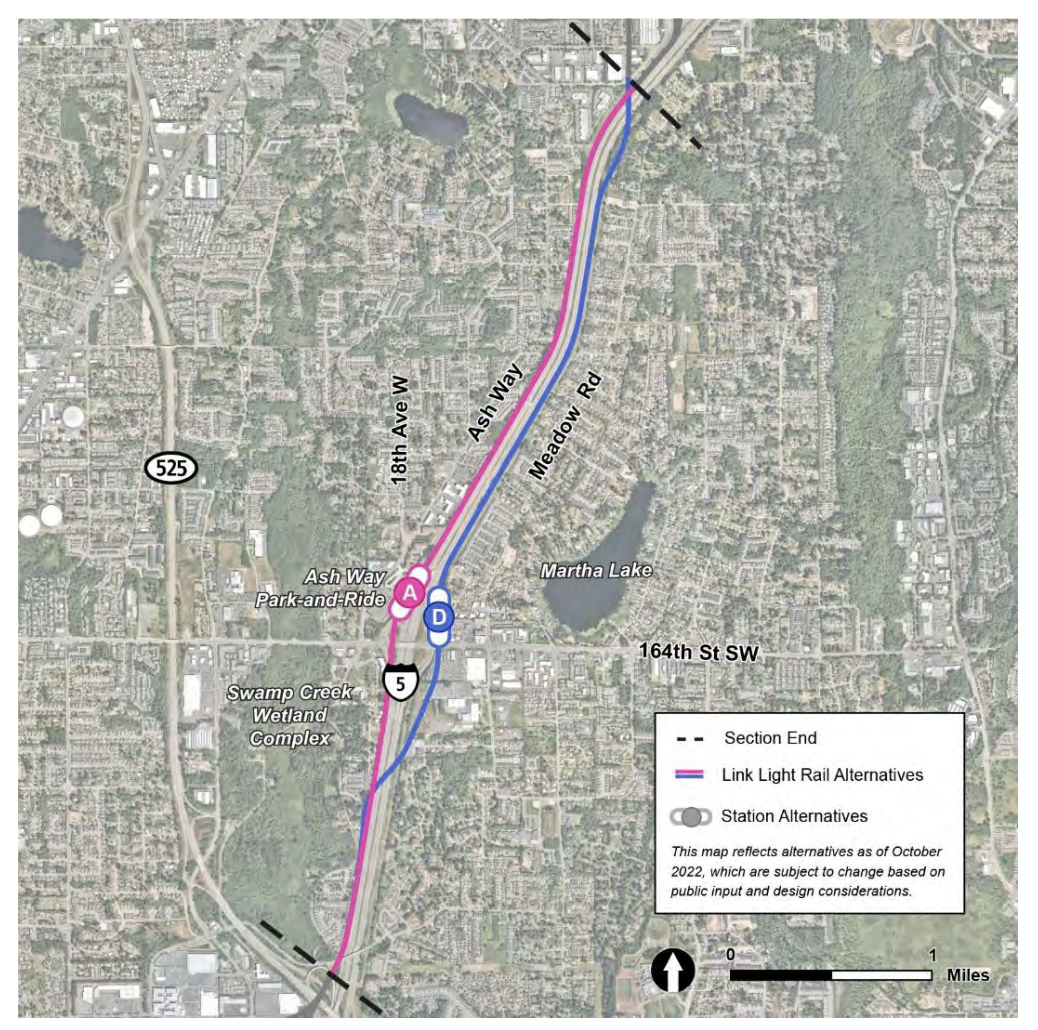
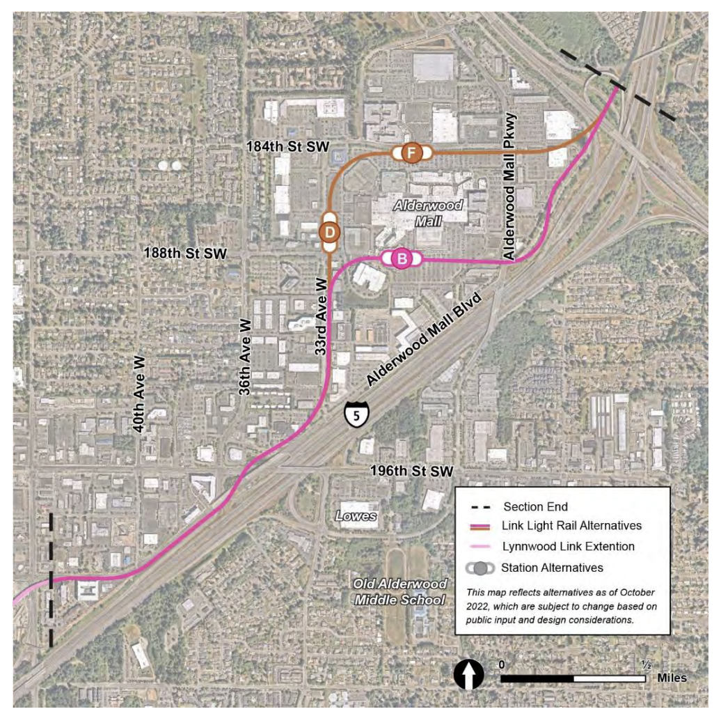
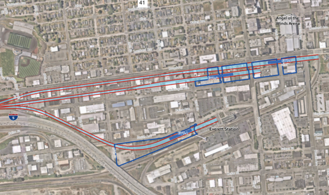
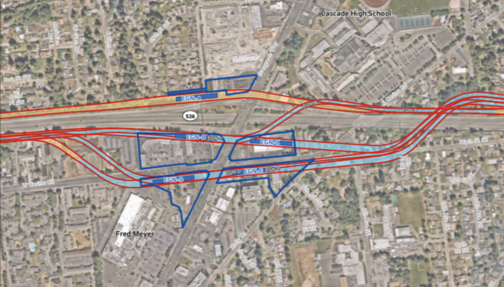
If the Sound Transit board proceeds with the remaining corridor options rather than a wider look, the body should also select the following options as the preferred ones:ALD-D for Alderwood West;ASH-D for Ash Way;MAR-B for Mariner;AIR-A or AIR-B for SR 99/Airport Road (unfunded provisional station);ENG-D or ENG-B for SR 526/Evergreen;BRD for the stationless I-5/Broadway segment;EVT-A for Everett Station; andSite F for OMF North.These options maximize the potential to tame dangerous roads, facilitate walk-to-station ridership, connect with other area transit options, encourage land use compatibility, support future infill station options, and avoid technically challenging properties and corridors.A broken process that never should have happenedTaking an excessive amount of private property to build an urban rapid rail system is not a best practice. It is an expensive and myopic folly that begets complicated, delayed projects and leaves a wake of destruction behind it.Unfortunately, Everett Link plans are using the bluntest, one-size-fits-all highway building approach to transit. Blame for that falls on elected leaders who have been steering the ship to run aground. But blame also falls on Sound Transit for structuring a process that has enabled such myopic decision-making, threatening displacement and subpar transit outcomes because of a failure to course correct and live with tradeoffs.Snohomish County should be getting the very best for the billions it will be spending on the Everett Link Extension. Building a lot of mileage of track will be a mere consolation prize though if communities get very little local connectivity to go with it. With an average station stop distance reaching 2.7 miles and spending potentially topping $1.5 billion per station when all is said and done, Everett and Snohomish County is on course to have very little to show for all the years fighting to complete the spine.Ultimately, to call the Everett Link planning process to date “flawed” would be the kindest of descriptions. But the Sound Transit boardmembers could change that. It’s up to them whether it stumbles clumsily and foolishly into environmental review to create costly generational mistakes, or is straightened out to serve generations of Snohomish County residents well.
You can contact the Sound Transit board ahead of Thursday’s meeting at both emailtheboard@soundtransit.org and meetingcomments@soundtransit.org. You can also provide public testimony in-person or online.
Editor’s Note: Stephen Fesler is a former Snohomish County land use planner and worked on the Everett Link project, and thus has specific knowledge of the project, local planning considerations, and area transportation and land use circumstances.