Today we will visit six street ends (and one great vantage point that is not a street end) on Lake Union. In previous posts, we have looked at street ends around West Seattle, South Ship Canal, from Ballard to Fremont, from Fremont to Portage Bay, as well as the Duwamish Waterway. The last post was for the street ends of Portage Bay and Union Bay.
For those new to this series, a little background on Seattle’s Shoreline Street Ends is helpful. Because Seattle is bounded and divided by numerous fresh and salt bodies of water the city has what are called ‘street ends’ — streets that end when they encounter a water body often continue under the water, sometimes resulting in mini-parks or recreational spaces. There are hundreds of such occurrences – almost as many as there are east-west and north-south streets.
Many of them, 142 to be exact, are part of a Seattle Department of Transportation (SDOT) program called Shoreline Street Ends. The program’s goals are to:
- Help create great neighborhoods;
- Improve public access to and enjoyment of Seattle’s shoreline;
- Enhance shoreline habitat;
- Encourage community stewardship of shoreline Street Ends;
- Support maritime industry; and,
- Responsibly manage private permits and deter non-permitted encroachments.
A little over half of the 142 street ends are defined by SDOT as “worth a visit,” while the remainder are either “not yet ready for visitors” or have “no public access.” Street ends are concentrated along the Ship Canal and Lake Washington, but also occur along each of the city’s other shorelines. Working with the city and neighborhoods to secure funding, pass legislation, and organize work parties, the non-profit and all-volunteer Friends of Street Ends help ensure Seattle’s accessible street ends grow in number and those already serving visitors continue to thrive.
Shoreline Street Ends vary in character from sandy beaches to docks wedged amongst shipyards and industrial uses. They are spacious and they are compact, and most are very easy to find. They support habitat for native species of flora and fauna and are convenient places to launch a kayak, sailboat, or motorboat. Oftentimes, they are adjacent to waterfront parks, expanding upon those assets. They are as varied as Seattle’s topography, and you can visit them any time.
Cycling is the best way to visit Seattle’s shoreline street ends. Many are accessed from low-traffic streets or bike paths.
Introduction
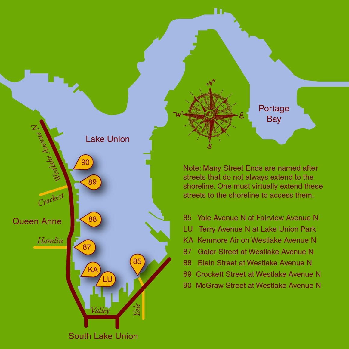
Lake Union has 16 ready-for-visitor street ends, six which occur on its southern and western shores and are profiled in this post. The three street ends on its northern shore between the Aurora Bridge and Ship Canal Bridge were written about in a previous post, and those along the eastern shore will be featured in a future post.
Lake Union, Portage Bay, along with the Ship Canal and Salmon Bay, are the heart of Seattle’s maritime activities. The street ends highlighted here give an unrivaled window through which to admire their pleasure and commercial ships, as well as the float planes that lend this body of water its vibrancy. Non-motorized uses are in abundance, too, be they paddleboarders, sailors, swimmers, or daring high divers. The expanse of the lake opens up great views to Downtown, Queen Anne, Wallingford/Fremont, and Capitol Hill.
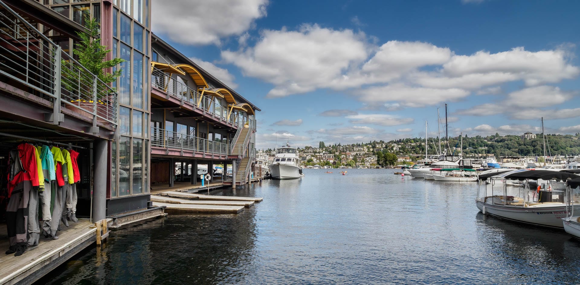
#85 Yale Avenue North
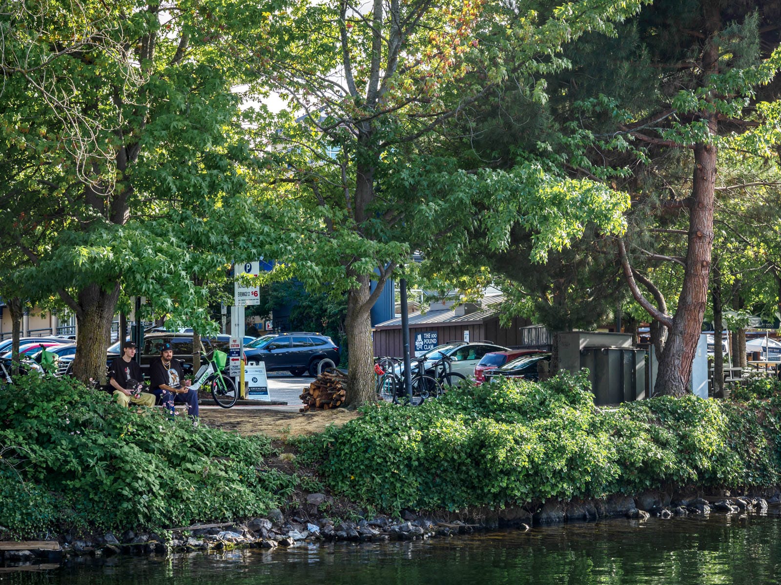
Street End #85 Yale Avenue North on the Lakes’ southern shore is, like many those featured in previous posts, it is quiet, leafy, and has a bench allowing friends to enjoy it.
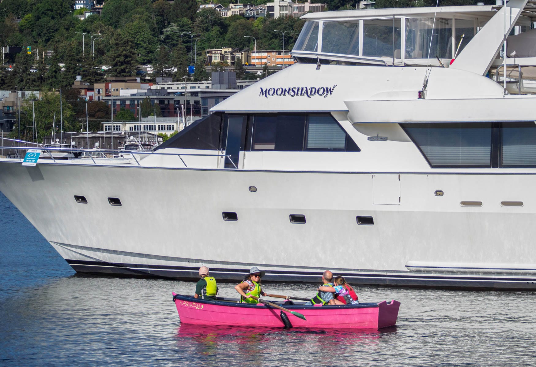
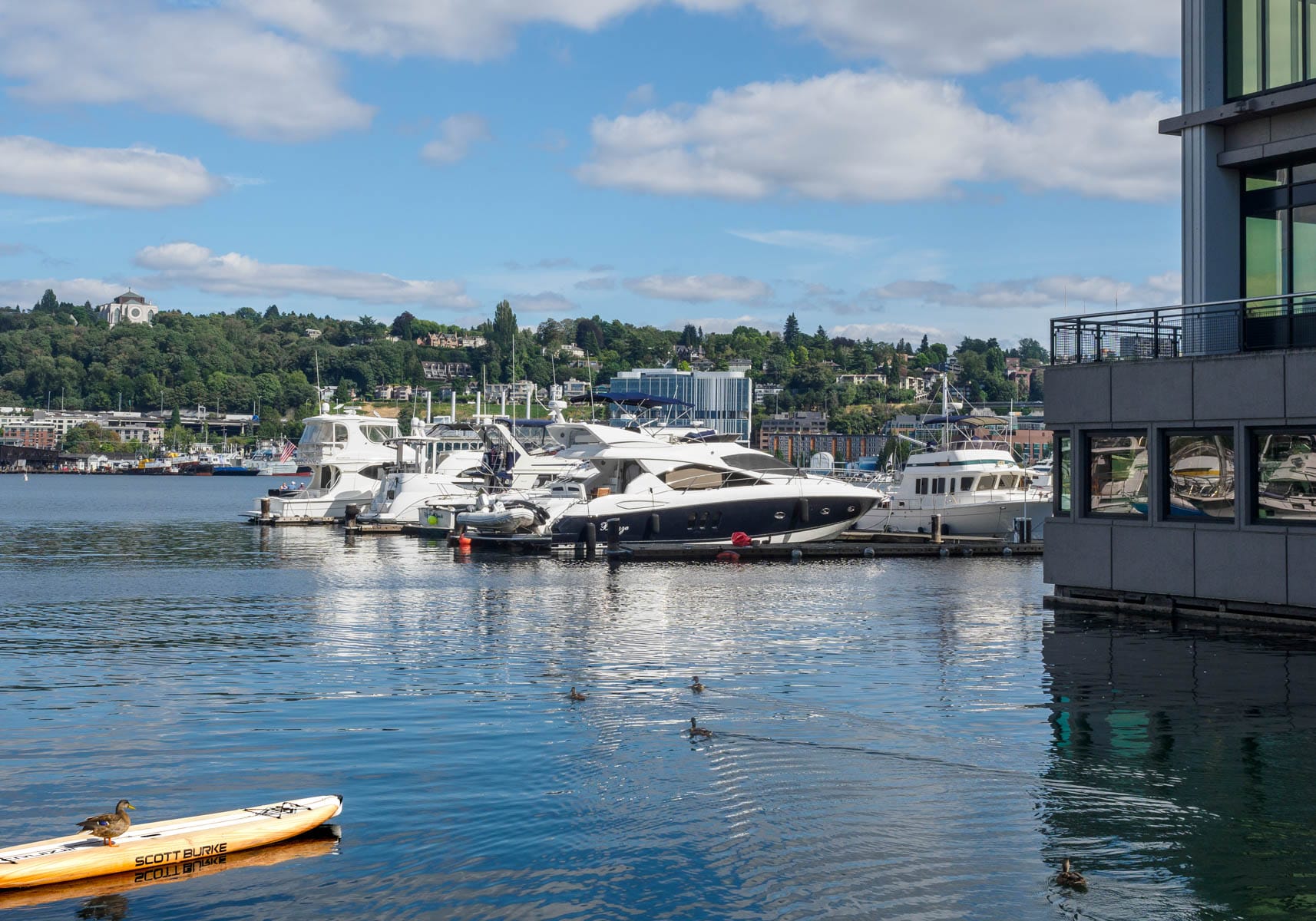
Lake Union has the greatest diversity of uses of any of Seattle’s water bodies, and includes at least a dozen marinas, dry docks, and even a seaplane base. At its southern end, there is Lake Union Park, downtown’s largest. Paddleboarders and kayakers abound in its waters, thanks to the many access points along its shores.
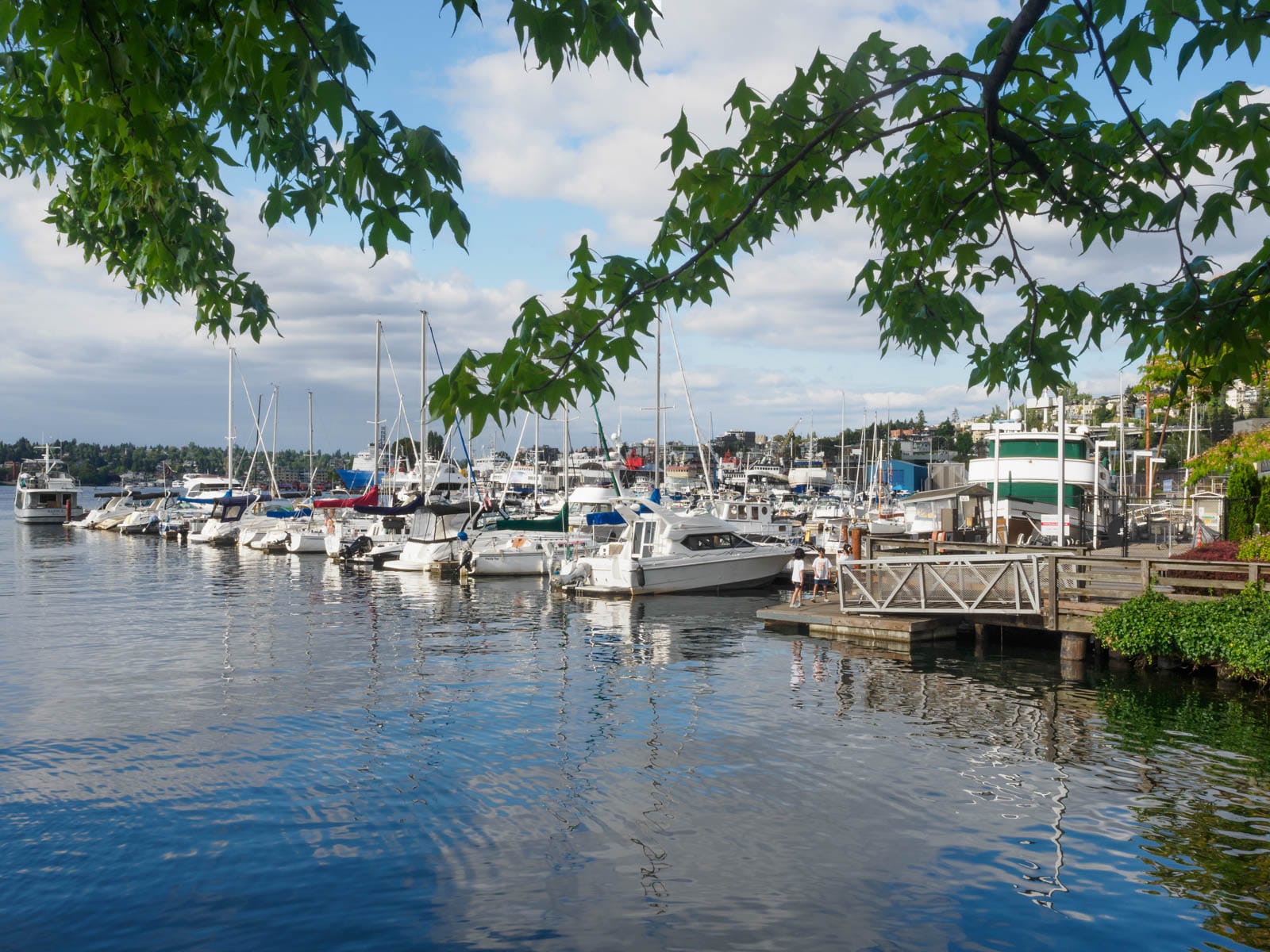
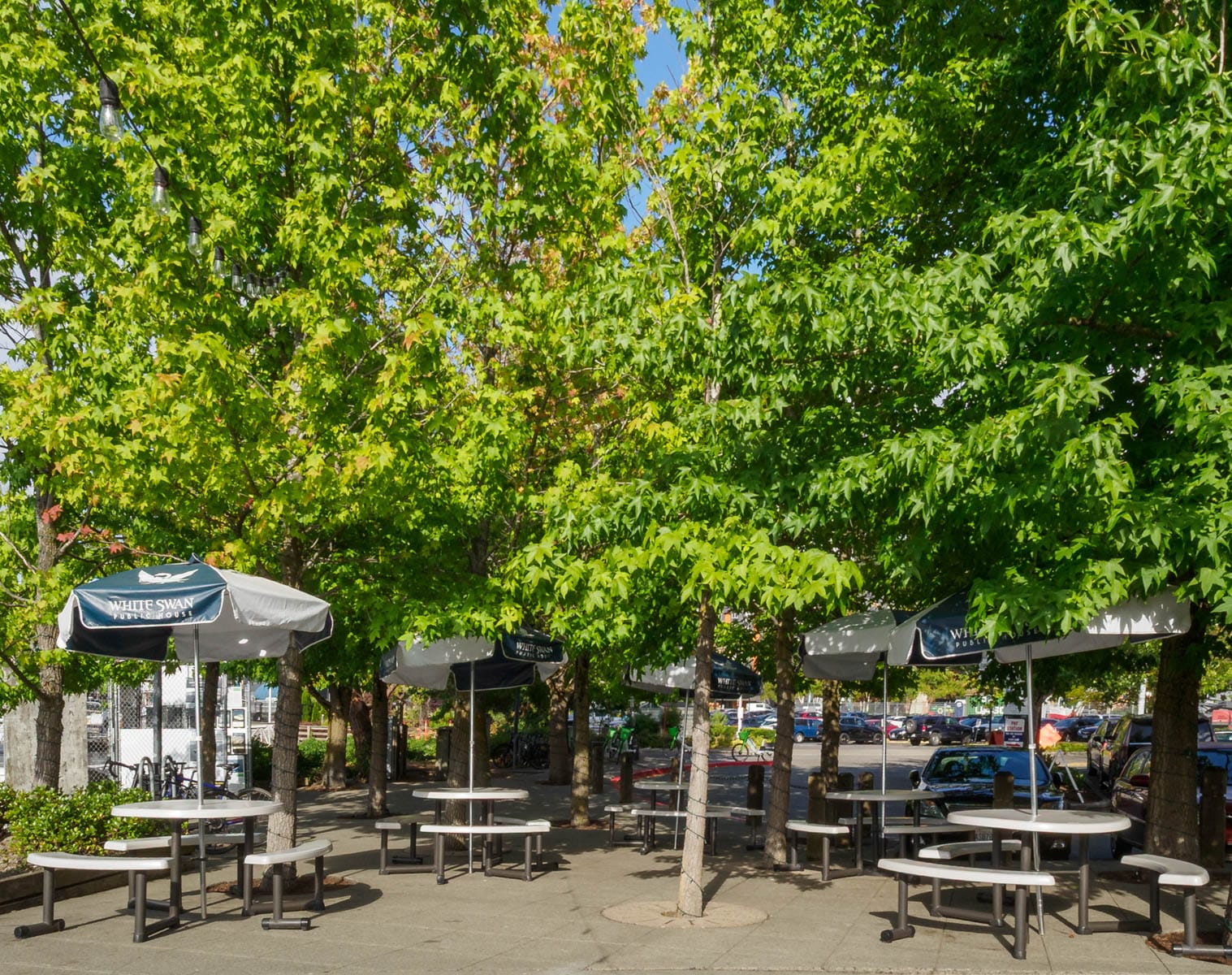
Lake Union’s street ends are linked together by the Cheshiahud Lake Union Loop, a seven-mile path named after one of the last of the Duwamish who lived on the lake. The path links street ends and a network of other open spaces, including many that are accessible to the public but privately owned. The tables and chairs shown above give access to a restaurant’s patio, expanding one’s seating options.
Lake Union Park (#86 Terry Avenue North)
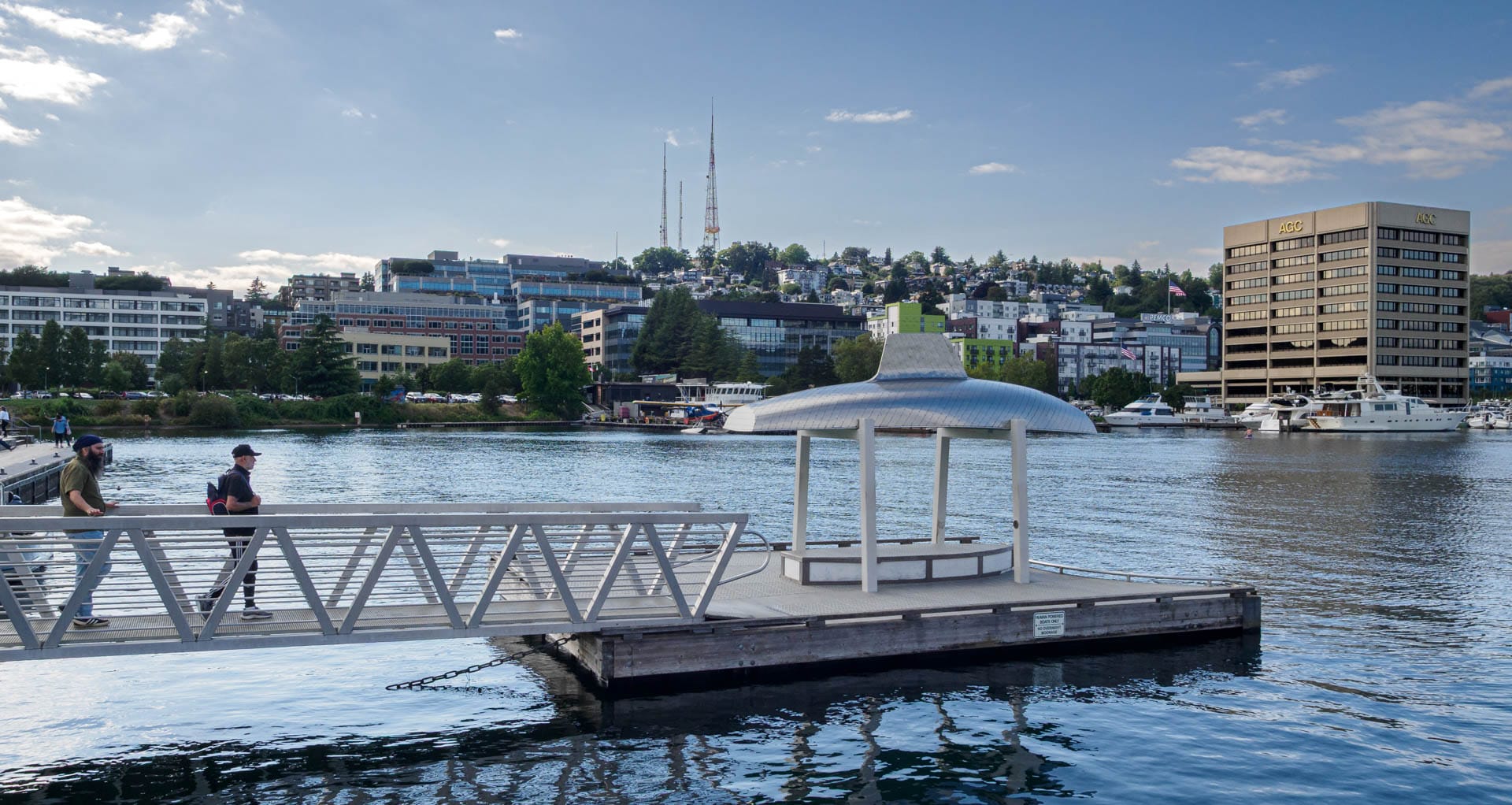
Street End #86, Terry Avenue North, was vacated when Lake Union Park was built – but it offers such a compelling prospect it is still very much worth a visit.
Lake Union Park is surrounded by boats, planes, people, as well as important cultural institutions such as MOHAI, the Center for Wooden Boats, and vintage ships. Being in such a diverse environment is immersive, and it is easy to lose track of the hours while watching people, planes, and boats go by.
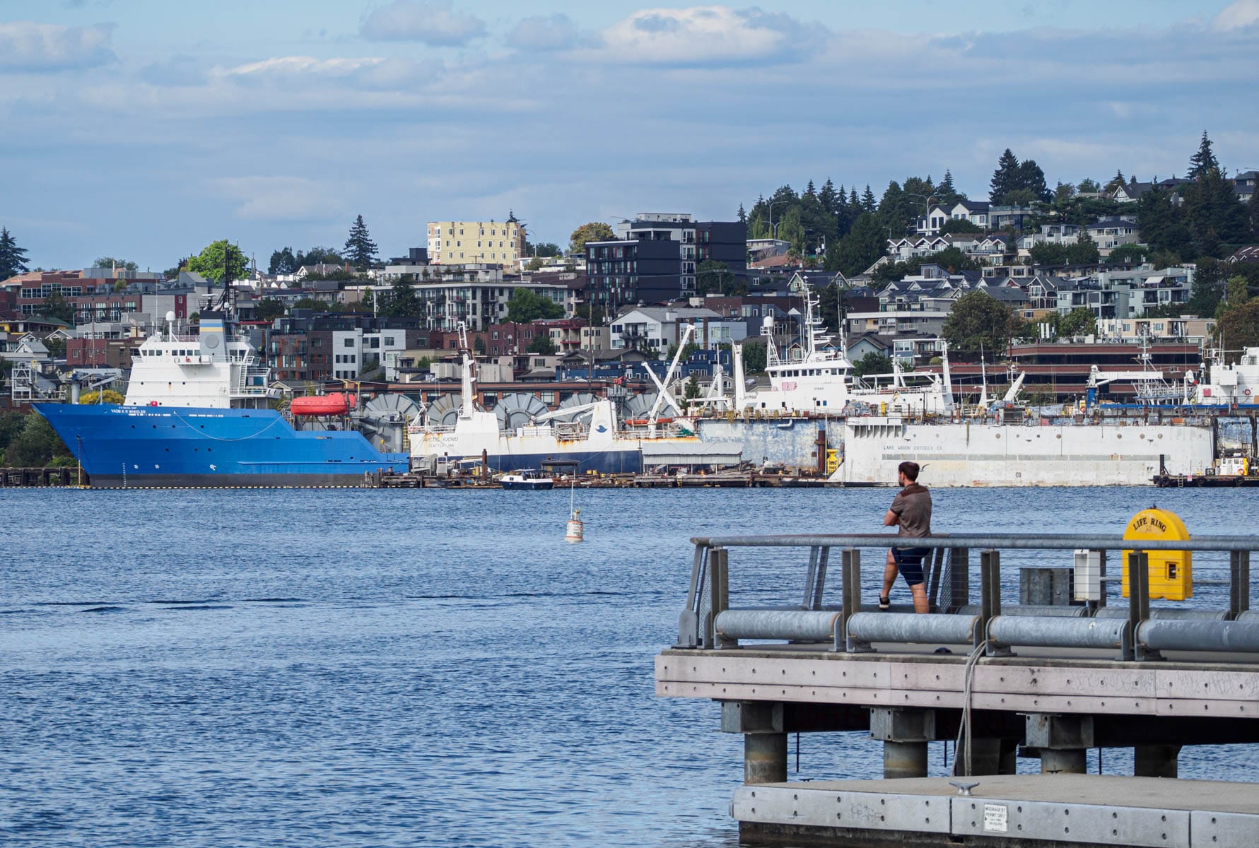
The pier is only one of several vantage points; there are also floating docks and rocky shorelines which offer more intimate ways to engage the water. In this photograph, you can see the Lake Union Dry Docks along with other commercial docks.
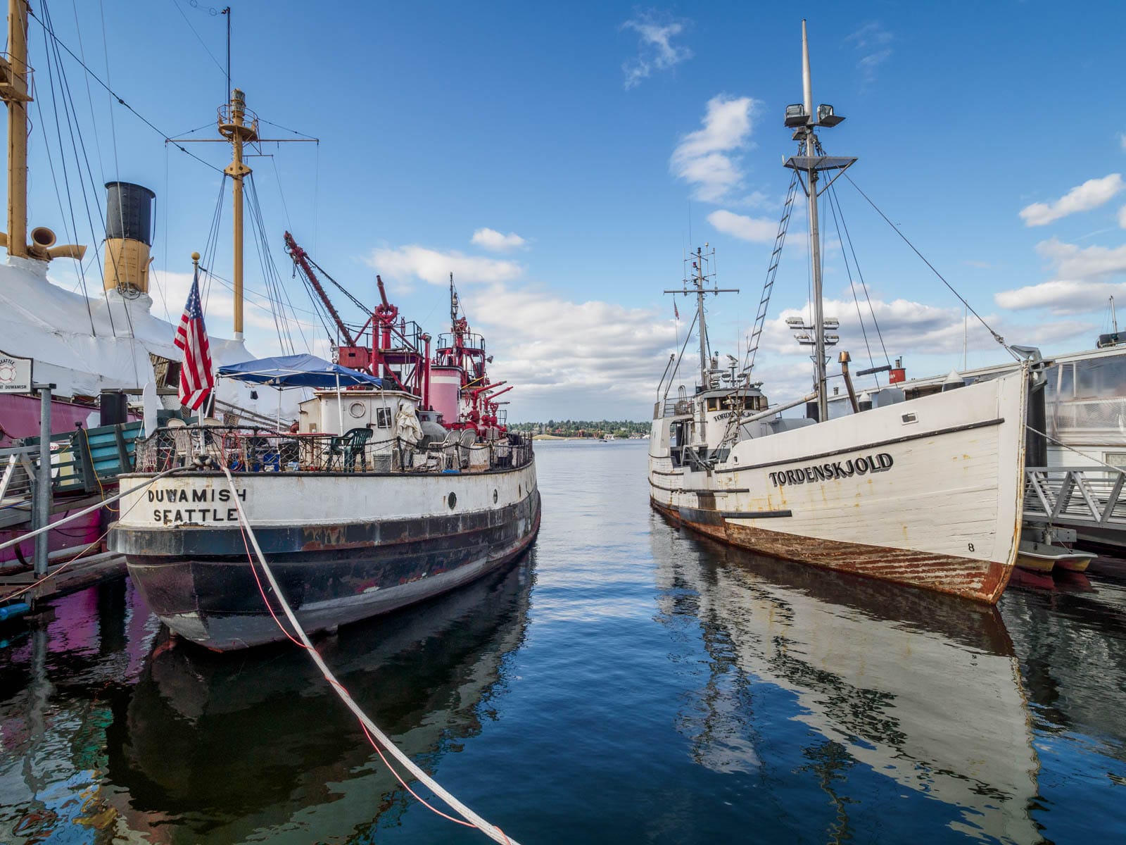
Two of the many vintage ships at the pier’s end. The Northwest Seaport Maritime Heritage Center and the Center for Wooden Boats foster a community of old-boat enthusiasts that educate, restore, and sail these lovely craft.
A view of Queen Anne on the lake’s western shore. Lake Union is the low point of its surrounding neighborhoods, which also include Downtown, Wallingford, and Capitol Hill. Nestled in this basin, it can feel tranquil and sheltering despite the buzz of activities animating it. The sculpture (the upside down boat) has acoustic properties – you can hear the motion of the water amplified when you stand in or beside it. Peter Richards is the artist.
Vessels of all sizes and means of power ply the lake’s placid waves.
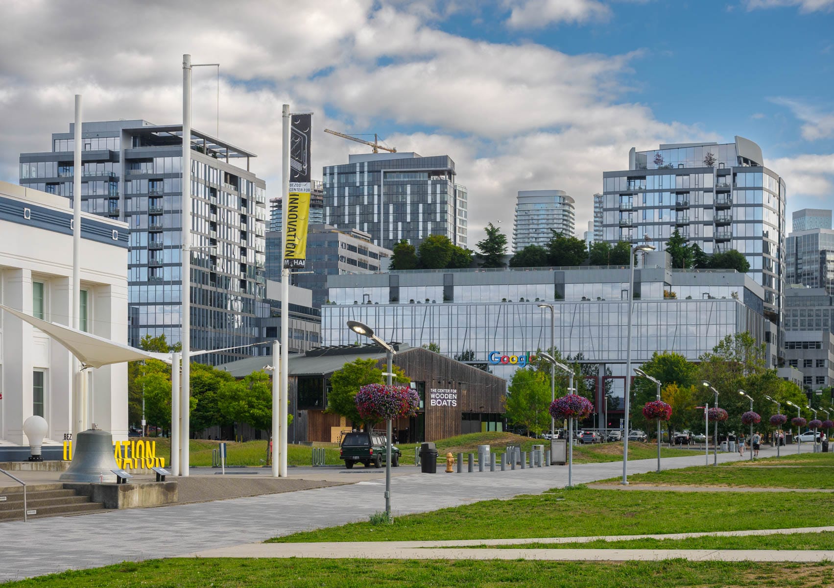
MOHAI and the Center for Wooden Boats, along with corporate neighbors and apartments to the south of the pier, define the western edge of Lake Union Park’s promenade that connects the park with downtown.
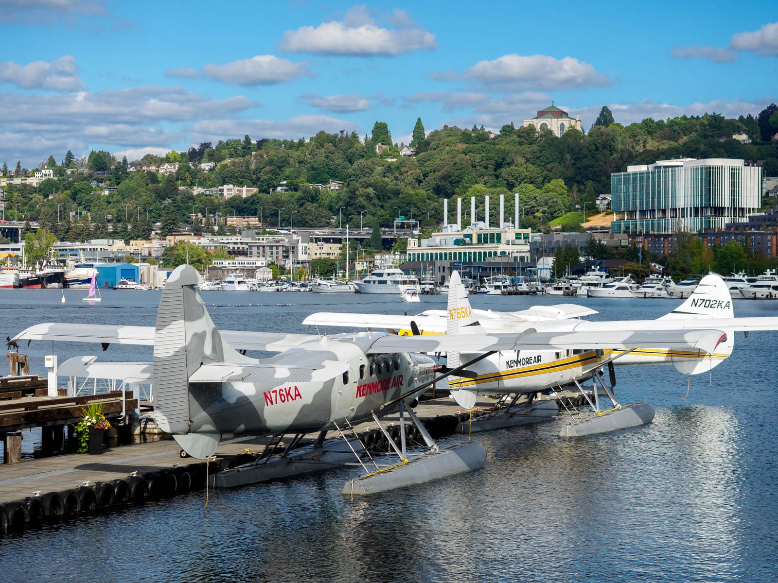
Kenmore Air Seaport
The Kenmore Air seaport is not a street end, but it is along the Cheshiahud Lake Union Loop and links the south shore street ends to those along the west shore. It’s a great spot for floatplane watching.
Watching the planes land and take off one is never quite sure exactly which path the pilot will choose as they navigate the least complex runway between the lake’s many users, all while tensing the viewer until finally relieved after the plane has broken with the watery surface. Air and the sea are one and the same to these amphibious craft.
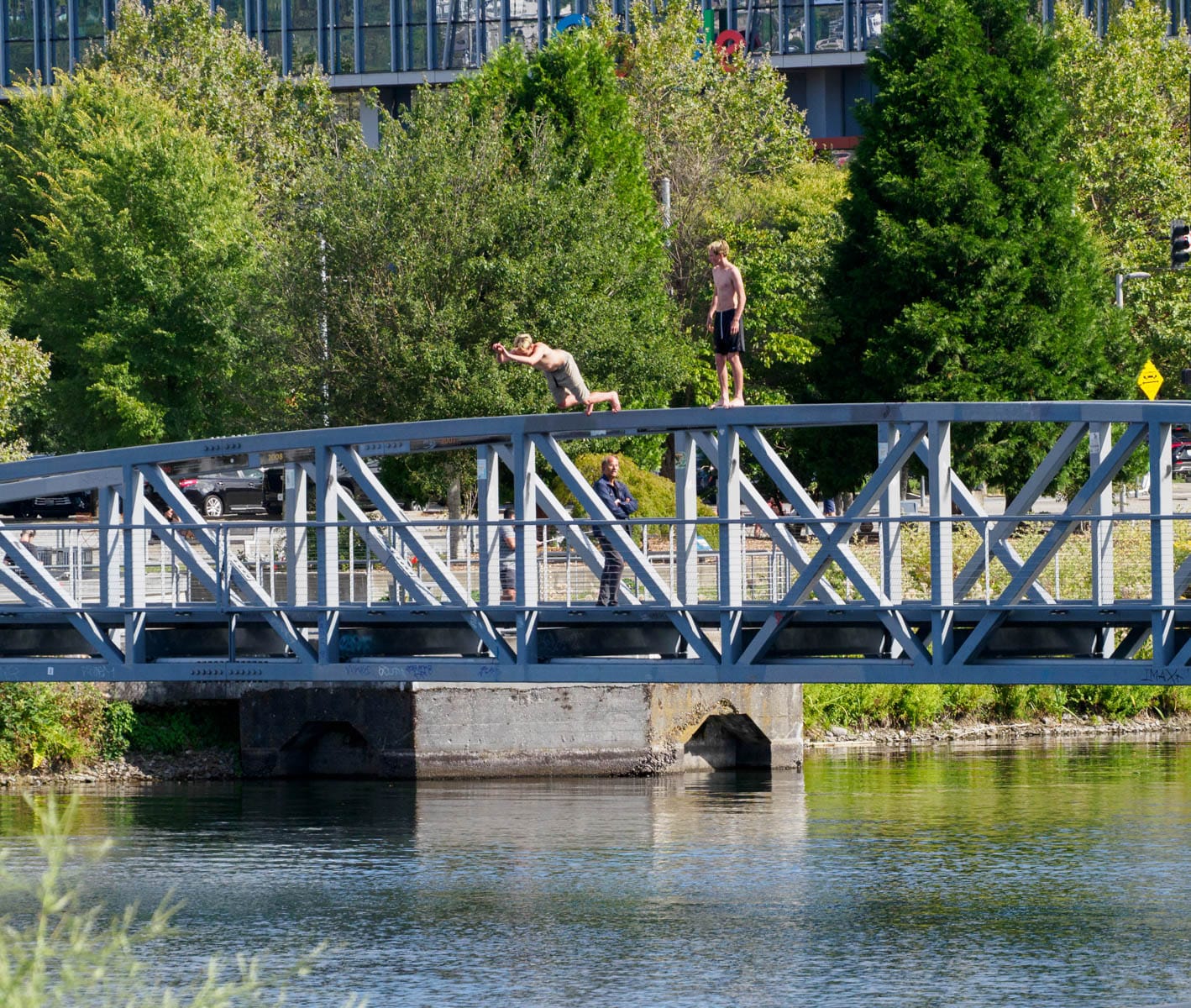
From the Kenmore Air seaport, the daring leaps divers take from the Lake Union Park Bridge are on full display.

#87 Galer Street West
The West Lake Union Pedestrian Bridge provides an elevated prospect for Street End #87, at Galer Street.
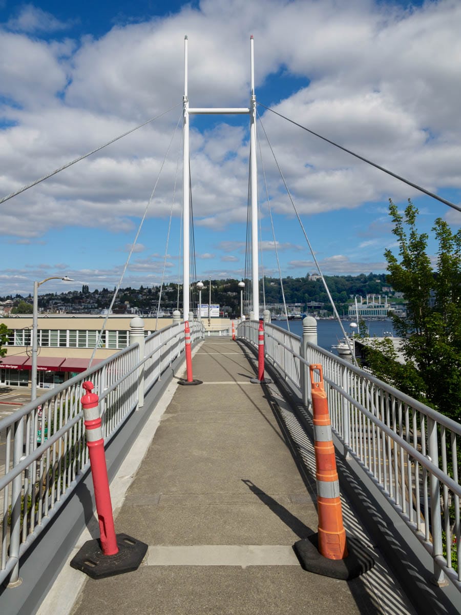
From the bridge, one can see over the buildings and landscape that frequently block one from seeing the water.
#88 Blaine Street
At first blush, some street ends, such as #88 Blaine Street, seems to have little to offer; however, curiosity and a bit of poking around is usually rewarded.
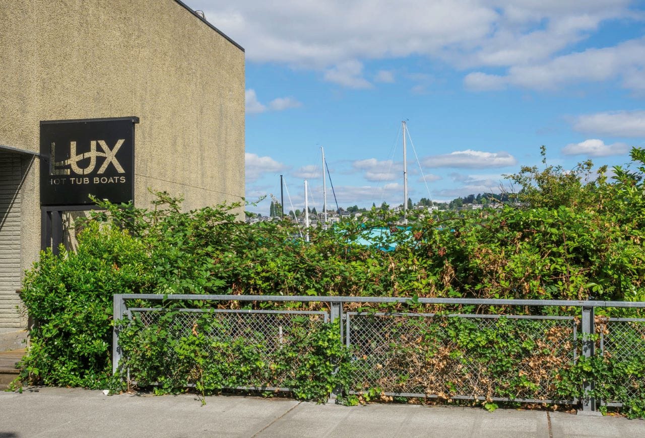
Street End #88 Blaine Street’s waterfront edge, rampant with blackberries, blocks views to the water. Invasives are a call for better local stewardship of these public assets.
With a little bit of effort, one is able to surmount such obstacles and catch a satisfactory glimpse of the water that lies beyond the blackberry bushes.
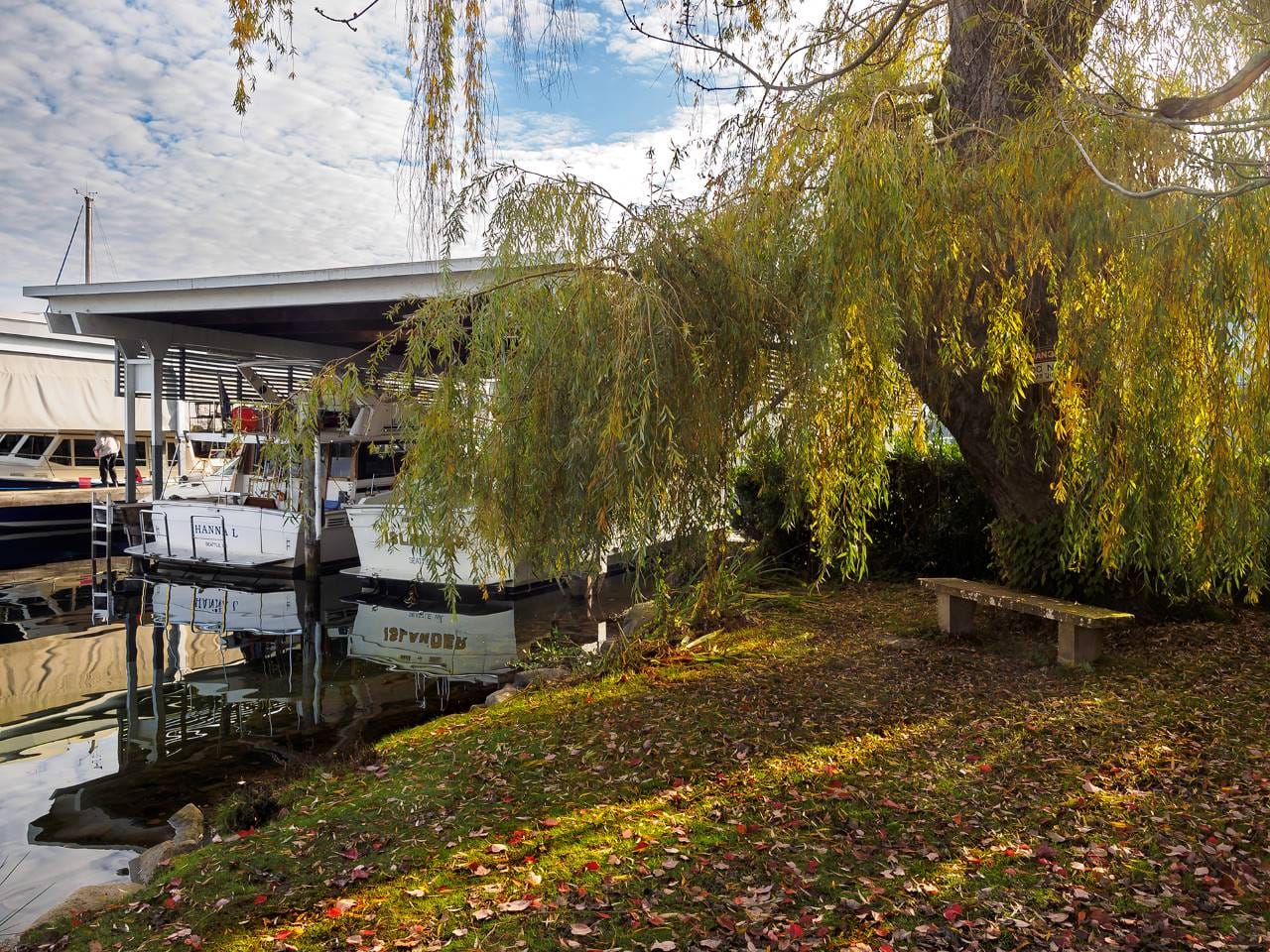
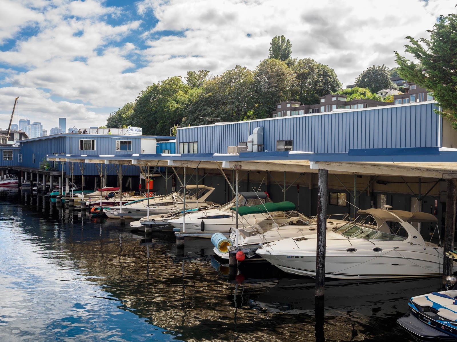
#89 Crocket Street
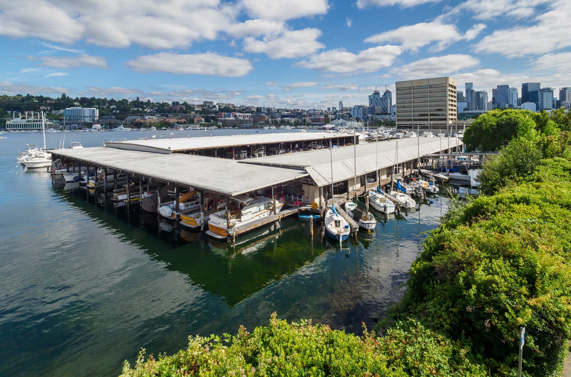
Street End #89, Crocket Street, provides access to a stair leading down to the water. Descending to the shoreline gives a different, more intimate experience. Here, the over-water businesses and lower access point create an enclosure and focus that contrasts with the openness of other street ends.
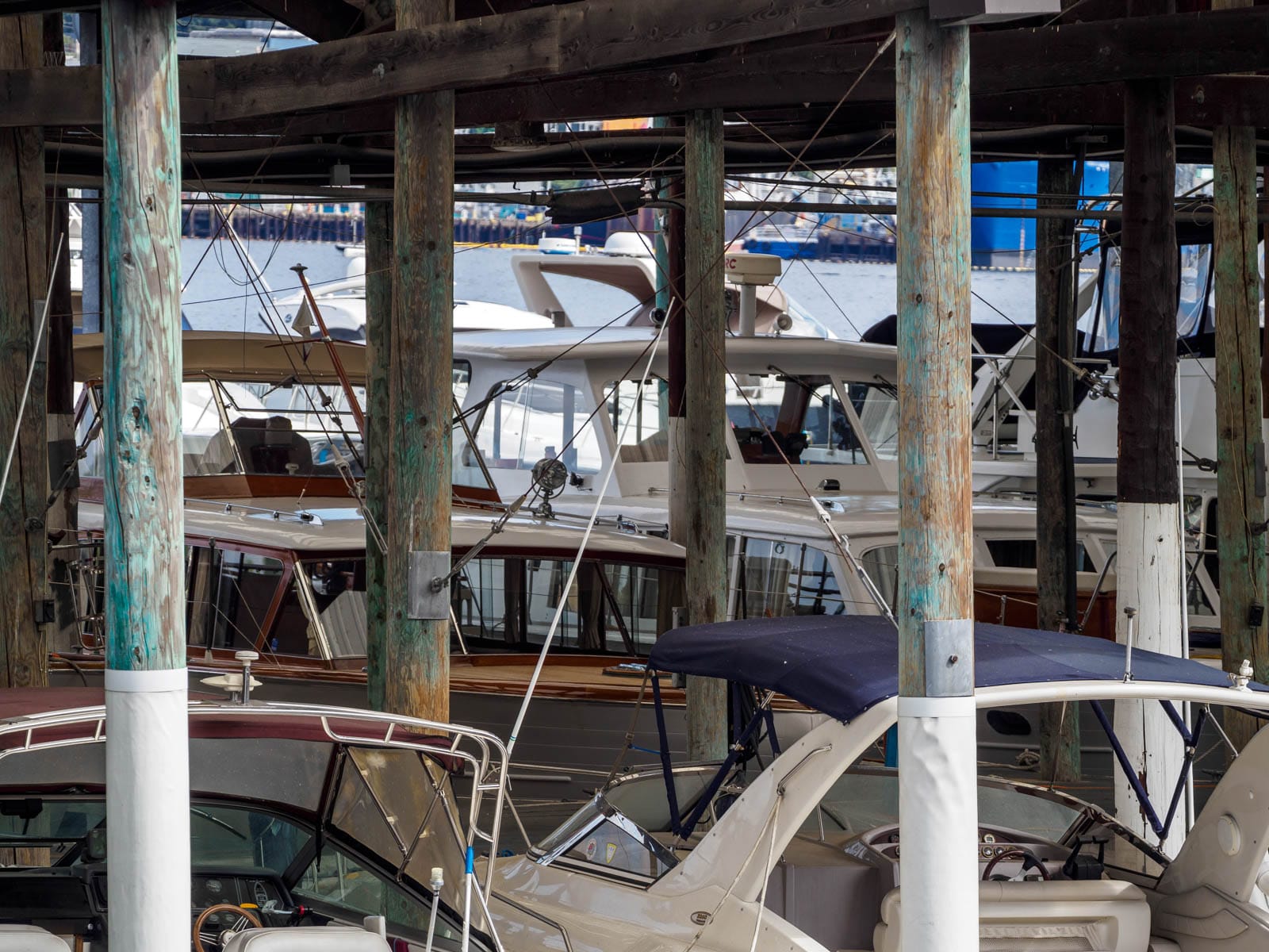
This intimacy is multi-layered, with the sheltering boat slips offering even greater solitude.
A forest of columns support a marina’s roof. Like the dappled light of a forest canopy, the reflected light from the water’s surface draws one into this shadowy place.
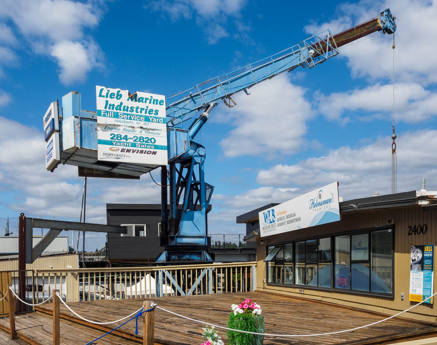
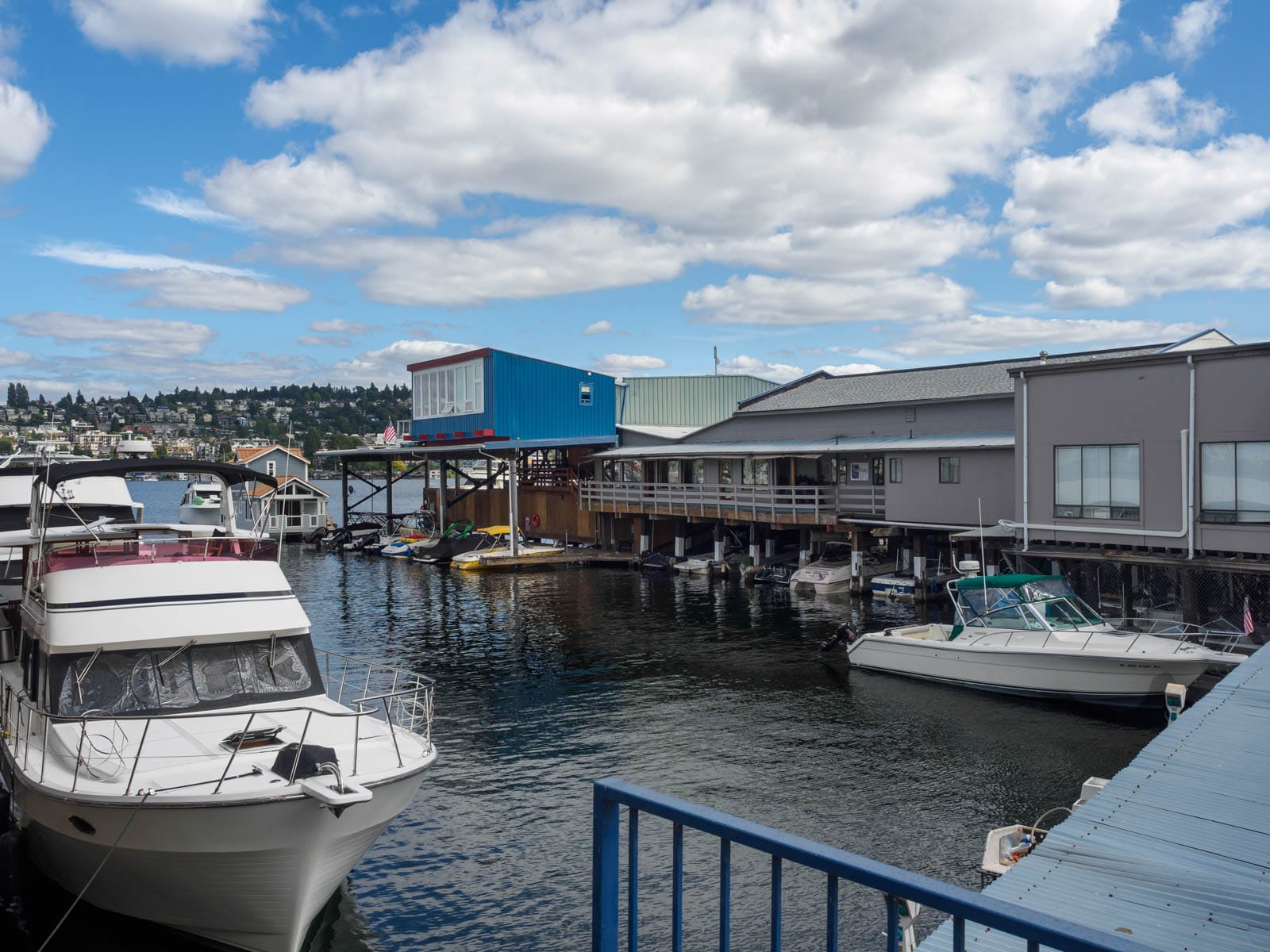
#90 McGraw Street
The final street end on today’s walk is #90, McGraw Street. This portion of the Cheshiahud Loop appears to be off limits for the moment, its wooden structure apparently in need of attention.
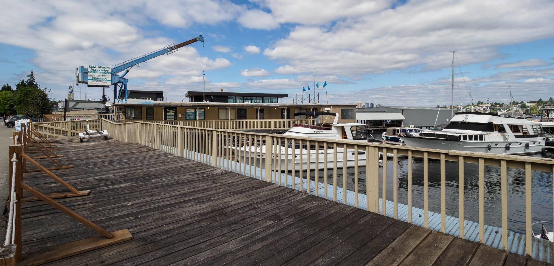
Viewed from the boardwalk’s edge, however, one can still remotely participate in the various goings on of the adjacent marinas.
A crane is the distinguishing feature of this street end and is emblematic of what makes Lake Union such a treasure. In the heart of our city we have a body of water of incredible variety and character, from industry to leisure that promotes conservation and exploration. And Seattle’s Shoreline Street End Program helps to provide access to it for all to enjoy.