As previously written, Seattle has 141 Street End shoreline points. A great sampler is accessed by foot or bicycle from the Burke-Gilman Trail (BGT) which provides a great wayfinding route. Along your journey, you will be rewarded with outstanding views of Seattle’s vibrant maritime heritage.

Street End 149

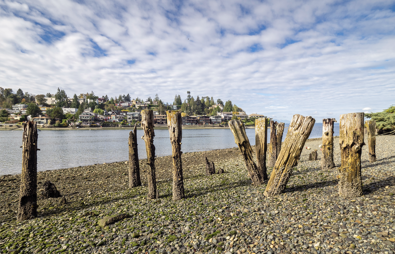
Street End 149 is the westernmost street end along the BGT, and is known as the NW 60th Viewpoint. It is maintained by Seattle Parks and Recreation and includes a small shoreline public access area and bench that was part of the adjacent Golden Tides Marina Center development. There was once a stop on the “Mosquito Fleet” ferry line here, and the pilings date from that era.
Street End 148


Street End 148 offers the rare chance to explore the intertidal zone; or, should one wish a safer prospect, one can enjoy the street end from a dry vantage point which doubles as a piece of stormwater infrastructure.
Street End 147
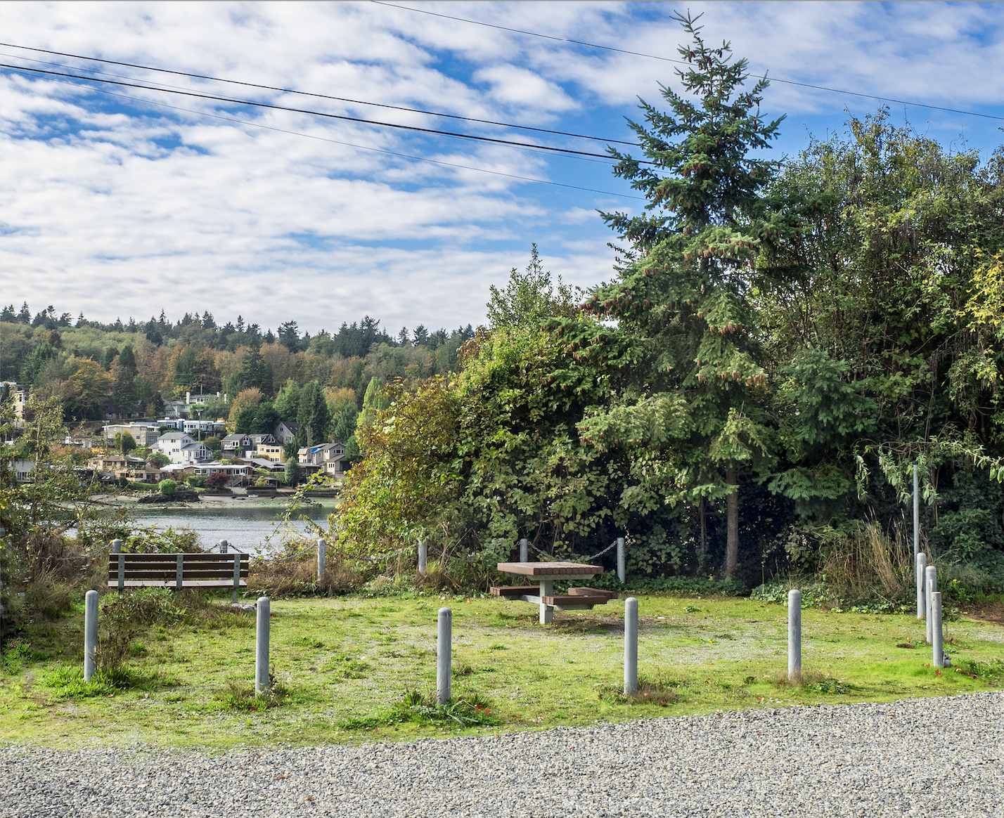
A short distance south of 148, Street End 147 (36th Avenue NW at Seaview Avenue NW) appears quite modest yet does have a picnic table and bench.
Street End 146
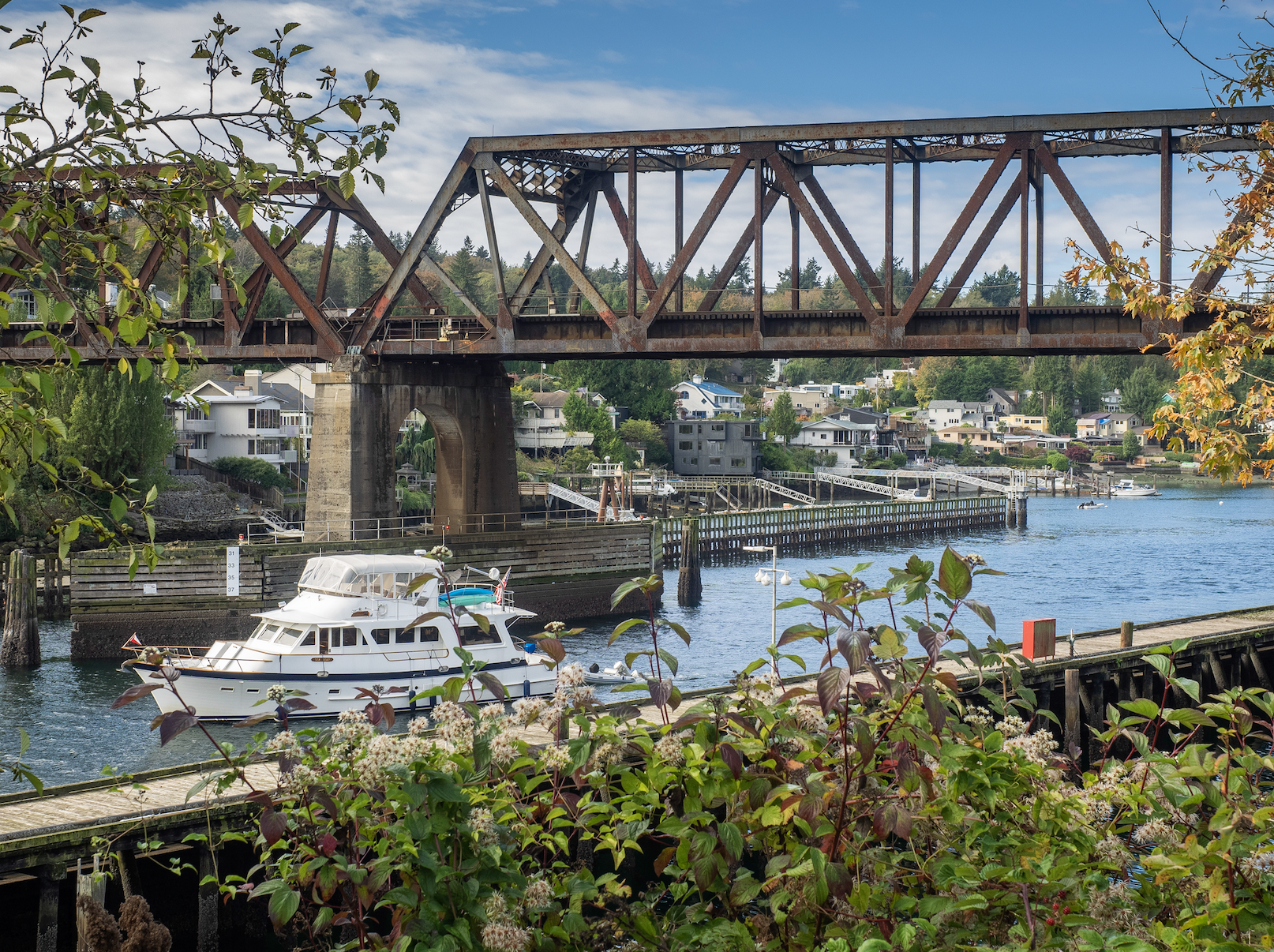
Among what must surely be one of the best maritime views in Seattle, Street End 146 known as the Salmon Bay Natural Area (34th Avenue NW at Seaview Avenue NW) reveals a piece of vital Seattle transportation infrastructure — Burlington Northern Santa Fe’s Salmon Bay Bridge. Built in 1914, this muscular structure was recently threatened with replacement, but the railroad company has recently agreed to continue to maintain it and upgrade it to current specs.
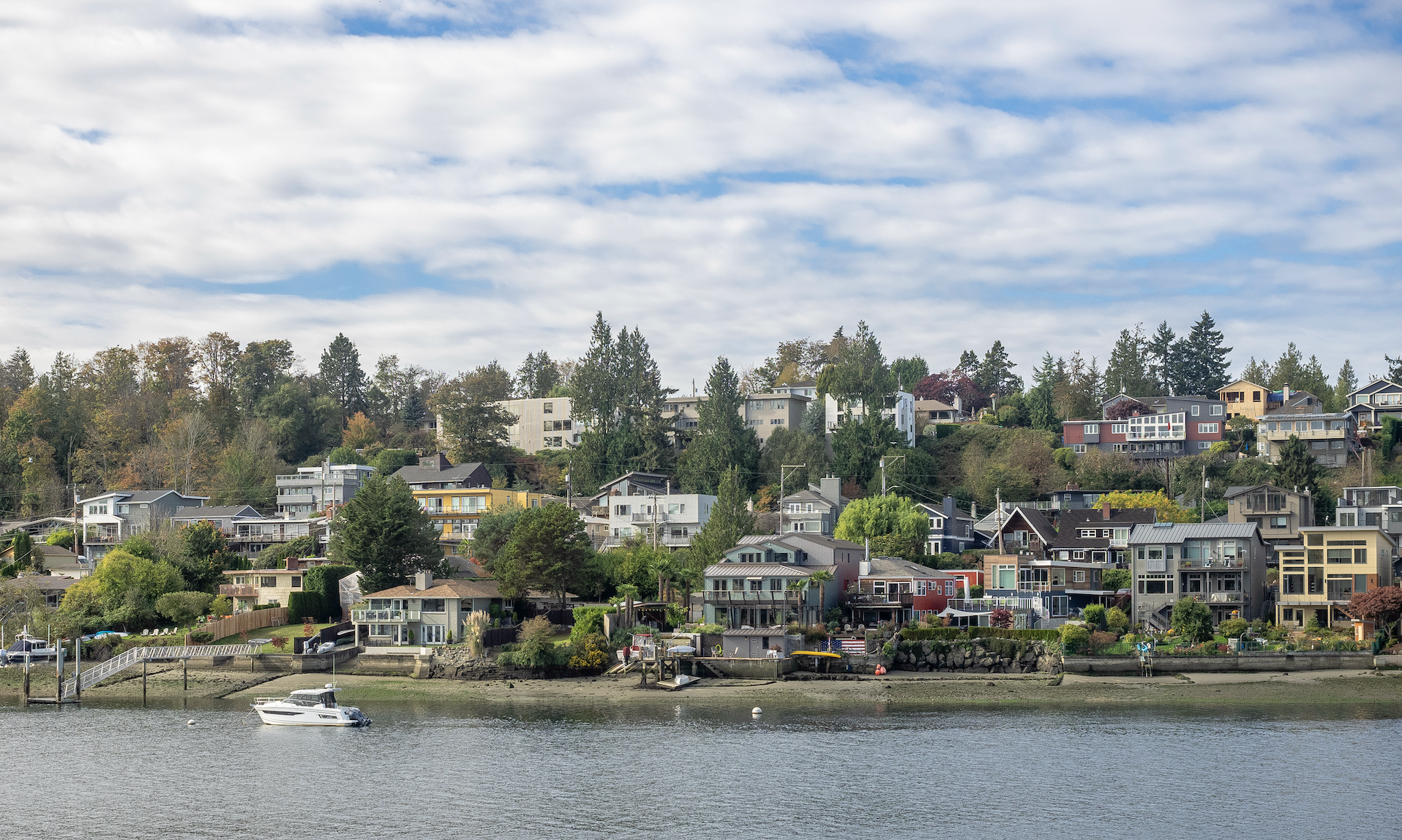
Both of which suggest one rest for a minute or two and take in the great views across Salmon Bay and its layers of single-family homes and apartments. Noting the vast expanse of private waterfront across the Canal is a reminder of how precious public access and viewpoints are.
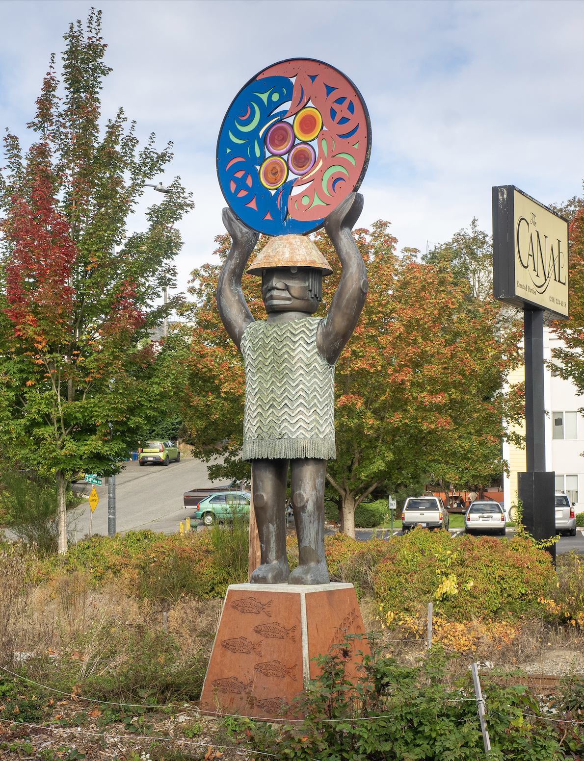
Views of the bridge and canal are afforded by a generous plaza with an interpretive sign, pavers, and a cantilevered overlook. The jewel of these improvements is the sculpture “A Salish Welcome”, which was created in 2010 by Marvin Oliver to welcome visitors to this location which has been valued by countless generations.
Street End 145
Access to recreation is, of course, one of the goals of the Street End program, and the shores of the Ship Canal at Street End 145 (28th Avenue NW at NW 54th Street) witness use by motorized, wind, and people-powered vessels.
Street End 144
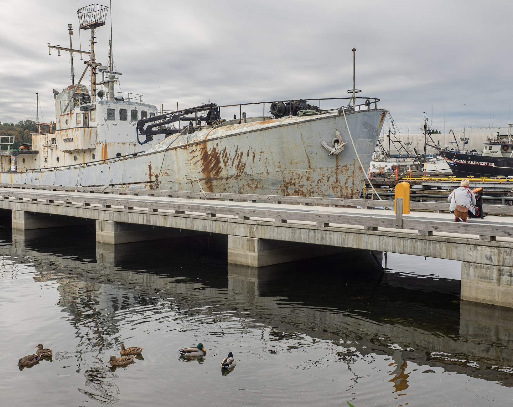
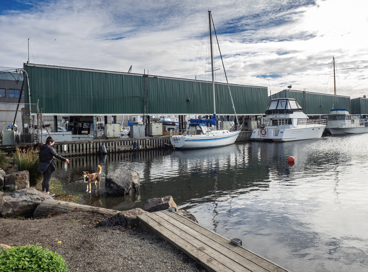
The BGT leads into the heart of Ballard’s thriving maritime industry, and Street End 144 (24th Avenue NW at NW 54th Street) allows for intimate viewing of powerful (if dormant) sea going craft. Recently improved, this street end has a concrete pier with artfully placed mosaics and open-air grating. The grating fosters fish habitat by allowing aquatic plants to grow in area that would otherwise be shaded and prevents hiding places for prey of juvenile salmon on their way to sea.

Canines, it seems, are a continued and welcome presence at these watery playgrounds. This street end also has seating, as well as a small gravel beach ideal for kayaking launching.
One of the pleasures of these access points into the inner-workings of Ballard is seeing the undeliberate — yet quite lovely — colors, shapes, and sizes of the vessels and their enclosures.
Street End 143
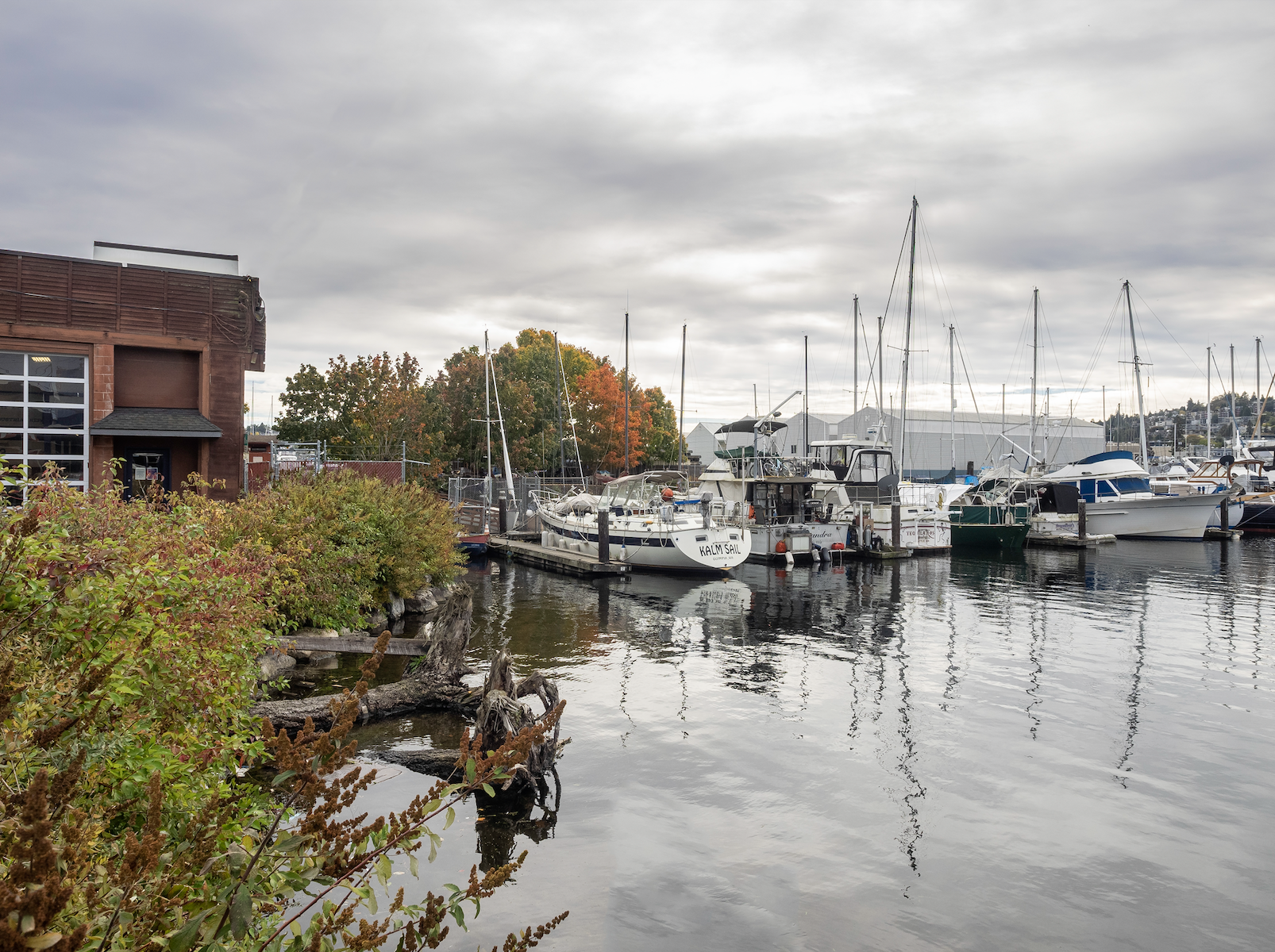
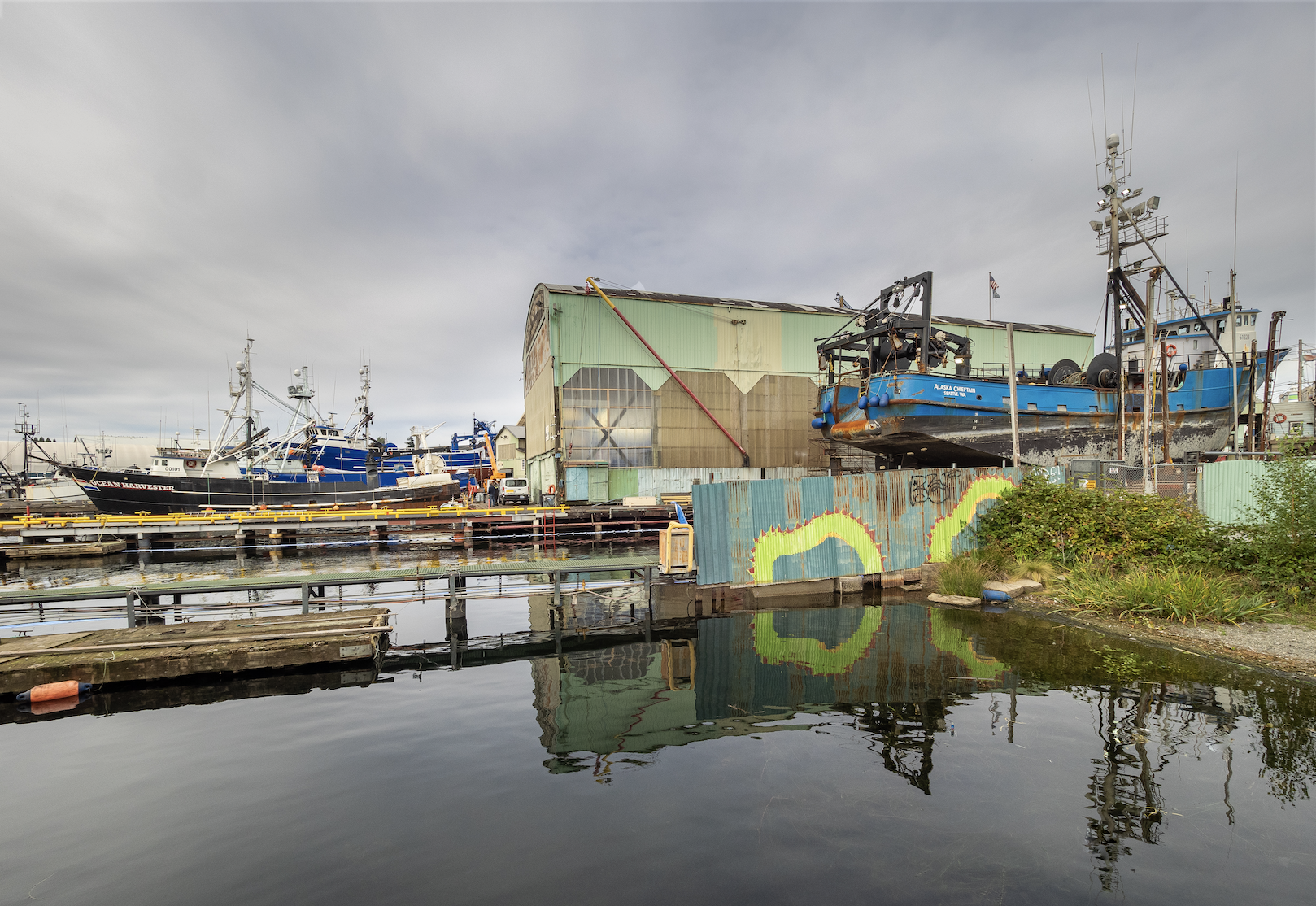
Contrasting the singular focus of the commercial vessels found at Street End 144, those on 143 (20th Avenue NW at Shilshole Avenue NW) have carefree airs and lush plantings — designed to be habitat-enhancing.

While those vessels across the Canal are more decidedly patrician and lack a working vessel’s patina and chromatic esprit.
Street End 141

Neither fancy ships nor robust docks can be found at Street End 141 (14th Avenue NW at Shilshole Avenue NW), reminding us all that street ends are open to all, blind to either pretense or modesty.
Street End 140


Street End 140 (11th Avenue NW at NW 54th Street) has a very impressive landscape and amenities making it worthy of a picnic. A small promenade, a bench, flower garden, and even a chair swing combine for a unique experience along the Ship Canal and were designed by University of Washington landscape architecture students.
Street End 137

The least improved of the Street Ends in this post, 137 (NW 39th Street at 3rd Avenue NW), still offers great views to our working waterfront including a view across the canal of Foss Maritime, the largest tug towing vessel maker on the West Coast.

Equally impressive is the view of the Ballard Bridge. The view is centered on the lifting span of the bridge, and the End’s amenities provide a comfy and scenic perch to watch the ships pass through the raised span.
Everyone should have access to Seattle’s diverse waterfronts. Since 1997 Friends of Street Ends has worked to provide access to and enhance Seattle’s shoreline street ends. Street Ends dot the shore of Lake Union and Lake Washington, the Ship Canal, Puget Sound, and the Duwamish. For more information on exploring or volunteering for our street ends, please visit our website or the Seattle Department of Transportation’s Shoreline Street Ends project page.