The recent explosive residential and commercial growth in South Lake Union has caused the City of Seattle and the Seattle Department of Transportation (SDOT) to re-evaluate transit access and reliability along the Westlake Avenue corridor. As there is no more room to add streets, the only viable solution is to utilize them better. With the recent passage of the Move Seattle transportation levy, this project will help make it possible to double the number of people who ride transit during the peak hours, beginning in late March 2016.
The Westlake Transit Improvement project will attempt to improve transit frequency, reliability, and speed along the Westlake Avenue corridor as well as Aloha and Valley streets by implementing a number of changes to the existing roadway. These changes will include new transit lanes, transit stop upgrades, and will facilitate shifting the King County Metro Route 40 bus to Westlake Ave M in both directions and the extension of the RapidRide C Line serving Downtown and West Seattle.
Throughout the planning process, a number of different alternatives were studied. These alternatives ranged from minimal changes, a “no build” option, to major ones. Two alternatives for highly-restrictive transit-exclusive lanes were studied. One of them proposed making Westlake one-way to general purpose traffic, while the other maintained two-way usage. In addition, two hybrid alternatives were studied that utilized both business access and transit (BAT) lanes as well as transit-exclusive lanes.
Through analysis of the data, however, it was determined that the overall difference in performance between the transit-exclusive options and the hybrid options was negligible, especially when taking into account the additional cost, time, and education involved. Ultimately, due to these reasons, one of the hybrid options (option A) was selected for continued design development.
Turn Restrictions, BAT Lanes, and Transit Exclusive Lanes
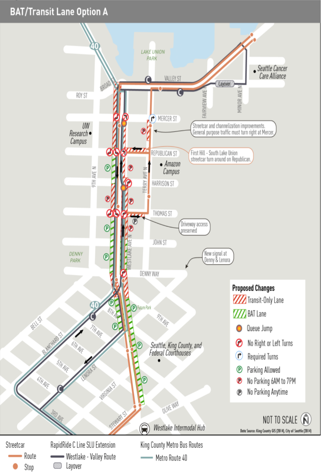
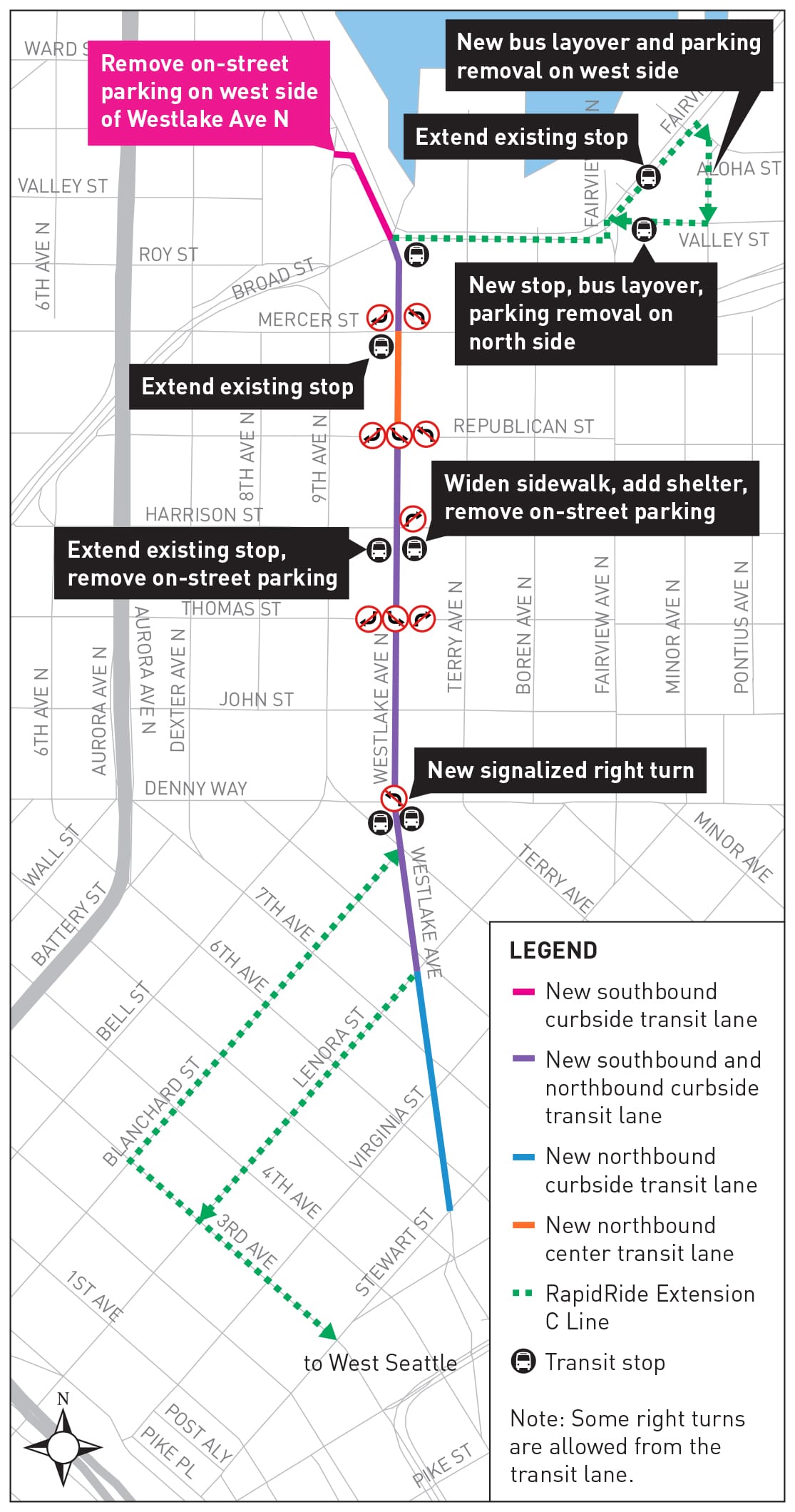
One of the major changes to the Westlake corridor will be the implementation of turn restrictions at a number of, currently, busy intersections. Right turns will be prohibited northbound at Denny, Thomas, Harrison, and Republican. Southbound, they will be prohibited at Mercer, Republican, and Thomas Streets. In addition, left turns will be prohibited southbound at Republican and Thomas streets. Removing turning cars from these areas should improve the transit and pedestrian experience drastically at the affected locations.
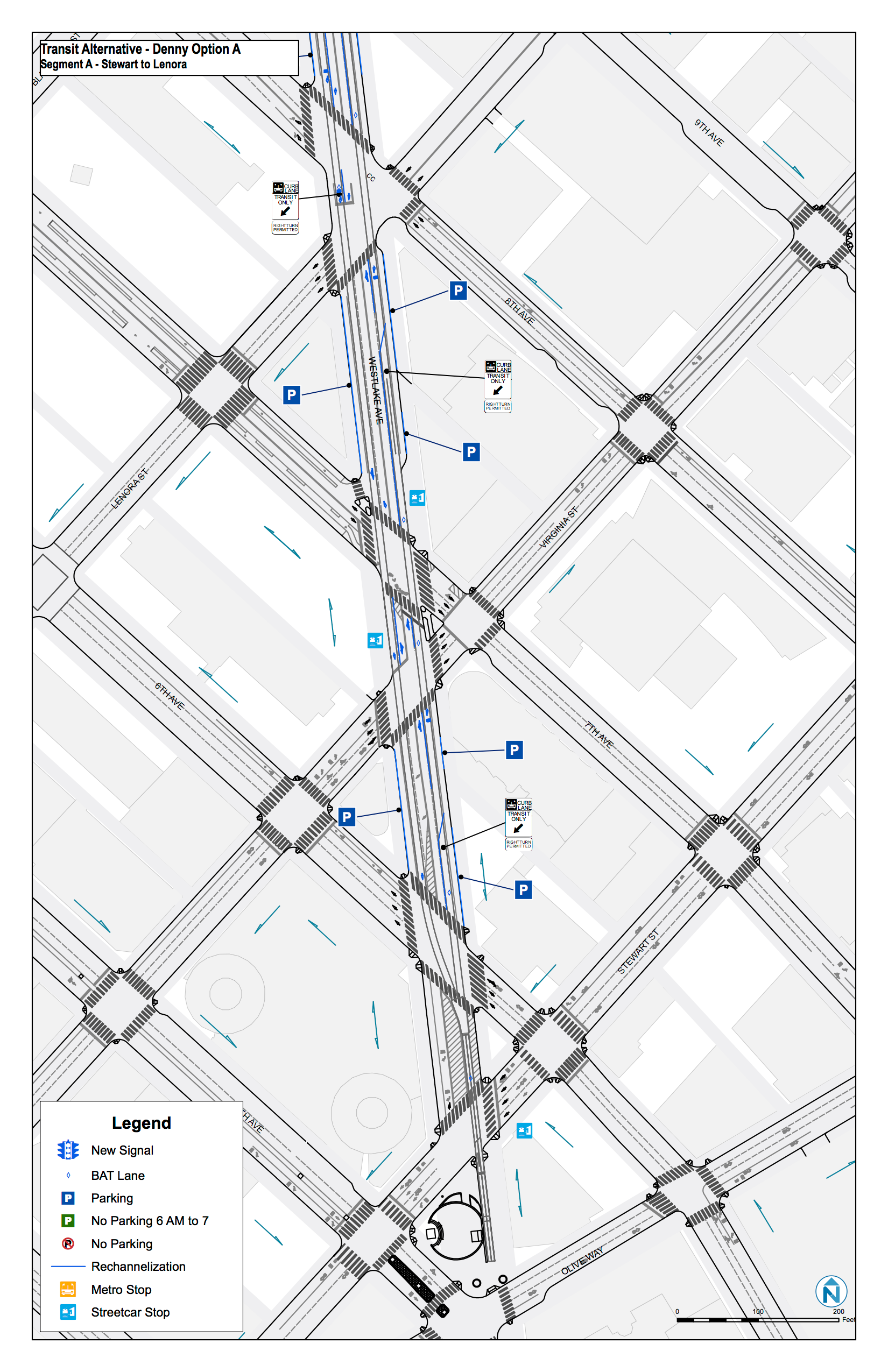
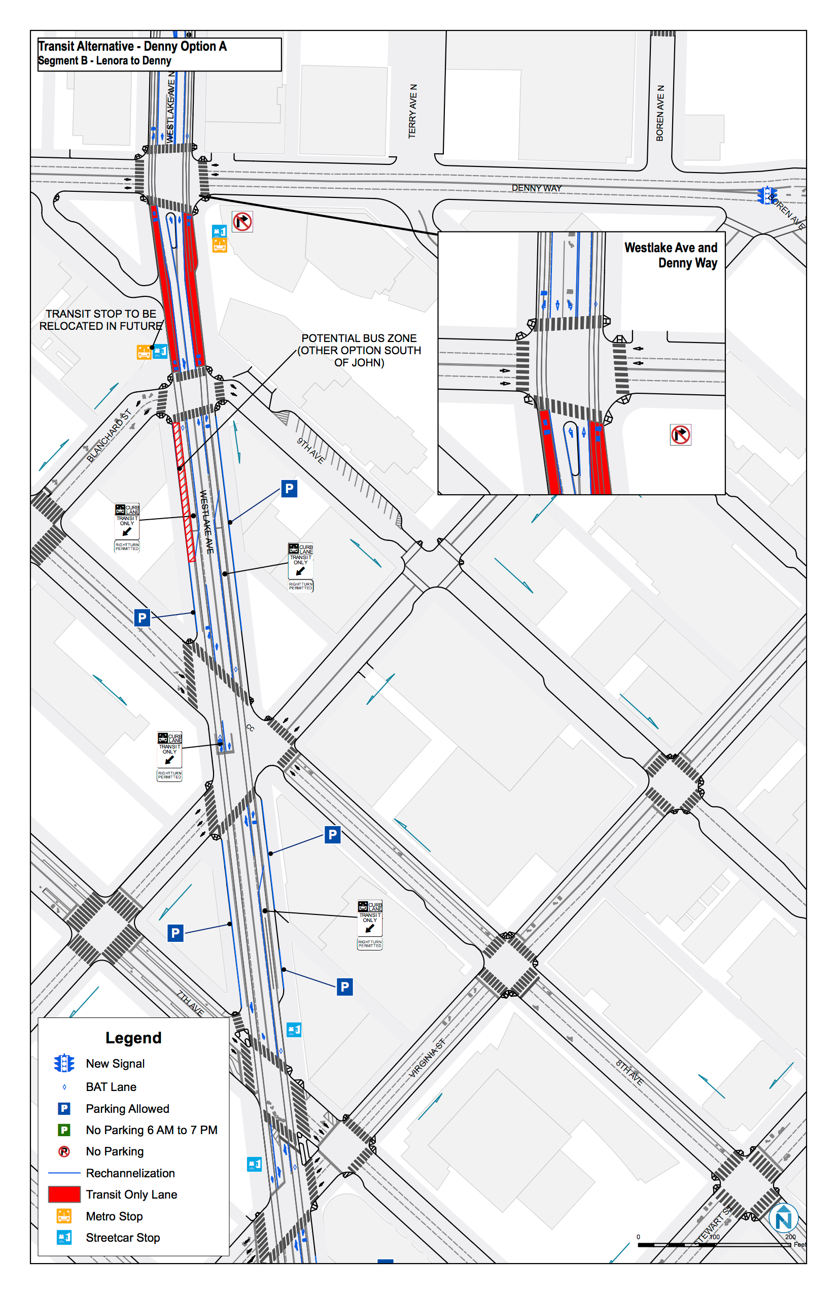
As mentioned above, the project will be converting the curb lanes along Westlake Ave N into either BAT lanes or transit-exclusive lanes. Where turns have been restricted, fully-exclusive transit lanes will be used. In other instances, BAT lanes will be used to allow for vehicles to make right turns.
Route 40, Route 70, RapidRide C, and South Lake Union Streetcar
Currently, the Route 40 bus operates northbound on Westlake Ave N and southbound on 9th Ave N. This project will shift the southbound leg from 9th to Westlake, and with a slight increase in service, will provide 9- to 15-minute frequency between Downtown and Ballard via Fremont.
The Route 70 bus operates on Fairview Ave N and will remain on its current routing. Reliability and speed will be enhanced through dedicated lanes across the Fairview Ave N and Mercer St intersection as well as improved handling of traffic at Fairview Ave N and Valley St. The Route 70 will also see a slight increase in peak-time service frequency.
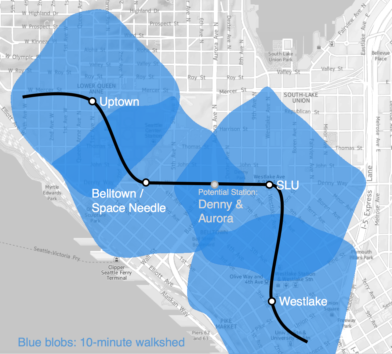
Perhaps the largest of the changes, and the one which will bring a huge boost in transit capacity to the South Lake Union neighborhood, is the arrival of RapidRide which will operate every 7 to 12 minutes during the day. In March 2016, RapidRide C and D lines will be decoupled to help both lines improve their overall reliability. The C Line, which originates in West Seattle, will now follow the streetcar line along Westlake Ave N and terminate on Minor Ave N between Aloha St and Valley St.
The introduction of RapidRide service to the corridor will necessitate the improvement, and in some cases relocation or enlargement, of existing bus and streetcar stops. Most, if not all, RapidRide stops will receive the full station treatment with shelters and real-time information displays that will be shared with the Route 40, 70, and streetcar where the routes overlap.
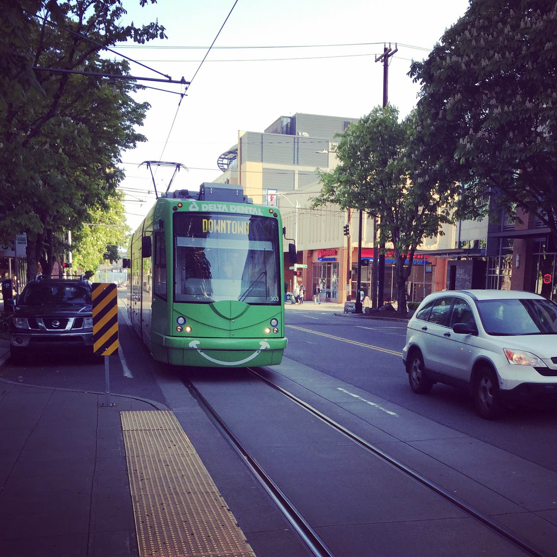
The South Lake Union Streetcar will benefit from this project as well. The new BAT and transit-exclusive lanes are also the streetcar right-of-way. Speed will be improved by the restricting of turns at some of the major intersections of Westlake Ave N. And, a new turning loop, intended for future First Hill Streetcars operating on the Center City Connector, will be built on Republican St between Terry Ave N and Westlake Ave N.
Pedestrians, Bicycles, and Parking

The pedestrian realm will be greatly improved along the alignment as well. Existing sidewalks will be widened in a number of locations and crosswalks along the corridor will be improved and enhanced where needed. SDOT will install new landscaping and street furniture as part of planned streetscape improvement. But the restricting of turns in many locations will greatly enhance the the overall safety and pedestrian experience.
Due to the design of Westlake Ave N, bicycling along this avenue, while legal, should be avoided. The location of the streetcar tracks in the curb lane have and most likely will continue to be a cause of injury to inattentive riders. As an alternative, and part of the Seattle Bicycle Master Plan, a number of adjacent, alternative routes have been created or are being planned to provide equivalent access to the neighborhood, away from the streetcar tracks.
Finally, SDOT reports that there are 127 existing parking spots, 6 existing passenger loading zones, and 6 existing commercial loading zones along the project corridor. As the project is currently envisioned, in order to accommodate, larger and newer bus stops, there will be a loss of 1 each of the passenger and commercial loading zones as well as 27 of the all-day parking spaces. The project, however, will be adding 28 time-restricted parking spaces to the corridor to help mitigate those spaces removed.
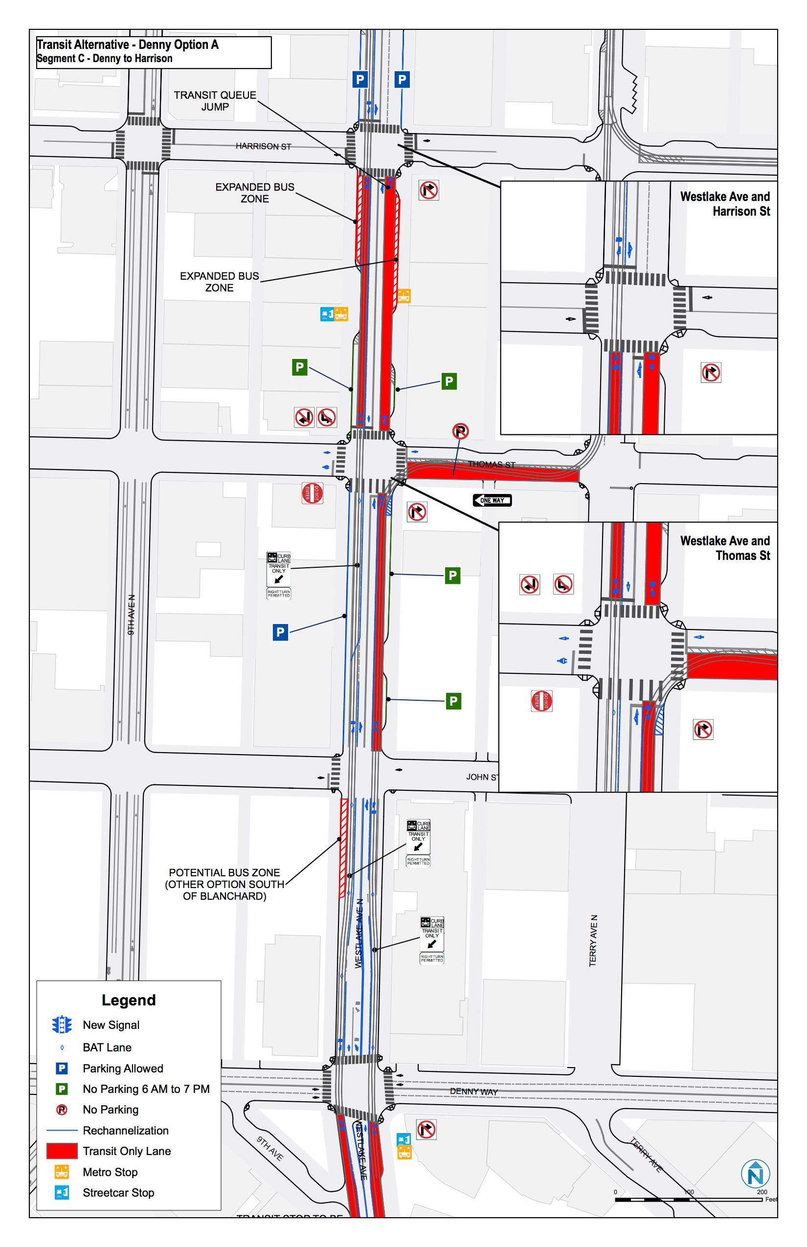
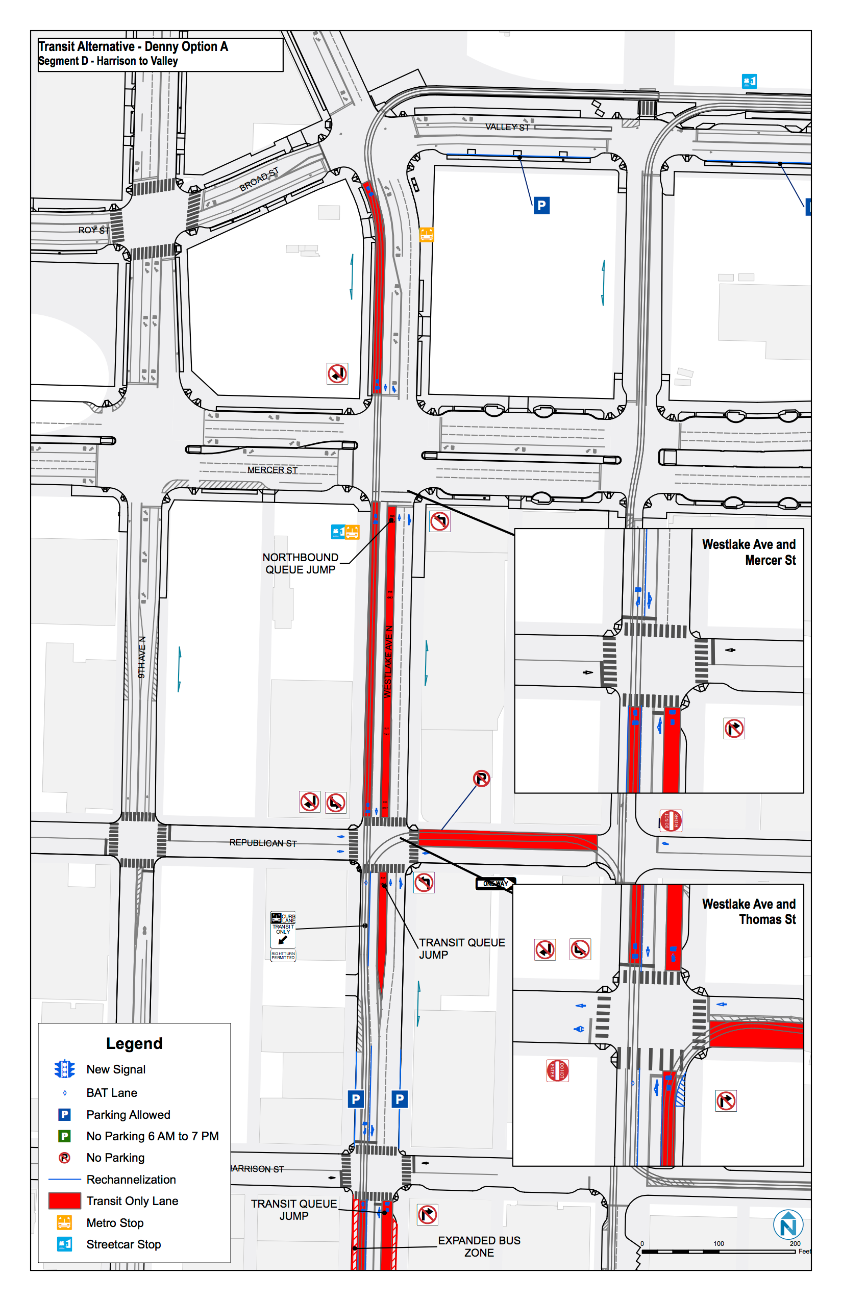
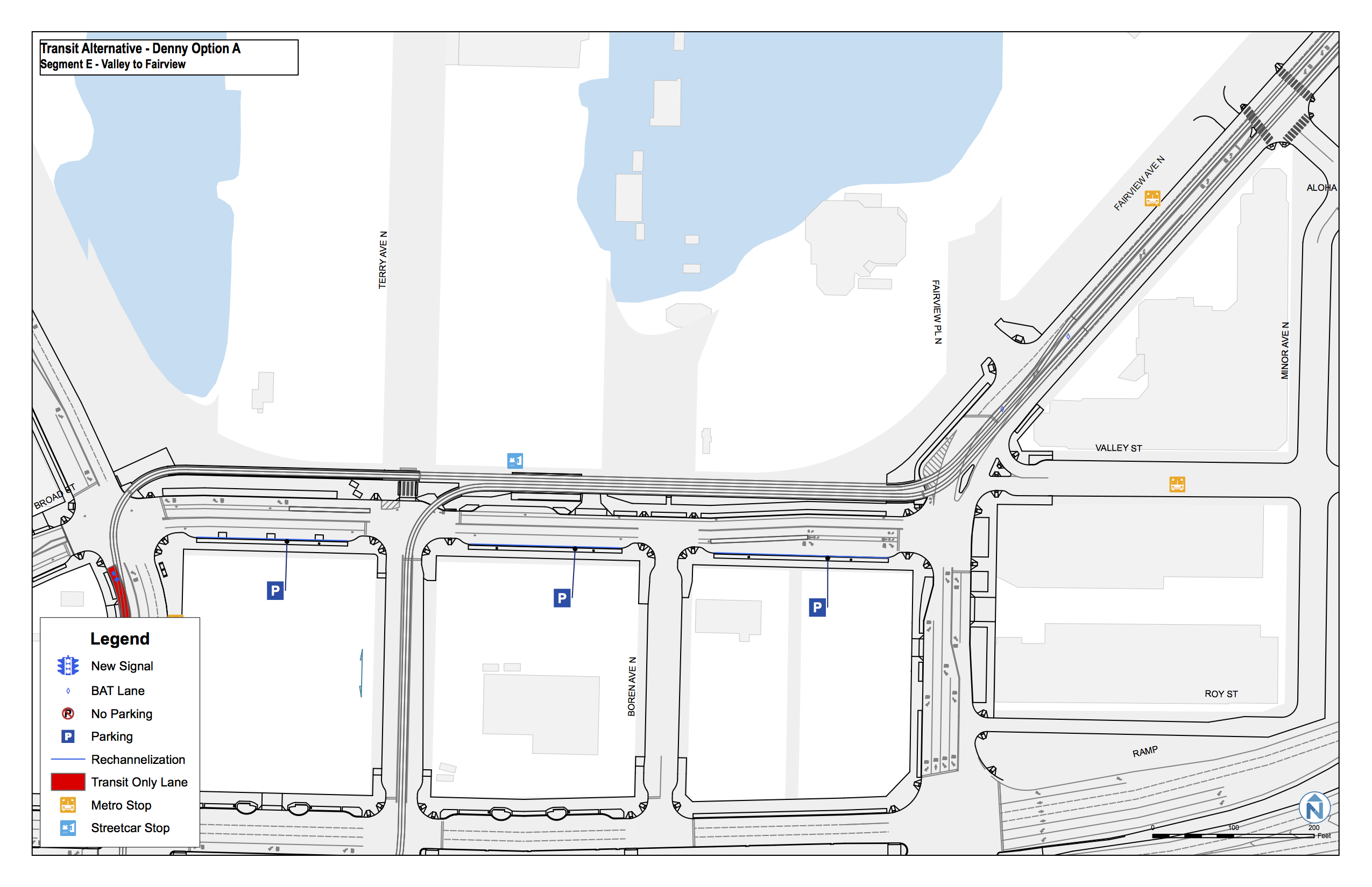
Corridor Layouts
The following are the initial plans for the corridor showing the location of the new transit lanes as well as turn restrictions and other changes.
 |  |
 |  |
 |
|
Note: The insets in the segment “D” graphic depict an alternative location (curb lane) for the northbound transit-exclusive lane.
The Takeway
While far from perfect, SDOT has attempted to strike a balance improving transit access and reliability in South Lake Union while still accommodating personal and commercial vehicular traffic. The identified corridor is an extremely congested one and quite deserving of the transit improvements these changes will make.
As experience has shown, however, it will be crucial for SDOT and the Seattle Police Department to properly enforce traffic rules along the corridor. Too often, people ignore the posted signage, often at the expense of pedestrians and other road users. The project intends to enhance the “Don’t Block the Box” program at two key intersections: Westlake Ave N and Mercer St and Fairview Ave N and Valley St. Failure to adequately enforce traffic rules will jeopardize reliability for both the South Lake Union Streetcar as well as the RapidRide C Line.
The addition of more, reliable transportation options between Fremont, Ballard, Downtown, and West Seattle will provide a welcome alternative to those wanting to choose commuting alternatives that do not involve a personal car and will provide immeasurable benefits to those living, working, and visiting the South Lake Union neighborhood.
The project is completing final environmental review as part of the SEPA process. If you have any comments on this project, you may be submitted in writing to Ethan Melone no later than 5pm on Monday, December 28, 2015.
Additional project information is available online.