

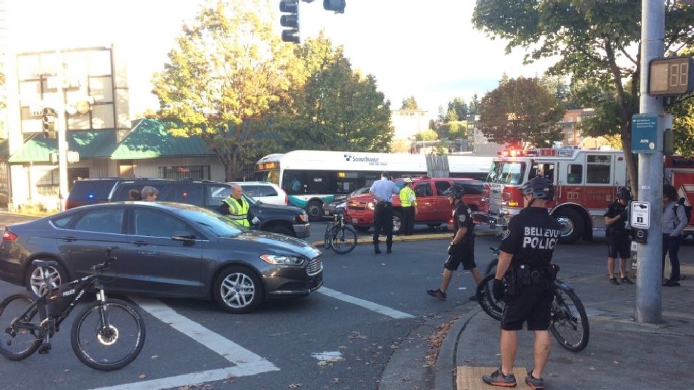
What makes a street dangerous? Do you need a “cutting-edge” algorithm to answer that question? The City of Bellevue has said yes as it embarks on a huge crowd-sourcing effort to teach Microsoft’s traffic data analytics algorithm how to identify humans walking and biking so that traffic-camera-recorded near misses can be cataloged.
The hope is that once identified, these unsafe street conditions can be corrected, leading to fewer collisions, particularly of the deadly variety. Without a computer telling humans want to think, Bellevue planners would have no idea where to start. Luckily machines can think for them, if we program them right. That’s where the unpaid labor benefiting one of the region’s largest corporations comes in.
Microsoft and the City of Bellevue want you to dedicate your time to watching traffic camera footage and label the humans to teach the machine to see pedestrians and bicyclists–incidentally a frequent problem for motorists too. Of course, this volunteer labor also helps Microsoft as it attempts to perfect its self-driving car software to sell to automakers. It’s a win-win–at least for Microsoft, who is likely to take this public-private partnership straight to the bank.
Geekwire, as it is wont to do, labeled the “Video Analytics Towards Vision Zero Partnership” a visionary bit of tech sorcery: “The research is a tremendous leap in the arena of transportation safety.” On the local level, Seattle Transit Blog and Seattle Bike Blog also gave fairly positive reviews, too, heralding the ability to identify areas with frequent near misses before they become the site of a deadly collision.
If a city had truly addressed most of its intersections with documented problems with not just near misses–which aren’t currently measured–but with actual crashes–which are measured–then an algorithm illuminating near misses would be hugely beneficial. However, almost no Americans live in that city yet; we still have our work cut out for us with collision-prone intersections, even before tackling near-misses. A nation doesn’t get to 40,200 traffic deaths per year because things are going so well.
Now this isn’t to say we can’t do two things at once. However, the problem arises when transportation planners take the attitude that without a machine-learning algorithm we can know very little. See the comments of Bellevue principal transportation planner Franz Loewenherz (and project manager for the Video Analytics Towards Vision Zero Partnership) in the Geekwire piece: “Right now you rely on crash reports. They don’t tend to give you enough data to make an informed decision.”
Needing to drown yourself in data before making a decision to improve safety hints that transportation planners are very hesitant to follow as a matter of course the NACTO (National Association of City Transportation Officials) street design guide, which offers a wealth of designs that discourage motorist speeding and offer protection to people walking and biking. Cities adopt “Complete Street” ordinances without intending to actually change the way they design streets when it comes down to it. Not only does adding protected intersections and protected bike lane decrease the likelihood of collisions–we already have data on that–it makes streets more pleasant places to be. We don’t need death threats to design this way, although the threat of traffic deaths is all too real.
Will a video analytics algorithm save street users? Well, if it gets DOTs to follow low-tech solutions that are already obvious. #VisionZero https://t.co/DY3j0SG37a
— The Urbanist (@UrbanistOrg) June 1, 2017
Tom Fucoloro zeroed in on this Vision Zero problem in his assessment:
Of course, this data will be solely academic if cities don’t have the political will to act on it. We already know, for example, that a wide curb radius encourages people driving to take turns too quickly and too close to people walking. Each of the red areas above could be addressed by extending the curbs closer to the center of the intersection or by installing a protected intersection. A more acute curb radius would require people driving cars to slow down and people driving large trucks or buses to swing left before turning right, but it would have a big positive impact on safety and would create more sidewalk space at each corner.
In sum, the prospect of machine learning apparently seems nearer than teaching old traffic engineers new tricks, namely the trick of designing streets and intersections that aren’t high-speed death traps. So on those grounds this project could be defended: we will use the cudgel of big data to finally coerce reluctant City officials and engineers into designing safer, lower-speed streets. Not that the technology itself will necessarily tell us anything we don’t know, but when our leaders worship at the alter of new technology sometimes you have to make an offering to get your way.

Doug Trumm is publisher of The Urbanist. An Urbanist writer since 2015, he dreams of pedestrianizing streets, blanketing the city in bus lanes, and unleashing a mass timber building spree to end the affordable housing shortage and avert our coming climate catastrophe. He graduated from the Evans School of Public Policy and Governance at the University of Washington in 2019. He lives in East Fremont and loves to explore the city on his bike.