However, some longtime local businesses fear that the changes will negatively impact their operations. So far, proposed solutions have not satisfied stakeholders.
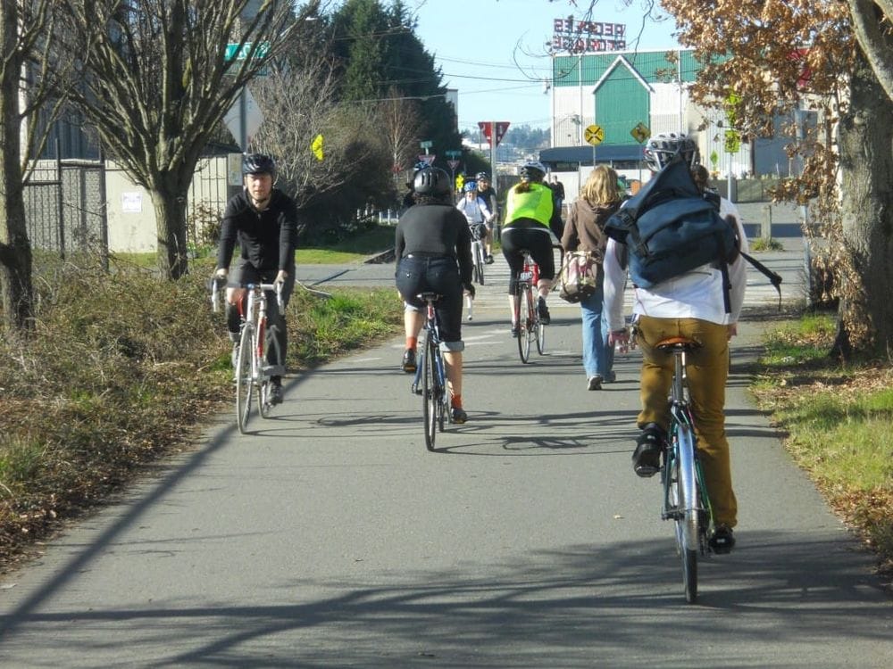
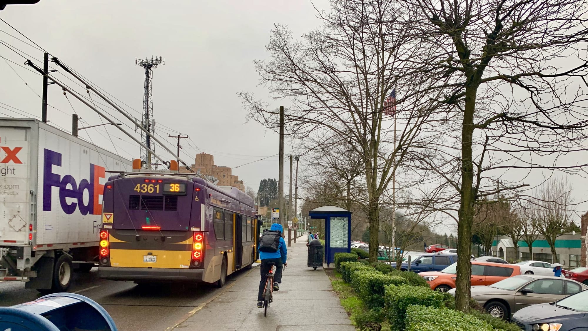
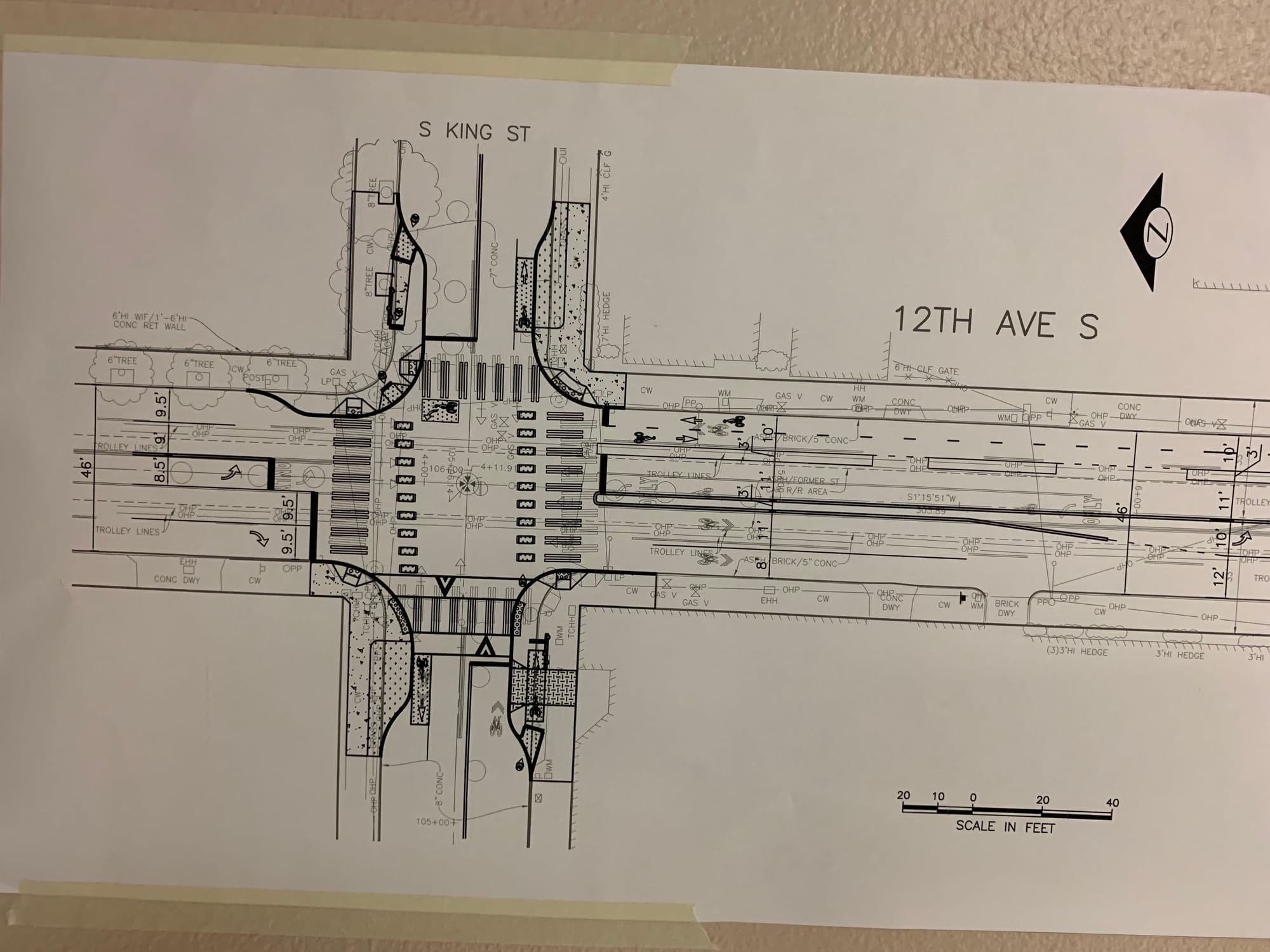
Everyday a diverse cross section of Seattleites pass through 12th Avenue S between the Jose Rizal Bridge and S King Street in Little Saigon. They travel through this crowded, narrow corridor because it is the only direct connection between North Beacon, the Central Area, and the rest of the city. During peak hours on 12th Avenue S you can watch freight trucks, buses, cars, pedestrians, and cyclists all compete for the same pavement. The result is not only chaotic, but also dangerous.
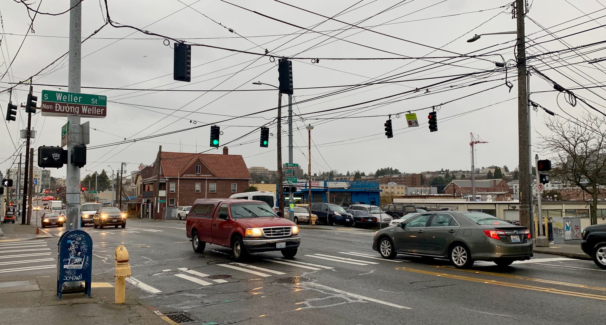
In recent years the high rate of collisions occurring on this two block stretch has attracted the attention of the Seattle Department of Transportation (SDOT). Between 2004-2018, 34 collisions occurred on 12th Ave S between S Lane St and S King Street. Additionally, a disturbing fact emerged from further study of the crash data. In all intersection crashes involving a pedestrian, the pedestrian had the right-of-way at the time of the collision.
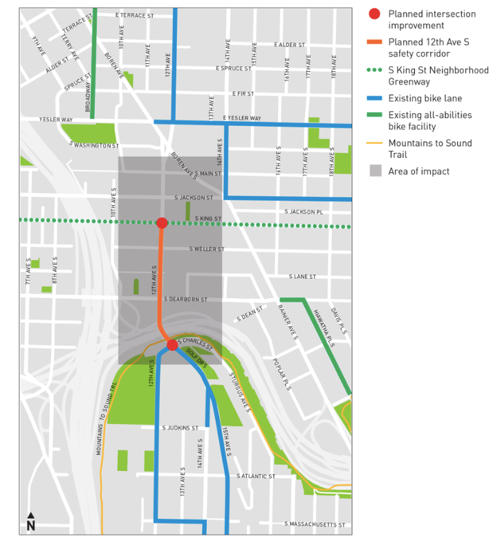
This signified an urban design problem and led to SDOT and the City of Seattle to create the 12th Avenue S Vision Zero Project. Vision Zero is the City’s plan to end all traffic fatalities in Seattle by 2030. One of the focuses of Vision Zero is implementation of protected bike lanes (PBLs) across the City.
Protected bike lanes have been one of the more controversial aspects of Vision Zero, and 12th Avenue S project is no exception. At recent meeting of neighborhood stakeholders, complaints about the plans for installing a PBL on 12th Ave S were voiced by local business owners. “I pay taxes. Do bikes pay taxes?” asked a business owner who was concerned that the PBL would negatively impact freight coming in and out of his commercial grocery operation.
“The city needs to come down here and see the reality. The reality is that I cannot make my deliveries with bikes. I wish I could, but I can’t,” stated another business owner, who in addition to bike lanes was concerned how the planned King Street Greenway would impact his ability to move freight.
Five meetings have taken place between the City of Seattle, Seattle Department of Transportation (SDOT), and 12th Avenue stakeholders since the project was kicked off last April. While some consensus has emerged, notably a recognition that traffic patterns need to change to increase safety for pedestrians, other subjects, like the protected bike lanes remain controversial sticking points.
Controversy Erupts in a Neighborhood on the Brink of Major Change
On the opposing end, bike advocates are frustrated by the fact that current plans leave a gap in the 12th Ave S PBL network between S King St and Yesler Way. While the City has committed to eventually connecting the PBL through the entire 12th Avenue corridor, there are no current plans for how to approach the gap, which runs through highly congested and dangerous intersections at S Jackson St and Rainier Ave S. Since implementation of the Bicycle Master Plan remains far behind schedule, critics point out that it could take a long time for the gap to be addressed, putting people’s lives at risk.
This is important because the surrounding area will be greatly increasing in residential and commercial density very soon. Little Saigon now sits on the brink of major change. Thousands of new residential units will come online in a few years when the Yesler Terrance redevelopment project and many other private and public developments are completed.
In anticipation of this significant increase in residential density, the City is paying close attention to how well this traffic corridor serves people using multiple modes of transportation, including bikes. This is important because the planned developments will add thousands of commute trips and many are targeted as walking, biking and transit trips, as evidenced by many of the buildings relatively low parking ratios.
According to data on Seattle in Progress, a review of the seven permitted developments within an approximate quarter mile walkshed of the project area reveals plans for 1,369 residential units, but only 1,008 parking spaces. Some of these developments will contain large commercial and office spaces, so not all parking will be for residents. Another significant project impacting future transportation in the corridor is a planned development at 1200 12th Ave S, in what is currently the parking lot for the Pacific Tower.
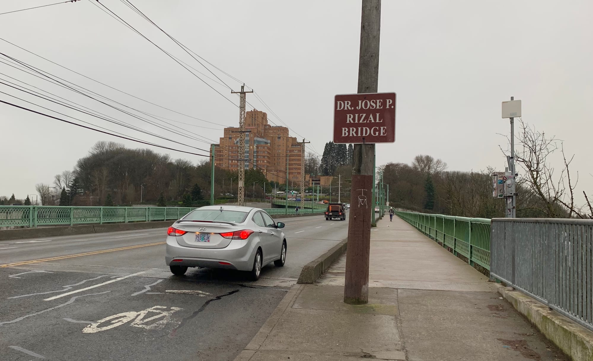
A new 302-unit apartment building with parking for 225 vehicles is planned on the south side of the Jose Rizal Bridge in what is currently the parking lot of the Pacific Tower.
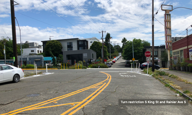
Because of topography and distance from North Beacon Hill commercial areas, future residents will need to travel over the Jose Rizal Bridge to meet many of their basic needs, placing them directly into the danger zone on 12th Avenue S.Recognizing the need for safe biking and walking connections to South Seattle, the City selected S King Street as a Neighborhood Greenway. Greenway improvements are expected to begin in 2019; however, local business owners are already upset at some of the changes that have taken place, such as the removal of the left turn lane at S King St and Rainier Ave S in May 2018, which was modified to increase safety for pedestrians and cyclists crossings Rainier Avenue.
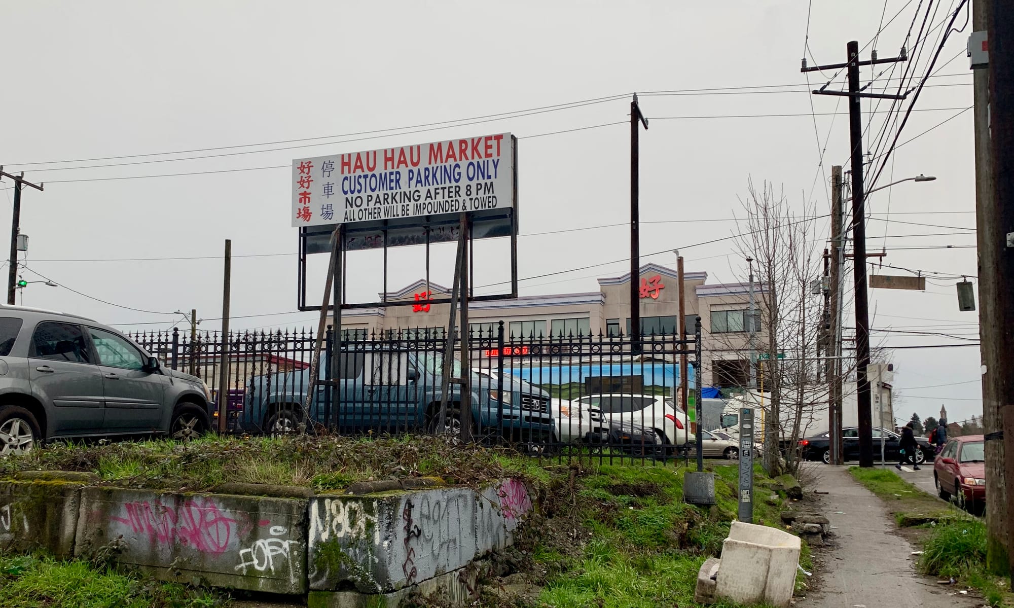
12th Avenue S has long been a neighborhood known its for immigrant businesses and serves as the commercial center of the Vietnamese community in Seattle. Lam’s Seafood, Hau Hau Market, King’s Oriental Market, Thanh Son Tofu, are some examples of immigrant owned businesses with substantial operations there that date back decades.
At the most recent stakeholders meeting it was clear that business owners felt that changes to the neighborhood were threatening their businesses and livelihoods. “I used to make 10-15 trips a day with my truck on [South] King Street,” said one business owner. “Why are they going to make that a street for bikes?”
Representatives from the City explained that S King Street was selected for the Greenway because street that met the requirements of connecting across I-5 without becoming prohibitively steep. Still for longtime community members who see the neighborhood changing around them, it appears to be increasingly difficult for them to see themselves as part of Little Saigon’s future. Gentrification has become a particularly thorny issue, and amenities like the King Street Greenway and 12th Avenue S protected bike lane are viewed by some as intended for future gentrifiers, not current residents.
Working Toward Compromise
In order to resolve the safety issues on 12th Avenue S, the City has made several proposals. The proposals are still in a conceptual phase and will opened up for community feedback in the coming months. Here are some of the more certain proposed changes:
- Removal of a lane of traffic on 12th Ave S. and addition of a protected left turn lane at S Weller St, the intersection where the majority of the collisions have occurred.
- Relocation of a bus stop to the intersection at S Lane St.
- Addition of a protected bike lane (PBL) that will connect 12th Ave. S with the S. King Street Greenway. Current plans envision the PBL as running in two directions on the north side of 12th.
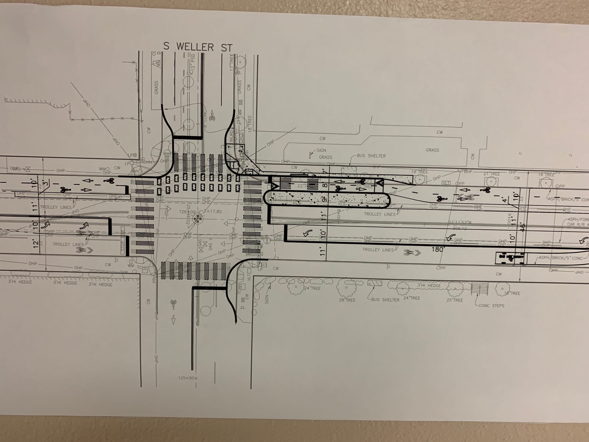
However, many details remain to be confirmed. Among them is the use of curb bulbs. SDOT would like install curb bulbs, which extend the sidewalk out into the street and make it easier for pedestrians to cross; however, stakeholders are concerned that the curb bulbs, in addition to the other changes, will make it impossible for large freight vehicles to pass through.
The City ran their models anticipating that freight vehicles would max out around 30 feet, however, some businesses insist that many vehicles are up to 70 feet in length. This length difference has required the City to rerun the models with new data and make changes accordingly.
A Hub for Social Services and Vulnerable Populations
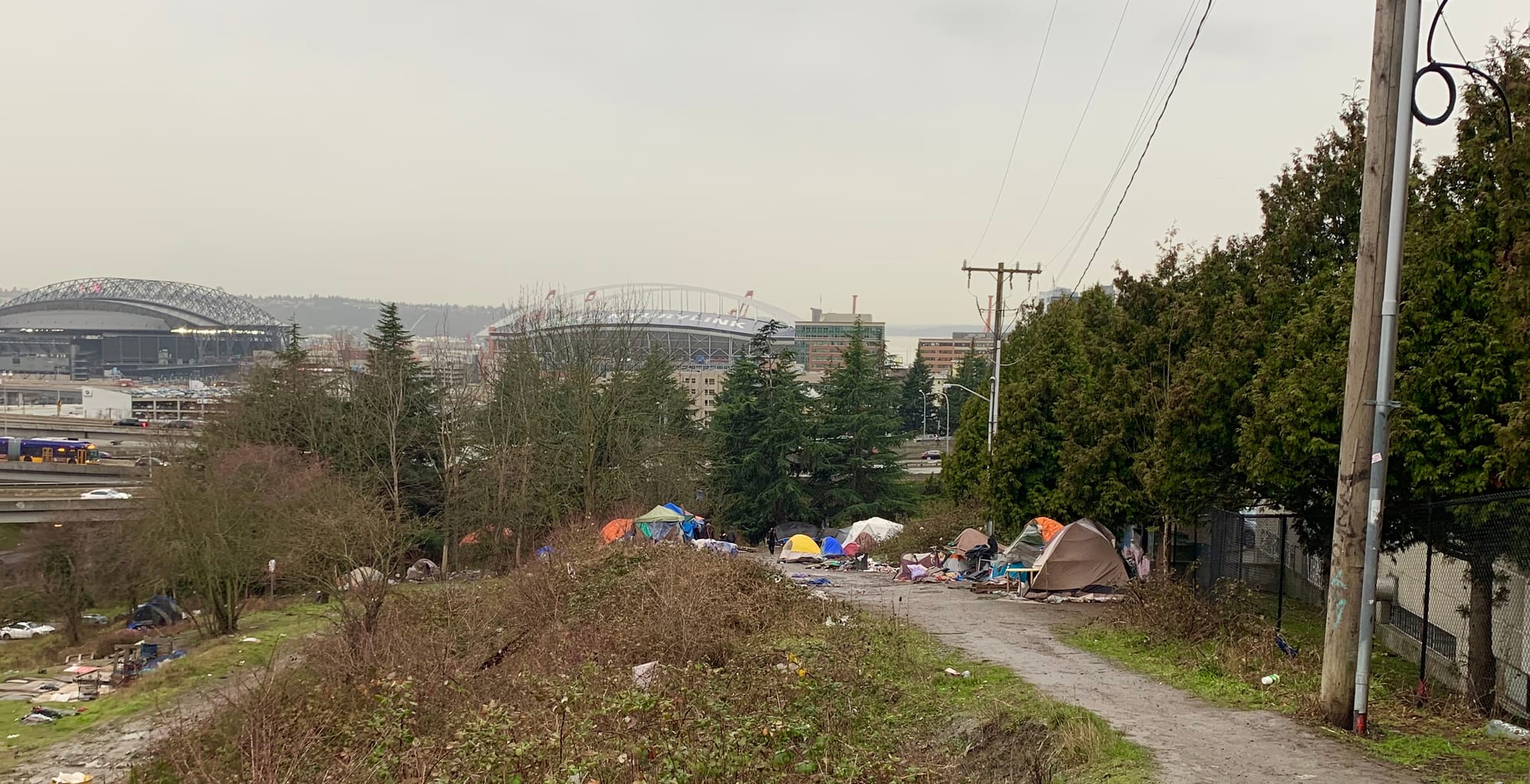
Further complicating discussion of proposed changes is the fact that 12th Avenue S operates as a de facto hub for social services and vulnerable populations. The City’s only Navigation Center, a low-barrier, service-enriched shelter targeting high-needs homeless adults living in encampments, is located at the corner of S. Weller and 12th Avenue S. Across the street at an undeveloped stretch of S. Lane Street owned by the Park Department is a large homeless encampment. Safety for all users of the intersections, including homeless residents and Navigation Center clients, is a top concern, especially as the encampment population size increases.
However, patients and employees of Seattle Indian Health Board (SIHB), which is located directly adjacent to the encampment, have voiced concerns about an increase in drug sales and consumption at the bus stop they share with the Navigation Center. As a result, SIHB is concerned about plans for relocating the bus stop further south to S. Lane Street, which is very close to the encampment. Already, patients have been deterred from using the current bus stop because of complaints of illicit activity at the bus stop.”It is a big barrier for the elderly to have to walk two blocks to the other bus stop,” a SIHB representative said.
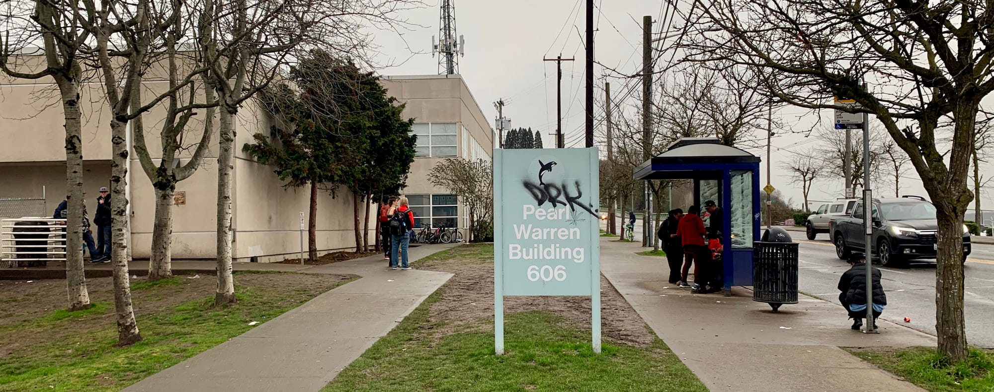
SIHB serves over 3,200 patients and provides over 32,000 bus passes annually. Many of their patients are elderly or include families with small children. Having a bus stop close by where patients can feel safe is important for patient access. To make the bus stop feel safer, SDOT plans to remove benches and visibility-limiting walls. They also plan to install blue lights that make it harder for IV drug users to identify veins when trying to inject drugs.
SIHB has also expressed concerns about safety for pedestrians and cyclists in the 12th Avenue S corridor. “We have had staff members hit by cars at the Weller intersection,” a SIHB representative said. “We know this street is dangerous.”
Is Compromise Possible?
The 12th Avenue S corridor illustrates Seattle’s some of most visible growing pains. Immigrants businesses, new residential and commercial developments, homeless encampments, and services for vulnerable residents are all packed into a short two block stretch. SDOT and the City will be increasing their outreach to the community in the upcoming months. As this happens they will be seeking to figure out how improve a complex and problematic corridor that serves as an important point of connection for many different users with many different needs.