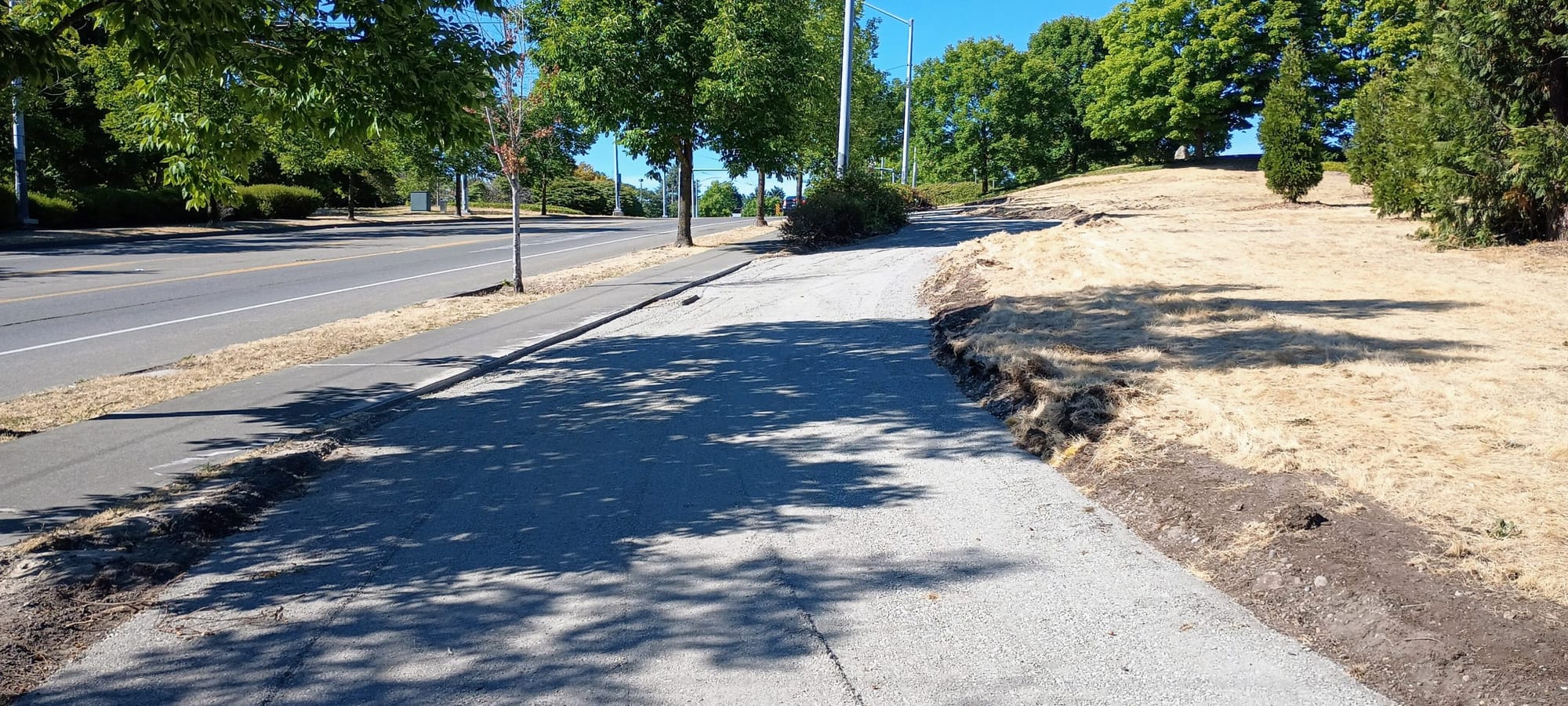
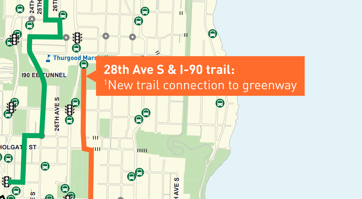
Earlier this month, the Seattle Department of Transportation (SDOT) started construction on a small stretch of multi-use pathway near I-90 that will have an oversized impact: It will finally connect the main neighborhood greenway throughout the Rainier Valley to the Mountains to Sound trail to Beacon Hill and across the lake to the Eastside.
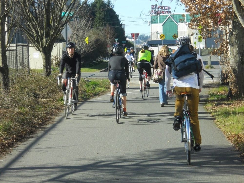
Since it opened in 2018, the six-mile, north-south greenway through Rainier Beach, Hillman City, Columbia City, and Mount Baker has abruptly ended at a random corner around 30th Avenue S and S College Street, with any riders who end up trying to connect to the trail finding a dead-end at the end of 28th Avenue S. A trail connection had been proposed across the highway lid since at least 2015, but it was left out of the original construction plan and sat unfinished.
As The Urbanist first reported in 2021, that trail didn’t move forward because the Washington State Department of Transportation (WSDOT) could not reach an agreement with SDOT around leasing right-of-way for trail access across the I-90 lid, which it controls. Because a short trail connection from a street end to an existing path couldn’t be considered a “highway purpose”, the state agency didn’t consider itself able to offer a no-cost trail lease to the City of Seattle.
“This segment of the [neighborhood greenway] is not adjacent to, severed by, or a part of any state highway. The trail does provide a separation of motor vehicle traffic and pedestrians from municipal streets and routes (increasing safety), but not from a state highway. There is no reliever effect, joint use, highway purpose or other benefit to the state. We must pass this test before the state can issue a no consideration trail lease as a highway benefit,” Marty Stickford, a program manager supervisor at WSDOT wrote in a letter to SDOT in 2018.
The only option presented as feasible was an airspace lease, which would cost Seattle $24,000 per year, escalating with inflation, in perpetuity, for a trail across a park that the city already maintains.

The issue eventually worked its way up through the agency to Barb Chamberlain, director of active transportation at WSDOT. Following a site visit in 2019, a way forward was found: instead of a direct connection to the I-90 trail, a shorter connection to the sidewalk on MLK Jr Way S. “On our walk-through we identified a possible alternative for you to consider: A short connection to the sidewalk from the end of 28th would likely be something we could say yes to,” Chamberlain wrote that year. “If you were to approach this as a widening of the sidewalk that wouldn’t be a new trail.” By 2021, that idea was turned into a full design.
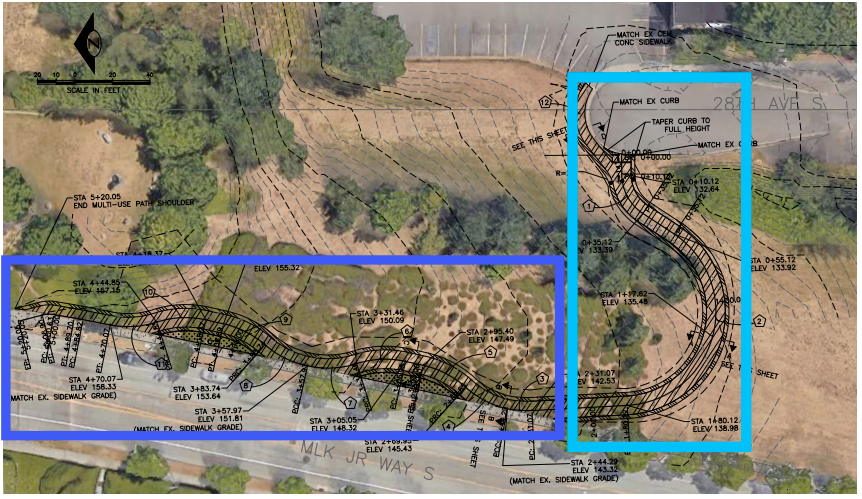
Even though this cut-through is not as ideal as a direct connection, it will unlock an entire segment of the neighborhood greenway. 28th Avenue S is a great gradual way to gain some elevation, in contrast with some of the steeper hills around like 30th Avenue S. While the Rainier Valley Greenway isn’t an adequate replacement for safe spaces for people to bike on nearby arterial streets in South Seattle, it still provides access to a lot of useful connections. Until now, it’s never been able to realize its full potential. It would have been very easy for either the state or the city to give up on making the connection, but all trail users will now benefit from their perseverance.
Nearby, a different project is moving forward that hadn’t even been conceived when the idea for a trail connection was developed: a protected bike lane on MLK Jr Way S that will connect from Judkins Park light rail station and the I-90 trail directly with the heart of Mount Baker at MLK and Rainier Avenue S. Originally set to start construction last year, it too has faced delays. And some of those delays can be traced back to the highway lid right-of-way as well.
“[O]ur partner transportation agencies informed us of new traffic control plan requirements during a standard interagency review,” an update to the project page last week noted. “This project is federally funded and crosses over I-90, which is in Washington State’s jurisdiction. We created new plans and shared them with our partners, requiring us to wait for their approval.” The project was originally set to go out to bid last year, but those additional reviews, on top of the fact that construction bids came in higher than expected, have pushed the timeline back. SDOT now expects to start construction this fall, with construction expected to take around six months.
Both projects are long overdue. When both of these connections come to fruition, people biking in the north end of the Rainier Valley will have access to the type of bike infrastructure that is much more common in North Seattle. This should also add momentum to keep going.
Tentative Agreement Reached on Rainier Valley Greenway’s North Connection