One of the city’s most highly-used bike trails is about to see improvements that will remove elements that have been giving trail users consternation for decades. The Port of Seattle Commission Tuesday approved allocating $1.5 million to address two major pinch points in the Terminal 91 Trail, which connects Magnolia to the north downtown waterfront as part of the Elliott Bay Trail. The widening project will remove a long-problematic bridge that creates poor visibility of the trail ahead and tackle another segment where the trail narrows to only a few feet wide.
Once completed, the pathway may feel like an all-new trail, as it follows closely on the wake of a separate project earlier this year that resurfaced the asphalt on the corridor for much of its length. The Port’s schedule currently calls for construction to start on the upgrades next fall, a period coinciding with slightly lower daily usage of the trail, with improvements substantially completed by Halloween. News of the planned trail improvements was first reported last week by Seattle Bike Blog.
“We’re really excited to see the plans to remove the T91 trail bridge from the Elliott Bay Trail,” Vicki Clarke, policy director for Cascade Bicycle Club, told the Commission ahead of their vote. “The bridge is a challenging pinch point…but rather than dwell on shortcomings, I’d rather focus on what removing the bridge and widening the trail means: a safer, more consistent, and comfortable ride or stroll.”
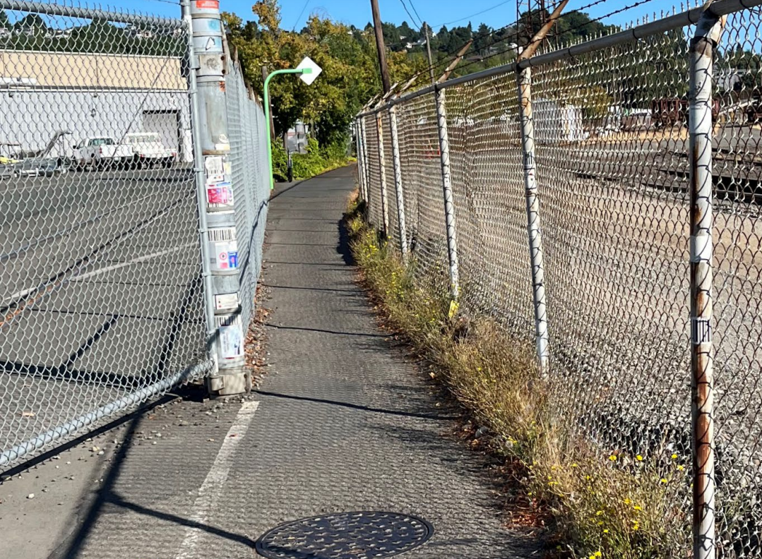
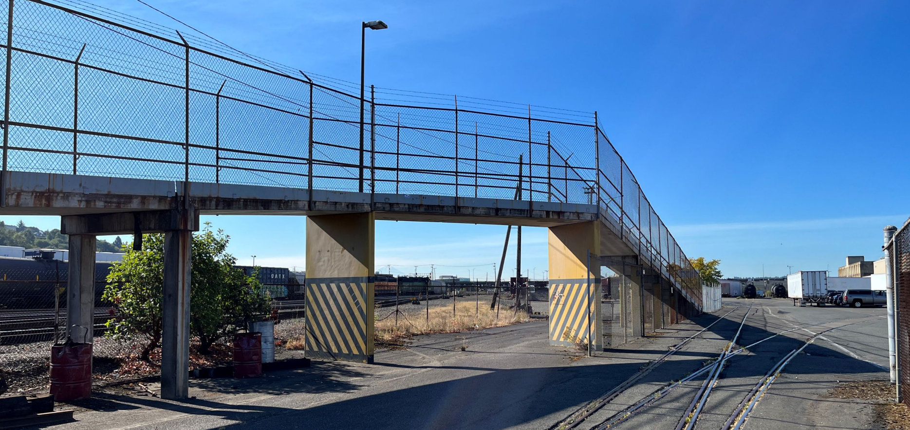
Open since 1987, the T91 trail is wedged in between Port property and the BNSF railyard, and about ten-feet wide along most of its length but existing rail infrastructure prompted some fairly big concessions to the trail’s design, most notably a bridge barely wide enough for two people biking to pass side-by-side that blocks visibility of any other trail users coming up the other side. That bridge was originally created so that vehicles could directly access rail cars without disrupting trail users, work that no longer occurs. The trail features another pinch point to the south that’s at-grade but similarly narrow. Both segments have signage directing people on bikes to dismount, though compliance with that rule is low.
“I am delighted to report that the Port of Seattle Commission just authorized this significant improvement to the bike path across Terminal 91 through Interbay,” Commissioner Fred Felleman said in a statement following the unanimous vote. “It has been a long priority of mine to widen the bike path and remove the bridge in order to enhance cyclists’ experience and to encourage this healthy form of commuting. It’s another example of where we’re working to further the coexistence of commerce and communities.”
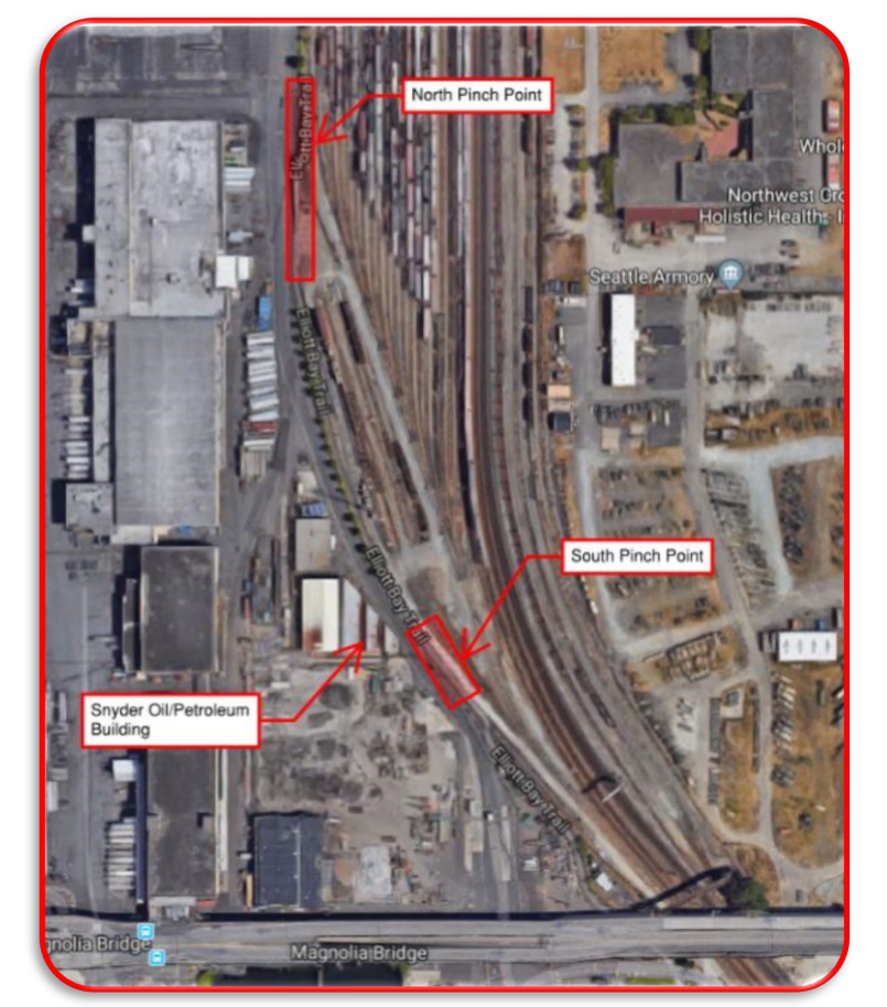
When complete, the narrowest segment of the trail will still remain the site of the south pinch point thanks to BNSF’s easement, but that pinch point will be widened to 8.5 feet without a buffer on either side. The Port did consider what it would take to widen the trail south of the existing bridge to a ten-foot standard width to match the rest of the trail. The answer? An additional $4 to $7 million to completely relocate the nearby rail spur.
The entire waterfront trail corridor will likely see a substantial increase in use as the City of Seattle works toward wrapping up work on the central waterfront trail and a related project to bridge the final gap between the Seattle Aquarium and the Olympic Sculpture Park, currently the subject of intense negations between the city and industrial partners like the Port. Last month, Melinda French Gates and city leaders announced a partnership that will invest $45 million in the corridor, largely in the form of a new “greenway” in the former Waterfront streetcar right-of-way along Alaskan Way on the Belltown waterfront. That project will be additive and not take the place of the planned city-funded bike connection on the same street.
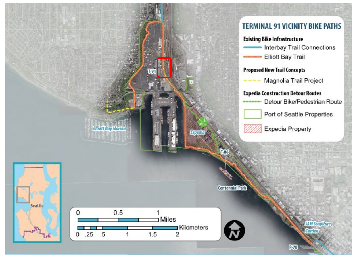
The Elliott Bay Trail is set to remain one of the easiest ways for people who walk and bike to connect between Magnolia, Interbay, and downtown, primarily due to the City of Seattle’s reluctance to make space on the main transportation corridors through the area, Elliott Avenue W and 15th Avenue W. The draft version of Seattle’s 20-year Transportation Plan, released in late August, doesn’t identify the corridor as an appropriate place to add bike infrastructure, despite the significant street space available to reallocate. Sidewalks on the street are also fairly narrow for a street that hosts a RapidRide bus (the D Line), when 18-foot sidewalks are the standard in the city’s guidelines.
As the primary freight corridor through the entire northwest quadrant of the city and a connector to the industrial lands around Interbay and Ballard, changes to the street face an uphill battle from freight advocates. Last year, a simple change to expand the number of hours that 15th Avenue W’s curb lane was dedicated for transit vehicles only received pushback from groups like the North Seattle Industrial Association, even though the number of hours the restrictions remain in effect on the street stayed relatively low.
For the foreseeable future, it doesn’t look like this corridor is going to become a candidate for any serious upgrades to benefit people who walk or bike, and the trail will remain many people’s best alternative — unless they need to access to any amenities on 15th Avenue W.

Another thing to watch with the T91 trail upgrades will be a detour during the construction period. The repaving work completed earlier this year on the trail was set to require a week-long, circuitous detour via the Magnolia Bridge — an experience that would deter many novice bike riders from trying the route again. In the end, the construction closure only lasted about one day, mitigating much of the impacts. For this project, the Port and the City of Seattle will need to collaborate better to find a more legible and usable detour.
Once construction is complete, this incredibly worthwhile upgrade will strengthen the entire citywide trail network and make nearly everyone who uses the Elliott Bay Trail happier.
Waterfront Seattle Projects Advance in 2022, But Full Trail Opening Years Away