On Thursday, the Seattle Office of Planning and Community Development (OPCD) released zoning maps for the 30 new neighborhood growth centers that the Seattle City Council approved in December, a key element of the city’s new long-term growth strategy. The new maps contain some clear disappointments for urbanists, particularly when it comes to anemic bus corridor upzones that were further emaciated in several areas.
After a period of public review and City Council deliberations, OPCD aims to pass the new zoning regime by this summer, a move that will bring the city into compliance with state law. Mayor Katie Wilson has pledged to come back and expand on these upzones, which would likely need to wait for next year to allow for environmental study and outreach work. Virtually all of the work to prepare these zoning changes happened under her predecessor, Bruce Harrell.
“This legislation builds on important zoning reform, updating the rules on what can be built and where, so we can create abundant and affordable housing,” Wilson said in a prepared statement. “Seattle is a great city, and more and more people want to make it their home. We’ll keep advancing zoning changes and developing social housing, as we expand our housing and affordability options. And we are just getting started.”
Wealthy enclaves beat back some upzones
OPCD had already circulated draft zoning maps earlier in the marathon process for the major update to the City’s Comprehensive Plan, which happens once per decade by state law. Planning officials portrayed changes from that earlier draft proposal as relatively minor, though journalists did not get a look at the maps during a press briefing on Wednesday to confirm that assessment.
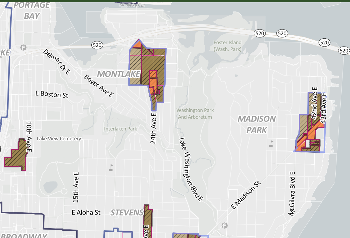
I'm already seeing a few notable ways that this has been scaled back from the last version of these maps that OPCD had released. Upzones along the Route 2 heading down to Lake Washington in Madrona have been cut out, for example.
— Ryan Packer (@typewriteralley.bsky.social) January 29, 2026 at 3:42 PM
[image or embed]
As is the custom in Seattle, several wealthy neighborhoods were able to wriggle out of proposed apartment zoning. Among those jettisoned (or never proposed) transit corridor upzones in some parts of North Capitol Hill, Madrona, Magnolia, and Montlake. Two entire blocks of zoning changes along Densmore Avenue N in Haller Lake, close to the impending Pinehurst light rail station, were dropped without explanation.
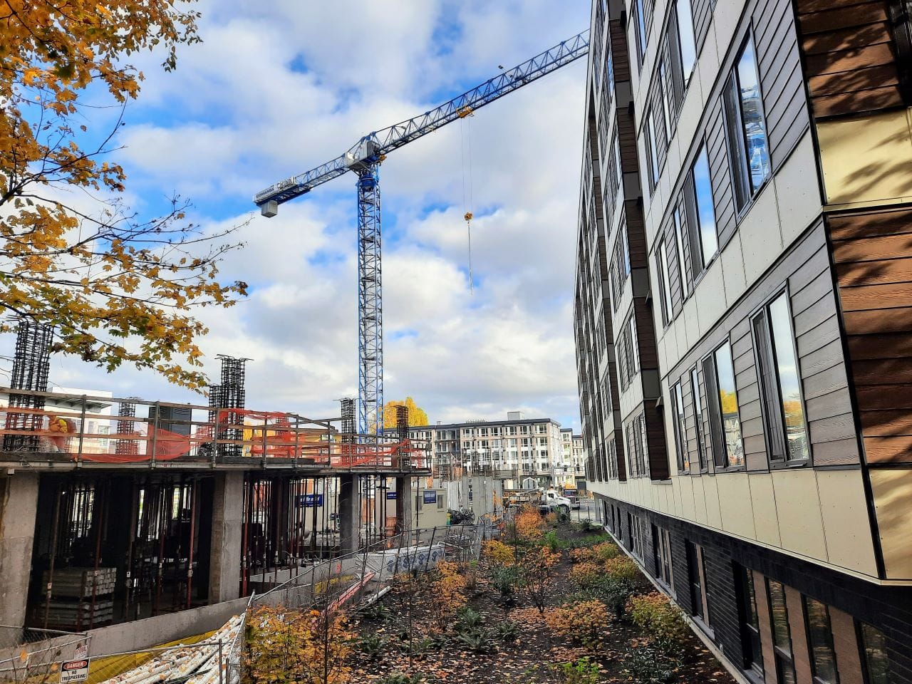
Where they are intact, those transit corridor rezones are only a half-block and generally Low-Rise 3 (LR3) zoning, which would allow five-story buildings. OPCD noted that the plan would update LR3 citywide to the stronger version that is currently only in urban centers, which it portrayed as an enticing zoning type for builders.
Upzones along the 49 in North Capitol Hill (next to our very nice under-construction highway lid) scaled way back.
— Ryan Packer (@typewriteralley.bsky.social) January 29, 2026 at 3:45 PM
[image or embed]
Urban Center expansions and Pinehurst center upzone
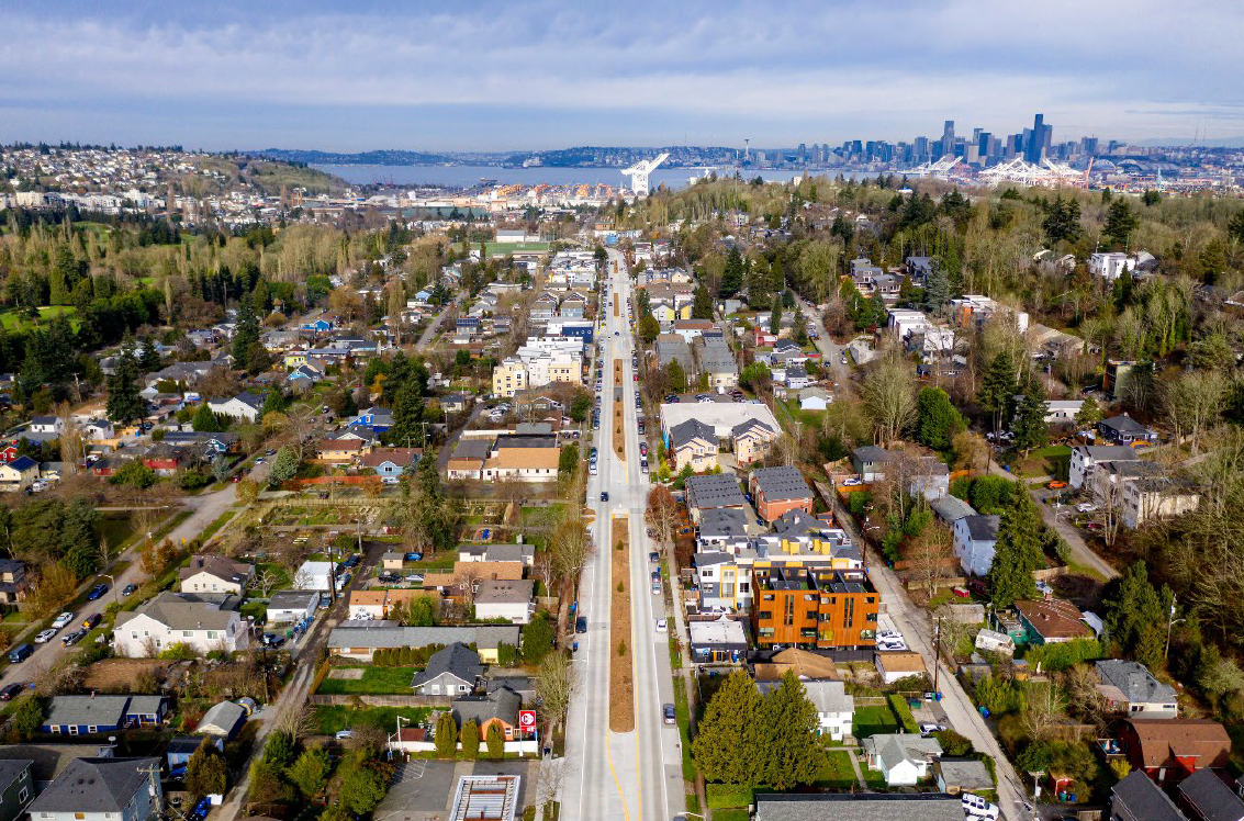
LR3 may be the most prevalent zoning type in the rezoned areas, including wide swaths of neighborhood centers and in a handful of expansions of existing urban centers that were included in the plan. Significantly expanded urban centers include Admiral District, Morgan District, and Greenwood.
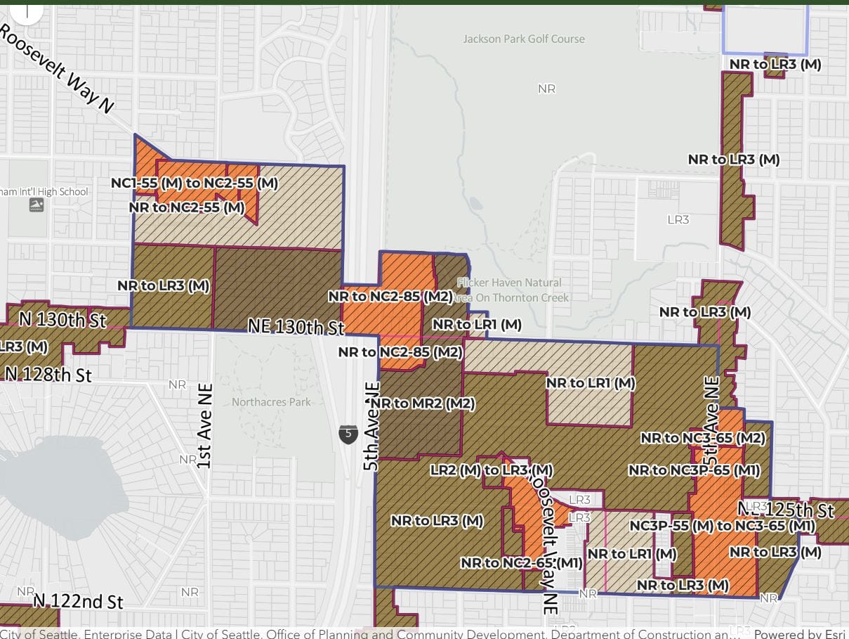
Pinehurst, meanwhile, is an entirely new urban center being added around Seattle’s soon-to-open infill light rail station at N 130th Street, which will be a stop for both the 1 Line and 2 Line. The presence of Jackson Park Golf Course next door to the station makes this an oddly shaped center.
Housing advocates had already raised concerns about how the transit corridor zoning was set to be implemented. The Seattle Planning Commission, the Complete Communities Coalition (of which The Urbanist is a member via its advocacy arm), and other advocacy groups were clear in pushing the City to upzone beyond the immediate transit street to neighboring quieter streets, with some suggesting a five-minute walk would be a better rule of thumb. That suggestion clearly died by the wayside.
Rather, the movement from the draft maps to the final maps was largely in the other direction, with OPCD dropping proposed upzones in wealthy neighborhoods where displacement risk is low.
In line with Ryan Packer’s earlier reporting, the Wilson administration is sticking with a plan to pass the zoning changes queued up in December under previous leadership and come back in Phase 3 and Phase 4 to expand on the plan and add even more potential density. Wilson ran a campaign focused on the issue of affordability and said she would have gone farther than the previous administration in encouraging housing density. Her campaign performed much better in apartment zones, as opposed to wealthier single family areas, where Harrell was popular.
Why Wilson isn’t overhauling Phase 2
OPCD Director Rico Quirindongo explained that state deadlines were looming and hinted at risks to grant funding provided via the Puget Sound Regional Council.
“The less time there is between the adoption of the Phase 1 legislation and the adoption of the zoning implementation, the better, both for Puget Sound Regional Council and the state,” Quirindongo said. “Opening up the box to try to make changes with the phase two package has delay implications that are concerning, and so that’s where we really want to lean into both Phase 3 and Phase 4 and do a real exploration of what are the other things we know we want to add back into the toolkit, and actually give us a little time to do that.”
Other cities around the state are coming under state scrutiny for not passing their Comprehensive Plans on time, or for leaving out key elements of recent housing reforms approved by the legislature. While Seattle is likely not in any jeopardy of seeing serious consequences for dawdling on its plan, being out of compliance could ultimately mean risking eligibility for state funding.
Quirindongo is among the city department heads that Wilson is intentionally keeping in his role, a vote of confidence that suggests that he’s on board with the administration’s plans to go bolder next time. But the fact remains that it has been OPCD’s planners who have been shrinking neighborhood centers and transit corridors in response to pressure from neighborhood groups wary of too much change.
While the plan did not increase housing opportunities to the extent advocates were urging, it does represent a major step forward compared to the status quo. Planning officials say the zoning changes on deck as a whole will double housing capacity, and stressed that the plan was designed to increase affordability and homebuilding momentum — notwithstanding some of the quiet cuts in response to neighborhood pushback.
Queuing up future phases
Quirindongo sketched a rough timeline for future phases of Comprehensive Plan tweaks, which could include zoning changes in Seattle “Regional Growth Centers” — Downtown, Northgate, Uptown, South Lake Union, Capitol Hill/First Hill, University District, and Ballard.
“The plan right now is that four get adopted as part of annual amendments in 2026, four more in 2027, Ballard in 2028,” Quirindongo said. “And there may be some upzones that are part of that consideration, related to those, to some of those subarea plans that are also part of Phase Four.”
It’s already been a long saga for this planning update.
The City broke the Comp Plan into phases after the Harrell administration fell behind schedule and ran into challenges meeting the state deadline to phase out single family zoning, as required in House Bill 1110. Ultimately, the City relied on an interim ordinance to meet the state mandate and passed permanent “Phase 1” legislation in December, which became effective on January 21, 2026.
- Phase 1 – Changes in urban neighborhoods (formerly single family zones) meeting state middle housing requirements, completed in December.
- Phase 2 – Rezones implementing new growth areas in Comprehensive Plan via 30 neighborhood centers, expansions of urban centers, and transit corridors.
- Phase 3 – Adding nine neighborhood centers and expanding six neighborhood centers (as requested in Comp Plan companion resolution) and upzones in selected areas within existing Regional and Urban Centers (centers that don’t have ongoing planning processes that will take longer).
- Phase 4 – Additional upzones around transit to incorporate 1) remaining changes required to fully comply with state transit-oriented development requirements passed in HB 1491 and 2) changes to implement remaining Regional Centers subarea plans and station area planning efforts which are ongoing. This phase could also include additional changes (e.g., transit corridors).
The Urbanist was able to a bit more clarity on why a supplemental environmental impact statement (EIS) was necessary in order to add the nine additional neighborhood centers that councilmembers proposed last year, largely at the prodding of Councilmember Alexis Mercedes Rinck, but ultimately only “docketed” for future passage.
Beyond the existing vague legal appeal risk excuse, Quirindongo and Michael Hubner, OPCD’s Long Range Planning Manager explained that the culling of centers that happened between the Comp Plan’s draft EIS and the final EIS meant that the 30 final neighborhood centers received more environmental study that the original list of about 50 neighborhood centers that Harrell’s office pared back. Under advice from the City’s legal team, planning officials wanted to make sure they had shown their work on State Environmental Policy Act (SEPA) requirements.
“The scope of the Final EIS did not include any of the centers that Council has now asked us to do additional environmental reviews,” Hubner said. “There’s some other complexities in the weeds of SEPA there that we need: integration with our transportation modeling and all of those things.”
The supplemental EIS work is already underway, with OPCD indicating it had hired a contractor. That work is scoped to include the nine additional neighborhood centers and six neighborhood center expansions. However, the City could potentially add more to the environmental review, with the caveat it could mean the study takes longer to complete.
“We all know there’s more work to do,” Mayoral spokesperson Sage Wilson said.
Correction: An earlier version incorrectly indicated that broader transit corridor upzones are in scope for the Phase 3 supplemental EIS. Barring a contract revision, those citywide corridor rezones would need to wait for Phase 4.