Urbanist Tours: Rainier Avenue Video Recap
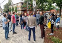
On Saturday morning, The Urbanist was pleased to be joined by Seattle Department of Transportation (SDOT) and dozens of advocates for a walking tour...
Rainier Avenue Data Suggests Road Diet Hasn’t Gone Far Enough Yet
Last week on Twitter, I provocatively asked, “Was the Rainier Ave road diet pilot a failure?“ While any roadway improvements that convert four lanes...
Spot Fix: SDOT To Convert Three Signals To All-Way Stop
The Seattle Department of Transportation (SDOT) has selected three signals across the city to be converted to all-way stops. The conversions require reprogramming signals...
SDOT Finalizes 65th Street Vision Zero Concepts
The Seattle Department Transportation is moving forward on making significant changes to NE 65th Street in North Seattle after asking for feedback on several...
Pike/Pine Protected Bike Lanes Get Another Design Change
The Seattle Department of Transportation (SDOT) is moving ahead quickly with a plan to install protected bike lanes (PBLs) on Pike and Pine Streets...
Help Decide How The Central Ridge Neighborhood Greenway Connects Neighborhoods
Through Sunday, the Seattle Department of Transportation (SDOT) is offering a survey to get feedback on a concept for the Central Ridge Neighborhood Greenway...
Holman Road Trades an Overpass for a Safe Crossing
Holman Road is a busy arterial connecting neighborhoods in Northwest Seattle. Stretching from N 105th St in Greenwood to 15th Ave NW in Crown...
Your Voice, Your Choice Project Winners Announced
The City of Seattle, via the Department of Neighborhoods, has just completed its first citywide experiment with participatory budgeting. In March, the department solicited...

