The intersection of 3rd Avenue and Yesler Way in Pioneer Square is a very awkward spot where a few different streets come together and every single bus entering the 3rd Avenue transit mall, the busiest bus corridor in the state, makes a turn of some type to get onto the street. Also, as a result of the angle at which some of the streets intersect, some of the pedestrian crossings are very long. The spot has been identified by the Seattle Department of Transportation (SDOT) as a High Collision Location (HCL), with several pedestrians struck by drivers and seriously injured at the intersection in recent years.
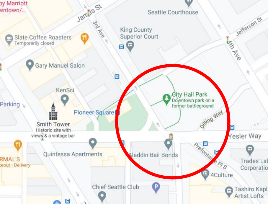

After analyzing crash data for the intersection, SDOT is proposing a modification to the intersection to improve safety for people walking and rolling across 3rd Avenue, and it could end up being a net positive for transit travel times on the street. With the change, northbound 3rd Avenue would be reduced to one lane only between Yesler Way and the existing mid-block crosswalk at the King County Courthouse. Prefontaine Place, on the other side of Yesler, would also be narrowed to one lane to prevent more than one bus at a time from entering a street with only one lane.
In a comprehensive look at citywide crash data released in 2020, SDOT found that intersection size, including the number of legs in an intersection and the number of lanes, was associated with an increased number of crashes involving pedestrians. Channeling traffic into fewer lanes, SDOT hopes that the number of crashes can be reduced. You can see a hand-drawn illustration of the changes SDOT plans here below:
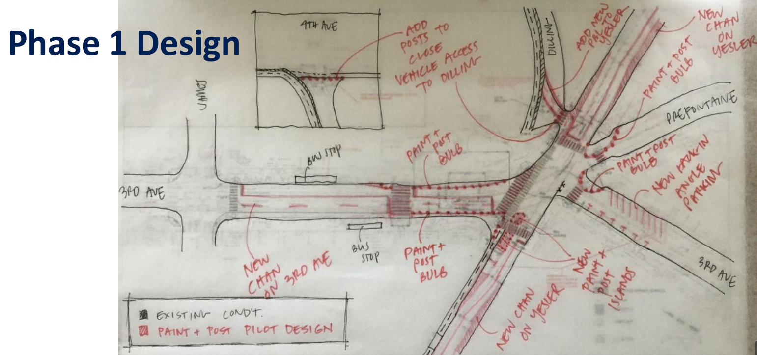
Overall bus travel times on 3rd Avenue are expected to improve as a result of this change because of adjustments that will be able to be made to the traffic signal at Yesler Way. “Any increase in delay or queuing resulting from reducing Prefontaine and 3rd Avenue to one NB lane is offset by the improvements gained from being able to adjust the signal operations with the revised channelization,” Metro was quoted as saying in an SDOT presentation to the Pioneer Square Preservation Board. But because the stakes for delaying buses on 3rd Avenue are so high, the new lane configuration will be done in a quickbuild pilot that can be reversed. That paint is expected to be installed sometime during March or April, for a four week period, and then evaluated.
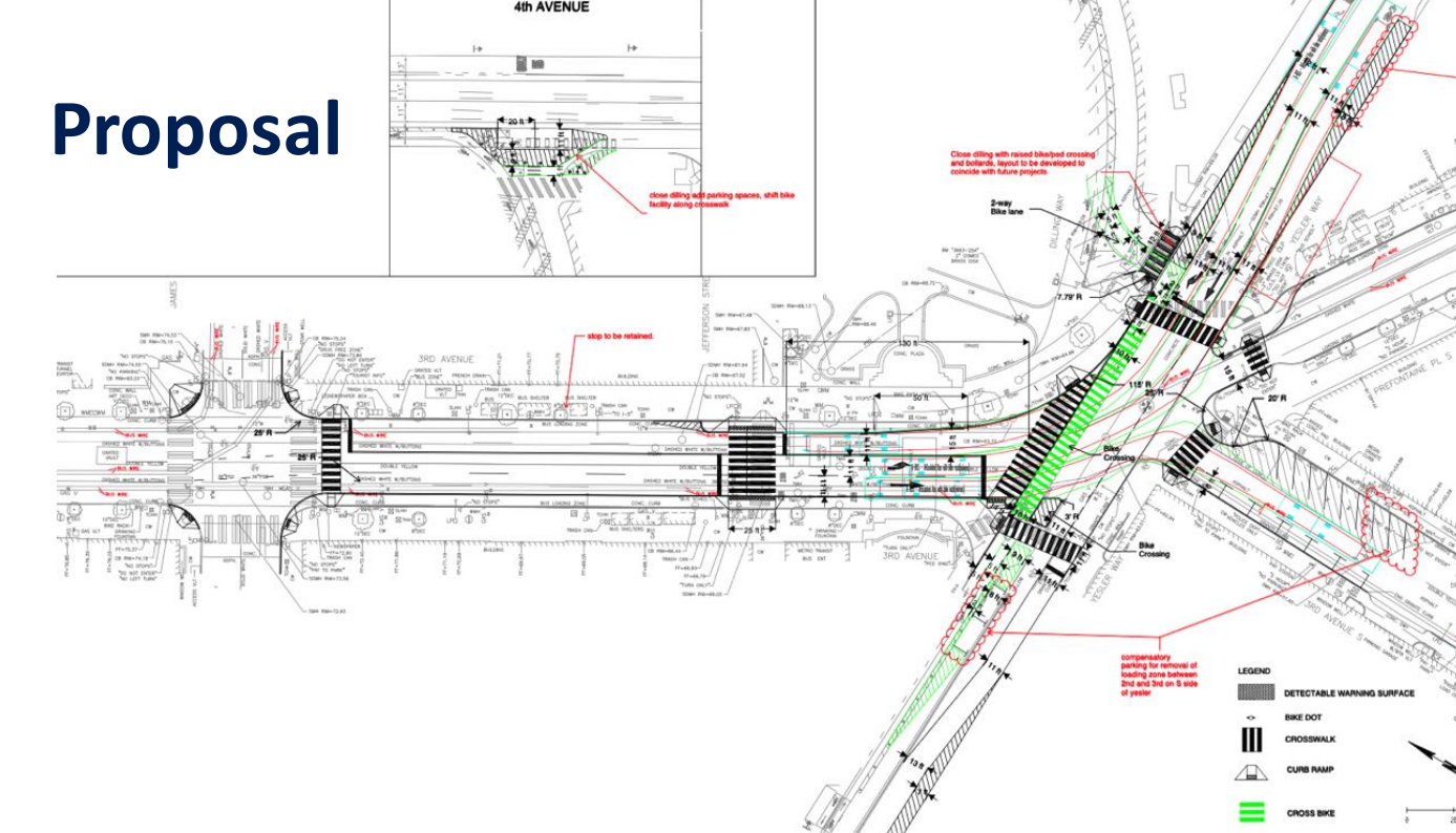
If that pilot is successful, SDOT will move forward with more permanent changes in the area. One these involves a full closure of Dilling Way to motor vehicles. Dilling Way is the short street connecting 4th Avenue and Yesler Way where SDOT installed a protected bike lane in 2021. The routing of that bike lane depends on people on bikes using the sidewalk for a short segment between Dilling Way and the 3rd/Yesler crossing, but the plans for the intersection would create a dedicated space for people on bikes to be able to cross the intersection without using the sidewalk. The path of bicycle travel is shown in green on the diagram below:

If the adjustment to only one northbound lane isn’t approved by Metro due to impacts to bus travel times, SDOT intends to construct smaller scale improvements like a curb bulb on the northwest corner of the intersection and pedestrian islands for the west crosswalk. If the pilot does stick around and SDOT is able to make those longer term investments like closing Dilling Way, the department will look for additional funding for improvements at the intersection like repaving the roadway and extending the sidewalks to fill in the curb bulbs.
Where is funding for this project coming from? The $1 million currently allocated is left over from the One Center City Near-Term Action Plan, intended to keep downtown moving during the “Period of Maximum Constraint,” the timeframe when various infrastructure improvements like the convention center expansion and the Center City Connector streetcar were (supposed to be) happening. In conjunction with that process, SDOT conducted a public life study of the area around the 3rd and Yesler intersection. A conclusion of that study was that the “spaces lack identity, a sense of place, and do not function as a cohesive network,” and are not welcoming. Pedestrian safety improvements at 3rd and Yesler are intended to help with that, as is work underway at 2nd and Yesler and a nondescript plaza called Fortson Square where the city has been making improvements.
It’s very far from clear what the future of City Hall Park, adjacent to this intersection, will be. In the final days of the Durkan Administration, King County moved to take over the space from the City of Seattle, and it currently sits closed, but it remains in the city’s court to act on that proposal. But these pedestrian improvements are intended to strengthen the connection between the park, Pioneer Square light rail station, and the King County Courthouse. With a relatively small budget, we can’t expect too much, but if crashes are able to be reduced that could be an easy win at this tricky intersection.
SDOT Adopts Policy Change to Allow More Marked Crosswalks Without Red Tape