The Seattle Department of Transportation (SDOT) is proposing changes to one of the most dangerous streets in the city, 4th Avenue S in SoDo, on a relatively ambitious timeline in the wake of several fatal crashes nearby just this year alone. The changes are relatively minor, quick-build type changes, but they do illustrate how SDOT can mobilize around improvements that weren’t previously planned in reacting to incident patterns as they develop. The department intends to install these improvements by this fall, significantly shortening the usual lead time for delivering safety improvements.
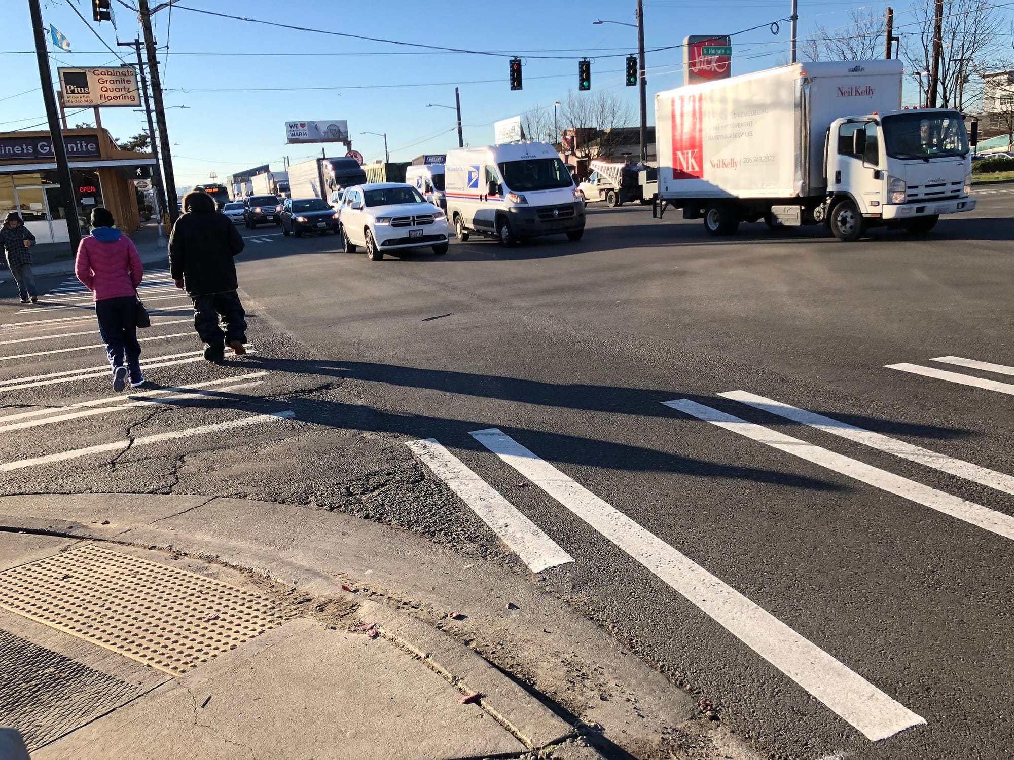
On May 11th, a driver struck 73-year-old Gan Hao Li as he was biking on the sidewalk along 4th Avenue S north of S Holgate Street. The driver was exiting a parking lot, using one of the many driveways along 4th Avenue S. The street is seven lanes wide, sometimes more in places where the curbside lane also has room for parked vehicles. One reason Li was using the sidewalk is the fact that there are no bike facilities whatsoever on the street, not an anomaly for SoDo. The sidewalk was the safest place on a street with a 30 mph speed limit, but that put him in danger from turning vehicles exiting driveways with drivers looking for other vehicles and not people on bikes.
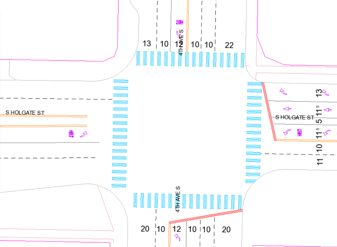
The “rapid response” changes that SDOT is proposing would be focused around the 4th Avenue S and S Massachusetts Street intersection, one block north of Holgate. The most major change would be a new center median on 4th Avenue S, blocking off the current left turn lane from being used except at the signalized intersection at Holgate. Every driveway currently accessed via that left turn lane would instead become a right-in-right-out driveway along with turns onto S Massachusetts Street. SDOT says this change will reduce conflicts and exposure and reduce left turn crashes, which can be higher speed collisions. One reason this could end up being the most impactful change is that it offers an opportunity to provide this alternative to center-turn lanes that could be utilized elsewhere in the city.
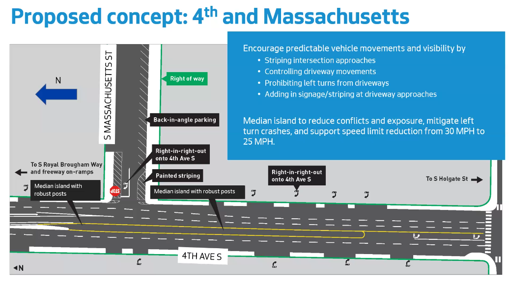
SDOT would also revamp the side street of Massachusetts, clarifying where drivers can park and narrowing the street via back-angle parking, but daylighting the intersection area to improve sightlines. Many parking areas in SoDo are informal, with sightlines frequently blocked by illegally parked cars.
Finally, SDOT also proposes reducing the speed limit on 4th Avenue S from the current 30 mph to the 25 mph currently in place along most other city arterials. This likely won’t move the needle much on average speeds on the corridor, which, with its considerable width, is clearly designed for much higher speeds, but SDOT has seen overall crash rates decline after adding more frequent 25 mph speed limit signs along other corridors in the city.
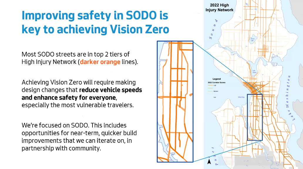
Jessica Kim of SDOT’s Vision Zero team told the freight advisory board this week that a full 10% of the traffic fatalities in Seattle since the start of 2020 have been within a quarter-mile radius of the 4th Avenue S and S Holgate Street intersection. Top of the list of the reasons that SDOT can point to as a source of the high number of crashes are the wide and multilane streets that cross the neighborhood, but there are some other factors that Kim mentioned. One of those is the lack of tree canopy in SoDo, which contributes to the urban heat island but also provides drivers with a clear line of view that makes them more comfortable exceeding posted speed limits.
The fact that these changes at 4th Avenue S and S Massachusetts Street are just a start doesn’t mean they won’t be controversial in themselves. One factor that led SDOT to present this proposal to the freight advisory board ahead of anyone else was likely the anticipated pushback on anything related to freight capacity in one of Seattle’s industrial zones. Even as the early designs were shown this week, Erin Goodman, Executive Director of the SoDo Business Improvement Area, suggested that the businesses she represents in the area should have been looped in on the project sooner. Chair of the freight board Jeanne Acutanza suggested that the timeline for implementation may not give them enough time to provide feedback on the relatively modest changes proposed for this small area.
These changes aren’t enough to improve safety in all of SoDo of course, or even in the entire vicinity of 4th and Holgate. The death of Antonio Tiongco, who was struck and killed one block away at 3rd and Holgate in January, would likely not have been prevented by any of the interventions being proposed here. Nothing here fixes the wide open intersection at 4th and Holgate, where severe collisions are frequent. At that intersection 77 feet of street space on 4th Avenue S meet 61 feet of street space on Holgate, according to SDOT’s own traffic control map. Leaving an intersection like this in place is a recipe for more severe collisions.
Seattle’s 2014 bicycle master plan doesn’t envision separated bike facilities on 4th Avenue S, but the street clearly has space to spare for them and the need to reduce excess street space to reduce collisions. SDOT is currently moving forward with a plan to connect Georgetown to south Downtown, eyeing 6th Avenue S and the SoDo trail for such a facility. That route may provide a more comfortable route for people trying to bike through the neighborhood, but isn’t a substitute for people trying to access goods and services in SoDo.
The city has already begun to look at the future of the 4th Avenue bridge over the Argo trainyard between Georgetown and SoDo. Right now, one lane on the bridge has been closed for five years in order to protect the structural integrity of the bridge, but that capacity has not been missed. Now is the time to start planning for a safer 4th Avenue that will provide a direct route for people to bike from downtown to destinations throughout SoDo, as opposed to zig-zagging around on the SoDo trail, 6th Avenue, and Airport Way. The City has to do everything it can to ensure that immediate, quick-build solutions are in service of a larger vision of safety and sustainability.
A “rapid response” Vision Zero response, though, is a positive development and one we’ll be watching to see more of. The City has an incredibly well developed response to things like potholes and signal maintenance but has not been as quick to respond to clear safety hotspots, and successfully responding here will set the template for future responses. Given the troubling trends on traffic fatalities, it needs to happen.
Plans Advance for a Safe Bike Route Between SoDo and Georgetown