A survey on possible Bell Street changes is open for public comment through February 12th.
As work continues at a feverish pace to complete some of the most long-awaited elements of Seattle’s downtown waterfront redevelopment, many Seattle residents are just learning about some of the project’s finer details. That’s because most of the decisions about what the new waterfront should look like were made years ago, some of them almost a decade earlier. But one final piece, Bell Street, hasn’t yet been designed, and it’s an opportunity to make sure it’s done right.
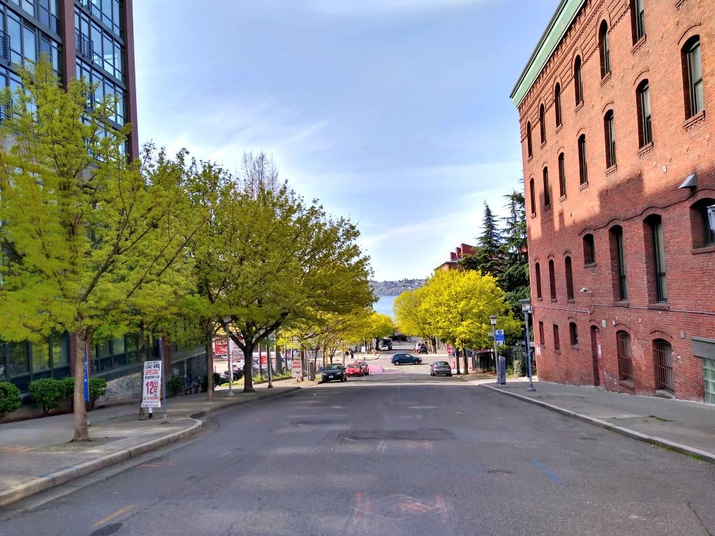
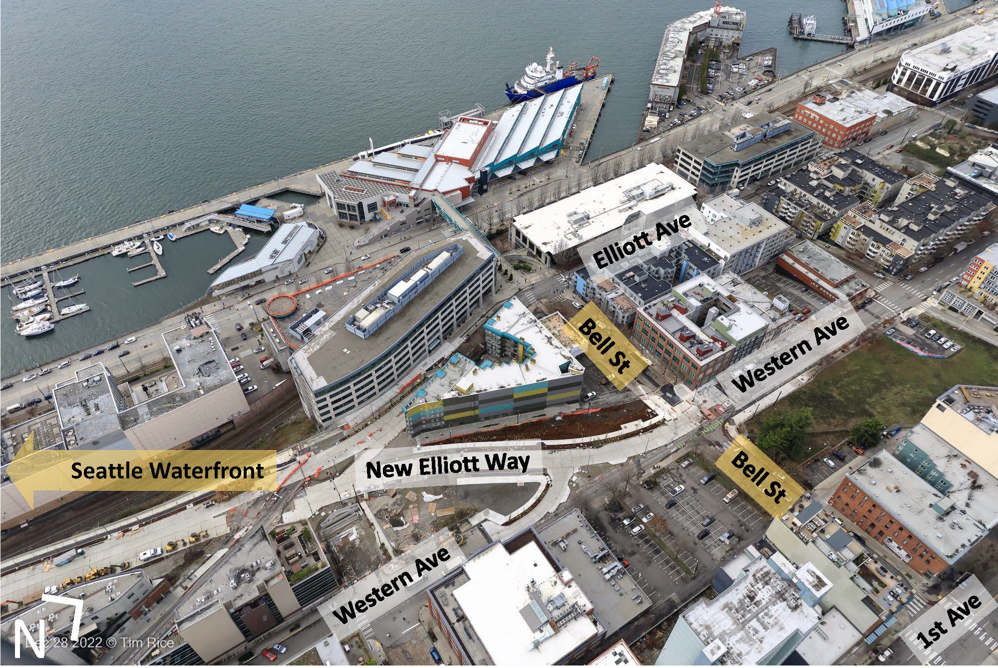
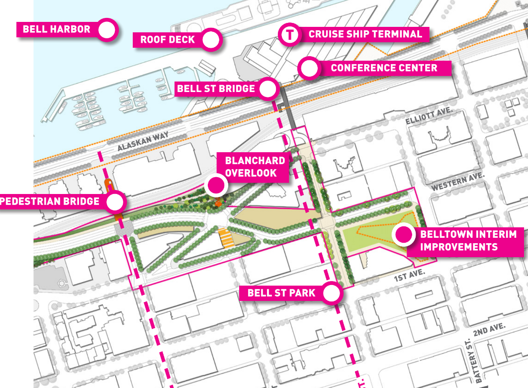
The Seattle Office of the Waterfront and Civic Projects has started design work on two blocks of Bell Street, at the very northern edge of the waterfront project site. Currently Bell Street Park, the curbless “green street” that opened in 2014, ends at First Avenue, but the waterfront has long been seen as an opportunity to extend the improvements made to that street down to Elliott Avenue, where a pedestrian overpass connects across Alaskan Way to the Port of Seattle’s cruise ship terminal at Pier 66.
“The connection between the newly designed portion of Elliott Way and Bell Street is important because it will link the Seattle Aquarium and Pier 62/63 to Belltown. The design will configure these connections carefully to encourage access and movement between Bell Street, the open spaces along the Belltown Bluff and the waterfront,” project materials from 2014 noted, as early designs were being developed for the entire Alaskan Way corridor revamp.
But while plans were drawn up for most of the new roadway, promenade, and other public space improvements, Bell Street has remained a bit of a blank slate.
Now the City is asking for feedback on what the final two blocks of Bell Street should look like. The city’s survey, which is active through February 12 (less than two weeks, it must be noted) starts with the assumption that vehicle traffic on the two blocks will be a given, but dedicated space for people to bike is still “TBD.”
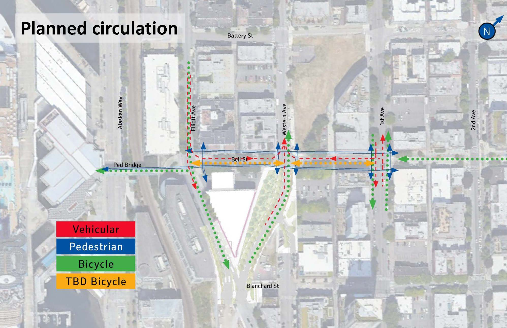
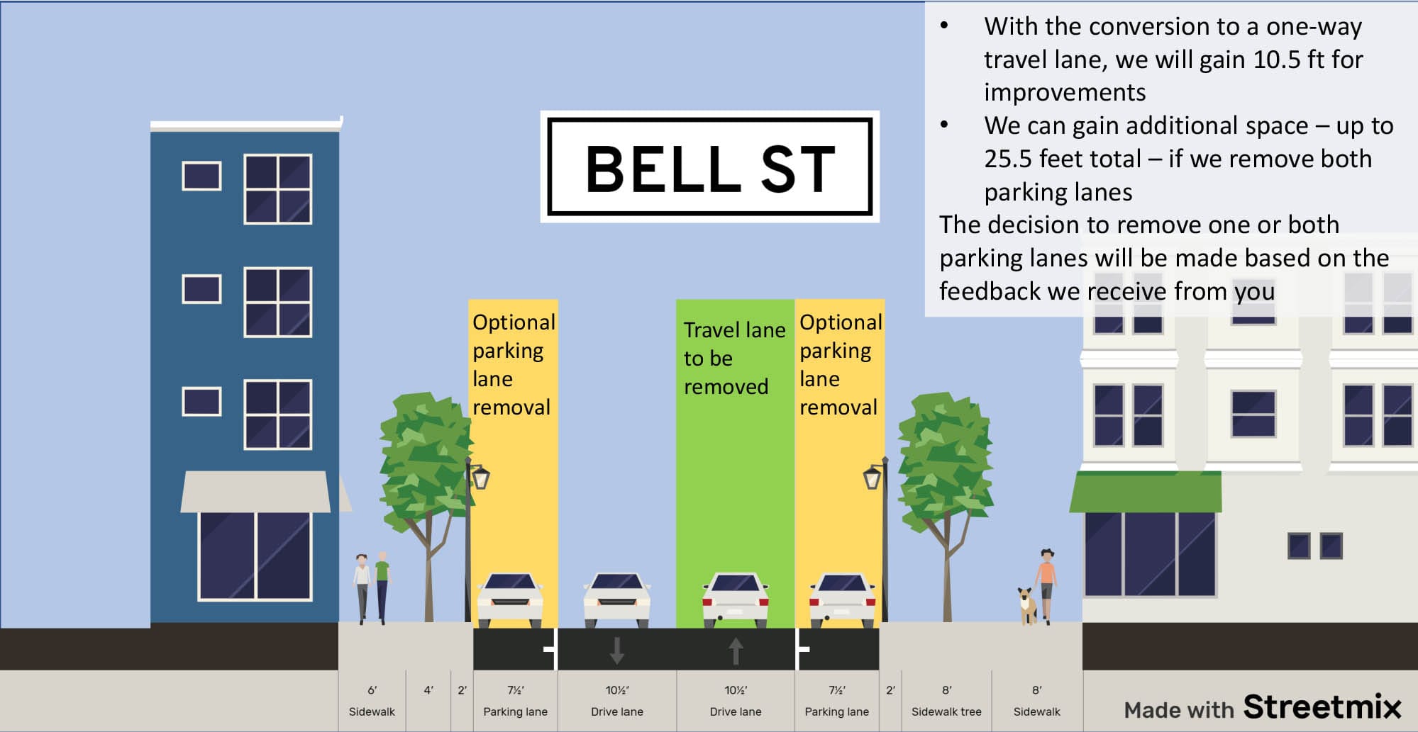
“Vehicles use this path coming to/from Belltown and the waterfront,” it notes. “Bell St will become a one-way road, eastbound between Elliott and Western avenues, and westbound between Western and 1st avenues.”
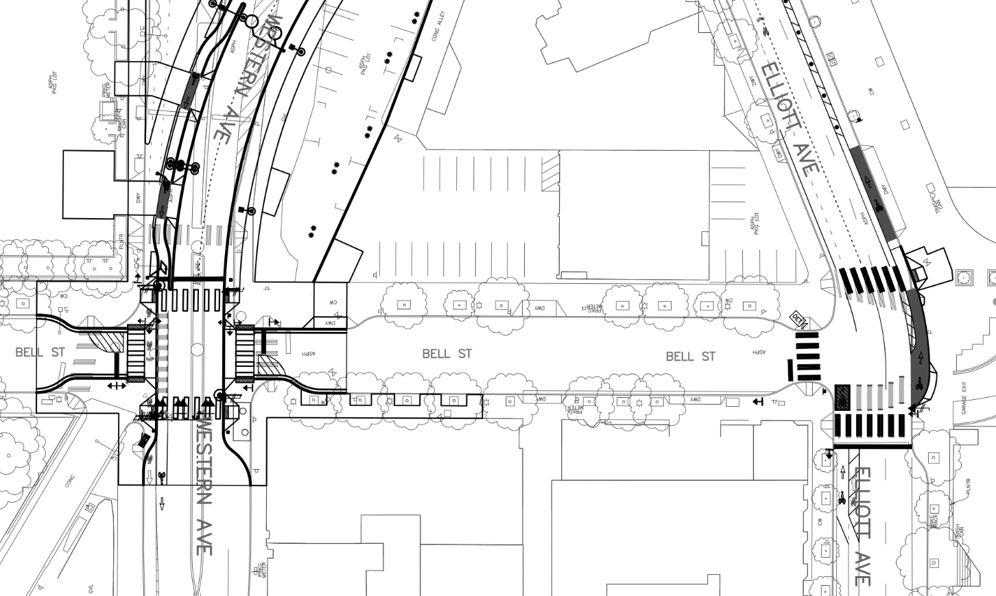
Apart from the alley, there are no driveways or garages that open out onto Bell Street between Western and First, but a full pedestrianization of at least some of the corridor doesn’t appear to be on the table here based on the survey. With vehicle access fully preserved, that means pedestrians and people on bikes need to be separated from drivers, which in turn requires reallocating what’s currently used as curbside parking.
This leaves the universe of options fairly limited. With the design for Bell Street starting just as work on the surrounding roadways — including the new four-lane Elliott Way connecting Belltown with the waterfront in roughly the same footprint as the former Alaskan Way Viaduct — is wrapping up, many of the considerations for the two blocks stretch are already set in stone… or concrete, rather.
The connections with both Western Avenue and Elliott Avenue are being put in place right now, with curb extensions that seem to push toward retaining parking on Bell Street. If those connections were being designed with the rest of Bell, the curbs might not need to be that large… if the street was being converted fully to pedestrian space. In other words, the previous choices of the waterfront project have narrowed the field of options now.
The City is framing the only choice now as whether to “remove” the two parking lanes on either side of Bell Street for bike and pedestrian space, while subtly suggesting that pedestrian space might not be the best use. “This section of Bell St, between 1st Avenue and Elliott Avenue, is steep and does not see as much pedestrian activity,” the survey notes.
Of course, the brand new walking connection between the waterfront and Bell Street itself is not open yet, which might have a slight impact on pedestrian activity in the area. The grade between Western and First is relatively steep, at just over 10%, but is actually less steep than adjacent streets like Blanchard (11%) or Lenora (13.2%).
The opportunities for Bell Street are heightened here because Belltown has largely received the short end of the stick from the waterfront redevelopment. The Battery Street portal property sits vacant after the City of Seattle has given Seattle Public Schools a decade to decide whether to develop a downtown school on the site. Another parcel, eyed early on in the project as a possible plot of open space (drawn up as a neighborhood playground by James Corner Field Operations) had been planned as a parking lot for electric vehicle charging until City Light backed off last year. An overlook at Blanchard Street was eliminated from the plans early on as negotiations progressed with the Washington State Department of Transportation.

Much to the chagrin of urbanists, the waterfront revamp left some big opportunities on the table to shift away from a waterfront oriented toward motor vehicles. Bell Street represents a chance to seize an opportunity and make sure that a final element comes together in the best way that it can — if the constraints of the public survey are able to be overcome, that is.
Former Battery Tunnel Site Gets Green Light for Downtown School