In an earlier article, I argued Seattle should expand its streetcar network and ensure high quality service with dedicated transit lanes starting in Belltown. Now I’m going to describe a few more places where extension of the planned network could yield significant benefits to neighborhoods likely to be overlooked by currently planned high capacity transit investments in Seattle. I’ll also address a few of the common objections raised of streetcar transportation.
Extension to Magnolia
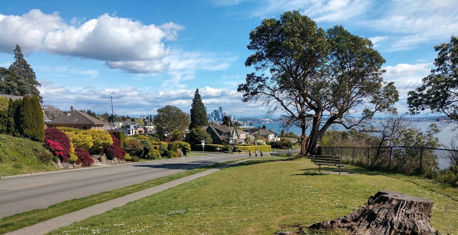
On the surface, Magnolia might seem like a silly choice for a streetcar line. The neighborhood currently has low transit use, is very car dependent, and has one of the lowest population densities in the city. However, there are a few good reasons we might wish to bring a streetcar here. Magnolia is a mere five miles from Downtown Seattle, which is close enough that one might expect a dense residential hub. However, due to restrictive zoning, the lack of an Urban Village designation here, and low transit access, the amount of people who can live in Magnolia comfortably is effectively constrained to fairly wealthy individuals outside a few small pockets of apartments in Magnolia Village and along Thorndyke Avenue W and Gilman Avenue W. This exclusivity forces growth to go other areas in the city, displacing more vulnerable communities in lower income areas.
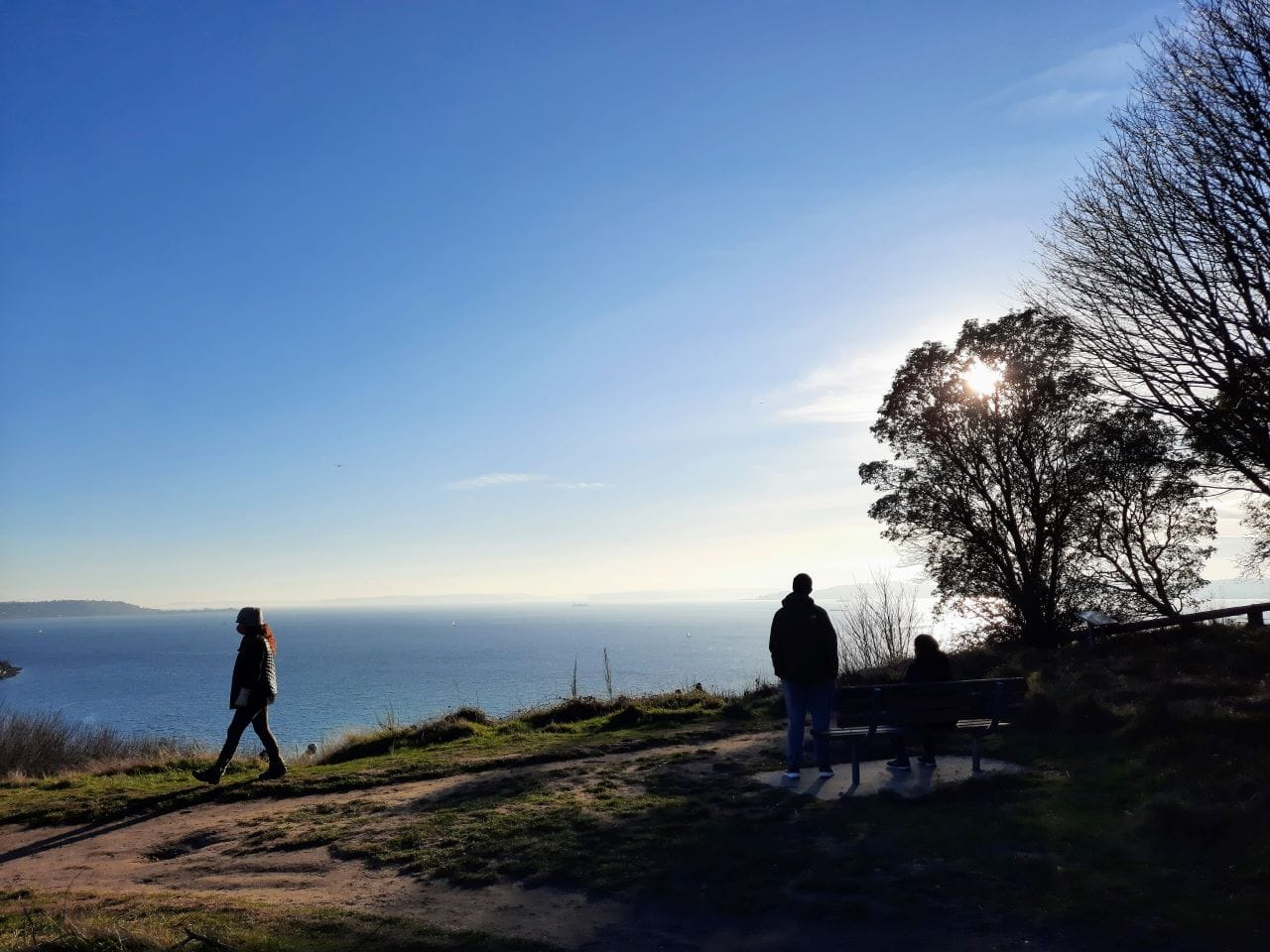
Rezoning for higher density and adding high capacity transit would be just the thing Magnolia would need to open up to many more people, taking pressure off of the few neighborhoods currently taking most of the density. Additionally, Magnolia hosts Discovery Park, which is the single largest park in the city limits of Seattle and something all Seattleites should have good access to whether they own a car or not. With poor transit access to the neighborhood and relatively few access points, this keeps the park hard to reach for much of the city’s population, but adding higher capacity transit and more residents near the park would reverse the situation. Streetcars could be the ideal vehicle to achieve all of these goals.
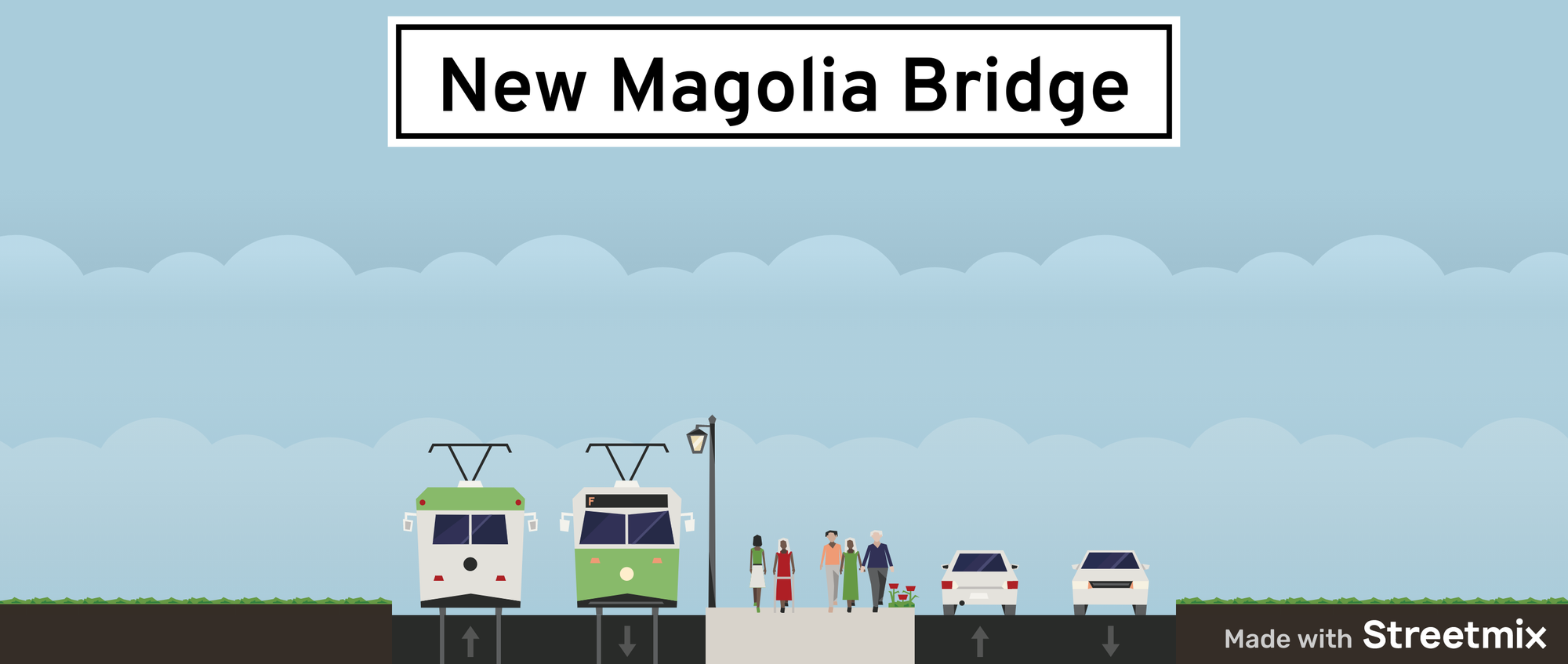
A big part of this project would be the new Magnolia Bridge. The Magnolia Bridge has structural issues and unfortunately the city transportation department’s replacement plans are aligned with some of the worst parts of auto culture. If a new bridge were to be built to Magnolia, it ought to be part of a process to increase density and living space available on the peninsula as well as improving transit alternatives. Instead of building a four-to-six-lane car bridge, any new bridge should have dedicated transit lanes, a lane width of dedicated space for folks walking or on bicycles, and at most two lanes for “general traffic.” This represents something closer to the reality of the transportation future for Seattle. In order to achieve the climate goals the city has set while supporting continued free travel between neighborhoods, more lanes need to be dedicated to non-auto based modes like streetcars.
A streetcar line could be just the carrot to win Magnolia over to urban zoning instead of the exclusionary zoning it has — which won’t be an easy fight. It would also greatly improve connections to the light rail station planned at Smith Cove with the completion of Ballard Link circa 2037.
On to Fremont
Unlike Magnolia, Fremont is already a high-density, high-transit demand neighborhood. Though there are already plans to make significant improvements to the King County Metro Route 40 that passes through Fremont, a completed Center City Connector project provides the opportunity to boost this capacity even further, which may be needed as the Metro’s Route 40 is one of the most crowded buses in the city. Between South Lake Union and Fremont, the relatively minor upgrades being proposed now for this route may not be enough to address the growing need for transit.
Fremont is at a level of demand that could use a stop on a high capacity rail line, none of Sound Transit’s currently planned lines are going to directly serve Fremont. While Seattle Subway does have plans (that we should support) to extend a subway line up north on the Aurora Avenue N Corridor, this project is likely to be decades in the future. In the meantime, it would be worthwhile to provide higher capacity options like streetcar to neighborhoods such as Fremont that are not otherwise yet on the light rail map.
While Sound Transit has never studied light rail to the area save for the Ballard Spur line on top of the hill, Fremont has long been identified as a streetcar route, from its original roots as a streetcar suburb to the city’s 2009 streetcar plan.
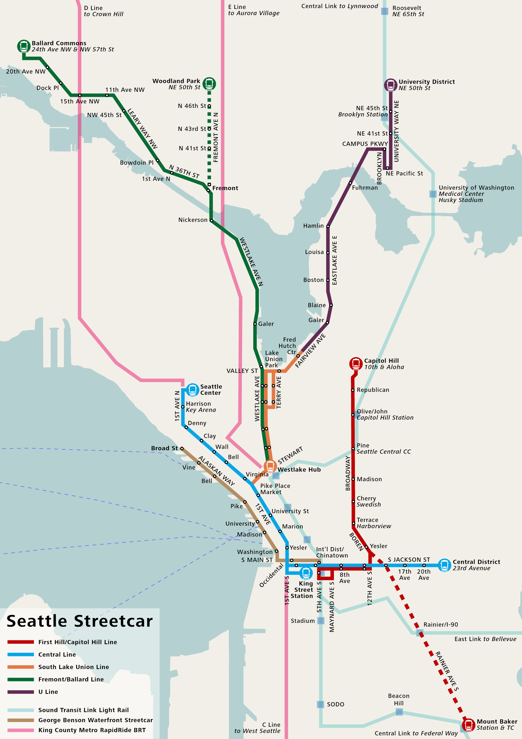
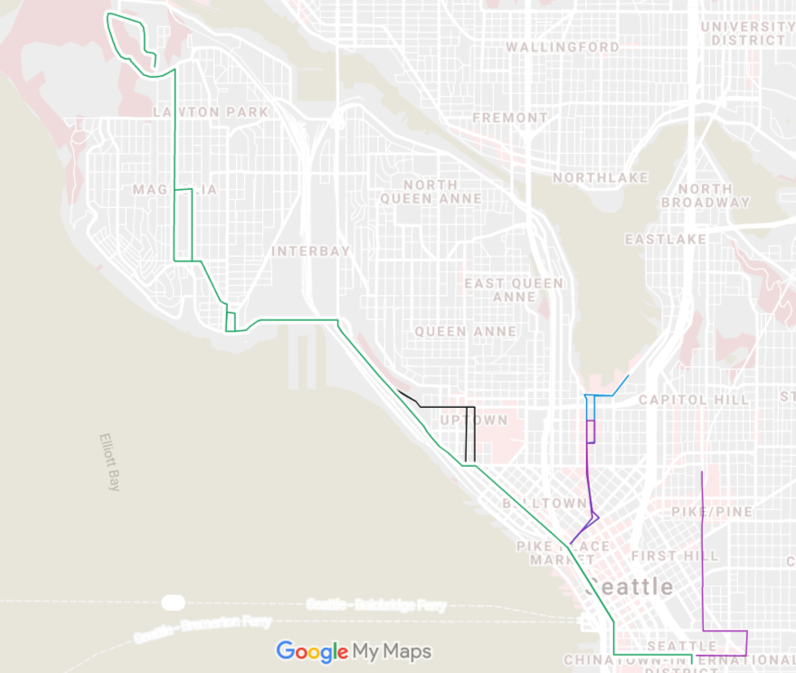
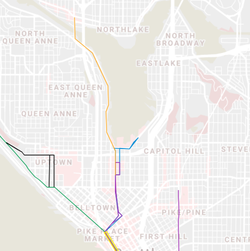
The specifics of the Fremont route are worth discussing because there are a few potential complications. First, the segment from Harrison Street to the Fremont Bridge would mostly be constructed sharing the bus lanes proposed for the Metro Route 40 bus project. Since bicycles have a dedicated corridor for travel immediately adjacent to Westlake Avenue, there should not be a need to have special accommodation for bicycles on this portion. The complications come with the connection to Westlake Avenue N at 9th Avenue. The end of the cycletrack and its diagonal connection to the cycle lanes on 9th Avenue need special care to not interact poorly with streetcar tracks. Building tracks that support flanging or building a bicycle overpass here would be worth including in any streetcar extension plan.
The additional complicated portion of this route is the end of the route on the north end of the Fremont bridge. Though the bridge itself was built to accommodate streetcars when it was originally constructed, the neighborhood has changed a great deal since then and interaction with bicycles and cars leaving the bridge will need careful consideration to prevent dangerous conflicts.
Why streetcars?
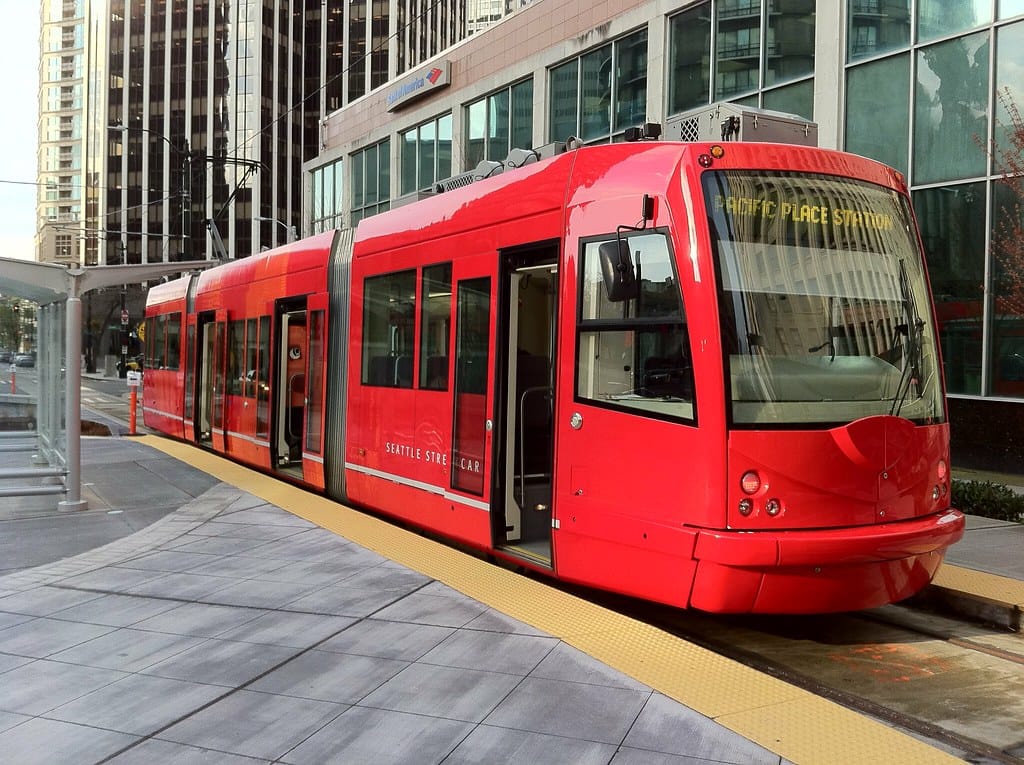
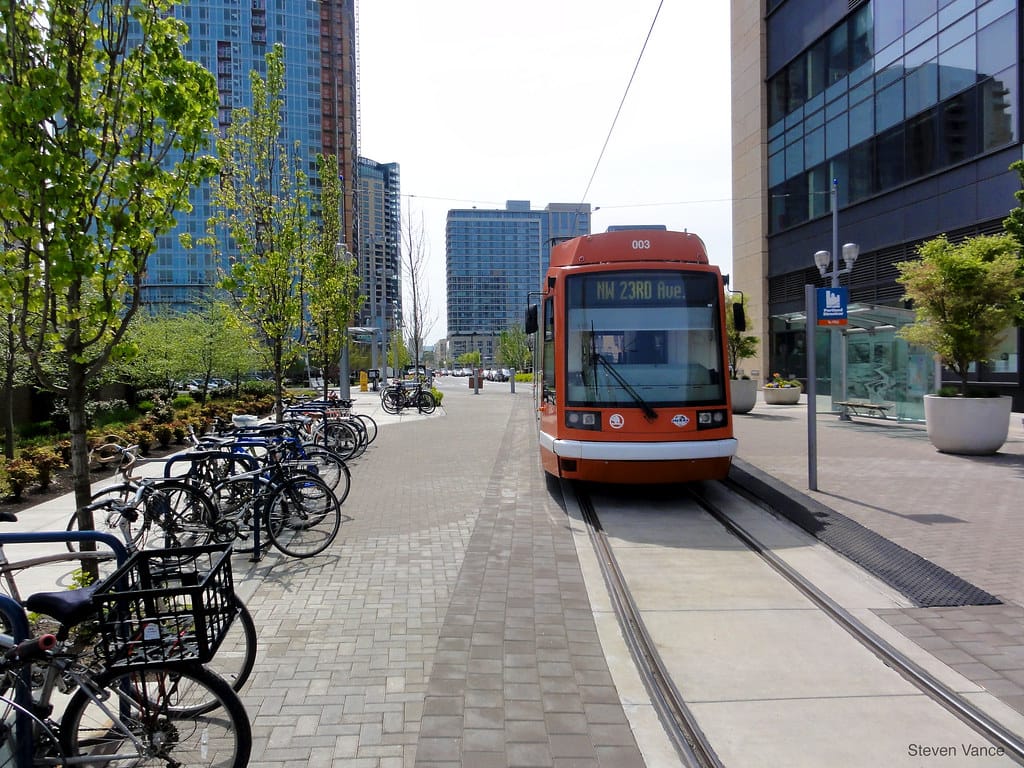
Many American urbanists espouse the opinion that streetcars do not provide a meaningful capacity boost over buses and that any streetcar route could easily be replaced by a better bus route. This is not true. While buses are more flexible on routing and can mix more easily with other vehicles, this can also be a drawback when trying to obtain exclusive lanes in a project. Since buses do not require special lanes to run in, its easier to reduce or remove exclusive lanes in the planning phase as “unnecessary” to the project. A recent example of this is the Madison bus rapid transit (BRT) project. Additionally, though the current Seattle streetcar capacity of 140 is similar to the maximum capacity of articulated buses (94 to 120), a bus at maximum capacity is a much more unpleasant experience for riders than a maximum capacity rail vehicle. Articulated buses in particular can be difficult to remain standing in when at maximum capacity and moving in road conditions or speeds that cause significant bouncing. Also, unlike articulated buses, it would be relatively easy to obtain longer streetcar vehicles with greater capacity which may be important if bus driver shortages continue to be an issue in the future. Finally, as a small technological issue, another unfortunate lesson of the Madison BRT project is that unlike streetcars, buses can have extremely inflexible selection on form factors that limit the city’s ability to fully electrify its transit fleet in a meaningful timeframe.
Streetcars can coexist safely with bicycles
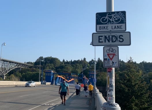
Safety of people on bicycles is an important consideration when building street rail. There are a few more options that are worth considering to reduce interactions between the rails and the bicycle users. One option is to take lanes that are to be exclusive to rail alone and not bury them in cement but leave the tracks exposed where possible to remove the possibility of bicyclists being surprised by narrow slots in the road. Another option is to use rails that can accept flangeway filler to prevent bicycle tires from falling in where rails must cross shared street surface or be shared with buses. The First Hill Streetcar already has a section of track in Chinatown that uses this configuration. A final option worth considering is building bicycle underpasses in sections where the traffic interactions are too complicated to have safe 90 degree crossing over the rail. This is not something that is very common in Seattle at this point, but is worth considering to bring safer crossings on more complicated intersections.
Let’s keep advancing the Center City Connector
The Center City Connector (CCC) extension is on hold, but is worth building and expanding for a number of reasons. The exclusive lanes requested for this project could potentially enable a cheaper path to exclusive lane rapid transit that light rail is taking decades to deliver and BRT projects that are being compromised out of existence.
As streetcars are frequently used as development tools, we could use projects like this to redevelop low-density, park-rich neighborhoods like Magnolia, which would otherwise be unlikely to see either transit or density increased. Longer cars could provide a capacity boost that Metro buses cannot come close to meeting.
Additional connections to Fremont would could also add a significant transit boost to relive crowding on Route 40 and provide some sort of high capacity transit to a neighborhood that is currently being skipped over by most the long-term Sound Transit plans. Conflicts with bicycles can be worked around by providing proper bicycle facilities where possible. Greater care to address bicycle safety issues needs to be taken into account more than what has happened in the past. Alignment and platform adjustments could improve the functionality of running three surface running train lines through this corridor.
Though streetcars are not as fast or high capacity as light rail nor as cheap as buses, being able to use these projects to get exclusive transit lanes may prove to be a more realistic option to spread more transit use throughout the city and increase dense city living in time to make a difference for the radical climate changes we are going through.
With Simple Improvements, Streetcars Can Thrive in Seattle
The Center City Connector Is A Critical, High Quality Transit Project