Puget Sound has embarked on ambitious transit expansions. But the success of those largely hinge on people living near stations and stops, no matter how much transit agencies lavish and spoil on parking-and-ride facilities. A centerpiece of these expansion efforts is Link, a light rail network set to grow to 116 miles by 2044. Yet, local governments across the region are sabotaging the success of the existing and planned system through overly restrictive zoning around stations.
In this series, we’ll walk through how local governments are failing to meet both the moment of housing need and working against the success of transit expansions in their own communities.
Link 2 Line zoning is woefully inadequate
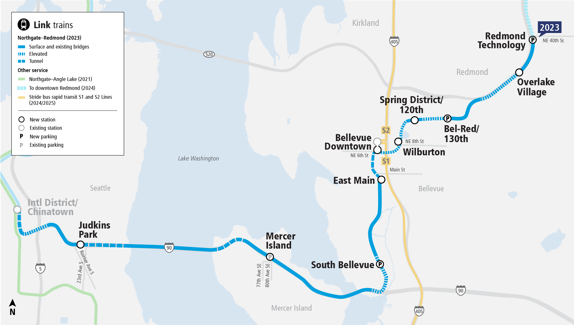
By 2023, the Link 2 Line, known also as East Link, will extend to Redmond Technology Station, home of Microsoft. Trains will run every eight minutes during peak hours from there to Northgate via Downtown Bellevue, Mercer Island, and Downtown Seattle. Sound Transit estimates that the line will serve 43,000 to 52,000 daily riders by 2026. Along the extension, the agency is providing 2,100 parking stalls at three stations. Most riders, however, won’t be driving to and from the stations. Instead, they’ll be walking, rolling, biking, and taking transit from nearby areas. Yet, Bellevue and Mercer Island have refused to take adequate steps around many stations to ensure their success and Redmond has missed a clear opportunity near their terminal station in the 2023 expansion. So, let’s walk through the transit-oriented development (TOD) missed opportunities.
Mercer Island banishes housing from the shores
In Mercer Island, city officials have done the minimum to comply with regional growth targets by zoning around its old strip commercial district south of I-90 for housing and mixed-use development. Projects have been taking shape in this area over the years and demand will surely increase once light rail opens. This district is somewhat separated from the station by the barrier that is I-90, but quality pedestrian facilities and landscaping buffers at least blunt some of the negative impacts a freeway presents.
North of I-90, zoning preempts any non-single-family housing and keeps lots large. Home prices reflect this policy choice with most homes averaging north of $2 million. This policy also ensures that few residents will use transit despite their close proximity to a station with quick access to Downtown Seattle and Downtown Bellevue. It also ensures that there won’t be more potential residents within a 15-minute walkshed or bikeshed of the station beyond those who might live in the district south of I-90. In essence, this policy choice by Mercer Island cuts the station’s walkshed and bikeshed in half and locks in skyrocketing home prices and rents.
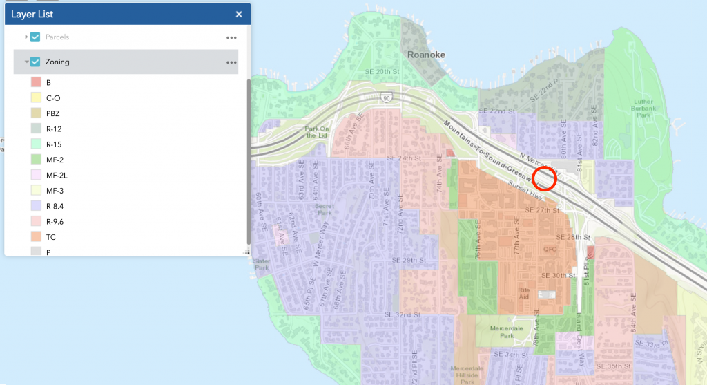
Zoning north of the station ranges from R-8.4 to R-15, which signifies that only one single-family home is permitted per lot and that the minimum lot size is a multiple of 1,000 square feet (e.g., R-8.4 has a minimum lot size of 8,400 square feet). That means only as many as five homes are permitted per acre. These are not transit-supportive densities, yet that’s how these properties are zoned adjacent to a major transit facility. Only four parcels north of I-90 are an exception to this in order to grandfather in old two multifamily developments (and oddly two single-family homes) on 3.8 acres of land.
For the mixed use and multifamily zoning that does exist south of I-90, this stretches only about a 10-minute walk from the station, and often far less. There are three principal varieties of zoning in this area. The predominate one is the Town Center zone, which actually comes in six flavors. The biggest difference is really in maximum building heights allowed, ranging from 39 feet (three stories) to 63 feet (five stories). In addition to the Town Center zoning, the limited areas at the edges are zoned MF-2 and MF2-L. These essentially act like a “buffer” to areas zoned single-family. MF-2 zones are limited to 36 feet in height (three stories) and 36 homes per acre. Conversely, MF2-L zones are limited to 24 feet in height (two stories) and 26 homes per acre. Other suburban development standards such as setbacks and lot coverage greatly reduce development potential. In sum, Mercer Island has nothing more visionary than a small area of three- to five-story buildings planned near its station.
What’s especially problematic about this zoning is that the city’s land use code mandates car parking. Generally, the parking mandates stipulate at least one parking stall per home in the Town Center zone and two parking stalls per home in the multifamily zones. Parking mandates reduce the potential for the number of homes that can be created on a lot, increasing living costs for residents, and greatly discourage people from walking, rolling, biking, and taking transit.
Bellevue aims for just two baskets
As for Bellevue, the city has completely flouted its growth targets and failed to adequately zone for housing across the city. Instead, the city has mostly put all its eggs into two baskets: Downtown Bellevue and the Spring District. Both have certainly boomed over the past decade, but most of the city has otherwise remained untouched despite incredible job growth in the city. Zoning policies by the city have actively pushed people to commute long distances to reach jobs in the city and some city councilmembers have concocted entirely untrue reasons to block any consequential zoning changes outside of these areas.
However, the city is getting a massive investment in light rail with seven light rail stations. Only three of these stations have somewhat reasonable zoning in place to encourage their success and the light rail system. Two of the other four are blunted by largely swaths of single-family zoning. And the other two are blunted by weak commercial zoning, leaving Redmond to carry the weight for one of them.
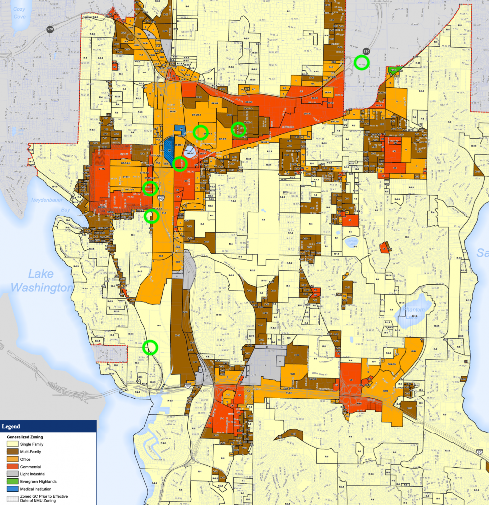
Before getting to the truly disappointing, it’s worth mentioning where Bellevue has done some good. In Downtown Bellevue, the city has a variety of zoning types that allow for denser residential, mixed use, and commercial uses, including highrises. Most of this is within a 10-minute walkshed though, so station area zoning could be extended further north and south of the existing city center.
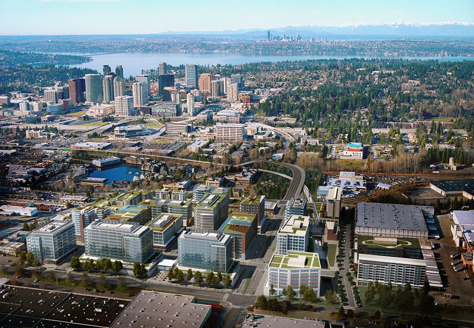
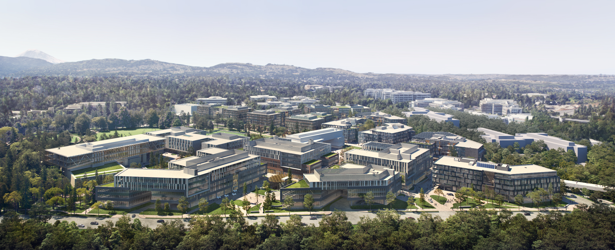
Similarly, the Spring District’s two stations are in areas that allow for lowrise and midrise apartments, mixed-use, and commercial uses as well as industrial activities. However, these again are mostly within a 10-minute walkshed or less; outside these areas, zoning is meager with low building heights and limited densities, even where zoned for multifamily uses. Single-family zoning ultimately creeps into these stations’ walksheds. Plus, Spring District development has overwhelmingly tilted toward office space rather than housing. The City of Bellevue contracted with one megadeveloper, Wright Runstad, to develop 36 acres in the core of Spring District. Wright Runstad commissioned a masterplan from NBBJ which is business-oriented, with around 13,000 employees to 2,000 residents — an off-kilter ratio also seen in Downtown Bellevue and Overlake. One bright spot is Sound Transit’s large Spring District TOD site, which will include about 500 homes, most of them affordable, in addition to retail, more than 400,000 square feet of office, and a public park. Bellevue Mayor Lynne Robinson has said she wants Wilburton and Eastgate to be the next Spring District, which unfortuantely could mean the pattern of overbuilding office space and underbuilding housing will continue.
Starting from east and going southwest, we see how Bellevue hasn’t really done the work to plan for its other stations:
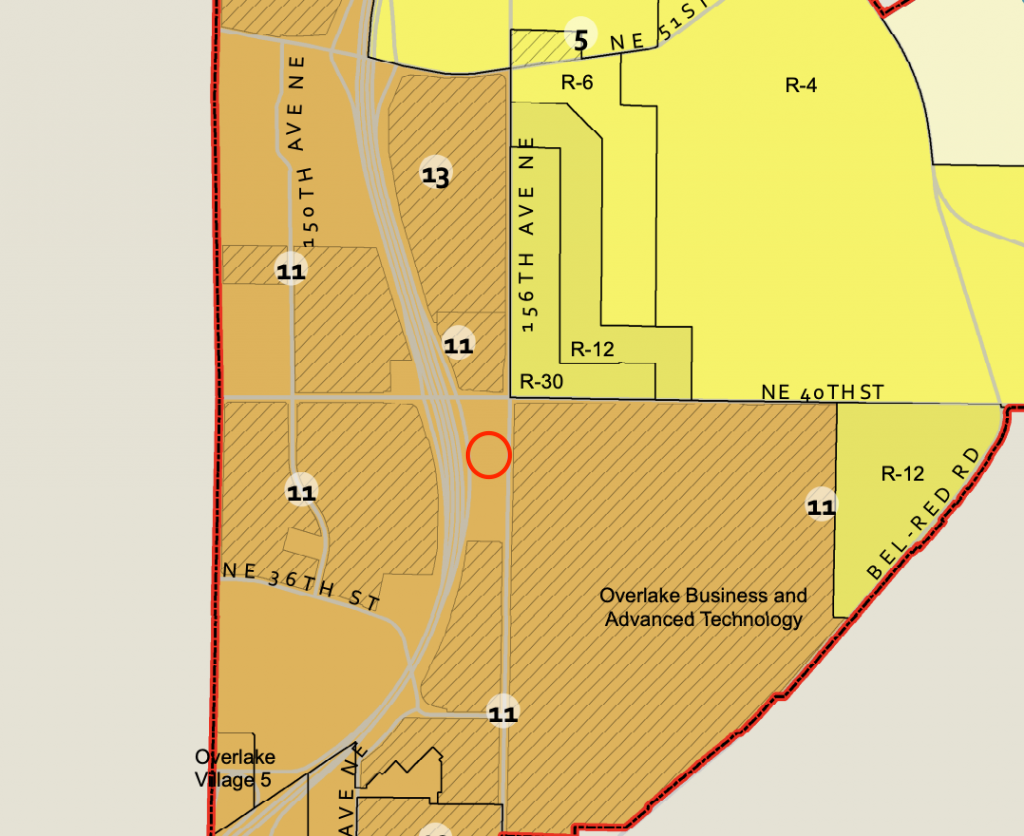
- Around the Overlake Village Station, the area is faced with problematic stroads and SR-520 that reduce the livability and potential of the area. But Bellevue has a good chunk of land within the station walkshed. Virtually all of it is over-parked strip commercial uses with zoning in place that isn’t enticing enough for economically feasible projects. Zoning preempts five-, six-, or seven-story buildings in the area even though Redmond has zoned for exactly that and seen Overlake Village blossom over the past decade — although Redmond and the Washington State Department of Transportation (WSDOT) are also in the midst of plowing a freeway ramp into the area, which will be a step backward. Floor area ratio standards also present an extraordinary barrier.
- Around Wilburton Station, the area has a mix of medical, multifamily, and strip commercial uses. Most of the medical uses run to the northwest of the station whereas multifamily is predominately to the east and strip commercial to the south. The city has been slow to rezone the area, having slow-walked the Wilburton planning process for years with no end in sight. That’s left prime land near the station undesirable for redevelopment due to suburban commercial zoning. On top of this, there are areas within the walkshed that contain very low density multifamily and single-family zoning.
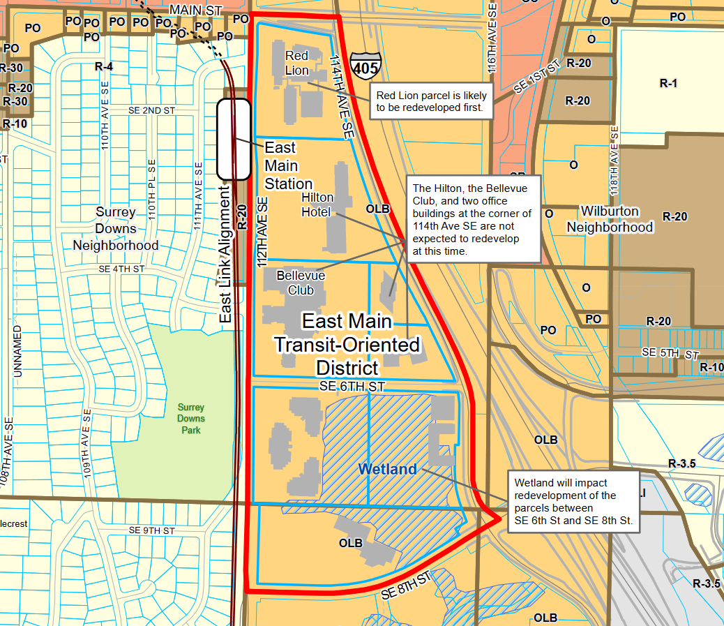
- Around the East Main Station, the area is primarily single-family to the west and suburban commercial to the east. Finally, after years of process, the city did rezone parcels immediately to the east for higher density development late last year, but calls for a very meager 1,500 or so homes. The city has failed to take on Surrey Downs just west of the station, however. That exclusionary community has long fought the idea of idea light rail, hoping to stop it in its tracks. Rezoning Surrey Downs wouldn’t assure development given restrictive covenants on the millionaires’ lots, but it would at least force a state conversation on banning the exclusionary practice and perhaps lot owners to rethink their covenants in the first place. East of I-405, there are still some areas within the walkshed with suburban commercial and single-family zoning.
- Finally, around the South Bellevue Station, the areas to the west are only single-family zones while a massive wetland network exists to the east. One can certainly understand not zoning for housing in the wetland area, but it’s perplexing why single-family zoning exists immediately west of the station. Like Mercer Island, homes in this area go for north of $2 million on average and have very large lots. A quirk in the area, too, is the Town of Beaux Arts Village which is a small, independent single-family community. Within the station walkshed, zoning should allow for denser residential uses and even some mixed-use. For many years, this station will be an important exchange point for people catching buses elsewhere on the Eastside and down south, so having more active uses would certain make that experience. Yet, the station hosts a massive parking garage. It’s not a way to welcome people to Bellevue, yet the zoning policies demand a lifeless station.
On top of this all, Bellevue still maintains general car parking mandates for multifamily housing near transit, which are as much as 0.75 parking stalls per home. But these aren’t graduated unlike the normal parking mandates outside of transit areas, which range from 1.2 to 1.8 parking stalls per home. For compact studio apartment developments, parking mandates at any level can be a project killer and in any case parking mandates around transit are simply problematic to driving transit’s success.
Redmond pulls punches near NE 40th Street
Lastly, we’ll end with Redmond. It’s worth noting that the city has done a lot of work to plan around its stations in general. That’s already led to great successes across the city. But one area where the city has missed is around the last stop of the initial Link 2 Line extension at Redmond Technology Station. That station is home to Microsoft’s main corporate campus and is seeing a lot of redevelopment activity.
Within the station’s walkshed to the northeast, the city has wide swaths of single-family zoning. The properties may be challenging for redevelopment given local stream networks that reach down to Lake Sammamish and the Sammamish River, but that shouldn’t inherently mean that they remain only for low-density single-family uses. After all, these are within the station area and right at the footsteps of Microsoft’s campus. Likewise, there are townhouse homeowners developments much closer to the station that may warrant more intensive, mixed-use zoning. Ultimately, this area is a little more unique with its issues than Mercer Island and Bellevue, but rethinking zoning near this station is a worthy endeavor.
Still, there’s no reason for housing advocates to despair, especially since the state legislature has taken up the cause. House Bill 1782 and House Bill 2020 would require zoning changes near major transit stops statewide. State legislators and Governor Jay Inslee are rallying around the idea, seeing the inaction and squandering of resources and opportunity at the local level. Send a letter to your legislators here.
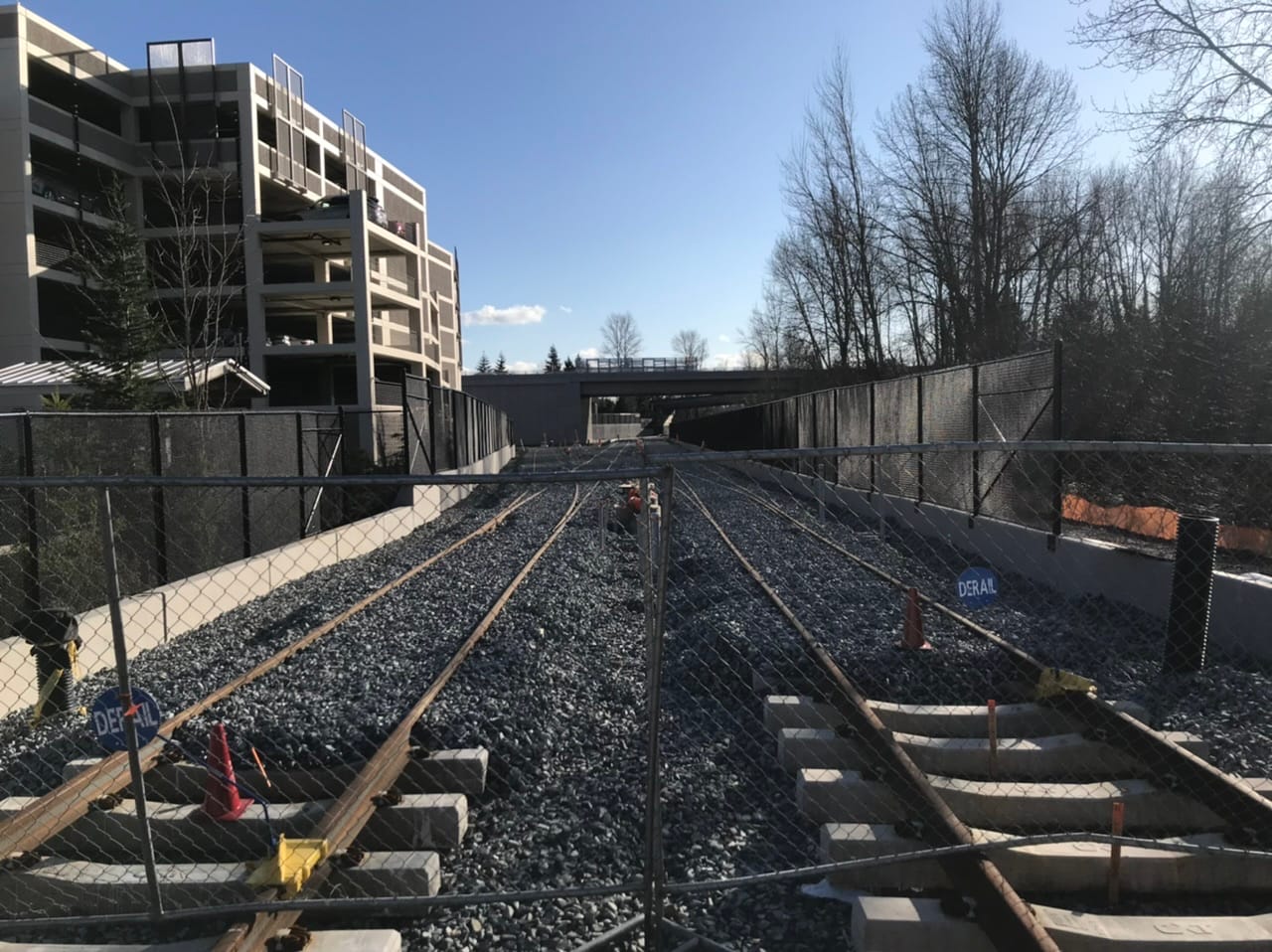
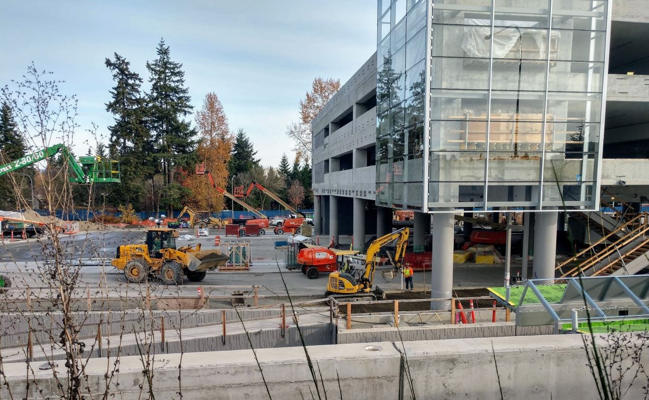
East Link Is Starting to Look Like a Light Rail Line as Construction Progresses