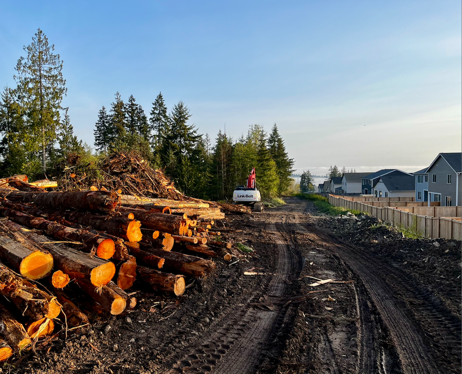
Construction has started on a 1.1-mile stretch of protected bike lanes along Martin Luther King Jr Way, finally starting work to connect Southeast Seattle, a quadrant long-disconnected to the city’s separated bike lane network. Tying together the I-90 bike trail and future Judkins Park light rail station with Mount Baker Station, the project represents the start of a fulfillment of a promise made to voters when they approved the 2015 Move Seattle transportation levy, which promised safety improvements along MLK.
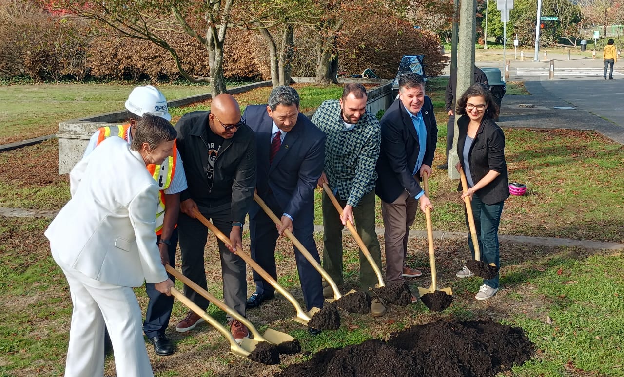
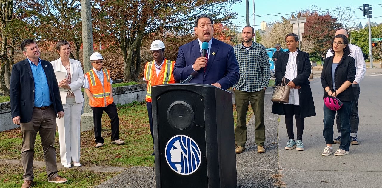
In early October, days after work crews started excavation for the bike lane, city leaders including Mayor Bruce Harrell and Sound Transit CEO Julie Timm celebrated a groundbreaking for the project, with city staff, advocates, and press. The ceremonial tossing of dirt was a long time coming.
Over the past few years, The Urbanist has been covering the trials and tribulations that a slate of promised bike safety projects have gone through to complete the design phases and move on to construction. The 2015 Move Seattle levy was heavy on downtown bike projects with the goal of expanding the Center City Bike Network and was set to leave out these crucial connections needed to fill in big missing gaps in the bike network, but the Seattle City Council stepped in to provide dedicated funding through the 2019 sale of the Mercer Megablock property in South Lake Union. But that funding didn’t ensure that getting the projects out the door would be easy.
At the groundbreaking, Seattle Department of Transportation (SDOT) Director Greg Spotts, who has been on the job for just over a year, described two things he has heard loud and clear during listening tour events: The city needs to make it safer to walk and bike on Rainier Avenue S and MLK Jr Way S in South Seattle… and that existing projects planned by SDOT are taking too long to get delivered.
“I’m so excited to say that today’s groundbreaking is the first in a series of projects that will be breaking ground over the next 18 months to make our streets much safer and more friendly to walk, bike and roll and access transit, and this is really the beginning of a wonderful series of investments and improvements,” Spotts said. He told the crowd specifically what he had done to ensure that delivery on projects on the South End was sped up.
“One was, telling my team that we need to bring an enterprise approach to the most important projects; the projects don’t belong to one person or one division, they belong to this entire 1000-person agency and everybody has to contribute,” he said. “And the second thing I did, is I appointed one of our executive team members, Jessica [Alinen], to be our liaison to the South Seattle cycling community, with a special emphasis on BIPOC cyclists.”
Spotts has regularly referred to work that the department has done to move the projects planned in South Seattle together as one large project to be delivered.
Councilmember Tammy Morales, one of the most outspoken members of the Seattle City Council when it comes to making street safety improvements and reallocating street space more equitably, did not speak at October’s groundbreaking. But she did release a statement following the event that noted the significant hurdles that had to be overcome for it to happen in the first place.
“I’m proud to see this project come to fruition after fighting for it for years. I’m proud of our community for standing up and demanding projects like this,” Morales said. “However, it should not take years of struggle to get life-saving investments in the South End, while other projects in the North End are given priority.”
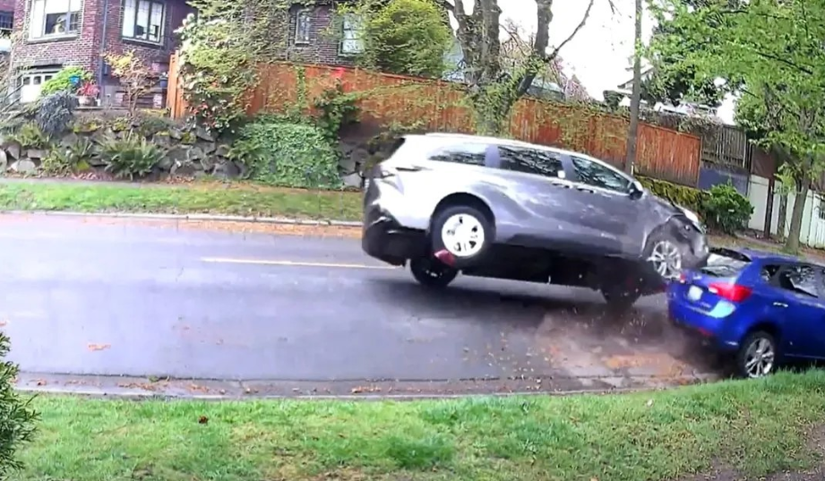
District 2 is the epicenter of the Seattle’s road fatality crisis, as Morales frequently underscores.
“These are life and death investments. More than half of all pedestrian deaths in Seattle happen right here in District 2. Just one week ago today, two women were killed by people driving in the South End, one on this very road and the other in SoDo,” Morales said, referencing events that occurred on the morning of September 27, on MLK near Graham Street and on First Avenue S at S Lucile Street, where people walking were struck and killed by drivers.
So what projects are on the way, and when are they expected? We checked in with SDOT to get an update on these incredibly urgent safety upgrades.
MLK Jr Way S Safety Project
The MLK project that the City just broke ground on will reallocate street space to create separated lanes for people biking between S Judkins Street, just north of the I-90 lid, and Mount Baker Station, at MLK Jr Way S and Rainier Avenue S. It also bridges a gap in the arterial sidewalk network along MLK, adding safe walking space where none currently exists along the east side of the street between S McClellan Street and S Bayview Street.
As The Urbanist reported last fall, the planned start of construction was delayed, with SDOT citing a number of factors, including additional hurdles due to grant funding provided via the federal government. After the project initially went out to bid and costs came in higher-than-expected, SDOT was forced to spend more time trying to find additional dollars, which the department was successful in doing. In August, a $5.3 million construction contract was awarded to C.A. Carey Corporation, and it was able to move forward.

The project also includes some upgrades around MLK Way and Rainier Avenue S that had originally been envisioned as “near-term” improvements as part of the vision for the Accessible Mount Baker project, which has mostly languished since the 2015 levy passed but which Councilmember Morales wants to restart thanks to a proposed budget amendment that will get a vote next week. In any case, substantial improvements to the arterial streets around this complicated intersection are a ways off at best, even as the City works to increase activity around the station with projects like the redevelopment of the former UW laundry facility.
The safety project under construction now is expected to wrap up next summer.
15th Avenue S & Beacon Avenue Safety Project
Even more transformative for South Seattle’s bike network are the planned separated bike lanes along 15th Avenue S and Beacon Ave S that will connect the neighborhood’s front door of the Jose Rizal Bridge all the way to the north end of Jefferson Park. In contrast with the MLK corridor project, this project has had to overcome considerable opposition from some nearby residents who are wary about losing on-street parking along 15th Avenue S.
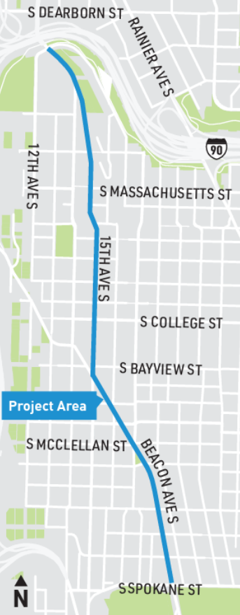
Originally set to start construction in early 2023, time for additional studies around parking utilization and more outreach to impacted residents has pushed that timeline back. But it has also allowed SDOT an opportunity to try a new phased approach that Director Spotts has stated he would like to continue to utilize moving forward: adding interim safety measures to a street before a full project goes out to bid. In the case of 15th Avenue S, SDOT added speed humps to the street to reduce drivers speeds, and installed a new all-way stop at one of the area’s trickiest intersections, Golf Drive S.
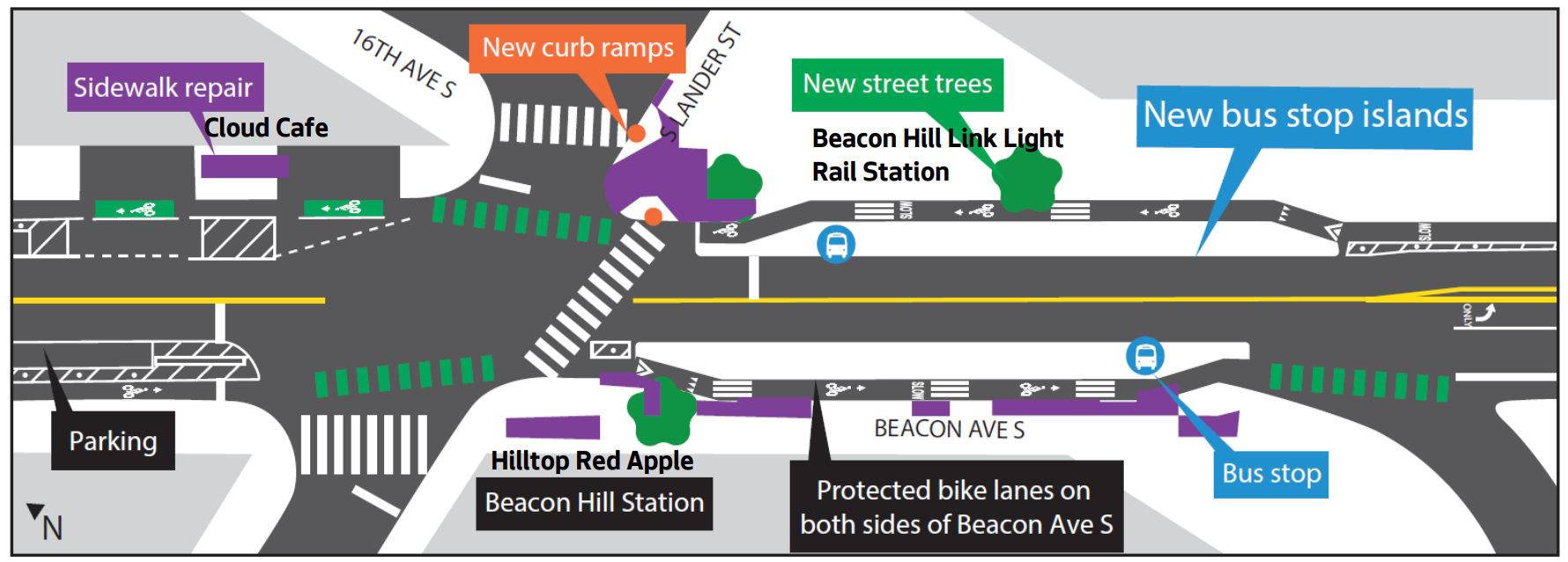
Construction on the full corridor upgrade, which will transform the area in front of Beacon Hill’s light rail station with new bus stop islands with bike lanes behind them, is expected to start next summer and continue for a full year, with the facility open by the fall of 2025.
Georgetown to Downtown Safety Project
A project that got rolling much later than the others, a proposal to connect Georgetown to the SoDo trail to enable a more direct connection to the Duwamish Valley from Downtown has been moving forward relatively quickly, advancing from 30% design this spring to 60% this summer — an accelerated timeline compared to most corridor projects. Thanks to a grant from the Puget Sound Regional Council, the project was able to able to get to full funding rather quickly as well.
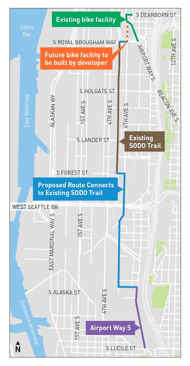
That fast pace isn’t sitting well with everyone, with a representative from the SoDo Business Improvement Area (BIA) visiting the freight advisory board this summer to discuss both “design and transparency concerns” that the business advocacy group has with the project. Many of those design concerns focus on the area where the trail will connect 6th Avenue S to the SoDo trail, at S Forest Street under the Sound Transit link light rail guideway.
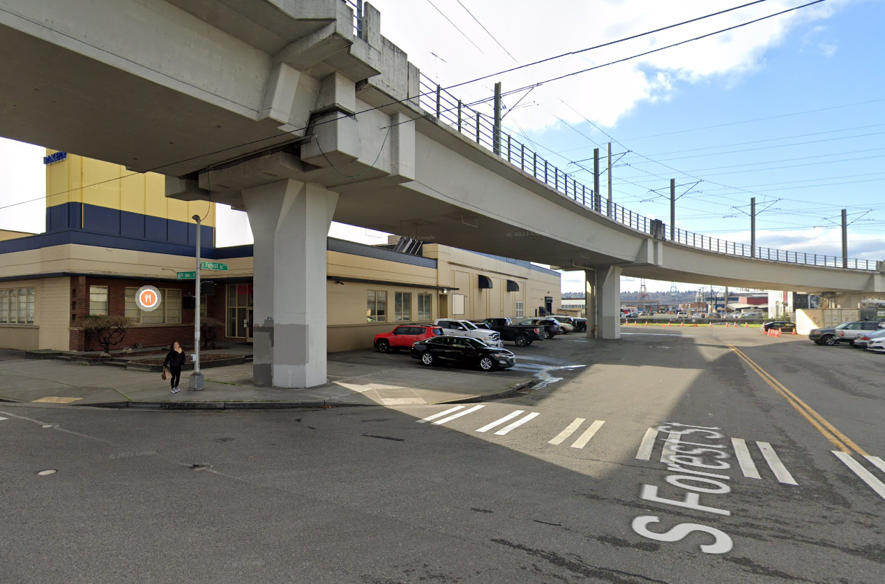
Franz Bakery, which has been at 6th and Forest for decades, has raised concerns about interactions between their delivery trucks and people on bikes travelling near their property. In response, the project team has tweaked the design to more intentionally avoid the parking and loading areas on the Franz property.
Without utilizing that route, however, it’s not clear how the circuitous path proposed by SDOT that was chosen instead of the more direct Airport Way S could work — a reroute was already a big concession to industrial interests in SoDo. For now, SDOT doesn’t appear to be poised to make any substantial changes to the route, and is moving toward finalizing design with the intent to award a contract by spring of next year. Construction could start by summer, and with a less complicated design than the project in Beacon Hill, be completed by the end of 2024.
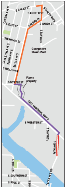
Georgetown to South Park trail
The hardest project to track out of any of these South End safety projects has been a plan to build a mixed-use trail through Georgetown to South Park’s front door at the north end of the South Park Bridge. Planned to mostly run alongside arterial streets on a wider-than-normal sidewalk, the project also has a segment that will be running through a long-disused parcel of city property, that is partially being transferred to SDOT for the trail and partially to Seattle Parks and Recreation for a new dog park adjacent to the trail. It has been repeatedly delayed without much fanfare.
The department has not sent an update to the email list for the Georgetown to South Park Trail since 2021, when SDOT said construction was expected to start the following summer. Even now, SDOT spokesperson Mariam Ali could only confirm that the department would have an update on the project “within the coming weeks.”
A longstanding priority for Georgetown community members, the project will provide people walking or biking a safe alternative to the existing facilities on E Marginal Way, which represent a big upgrade over painted bike lanes in the road. But travel through Georgetown’s main business district along Airport Way will still remain daunting for people on bikes, despite significant city investments at either end of Airport Way. The idea of reallocating space along the street from parking to other uses will be left to another time.
Barriers Added to Columbian Way Bike Lane
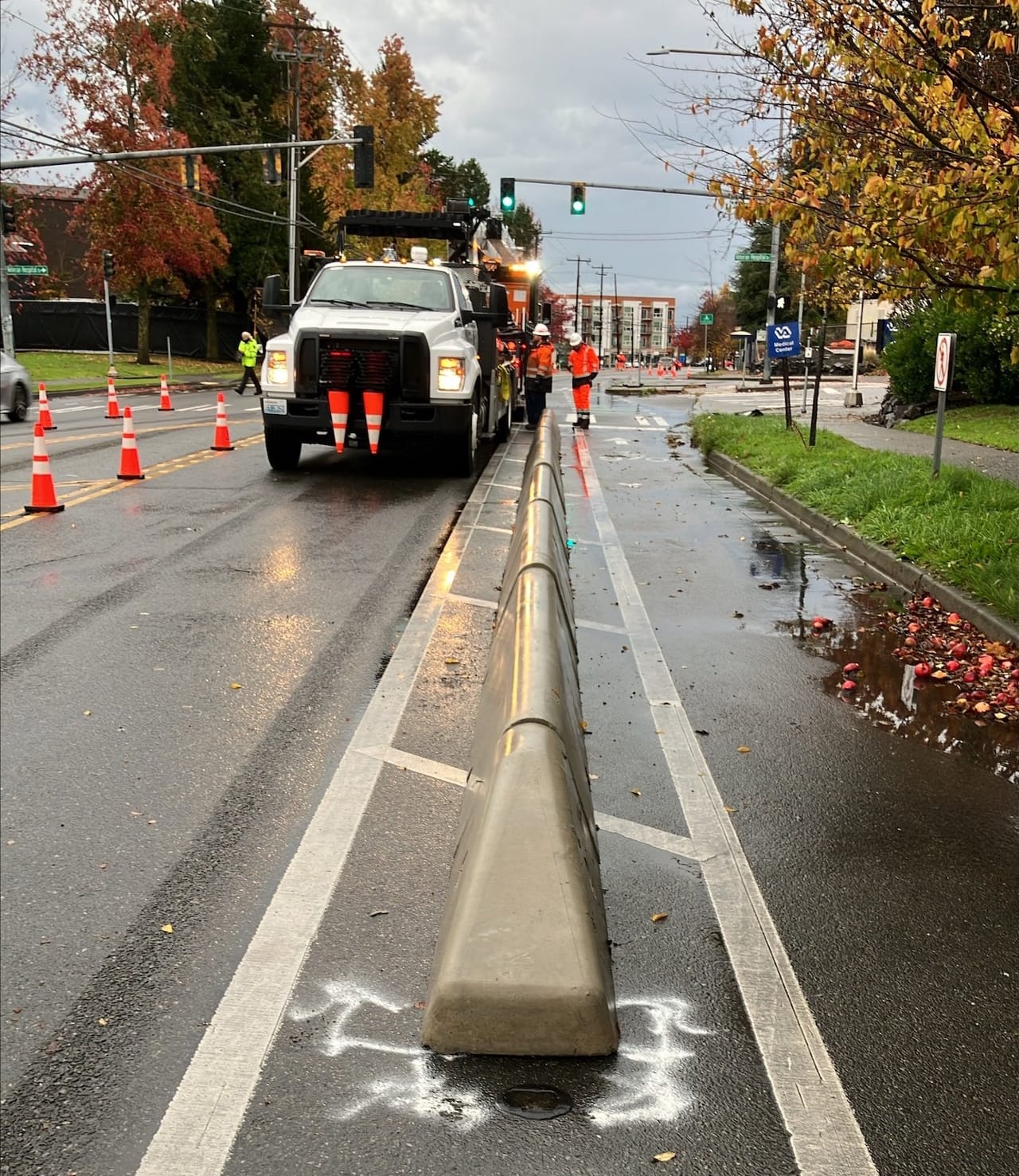
Upgrades are also starting to go into place along existing protected bike lanes in South Seattle. This past week, SDOT installed the first stretch of improved protected bike lane barriers along a stretch of S Columbian Way between S Snoqualmie Street and 16th Avenue S. As announced last summer, this is part of a pilot program testing out different treatments that go beyond paint-and-post, in this case with a so-called “Toronto style” barrier that consists of a low continuous curb. Other pilot treatments are planned in the South End along S Othello Street and S Dearborn Street near I-90.
But these pilot treatments aren’t exactly what Councilmember Tammy Morales had in mind when she successfully passed a proviso in last year’s budget allocating $1,000,000 in existing funding to upgrade bike lanes across District 2 — not just a few small segments. That proviso still remains active, but it remains to be seen whether its fulfillment will be prioritized.
Shovels in the ground, symbolic or otherwise, do represent real progress when it comes to ensuring the South End, left behind when it comes to safe streets upgrades, is able to catch up to the rest of the city. But the big question is whether that momentum will be able to be sustained into the next transportation levy, with Move Seattle up for renewal next year, or if the city will collectively decide it has other priorities.
Another Bike Network Delay in South Seattle: The Georgetown to South Park Trail