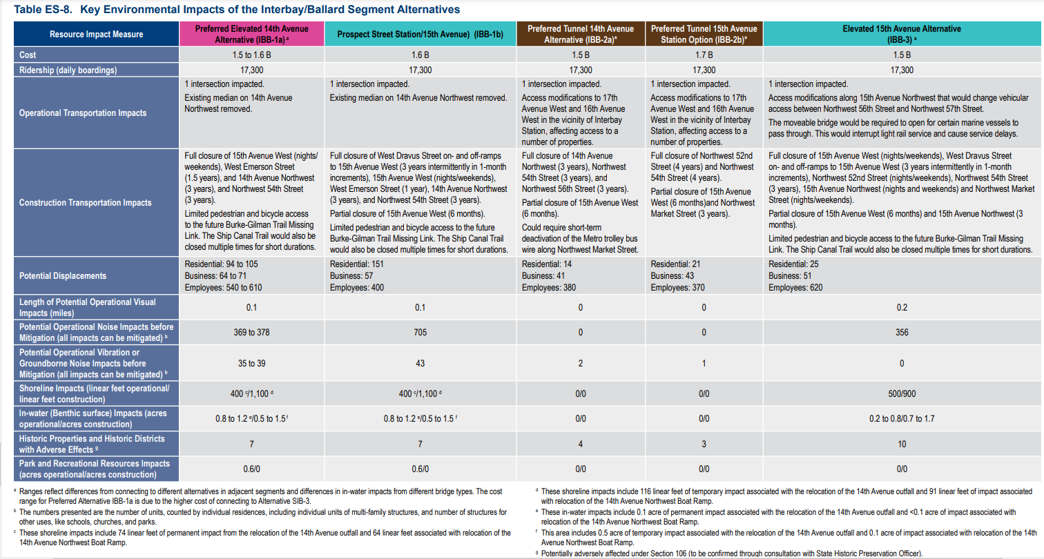
A Coast Guard vertical clearance determination dealt a blow to elevated light rail options for Ballard Link, giving tunnel alternatives a boost — not to mention superrich superyacht owners.
In order to accommodate the superyacht community, the United States Coast Guard has determined that fixed bridges crossing Seattle’s Ship Canal between Puget Sound, the Ballard Locks, and Fremont must have at least 205 feet of vertical clearance. Such bridges would be 70 feet higher than the Aurora Bridge and 150 feet higher than the Ballard Bridge when closed.
This determination was made specifically for Sound Transit’s planned extension of light rail to Ballard, but similar findings impacted plans for replacing the Salmon Bay rail bridge and will steer the future replacement of the Ballard Bridge. Horizontal bridge clearances were also included in the determination, with some proposed Sound Transit bridge designs found to require wider clearances to avoid collisions in the narrow channel. Thus, Coast Guard guidance also limits the moveable bridge alternatives that Sound Transit and likely drives up their cost by requiring wider spans in the moveable section.
The 205-foot vertical clearance requirement was guided by comments from maritime stakeholders in the area. Several groups — including businesses, the National Marine Trade Association, and the Port of Seattle — are attempting to create a cluster of superyacht service facilities in Seattle. Such private ships are sized to clear height limits in global ports. Seattle’s competitiveness in this market depends on accommodating such vessels.
Coast Guard Sound Transit Letter by Natalie Bicknell on Scribd
Rachelle Cunningham, public information officer at Sound Transit, confirmed that the agency had been in coordination with the Coast Guard during the development of alternatives for the West Seattle and Ballard Link extensions, but also acknowledged that the new stricter height guidance in the Coast Guard’s letter offered complications for understanding cost differences between the alternatives under consideration for getting light rail across Salmon Bay.
“Since the letter was received after the Draft EIS (Environmental Impact Statement) was published, we would need to do additional design work to fully understand how the guidance would affect the bridge concepts studied in the Draft EIS. Potential revised bridge concepts could possibly include moveable bridges or higher fixed-height bridges,” Cunningham said in an email to The Urbanist.
Maintaining freedom of navigation
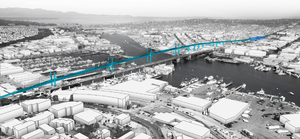
On February 8, 2022, the Coast Guard sent a Preliminary Navigation Clearance Determination (PNCD) to Sound Transit, as was revealed through a public records request. The document was prepared as an official response to the transit agency’s plan to cross the navigable Ship Canal with a light rail bridge or tunnel. Sound Transit studied two primary bridge options, one west of the existing Ballard Bridge at 15th Avenue, and one east of the bridge at 14th Avenue.
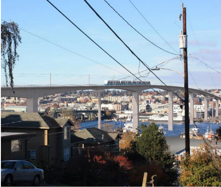
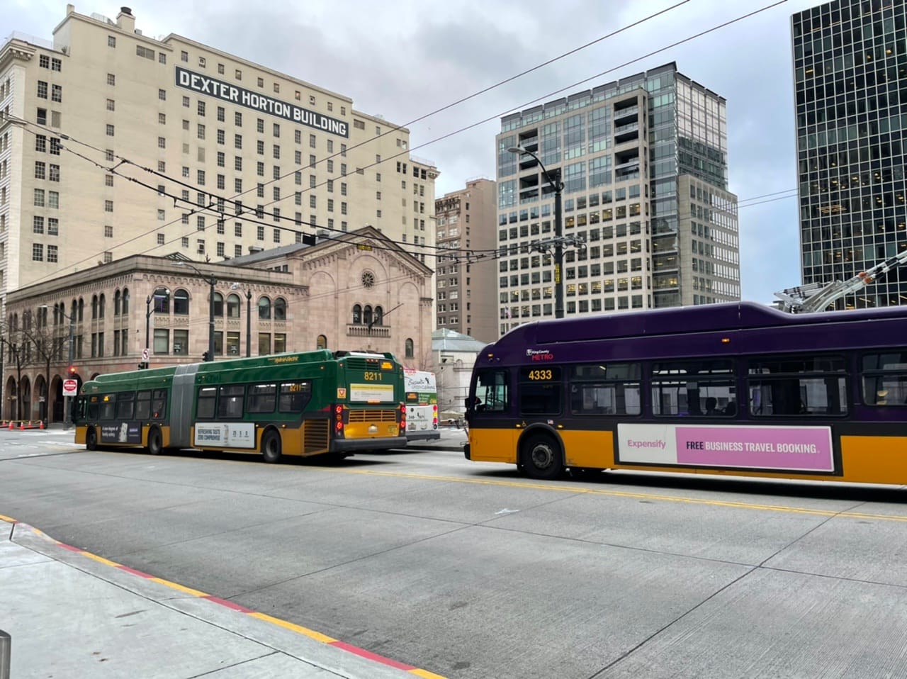
In the agency’s draft designs, the 14th Avenue W option is a fixed bridge and the 15th Avenue W bridge is a moveable bridge. However, Sound Transit’s executive corridor director Cathal Ridge said a fixed bridge west of 15th Avenue would also be feasible. The fixed bridge was designed to have at least 136 feet of vertical clearance, which matches the George Washington Bridge, which carries Aurora Avenue over the Fremont Cut.
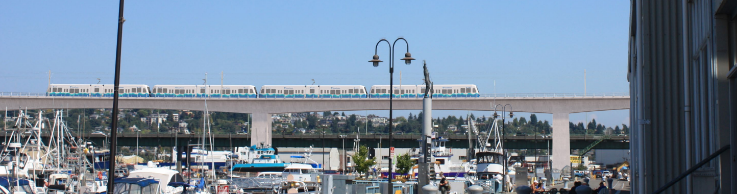
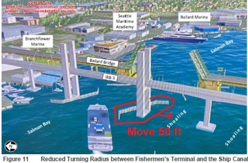
No Sound Transit bridge proposal met the Coast Guard’s threshold of preserving the reasonable needs of navigation. The height of the fixed bridges was too short by 69 feet. The 15th Avenue bridge included proposed piers that would be too close to the deepest navigation channel, causing potential collisions for boats turning out of Fishermen’s Terminal. There were no such issues with the tunnel proposals.
In reaction to the news, Seattle Subway argued the case for a tunnel to Ballard was boosted as the bridge alternatives appeared increasingly untenable. In particular, the group has called on the agency to bring back a 20th Avenue W alternative, which was eliminated from consideration as a station location when cheaper bridge options were assumed possible. Seattle Subway executive director Efrain Hudnell pressed the case for a tunnel to the core of Ballard.
“The high bridge on 14th is still the baseline for third party funding, however, these Coast Guard requirements will add costs such that a tunnel to the central core of Ballard makes more sense in comparison,” Hudnell said.
The 14th Avenue tunnel alternative had already achieved cost parity in the agency’s recent estimates for the Draft Environmental Impact Statement (EIS). The Coast Guard’s bridge specifications may make the 14th tunnel option the cheapest option and the 15th — and perhaps even 20th option — comparable to bridge alternatives. (If you haven’t yet, remember to submit your public comment on the DEIS by April 28th.)
The Coast Guard’s findings are based on their Congressional directive “to maintain the freedom of navigation on navigable waters of the United States and to prevent impairments involving navigable streams.” Not only is it the Coast Guard’s duty to protect waterways, but also to prevent reducing “riparian maritime capacity or capability” by narrowing access to on shore facilities like marinas and vessel moorage. The PNCD’s description of what is navigable in Seattle offers insight into the future of maritime uses in this area.
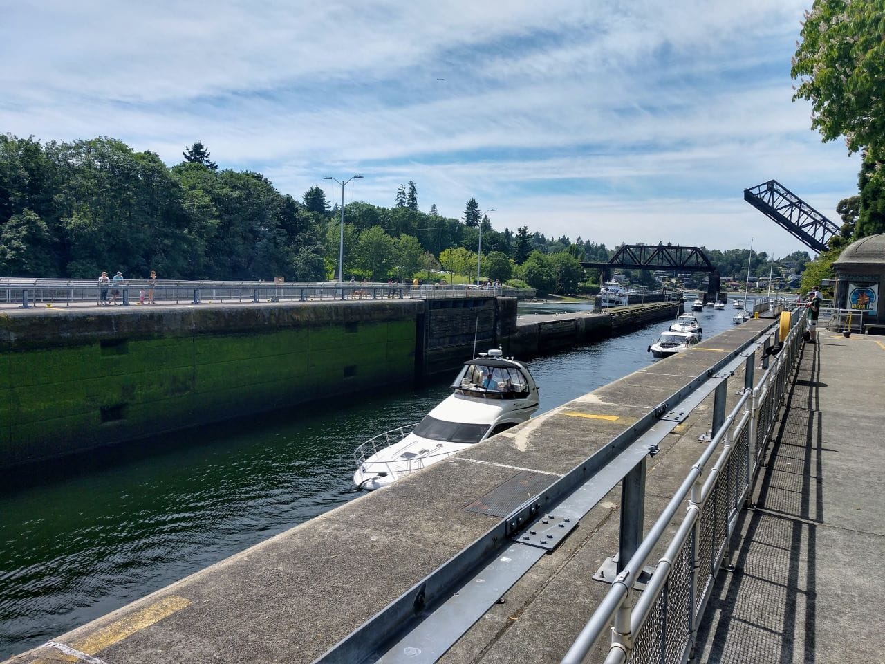
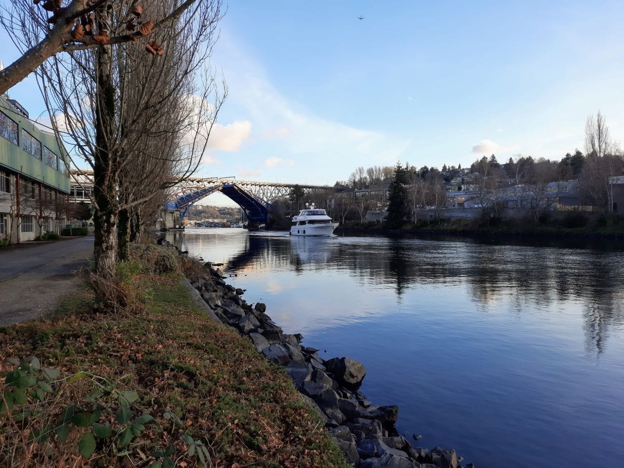
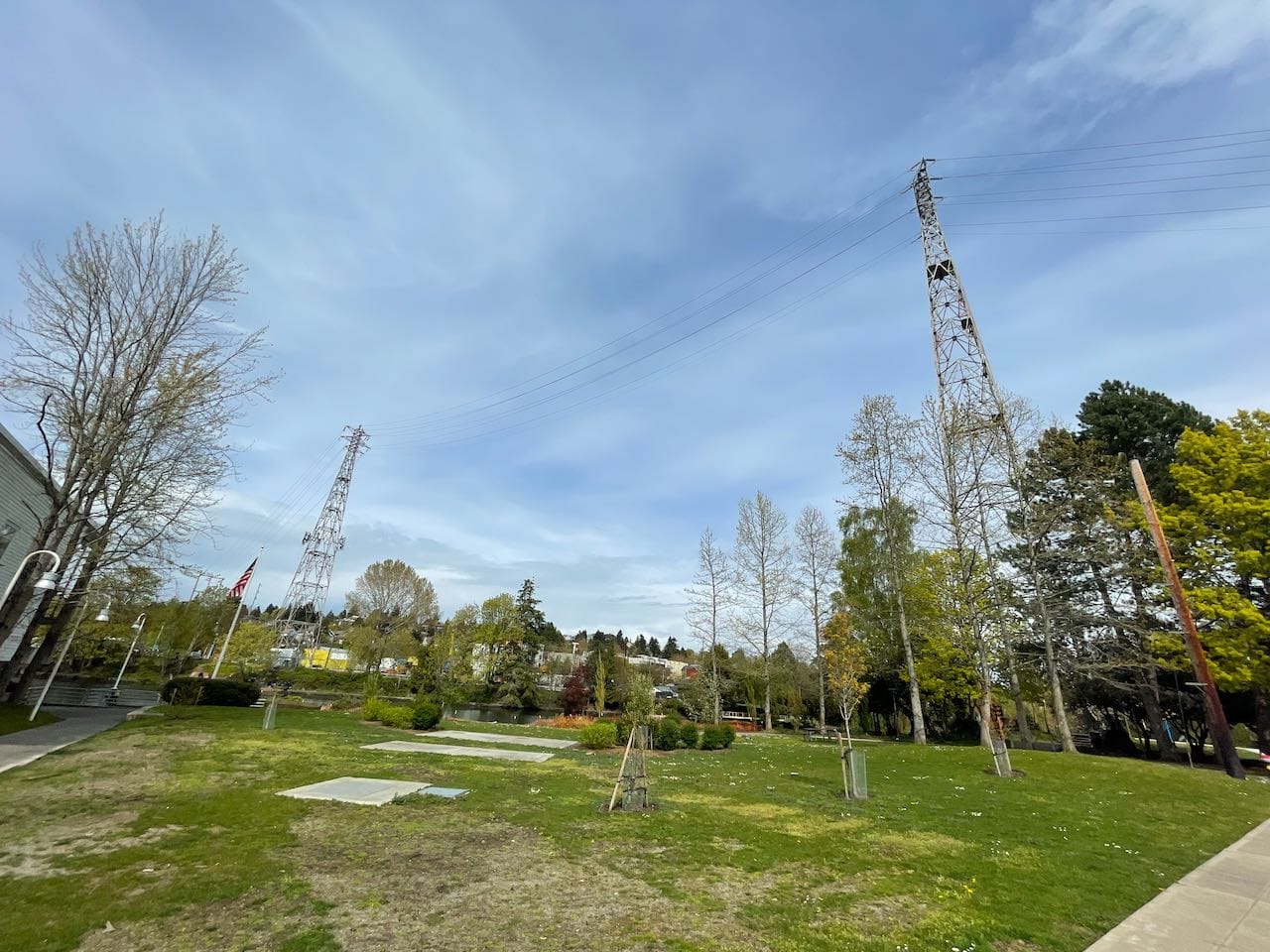
First, the Coast Guard views all bridges from the Pacific Ocean to Fremont as clear of height restrictions. The Salmon Bay Rail Bridge and Ballard Bridge are both draw bridges that open completely, so they have “unlimited vertical navigable clearance.” The first unnavigable height restriction any ship encounters are power lines crossing from Queen Anne to Fremont, almost two miles inland from Puget Sound. Their vertical clearance is 160 feet, according to the Coast Guard.
Steven Fischer, Bridge Program Administrator for the Coast Guard’s office in Seattle, said that adding a fixed bridge west of the power lines “is a big thing. There has been unlimited vertical clearance for a hundred years.” This is because many maritime businesses spent that hundred years building and servicing ships in Salmon Bay. The Coast Guard views restricting access to these businesses as reducing capacity, and therefore unacceptable. Fischer mentions that the 205-foot requirement was conveyed to BNSF in their discussions about replacing the Salmon Bay Rail Bridge, before they decided to scrap the vertical-lift bridge (a structure that does not fully open) and pursue a “heavy maintenance” strategy of the existing bridge.
Second, the width of navigability in the Ship Canal is based on the 80-foot width of the Ballard Locks and the 150-foot width of the channel under the Salmon Bay Rail Bridge and Ballard Bridge. However, steering a ship is not like staying in a lane on the highway as boats are under the influence of the environment. There is no set on-ramp to the navigation channel that can be simply adjusted around additional bridge pilings.
Fischer put it this way: “Boats can’t sit still with wind and currents. It’s a dynamic environment.” To make their determination, the Coast Guard ran simulations with tugs, barges, and commercial ships steered by professional pilots. Simulated vessels were not able to turn from Fishermen’s Terminal to the shipping lane under the 15th Avenue proposed transit bridge. “A little wind exacerbated the problem,” Fischer said.
The Superyacht Hub
While the turning radius into the navigation channel makes sense, the 205-foot height requirement seems arbitrary. Lots of boats make it through the 80-foot wide, 825-foot long Locks and continue under the 136-foot-high Aurora Bridge, with quite a bit of clearance. Many of the fishing vessels in the area don’t go over 130 feet in height, or even block the view from the much lower Ballard Bridge. What boats need that kind of clearance?
The Coast Guard’s determination and Sound Transit’s documents specifically call out superyachts. These private luxury vessels can reach lengths upwards of 500 feet, which is still manageable for the Ballard Locks. As the superyachts come from Europe, their only height limit is the Panama Canal, which is 205 feet. That’s the source of the Coast Guard’s determination.
Steven Fischer points out that quite a few global facilities are lining up at around that height. In addition to the Panama Canal, there’s the Golden Gate Bridge at 213 feet, the Astoria-Megler Bridge (at the mouth of the Columbia River) at 197 feet, and the Coronado Bridge in San Diego at 200 feet. Of the international superyachts that have come into Seattle, a handful have gotten close to that 200-foot height, Fischer said.
When it comes to whether or not there may be some flexibility regarding height restrictions, Cunnningham confirmed that Sound Transit has yet to engage in further discussion with the Coast Guard on the question.
Superyachts are a deeply appealing market for Seattle to court. The city’s history of ship building and its position with the furthest northern freshwater marinas are a natural fit for the industry. Decreasing numbers of maritime workers and recent shipyard closures, including Foss in Interbay, have created an urgency to reinforce maritime industries in the area. This has prompted local businesses and the Port of Seattle to found Superyacht Northwest, a marketing organization focused on positioning the area as a hub for the big boats. The Coast Guard’s determination letter echoes the promotional material that “services conducted at these facilities represent up to millions of dollars of business per vessel visit in addition to the ancillary marine service businesses (lodging, food services, marine supply, etc.).”
However, like cruises, servicing superyachts comes at a price. They are climate bombs, expelling immense amounts of carbon and pollutants for a very small caste of people. “It has been estimated a superyacht with permanent crew, helicopter pad, submarines and pools emits about 7,020 tonnes of carbon dioxide a year, more than 1,500 times higher than a typical family car,” The Guardian reported. The ships are ostentatious shows of wealth, whether they’re used to dismantle bridges or target as illustrations of inequity. Some vessels also have questionable ownership, highlighted by recent seizures of superyachts belonging to Russian oligarchs. And now they are being used as an argument to steer the design of Seattle’s transit future.