SDOT plans to spend a decade studying Aurora Avenue changes, but should act much sooner.
In 2021, SDOT began studying improvements to Aurora Avenue with funding from WSDOT and King County Metro. In 2022, the Washington State Legislature allocated $50 million for a demonstration project in the Licton Springs section of Aurora Avenue. The state wanted design completed by fall 2023, and for construction to begin in spring 2024. In other words, the state wanted the city to take action quickly.
The city opted to continue studying the entire corridor instead and, in 2024, the intent to fund $50 million for Aurora was dropped from the state budget.
In the five years since the study began, not much has changed. The most meaningful near-term improvement is likely a signalized crossing of Aurora and N 137th St. Otherwise, a few turn restrictions, hardened centerlines, and repainted crosswalks are all SDOT has to show for five years of work.
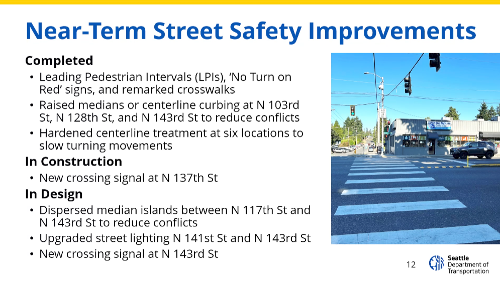
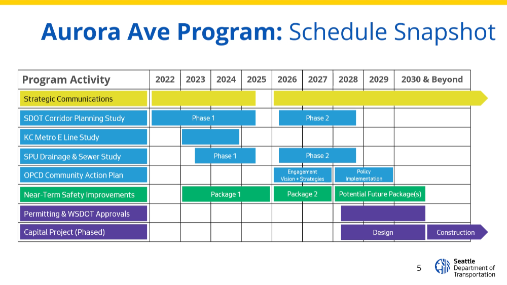
The proposed alternatives in the long term corridor study leave much to be desired. The agency's current estimate for when the study will be completed and construction on larger capital projects will begin is now 2031 - a full decade after the study began. (Of course, this assumes funding will be available then.)
Reconnect Fremont - A demonstration project to build momentum and trust
We need to build momentum for change along Aurora. Trust is lost when planning and studies take a decade without meaningful near-term changes. Reconnect Fremont is a demonstration project to overcome the existing inertia, rebuild trust with the community, and make people reimagine Aurora as more than a highway bisecting their neighborhood.
Aurora Avenue is classified as an Urban Village Main through Fremont. According to SDOT’s Streets Illustrated guidelines: “while Urban Village Main Streets must accommodate the movement of people and goods through the Urban Center or Village, the design of these streets encourages slower speeds and clearly communicates that walking, bicycling and transit access are prioritized.”
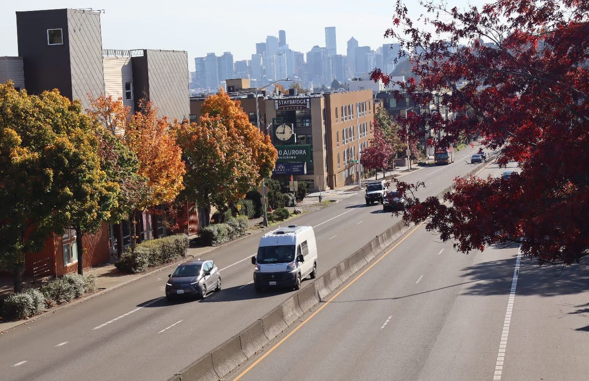
If you’ve ever traveled along this section of Aurora, you know that walking, bicycling, and transit access are not prioritized. A concrete barrier runs down the center, and there are no street level crossings. For vehicles, this section of Aurora is an uninterrupted freeway. For everybody else, it’s a physical barrier.
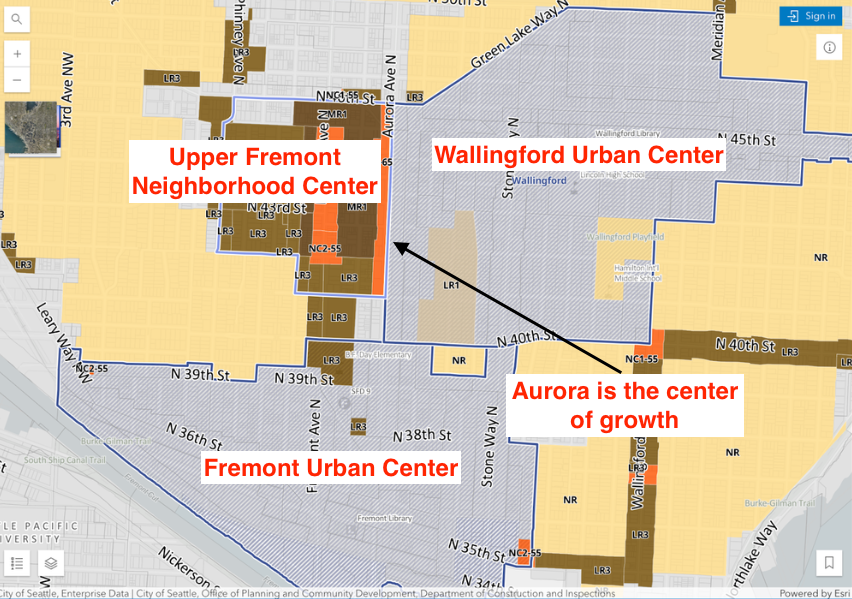
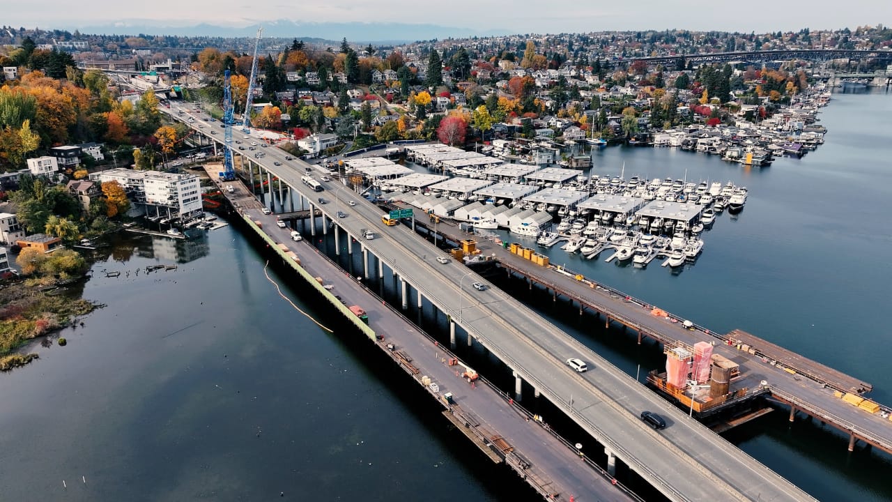
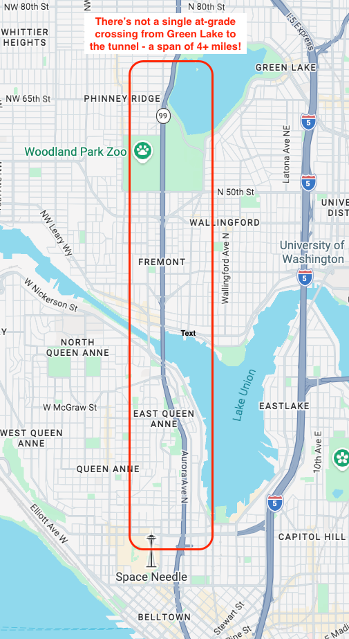
Different stretches along Aurora have different problems. The most obvious issue in the Fremont stretch currently is high speeds (speed limits were reduced in other sections of Aurora in 2021, but not in Fremont), no accessible crossings, and a dearth of E Line stops. From N 68th Street near Green Lake to the Aurora tunnel, there is not a single street level crossing.
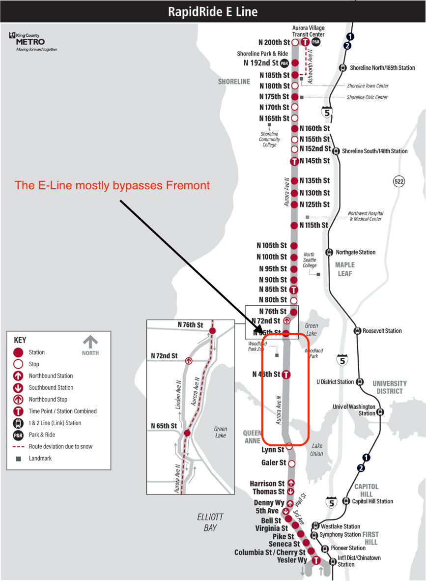
The E Line is the highest ridership bus line in Washington State. But the only E Line stop in Fremont is at N 46th Street. The nearest northbound stop is at N 65th St, more than a mile away. The nearest southbound stop is at Lynn Street, more than 1.5 miles away. There is only a single E Line stop in a 2.5-mile stretch through one of the densest neighborhoods in North Seattle!
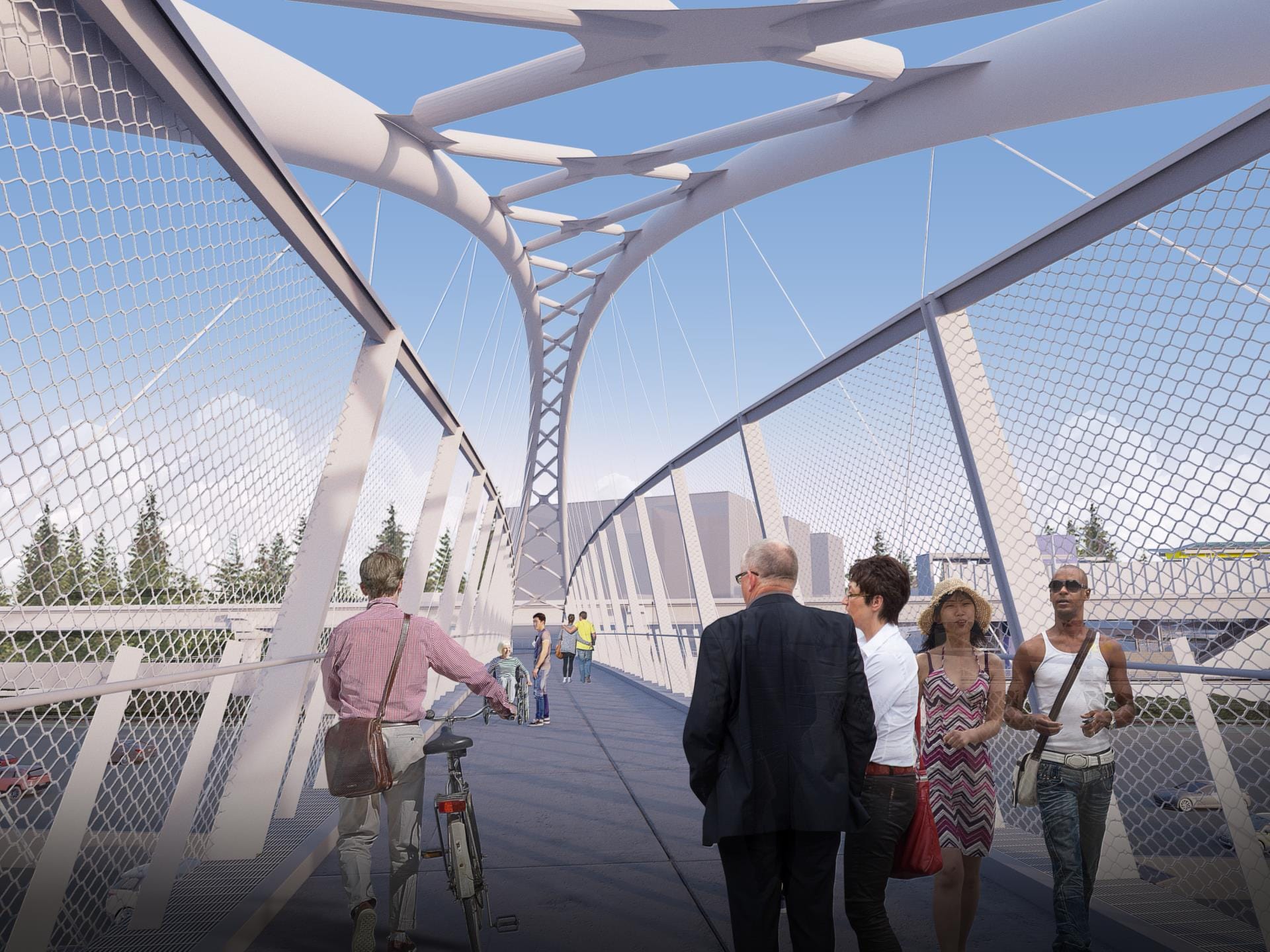
It doesn’t have to be this way. Reconnect Fremont proposes a series of concrete improvements that will restore east-west connectivity, improve transit access, and build momentum for the entire Aurora corridor through near-term action.
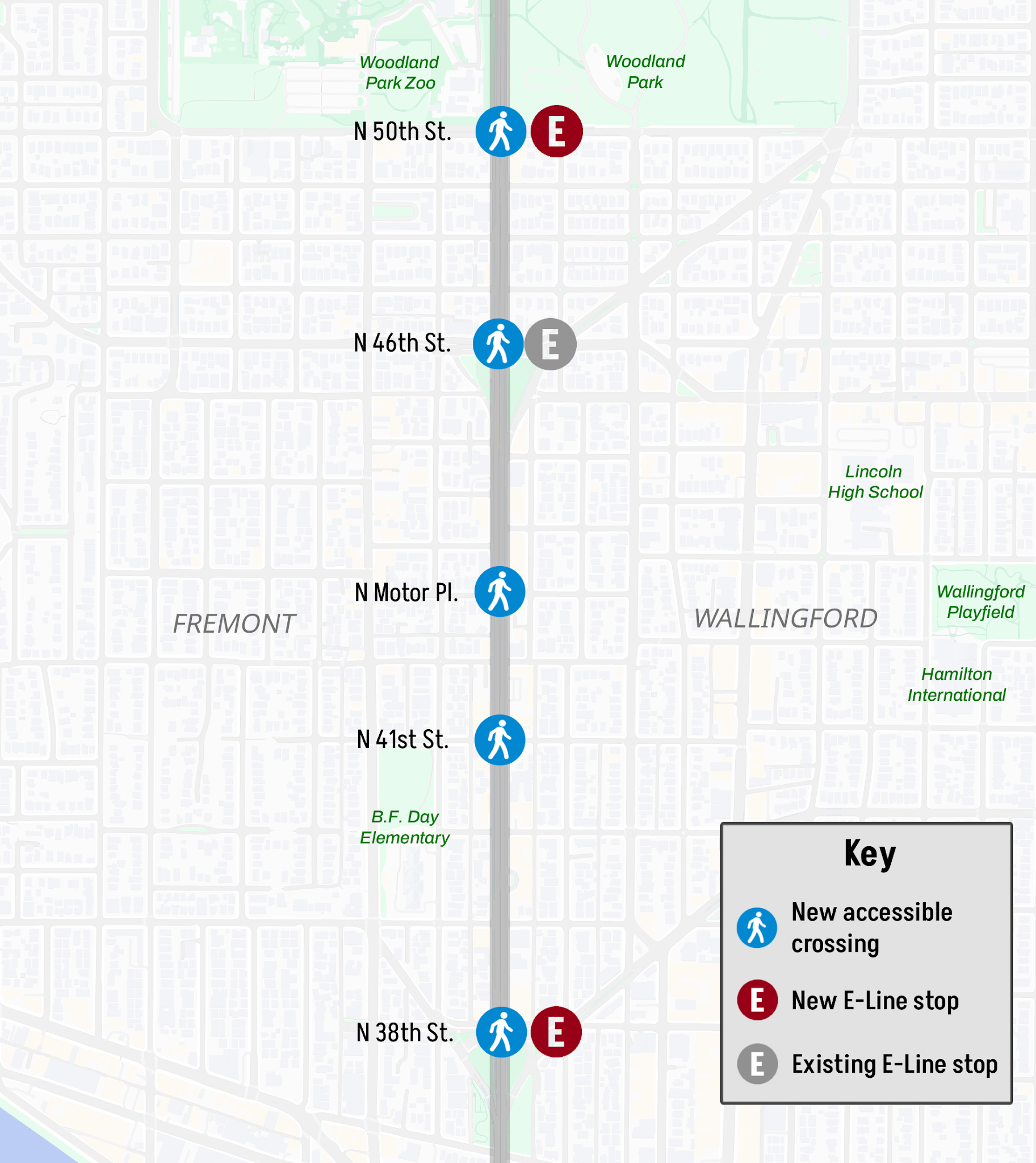
N 38th Street
As the densest part of Fremont, the desire for an E Line stop at N 38th Street is over a decade old. King County Metro would like to build a stop here, provided that the city and state install a safe street level crossing.
The current walk from the sole E Line stop at N 46th Street to the Fremont core is 20+ minutes. An E Line stop and street level crossing at N 38th Street will provide improved access to the Lower Fremont commercial district, as well as the increasing density along Stone Way.
N 41st Street
There is currently a pedestrian overpass at Aurora and N 41st Street, just a block from the B.F. Day Elementary School. In 2025, SDOT completed a seismic retrofit of this bridge at a cost of more than $2 million, despite the schools in the area having previously requested a street level crossing be installed at this location.
The enrollment area of B.F. Elementary School spans both sides of Aurora. Parents with strollers or kids with bikes have an unnecessarily difficult experience trying to cross Aurora using the inaccessible overpass.
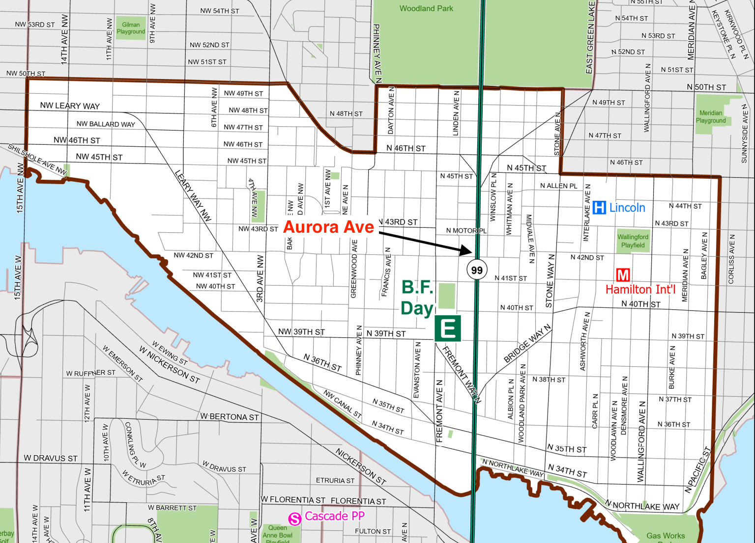
As the Seattle School Traffic Safety Committee said, “A safe, pleasant, at-grade crossing will reunite a neighborhood with the happy add-on of making the commercial spaces along Aurora more accessible for all.”
N Motor Place Crossing
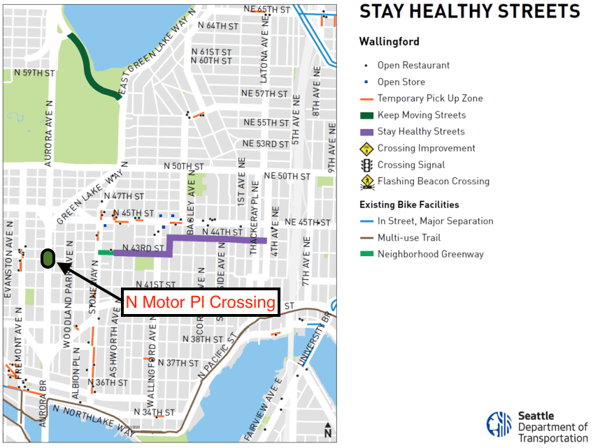
The first neighborhood greenway in Seattle was the Wallingford Neighborhood Greenway (now rebranded a Healthy Street). It connects to Hamilton International Middle School, Lincoln High School, the Wallingford Playfield, and the Wallingford commercial district along N 45th Street. The Healthy Street currently ends at Stone Way, but there is an opportunity to extend it further west.
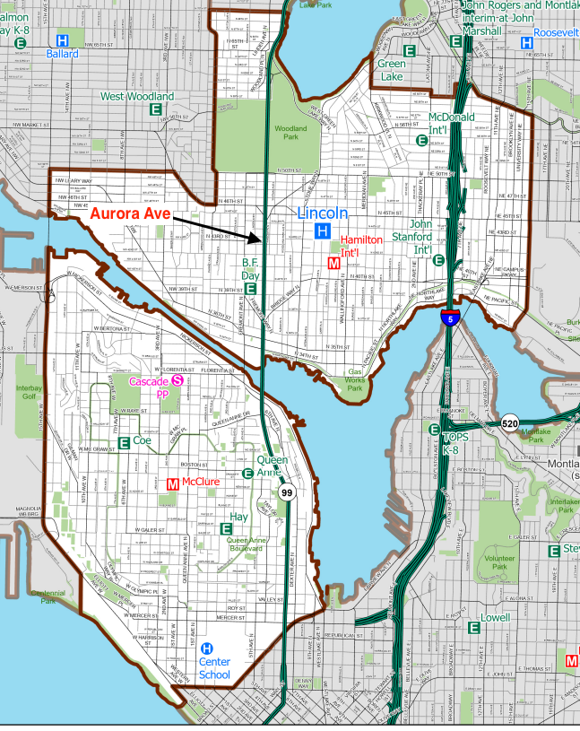
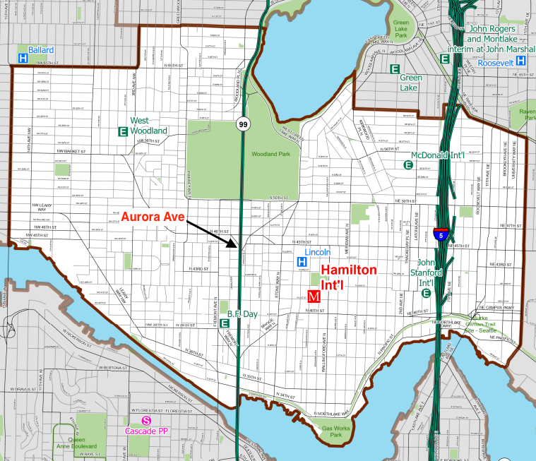
The enrollment areas of Hamilton International Middle School and Lincoln High School cross Aurora. The Upper Fremont Neighborhood Center will add density a few blocks west as well, and a 71-unit supportive housing facility already exists on the west side of Aurora and N Motor Place.
A street level, signalized crossing of N Motor Place can extend Seattle’s first Neighborhood Greenway, provide a safe bike connection for kids getting to school, and connect the increasing density in Upper Fremont with the existing commercial district in Wallingford.
N 46th Street
The lone E Line stop in Fremont is at N 46th Street and serves more than a thousand riders per day. It is also a transfer point to Route 44 which connects to U District and Ballard. The bus stop is surrounded by on- and off-ramps and high speed traffic.
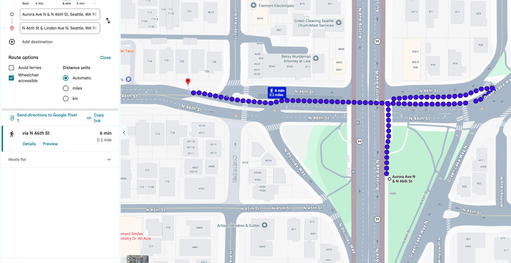
It is a common sight to see someone hop the jersey barrier to catch the E Line on the other side of Aurora Avenue. A street level, signalized crossing at N 46th Street would provide safe and convenient access to this bus stop.
N 50th Street
In 2023, Chief Seattle Club opened the Goldfinch building at Aurora and N 48th Street. In 2026, DESC opened Clover Place at Aurora and N 49th. Plans are currently underway for a multi-purpose athletic field at Woodland Park near Aurora and N 50th Street to serve Lincoln High School. The Woodland Park Zoo (which draws over a million visitors per year) is a few blocks from Aurora and N 50th.
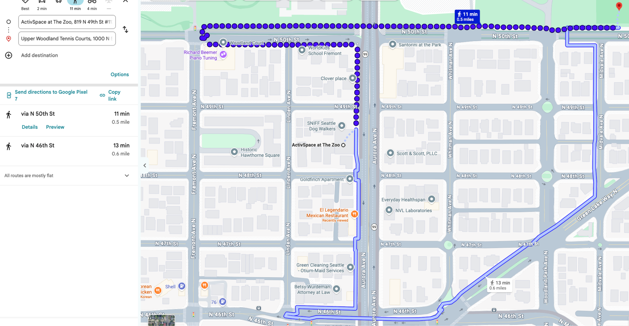
There is significant demand for an E Line stop and street level crossing at Aurora and N 50th. The Woodland Park Zoo has expressed support for such improvements, as have the Friends Of Lower Woodland Park and the neighbors in the area.
Woodland Park Avenue Greenway
There is currently no all ages and abilities bike route from the Burke-Gilman Trail in Fremont connecting to Woodland Park and Green Lake. Most people take Stone Way N, which contains a door-zone bike lane going north and no bike facilities at all going south. Stone Way N is an arterial listed on the High Injury Network, although it got some safety improvements in 2026 as a result of advocacy from Ballard Fremont Green Streets.
Woodland Park Avenue was listed on the original 2014 Bicycle Master Plan and the 2024 Seattle Transportation Plan as a neighborhood greenway. Building this greenway would provide a much-needed connection between the Burke-Gilman Trail and Woodland Park. The main challenges are the crossings of the arterials – Bridge Way N, N 46th Street, and Green Lake Way N – but some improvements are already on the way.
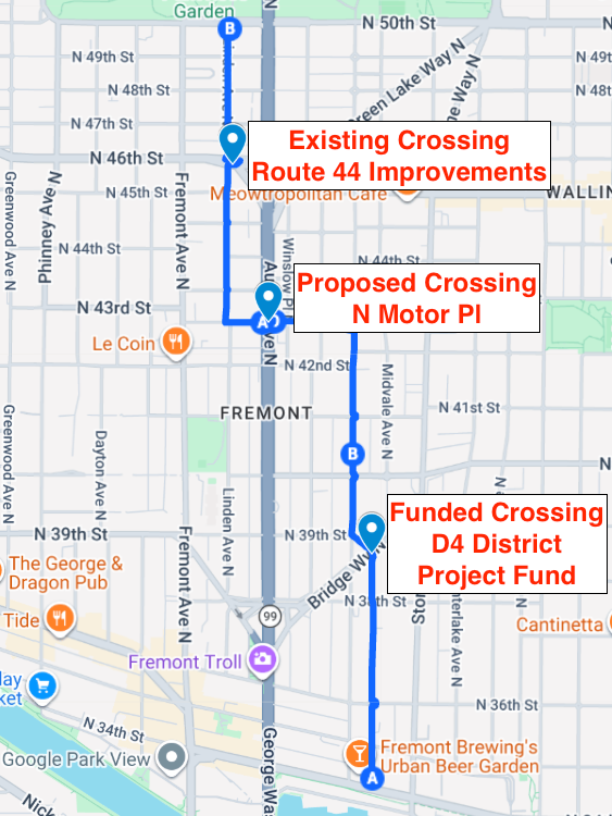
In 2016, a Neighborhood Street Fund application was submitted for crossing improvements at N 46th Street and Green Lake Way N, but was not chosen for funding. In 2026, one of the projects selected in the D4 District Project Fund was an enhanced pedestrian crossing of Bridge Way N at the Woodland Park Avenue intersection.
With the aforementioned signalized crossing of Aurora Avenue and N Motor Place, we can build the desired bike route between the Burke-Gilman Trail and Woodland Park without having to wait for future improvements at N 46th Street and Green Lake Way N. How? In 2022, the Route 44 TPMC built a crossing of Linden Ave N and N 46th. By making a greenway on Linden Avenue N at N Motor Place, we have the connection to Woodland Park. Linden Avenue N is already a proposed greenway in the Seattle Transportation Plan, and this connection would also create a safe route to the Upper Fremont Neighborhood Center.
Reconnect Fremont has broad support
The Aurora Reimagined Coalition has hosted two walks for Reconnect Fremont. Reconnect Fremont has been presented to the Fremont Neighborhood Council, Seattle School Traffic Safety Committee, Seattle Pedestrian Advisory Board, and Lincoln High School PTSA, and is endorsed by a broad coalition of organizations, such as the Cascade Bicycle Club, Amalgamated Transit Union 587, Ballard Fremont Green Streets, the Downtown Emergency Service Center, the Fremont Chamber of Commerce, the Fremont Neighborhood Council, the Transit Rider’s Union Bus and Transit Service Committee, and Transportation Choices Coalition.
Reconnect Fremont has also received letters of support from Cascade Bicycle Club, Friends of Lower Woodland Park, and the Woodland Park Zoo, and has strong support from state lawmakers.
Take Action
Let our leaders and decision makers know that you want to Reconnect Fremont - sign the Action Network campaign!
 Ryan Packer