Later this year, Bellevue City Council will complete a years-long process to rezone the Wilburton neighborhood east of I-405. Historically a commercial and office corridor, the city has identified the neighborhood as a key area to absorb new growth to best take advantage of light rail’s opening next year. And the demand for housing is high — economic forecasts foresee the development of over 5,000 units of housing within the neighborhood in the next 20 years.
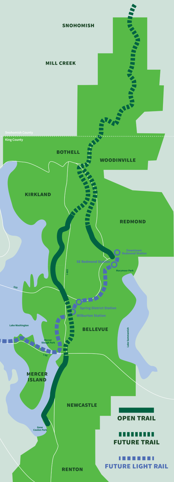
With so much attention and excitement granted to East Link, it’s easy to forget that our region’s largest light rail expansion since 2009 is only one piece of a larger suite of public investments that will fundamentally transform the neighborhood’s identity. Investments to complete key portions of Eastrail will provide a dedicated, multimodal alternative to I-405 and connect East King County communities with each other. Although a project initiated for auto-centric reasons, an upcoming rebuild of the Main Street interstate crossing will create dedicated bicycle and pedestrian connections to the East Main light rail station — in effect expanding the walk and bikeshed of this station into the Wilburton neighborhood. And the city’s Grand Connection corridor, with its arts-focused “rooms,” planned lid park, and multimodal infrastructure, will will provide as much in placemaking potential as it does in pedestrian connections.
With literally hundreds of millions of dollars of public investment being spent in and around the Wilburton neighborhood, it’s important to make sure there’s actually a public that can enjoy these benefits. The rezones are crucial in order to spur the commercial and residential redevelopment needed to adequately support these public investments. Wilburton has been identified as a key growth area by both progressive and conservative leaders alike, so there’s appetite for changes that will significantly alter the neighborhood to support the coming transit and trail infrastructure.
The city council’s deliberations later this year will ultimately decide the exact land use code amendments and specific policies around things like Floor Area Ratios (FAR), building heights, public amenities, and transportation investments, but these discussions won’t happen in a vacuum. The city council will have staff, as well as the years of public outreach they’ve helped lead, to support their decision-making. In preparation for these discussions, I thought it’d be good to document the site as it currently exists, examine the outreach that’s already been conducted, and review decisions made during the similar rezone process around East Main Station to warn of potential mistakes.
The site today: a place to visit, not to be
As a longtime Bellevue resident who’s traveled through nearly all parts of the city for school, work, and leisure, I thought I had spent my fair share of time in Wilburton. But when I started my photowalk through the site on a cold Thursday afternoon, I quickly realized that my previous escapades in the neighborhood had really been limited to short errands — a quick stop in the Best Buy, grocery shopping in the Uwajimaya, or oogling the plants in the Home Depot. Another important realization was that nearly all of these trips were facilitated by my partner’s car.
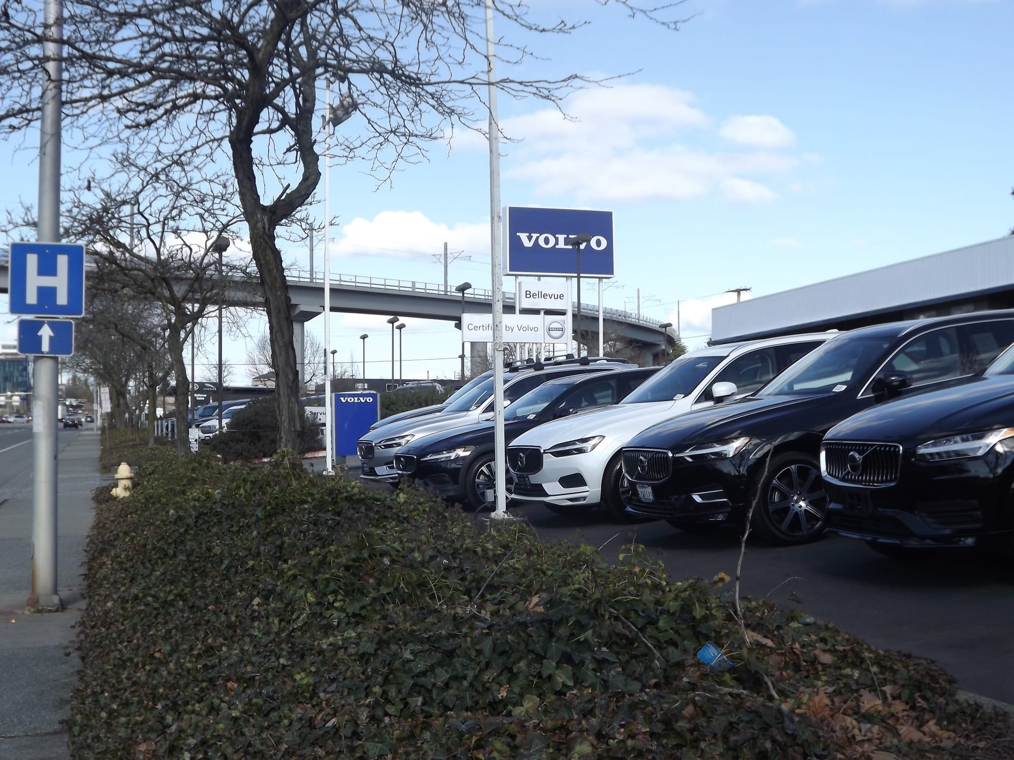
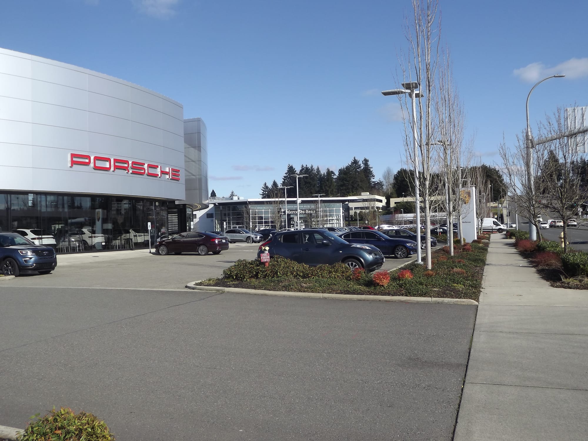
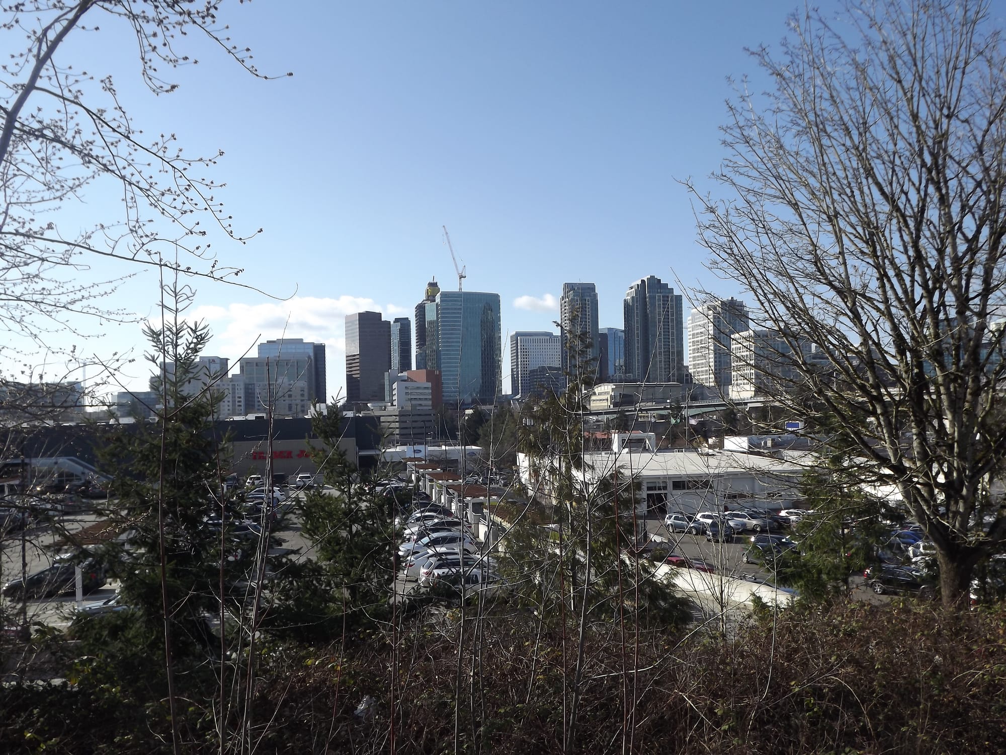
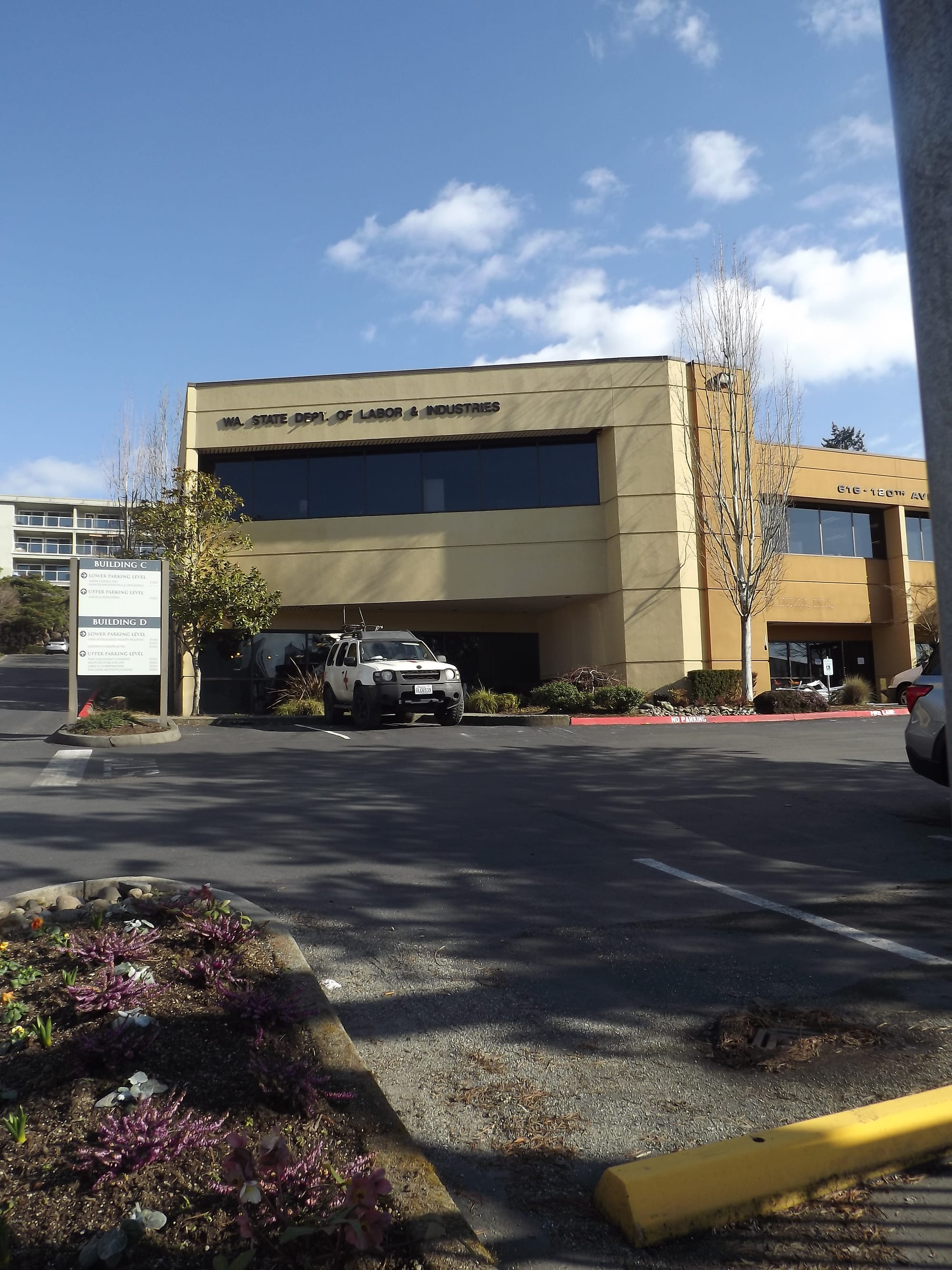
And, walking the streets with my friend and seeing what the streetscapes had to offer, it felt like my experiences were by design. The adjective that consistently popped in my mind during my venture was “suburban.” Were it not for the skyscrapers in the not-so-distant Downtown Bellevue skyline, the Wilburton site would feel like most other suburban neighborhoods in North America: big box stores with even bigger parking lots, wide roadways with speeding cars, strip malls with large setbacks from the sidewalks, and car dealerships.
So many car dealerships.
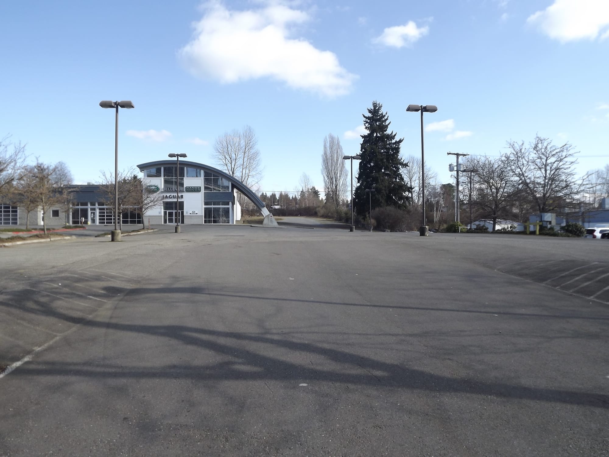
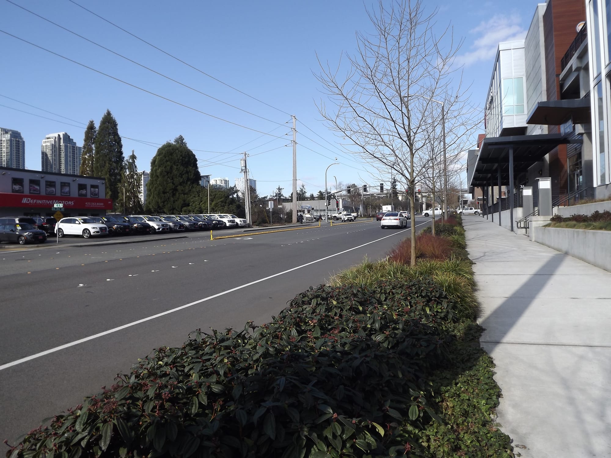
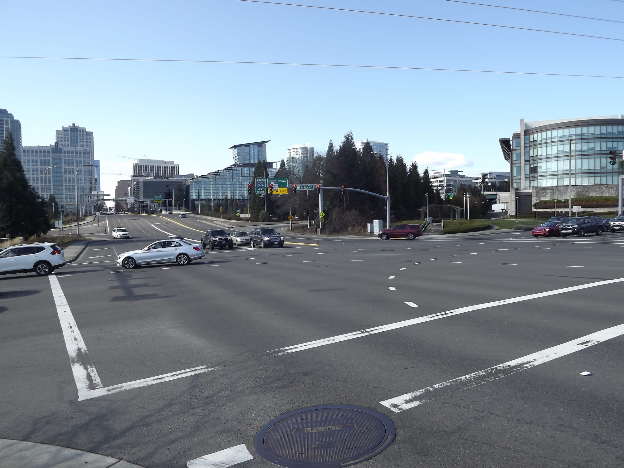
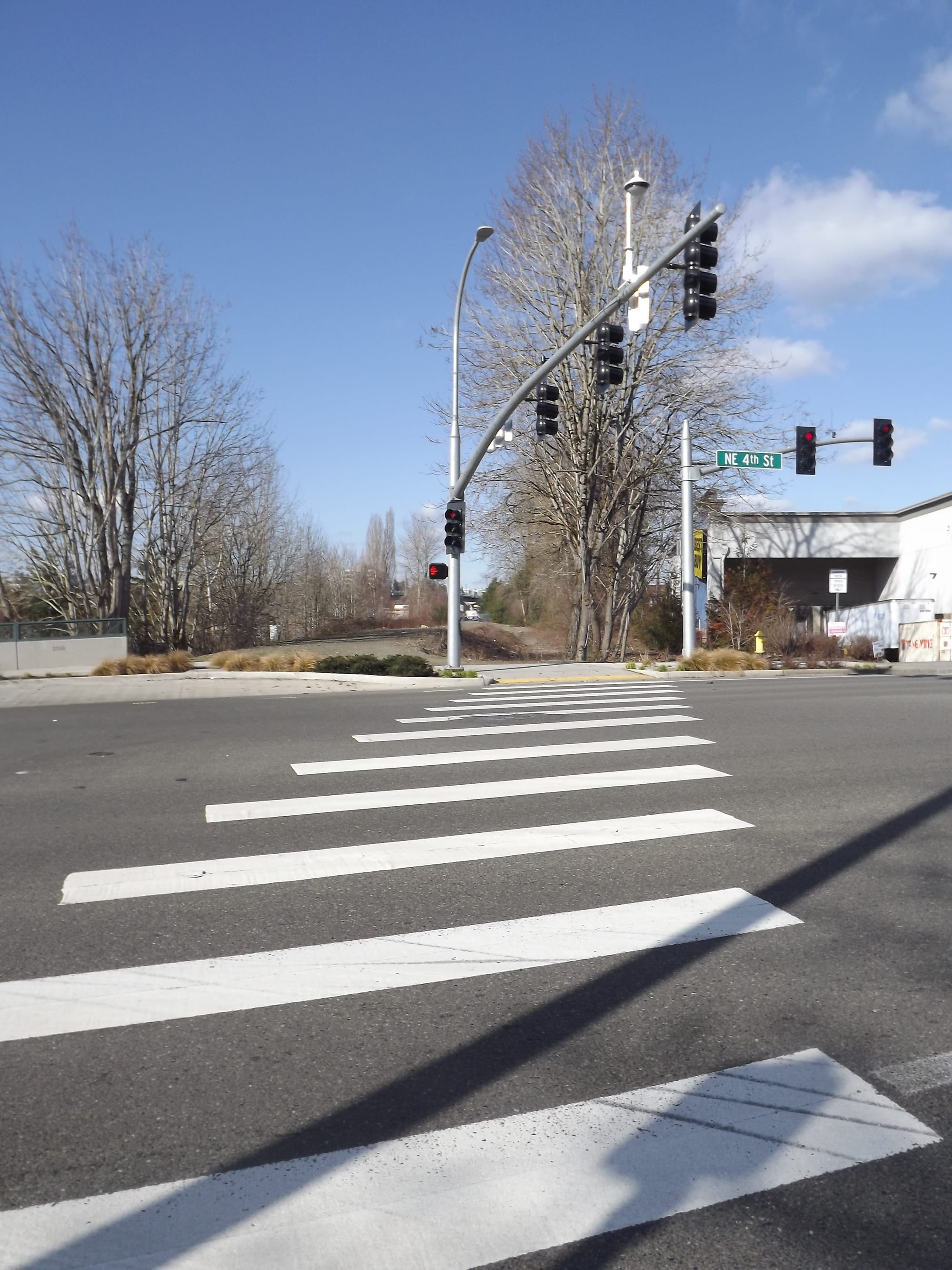
Given the current zoning that’s primarily for low-rise office or retail uses, this (lack of) neighborhood character comes as little surprise. Wilburton is not designed as a place to stay — it’s a place to visit or pass through, then quickly leave (ideally in your vehicle). Yes, derisive urbanists (myself included) have often ascribed this quality to all of Bellevue, but the Wilburton neighborhood seems to enter its own league in this regard. Wide highways like NE 8th Street and 116th Avenue NE converge to create seas of asphalt and monstrous intersections that require half a minute to cross. Godspeed to those brave few whom I’ve seen (whether by choice or by necessity) bike along these dangerous corridors.
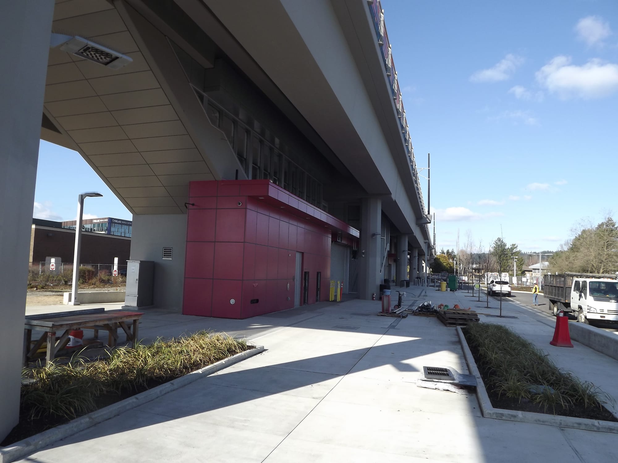
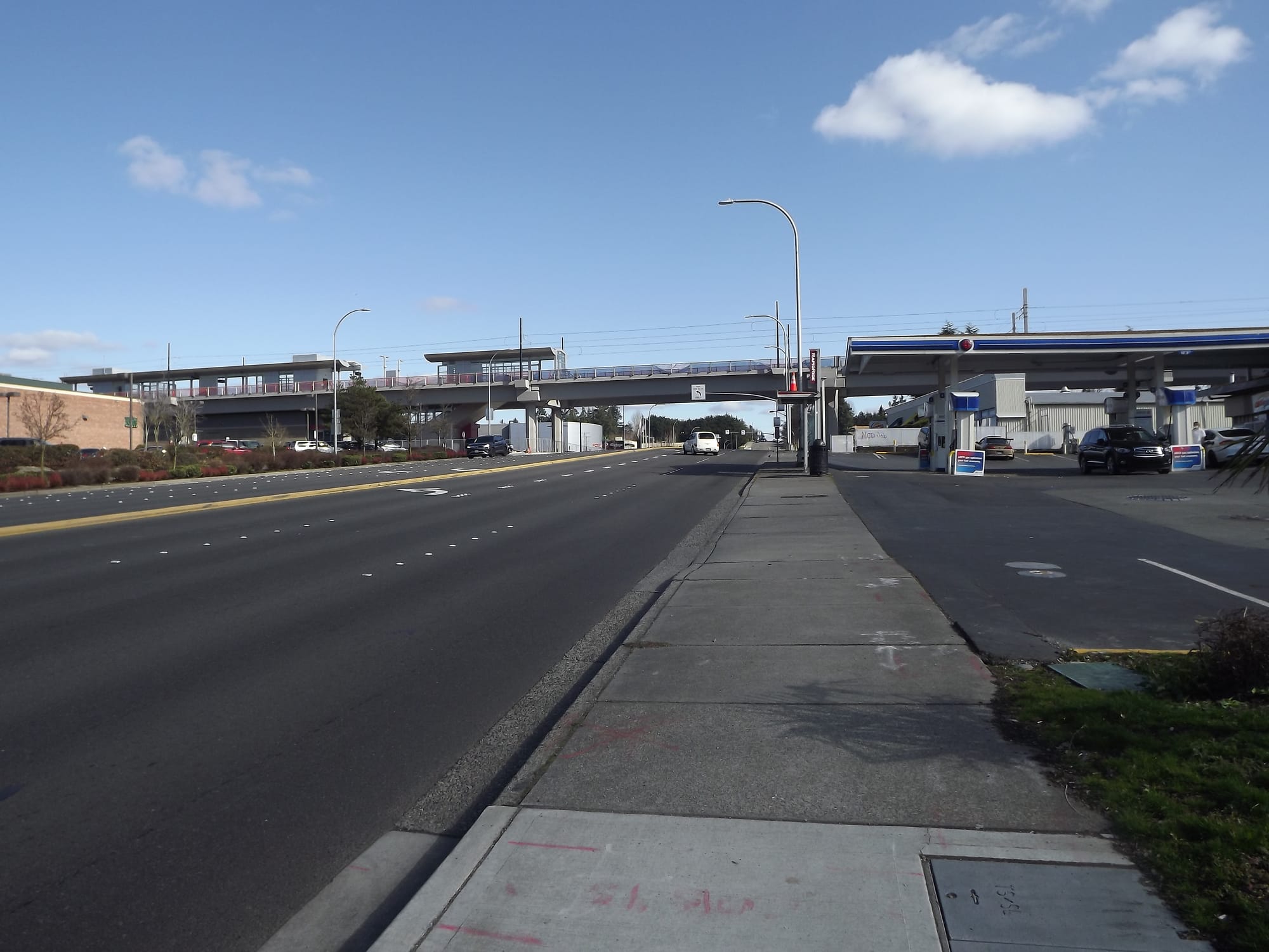
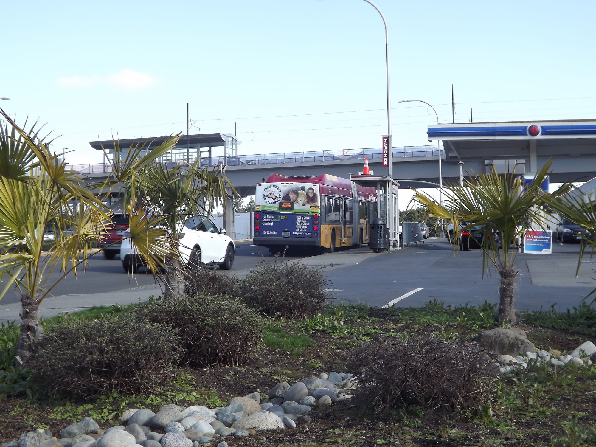
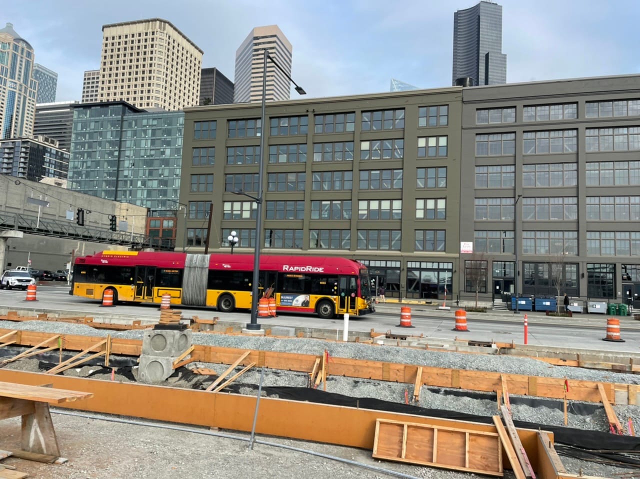
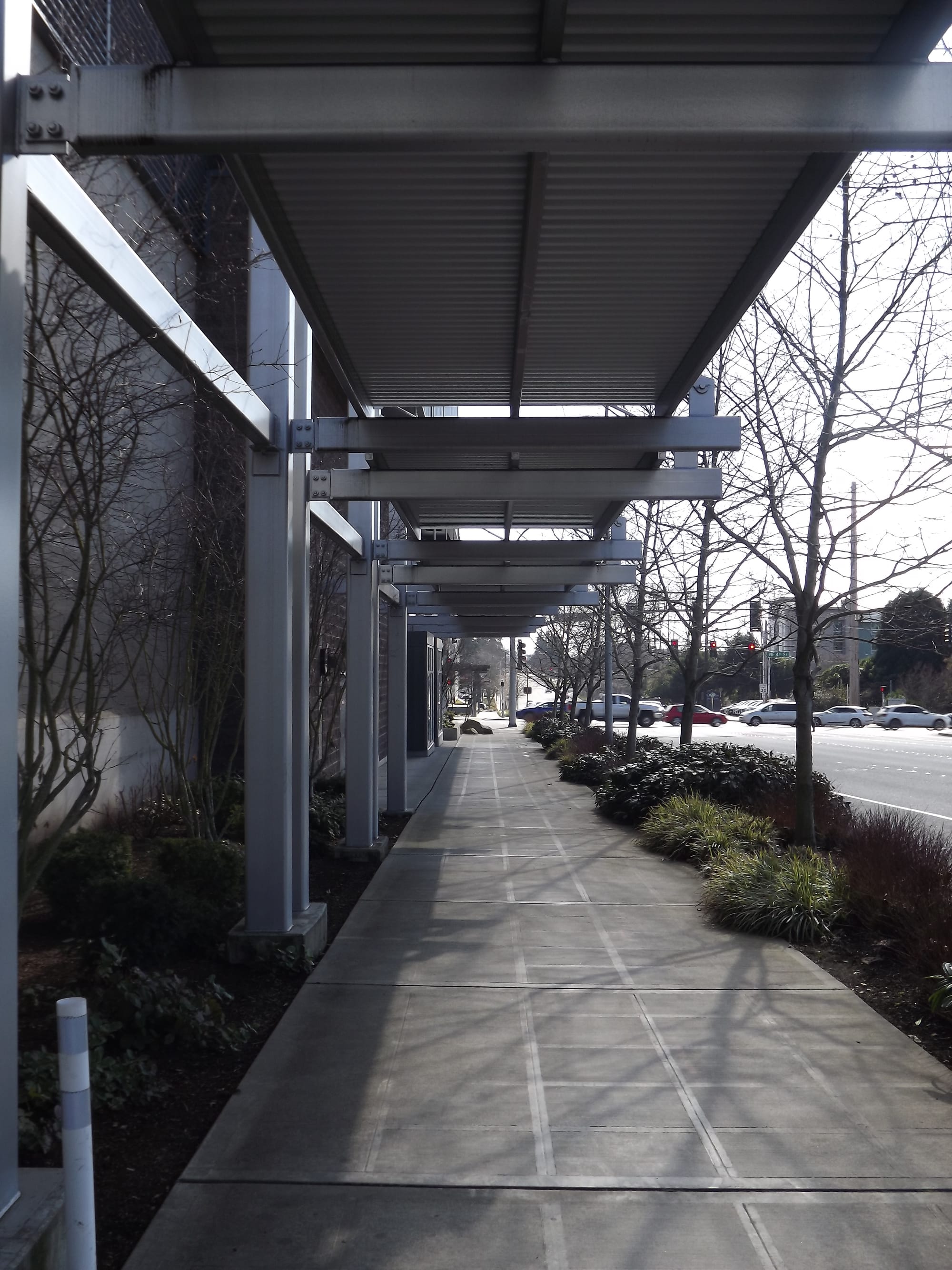
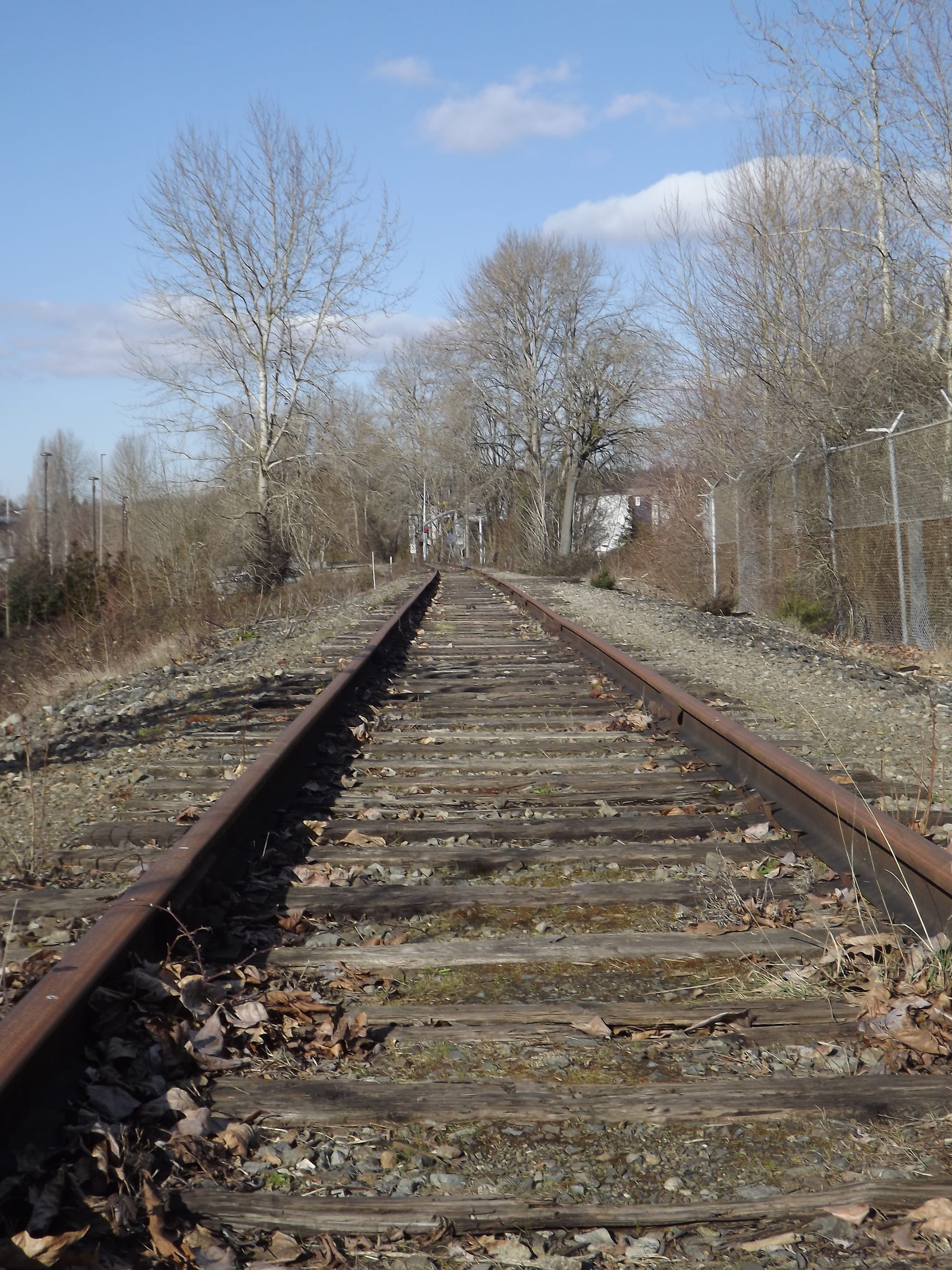
Although Eastrail will be a high-quality multimodal connection through the neighborhood when it’s fully open, its Wilburton portions are of little use to anybody right now since they remain dilapidated railroad tracks connecting office buildings with parking lots. Transit offerings along the main corridors are decent, with Route 271 and the RapidRide B Line providing frequent service throughout the day. However, with no dedicated right of way along NE 8th Street or 116th Avenue NE (despite the ample roadspace), buses frequently get stuck in the same traffic and at the same lights that all those private vehicles get trapped in.And if Bellevue is the City in a Park™, the Wilburton site seems to be a place the city has forgotten. Its beautiful botanical gardens may be located beyond the steep hills to the east, sure, but they’re by no means interwoven into the (sub)urban fabric of the area, and they’re certainly not easily accessed by foot. Instead, pedestrians are allotted miniscule plots of greenspace, like at the SW corner of the Overlake Medical campus. These may provide a bench to have a meal or share a chat with a friend, but the only views of interest are the dudebros speeding by in their colorful muscle cars with the honking of horns and blaring of ambulances bellowing in the background. In Wilburton, there’s no respite for the soul, surely not at the level that’s needed in an urban environment like the one Bellevue aspires to be.Citizen outreach supports a bold vision
I paint such a negative portrait of the neighborhood because of the sincere sense of hope that arises when presented with a compelling alternative to the status quo. And with the publication of the final report from the Wilburton Citizens’ Advisory Committee (CAC) in the summer of 2018, the community was gifted with a very different vision for the neighborhood. The culmination of a year and a half of work from fifteen community members (including then Planning Commission Chair and current City Councilmember Jeremy Barksdale), the report contained several suggestions that would improve the site’s livability for future residents.
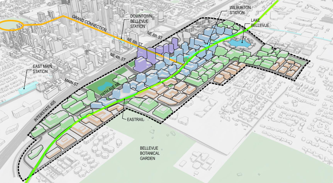
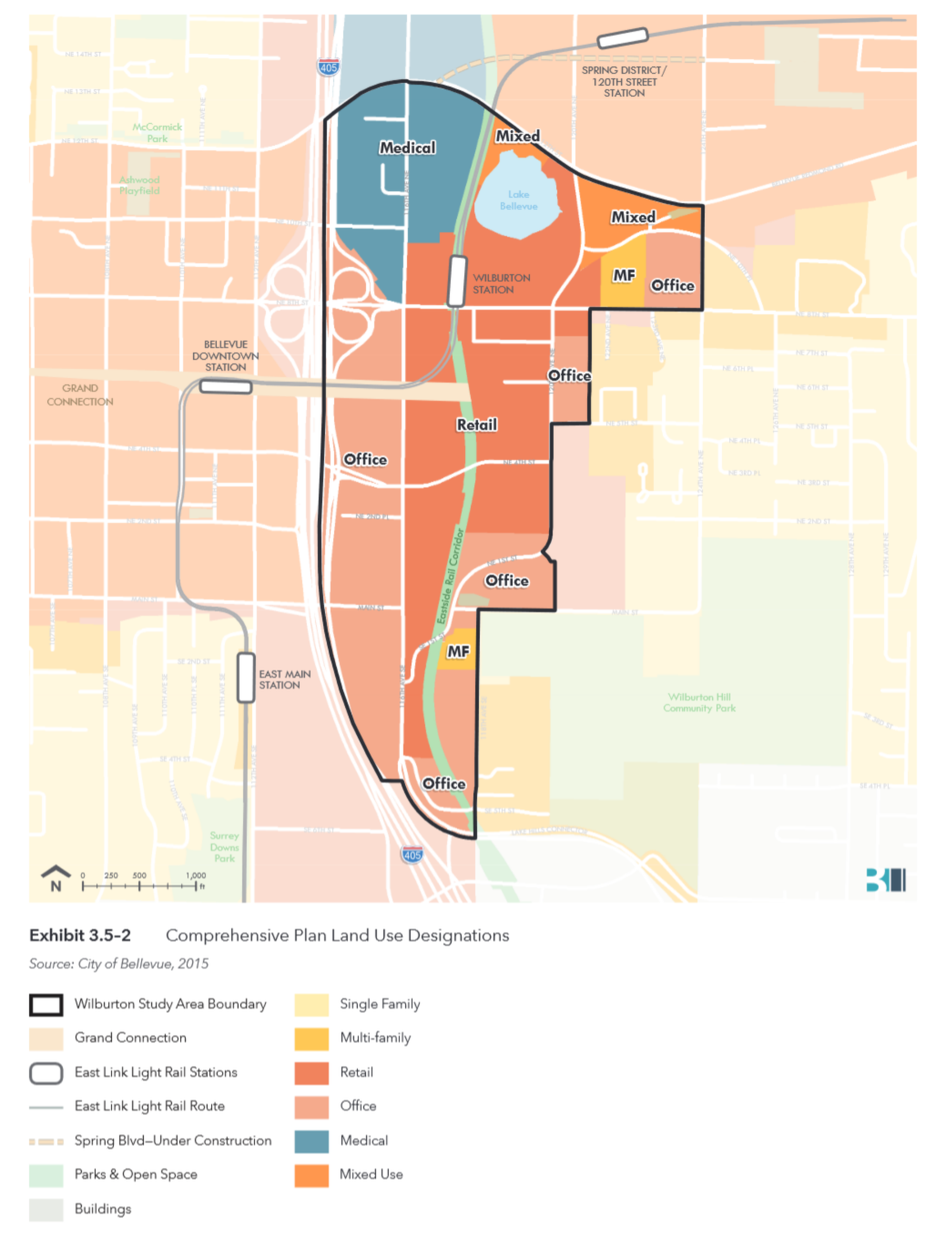
The most important discussions presented in the document focused on urban form, development intensity, and building heights. CAC deliberations mostly centered on how much development should be allowed in the central part of Wilburton, as well as how much building heights should be tapered down as one moves south and east through the site. Ultimately, the CAC settled on the above map, which would allow building heights between 250′ and 300′ and Floor Area Ratios (FAR) between 4.0 and 6.0 in the central core, with heights gradually tapering down as one moves outwards. For comparison, this roughly matches the maximum height and FAR allowed for buildings in the East Main TOD site that provide public benefit. Similar to the East Main site, the CAC supported an incentive-based system to encourage the development of public amenities in exchange for higher FAR (more on this later).
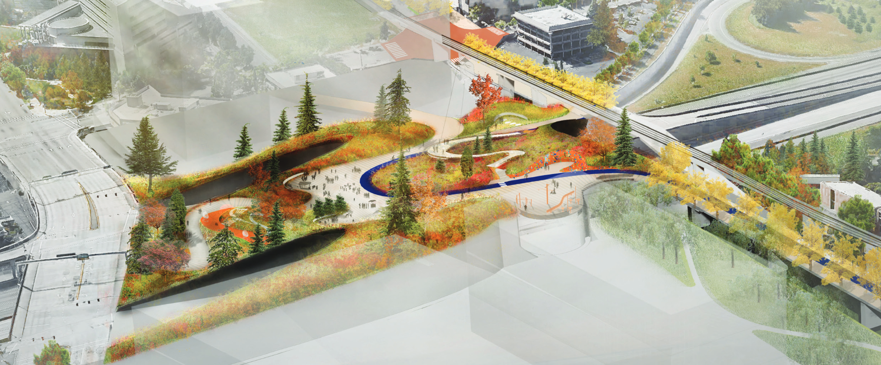
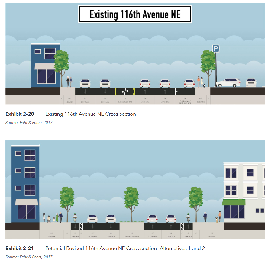
The CAC vision also calls for a neighborhood with a markedly different transportation system from car-dominant present. Instead of concentrating all non-vehicle mobility onto Eastrail, the CAC instead put forth vision of a “double spine”, with 116th Avenue NE being remade into a multimodal boulevard. Street improvements, such as the extension of NE 6th Street to 116th Avenue NE, the creation of alleys and festival streets, and smaller block sizes, are meant to facilitate a more pedestrian-oriented environment. Land use codes that incentivize private creation of public spaces are envisioned to complement future open spaces, such as the future Lid Park.
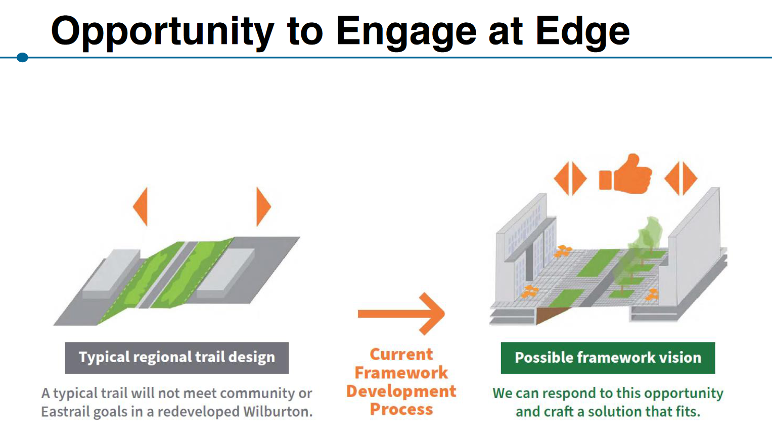
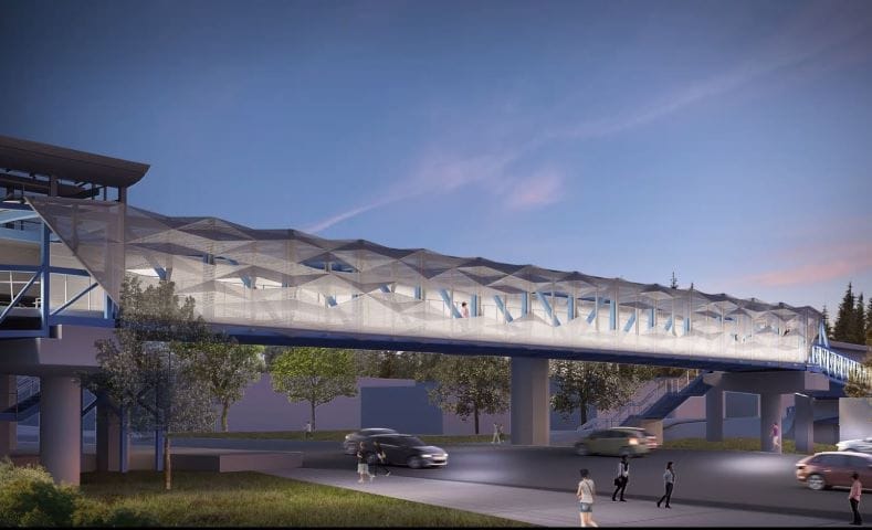
Eastrail itself is envisioned as an open space that can facilitate gathering and community beyond its function as a transportation corridor. In recent months, staff has examined policy language that would help the Wilburton portions of Eastrail better sync with surrounding businesses as they redevelop. The goal is to incentivize developments to face their storefronts towards the trail, instead of having parking lots or backsides along the trail (as many businesses currently do). Such an interface between public and private space would add opportunities for placemaking along what is likely to be one of the busiest areas of Eastrail. Due to the significant grade differences between the trail and parcels to the east and west, this may prove to be a difficult task, but the opportunity is promising.Bringing the vision to reality: points of cautionAs visionary as portions of the CAC report are, it’s important to note that the advisory committee is just that. Its purpose was to assemble community feedback and create a document to advise the city council — however, ultimate discretion (and responsibility) to craft a multimodal, sustainable, livable, and thriving mixed-use district rests with city council itself. Some recommendations from the CAC report already are unlikely to become final policy: the committee’s vision for an at-grade Eastrail crossing at NE 8th Street is likely to remain unfulfilled, as construction on an artistic multimillion-dollar bridge is set to begin later this year.
The city council’s process does leave room for improvements to the CAC vision, but given the body’s even split between conservative and progressive voices, it’s more likely that compromises with business interests might water down the ultimate effectiveness of the Land Use Code Amendment (LUCA) in providing much-needed housing. During the East Main LUCA discussions a few months ago, this manifested in a few forms. For example, staff suggested that base FAR limits should be higher for residential development compared to commercial and retail; this was meant to incentivize residential development by enabling developers to get more bang for their buck if they chose residential development over commercial uses. However, conservative members listened to business interests and supported raising base FAR on commercial development to match residential, removing this incentive. Luckily, this policy did not advance, and residential development remains incentivized with a higher base FAR.
However, development of affordable housing perhaps took a hit when city council voted to broaden the public amenities available for developers to use. Quickly summarized, Bellevue encourages developers to construct infrastructure for the public benefit through incentives. By agreeing to build things like affordable housing, new streets, or open spaces, developers can obtain greater FAR that they can then use to build more on their site. Because developers can largely choose what they’d like to build from the list, keeping the list of potential amenities small gives developers fewer options to choose from, but more likely ensures that those amenities get built. During the East Main LUCA process, however, the city council elected to add several additional public amenities to the list, like public art and childcare facilities. Although both important and well intentioned, the addition of these amenities may prevent other items of public benefit from being constructed, like the affordable housing that’s sorely needed in the city.