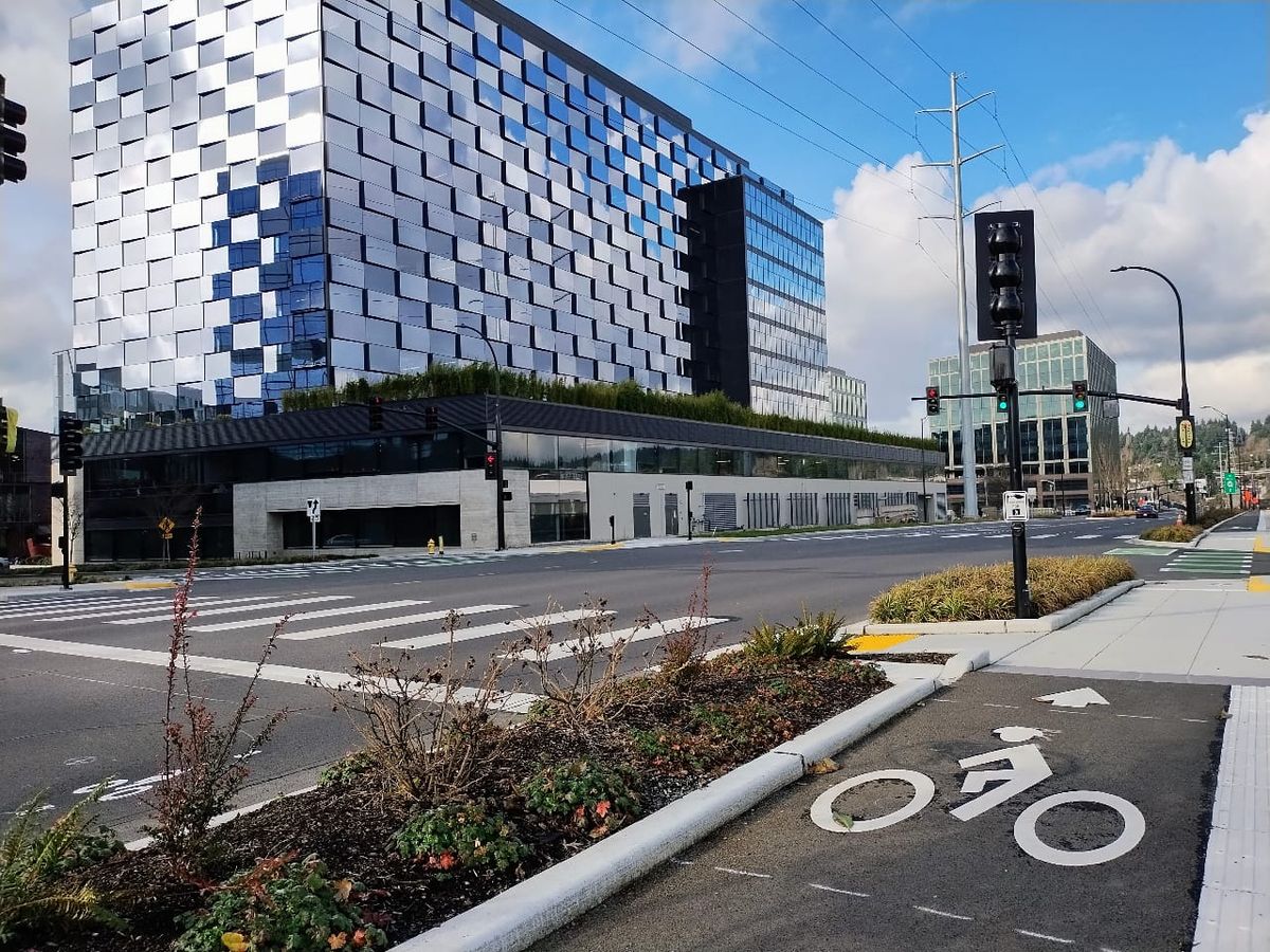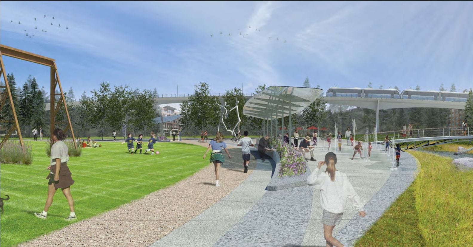
Do arterial roads belong in city parks? That is one of the key questions the Bellevue City Council will need to consider during its October 6 budget deliberations on transportation projects. The staff has presented an option to give full funding (for the first time) of $74.8 million to the one-third-mile, two-lane Spring Boulevard “gap” with a new 0.1% sales tax. But this "Zone 3" plan is colliding with another emerging project on the same land: the BelRed Neighborhood Park.
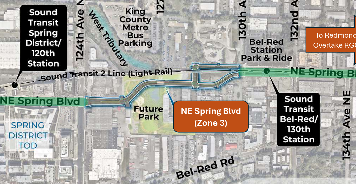
We believe roads like that do not belong in a park. The City should instead plan a pedestrian/bicycle-only trail. But before we make that case, let’s step back to understand the historical precedents and the reasons the City wants to build the road.
Parks vs. Roads: A Brief Bellevue History
Bellevue, the self-described “City in a Park,” has many beautiful parks, such as Bannerwood, Crossroads, Downtown, Highland, Lake Hills, Lakemont, Mercer Slough, Meydenbauer, Robinswood, Surrey Downs, Weowna, and Wilburton Hill. The fact that none of these parks have arterial roads going through them shows Bellevue residents have been prioritizing parks over cars for as long as the city has existed.
Wilburton Hill Park presents a particularly enticing cut-through opportunity to extend 124th Ave south of Main St to the Lake Hills Connector. The City considered this project many years ago, but it was so forcefully rejected by residents that the policy to not do it is now cemented as S-WI-15 in the Wilburton subarea plan.
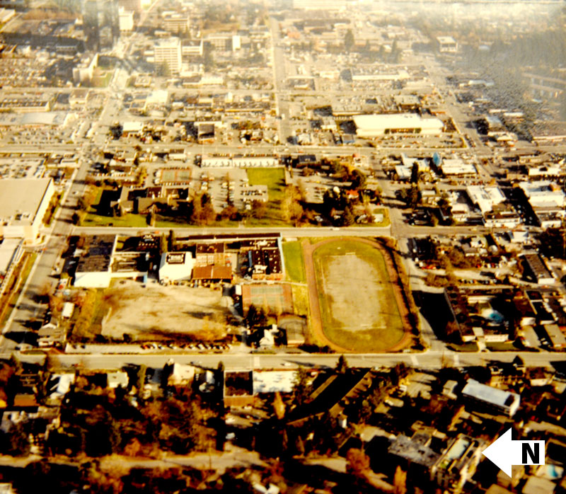
Downtown Park is another interesting case to examine. Before building that park in the mid 1980s, the City removed a large section of 102nd Avenue, which had bisected the site for decades. As a video from the time makes clear, the City wanted to create a big, green meadow that would last forever, and it would have been unthinkable to compromise that vision for a few seconds of driver convenience.
Downtown Bellevue of the 1980’s, like BelRed today, was a mostly commercial district just beginning its journey to the mixed-use, high-rise urban center it is now. The successful Downtown Park strategy of prioritizing urban green space provides a model worthy of replication in BelRed.
The Case for Spring Boulevard
So if Bellevue has never allowed arterials in parks in the past, then why is it planning to do so now? The City laid out the purpose of Spring Boulevard's Zone 3 in an application for a federal grant in 2024. According to the City, the project would:
- Fill the gap between the two completed sections of Spring Boulevard with one lane in each direction, protected bike lanes, and sidewalks
- Improve access, circulation, mobility, and safety for people walking, biking, rolling, or driving
- Attract investments to the neighborhood
- Accommodate the rapid growth expected to follow the BelRed rezoning.
- Reduce vehicle miles travelled, and therefore greenhouse gas emissions
- Reduce trip times by:
- 13-20 minutes for walking
- 3-4 minutes for biking
- 2-3 minutes for driving
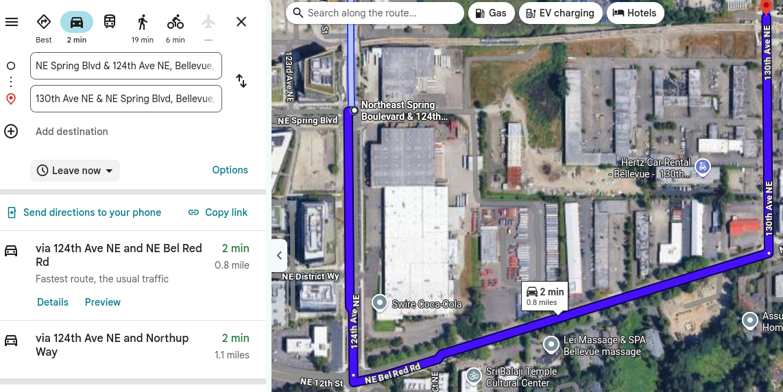
We dispute the 2-3 minute reduction for drivers. Google Maps estimates the total driving time for the existing route along BelRed Road at just two minutes, so the reduction in driving time would be even less. Also, cars on the new route would often need to yield at crosswalks in the busy park, further eroding any small improvement in driving times.
Apart from that exaggerated driving time reduction, all of the other justifications for the project would also apply to a trail. In fact, if the City wants to reduce greenhouse gas emissions, a trail would be better than a road because it would be more effective at encouraging travel by bicycle without creating the infamous induced traffic demand associated with new roads. And if the City wants to attract investment, a park without an arterial would be more appealing to residents, and therefore more attractive for housing developers and employers.
The Case against Spring Boulevard
The Spring Boulevard plan was initially presented to the City Council in 2011. At that time, there were plans for another large park in BelRed. It was tentatively called Northup Meadows, and it would have been on the site of what instead became Sound Transit’s train base. Since the plan for that park fell apart, the other BelRed park (in Spring Boulevard’s path) has gained a new degree of importance as the only park in the rapidly-growing area. It is only appropriate to re-evaluate the need for Spring Boulevard (Zone 3) in light of the significantly changed conditions.
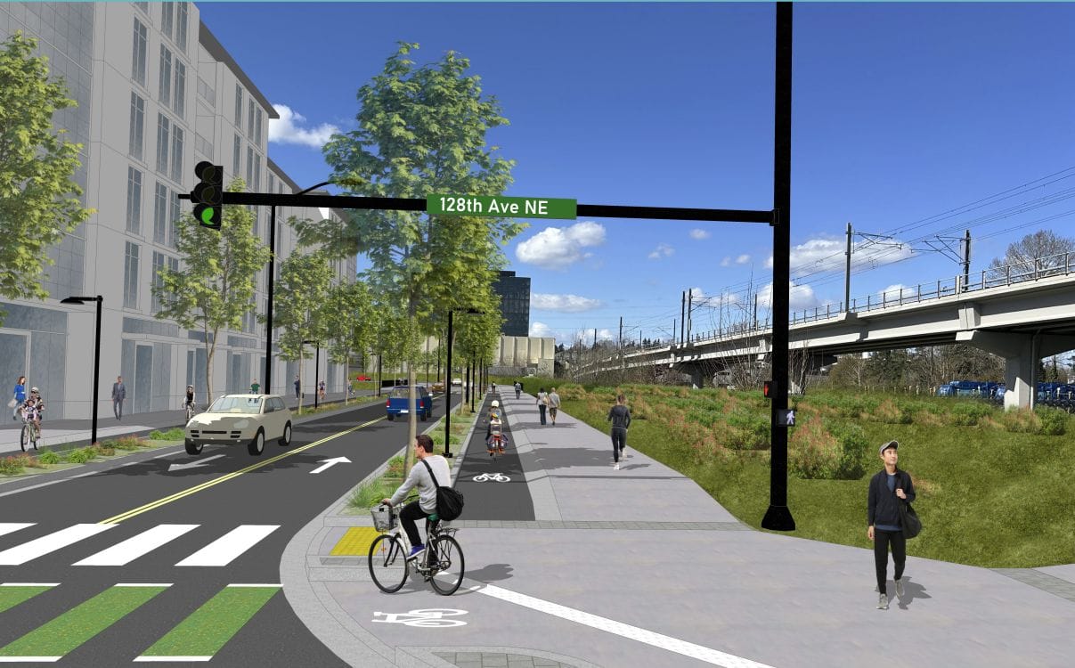
To put our case simply: BelRed Park is a wonderful idea and letting drivers cut through would wreck it.
Parents visiting the park would need to constantly worry about safety as distracted drivers speed by. Their kids couldn’t roam freely and play. Picnicking families would have to put up with constant road noise and backfiring car exhausts. Green grass would cede to hot asphalt. Even with a crosswalk or two, people would try to cross the road everywhere, a recipe for pedestrian injuries. Being close to light rail stations could make BelRed Park one of the best outdoor event spaces in the city, but nobody wants a bunch of loud cars cutting through their event.
Now let’s talk about money. Spring Boulevard's Zone 3 project would cost about $75 million. Last year, Bellevue staff estimated a trail cost at $18-20 million (on page 12 of these minutes). In other words, about 75% of the project budget would be directed exclusively at the goal of trying to save drivers a few seconds of travel time.
With a trail, all of the City’s other goals could be achieved at 25% the cost. (Since most of that cost is for land acquisition, and the land owner is Sound Transit, who has been supportive of parks and pedestrian infrastructure around their stations, we might be able to save even more money by making a deal with Sound Transit to put a trail on their land without buying it.)
To recap, the trail option would:
- Save $57 million, compared to the road
- Offer even more safety for pedestrians and cyclists
- Prevent even more greenhouse gas emissions
- Attract even more local investment
- Not be wildly inconsistent with decades of established precedent
- And actually make BelRed Park better, instead of vastly worse.
Think about your favorite park. Now imagine what it would be like with an arterial road going directly through it. That’s what the Spring Boulevard Zone 3 project would do to BelRed Park, before it even has a chance to show how great it can be.
 Ryan Packer